


Mount Regan - Southeast Ridge, September 2011

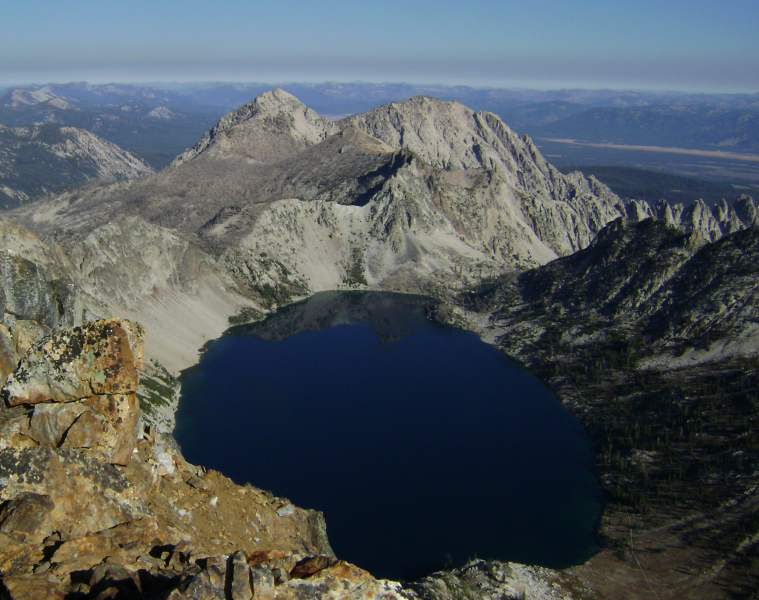
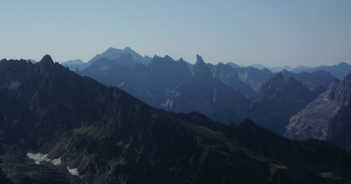
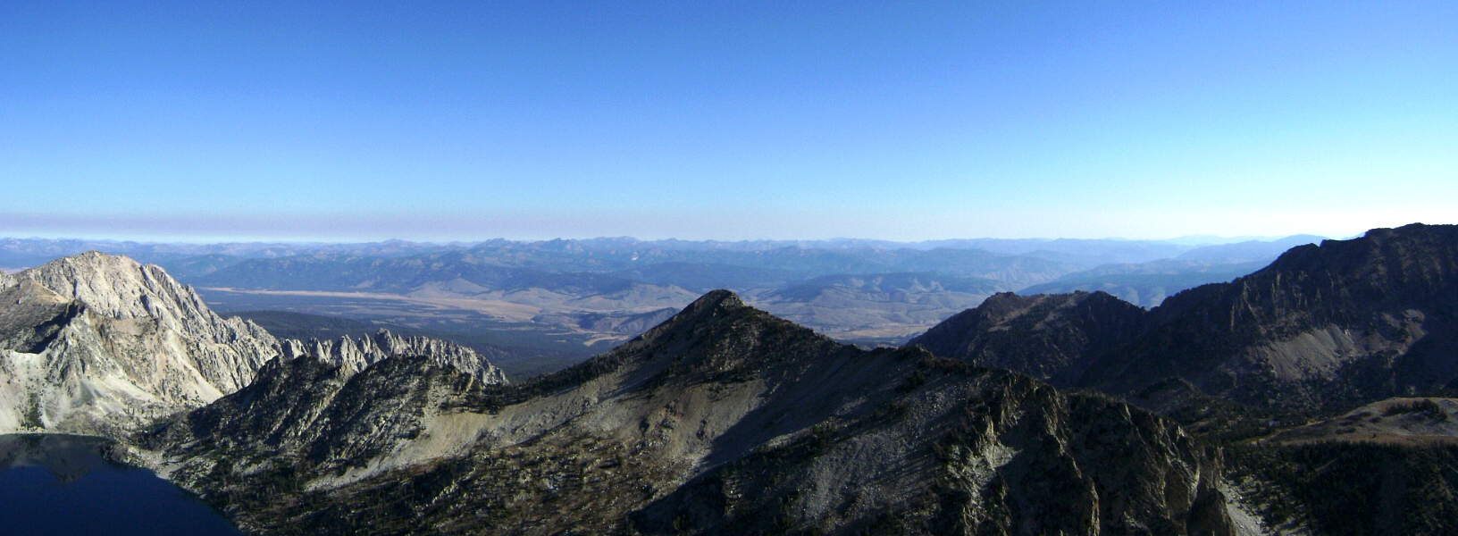
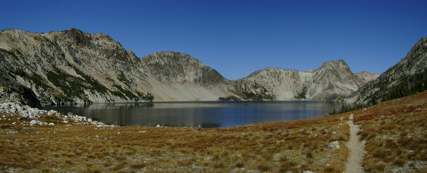
Located in the far northern part of the Sawtooth National Recreation Area, Mt. Regan is an aesthetic and deservedly popular peak. Its sheer North Face towers above Sawtooth Lake's south shore and makes for a dramatic backdrop to an otherwise scenic and tranquil location. The standard Southeast Ridge route presents little in the way of technical difficulties, save for a supposedly classic class-4 scramble over an exposed ledge very near the summit. Due to the peak's northerly position, the view south into the heart of the Sawtooths is exceptional. Warbonnet Peak and the neighboring Monte Verita Ridge area are impossible to ignore and inspire one to venture deeper into what is unquestionably Idaho's most rugged and spellbinding mountain range.
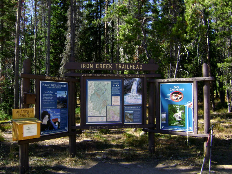
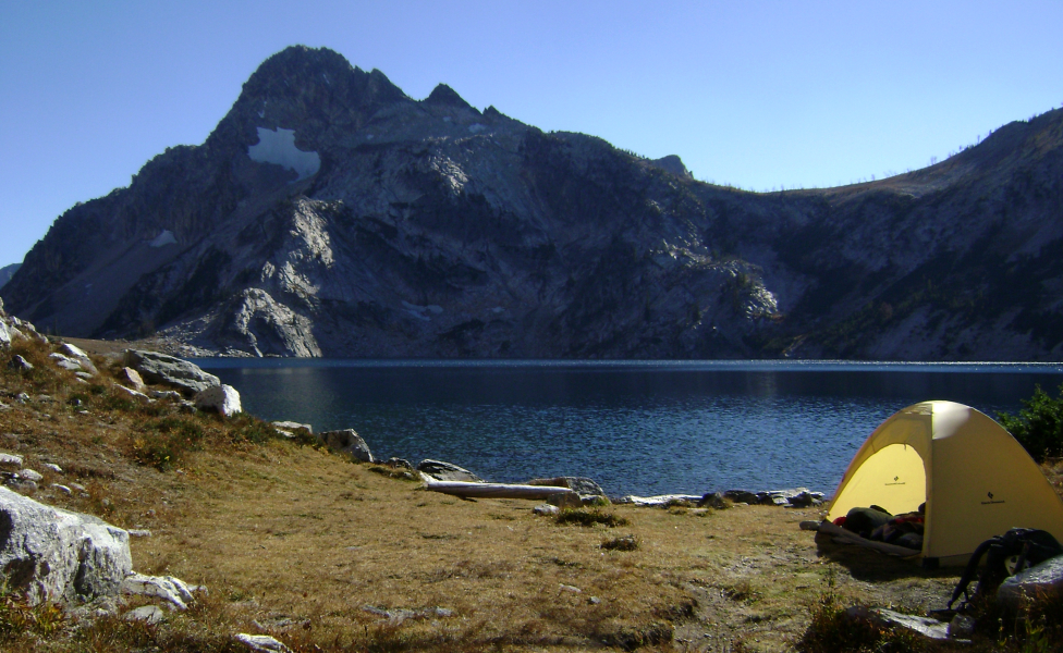
Okay, so now that I've piqued your interest you might be wondering how to get there. Two miles northwest of Stanley go west onto Iron Creek Road for 3.8 miles until you reach the Iron Creek campground and trailhead. Follow the well marked and maintained trail from Iron Creek Trailhead, passing Alpine Lake in about 3 miles. Reaching Sawtooth Lake in about 5.5 miles, I claimed my campsite for the night and got on to the arduous task of relaxing in the warm afternoon sun. Campfires aren't permitted within a certain radius of the lake, so no matter how tempting it may be to make use of the existing fire pits, know that unseen campers at the other end of the lake may take exception to those breaking the rules. Don't say I didn't warn you!
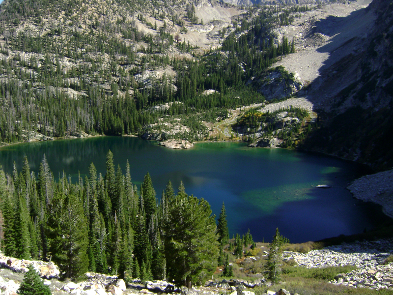
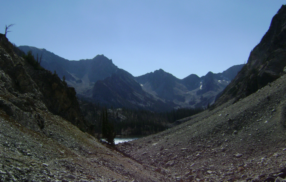
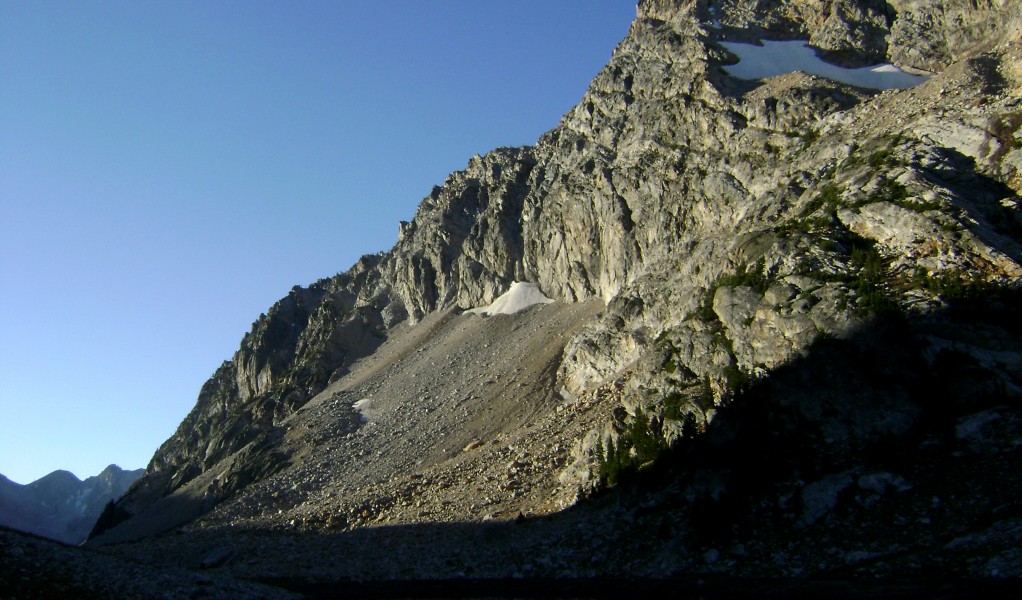
Continuing along the east shore of Sawtooth Lake, I followed a well-traveled trail into a moraine basin beyond Lake 8489. I left the trail just before reaching Lake 8271 and proceeded to scratch my way up a talus and scree slope below Regan's Southeast Ridge. I gained a left-leaning gully/ramp feature near the left apex of the talus slope and reached the ridge crest without further difficulties. The lower part of the "ridge" is almost indistinguishable from the broad south face and makes for a somewhat loose and tedious hike at first. As always, staying as close to the crest as possible offers the most enjoyable travel.
The ridge dead-ends at a headwall below the summit. There's a ramp/ledge system on the NE side of the summit dome that leads to a short slabby face at left that can be scrambled up easily enough to reach the summit boulders (I returned this way). Whatever you do, I advise against doing as I did and blindly following the aforementioned ledge almost the entire way around the North Face of the peak. It is loose, very exposed and entirely avoidable! The enormous summit blocks actually make for some entertaining scrambling, with at least one awkward squeeze move that required some concentration to get past. The view south from Regan's summit towards Monte Verita Ridge is impressive, with Warbonnet Peak was clearly identifiable looking southwards.
I continued on to the ranger station outside Stanley later that afternoon and reserved a couple nights at one of the campgrounds near Redfish Lake that were still open this late in the season. Despite the stellar weather, pleasant temperatures and absence of bugs, there weren't a lot of people visting the area. Save for the occasional mountain biker, most I spoke with were looking forward to the coming snow season and the great ski touring the Sawtooths are apparently known for. In any case, I hit the sack early that night as I had a climb of Thompson Peak planned for the following day.
Click here to view photos.
![]()


