Last Updated: October 19, 2024


Start

Recent content updates are viewable under what's new.

Reports in the queue for posting are coming soon!

Upcoming reports & photos:

Oh my! Quite the backlog here...

  • Lizzie Lake (Long, Tynemouth, Arrowhead, Tabletop & Anemone) - scramble (August 2023)
  • Armchair Traverse - scramble (August 2023)
  • Snowspider Mountain - scramble (September 2023)
  • Mount Trorey - scramble (September 2023)
  • Macleod Peak - scramble (September 2023)
  • Ben Lomond - scramble (September 2023)
  • Mount Killam (Gambier Island) - hike (September 2023)
  • Lone Goat & Snow Camp Mountain - hike (September 2023)
  • Isollilock Peak - scramble (October 2023)
  • Mount Manson - Mount Hatfield Traverse - scramble (October 2023)
  • The Gargoyles & Columnar Peak - scramble (October 2023)
  • Opal Cone and Lava Glacier - hike (October 2023)
  • Park Butte (WA) - hike (October 2023)
  • Trappers Peak (WA) - scramble (October 2023)
  • Rattlesnake Ledge (WA) - hike (November 2023)
  • Sauk Mountain (WA) - hike (November 2023)
  • Sunshine Coast (Mount Daniel, Pender Hill) - hike (November 2023)
  • Mount Dickerman (WA) - hike (November 2022)
  • Verona Peak AKA Winter's End - snowshoe (November 2023)
  • Dolomites (IT) - snowboard (December 2023)
  • Red Rock Canyon (NV) - scramble (January 2024)
  • Flute Summit & Oboe Summit - snowboard (February 2024)
  • Whistler Miscellaneous (Train Wreck, Loggers Lake, Shadow Lake and more) - hike (February 2024)
  • Mount Underhill - hike (March 2024)
  • Bombtram Mountain - snowshoe (March 2024)
  • Steep Peak - snowboard (March 2024)
  • Ruby Mountain (WA) - snowshoe (April 2024)
  • Blustry Mountain - hike (April 2024)
  • Sowerby Peak (Barr East) - snowshoe (April 2024)
  • Picacho Peak (AZ) - hike (April 2024)
  • Kitt Peak Observatory (AZ) - (April 2024)
  • Mount Wrightson (AZ) - hike (April 2024)
  • Saguaro National Park (AZ) - April 2024)
  • Superstition Peak/Benchmark (AZ) - scramble (April 2024)
  • Mount Humphreys (AZ) - hike (May 2024)
  • Petrified Forest National Park (AZ) - (May 2024)
  • Piestewa Peak (AZ) - hike (May 2024)
  • Channeled Scablands (WA | Columbia Gorge, Ancient Lakes, Potholes Lake, Palouse Falls and more) - hike (May 2024)
  • Rhododendron Mountain ("Pk. 2220") - snowshoe (June 2024)
  • Flora Peak - hike (June 2024)
  • Gibson Peak - snowshoe (June 2024)
  • Mount Urquhart - scramble (June 2024)
  • Rock Mountain (WA) - hike (July 2024)
  • Ladies Pass Quartet (WA | Cape Horn, Ladies Peak, Snowgrass NE Peak, Snowgrass Mountain) - scramble (July 2024)
  • Old Snowy (WA) - scramble (July 2024)
  • Dog Mountain (WA) - hike (July 2024)
  • Mount Ratney & Mount Bardean - scramble (July 2024)
  • Torrent Peak - scramble (July 2024)
  • Steep Peak - Darkside Peak Traverse - scramble (July 2024)
  • Silvertip Mountain - scramble (July 2024)
  • The Old Settler - scramble (July 2024)
  • Silent Hub Peak - scramble (August 2024)
  • Saint Jacobs Mountain - scramble (August 2024)
  • Mount David (WA) - scramble (August 2024)
  • Goat Mountain West Peak & Table Mountain (WA) - hike (August 2024)
  • Griswold Pass (Tuber Hill, Glacier View Peak, Subatomic Peaks: Baryon, Meson, Muon, Lepton) - scramble (September 2024)
  • Yellow Aster Butte (WA) - hike (September 2024)
  • Mazama Dome (WA) - hike (September 2024)
  • Ptarmigan Ridge - (WA | The Portals East Peak, Coleman Pinnacle) - hike (September 2024)
  • Tetrahedron Peak - scramble (September 2024)
  • Lone Cone & Peak 86 (Tofino) - hike (September 2024)
  • Mount Athelstan ("Pk. 2460") - scramble (September 2024)
  • Excelsior Peak and Cowap Peak - hike (October 2024)
  • Hollyburn Peak - hike (October 2024)
  • Cheam Peak - hike (October 2024)
  • Blanchard Needle - scramble (October 2024)

*As of 10/13/2024


Database

Query the reports database, selecting from criteria which include name, location, type, season etc.

Quick Links

Essential links & whatnot:


Jump To

Select from list below to jump to a specific area on this site.


| Featured Trip Report |


Last Updated: Mar. 25, 2002

Mount Shuksan - Sulphide Glacier, October 2001


My first attempt at climbing Mount Shuksan yielded little more than being rained-out while at camp on Shannon Ridge. For my second attempt, I made sure to check the weather forecast beforehand. Being somewhat late in the season I knew that I was risking another big disapointment, but, the forecast was calling for fair weather and I wanted Shuksan bad. After much convincing, I was finally able to talk Andy into a day-trip up the Sulphide Glacier.

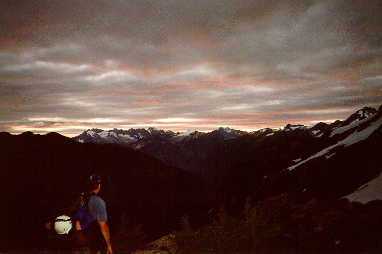
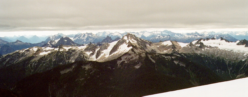
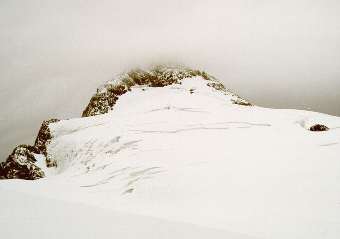
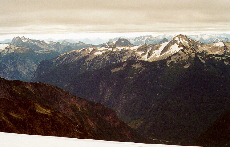
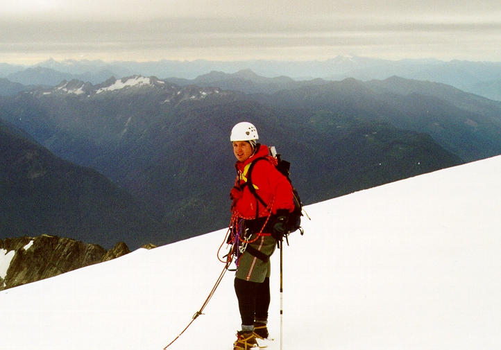
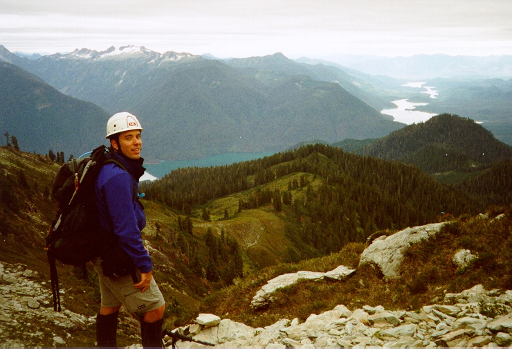
We left my place at 2:30am on Saturday and started hiking in at around 5:00am. It was cool and the stars were out. By the time we reached the top of Shannon Ridge the sun was just starting to rise and a strange red hue was cast against the underside of the clouds. I figured the clouds would burn off. This was not to be the case. There were a few inches of fresh snow on the glacier and so we had some careful route finding to do, with several crevasse end-runs. Sunshine filled the valley just beyond us with Tomyhoi and American Border Peaks seen basking in the sunlight. This was our turning around point...and to think we were so close. We had less than 1500ft to go.

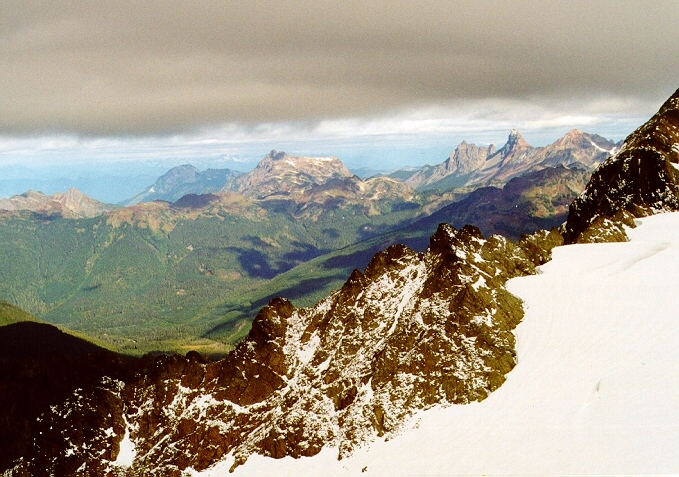
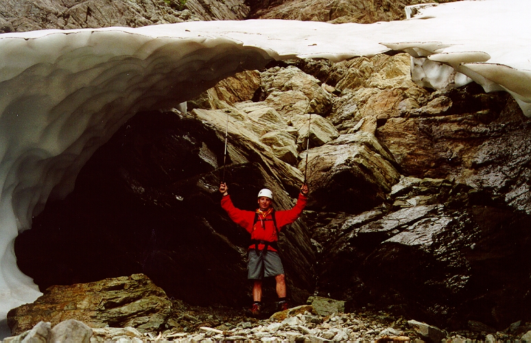
To avoid the back and forth traversing around crevasses that we did on the way up, we took a more direct route on the descent and had to skirt several yawning crevasses. On our way up we encountered some inconsistencies between what we were seeing and what we gathered from the route description. We found out later that we hadn't actually ascended the Sulphide Glacier from its toe, but rather traversed below cliffs (left of the glacier) until able to scramble up over rocks and gullies to about halfway up the glacier. I think ascending the glacier from its base makes for easier going.

The next several days brought perfect weather and so we returned the following Saturday. Knowing the good weather window was about to close, we embarked on another early morning start, this time after sleeping at the trailhead. Again, we were on the trail by 5:00am and the stars and moon were out. By the time we reached the top of Shannon Ridge a little more than an hour later, the clouds had begun to roll in. Knowing this was the beginning of a building weather system, we once again turned back, hiked back to Andy's truck, crawled into the back and passed out for a few hours. Will return next season.

Click here to view photos.
home | email | copyright

All photos and text for sverdina.com are copyright © 2002-2024

It would be very much appreciated if you please ask before copying and/or re-publishing content from any part of these pages. To do so, please click here to send a message via feedback form.

Thank You.

©2024 sverdina.com |