


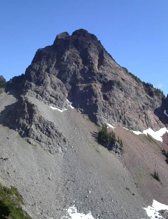
Mount Thomson - West Ridge, July 2003
 as seen from near Lundin Peak (foreground left).")
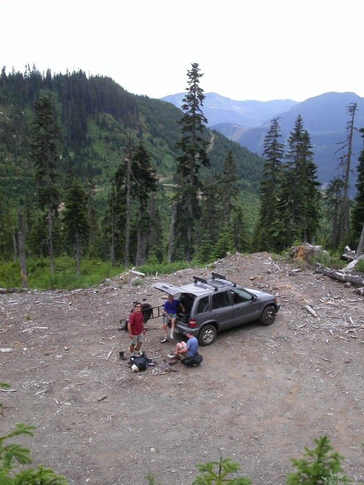
Eric, John, Scott and I set out to climb the West Ridge of Mount Thomson. In store for us was a relaxed and enjoyable day on rock of moderate technical difficulty. Adding to the appeal of this climb was the fact that we shaved about 3 miles and 1100 vertical feet (one way) on the approach by taking a shortcut. Rather than hike the PCT starting at Commonwealth Basin, we instead continued eastbound on I-90 to the Gold Creek exit. We followed FSR 9090 (fortunately the gate was open) for a few miles to a sharp switchback at about 4100'. The unofficial trail to Kendall Peak Lakes begins here. We veered left off of FSR 9090 and drove northwest on a rough and somewhat overgrown logging spur for more than a quarter mile (might be tough on a 2WD vehicle with limited ground clearance). The logging spur ended at an intersection with minor spurs branching off in several directions. We followed the left spur a short distance to where it terminates at a logging platform. Eric parked his car here. We started hiking at around 7:00am following an overgrown skidder track upwards for several hundred yards (bears NNE along the edge of the clear cut), then headed northwest through occasionally brushy forest to more open forest above. We reached the PCT at a small timbered saddle after gaining about 400 feet.
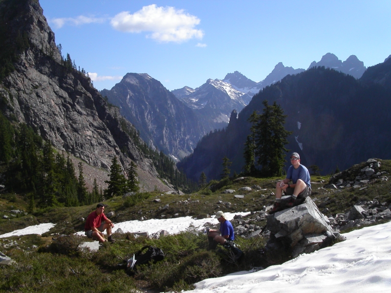
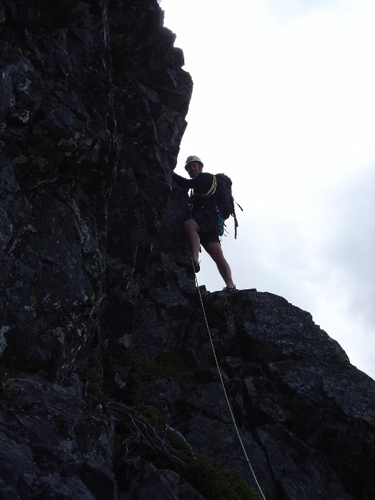
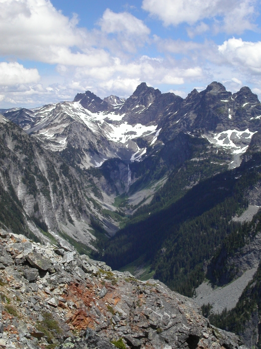
The hike up to the infamous Kendall Catwalk went quickly (about 2 miles) with improving surrounding scenery. In another mile we reached Ridge and Gravel Lakes (Alaska Lake shown here). At about a half mile beyond the lakes we found ourselves directly below Bumblebee Notch, here we followed a steep climber's path on the right side of a watercourse to reach the aforementioned notch. We headed back down the north side and cached all unnecessary gear at a large boulder in the basin south of Mount Thomson. We stopped here for a brief rest. From the basin we headed NW up a talus slope and finally a loose gully to reach the West Ridge at about 6000 feet. We free-climbed up around a block (class 3/4), then made a short but exposed traverse on the north side of the ridge to a small notch. We set up a belay at this notch and Scott led out with a belay from John. Eric and I sat back and watched the action from cramped quarters. With John barely out of view, I began leading up the first pitch myself. The first pitch makes an exposed leftward traverse into a chimney, then leads up to a big ledge with scrub trees. Rather than stop and set up a belay here, I opted to continue up another chimney beyond the scrub trees (the traditional second pitch?) and set up a belay at the next grassy ledge. We stretched this pitch out to about 55 meters.
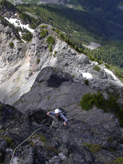
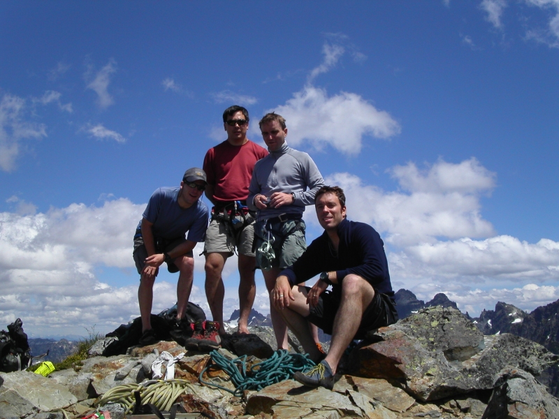
The second pitch starts out at the far right of the belay ledge. The pitch is short (30-40 meters), but climbs steeply with blocky holds on or near the crest of the ridge. A short "walk" up the low angle slab of the 3rd pitch leads to the next belay. Pitch four starts out with a couple of easy moves to a narrow ledge, then a short rightward traverse to reach the "crux". Climb up through the crux (5.5 - 5.6 for maybe a move or two) to reach another small ledge. Continue up a steep but short rock wall (note nut permanently stuck in crack) to yet another grassy ledge and a dead belay tree of dubious reliability. At the top of the fourth pitch, we coiled our rope and expected an easy walk to the summit. Scott and John apparently crossed to the left side of the crest while Eric and I went right. Going left seems quicker and safer compared to the loose and somewhat exposed route we took. By 1:00pm, we were all standing on the summit.
For the return route, we descended the East Ridge (class 3 and 4). It is possible to make two rappels down the trickiest sections, but isn't really necessary. We then located a climber's path that led to a notch before descending steep scree slopes and boulder fields back into the basin on Mt.Thomson's south side. Eric and John were waiting at our gear cache when Scott and I arrived. The hike out along the PCT was casual. Along the way, we encountered several backpackers out for an afternoon stroll. In contrast, we didn't see anyone on our hike in. We wondered if anyone was paying attention to the clouds that had been building that afternoon. Soon, we were back at the short bushwhack slope, for the final descent back to the car. We reached the car around 5:00pm. Hiking boots were exchanged for sandals and sweaty polypro was replaced with dry cotton. The last door was shut as the first drops of rain began to fall. By the time we reached I-90, the rain had turned into a deluge. Phew! We timed this one just right!
Click here to view photos.
![]()


