Last Updated: September 7, 2024


Start

Recent content updates are viewable under what's new.

Reports in the queue for posting are coming soon!

Upcoming reports & photos:

Oh my! Quite the backlog here...

  • Mount Hanover - scramble (August 2023)
  • Lizzie Lake (Long, Tynemouth, Arrowhead, Tabletop & Anemone) - scramble (August 2023)
  • Armchair Traverse - scramble (August 2023)
  • Snowspider Mountain - scramble (September 2023)
  • Mount Trorey - scramble (September 2023)
  • Macleod Peak - scramble (September 2023)
  • Ben Lomond - scramble (September 2023)
  • Mount Killam (Gambier Island) - hike (September 2023)
  • Lone Goat & Snow Camp Mountain - hike (September 2023)
  • Isollilock Peak - scramble (October 2023)
  • Mount Manson - Mount Hatfield Traverse - scramble (October 2023)
  • The Gargoyles & Columnar Peak - scramble (October 2023)
  • Opal Cone and Lava Glacier - hike (October 2023)
  • Park Butte (WA) - hike (October 2023)
  • Trappers Peak (WA) - scramble (October 2023)
  • Rattlesnake Ledge (WA) - hike (November 2023)
  • Sauk Mountain (WA) - hike (November 2023)
  • Sunshine Coast (Mount Daniel, Pender Hill) - hike (November 2023)
  • Mount Dickerman (WA) - hike (November 2022)
  • Verona Peak AKA Winter's End - snowshoe (November 2023)
  • Dolomites (IT) - snowboard (December 2023)
  • Red Rock Canyon (NV) - scramble (January 2024)
  • Flute Summit & Oboe Summit - snowboard (February 2024)
  • Whistler Miscellaneous (Train Wreck, Loggers Lake, Shadow Lake and more) - hike (February 2024)
  • Mount Underhill - hike (March 2024)
  • Bombtram Mountain - snowshoe (March 2024)
  • Steep Peak - snowboard (March 2024)
  • Ruby Mountain (WA) - snowshoe (April 2024)
  • Blustry Mountain - hike (April 2024)
  • Sowerby Peak (Barr East) - snowshoe (April 2024)
  • Picacho Peak (AZ) - hike (April 2024)
  • Kitt Peak Observatory (AZ) - (April 2024)
  • Mount Wrightson (AZ) - hike (April 2024)
  • Saguaro National Park (AZ) - April 2024)
  • Superstition Peak/Benchmark (AZ) - scramble (April 2024)
  • Mount Humphreys (AZ) - hike (May 2024)
  • Petrified Forest National Park (AZ) - (May 2024)
  • Piestewa Peak (AZ) - hike (May 2024)
  • Channeled Scablands (WA | Columbia Gorge, Ancient Lakes, Potholes Lake, Palouse Falls and more) - hike (May 2024)
  • Rhododendron Mountain ("Pk. 2220") - snowshoe (June 2024)
  • Flora Peak - hike (June 2024)
  • Gibson Peak - snowshoe (June 2024)
  • Mount Urquhart - scramble (June 2024)
  • Rock Mountain (WA) - hike (July 2024)
  • Ladies Pass Quartet (WA | Cape Horn, Ladies Peak, Snowgrass NE Peak, Snowgrass Mountain) - scramble (July 2024)
  • Old Snowy (WA) - scramble (July 2024)
  • Dog Mountain (WA) - hike (July 2024)
  • Mount Ratney & Mount Bardean - scramble (July 2024)
  • Torrent Peak - scramble (July 2024)
  • Steep Peak - Darkside Peak Traverse - scramble (July 2024)
  • Silvertip Mountain - scramble (July 2024)
  • The Old Settler - scramble (July 2024)
  • Silent Hub Peak - scramble (August 2024)
  • Saint Jacobs Mountain - scramble (August 2024)
  • Mount David (WA) - scramble (August 2024)
  • Goat Mountain West Peak & Table Mountain (WA) - scramble (August 2024)
  • Griswold Pass (Tuber Hill, Glacier View Peak, Subatomic Peaks: Baryon, Meson, Muon, Lepton) - scramble (September 2024)
  • Yellow Aster Butte (WA) - scramble (September 2024)
  • Mazama Dome (WA) - scramble (September 2024)
  • Ptarmigan Ridge - (WA | The Portals East Peak, Coleman Pinnacle) - scramble (September 2024)
  • Tetrahedron Peak - scramble (September 2024)
  • Lone Cone & Peak 86 (Tofino) - hike (September 2024)
  • Mount Athelstan ("Pk. 2460") - scramble (September 2024)
  • Excelsior Peak and Cowap Peak - hike (October 2024)

*As of 10/05/2024


Database

Query the reports database, selecting from criteria which include name, location, type, season etc.

Quick Links

Essential links & whatnot:


Jump To

Select from list below to jump to a specific area on this site.


| Featured Trip Report |


Last Updated: Sep. 6, 2006

Twin Sisters Traverse - West Ridge of North Twin & Northeast Ridge of South Twin, July 2006
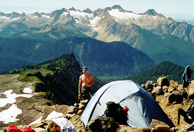


Jeff, Paul and I climbed the North and South Twin Sisters on a mostly cloudy July day. Actually, I think we found the only cloudy spot in the state that weekend, and we were thus deprived of all views of Mt. Baker and most of the surrounding scenery. The views (or the lack thereof) aside, some fun climbing was had, particularly on the North Twin. As expected, the West Ridge of the North Twin fully lives up to its reputation of being a thoroughly enjoyable scramble on solid olivine (peroditite)...the kind of climbing that can be made as easy or interesting as one desires. While the Northeast Ridge of the South Twin has little of the aesthetic value the North Twin's West Ridge possesses, it is arguably the most "solid" line on the peak. The descent of South Twin's West Ridge, on the other hand was a loose and exposed affair and we were more than happy to be back down in the basin between the peaks.

We parked at gate across bridge (unlocked) and rode uphill 3.4 miles to a gravel berm at the edge of a spur road at right (40 exhausting minutes on bikes). 6.0 miles of biking total to intersection with trail/overgrown road leading up to base of WR of NT. Stashed bikes here and started hiking. By about 12 we were on top of NT, approx. 5 hours from car. Great scrambling! Descended the prominent gully (no snow at all) on south side of NT. Ugly. Not recommended. One double-30 rap. Better traverse route is down NW Ridge of NT to a short rappel onto glacier. Once in basin between peaks, climbed 600 ft back up on Class 3/4 slabs to left of lowest notch. From notch, got onto glacier (no crevasses) to get to NE Ridge of ST. Easy Class 3 to summit. Register is at SE end but NW end looks higher. But when you go over to NW end, SE end looks higher. Register could be bigger with new notebook. Old tattered junk in there now.

Descended WR of ST for a while (doing one single-30 rap). It's harder than the Class 2/3 Beckey describes. Having enough of that, we bailed to the basin between the peaks, down-climbing lots of crap rock and sloping slabs with debris to the high steep snow. One more 30m rap got us to the moat where Jeff took a much easier/safer line than Paul and me. Took the basin trail out (past the cabin ruins) to the logging road on south flank of lower WR of NT. Retrieved bikes and hung on for a white-knuckled descent back to the car! Gate was still unlocked. Dang! Stats: 16.5 miles round trip river to river. 14 hours. 7,500' net gain.

All-in-all a worthy outing, despite the grief on South Twin's West Ridge. My advice to anyone looking to repeat this traverse - descend the South Twin's Northwest Ridge instead and retrace your steps across the glacier and back to the low saddle between the peaks. From what we could gather, a single rope rappel (60m) will reach back into the basin. If all else fails, down-climbing the class 3/4 slabs just beyond the saddle would work as well. Also, as mentioned previously, descending the North Twin's NW Ridge to get on the glacier would be better (and more aesthetic) than downclimbing the South Face gully.

Click here to view photos.
home | email | copyright

All photos and text for sverdina.com are copyright © 2002-2024

It would be very much appreciated if you please ask before copying and/or re-publishing content from any part of these pages. To do so, please click here to send a message via feedback form.

Thank You.

©2024 sverdina.com |