Last Updated: March 4, 2023


Start

Recent content updates are viewable under what's new.

Reports in the queue for posting are coming soon!

Upcoming reports & photos:

Oh my! Quite the backlog here. Busy with life and adding to the queue every chance I get...

  • Flute & Oboe - ski tour (March 2022)
  • Suicide Bluffs - snowshoe (April 2022)
  • Slalok Mountain - ski tour (April 2022)
  • Dam Mountain, Little Goat, Thunderbird Ridge - snowshoe (May 2022)
  • Leading Peak - hike/scramble (June 2022)
  • Camelshoof Mountain - hike (June 2022)
  • Askom Mountain - hike (June 2022)
  • Metal Dome - hike (July 2022)
  • Mount Sproatt - hike (July 2022)
  • Mission Ridge/Peak - hike (July 2022)
  • Harris Ridge & Nea Peak - hike (July 2022)
  • Three Brothers Mountain - hike (July 2022)
  • Zupjok, Llama & Alpaca Peaks - hike (July 2022)
  • Shulaps Mountain - hike/scramble (August 2022)
  • Mount Sheer & Ben More - hike/scramble (August 2022)
  • Cathedral Mountain - hike/scramble (August 2022)
  • Mount Penrose - hike/scramble (August 2022)
  • Caltha Peak - hike/scramble (September 2022)
  • Beauty Peak - hike (September 2022)
  • Markhor-Needle Traverse & Flatiron - hike/scramble (September 2022)
  • Conway Peak - hike (September 2022)
  • Green Mountain/Pk 2200 - hike/scramble (September 2022)
  • Mount Brew (Whistler) - hike (September 2022)
  • Mount Barbour - hike/scramble (October 2022)
  • Mount Gillespie - hike/scramble (October 2022)
  • Cougar Mountain - hike/scramble (October 2022)
  • Barn Bluff (Red Wing, MN) - hike (October 2022)
  • Mount Steele - hike/snowshoe (November 2022)
  • Hunter Lookout - hike (November 2022)
  • Belcarra Mountain - hike (November 2022)
  • Oyster Dome - hike (November 2022)
  • Mount Thom & Cilliwack Mountain/Hillkeep - hike (December 2022)
  • Frenchman Mountain (Las Vegas, NV) - hike (January 2023)
  • Rolley Peak/Lookout - hike (January 2023)
  • Round Mountain - ski tour (February 2023)
  • Blowdown Peak - ski tour (February 2023)
  • Silverdaisy Mountain - ski tour (March 2023)

*As of 03/07/2023


Database

Query the reports database, selecting from criteria which include name, location, type, season etc.

Quick Links

Essential links & whatnot:


Jump To

Select from list below to jump to a specific area on this site.


| Featured Trip Report |


Last Updated: Aug. 19, 2003

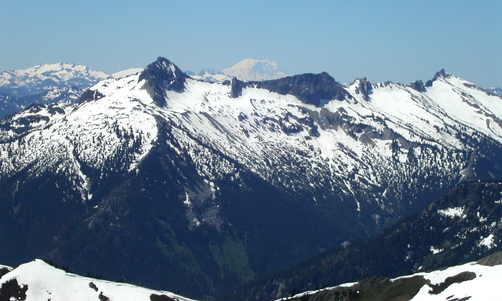
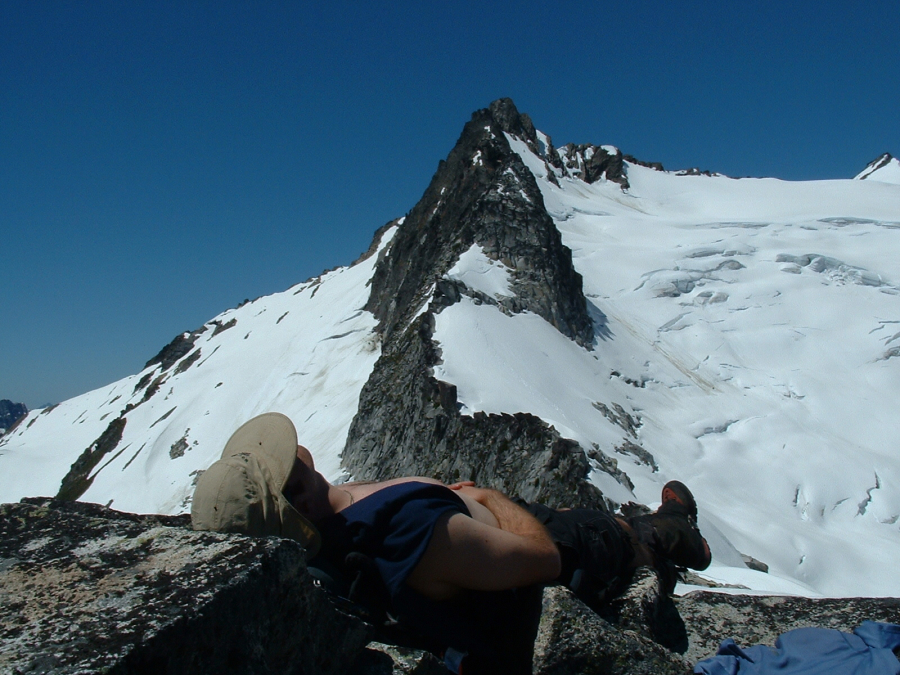
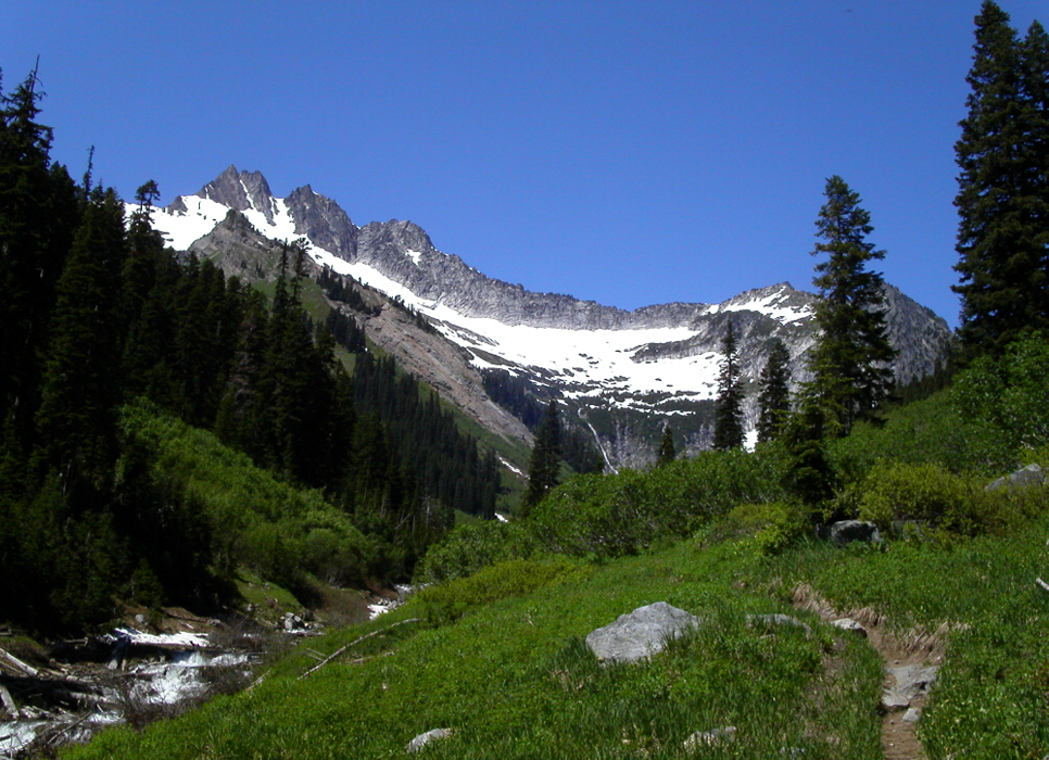
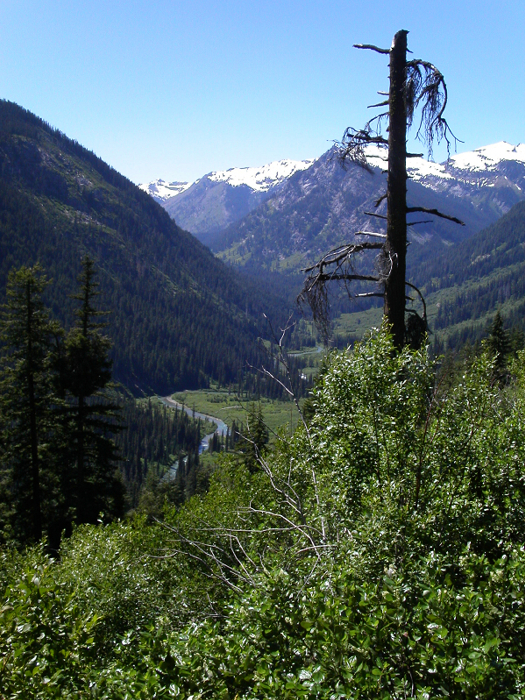
Clark Mountain - Walrus Glacier (Attempt), June 2003


After having climbed Mount Baker's North Ridge the previous weekend, I wanted to climb something a little less involved but still interesting. Clark Mountain satisfied this requirement. I had spied the peaks of the Dakobed Range from various other summits over the years (Mt. Maude, Seven Fingered Jack and Chiwawa Mountain, for example) and promised myself that I'd visit the area someday. Scott and I ambitiously settled on Clark as a day trip with a trailhead bivy the night before. We headed east on US-2 (Stevens Pass) to the Lake Wenatchee turn-off (Coles Corner, about 20 miles east of Stevens Pass). We turned north onto Lake Wenatchee River Rd (SR 207); bearing left after crossing Wenatchee River and proceeding west along the north shore of the lake, passing the Lake Wenatchee Ranger Station. About 1.5 miles after the ranger station, we turned right onto the White River Road (FS 6400). We followed this road for about 11 miles to where it ends at the White River Trailhead.

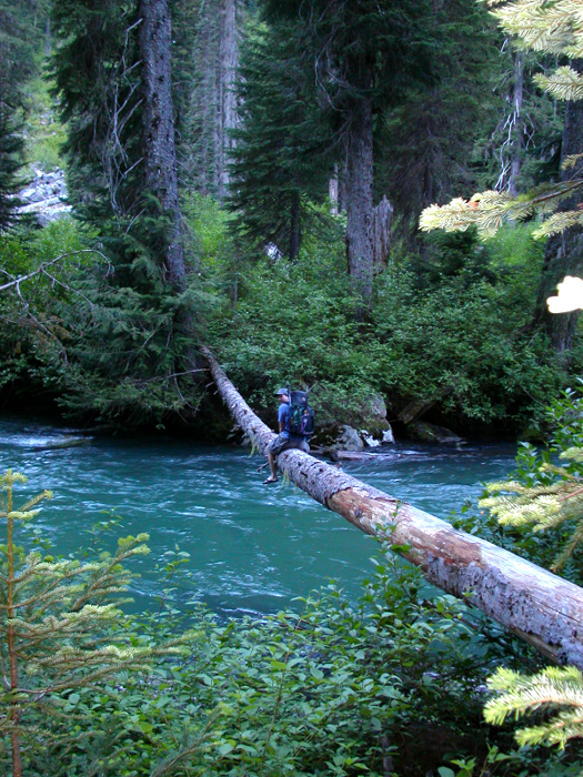
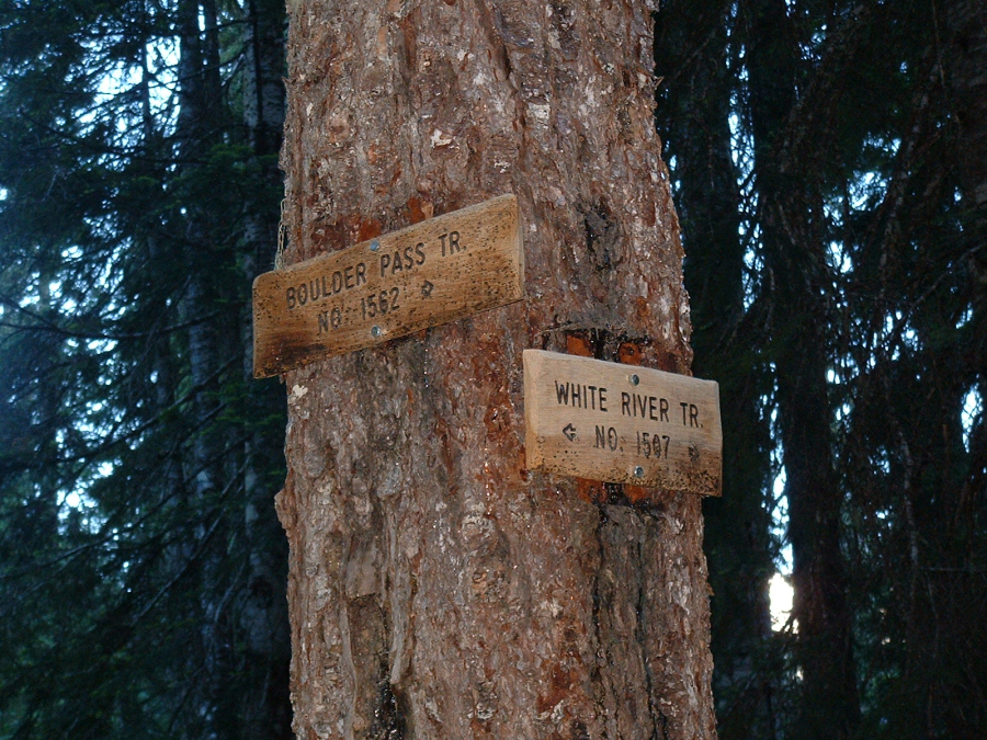
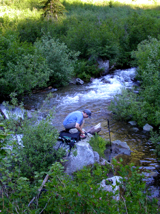
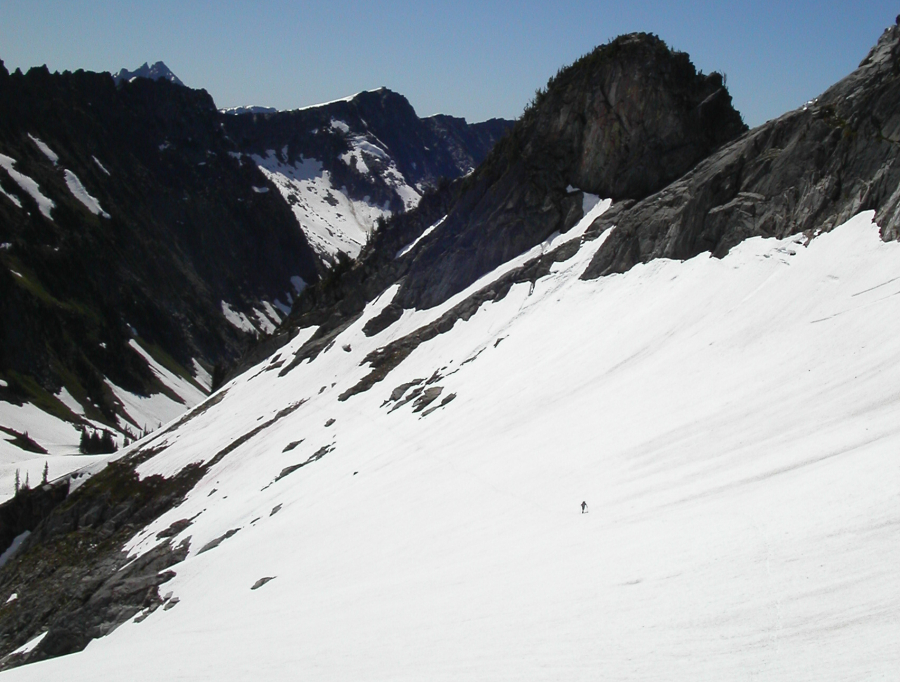
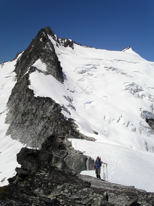
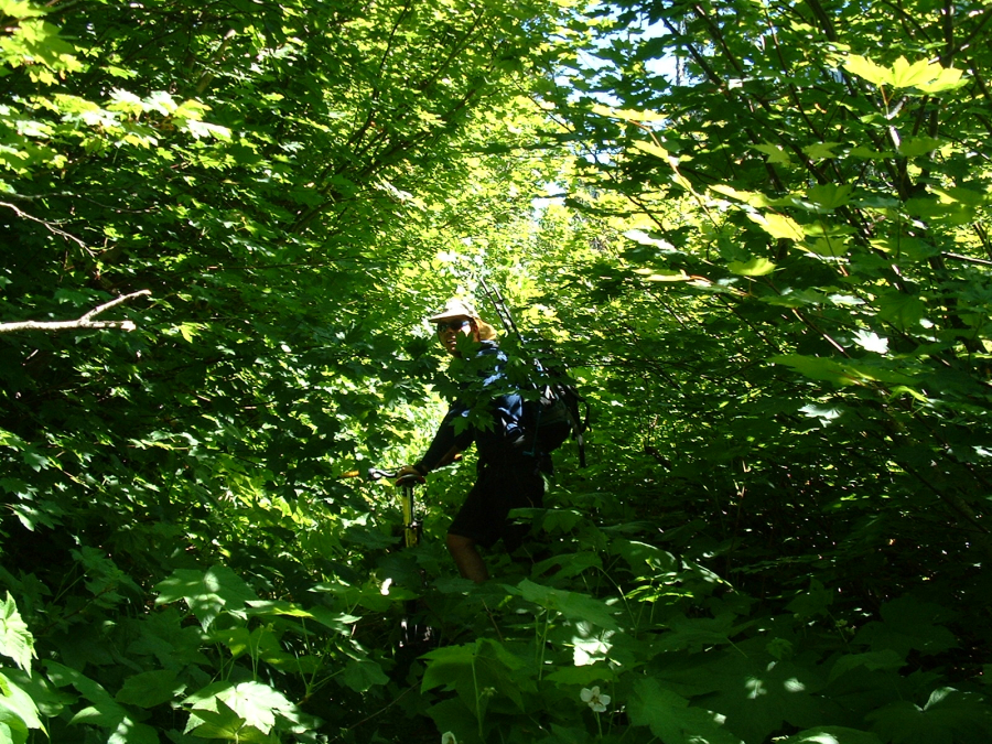
Scott folded the rear seats down in his Legacy wagon, and we tried to get some quick sleep before our 3:30am wakeup time. Our one-day ascent was dictated by my having to be back in Seattle by 9pm the same day. With over 10 miles to reach Boulder Pass (near glacier's edge) we had a big day ahead of us. To help speed things along (albeit illegally), Scott and I brought our bikes for the four miles of the mostly flat White River Trail. We hopped on our bikes and cruised easily along the White River Trail. It was little after 4am. Seldom did we have to get off and push our bikes. The trail, however, was covered in bear scat; a detail I will pay more attention to in the future. We reached the junction with the Boulder Creek Trail in less than 45 minutes. Bikes stashed, it is here that I would make a navigational blunder. Knowing that the approach entails at least one creek ford, I ignored the obvious and stupidly assumed that we had to cross the White River. (more...)

Click here to view.
home | email | copyright

All photos and text for sverdina.com are copyright © 2002-2023

It would be very much appreciated if you please ask before copying and/or re-publishing content from any part of these pages. To do so, please click here to send a message via feedback form.

Thank You.

©2023 sverdina.com |