Last Updated: September 17, 2023


Start

Recent content updates are viewable under what's new.

Reports in the queue for posting are coming soon!

Upcoming reports & photos:

Oh my! Quite the backlog here, eh? Busy with life and adding to the queue every chance I get...

  • Caltha Peak - hike/scramble (September 2022)
  • Beauty Peak - hike/scramble (September 2022)
  • Markhor-Needle Traverse & Flatiron - hike/scramble (September 2022)
  • Conway Peak - hike/scramble (September 2022)
  • Green Mountain/Pk 2200 - hike/scramble (September 2022)
  • Mount Brew (Whistler) - hike/scramble (September 2022)
  • Mount Barbour - hike/scramble (October 2022)
  • Mount Gillespie - hike/scramble (October 2022)
  • Cougar Mountain - hike/scramble (October 2022)
  • Barn Bluff (Red Wing, MN) - hike/scramble (October 2022)
  • Mount Steele - hike/snowshoe (November 2022)
  • American Mountain (attempt), Hunter Lookout - hike/snowshoe (November 2022)
  • Belcarra Mountain - hike/scramble (November 2022)
  • Oyster Dome - hike/scramble (November 2022)
  • Mount Thom & Cilliwack Mountain/Hillkeep - hike/scramble (December 2022)
  • Frenchman Mountain (Las Vegas, NV) - hike/scramble (January 2023)
  • Rolley Peak/Lookout - hike/scramble (January 2023)
  • Round Mountain - ski tour (February 2023)
  • Blowdown Peak - ski tour (February 2023)
  • Silverdaisy Mountain - ski tour (March 2023)
  • Spearhead Glacier/Husume Coulior - ski tour (March 2023)
  • Cowboy Ridge/Peak 2026 - ski tour (April 2023)
  • Slahanay Peak - hike/scramble (April 2023)
  • American Mountain & Mount Lincoln - hike/snowshoe (May 2023)
  • Mount Mclean Attempt, Red Rock Trail, Dragons Back Trail - hike/scramble (May 2023)
  • Stawamus Chief (South, Middle & North) - hike/scramble (June 2023)
  • Flint & Feather - hike/scramble (June 2023)
  • Goat Ridge (Squamish) - hike/scramble (June 2023)
  • Grouty/Mortar Peaks - hike/scramble (June 2023)
  • Pebble-to-North Creek Traverse incl. Pebble, Thiassi, Wesley & Sugus - hike/scramble (July 2023)
  • Mount Truax - hike/scramble (July 2023)
  • Blackcomb Buttress - rock climb (July 2023)
  • Whitecap Peak - hike/scramble (July 2023)
  • Mount Hanover - hike/scramble (August 2023)
  • The "Long Traverse" incl. Long, Tynemouth, Arrowhead, Tabletop & Anemone - hike/scramble (August 2023)
  • Armchair Traverse - hike/scramble (August 2023)
  • Snowspider Mountain - hike/scramble (September 2023)
  • Mount Trorey - hike/scramble (September 2023)
  • Macleod Peak - hike/scramble (September 2023)
  • Ben Lomond - hike/scramble (September 2023)
  • Mount Killam & Gambier Island - hike/scramble (September 2023)

*As of 09/24/2023


Database

Query the reports database, selecting from criteria which include name, location, type, season etc.

Quick Links

Essential links & whatnot:


Jump To

Select from list below to jump to a specific area on this site.


| Featured Trip Report |


Last Updated: Nov. 18, 2005

Mount Constance - West Arete, September 2005


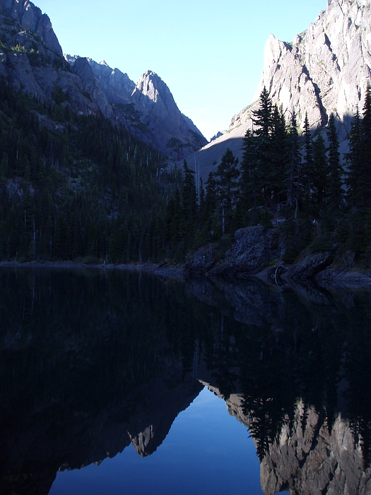
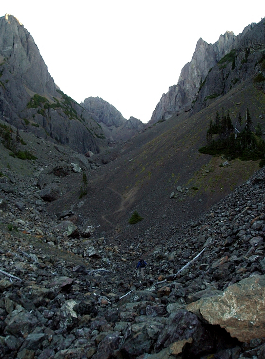
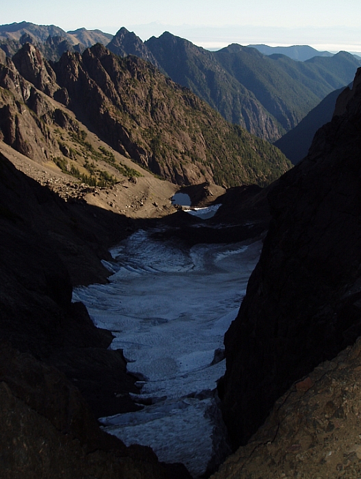
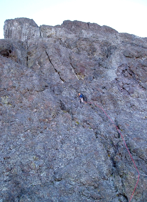
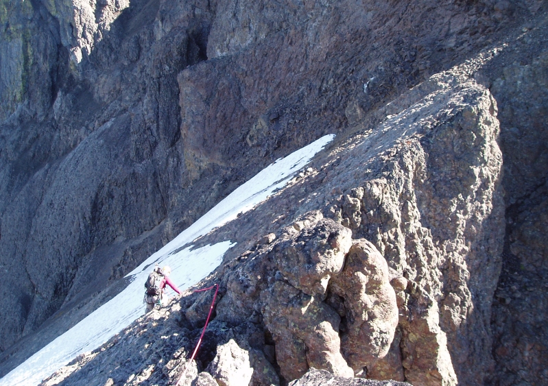
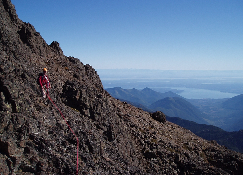
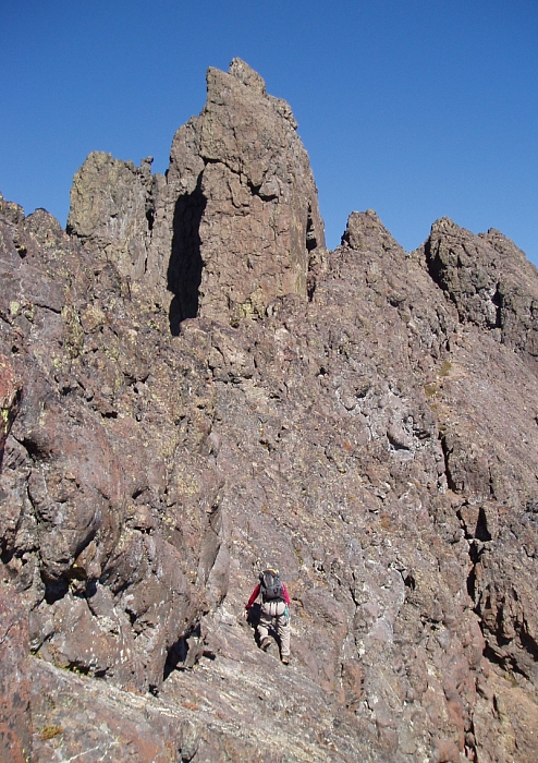
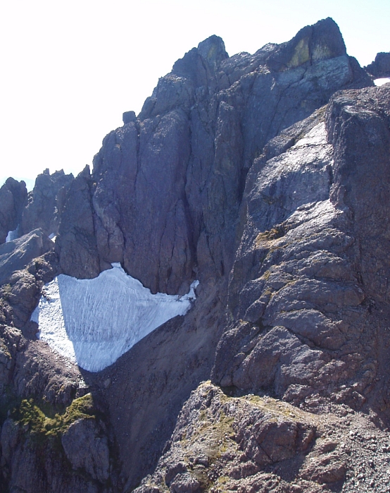
Perhaps the most prominent peak viewed from Seattle, Mount Constance is one of the Olympic "big boys". At 7743 feet, Constance is the 3rd tallest peak in the range and along with The Brothers, Mount Olympus and perhaps a few other token Olympic peaks, it makes for a worthy objective. In a mountain range comprised primarily of rotten volcanic rock, Mount Constance stands apart in that it is among very few that boasts an enjoyable technical route on reasonably solid rock - the West Arete. Certainly, there are easier routes, namely the Finger Traverse or Terrible Traverse, but for a route-bagger such as myself, only the West Arete would do.

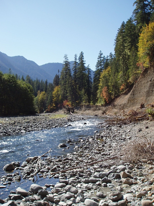
Convincing Eric to join me on this adventure took some doing - this would be his third time on Constance, and as such I'm sure he won't hesitate to demand repayment in full with some grueling, out-of-the-way suffer-fest that I'm obligated to join him on. Oh joy. Anyway...after parking at the foreshortened road's end, we descended the scarp left behind by the washout and pushed our bikes along a dusty path paralleling the Dosewallips River. Regaining the road at the other end of the washout, we pedaled the five miles or so to the bridge spanning Constance Creek (a gradual but constant incline) with the Lake Constance Route trailhead sign just beyond at right. Behind a large boulder below at left is a good, albeit unnecessarily strenuous to get to location to stash a bike...or thirty. (more...)

Click here to view photos.
home | email | copyright

All photos and text for sverdina.com are copyright © 2002-2023

It would be very much appreciated if you please ask before copying and/or re-publishing content from any part of these pages. To do so, please click here to send a message via feedback form.

Thank You.

©2023 sverdina.com |