


Sperry Peak - South Ridge, October 2007

Having been granted the proverbial green light to take a break from his parental obligations, and myself having been cleared for a day off from my caretaker duties (Agata recently underwent sugery on her ankle), Scott and I were effectively handed a kitchen pass to go play in the hills. I succeeded in talking Scott out of skiing up on Mt. Baker, citing the obvious lack of new snow, for my tastes anyway and instead proposed doing a scramble of some sort. A few options were discussed, but we eventually settled on climbing Sperry Peak's South Ridge. With the shorter days, and more than just a dusting of snow on the higher peaks, this easy rock scramble seemed the ideal venue for a casual, yet enjoyable romp in the mountains.
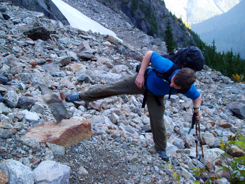
I picked up Scott at his Mill Creek residence around 6:30am and proceeded to drive to Granite Falls and beyond, taking a right on the obscure turnoff that leads to the Sunrise Mine Trailhead. Only a few cars were present and we wondered if anyone would be joining us on our route. We were on our way by 8:30am, following a trail through cool, dark and damp forest. A footbridge near the trailhead is mostly destroyed, but can still be passed by carefully negotiating the slippery rocks in the creek. The trail crosses the South Fork of the Stillaguamish River after about a half-mile. The big log that apparently served for many years as a bridge was nowhere to be found. Careful boulder hopping again saw us safely to the opposite bank. Once across the Stillaguamish, the trail leaves the forest and traverses into lower Wirtz Basin.
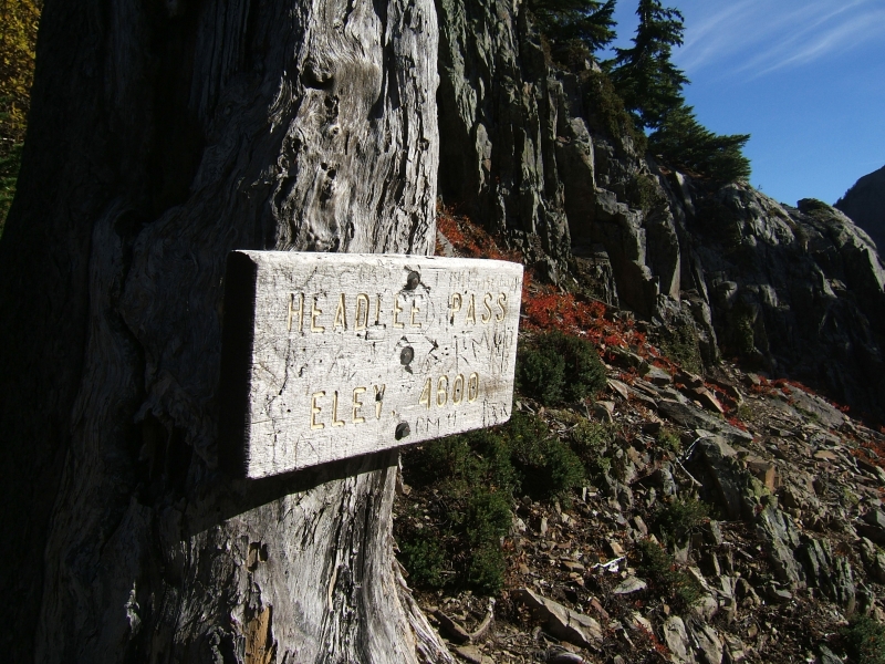
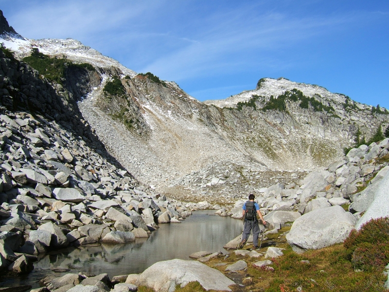
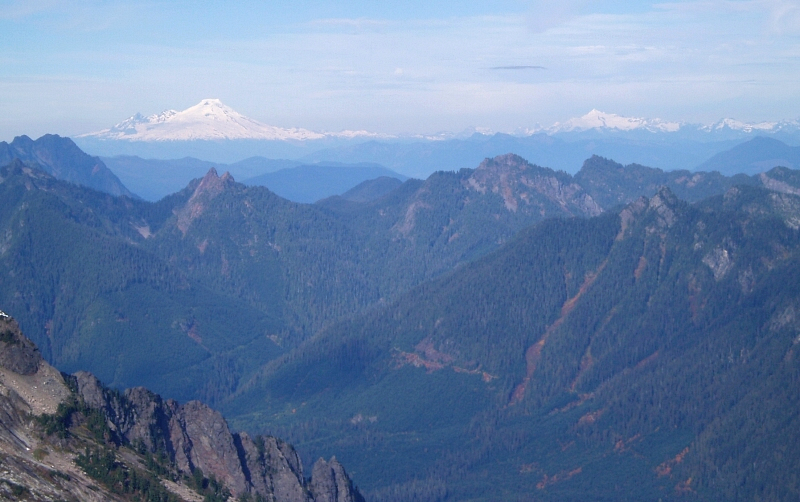
A series of steep switchbacks climbs through some brush and evergreens before breaking out of the trees and proceeds in long switchbacks across a large talus field marked by cairns (which we took every opportunity to topple). Headlee Pass soon came into view - it isn't visible from the entrance to the basin. It was the same sweaty grunt hiking up the ever-tightening switchbacks as they spiral to the top, as it was the last time I was here to climb Vesper Peak back in 2002. Lake Elan is less than a half-mile from the pass. The trail descends about 50 feet, and contours beneath Sperry Peak on a talus slope to the outlet stream. Looking up, a good amount of dusting on the top 500 feet of Vesper Peak (6,214 feet) was readily apparent. Turning right near the lake's outlet, Scott and I proceeded up heather benches aiming for heather gully that leads to a notch in Sperry's South Ridge.
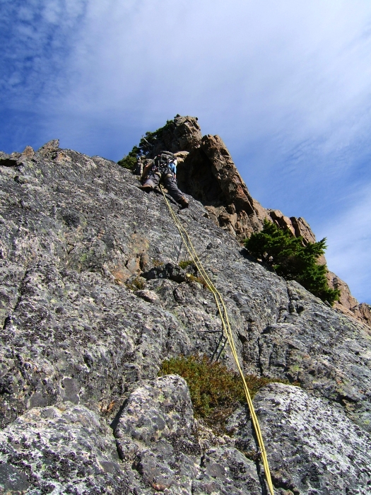
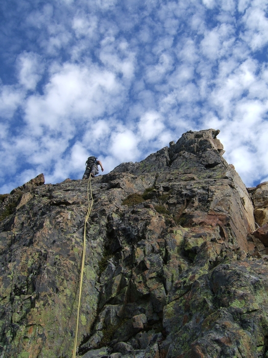
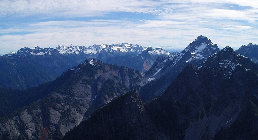
The rope, rack and harnesses came out of our packs at the notch. I led out from the notch up a short, steep section of ridge. When the rope came tight, I yelled down to Scott to simply simul-follow. I tried my best to climb on the crest as much as possible with only short sections of brush or rock of dubious quality forcing short detours on the occasionally brushy left side of the crest. Forced to traverse a snowy patch, again just left of the crest, we gained another notch before climbing steeply upwards to re-gain the crest. The ridge eased-off for a stretch, making for an enjoyable, yet airy ramble with nice views of Vesper Peak and Lake Elan to the left and the Monte Cristo Group in the distance to our right. Peering over the right-side of the crest, the rock on the East Face fell away dramatically. I reeled Scott in at a sandy ledge before embarking on the next leg of the climb. Reminiscent of the North Twin's West Ridge, the climbing at this point can be made as interesting or mundane as desired. Continuing up on broken rock amongst scrub evergreens, I neared an aesthetic finger of rock perched atop the crest. I backed-off the final moves to the very top of this finger when a key hold threatened to come loose, taking a good portion of the finger down with it.
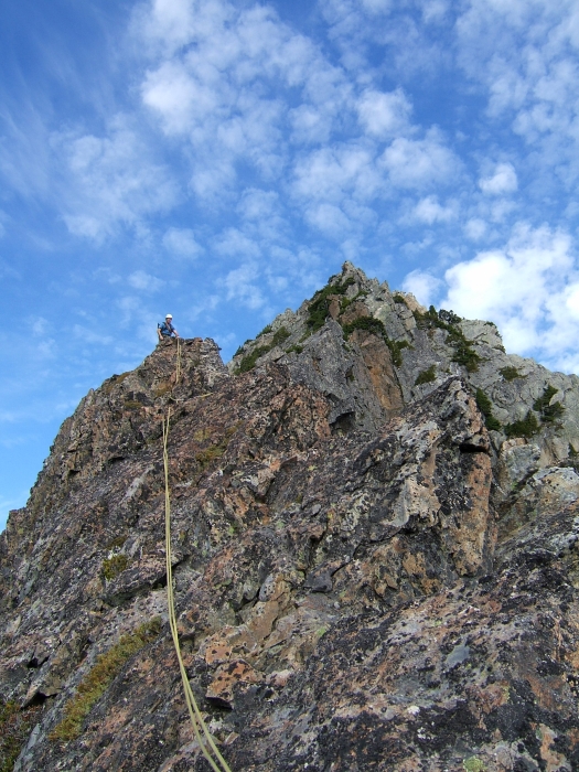
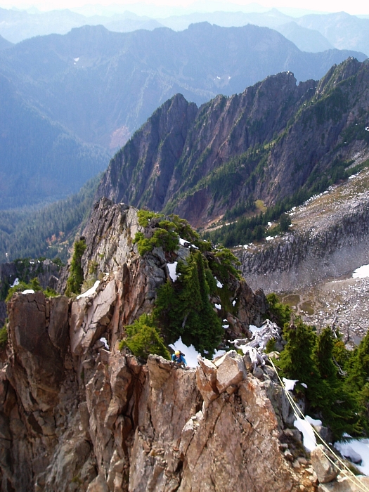
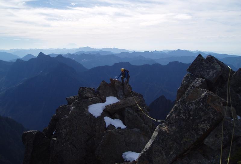
A short traverse left and up a dihedral saw me back on the crest. I continued to a small saddle (seen here) and reeled Scott in again to help mitigate rope drag. Beyond the saddle, I climbed a short hand crack just right of the crest, and worked my way into a cave roughly the size of a small closet. With my feet peeling-out on the featureless rock on either side, I struggled to pull through the slight overhang, eventually giving up after several false starts. I settled for the easy bypass at left. Climbing above the cave, I encountered a fun slab with finger crack followed by a few, fun stemming moves in a dihedral before topping-out on a false summit. I scrambled down into the notch beyond the false summit and again back up to finally reach the summit proper. I dropped my pack and rack and reeled Scott in one final time. It was great fun watching Scott climb up over the false summit - with the October afternoon sunshine painting a fading pastel of successive ridge crests off into the distance, this vista exemplifies the climbing in this rugged but accessible corner of the Cascades to me.
Lofty aspirations of continuing on to the summit of Vesper were nixed in favor of a long rest on the summit. After a tasty lunch, courtesy of Starbucks, it was time to begin our descent. Plunge-stepping though crusty snow on the West Ridge, we soon dove into steep brush and proceeded to brachiate our way down the slippery Southwest Slope. Gaining a broad bench above Lake Elan, Scott and I proceeded to the low saddle between Sperry and Vesper before beginning the descent down to the lake proper. Traversing the north-edge of the lake, we noticed a party of two descending from somewhere on Vesper. In addition to the father-and-son team descending from Headlee Pass earlier that morning, these were the only souls we encountered that day.
We were back at Headlee Pass in no time and soon found ourselves toppling the last of the cairns that somehow eluded us on the hike in. Despite our efforts, something tells me that the party behind us managed to navigate their way back to the trailhead just fine. In any case, we finally reached my car around 5:30, just as the first drops of rain began to fall. I took one last glance at Sperry and its prominent Northeast Ridge from the rearview mirror on the drive back home and wondered what to make of the 5.7 rating in the CAG. Reflecting on Martin's suggestion earlier this summer to climb the route, it now struck me how obvious and seemingly aesthetic the line really is. I guess I'm not quite done with Sperry, or it with me for that matter. But, alas all that will have to wait; wait for the wind and rain and snow to pass, wait for the melt and scorching sun to pass, wait for crisp mornings and long shadows of Autumn, when my attention is once again drawn to the peaks of the Mountain Loop at the time of year when they're at their best!
Click here to view photos.
![]()


