Last Updated: April 17, 2024


Start

Recent content updates are viewable under what's new.

Reports in the queue for posting are coming soon!

Upcoming reports & photos:

Oh my! Quite the backlog here...

  • American Mountain & Mount Lincoln - hike/snowshoe (May 2023)
  • Mount Mclean Attempt, Red Rock Trail, Dragons Back Trail - hike (May 2023)
  • Stawamus Chief (South, Middle & North) - hike/scramble (June 2023)
  • Flint & Feather - hike/scramble (June 2023)
  • Goat Ridge (Squamish) - hike (June 2023)
  • Grouty/Mortar Peaks - hike/scramble (June 2023)
  • Pebble-to-North Creek Traverse incl. Pebble, Thiassi, Wesley & Sugus - hike/scramble (July 2023)
  • Mount Truax - hike/scramble (July 2023)
  • Blackcomb Buttress - rock climb (July 2023)
  • Whitecap Peak - hike/scramble (July 2023)
  • Mount Hanover - hike/scramble (August 2023)
  • The "Long Traverse" incl. Long, Tynemouth, Arrowhead, Tabletop & Anemone - hike/scramble (August 2023)
  • Armchair Traverse - hike/scramble (August 2023)
  • Snowspider Mountain - hike/scramble (September 2023)
  • Mount Trorey - hike/scramble (September 2023)
  • Macleod Peak - hike/scramble (September 2023)
  • Ben Lomond - hike/scramble (September 2023)
  • Mount Killam & Gambier Island - hike (September 2023)
  • Lone Goat & Snow Camp Mountain - hike (September 2023)
  • Isollilock Peak - hike/scramble (October 2023)
  • Manson - Hatfield Traverse - hike/scramble (October 2023)
  • Gargoyles & Columnar Peak - hike/scramble (October 2023)
  • Opal Cone and Lava Glacier - hike (October 2023)
  • Park Butte (WA) - hike (October 2023)
  • Trappers Peak (WA) - hike/scramble (October 2023)
  • Rattlesnake Ledge (WA) - hike (November 2023)
  • Sauk Mountain (WA) - hike (November 2023)
  • Mount Daniel & Pender Hill (Sunshine Coast) - hike (November 2023)
  • Mount Dickerman (WA) - hike (November 2022)
  • Winter's End (Verona Peak) - hike/snowshoe (November 2023)
  • Dolomites (Italy) - snowboarding (December 2023)
  • Red Rock Canyon (NV) - hike (January 2024)
  • Flute & Oboe - split tour (February 2024)
  • Whistler misc. (Train Wreck, Loggers Lake, Shadow Lake etc.) - hike (February 2024)
  • Mount Underhill - hike (March 2024)
  • Bombtram Mountain - hike/snowshoe (March 2024)
  • Steep Peak - split tour (March 2024)
  • Ruby Mountain (WA) - hike/snowshoe (April 2024)
  • Blustry Mountain - hike (April 2024)
  • Sowerby Peak (Barr East) - hike (April 2024)

*As of 04/21/2024


Database

Query the reports database, selecting from criteria which include name, location, type, season etc.

Quick Links

Essential links & whatnot:


Jump To

Select from list below to jump to a specific area on this site.


| Featured Trip Report |


Last Updated: Mar. 25, 2002

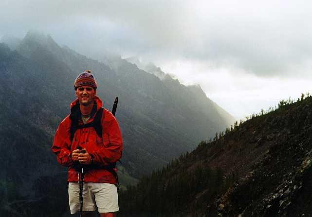
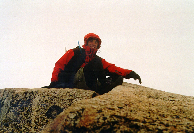
Mount Stuart - Cascadian Couloir, July 2001


Chris and I were desperate for the summit of Mount Stuart, by any route possible. So, on a weekend with marginal weather in areas farther west we hoped for Eastern Washington sunshine and set course for Mount Stuart via the Cascadian Couloir. We drove to the trailhead on a Friday evening, pitched a tent on the parking lot gravel and fell asleep to wind gusts and rain showers. Chris had other obligations that Sunday and so we had to pull it all off on Saturday. With 8000ft of total elevation gain, it ended up being the biggest single day climb I have accomplished to date. I just wish I could have had a view to show for my efforts.

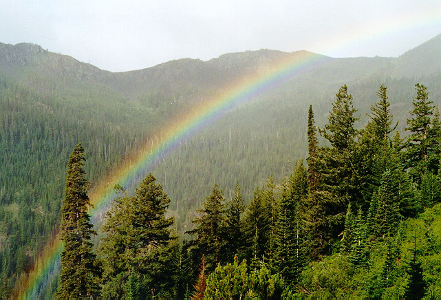
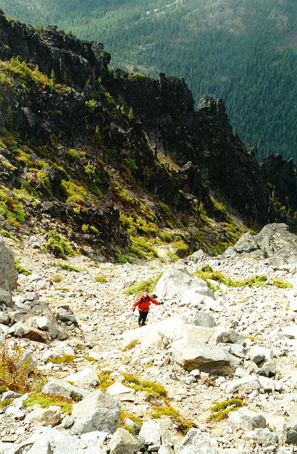
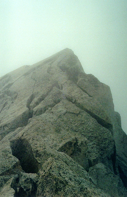
We hiked up to Long's Pass and were met with a stiff breeze and crummy weather. We dropped down to the base of the adjacent valley, took a right and followed a stream for a ways, ignoring a few trail spurs to our left. We settled on the 4th or 5th trail spur and started heading up the mountain. We stopped shortly thereafter for a rest and some eats and had a rainbow to enjoy while doing so. I was convinced that the clouds would burn off by afternoon. Chris felt otherwise. The Cascadian Couloir was loose and steep in places. The clouds would thin out at times but unfortunately nothing permanent. Eventually, we reached the broad talus slopes above the Couloir. Chris stopped for a rest but I continued through the fog until I reached what I first thought was the summit, but my altimeter suggested otherwise. Shortly thereafter Chris scrambled over the last few boulders to the false summit. (more...)

Click here to view photos.
home | email | copyright

All photos and text for sverdina.com are copyright © 2002-2024

It would be very much appreciated if you please ask before copying and/or re-publishing content from any part of these pages. To do so, please click here to send a message via feedback form.

Thank You.

©2024 sverdina.com |