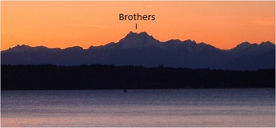
The Brothers - South Face, November 2001

This is the second of two trips out to the South Brother. On the first trip, Chris and I embarked for the Lena Lakes trailhead (near Hamma Hamma River) on a soggy Spring Friday evening in 1999. After what seemed like an interminable drive across Bainbridge Island, we arrived at our destination. The next day we hiked through the Valley of Silent Men, past lower Lena Lake, to a camping area far up in the valley. We cooked dinner, talked of ATM switches and routing hardware and had a good laugh at how frivolous it all seems out in here in the wilderness.
Summit day was unfortunately another misty day. I'm not sure why exactly we decided to go for the summit, but the going was extremely slow in all the fresh snow. As I approached the summit, all I could see was white. I could not tell where the mountain ended and sky began. I hung out long enough to choke a granola bar down my throat. I was soaked and cold and had no interest in lingering. I descended a few paces seeking shelter in an alcove and waited for Chris to tag the summit. We glissaded down with our shovels in record time, packed up headed out. We reached the car just as it got dark thankfully catching the last Bremerton - Seattle ferry run of the night (after a very confusing navigation screw up, might I add) and collapsed into a real bed a few short hours before having to wake up for work.
Blessed with an unusually good weather weekend in November 2001, I chose to revisit The Brothers for the day and experience the view that I missed last time. All was well until I got a nice speeding ticket a few miles outside Bremerton. Refusing to let that get me down, I vowed to take the ferry next time and continued driving to the Hamma Hamma River camping area. The water was quite high at Lower Lena Lake and some of the lower camp sites and portions of the trail were flooded. There wasn't a soul out here today and the solitude was a welcome change. Unlike my previous trip, there wasn't any snow to cover up all the dense brush and small trees. The going slowed somewhat and became quite frustrating, particularly in an area that appeared to be prone to winter avalanches, judging by the amount of fallen trees and debris that had to be walked over and around. The trail then ducked back into some trees and became quite steep before reaching a wide rock gully that opened up to broader talus slopes above, beneath the base of South Brother.
I traversed right below the cliffs and aimed for a prominent chute just before a small stream crossing. Chris and I had climbed up through the chute last time, but with the lack of snow cover it seemed that the better option was to swing farther to the right and ascend the shoulder. Ideally, once above the gully one would want to bear slightly to the left and follow a series of alternating wide and narrow gullies to the upper portion of the mountain. I attempted to avoid this by climbing directly upwards from the shoulder and encountered some steep and cliffy terrain and had to backtrack somewhat. Once on the upper portion of the mountain, I aimed for the saddle directly above me and had unobstructed views of the Olympic Range.
There was still more mountain to my right so I made an ascending traverse in that direction. I finally reached a broad ramp that lead to the highest visible point and a short scramble later I was on the summit soaking in the sunshine coming at me from the south. To the northwest lay Hood Canal and Everett with a distant view of the Cascades. Mount Rainier dominated the view directly southeastward. The only company I would have that day would be a small single prop airplane flying circles around the summit. I had already exceeded my turn-around time and with the shorter days, I knew it would be dark before I reached my car. Descending back down the series of gullies on the South Face was painfully slow as the rock was steeper than I expected and icy. I reached the floor of the valley at dusk and jogged back to Lower Lena Lake before it became completely dark. I spent the remaining hour-and-a-half trying to ignore the sensory deprivation-induced visual and auditory hallucinations. After what seemed like an eternity, I reached my car and two or three beers later my neurons were firing correctly again.
Click here to view photos.


