


Mount Curtis Gilbert - Conrad/Meade Glacier, November 2004

I first spied the Goat Rocks from the southwestern flanks of Mount Rainier during my early attempts at climbing that pesky volcano. Probably the most rugged and certainly the tallest and most interesting of the high peaks of the Southern Cascades (actual Volcanoes excluded), the Goat Rocks tend to be overlooked for the more obvious peaks in the area - Rainier, Adams and Saint Helens. However, the Goats tower above the densely timbered hills that constitute the majority of the Southern Cascades and as such beckon the Cascades peakbagger to come in for a closer look. Future views of the range from Castle Saddle (Tatoosh Range) and most recently from the northern slopes of Mount Adams rekindled my desire to visit this remote area. I easily sold the idea to Eric Hoffman, Eric Houtkooper (Hoochie ~ as we called him back at WSU) and Jerry Sanchez...what better opportunity than to spend a sunny November weekend in the Goats? Our objective you ask? Why the tallest peak in the range of course - Mt. Curtis Gilbert (8,184 ft). Our route? The Conrad Glacier; and we'd do it on skis/split to boot! Um, well, sort of...
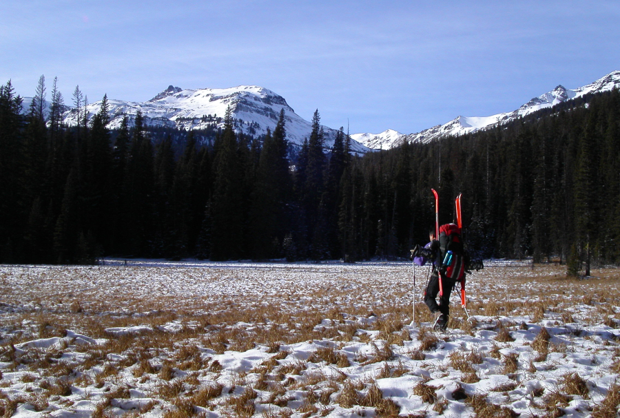
We started at the Conrad Meadows trailhead. The approach is a mind-numbing valley slog for most of the 8 miles to camp. It was easily the farthest I have gone with skis (plus overnight gear) on my back. Surely we would be skinning within a couple miles of the trailhead right? Not so! At best, we skinned maybe the last mile to camp. No doubt a reminder that it is still very much autumn and not winter yet! Despite the trivialities of the approach, there are at least two suggestions I'd offer any prospective party. First, at a faint fork in the trail about two miles in, take the "un-maintained" uphill (right) fork, else you will find yourself running laps on the Surprise Lake Loop! The correct trail traverses a minor forested ridge and descends to the Conrad Creek Valley for several more miles of uninteresting forest and meadow walking. We eventually lost the trail at a marshy meadow, and blindly plowed ahead through slushy mud to reach open forest, and the trail, at the opposite end of the meadow. A wise alternative would be to crash through dense forest skirting the right edge of the marsh. While doing this, look for a trail continuation which climbs up around the fallen trees down low and avoids the marsh entirely.
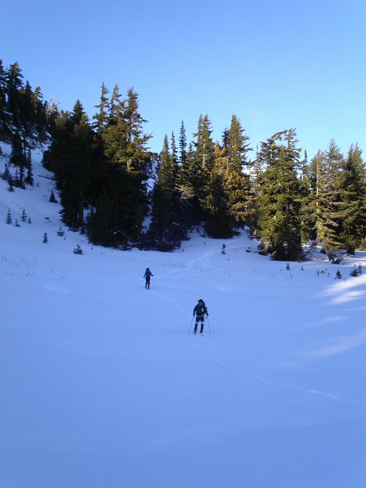
Beyond the marsh, the steepest hiking of the day was encountered; we were now finally making some honest elevation gain. Eventually the snow and mud mix on the trail gave way to a thin, but consistent blanket of snow. At a small drainage (draining left/southeast) with cliffs ahead, we turned right and booted up cold, powdery snow to a broad, lightly timbered bench immediately above the aforementioned cliffs. This bench more or less makes a high traverse on the northwest side of the upper Conrad Creek drainage all the way to Conrad Lake. With Conrad Creek now far below on our left, we finally removed the skis from our packs and skinned along the bench into the broad U-shaped basin draining the Conrad Glacier.
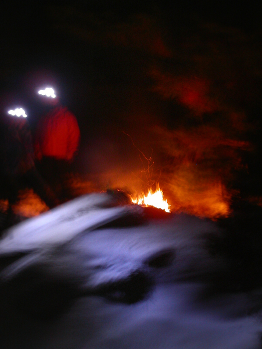
We came to a clearing, and caught our first glimpse of Conrad Lake far ahead of us - our intended camp. With darkness rapidly approaching and a member of our party still straggling some distance behind us, it seemed unlikely that we'd reach the lake on this day. We shifted our attention to finding a suitable location to pitch our tents, preferably one with running water nearby. But, first we had to find a reasonable way to negotiate a sparsely snow-covered scree slope that interrupted the otherwise level bench we were following. Much flailing and cursing saw us across this annoying traverse. Fortunately, as the terrain leveled off again, we encountered a small stream with a small stand of sheltering trees nearby. Aha...too good to pass up! Yup, this would be our camp spot for the night. To quote Eric, who captured the mood of the evening perfectly: "Once camp was set, bellies full, and fire going, we just sat around and told stories about trips past. We weren't alone as we were soon greeted by Jack, his distant cousin Jose, and adopted nephew Yaeger." Perfect.
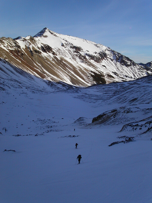
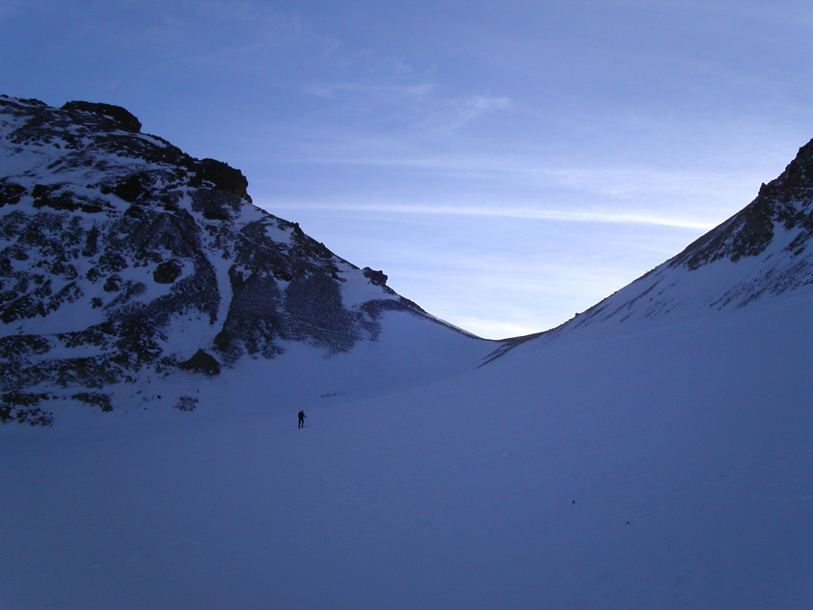
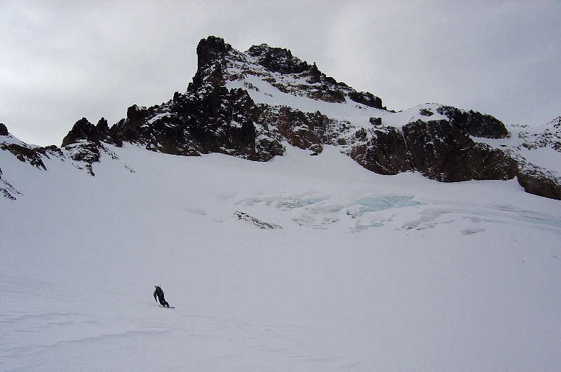
Clouds rolled in late that evening and cast doubts in our minds for what the next day would bring. By morning, however, the skies were mostly clear, revealing a sunrise almost as spectacular as the sunset the night before. As the orange glow of November's early morning sun crept up the basin, we set out towards Conrad Lake. The glacier came into view as we neared the lake. It looked a bit bony, and rocks were still protruding from the recent shallow snow cover. We had certainly hoped for better conditions than this. Eric and I slapped our skis down on the hard snow/ice of the lower Conrad Glacier for traction. Apparently, Hoochie and Jerry weren't inspired by the exposed, blue glacier ice and the slapping sound, so opted instead to skin up an enticingly sunny slope nearby. As the glacier leveled off, shallow pockets of wind-deposited powder concealed the ice below. After one final short, but steep and icy pitch, we gained the low saddle between the Conrad and Meade glaciers...and at last, also some direct sunlight!
Eric became frustrated with that last bit of ice below the saddle (splitboard skins apparently climb ice better than regular skins). Furthermore, he curiously opted not to ski the short but most-enjoyable descent down from the saddle onto the Meade Glacier. Instead, he chose to leave his skis behind, and boot the rest of the way to the summit (and back down to the lake). After converting my board back to skin-mode at a level bench partway down the Meade, I chased after Eric and joined him at a small wind-sculpted ridge just below Gilbert's summit crags. I ditched my skis there and followed in Eric's footsteps to the far northwest edge of these crags whereupon I climbed a short but easy rime ice/rock pitch to the narrow summit ridge. A pole with USGS seal capping its top and protruding from the crest where we topped out suggested to us that we had reached the true summit. However, the rocks a few yards to our southeast were easily a couple feet taller than where we were standing. Screw it...close enough.
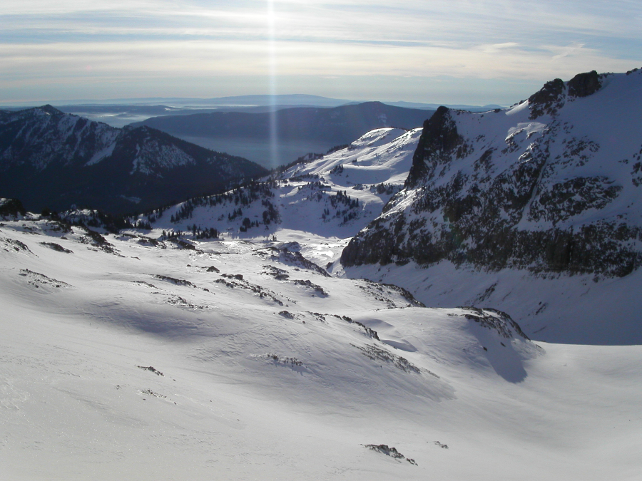
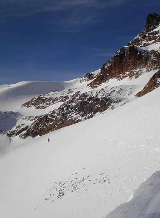
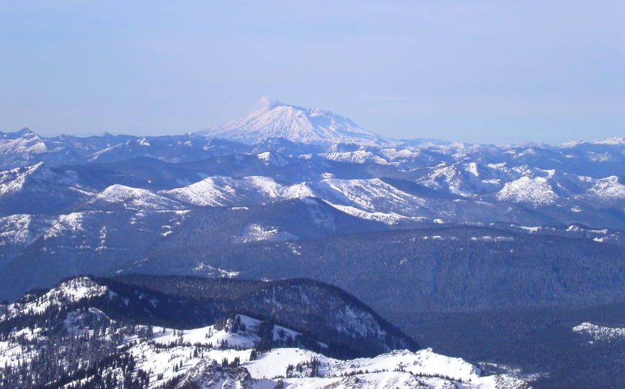
Views - there were plenty, from the obvious volcanoes surrounding us, to the spine of the Goat Rocks extending to the northwest. The basin below Old Snowy's north side looked like it would be an awesome ski. Certainly the snow coverage appeared to be better there. I made a mental note to come back and climb/ski Old Snowy someday. We didn't dawdle on the summit for long and were soon making our way back down to where I had stashed my split. Eric continued down while I assembled my board for the descent. Thanks to Eric's suggestion, I found nice snow on an open slope to skier's right of our up-track. Cutting back left near the bottom, I rode past Eric and followed our skin/boot track back towards the Conrad - Meade saddle. I side-slipped a short icy slope directly below the saddle, and thankfully found some nice wind-swept powder at the skier's-right margin of the glacier. After threading though exposed rock-bands near the bottom, I rode a final powder slope down to the lake. A good run! Too bad I didn't have time to go back for another lap.
Back at camp, we learned the outcome of Jerry and Hoochie's attempt at skiing that other slope. After having only skinned short distance above the lake, one of Jerry's Silvretta bindings brokeâ¦or so he thought. Actually, he had this problem once before - when we toured on Ruth Mountain a couple of years ago. That time we actually broke the binding trying to hammer the slider-track adjustment back to the center position. Unable to re-adjust the binding, Jerry couldn't keep the ski on his feet and so had to turn around and boot back to camp. My advice: DO NOT get Silvrettas! Probably as an act of solidarity, Hoochie decided to join him shortly thereafter. So, no turns for Jerry...or Eric, and scarcely any turns for Hoochie. We're off to a lousy start here folks! Now in a race against the coming darkness, we hurriedly packed up camp and set out on the unpleasant 8-or-so-mile march back to the car. Almost as fast on foot as he is on skis, Jerry motored ahead. He had pulled up his car and had the heat cranked by the time we staggered up to the roadside in the waning twilight. What a guy! Now who's up for Old Snowy?
Click here to view photos.
![]()


