


Kyes Peak - South Ridge, August 2002
 as seen from West Face of Sloan Peak.")
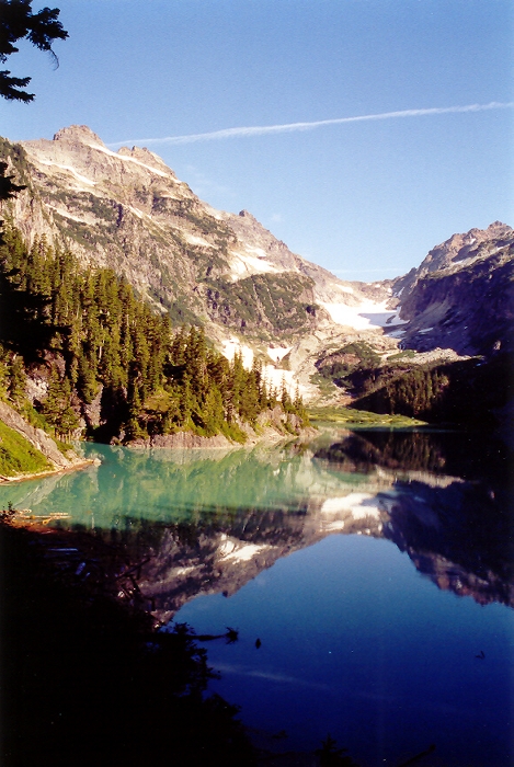
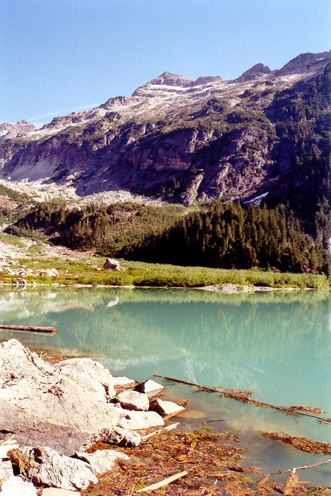
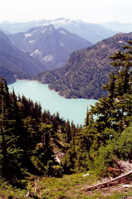
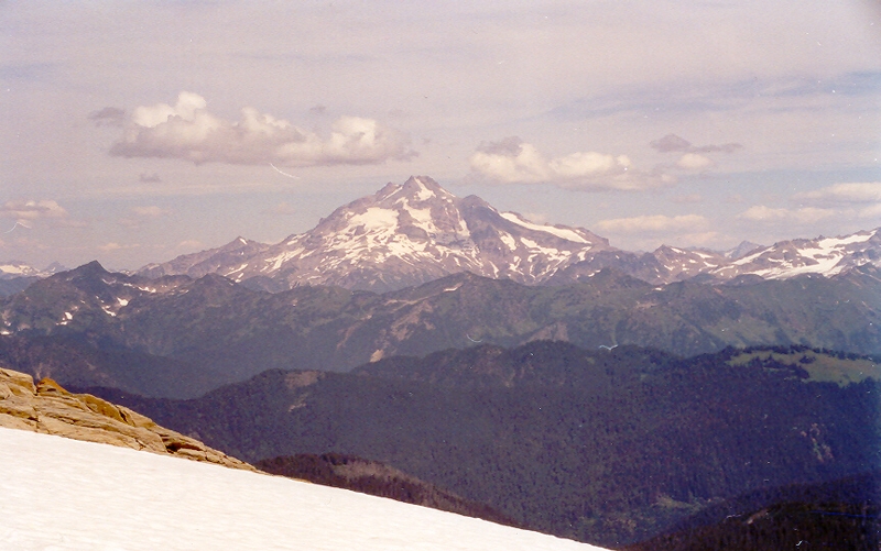
It was time to explore the Monte Cristo Group again. I tossed around the idea of either climbing Columbia or Kyes Peak, and eventually settled on Kyes Peak via the South Ridge as it involved an approach that I haven't already done. Kyes Peak also happens to be the highest summit of the Monte Cristo Group and therefore would probably offer the best views of the surrounding area. I started up the trail around 7:00am and made good time hiking through lush forest to subalpine meadows. The trail then dropped a bit to the tiny Virgin Lake (frothy scum floating on surface) and eventually drops all the way down to Blanca Lake. If planning on climbing Kyes via the South Ridge, I recommend seeking out the faint climbers trail at the north end of Virgin Lake and following it as it winds up and down the ridge crest. I screwed up and descended all the way down to the southern end of Blanca Lake but was compensated by the majestic views of Columbia Peak.
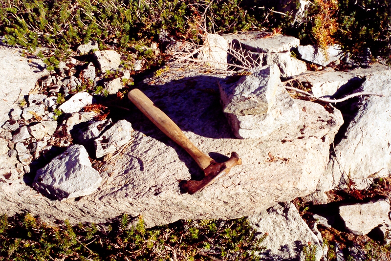
I skirted the left edge of the lake and followed a trail that headed off from the north end of the lake. En route, I passed by this hammer resting on a rock. I wondered how long it had been here and thought of taking it with me but frowned at the prospect of carrying any extra weight. I left the hammer where it was. The trail soon disappeared in a large swath of avalanche debris and I began to wonder how I would go about gaining the ridge. I scouted the far edge of the avalanche debris to see if I could locate the trail again. No such luck. I then retraced my steps back to the northern edge of the lake and followed the shoreline towards the base of the cliffs below the South Ridge. From below, I noticed an obvious weakness in the cliffs and scrambled up talus and bushwhacked my way through brush until I reached the drainage below a large, partially snow-filled gully. The gully appeared to provide access to the upper ridge and so I began the steep ascent. Soon I reached the ridge crest and located the ridge-top climber's trail. A sense of relief came over me as I took in the view of Blanca Lake now far below me.
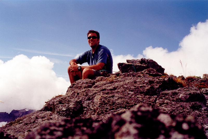
I followed the ridge trail as it followed the crest and dipped left of the crest to avoid cliffy terrain. Eventually the trail ended at a large scree field with snow patches. I made a rising traverse on the snow patches (passing cliffs to my right) and headed up on steep loose gravel towards a saddle on the ridge to my right. I passed over the saddle and continued traversing over more loose ground (some exposure) on the north side of the ridge. Shortly thereafter I reached a large snowfield and had grand views of Glacier Peak to the northwest. I had ascended snow and gravel on the right side of the spire. I then crossed over to the north side of the ridge via a saddle. I could now see the summit before me and traveled on snow (drops off steeply to the right) towards rock ledges below and right of the summit. I then scambled up mostly 3rd class terrain until reaching a knife edge and a decision making point. I could either traverse thin and exposed heather ledges above cliffs and the Pride Glacier far below (north side of summit), or work my way up what appeared to be a short fifth-class chimney. I chose the chimney and reached the summit shortly thereafter.
Weather was building to the west and clouds were approaching rapidly. I signed the summit register and headed back the way I came. Rather than re-tracing my steps back down to Blanca Lake, I followed the ridge trail as it alternated on both sides of the ridge (losing it on several occasions when cliff bands were encountered) all the way back to Virgin Lake. I finally reached the trailhead at 6:00pm. A satisfying day in the Monte Cristo Group!
Click here to view photos.
![]()


