


Monte Cristo Peak - North Col, June 2004 (by Paul Klenke)

They say that tanning beds are bad for you. But what if that tanning bed is 7,000 ft up? What if that bed is at the Monte Cristo Tanning Salon? To answer these questions, Sergio and I headed up to Monte Cristo Peak to find out. I had to be back in Seattle around 7:00PM, so we were limited in our route selection. Sergio wanted to come in via Curry Gap on the east. Having been that way on a failed attempt at the Northeast Ridge of Kyes, I knew it was not doable within our time constraints. Instead, the standard approach from the mining ghost town of Monte Cristo would have to be the route.
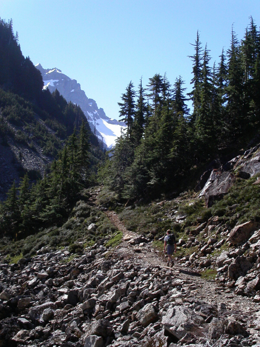
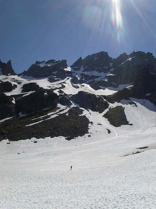
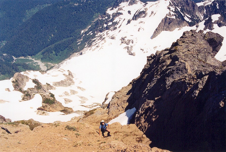
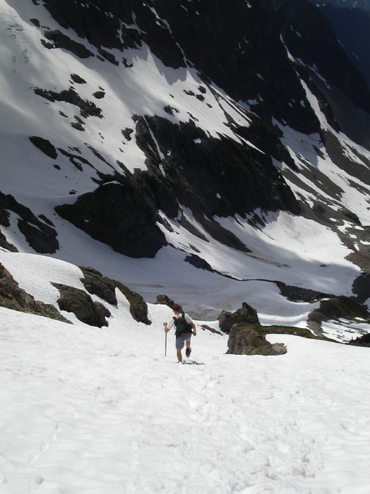
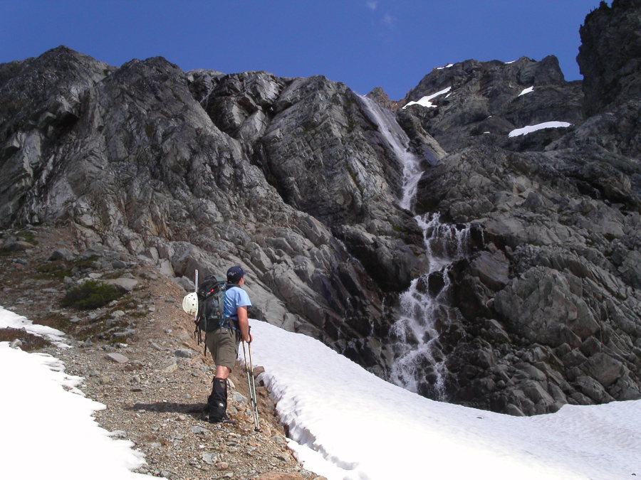
We started out at Barlow Pass (2,300 ft) at 8:00AM on bikes. It takes less than an hour to ride the four miles to the old town (2,700 ft). Then the exasperating trail to Glacier Basin was next. I hate that rocky trail past the waterfalls with a passion-almost as much passion as the water itself tumbling over the falls. It kind of seems odd that the miners of yore didn't build a better one in the late 1800's. I've joked that I probably would have climbed every peak in the Glacier Basin cirque by now if it weren't for that blasted trail! In probably an hour from the town we made the basin (4,500 ft) and saw our route to the North Col high up on Monte Cristo's North Ridge. It initially looked way steep but the closer we got the lower the angle it presented to our eyes. Sergio chose to put on his lightweight Stubai crampons early and boot it up the snowfield. I chose the melted out minor spur ridge. For me the solid spur ridge went real quick and I privately wondered why Sergio chose the slog route.
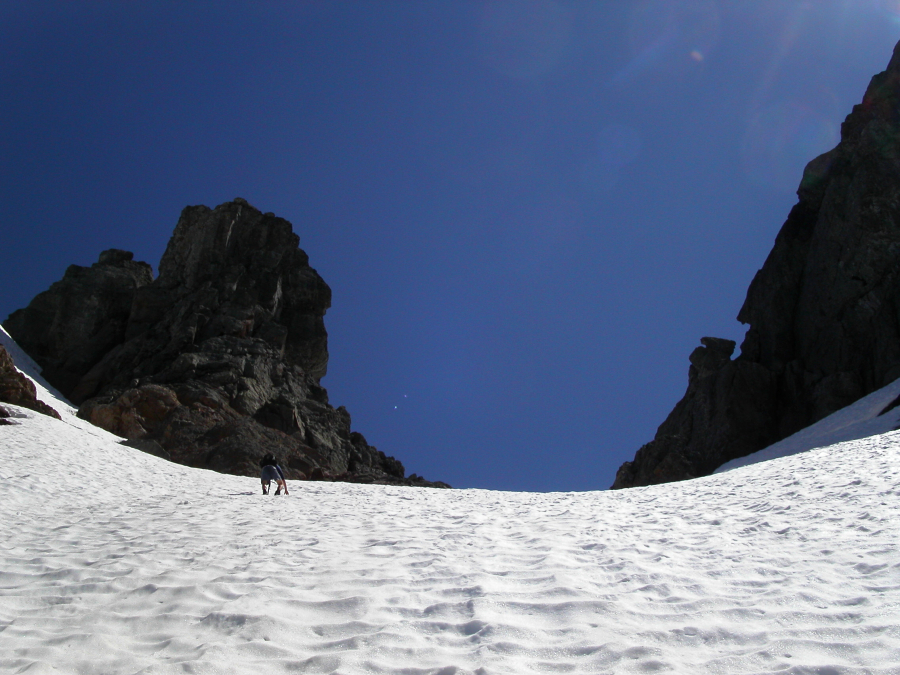
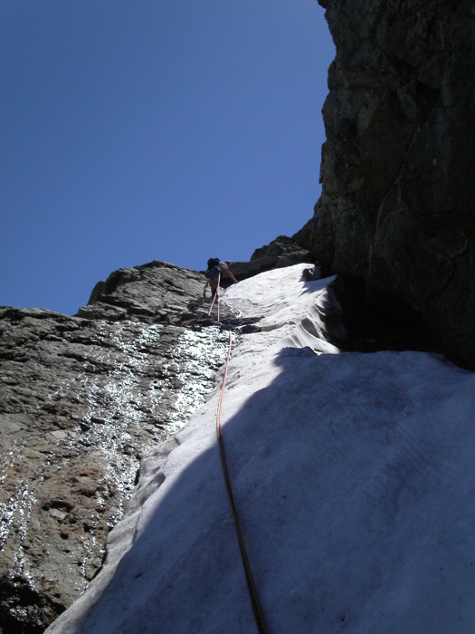
The spur eventually disappeared where a constriction in the slope/gully met a short wall with an option to go left or right around it. I should have chose the rightward path but got to smacking my lips at the sight of some Class 4 fun. Well, that was the plan anyway. What I really got was Class 4 rock slickened by waterfall spray. These two add up to Class 5 (wet Class 5). I got my pee-pee slapped on that so backed off to another possible slot. The slot was there but required a fearsome leap across a deeeep moat. After that, two simple low-fifth moves got me off the snow finger and onto rock. I then met Sergio on the other side of the rock wall and we continued on up to the col. I didn't put on crampons but very well could have. The snow at the top was steep enough and hard enough that I had to kick steps with alacrity.
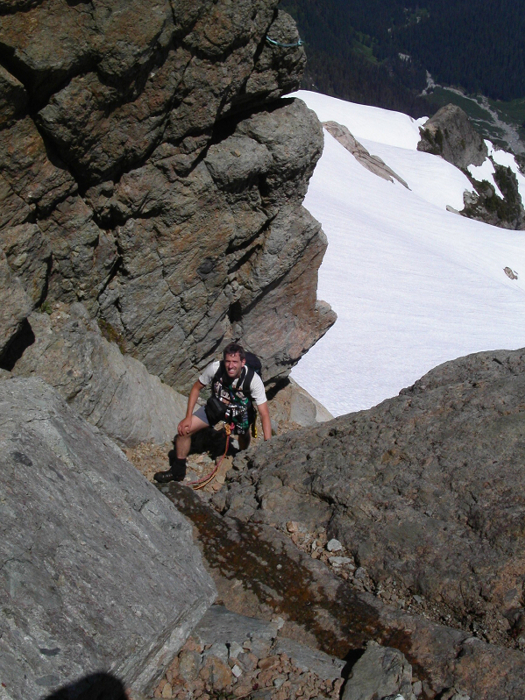
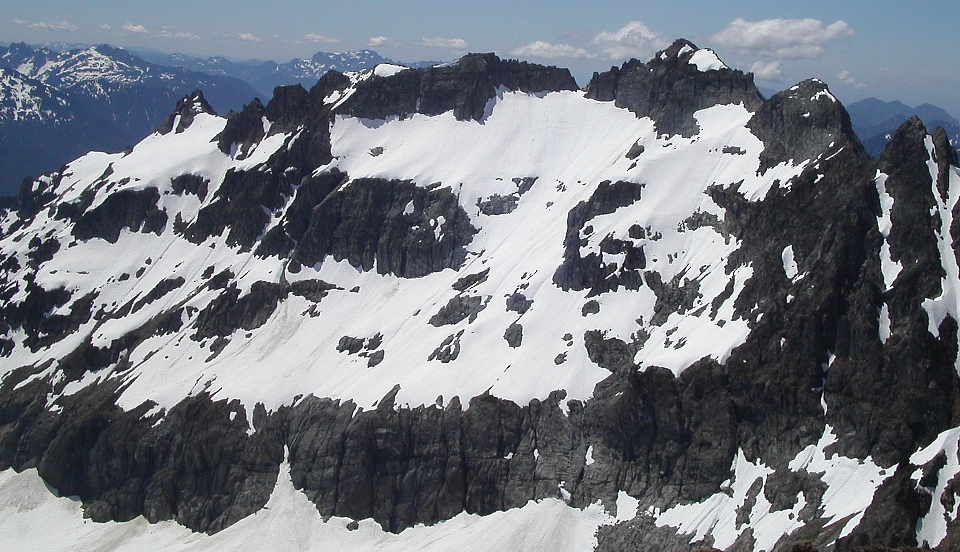
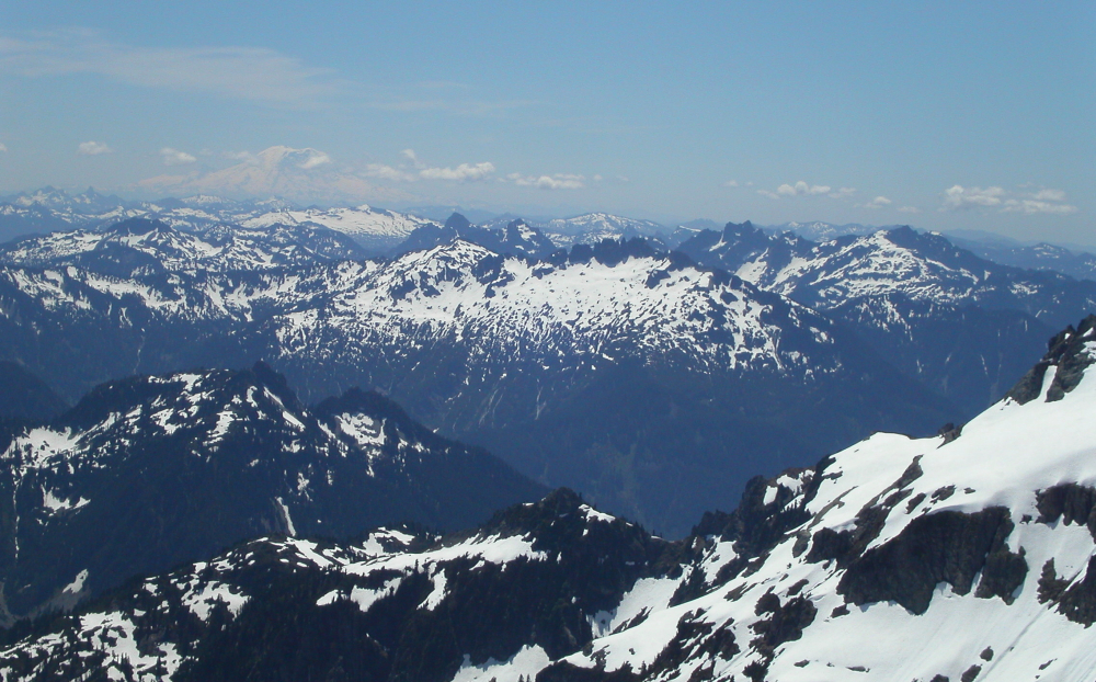
The North Col is a beautiful place. The view of Columbia through the gap to the west is especially noteworthy. However, there are many other views to the east that first present themselves here. Kyes Peak is also across the way to the south as is the final snow slope to the East Face of Monte Cristo. We couldn't yet see the section of the face where the supposed rock climbing route is, but we could see how steep the snow traverse over to it would be. I was surprised by this steepness. With Sergio kicking nice steps for me in his crampons I followed. We surveyed the rock wall above us looking for a chink in the count's armor. Rounding a small corner past some deep moats, we came upon an obvious crack. This must be it, we surmised, our decision bolstered by the climbing paraphernalia around the crack: three slings and an old piton. Fortuitously, a snowblock had fallen into the moat to provide us with a perfect step across to a rock ledge immediately below the route. How convenient! Apparently, judging by a sling and the old piton at our feet, the route starts even lower down when the snow has receded farther away (down) the face. In this regard, it might be recommendable to do this climb earlier in the season than later.
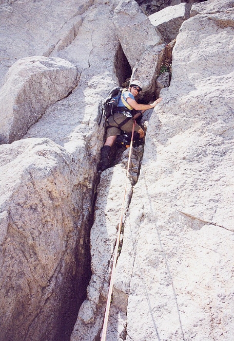
Since it was Sergio's idea for the venue, I graciously allowed him to do the leading. It wouldn't be a long lead but it was still the fun end of the rope. Doubling up our two 30m ropes, Sergio headed up. The first move was probably the hardest (5.6+) but entailed no exposure at all. The second move was in a wider part of the crack-almost a concavity-and was a few decimal places easier. The third move was about as hard as the first but was more committing and about 25 feet off the deck. The required climbing technique was also different (sort of a heave move over a bulge in a tight crack). Above the crack a rappel station was encountered. A ramp led left to easier Class 3 terrain.
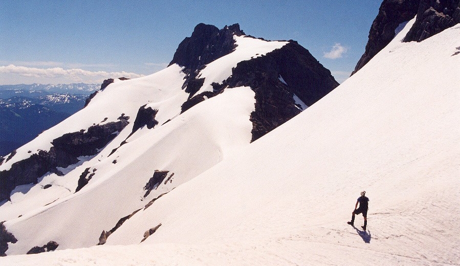
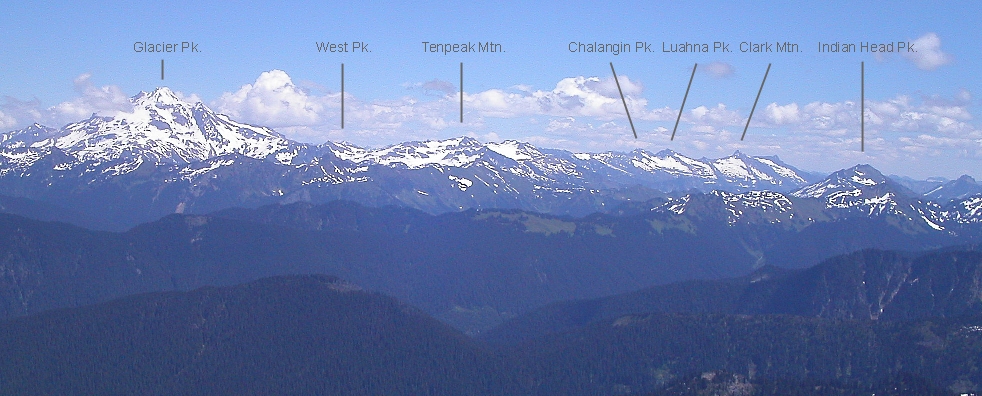
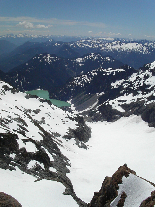
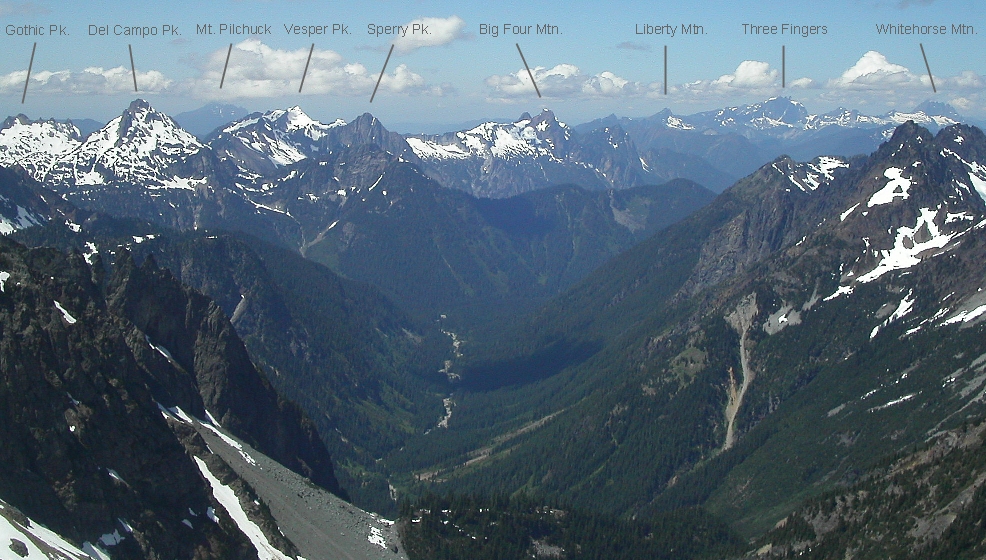
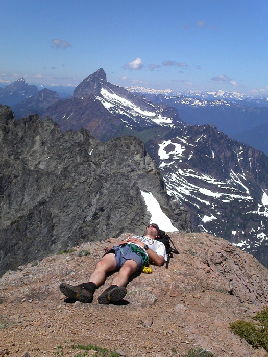
At some point, the geology changed from solid rock to total crap breccia. There was no mistaking it once we had transitioned to the latter. The rock was eroded and friable and the higher we went the worse it got. The last fifty feet or so was on pillowy blocks with sharp bulbous nubbins and pockets. Fortunately the summit (7,136 ft) was quite flat and blunt. A table-like rock provided a nice seat. Strangely, there was no register. The views were amazing-your standard set up from a 7,000-ft top. Kyes Peak stood sentinel-like over the east fringe of the Columbia Glacier. The long horizontal breccia striations of Columbia Peak were to the southwest. We could also see pretty much our entire route to the peak from the road to Monte Cristo then to Glacier Basin and finally to the mountain we were standing on.
How long would it take us to get down and back to the car from the top? Having made a time calculation, I figured we had 25 more minutes to lounge around so we bought a pass to work on our tans at the Monte Cristo Tanning Salon. While Sergio doffed his shirt to work his white chest on the summit table, I chose another flat bed nearby. 20 minutes of baking with no wind and heavy sun had us practically sweating as we lazed. However, a cool breeze picked up and evaporated that sweat. The temperature dropped enough to spur us into leaving and that we did.
Back at the rappel station we tied two 30m ropes together and rappelled back down to the base of the 5.6 crack (one 50m rope should also suffice for this rappel). We both put on crampons this time for the careful backtrack along the steep snowfield to the North Col. The snow leading off the other side was just soft enough that crampons weren't working for me (some balling at the heels while plunge-stepping so I took them off). Sergio kept his on a little longer. Within an hour we were back to Glacier Basin. Then only the rough rocky trail to go to get back to Monte Cristo. A speedy 20-minute downhill bike jam got us back to the cars at just the time I wanted to be back there: 6:00PM. We saw no one else other than on the road, although a twosome had signed in at the kiosk for a trip to Glacier Basin. I guess they saw the beds at the Monte Cristo Tanning Salon were going to be occupied so decided not to come up to the summit too.
Click here to view photos.
![]()


