Last Updated: April 17, 2024


Start

Recent content updates are viewable under what's new.

Reports in the queue for posting are coming soon!

Upcoming reports & photos:

Oh my! Quite the backlog here, eh?

  • American Mountain & Mount Lincoln - hike/snowshoe (May 2023)
  • Mount Mclean Attempt, Red Rock Trail, Dragons Back Trail - hike (May 2023)
  • Stawamus Chief (South, Middle & North) - hike/scramble (June 2023)
  • Flint & Feather - hike/scramble (June 2023)
  • Goat Ridge (Squamish) - hike (June 2023)
  • Grouty/Mortar Peaks - hike/scramble (June 2023)
  • Pebble-to-North Creek Traverse incl. Pebble, Thiassi, Wesley & Sugus - hike/scramble (July 2023)
  • Mount Truax - hike/scramble (July 2023)
  • Blackcomb Buttress - rock climb (July 2023)
  • Whitecap Peak - hike/scramble (July 2023)
  • Mount Hanover - hike/scramble (August 2023)
  • The "Long Traverse" incl. Long, Tynemouth, Arrowhead, Tabletop & Anemone - hike/scramble (August 2023)
  • Armchair Traverse - hike/scramble (August 2023)
  • Snowspider Mountain - hike/scramble (September 2023)
  • Mount Trorey - hike/scramble (September 2023)
  • Macleod Peak - hike/scramble (September 2023)
  • Ben Lomond - hike/scramble (September 2023)
  • Mount Killam & Gambier Island - hike (September 2023)
  • Lone Goat & Snow Camp Mountain - hike (September 2023)
  • Isollilock Peak - hike/scramble (October 2023)
  • Manson - Hatfield Traverse - hike/scramble (October 2023)
  • Gargoyles & Columnar Peak - hike/scramble (October 2023)
  • Opal Cone and Lava Glacier - hike (October 2023)
  • Park Butte (WA) - hike (October 2023)
  • Trappers Peak (WA) - hike/scramble (October 2023)
  • Rattlesnake Ledge (WA) - hike (November 2023)
  • Sauk Mountain (WA) - hike (November 2023)
  • Mount Daniel & Pender Hill (Sunshine Coast) - hike (November 2023)
  • Mount Dickerman (WA) - hike (November 2022)
  • Winter's End (Verona Peak) - hike/snowshoe (November 2023)
  • Dolomites (Italy) - snowboarding (December 2023)
  • Red Rock Canyon (NV) - hike (January 2024)
  • Flute & Oboe - split tour (February 2024)
  • Whistler misc. (Train Wreck, Loggers Lake, Shadow Lake etc.) - hike (February 2024)
  • Mount Underhill - hike (March 2024)
  • Bombtram Mountain - hike/snowshoe (March 2024)
  • Steep Peak - split tour (March 2024)
  • Ruby Mountain (WA) - hike/snowshoe (April 2024)
  • Blustry Mountain - hike (April 2024)

*As of 04/17/2024


Database

Query the reports database, selecting from criteria which include name, location, type, season etc.

Quick Links

Essential links & whatnot:


Jump To

Select from list below to jump to a specific area on this site.


| Featured Trip Report |


Last Updated: Jun. 12, 2004

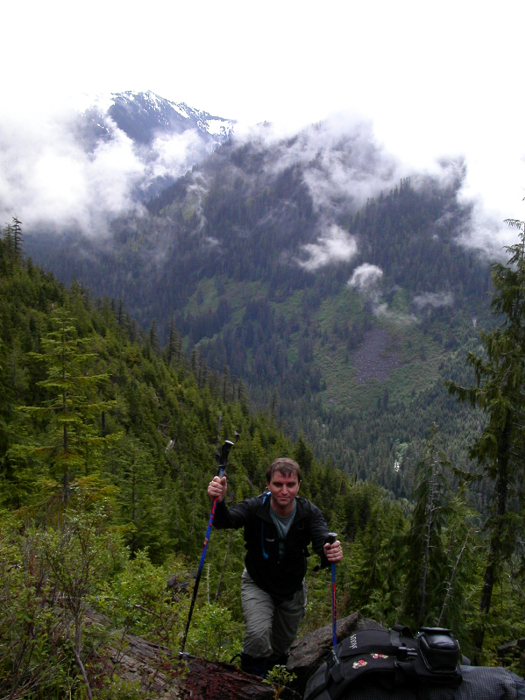
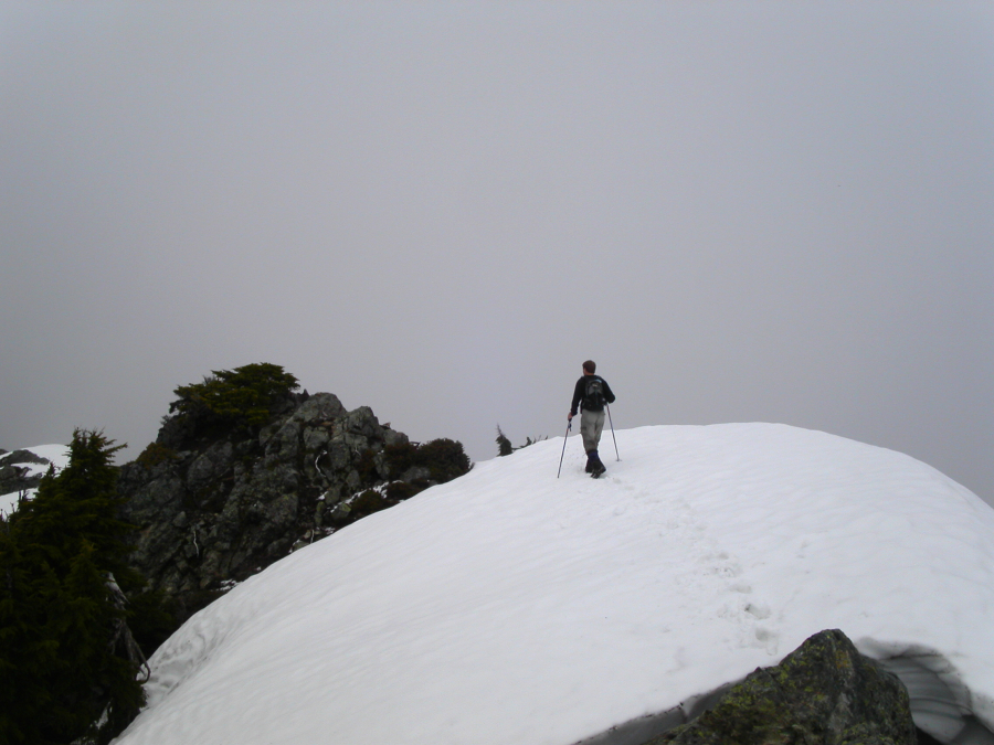
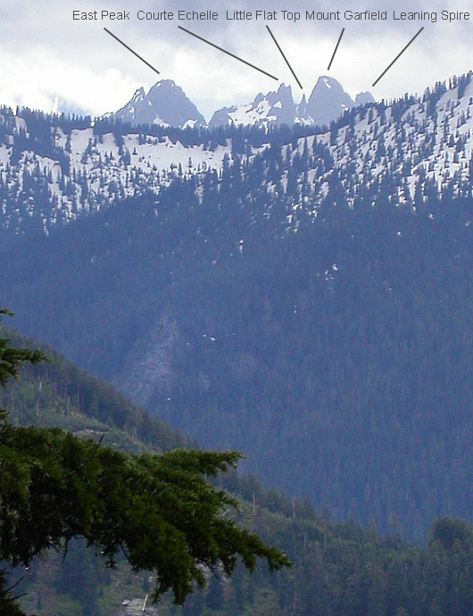
Mount Phelps - South Route, June 2004


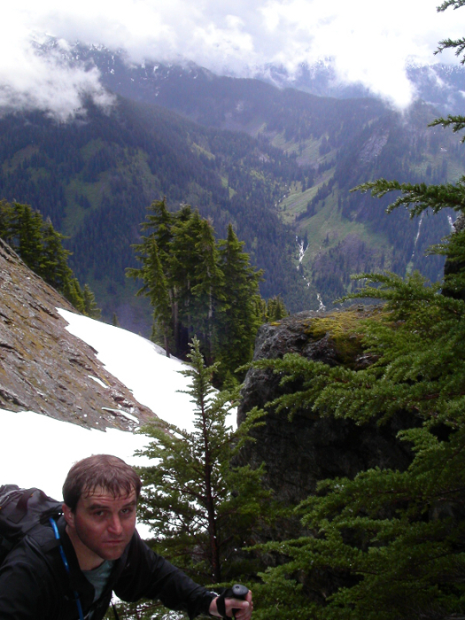
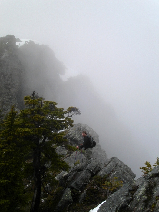
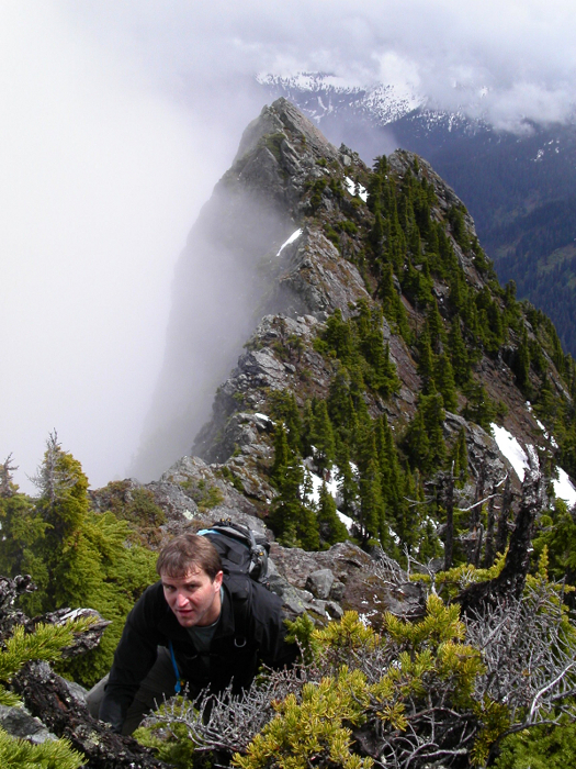
Mount Phelps (5535ft) is some 20 miles up the North Fork Snoqualmie River Valley. It is directly east of Seattle and, because of the relatively low elevation of the intervening mountains, forms a dominant feature in the skyline. Commonly mislabeled as McLain Peaks on most maps despite WSBGN and USBGN name-change approval granted in the 1980s, Phelps still seems to suffer from an identity crisis. The peak's prominence combined with the desperate need for Eric and myself to at least get out and climb something, in spite of the certainty of foul weather, resulted in this outing to Phelps. Late May and early June has been a rough period...thunderstorms, tornados and rotten weather both west and east of the crest yielded bouts of spring cleaning at home and a renewed interest in pulling plastic. Whether being rained out at camp below Mt. Stuart's Ice Cliff Glacier or repeated cancellations of climbs in BC's Coast Mountains, I have been reminded of what typical Pacific Northwest springtime weather is usually like (excluding the extreme weather events).

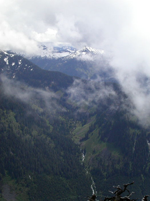
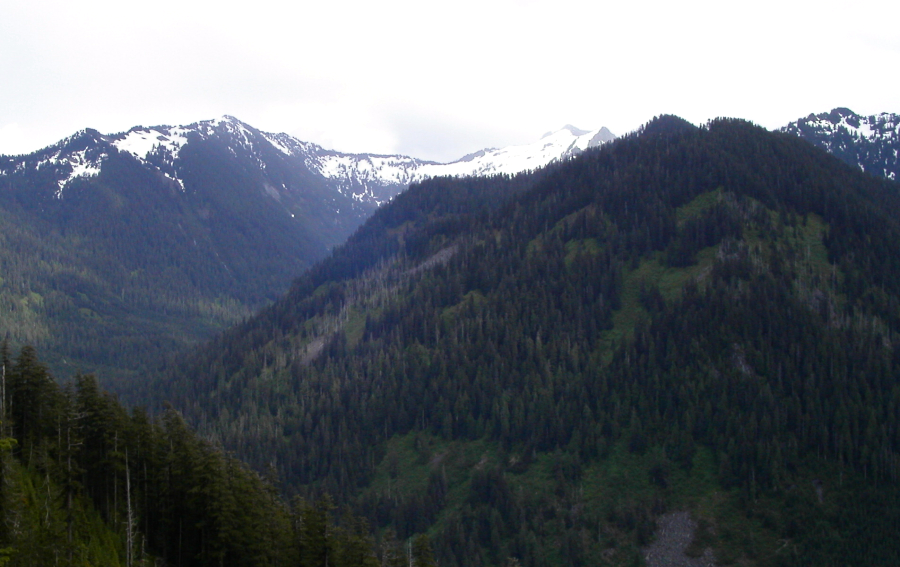
With expectations of precipitation, whiteout and brush, Eric and I rendezvoused at the North Bend Starbucks at 9:00am. Turning left off of East North Bend Way, we proceeded north along Ballarat Ave. N. and drove on paved road for some distance before venturing into a vast, unsightly clear-cut area crisscrossed by countless logging roads. With frequent Thomas Guide consultation stops and some confusion reconciling that with information in Beckey's CAG, we eventually arrived at our destination - the road-end of NF5736, marked by an old log dump near the elusive Blackhawk Mine. Bullet casings and shotgun shells littered the muddy turn-around area, and, sure enough, just as we were about to set out, a pair of Vietnamese gun-enthusiasts pulled up to do a little shootin'. (more...)

Click here to view photos.
home | email | copyright

All photos and text for sverdina.com are copyright © 2002-2024

It would be very much appreciated if you please ask before copying and/or re-publishing content from any part of these pages. To do so, please click here to send a message via feedback form.

Thank You.

©2024 sverdina.com |