


Ptarmigan Traverse - July 2005 (Mount Formidable, Sentinel Peak and Dome Peak)

A popular high-alpine traverse first completed by members of the Ptarmigan Climbing Club in July 1938, the almost 40-mile long Ptarmigan Traverse links Cascade Pass to the Suiattle River area. Though not necessarily technical in nature, this cross-country traverse does require good mountaineering and navigation skills. It crosses 6 or more crevassed glaciers, traverses above 5 or 6 major valleys and can include any number of peaks. For Eric Hoffman and me, it was the only logical way for us to bag Mount Formidable, Sentinel Peak and Dome Peak (again). We had hoped for Spire Point and Sinister Peak as well, but came up short of our target.
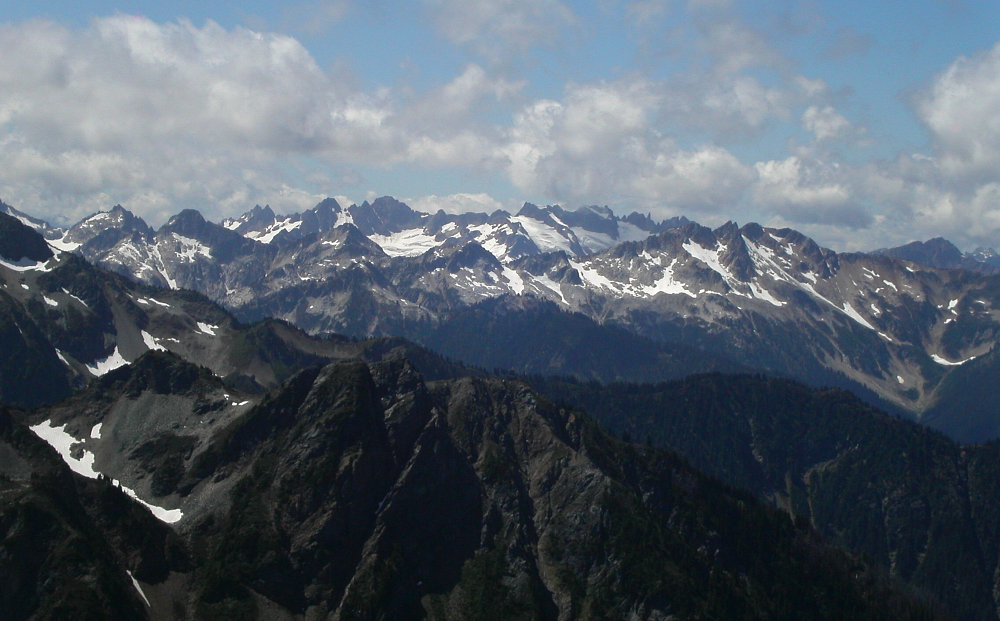
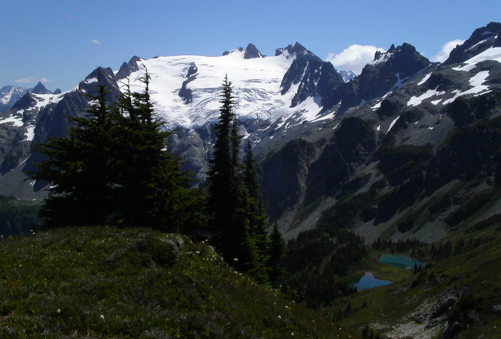
Target or not, we definitely didn't leave the area empty handed. For us, the real draw was really just to see this fabulous corner of the North Cascades. To me, among the top three scenic climaxes of the entire Cascade Range, the Ptarmigan Traverse area offers the pilgrim solitude among sublime vistas of heavily glaciated peaks, tranquil turquoise lakes and lush, sun-filled valleys.
Our itinerary was as follows (noting key points along the way):
Day 1
Car drop at Suiattle River Road barricade
Start hiking from Cascade Pass trailhead
Climb to Cache Col and Spider - Formidable Col
Make camp in bivy sites south of Mount Formidable
Day 2
Climb South Route on Formidable (4 hrs camp-to-camp)
Descend to Yang-Yang Lakes
Climb Le Conte Glacier to Le Conte - Sentinel Saddle
Make camp in bivy sites above head of South Cascade Glacier
Day 3
Climb Southwest Route on Sentinel (3.5 hours camp-to-camp)
Descend from camp to White Rock Lakes
Ascend Dana Glacier to Spire Col
Descend from Spire Col to Itswoot Ridge
Day 4
Attempt Sinister via South Route
Climb Dome Peak
Return to Itswoot Ridge camp
Day 5
Hike out via Bachelor and Downey Creek
Drink copious amounts of beer!
After a car drop at the barricade on the Suiattle River Road, Agata generously dropped Eric and I off at the Cascade Pass Trailhead. Lugging packs with 5-days worth of food and gear, we got moving by 9:30am and arrived at Cascade Pass in about an hour. Leaving behind the last people we would see for the next 5 days, we began an ascending traverse towards the small Cache Glacier. We slogged up to Cache Col and reached Kool-Aid Lake just in time for lunch (4 hours from car).
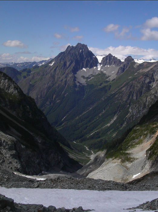
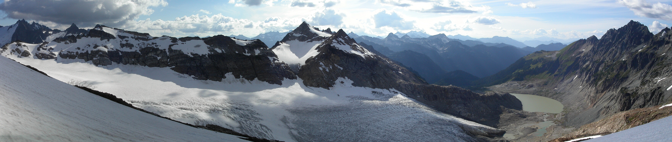
A few minutes of hiking beyond Kool-Aid Lake brought us to Red Ledge. We squeezed through the muddy moat then scrambled up a few feet of wet 4th-class choss to reach the actual ledge (easy walking). Above Red Ledge, the Middle Cascade Glacier really hit me hard. Dramatic and mesmerizing, I momentarily lost myself in that viewâ¦and the views would only get better. Staying left, we traversed towards the glacier's edge and roped up for the short slog to the Spider-Formidable Col (the lower, left notch). Approaching the notch, stunning glimpses of unfamiliar peaks and glaciers began to emerge (Mt. Agnes at far left with Gunsight Peak to its right and Old Guard and Sentinel Peak rising above the Le Conte Glacier - left to right). We descended 200-300 feet from the col, and traversed right over snow and talus looking for a good spot to set up camp. We soon spotted an ideal bivy site on a flat, heathery protrusion overlooking Flat Creek Valley with the Le Conte Glacier and nearby Mount Agnes in full view. There was also a small trickle of water a few yards below camp, confirming our decision to press on rather than stopping for the night at the standard Kool-Aid Lake camp. It was time to relax and read-up on the route to Mount Formidable - our objective for the following morning.
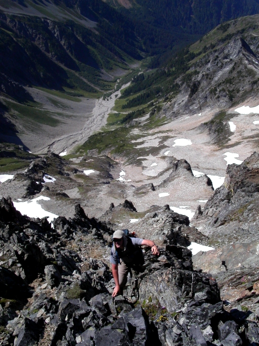
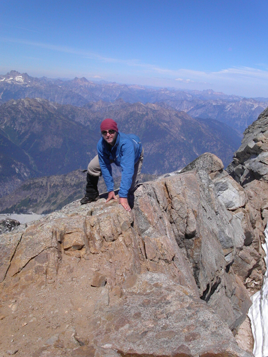
Leaving camp at 8:00am, we climbed to the crest above our bivy site then dropped west down an unpleasant scree gully to the basin below. Traversing the basin over snow and talus, we scrambled up to gain the crest of another rib (cairns). We continued up the rib a short distance, and then traversed left to the edge of rock-hard snow near the base of a hidden (right-leaning) couloir. Front-pointing up steep snow a short distance, we exited the couloir at right and began scrambling upwards towards a small headwall. We encountered some difficulty here, with Eric eventually working back left into the main gully and me exploring a narrow 3rd and 4th-class chimney right of the headwall. We reunited a few minutes later on a grassy slope above our respective gullies and continued scrambling directly upwards on 3rd-class rock for a bit before reaching the summit. We signed the register, ate lunch and lounged in the sun for about 10 minutes. Returning from the summit, we reversed our route back to camp (4-hours round-trip) and packed up for the next leg of the traverse.
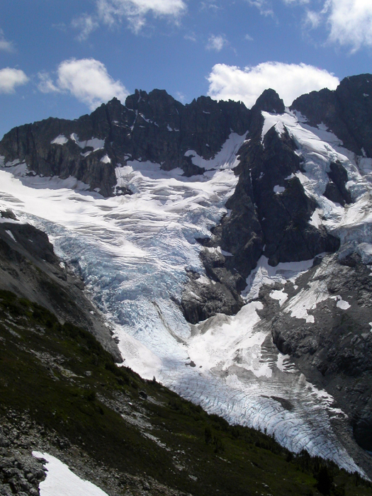
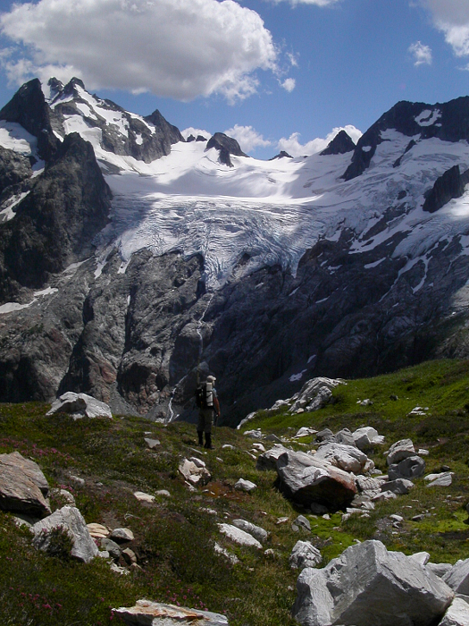
Descending from our bivy site, we followed a worn path through heather, reaching Yang Yang Lakes around 2pm. Eager to cover more ground on this second day, I convinced Eric to forgo the lakeside camp and keep moving. Following a good path beyond the lakes, we gained some elevation, then traversed back right once above the lakes. Losing the trail in a large talus bowl, we worked upwards a short distance before looking left and spotting a faint path on a heathery ramp leading to the ridge crest above. Staying on the broad crest, we followed bits of trail, talus and finally snow, beneath Le Conte Mountain towards the lower, right-edge of the Le Conte Glacier. We roped up and I again followed Eric's lead as he navigated crevasses en route to the upper slopes. Working left near the base of the glacier, he found a good bridge and we continued towards the Le Conte - Sentinel Saddle without further difficulties.
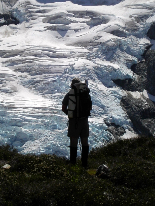
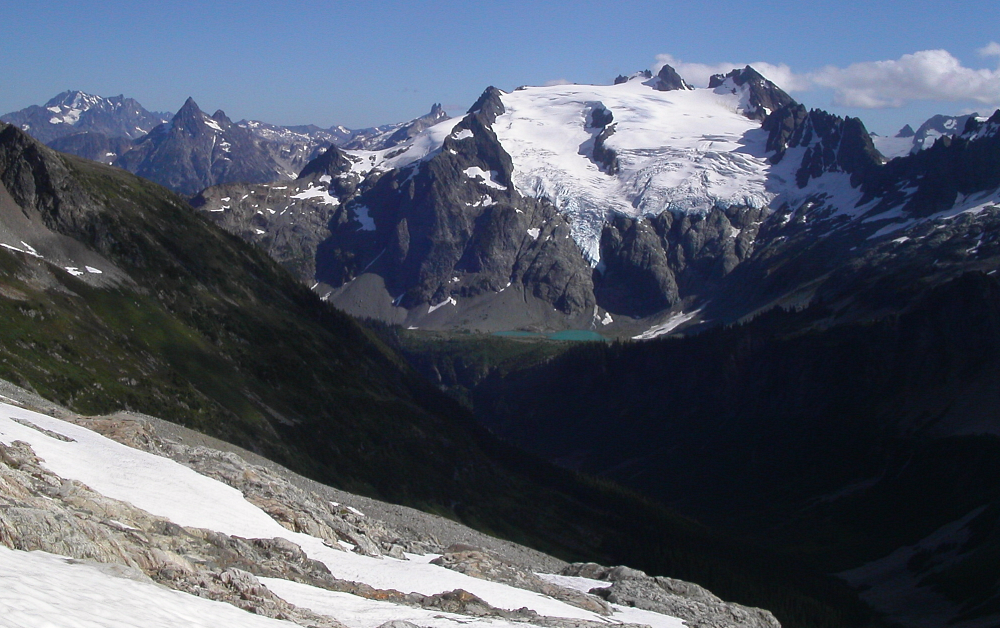
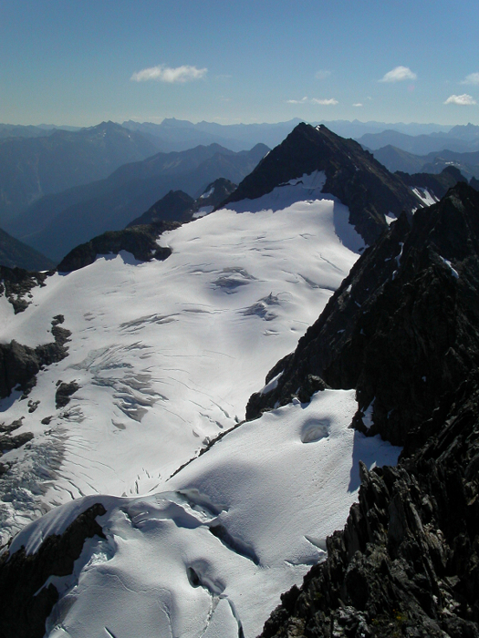
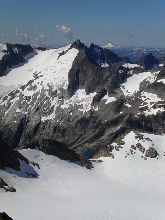
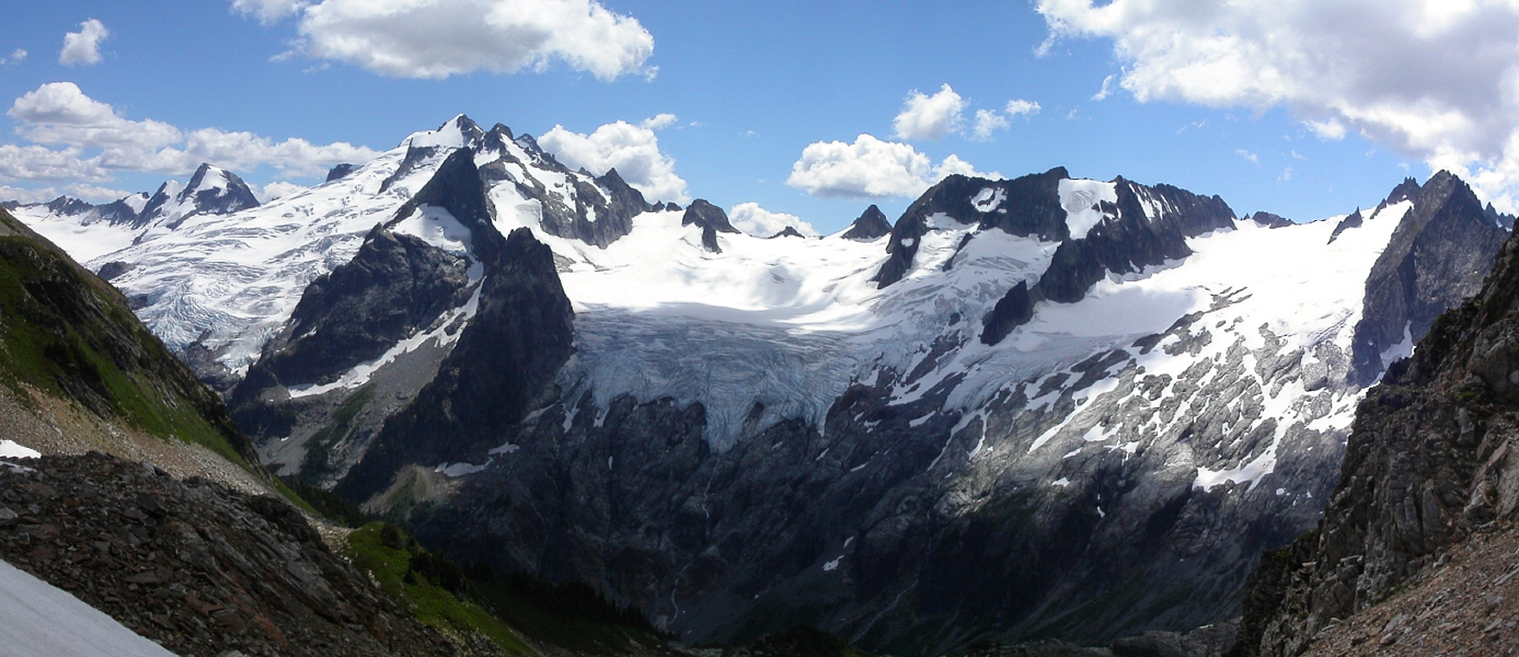
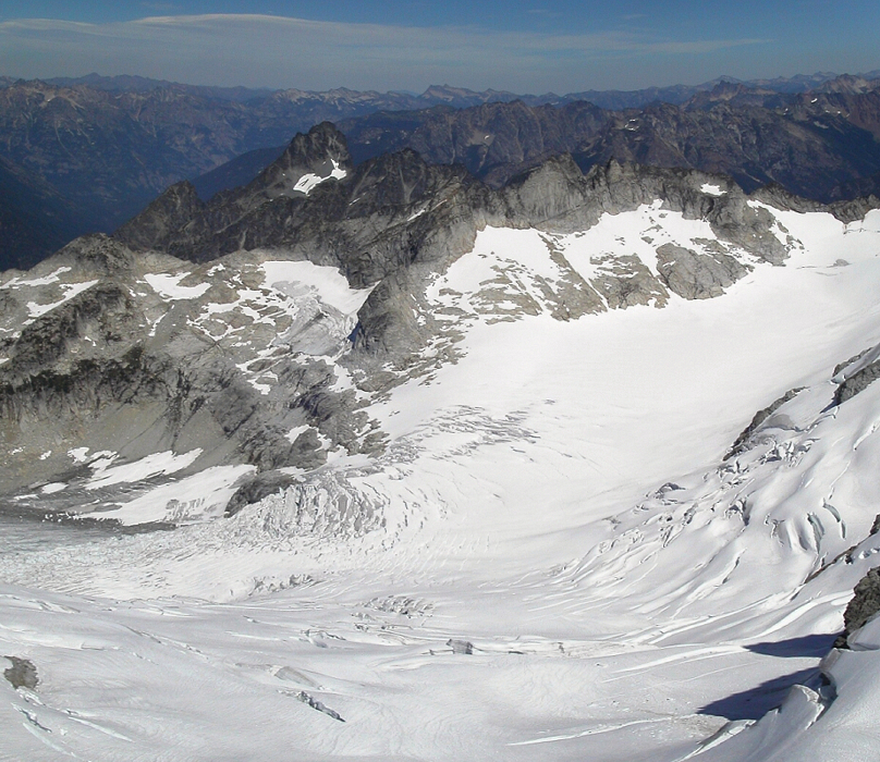
The view of the South Cascade Glacier from the saddle is nothing short of stunning. I knew the glacier would be large, but only in person does one appreciate how significant it really is. It also looks quite different from the other glaciers in the area. Almost a mile long, flat and bound by steep walls on either side, with a snowy col at its far end, this view would certainly not be out of place in BC's Coast Range. Looking across from the Le Conte - Sentinel Col, we could also see a large metallic box perched on a ridge crest above the toe of the glacier, and figured it had something to do with the monitoring that takes place here - a gauging station perhaps. A long snow traverse high above the glacier soon saw us to nice, flat bivy sites on top of a slabby outcropping of rock perched high above the upper reaches of the South Cascade. Once again, we also found running water nearby and felt we had done good to maximize the daylight hours by passing on the Yang Yang Lakes camp. With Sentinel Peak looming directly above we'd also be able to scramble to the summit relatively quickly before embarking on the next leg of the traverse.
The next morning, we started out hiking the slope above camp and then traversed left onto bulletproof snow below Sentinel's South Face. We front-pointed up into a moat right of the obvious ledge/ramp cutting across the face above us. Once through the moat, we had the sandy, down-sloping ledge to contend with. Though not difficult, the ledge traverse is narrow and exposed and demanded my full attention. I did not relish the thought of having to go back down that thing. Beyond this ledge, easy scrambling saw us to the summit with its exquisite view of the Chickamin and Dana Glaciers. Looking down on the Le Conte Glacier, we were surprised to see a mountain goat traversing the crevassed upper-slopes. After a short break, we started back down and returned to camp to pack up.
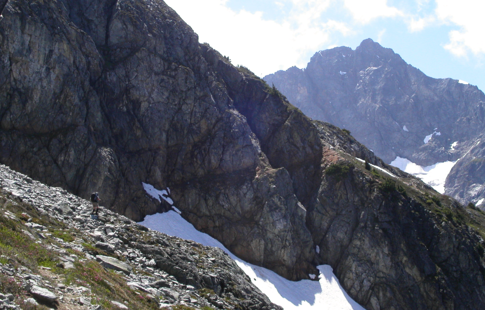
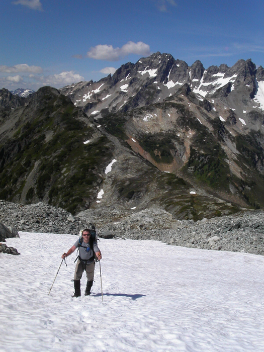
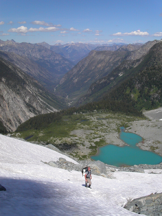
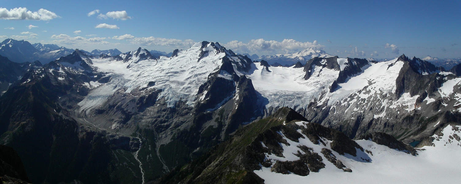
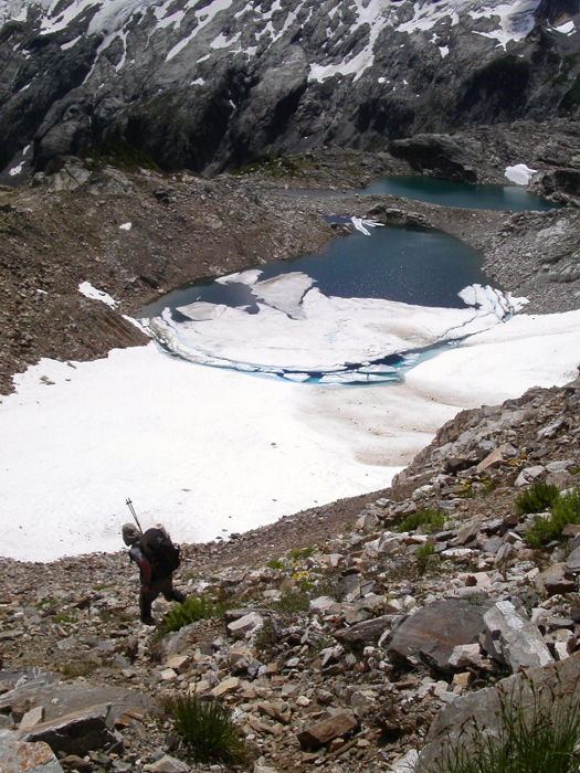
Descending steep snow left of our bivy site, we finally set foot on the South Cascade Glacier and made for an obvious, col (Lizard Pass) above White Rock Lakes...and what a view we had from there! The descent from the col is loose and tedious, but we soon found ourselves down by the lakes pondering where we were headed next. From where we were standing, the slabs beneath the Dana Glacier appeared vertical and impossible to climb. It just seemed so unlikely from that perspective, that we were surprised to find easy talus and class 2/3 slabs once we got there. From White Rock Lakes, the trail makes a somewhat brushy descending traverse near the head of West Fork Valley, towards talus slopes beneath those deceptively forbidding slabs.
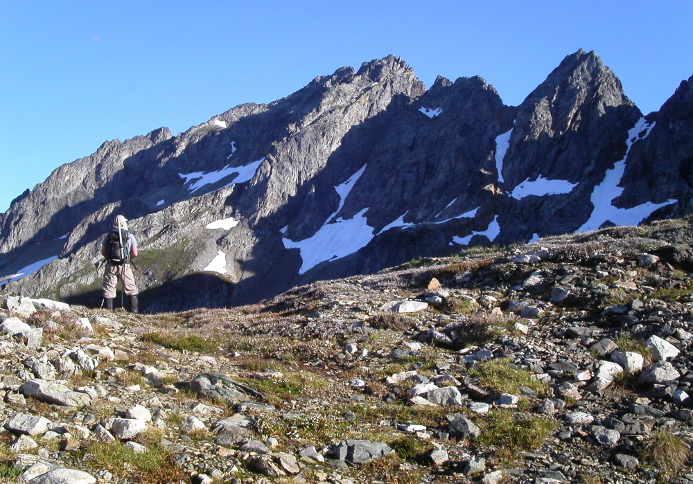
We roped-up at the glacier's edge, and aiming for a large finger of snow traversing up and left onto the glacier proper, I led out for what would be the longest slog yet. We followed an aesthetic snow arete near the top of the glacier, reaching Spire Col late that afternoon. Exhausted from endless post-holing through foot-deep slop and with boots and feet thoroughly drenched and now freezing cold, we happily passed on the Spire Point climb. We decided to just head for camp at Itswoot Ridge instead. Eric had beta that suggests taking the 3rd gully to the west for the descent from Spire Col, but I'm not sure that this is what we did. Looking back, the other gullies appeared equally as loose and shitty as the one we descended.
We finally found ourselves at camp an hour later, and happily peeled our soggy boots from our pruned feet. Note that Itswoot Ridge has got to be one of the finest bivy sites in the Cascades - a ridge camp with running water, excellent views and full western exposure that remains basked in sunlight until very late in the day. Incidentally, it was here where I first met Eric back in September of 2002. With Sinister Peak as our next objective, we opted to approach from the south. Doing so would allow us to avoid some nasty crevasse navigation on the Chickamin Glacier (as seen from Sentinel). Furthermore, conditions on the North Face route we intended to climb were suspect, as portions of route (traditionally a late-season route) were already melted out, courtesy of the record low snow this winter. With this plan in mind, we settled in for the night hopeful for what the morning would bring.
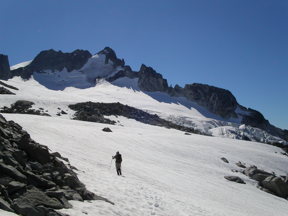
From the Dome Glacier that next morning, we traversed snow and steep scree beneath Hydramatic Spire, and then kept traversing the south side on polished slabs to reach an impasse (cairns here). We needed to find a way down a formidably cliffy barrier, and paced up and down the edge looking a weakness that would allow an easy descent into the basin below. Before us, Sinister Peak loomed tantalizingly close, but still discouragingly far away. With motivation waning in the unforgiving heat of the day, I simply gave up and suggested to Eric that we just go for the summit of Dome Peak instead. He agreed, and so we made our way back to the Dome Glacier and finally onto the summit of Dome Peak itself.
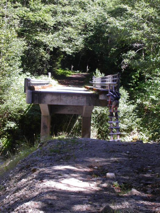
Having been engulfed in fog on my previous climb of the peak, it was interesting to actually see the exposure on that final exciting traverse to the summit. By the way - from the summit, we could see a heathery bench that seems to connect the basin below Sinister's south slopes with the troublesome barrier about 300 - 400 feet below where we were (~6900ft). Skeptically optimistic of Eric's estimated 4 hours to reach the trailhead, we departed camp that following morning and began making our way down to Cub Lake. Frequently stopping to gorge ourselves on berries along the trail, with Eric preferring huckleberries over my preference for salmon berries, we still found ourselves hiking along Downey Creek 6 hours later. We eventually reached the road and proceeded towards the large washout at the bridge over Downey Creek. Budget cuts must have hit the forest service hard, for the best "repairs" they apparently can manage is a rickety, home-made ladder spanning the 15-feet of air between the bridge-deck and what remains of the old roadway.
Final notes - the traverse can reasonably be completed in 4-days, including the three summits which we bagged. Also, by avoiding the standard lakeside camps, we were able to evenly split the bulk of the traverse (Cascade Pass to Itswoot Ridge) across three days, leaving the option for climbing Dome and returning to the trailhead on the fourth day. Though running water was readily available at our camps, this may not be the case later in the season. None of the glacier crossings gave us much difficulty, however, gaining the Le Conte Glacier later this season could be a daunting task. Furthermore, in comparing with my photos from previous years, I'd say the general condition of the glaciers resembles more of what one might expect for September, not July. We need some HARD winters folks!
Click here to view.
![]()


