


Sloan Peak - West Face Corkscrew Route, August 2003

Ever since my Sloan Glacier reconnaissance trip in the spring of 2000, featuring the heart-stopping frigid N. Fork Sauk River ford, I've wanted to venture back to the area and bag the summit of Sloan Peak. Originally planning on climbing the Sloan Glacier/Corkscrew Route, my mind was changed last season by a posting on CascadeClimbers.com that said simply "Sloan Glacier = Slog, Rock = Fun." By "rock", I understood the poster to be referring to the routes on Sloan's impressive West and Southwest Faces. The 2002 summer climbing season came and went and, for various reasons, I never made it out to Sloan Peak. Then, in August of 2003 Mike Stanton and Theron Welch climbed the West Face and posted a trip report to show their efforts. The temptation was too much. Armed with Beckey's route description and Stanton's report, John Mefford and I set out to climb the West Face ourselves.
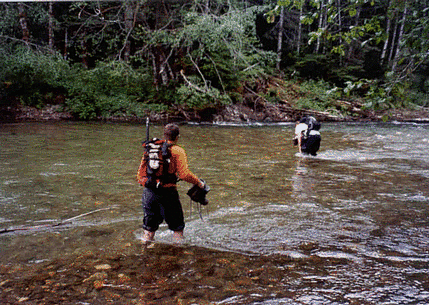
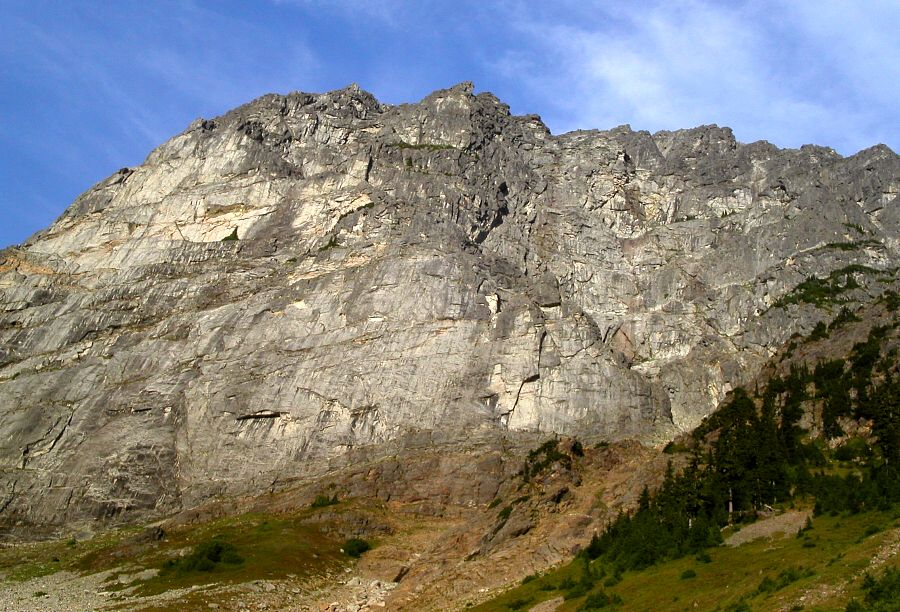
The Bedal Creek Trail approach is short (3 miles?), and alternates through open forest and damp patches of dense brush (the kind that obscures the trail underfoot). The trail eventually ends at a dry creek bed. We followed the occasional cairn for a short distance up the creek bed before tiring of boulder-hopping and instead sought a trail continuation on the left side of the bank. A faint trail and some orange flagging seemed to suggest we were headed in the correct direction (continuing up the creek bed a while longer, the main trail resumes again on the right bankâ¦look for cairns). We exited the trees at the far left side of Bedal Basin, the sheer Northwest Face of Sloan Peak rising mostly in front and right of us. Angling to the right, we traversed heather then made a rising traverse on the talus slope that fans out below Sloan Peak's Northwest Face. At the far right of this talus slope we descended a short distance into a loose gully, which we then climbed up as the West Face began to tower above us. Rather than getting suckered into the gully, a better way might be to continue traversing beneath the West Face, aiming for a prominent rib that extends from ledges on the West Face. This rib becomes the lightly timbered and grassy ridge that defines the southwestern perimeter of Bedal Basin (following the trail on the right side of the previously mentioned creek bed would lead one straight to this rib). Ideally, one would want to hike to the crest of this rib and begin climbing towards prominent ledges that break the West Face.
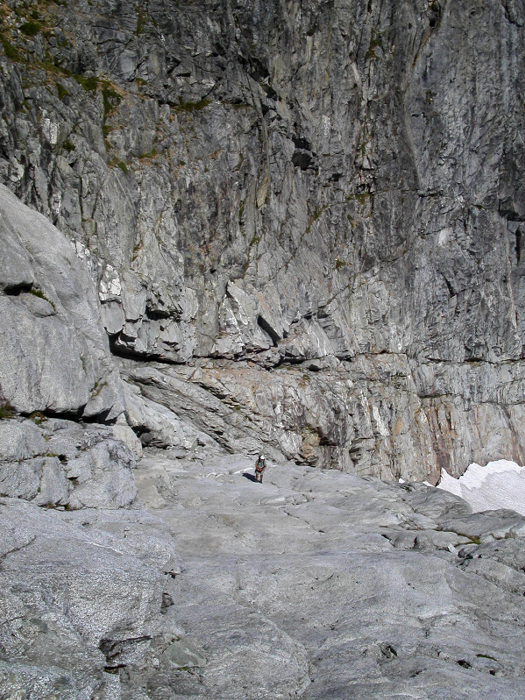
Anyway, from the top of the gully, we were able to turn left into a "slabby gully" (class 3/4) directly below the West Face, and climb straight up towards the ledges. From the top the gully, I veered left, hiking up sandy benches with a rock step or two to reach the largest of the aforementioned grassy ledges. John, on the other hand, proceeded straight up a chimney and unwittingly committed himself to some thought-provoking exposure before reaching the ledge. We walked up and down the ledge looking for a logical place to begin the technical portion of the climb. We found the Beckey description and photos to be somewhat vague and couldn't reconcile what we saw with what was written in Stanton's report. Precious minutes were being wasted. Looking up, we finally located a sling wrapped around a horn and decided this had to be the start of the route (it would later occur to me that the sling was probably evidence of someone bailing).
For reference, this first pitch was located on an uphill-trending section of ledge right of where I had come up and right of a detached, leaning flake; but left of the corner (continuation of the lower rib?). John started out leading the first pitch. Right off the bat he encountered featureless rock encrusted with lichen that offered little in the way of pro. More than an hour must have gone by as John searched for various easier alternatives. He was still no more than 15 feet above me. Growing frustrated, I convinced John to come back down (I lowered him off a nut and oval 'biner he found in a crack-further evidence that this was a bail route). We continued hiking the ledge rightward to explore our options around the corner.
The climbing here appeared somewhat easier, but it was hard to tell if it would go. After looking at my watch (it was around 1pm), I decided to call it off. The Beckey description gives 6 hours to complete the route when starting a bit below where we were. If things went well, we would be on the summit by 7pm. If not, well let's just say that one forced bivy on an exposed ledge (NE Buttress of Mt. Goode, for example) is enough excitement for one season. John was visibly disappointed, but soon accepted the wisdom of my decision. Still determined to reach the summit, I proposed that we proceed along the ledge, in hopes that it continued around the Southwest Face of Sloan Peak, all the way to the South Ridge. If all else fails, we could always return down the gully; but I preferred not to relive that. Vaguely remembering a Beckey description I had read some years back, I knew there was a non-technical, and therefore faster, way to gain the upper Corkscrew Route via a ramp in the South Face. If we could get to the South Ridge, I knew I would be able to get us to this ramp.
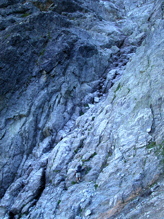
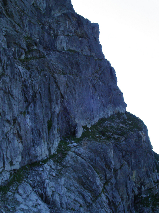
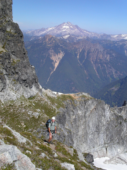
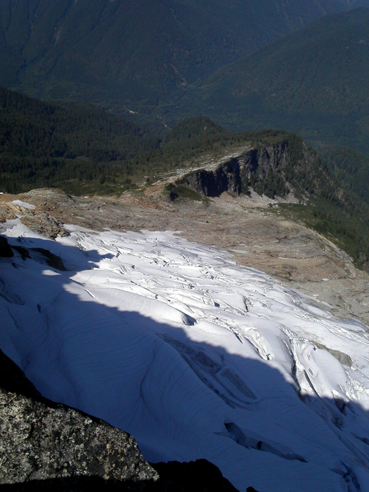
Rolling up and down, the ledge at times was narrow, sandy, and down-sloping. It was certainly always exposed. Thankfully, the ledge did in fact wrap the entire way around Sloan's Southwest Face. From the South Ridge, we descended a couple hundred feet into the basin below the South Face. Crossing a small glacial remnant, we traversed snow to the edge of the ramp. We saw rap slings (more bail slings?) and rope hanging from various spots in the rock below the ramp. A deep moat prevented easy access to a good chimney leading to the top of this ramp, so we were forced to ascend the ramp from below where low angle slabs meet the snow. We stepped over a small moat, deposited our crampons and axes, and climbed up these smooth slabs (class 3, some class 4), passing a few rap stations, to the grassy top-half of the ramp. Looking up and right, I could see the upper, grassy ramp, where I assumed the Corkscrew Route was. Turning right at the top of the ramp, we climbed up a short 4th - low 5th-class dihedral, then scrambled up easier rock, and then finally up grassy steps to reach the upper ramp. Surprise, surprise: the Corkscrew Route trail!
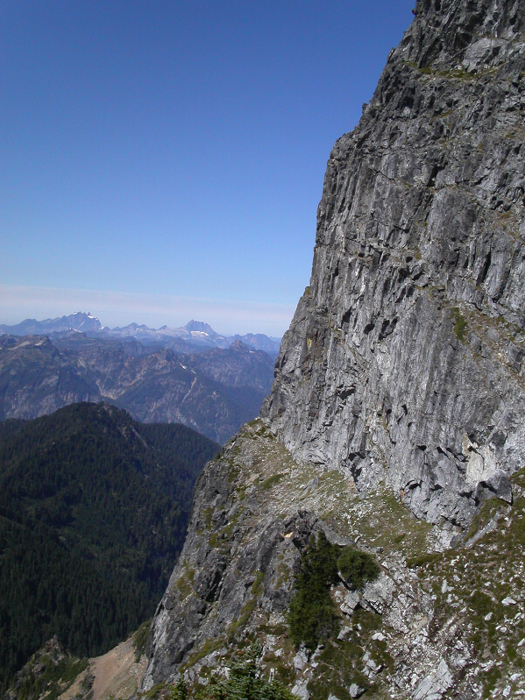
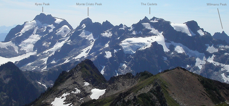
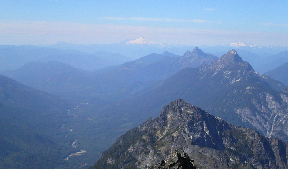
We followed the trail as it looped back around the upper Southwest/West Face on a broad ledge. The trail finally turns upward on loose scree with the odd 4th-class step thrown in there for good measure. A short but fun 3rd- class scramble makes for an enjoyable finish to an otherwise easy route. Sloan Peak overlooks the Mountain Loop Highway area and is seemingly equidistant from both the north and south branches of the loop. In fact, with nice near field views of the Pride Glacier, Keyes Peak, Monte Cristo Peak, Del Campo Peak, Vesper Peak, Three Fingers, and Whitehorse Mountain, to name a few, Sloan Peak quite possibly offers the best vantage point from which to view the Mountain Loop area peaks.
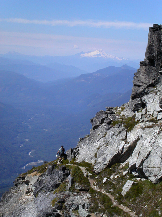
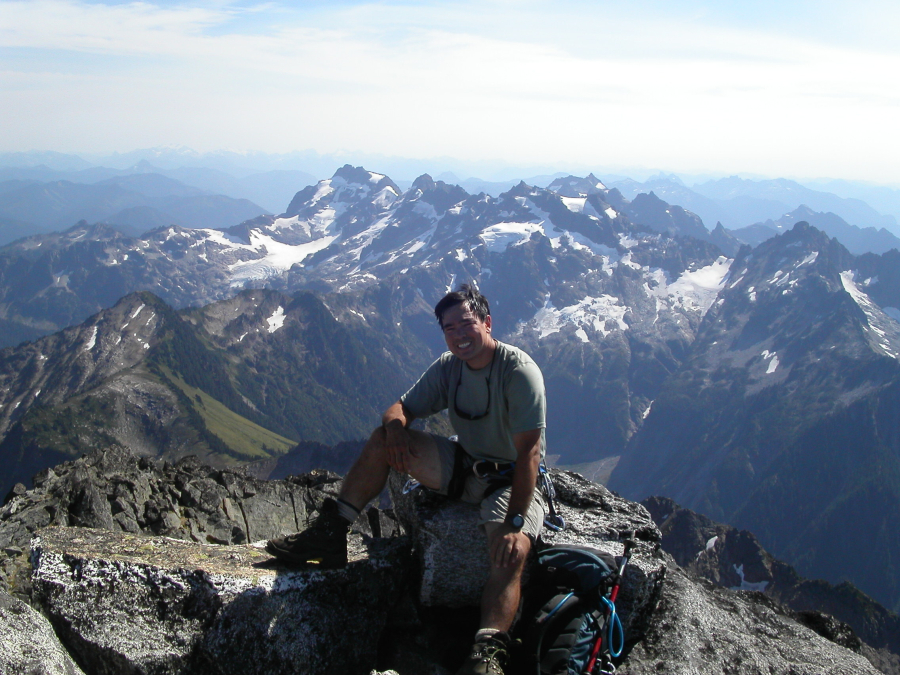
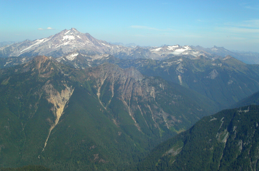
It was now a little before 4pm. Looking north, towards the Buckindy/Misch area, John and I could see a plume of smoke rising from one of the numerous wildfires currently burning in the North Cascades. The late-season, southwestern view of Glacier Peak was also far from pretty. The Sitkum and Kennedy Glaciers must have taken a beating this summer! Looking east, there really isn't much that stands between Sloan Peak and the peaks of the Dakobed Range, most notably Clark Mountain. We rested on the summit for about 20 minutes before beginning the descent. Returning the way we came, we rappelled the aforementioned dihedral and the final steep section of slab above the snow, using a rap station the previous Stanton party had made. I was particularly concerned with the reliability of the rocks hammered into cracks to prevent the sling from lifting out. Fortunately, there would be no disasters on this day. Stopping momentarily on the glacier at a small rivulet of refreshing glacier water, we returned to the South Ridge and followed it down to the bivy sites at a broad saddle.
A trail descends from the saddle into a boulder field with the Southwest Face at right. We traversed steep heather, scree and hardpan until reaching the now infamous rib bisecting the West Face. We chose to descend to a low, timbered saddle in the rib, crossed back over into Bedal Basin, and descended steep, slippery grass while making frequent use of green belays. Someone had obviously gone this way before us, as I could see a glissade track of matted down grass descending the slope. What the hell...I sat down and glissaded grass. It was easier than walking! We soon found a faint trail, this time descending the opposite side of the basin we had climbed up. The trail deposited us again in a dry creek bed. Following the occasional cairn, we descended the creek bed as it became steeper and narrower. The cairns were now nowhere to be found (the trail probably resumed somewhere on the right side of the bank). The going became slow and tedious and we finally decided to bail on the creek descent. We climbed out through damp vegetation on the right side of the creek, traversed a bit through open timber, then, voila, stumbled upon the trail.
We followed the trail back down, where it once again led us into a dry creek bed. These creek beds were really starting to annoy! As before, we followed cairns and pink flagging until they were nowhere to be found. We stopped, backtracked a few yards, and found the obscure trail continuation back on the left bank. We were making good time until tempted by deliciously ripe salmonberries. John and I reached the car at 9 pm, just as total darkness set in.
Click here to view photos.
![]()


