


Mount Washington (Olympics) - Southeast Ridge, June 2007
 with Jefferson Peak and Mount Pershing in center. Photo taken from South Brother.")
Motivated by an unsuccessful attempt at reaching Washington's summit via the Winter Direct route earlier this year, Martin and I came up with the bright idea of returning to climb the Southeast Ridge. The ridge sure looks aesthetic from the pullout where we parked and especially from our previous vantage point on the East Ridge. Furthermore, this route has been likened by some to be comparable to the West Arete on Mount Constance which I thought was an enjoyable climb in and of itself.
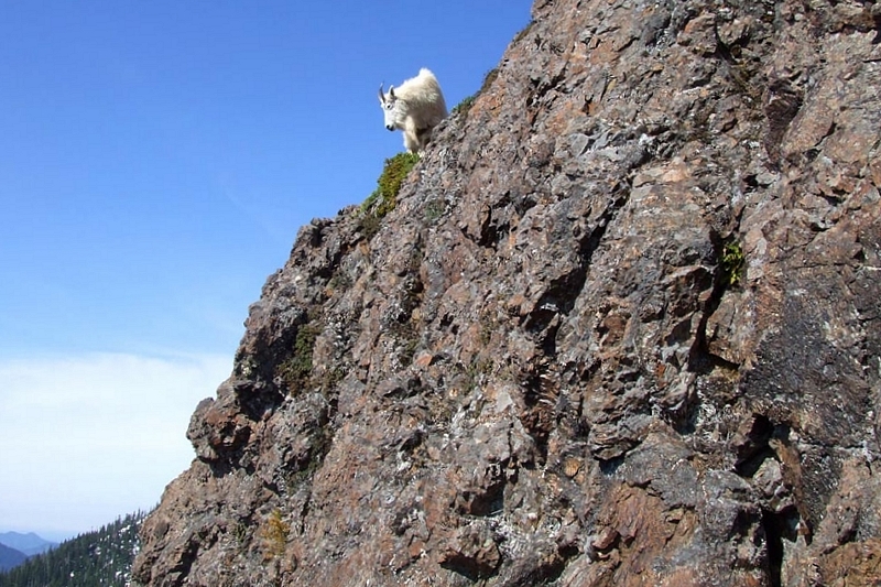
From the pullout just beyond the fork with FSR014, we walked the road and began looking left for a climber's path shortly after an obvious waterfall. We followed this path as it ascends the forested rib extending from the lower Southeast Ridge until it dead-ended in a scree slope beneath some crags. Flagging seemed to continue along the left-side of the rib. Our beta suggested staying right, so we proceeded upwards (recommend cutting hard to the right at this point instead). Loose and unpleasant 4th-class scrambling soon saw us to a steep rock gully that seemed to exit onto the ridge above. Bruce and I anchored into a good tree near the base of the gully and belayed Martin as he led a pitch of low 5th kitty litter rock to the crest. A family of mountain goats also kept us on our toes by trundling rocks down on us while Martin was climbing. As expected, this pitch led us to a rocky promontory well before the actual start to the Southeast Ridge. We briefly scrambled the crest, then traversed steep snow at right into the basin beaneath the east wall of the Southeast Ridge. Turning left, we booted up steep snow to reach a saddle beneath the normal start of our route. Our shenanigans had already cost us about an hour (two-hours total from car).
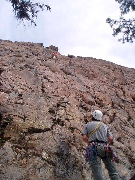
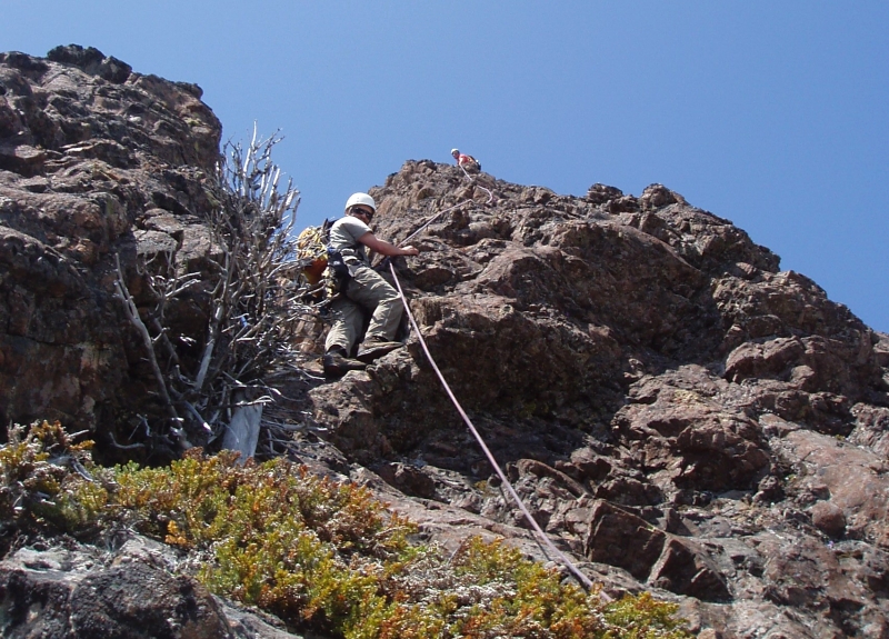
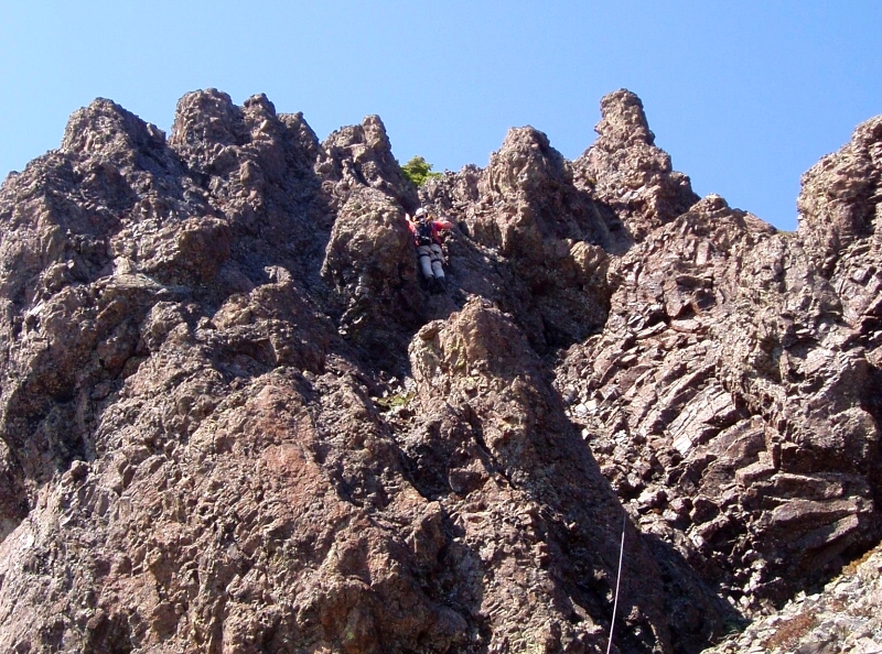
Looking up from the saddle, I spotted the first of two bolts found on the first pitch. We roped-up with Martin leading the first 5.6 pitch on decent rock with adequate protection. The next pitch was steeper 5.6-ish crap rock. Every hold had to be tested. Every step was suspect and had to be weighted delicately. Protection opportunities were also very limited. Hoping the rock would improve, we continued on. The next 5 pitches consisted of 4th to low 5th class choss on or slightly right of the crest with continued poor protection.
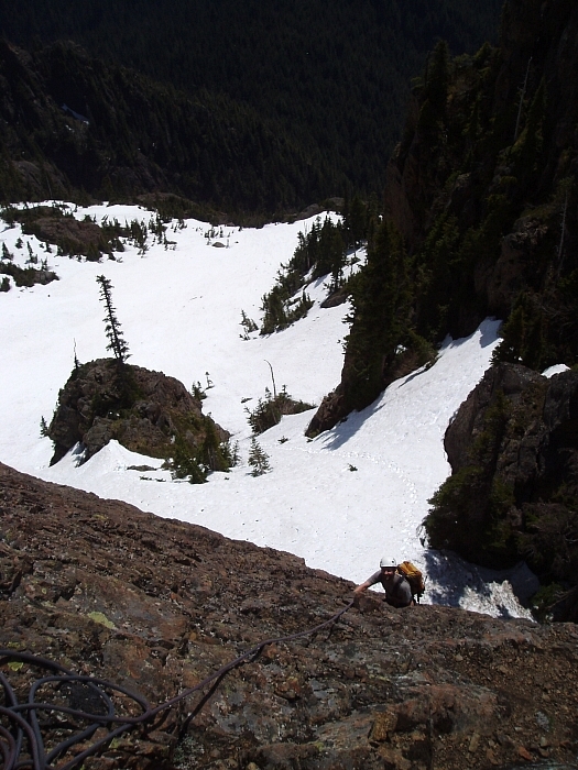
We had hoped to be able to simul-climb most of the route, however given the quality of the rock we felt it wise to pitch it out. With Bruce and I simul-following on one rope, we had to take great care not to dislodge boulders onto the lower climber. Probably due to the concentration devoted to not being a victim of the loose rock, many of the pitches now meld together in my mind. I do recall several less than enjoyable belay stances with marginal anchors, a section of steep run-out rock and a short low-5th chimney shortly before reaching a large belay ledge beneath the first tower.
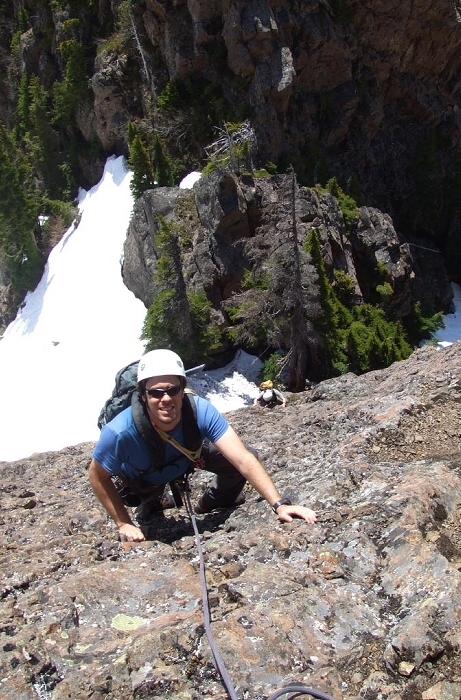
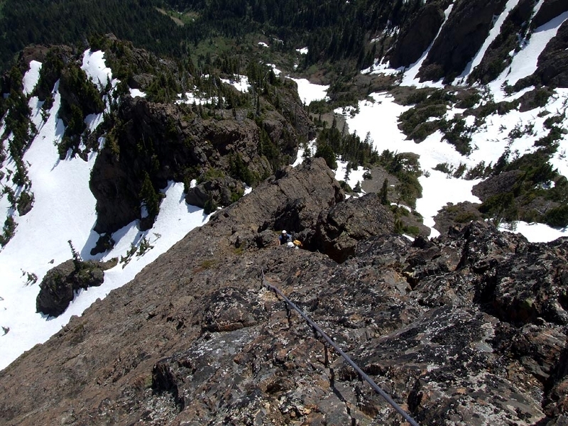
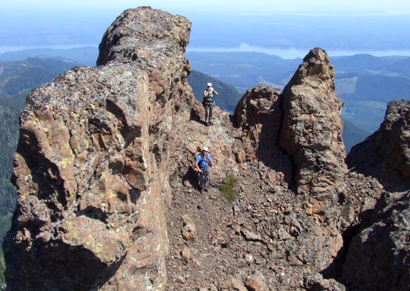
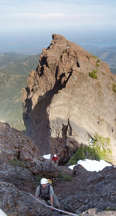
Traversing right before continuing up, we topped-out on the tower and scrambled a scree ledge to get to the first rappel station. After rapping about 80 feet into a notch, we climbed out the other side following a ledge just left (south) of the crest. After the ledge, a short walk led to a short but steep low 5th choss gully. The gully brought us back onto the crest where the next rappel station was located. We reached the second rappel station and rapped into the second notch. I then led a short, but steep pitch out from this notch to easy scrambling terrain followed by yet another notch with more steep rock on the other side. A few mid-fifth moves again led to easier scrambling terrain beneath the final tower. I slung a solid horn and belayed Bruce and Martin up. Martin took the next lead, first traversing left into a gully then climbing some unexpectedly sound rock up to the top of the tower. A short down-climb then led to the final notch - the same notch Martin and I found ourselves in after topping out on Winter Direct about six weeks ago.
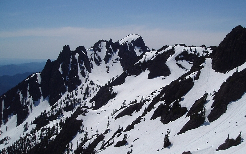
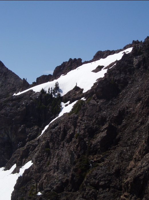
With Bruce and Martin doubting my assertion that the next pitch would be our last before reaching easy scrambling terrain near the summit, I racked-up and grunted my way up steep rock opposite the notch (~5.7). I belayed-up my partners and together we walked to where the Route 1 scramble route/path goes on its way to the final summit block. We dropped our packs here proceeded to tag the summit - an easy path follows a ledge at right or just proceed straight up for a final dose of 5th-class choss directly beneath the summit. We topped-out at 7pm...a long day indeed! Looking west into the heart of the Olympics, I was suprised at how much snow there was in the valleys and on the peaks. It looked more like what one would expect to see in early May, not June!
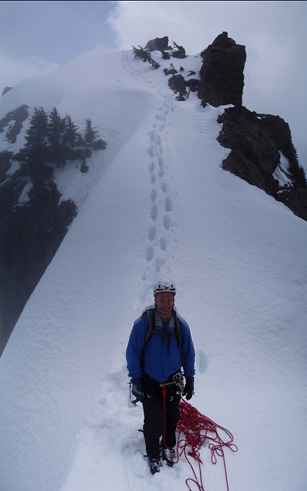
I took a few moments to scribble our names in the register and snap a few photos before returning to my pack. Following footsteps down Route 1, we soon faced a steep snow slope with two moat-sections we would have to climb through. Careful face-in down-climbing on mushy snow soon saw us down into the basin. Following tracks we glissaded and plunge-stepped our way back to timberline, eventually picking up the trail and reaching the cars about an hour-and-fourty-five minutes after leaving the summit. In contrast, we had been on route for almost 8 hours!
Though I wouldn't necessarily recommend this route to anyone and it is certainly a far cry from the West Arete of Constance, I do feel some measure of satisfaction having climbed the Southeast Ridge. The scenery and setting are superb and uniquely Olympic. The route finding adventure of climbing over towers and into notches, and weaving on or around the crest on ramps and hidden ledges leaves one in constant anticipation of what lies around or over the next bend or bulge. Besides, if you can stomach this rock then anything in the North Cascades should be comparatively solid, right?
Click here to view photos.
![]()


