


Mount Garibaldi - Northeast Face, June 2002

Paul Cookson and I had Mount Garibaldi on our agendas since we first met on Silver Star in June of last year. We originally intended to go after the peak the weekend prior, but the weather had other things in mind for us. We rescheduled for the following weekend and hoped the weather forecast would be more cooperative. By mid week the weather models were predicting a weak ridge of high pressure to remain over the South Coast Mountains and it looked like the climb would be a go.
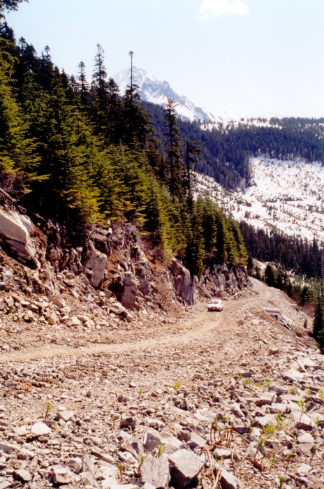
I met Paul and John in N. Vancouver on Saturday morning and together we drove out to Squamish. We stopped at the base of Stawamous Chief and had a rare unobscured glimpse of the mountain rising above the ridge before us. Brohm Ridge, our ascent route, was clearly visible on the left (west) side of the mountain. I recommend a high clearance vehicle to ensure safe passage up the rough Brohm Ridge jeep road. It took all of three people to drive, navigate and clear the road of boulders on our way up to where we parked at 4200ft.
We hiked up the remaining bit of road to what we thought would be a parking area. Instead the road seemed to simply end just around a curve 5 minutes above where we were parked. We encountered snow here and began kicking steps up through the trees. Many trees were marked with orange flagging or had orange markings painted on them and I assumed we were headed in the right direction. We then followed what appeared to be a snow-covered road and snowmobile tracks to the broad ridge top, at which point we had our first close-up view of the mountain.
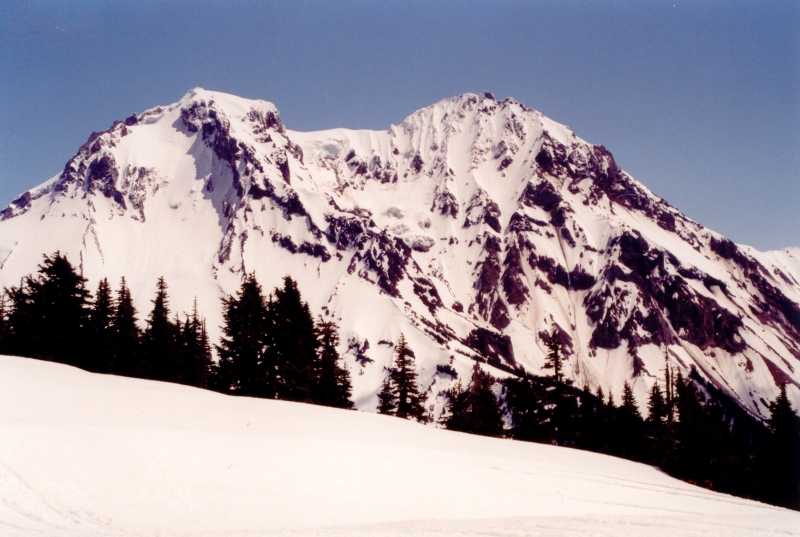
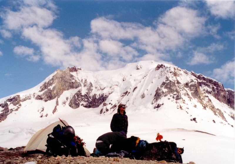
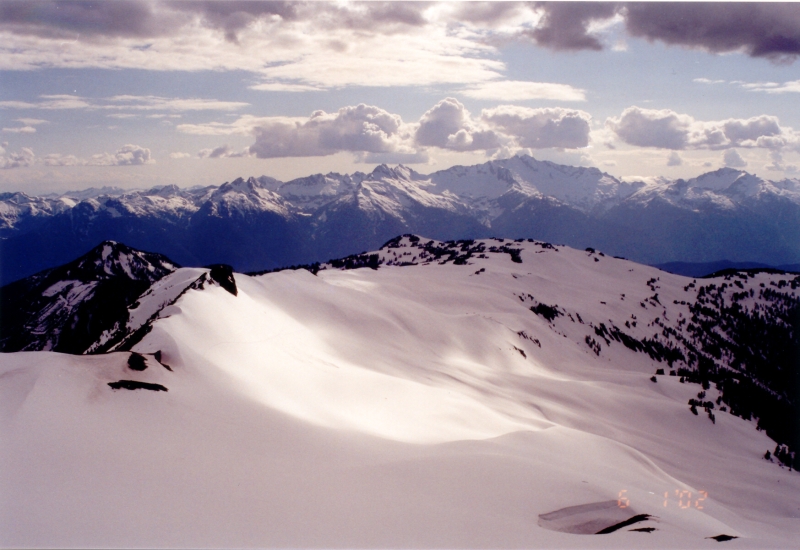
I put on my skis and began skinning up the ridge as the perfect blue skies began giving way to puffy little clouds. Snowmobilers could be heard in the distance and their tracks were now everywhere. The skinning/slogging wasn't a difficult, with the exception of one long unpleasant traverse below the rock to the left in the photo. The Tantalus Range rose majestically from across the valley. Both Paul and my climbing wish lists began to grow. We set up camp at a bare spot on the edge of the Warren Glacier and enjoyed the warming afternoon sun until it dipped behind the peaks across the valley. We went through some crevasse rescue exercises after dinner and went to sleep shortly thereafter.
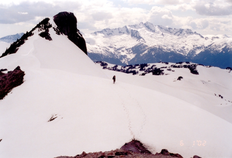
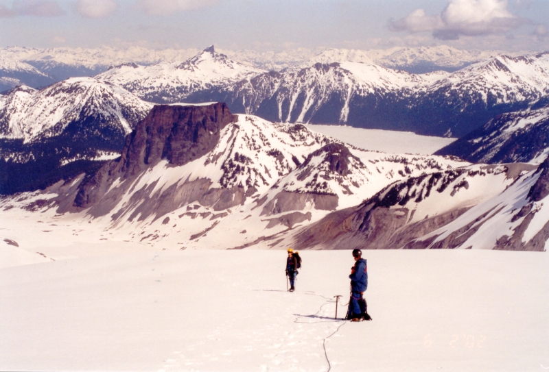
We awoke at 3:30 in the morning and already the sun was lighting up the horizon. We crossed the level Warren Glacier and encountered little difficulty navigating crevasses. A steep wall had to be climbed in order to get on top of the North Pitt Glacier. The sun was now illuminating the peak. From a distance we could see the infamous bergschrund and debated as to whether it was easily passable or not. We continued towards the saddle between the "tent" and Garibaldi's main summit to get a view of the route that goes between Atwell Peak and Garibaldi's summit. The route appeared quite steep and technical. The bergschrund we were looking at earlier appeared like it was easy to cross from our vantage point and so we headed up towards it.
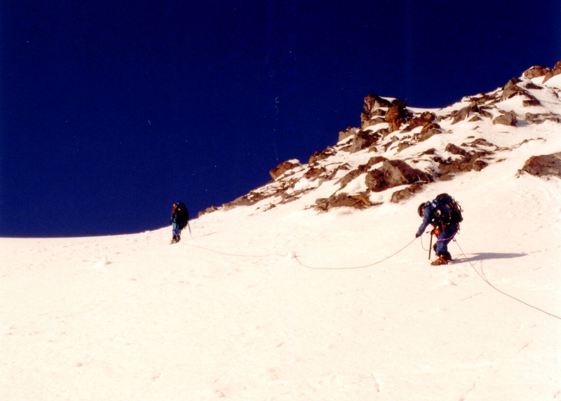
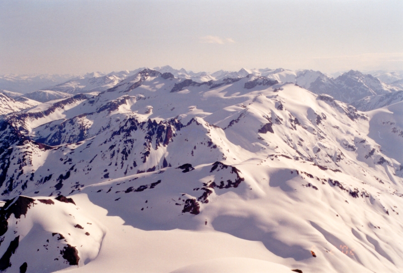
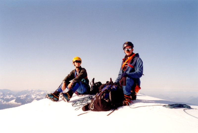
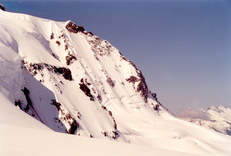
The bergschrund crossing was trivial but we encountered snow and ice to about 50 degrees heading up to the summit. The views from here are spectacular! To the east rose Mamquam Mountain and countless other peaks beyond. Wedge Mountain was clearly visible to the north, as was the Sphinx, Table, Black Tusk, Lake Garibaldi and even the 7th Heaven side of the distant Blackcomb ski area. To the southwest we had sweeping views over Howe Sound and Vancouver Island in the distance. Atwell Peak stands to the left with the Sky Pilot Range behind it. It was warm and calm, with barely a breeze. A rare treat for a summit in the Coast Range. After about 15 minutes, we carefully headed back down. Paul sinks four pickets into the softening snow as we do a running belay back down and over the 'schrund.
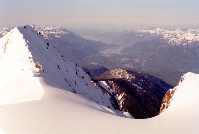
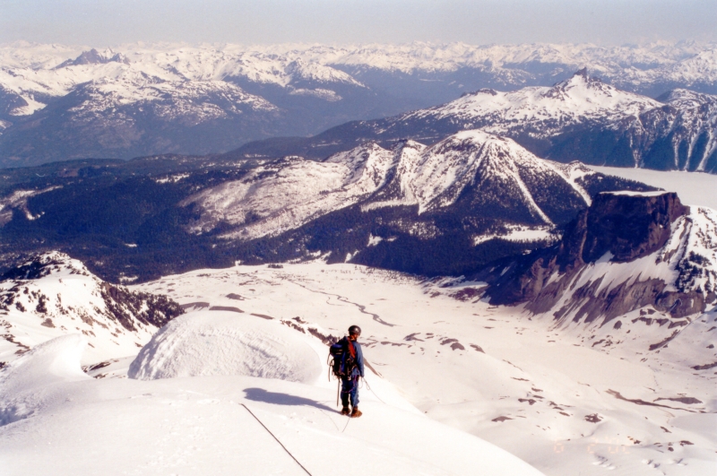
Up until this point, there wasn't another soul to be seen. Now we could see a party of four working up the now slushy snow towards where we were. We stopped, chatted briefly and wished them well as we continued on down. We walked for a few minutes and stopped again to admire the view. The Table, Black Tusk and Lake Garibaldi lie before us. The impressive North Face of Garibaldi would occasionally drop a chunk of ice onto the upper Warren Glacier. This seemed to occur most frequently in the early evening long after the hottest period of the day. We trudged back to camp, ate and slowly packed up. I skied clumsily down into the basin and skinned back up along the ridge. We failed to retrace our steps heading back down through the trees to where the car was parked and ended up a couple hundred feet lower on the jeep road near a logging operation. The insects were now swarming and we therefore didn't waste any time getting outta there. In my haste, I would unknowingly donate my skis to the BC Department of Forestry. I'm an idiot!
Click here to view photos.
![]()


