Select from list below to jump to a specific area on this site.
| Latest Posts |
Tuesday, January 29, 2020
Locomotive Mountain - South Ridge, August 2019
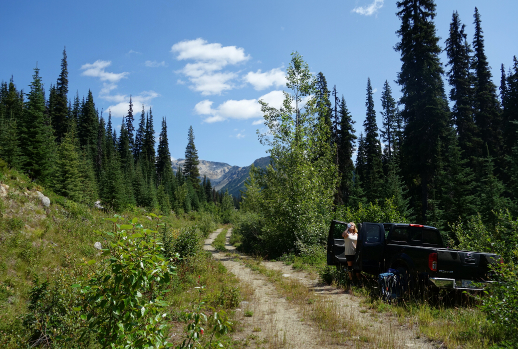
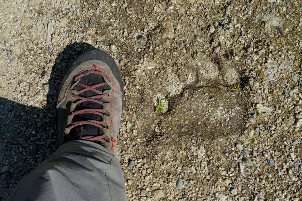
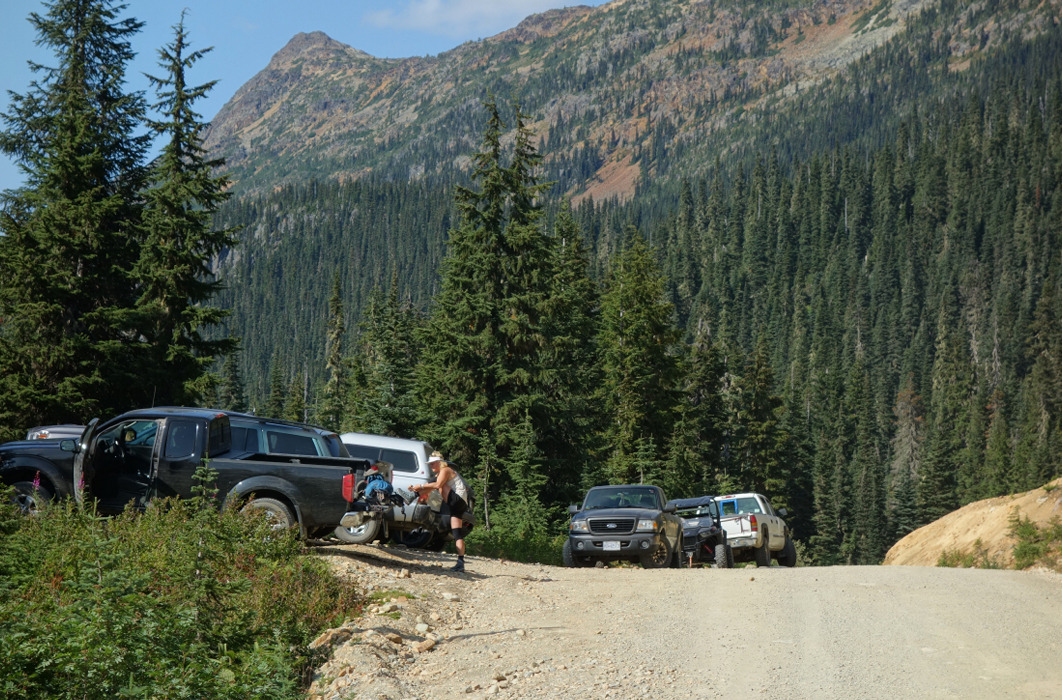
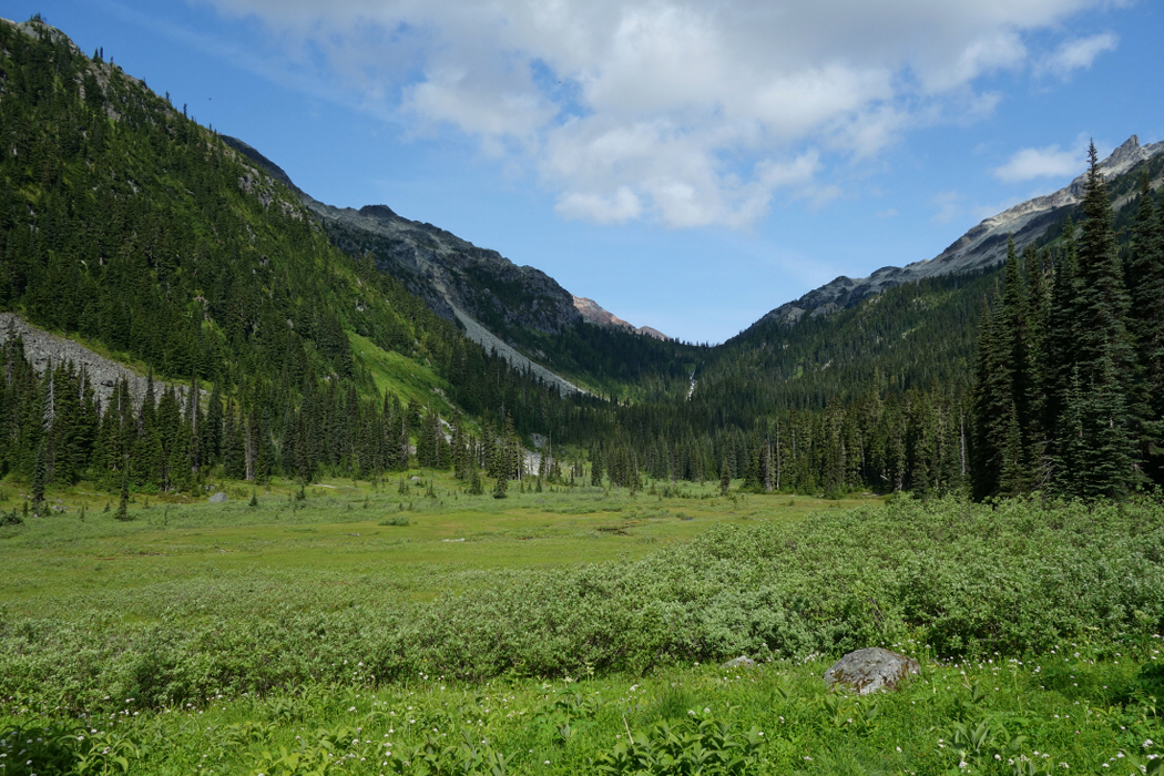
We intended on climbing Beaujolais and Mystery (aka Sockeye Horn), going so far as to drive up the forest road as far as we dared and completing the remaining miles to the trailhead, assuming one can call it that, on foot. Alas we could have spared ourselves the hassle, the needless "Canadian pinstriping" and sweaty FSR walk with overnight packs. And no, the grizzly paw imprints in the mud wasn't why we turned back either. Don't ask. Long story short, we eventually found ourselves at the Semaphore Lakes Trailhead with plans to climb Locomotive Mountain instead. Although easily doable in a day, the long drive from Vancouver and subsequent shenanigans had consumed most of the daylight hours. We resigned ourselves to making the short hike to the lakes and camping there that night, then climb the peak the following day returning home a day earlier than scheduled. All of which worked out just right considering the unexpected change in weather headed our way.
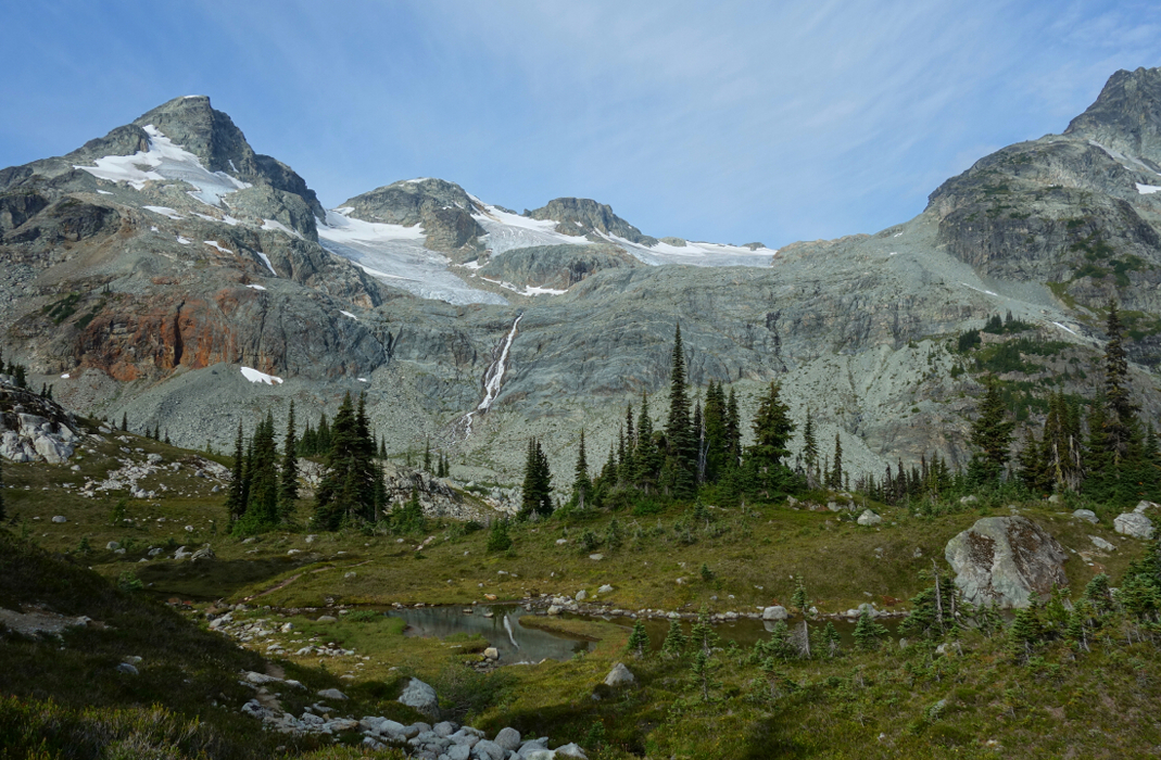
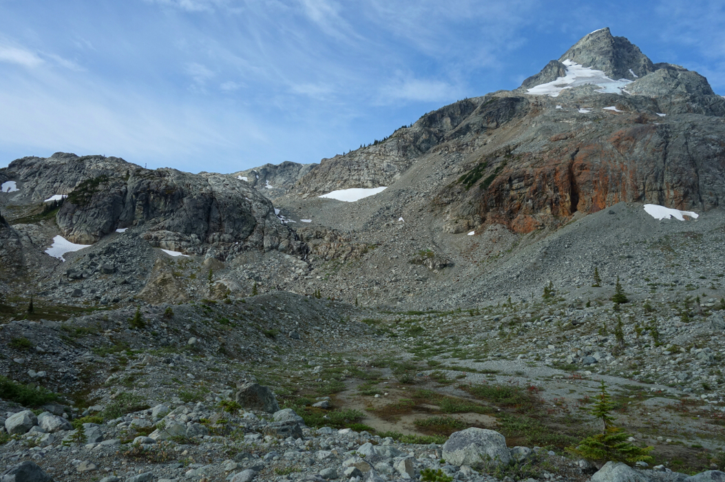
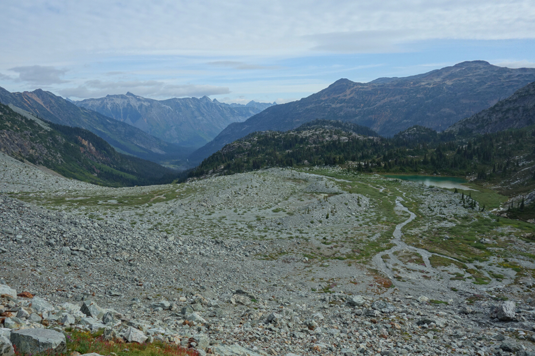
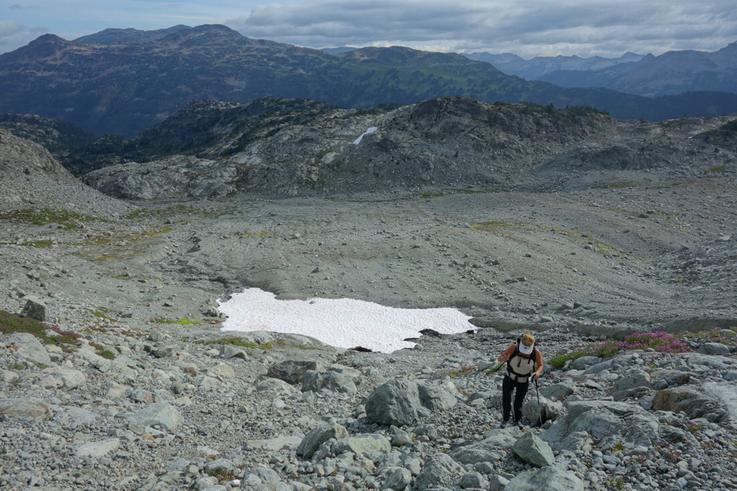
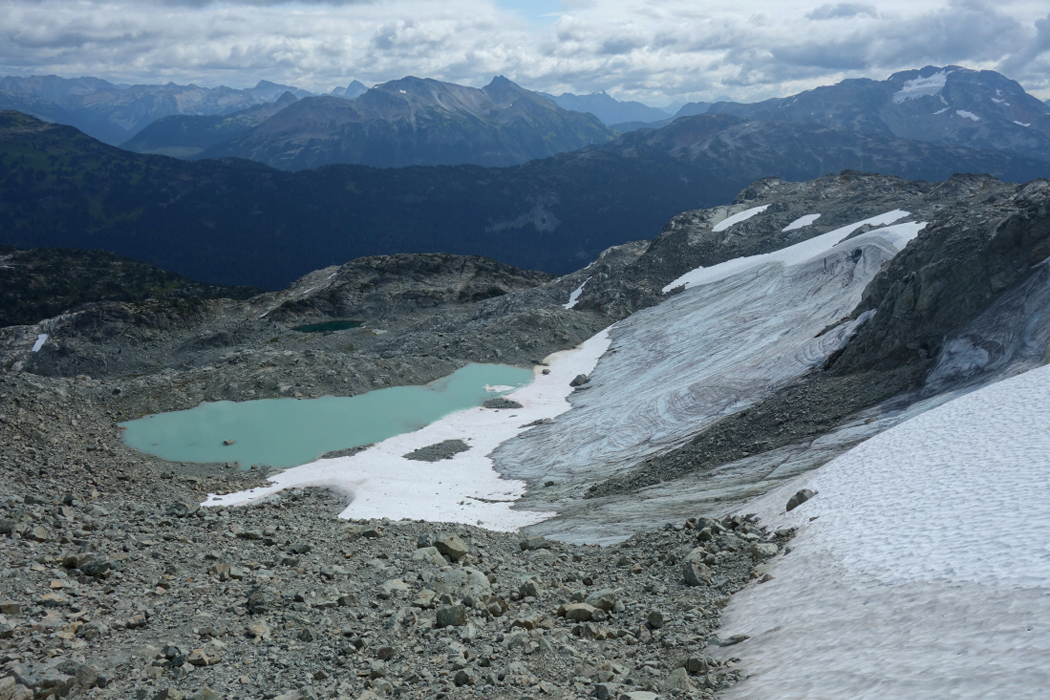
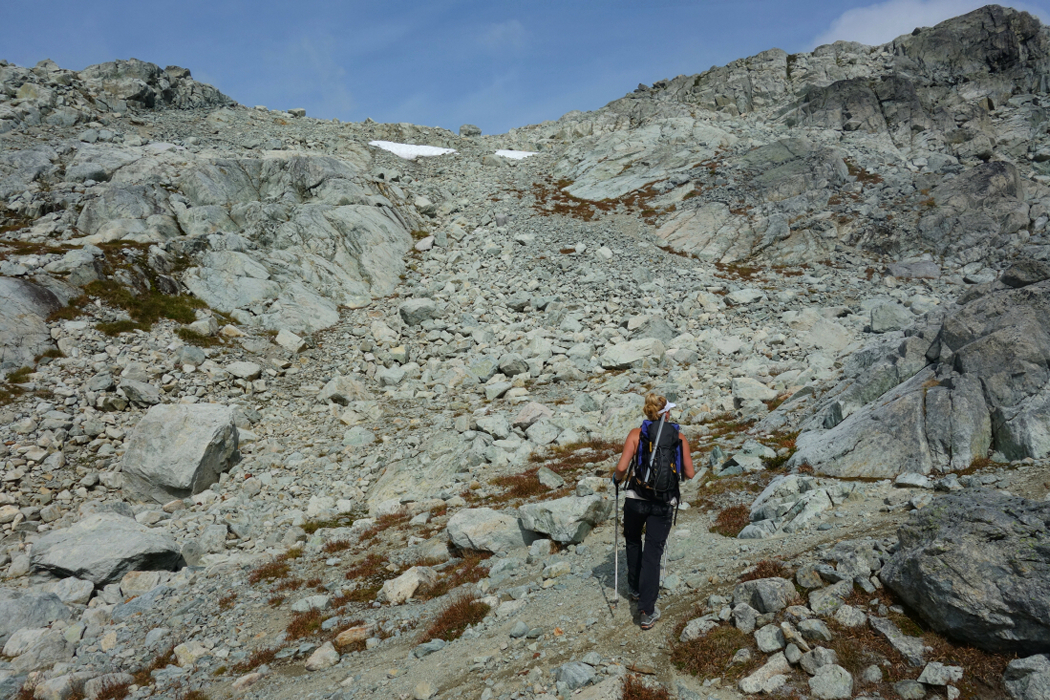
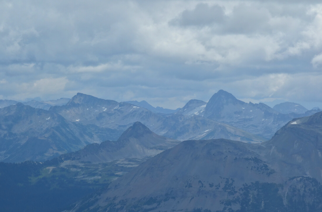
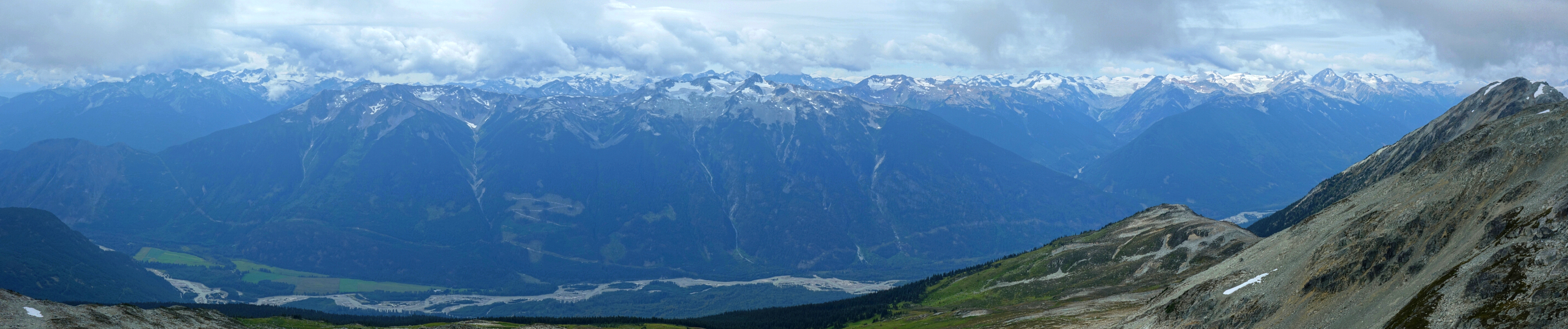
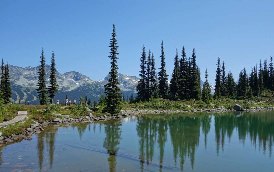
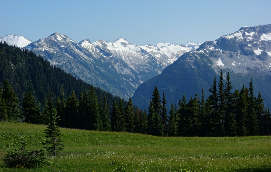
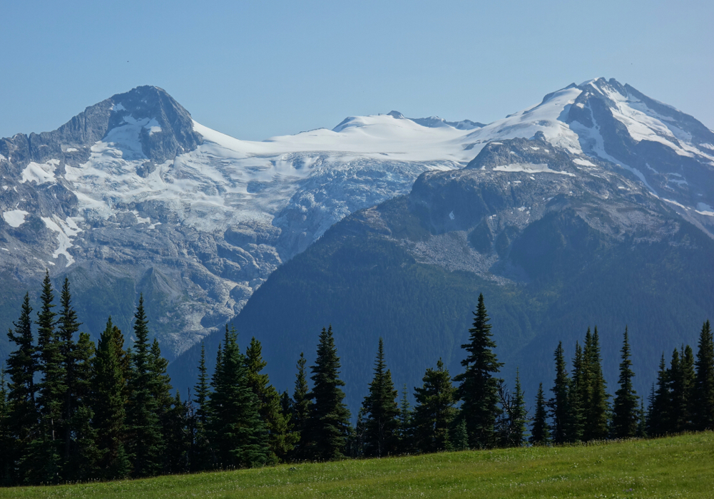
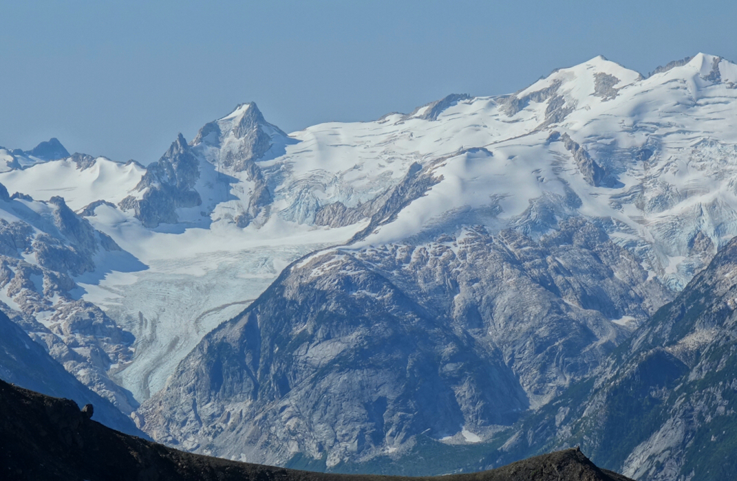
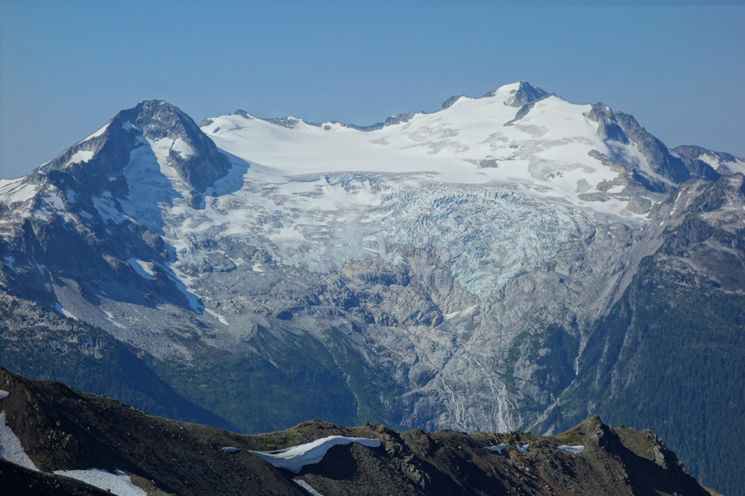
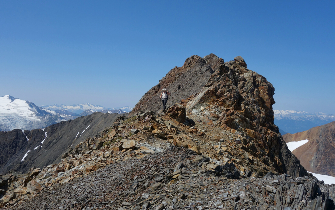
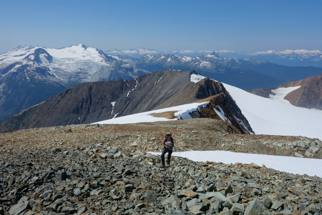
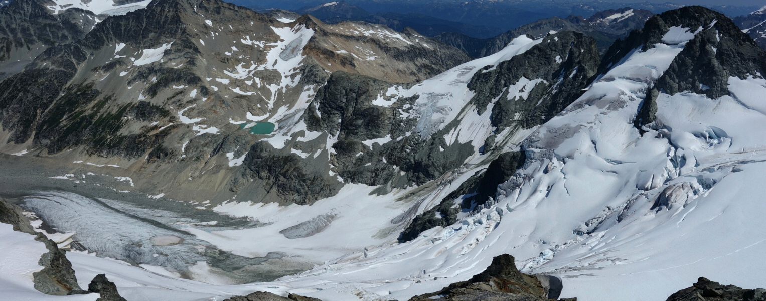
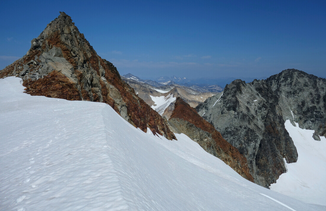
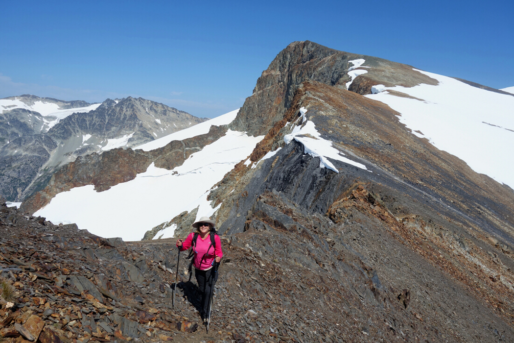
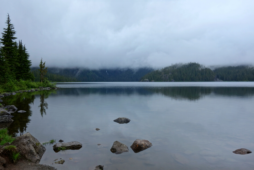
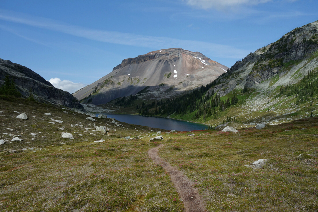
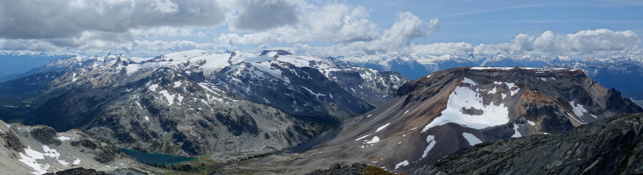
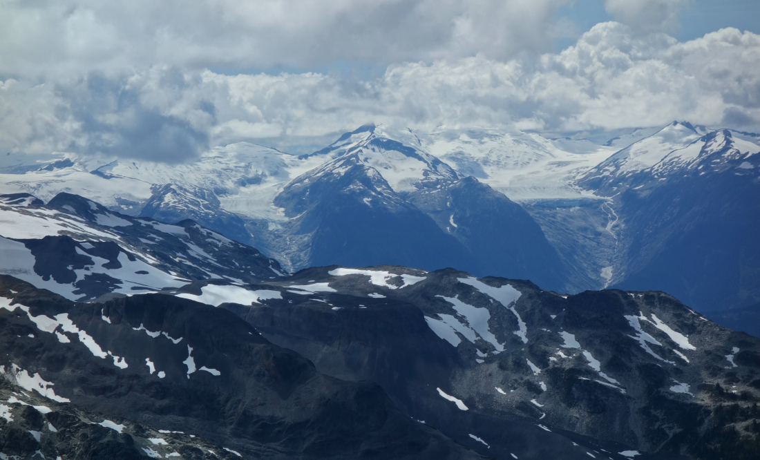
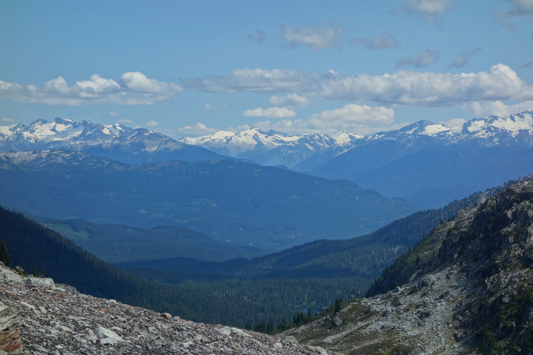
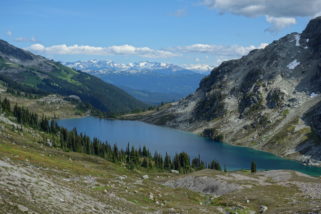
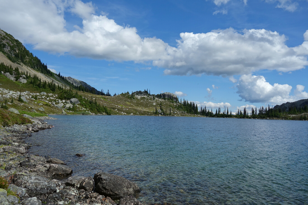
I've visited the Semaphore Lakes area previously, having climbed taller Face Mountain back in July 2010. Locomotive shares the same approach and is a shorter climb overall with better views. From the large moraine basin beneath the two peaks, we aimed for a talus saddle just left of the reddish cliffs directly beneath the objective. Continuing over the saddle, we followed the outlet stream upwards to reach a large, plain-like area which we crossed aiming for Locomotive's South Ridge directly ahead. Contouring around a small glacial lake not visible from below, we made the final push to the ridge crest. Traversing steep talus and hardpan made for tedious travel here. We took to the remaining snow on return and had a much easier time of it. Once on the broad South Ridge, we turned right and followed the path of least resistance to the rounded summit.
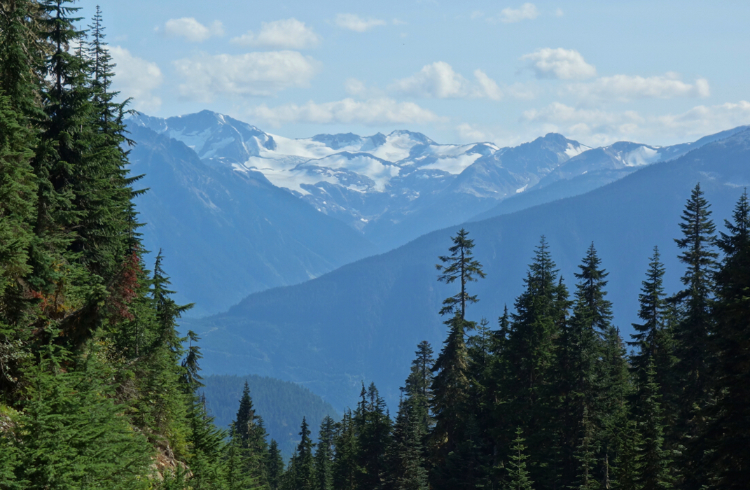
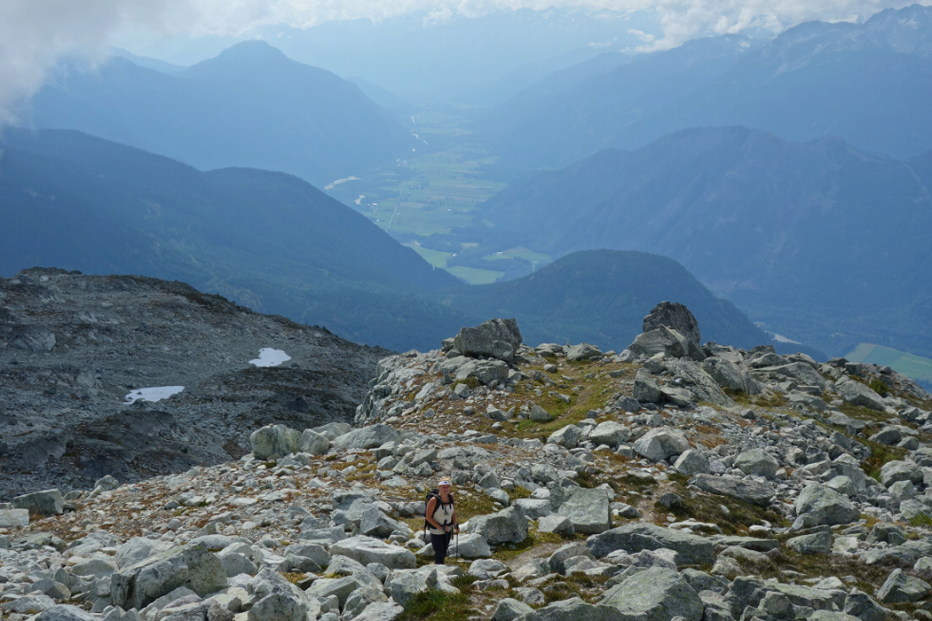
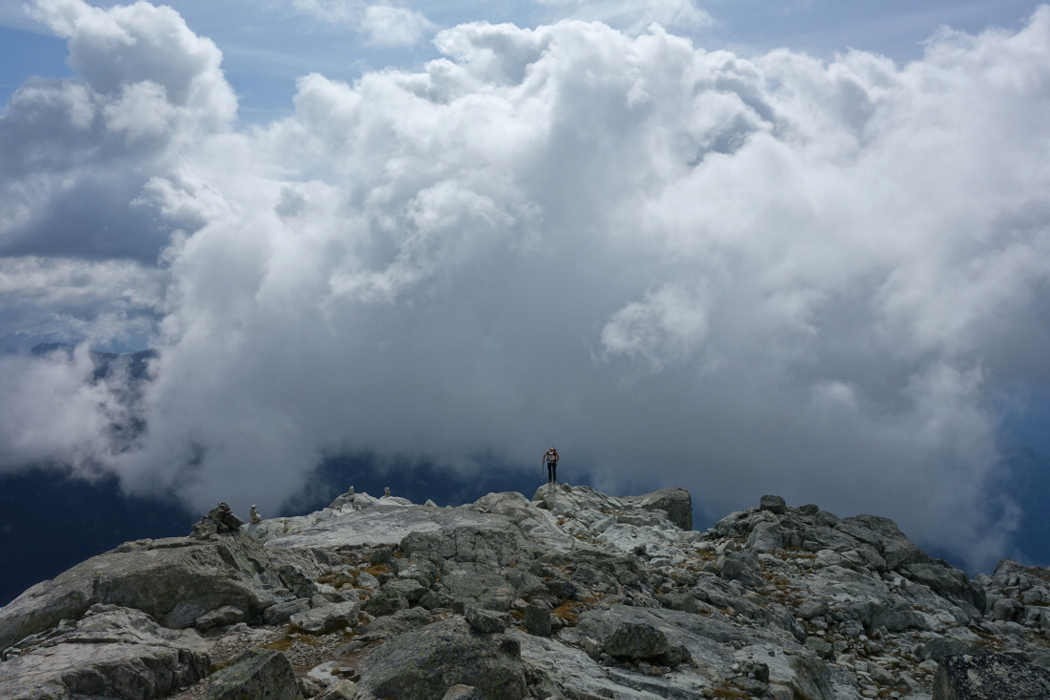
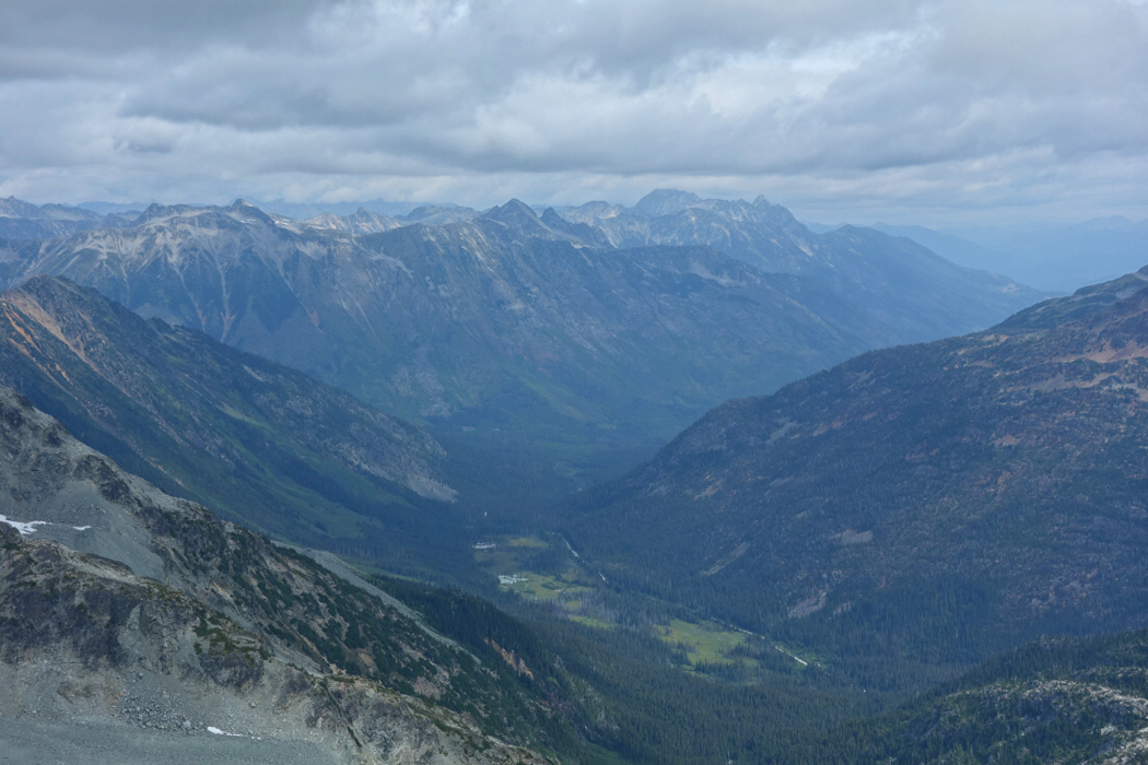
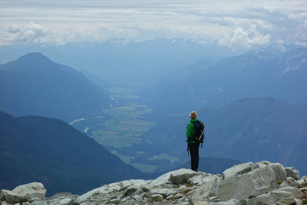
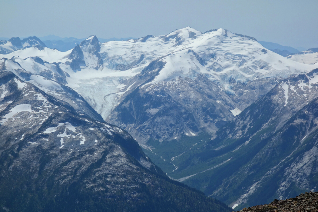
The unobstructed views of the Pemberton Valley did not disappoint and is probably the main reason for climbing Locomotive. I also enjoyed the different perspective on Train Glacier cradled in the cirque between Locomotive and Face. The blue skies we awoke to that morning had given way to clouds, which were building around us and starting to cling to the higher peaks. Rain certainly wasn't in the forecast before we left the house, but it sure seemed like it was coming. A flock of birds repeatedly circled us on the summit, reminding me of a similar experience I encountered on top of Mount Baring. Then, like today clouds had been building and rain was on the way. We decided not to push our luck and returned to camp after about 15 minutes up top, packed-up and hightailed it back to the truck. Got to within a couple miles of Pemberton before the first drops of rain hit the windshield. Phew...no rained-out weekend for Team Verdina. Been there done that!
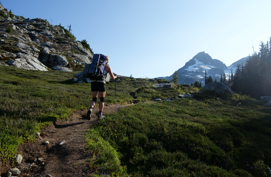
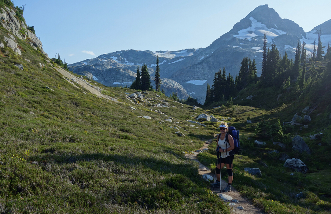
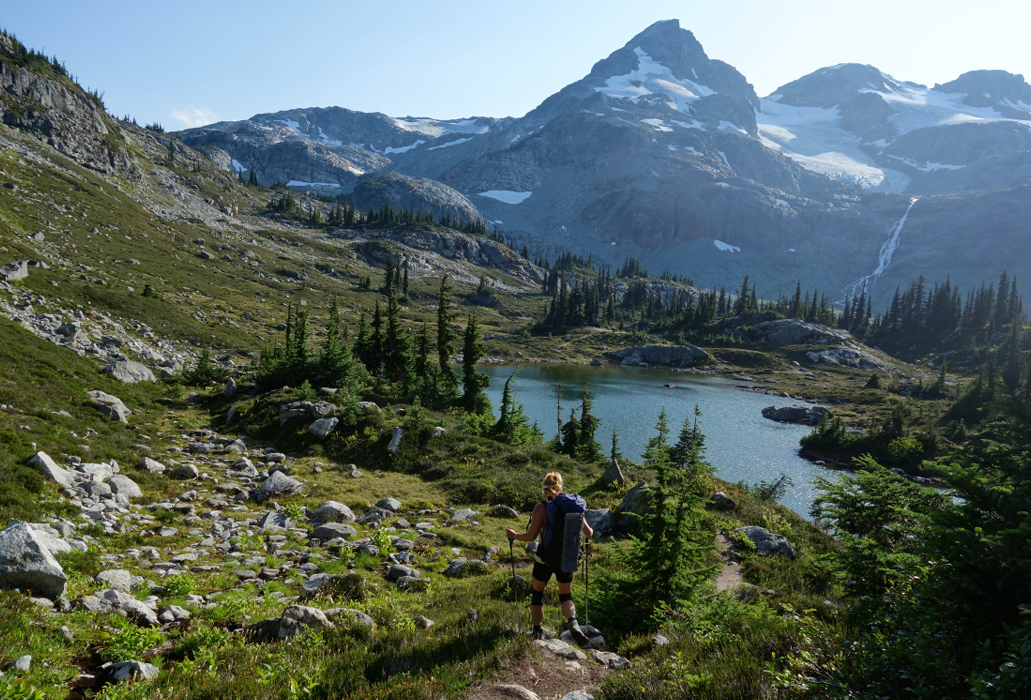
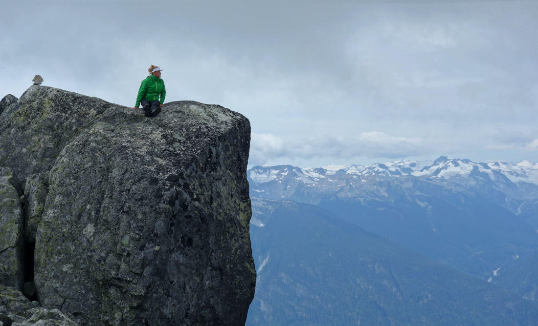
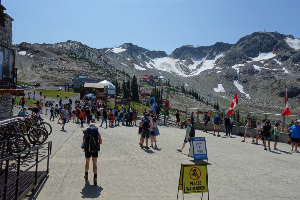
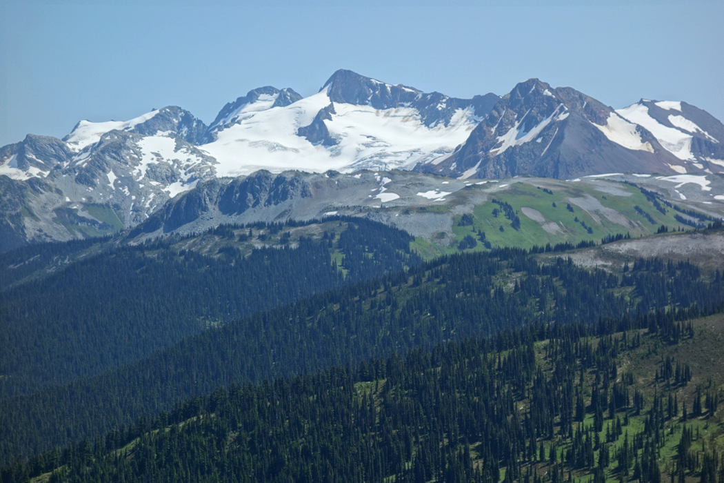
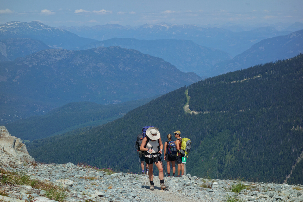
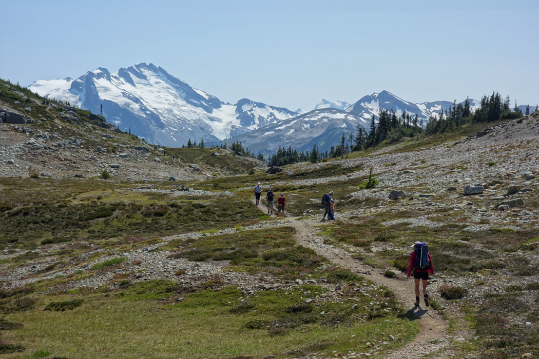
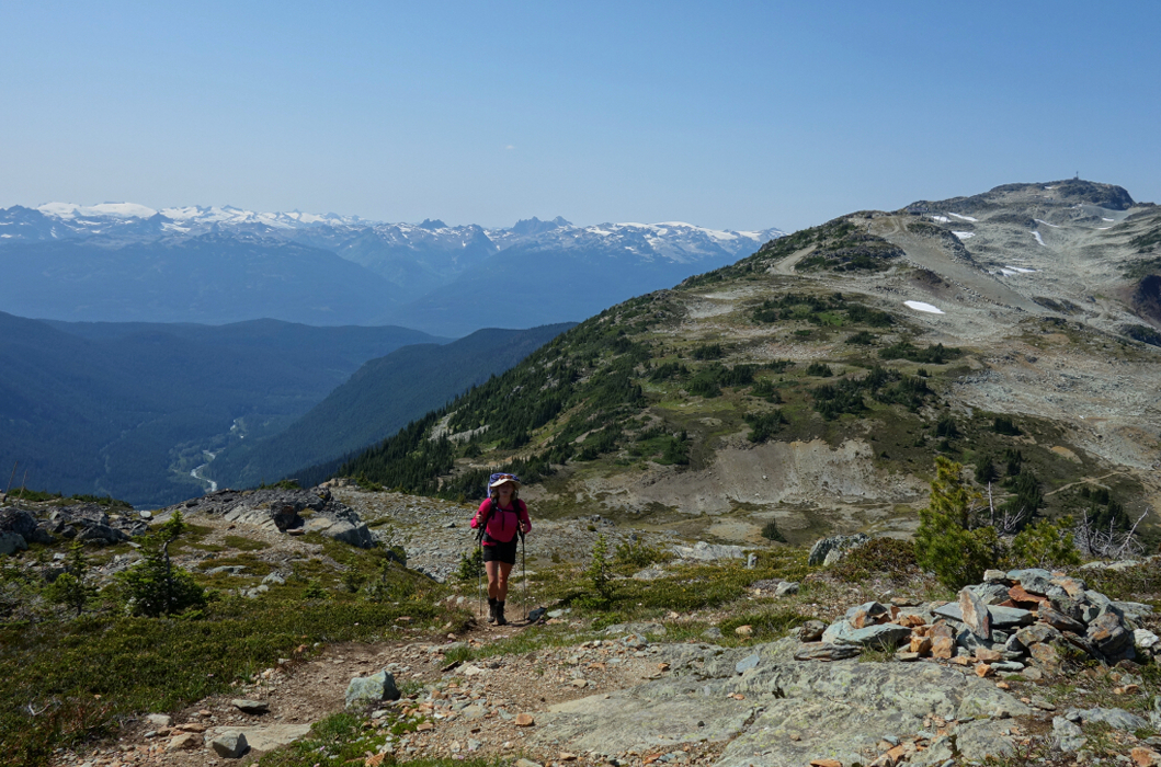
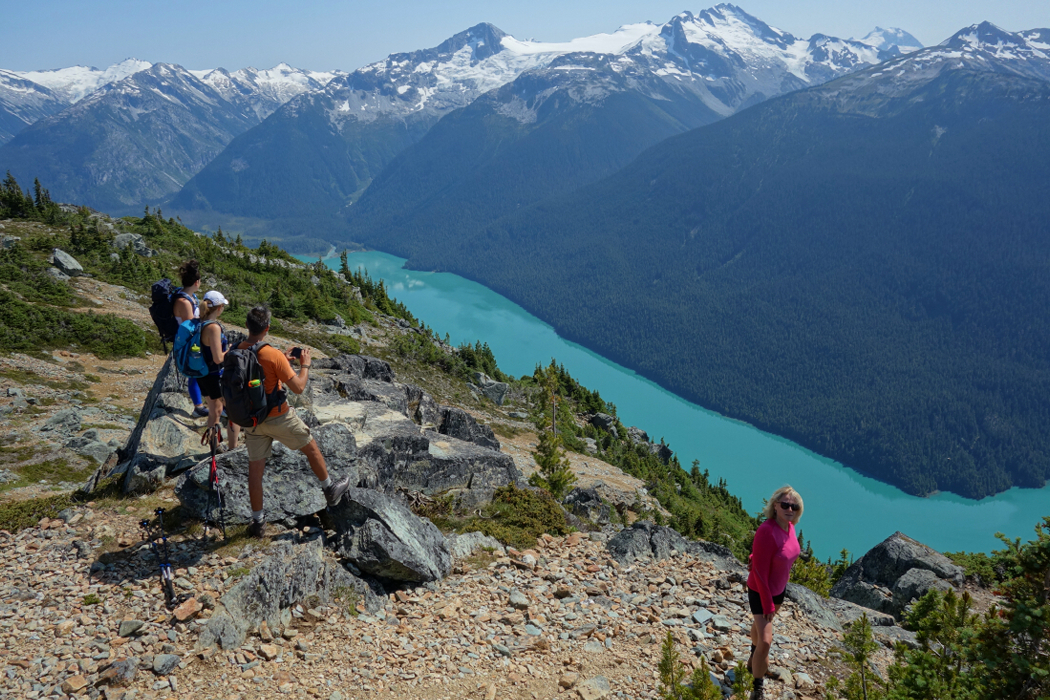
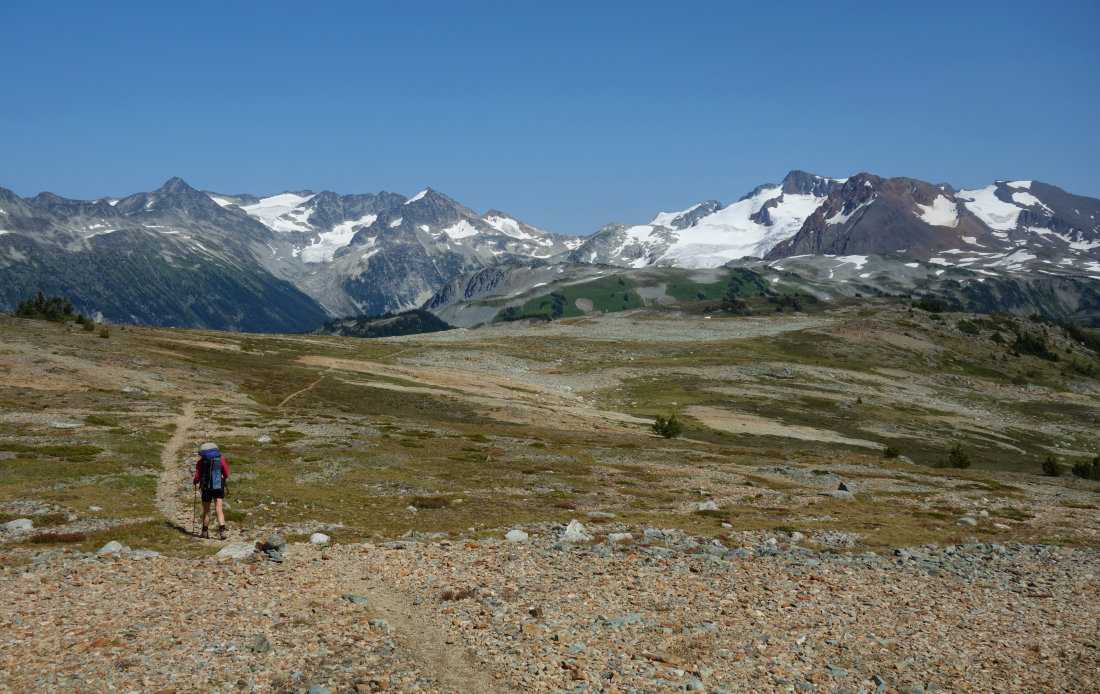
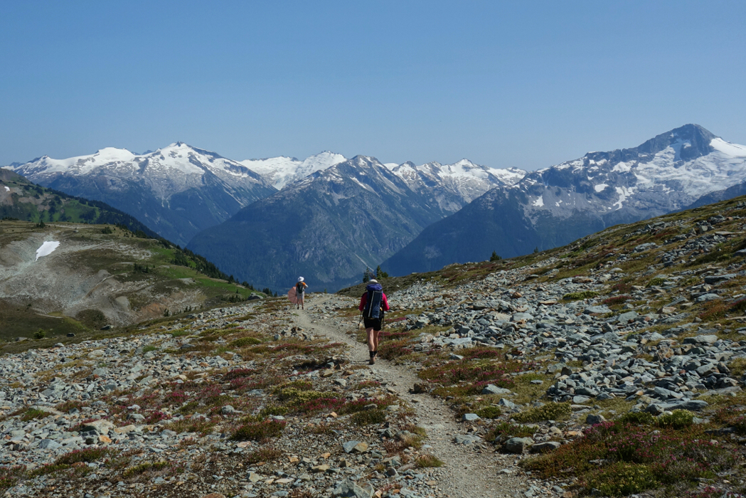
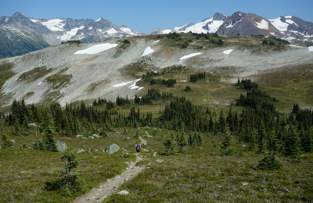
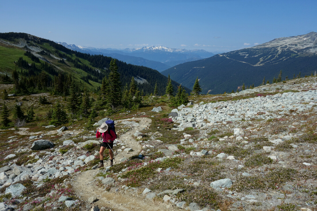
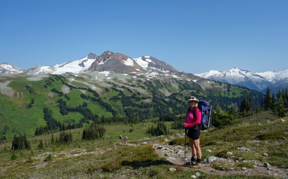
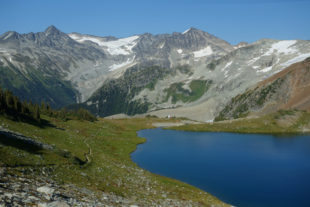
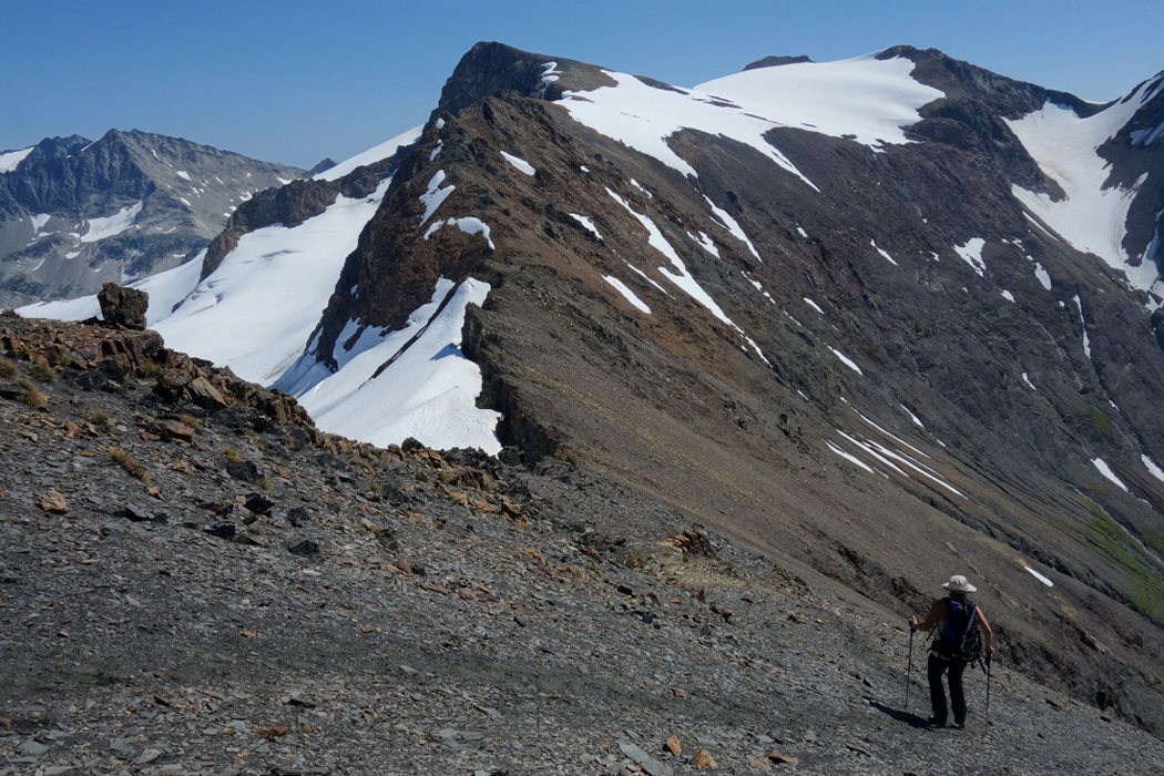
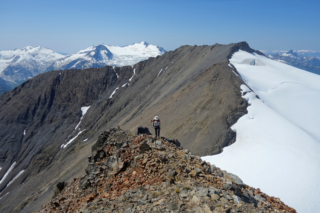
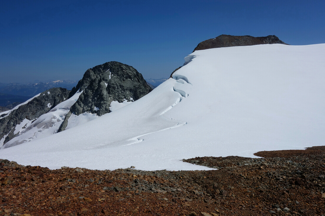
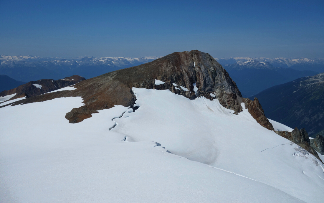
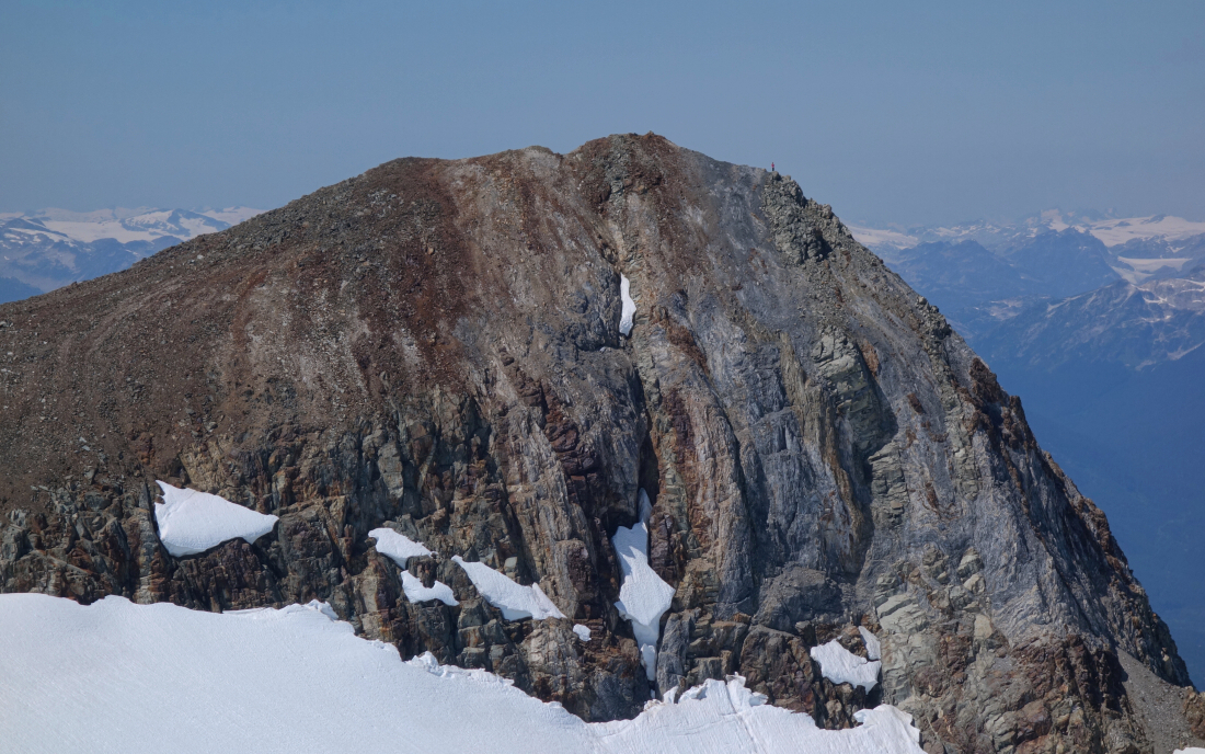
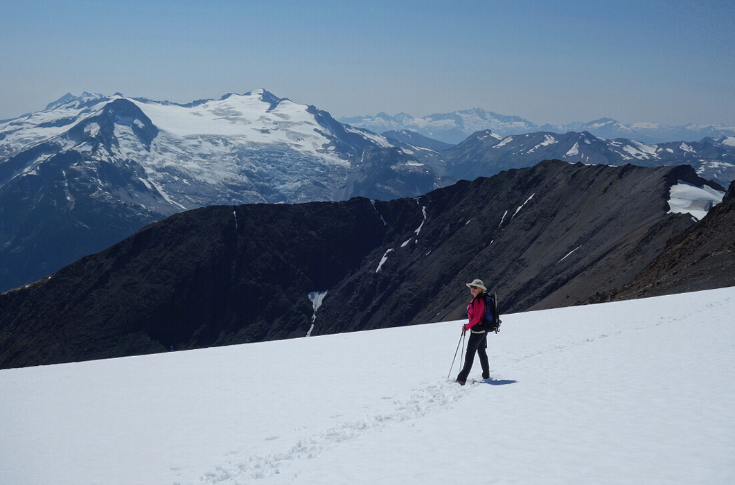
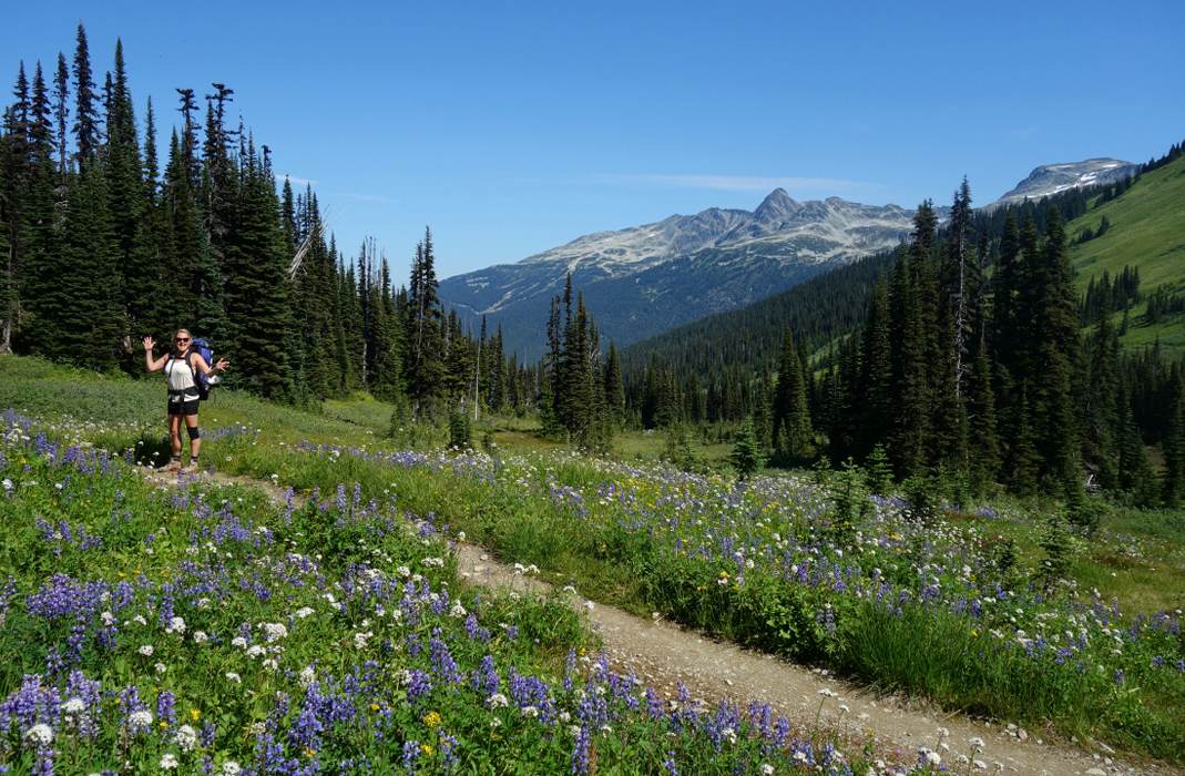
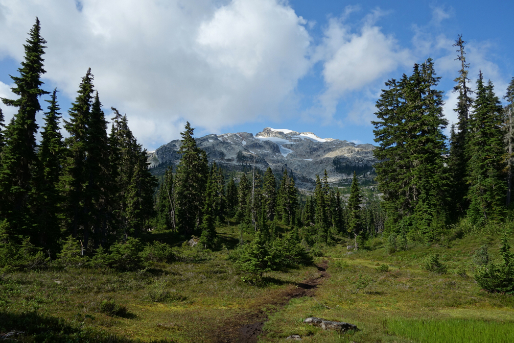
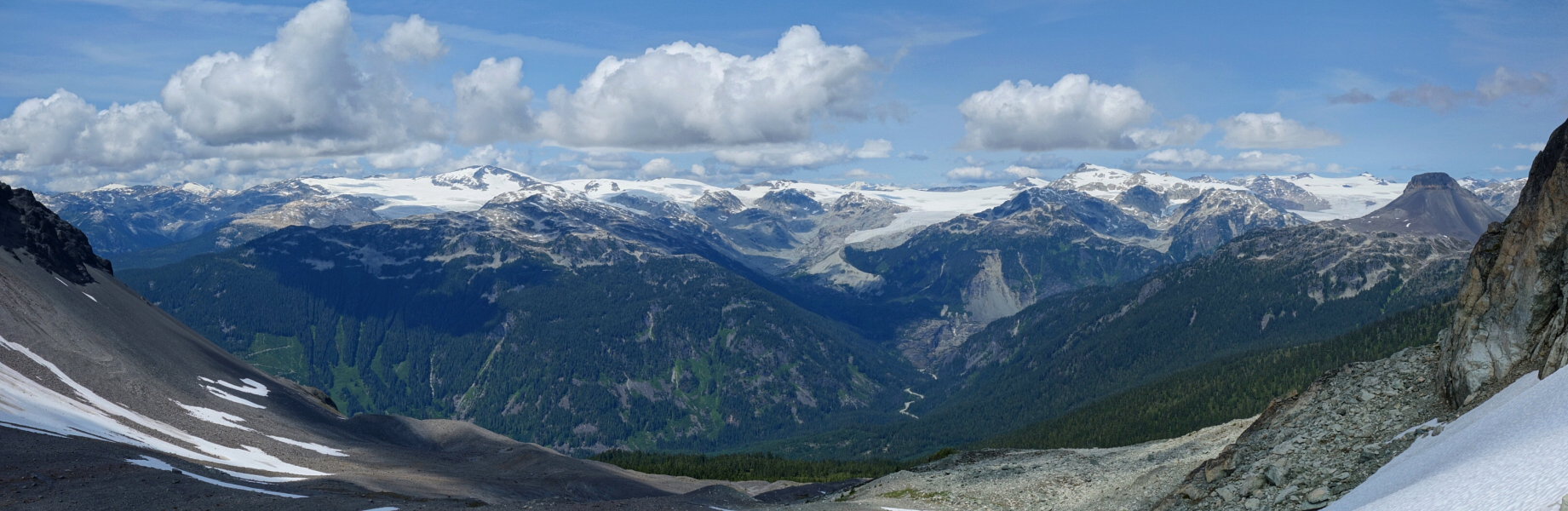
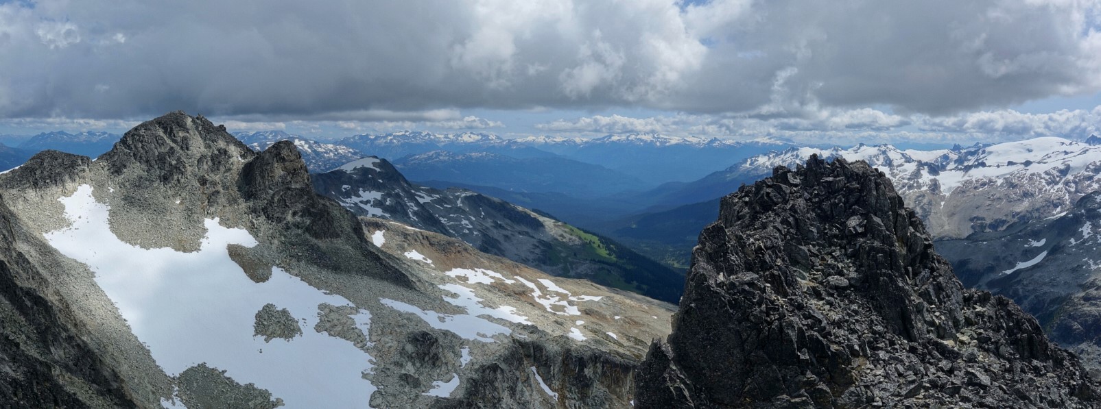
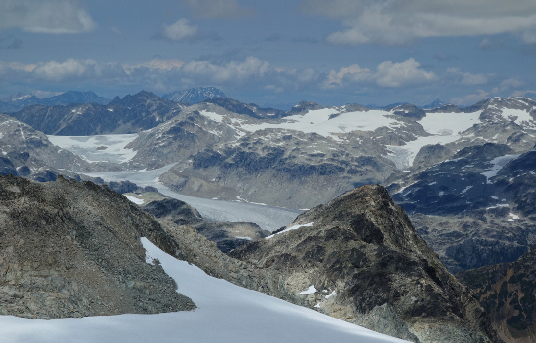
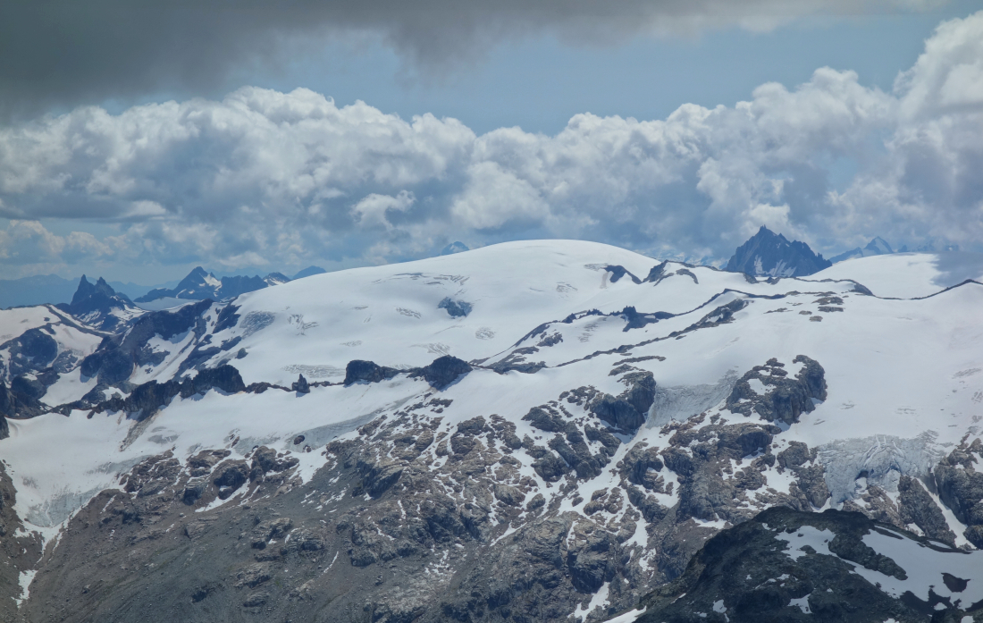
I've had my eye on Overlord Mountain for some time now, and for good reason I might add. I don't consider myself a seasoned veteran of climbing in the South Coast by any means but based on the trips I do have under my belt; Overlord is a classic! I had the intention on bagging the peak back in May this year but was thwarted by poor snow conditions (climbed Fissile instead). Turns out it was a blessing in disguise. For what it's worth, I'd suggest leaving Overlord for later in the summer. With the seasonal snow gone, the colors and contrast of mid summer really do this corner of Garibaldi Provincial Park justice. Combine that with a gondola-assisted start, then a pleasant hike along Whistler's summer trails and past the resort boundary over the infamous Musical Bumps to lovely Russet Lake for the full meal deal. The approach over the 'bumps is truly unique in that it comprises an ~8-mile "ridge" of subalpine meadows linking a world-class ski resort to the edge of a vast wilderness. Known as the Fitzsimmons Range, this "ridge" essentially culminates with Overlord Mountain itself. As the highest summit within the headwaters of Fitzsimmons Creek, Overlord offers a commanding perspective on the Spearhead Range to the north, the McBride Range to the south and a seemingly infinite ocean of peaks and glaciers that lie beyond.
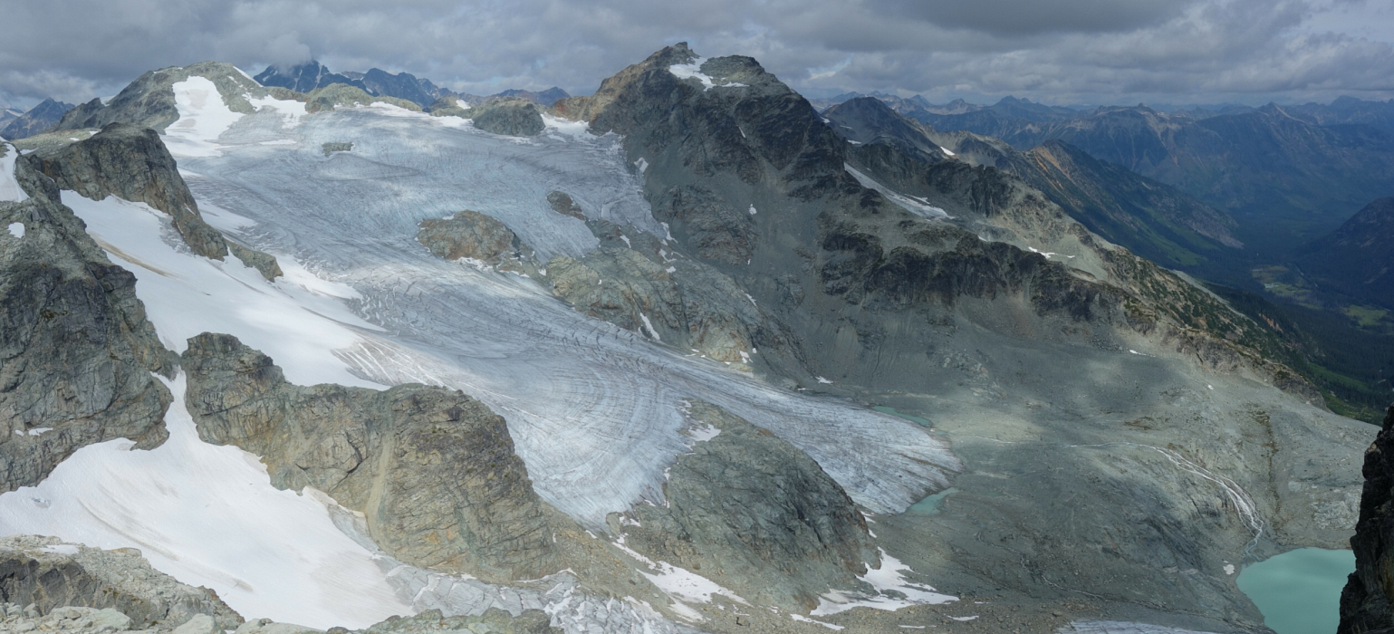
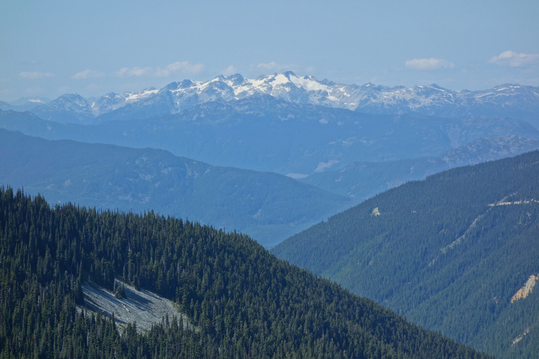
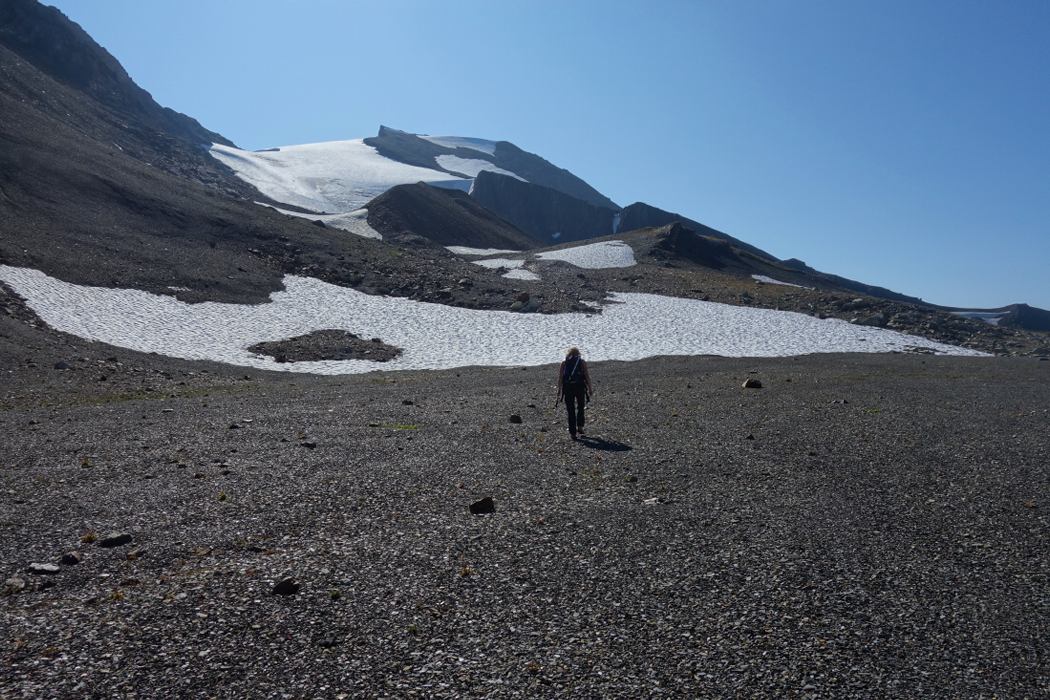
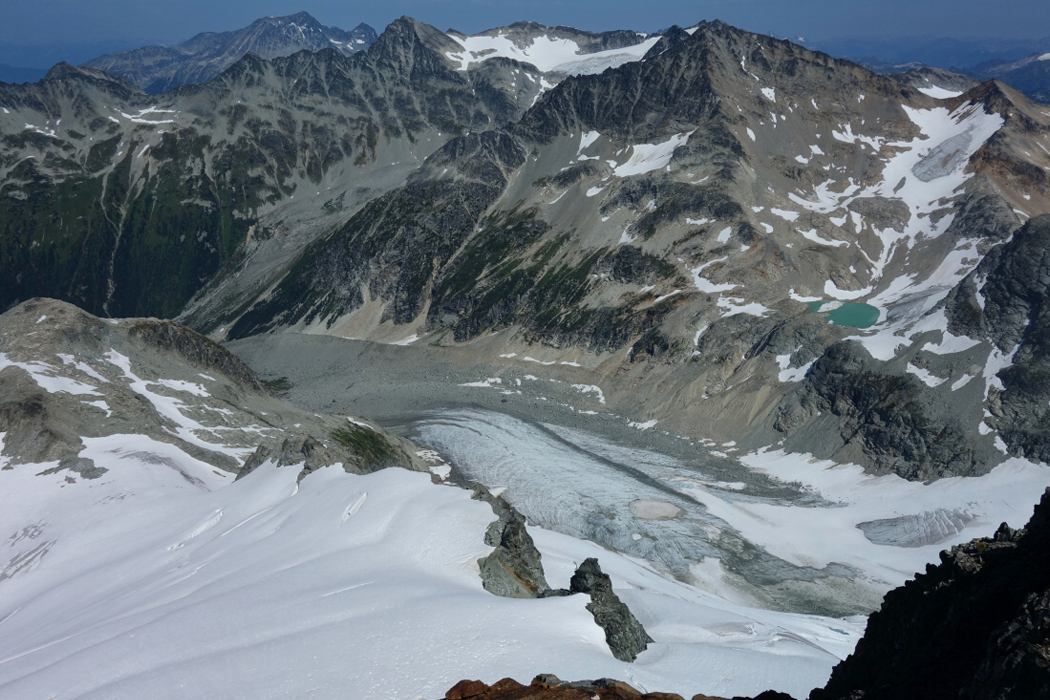
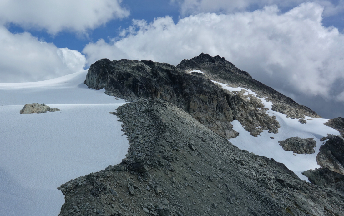
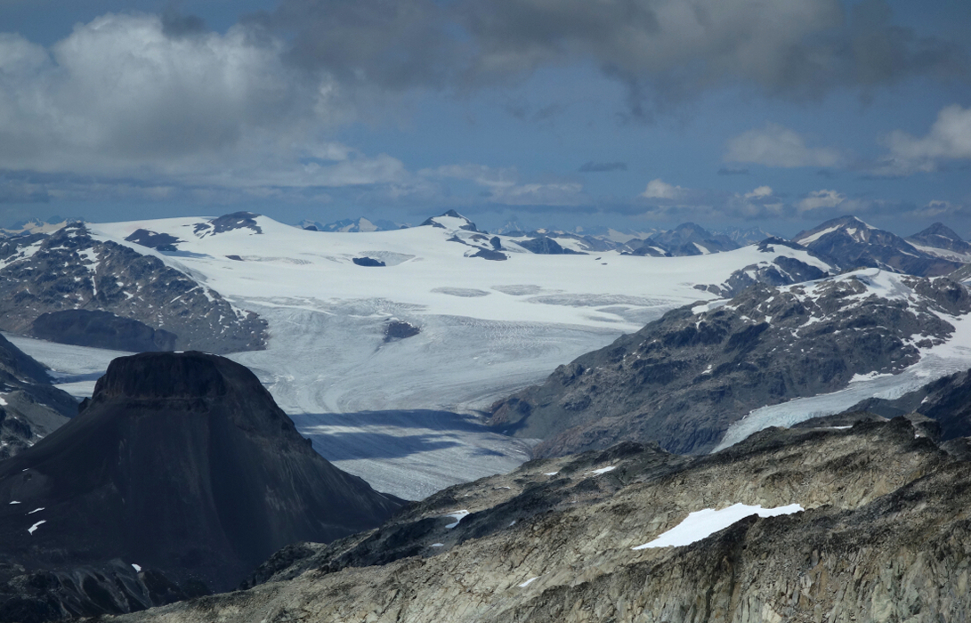
The summer route to Overlord entails climbing up and over Whirlwind Peak (or close to it), then scrambling along the connecting ridge by going over Refuse Pinnacle along the way. There isn't much hands-on climbing on route, but the position and setting is about as good as it gets! Obviously, the views from up top are simply outstanding. Since I happened to be in the neighborhood, I went and tagged Mount Benvolio, just a short skip across the Overlord Massif plateau. From Benvolio, I enjoyed unobstructed views of Cheakamus Mountain and countless glacier-clad peaks behind it, not to mention the mighty Diavolo Glacier right beneath my feet and of which I have fond memories from when I did the Spearhead Traverse.
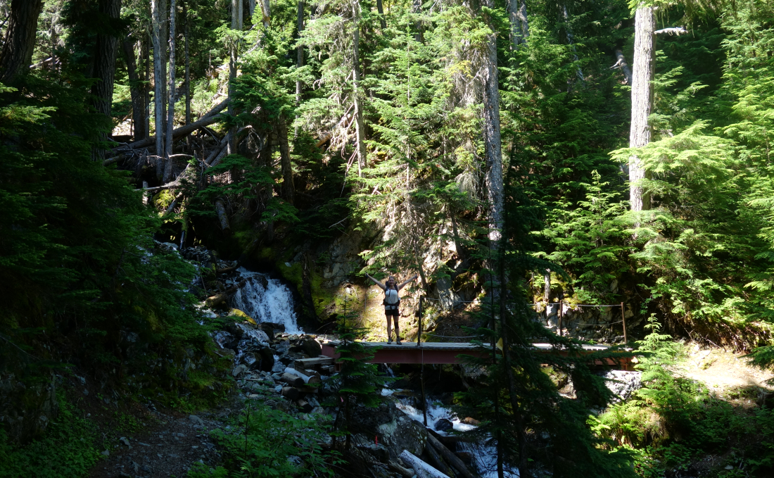
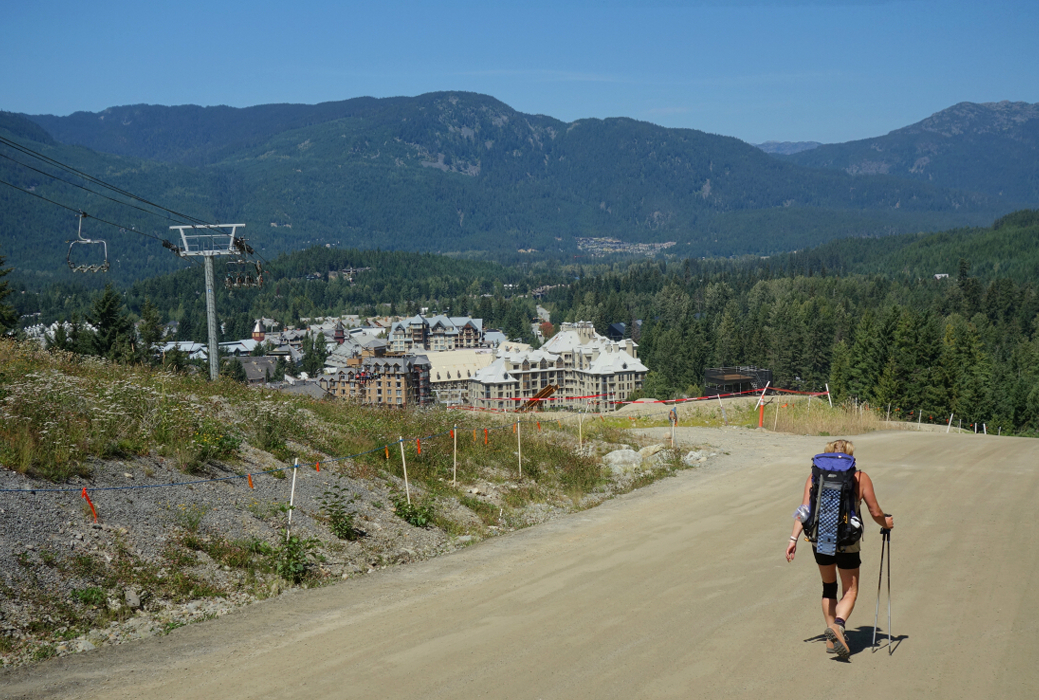
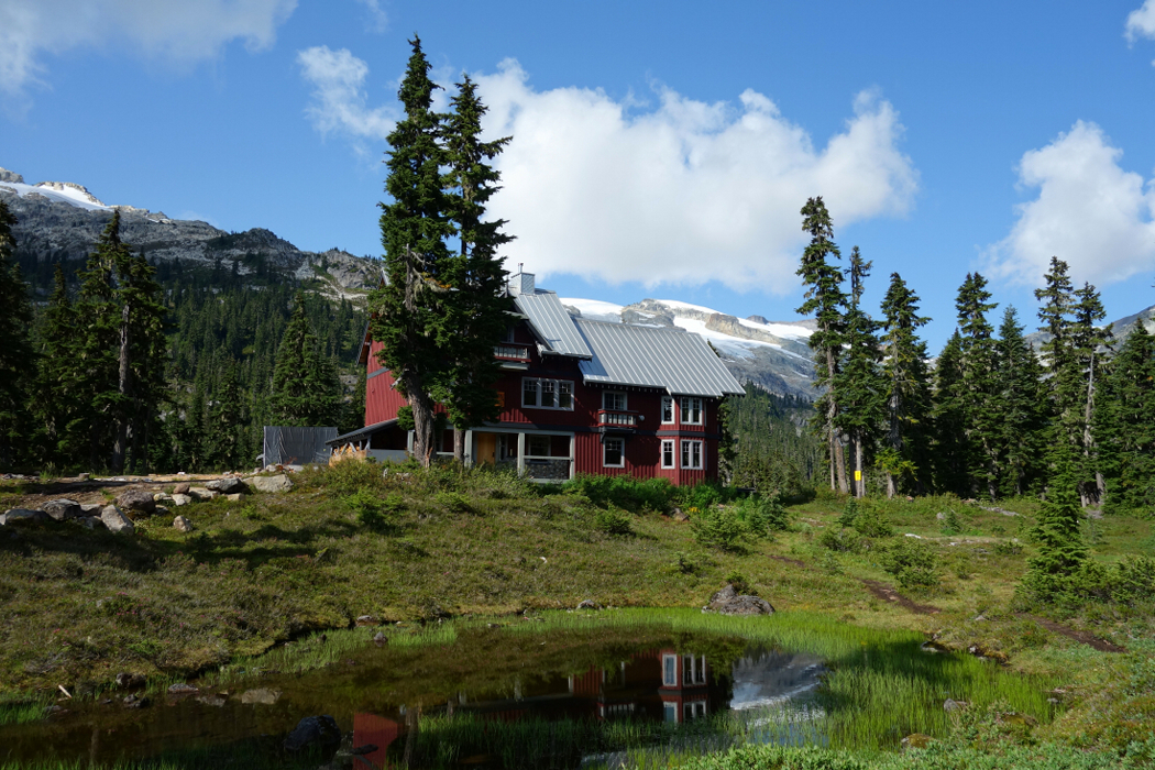
Returning from the summit, we made it back to camp without incident, packed up and invited ourselves to a comprehensive tour of the new Kees & Claire Hut nearing completion on a bench above the lake opposite where the old hut is located. I've commented on this before but suffice to say that the K&C hut makes for some damn fine backcountry accommodations! Ok, it's not exactly a rifigio in the Dolomites, but then this ain't the Alps either. For something different, we decided to return via the Singing Pass Trail rather than going back up and over the 'bumps. Not sure it was any faster than taking the high route back to Roundhouse Lodge, but then again, we didn't have a gondola waiting to take us down to the village. Preparations for Crankworx were underway once we finally made it back to civilization, and so we decided to stick around and watch some MTB action while enjoying a well-deserved meal from the patio at the GLC. That's right, food service with entertainment practically at the trailhead. I'll take that over driving down a bumpy forest road and spilling my beer and spicy pork rinds all over myself any day!
Mount Callaghan & Valet Peak - West Route via Callaghan Lake, July 2019
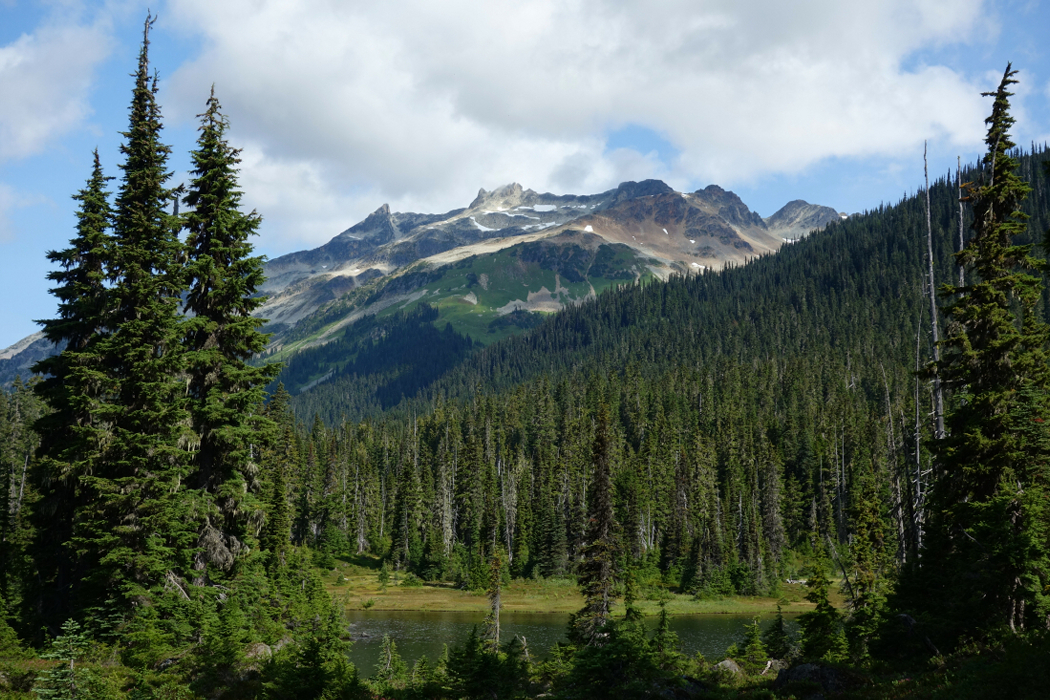
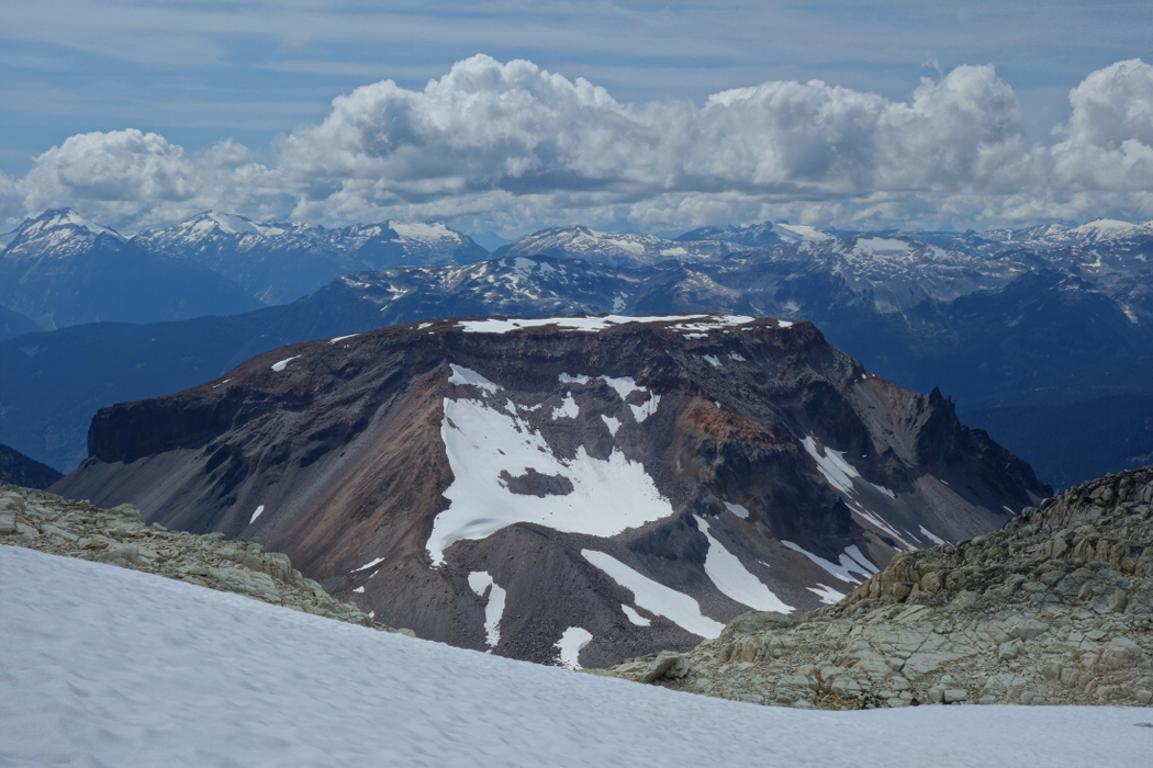
Tucked away at the back of Callaghan Valley, Callaghan Mountain is a glaciated massif from which incredible views of the Pemberton Icefield and the glaciated peaks of the Ashlu-Elaho divide are to be had. I'd always been a bit curious about what was up there having driven past the turn off from the Sea-to-Sky Highway countless times over the years. I did check out the newly constructed Whistler Olympic Park facilities located a short distance up the valley sometime before the 2010 Olympics, but that didn't do much to satisfy my curiosity. And yes, I suppose it also bears mentioning that my very first time with Whistler Heli we boarded slopes on the south side of the valley in a zone called Cal-Pow. But alas, I had no idea what I was looking at at the time.
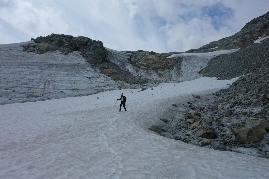
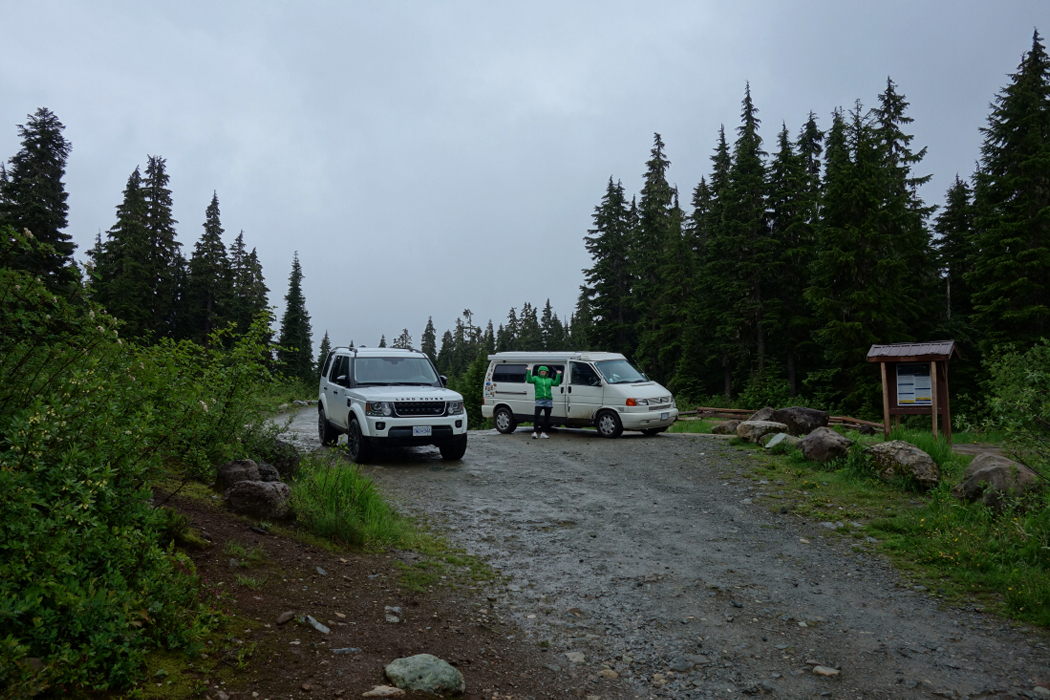
My first attempt at the peak this year was thwarted by weather and amounted to little more than a soggy night in the campervan at Callaghan Lake. I returned some weeks later and made my way up the trail, past Journeyman Lodge and Ring Lake to the high pass between Ring Mountain and the Callaghan massif. As expected, the views from this spot offered up one of the finest vantages from which to behold the Pemberton Icefields I've seen to date. I'd gone a bit out of my way to reach this pass and decided that it now made more sense for me to scramble up the peak just to the northeast (Valet Peak) in hopes that I could follow the connecting ridge towards Mount Callaghan. Fortunately, this proved to be a viable route with a short snow gully down the north side offering a timely exit just as the ridge began to cliff out. Skirting the cliffy difficulties now to my right, I soon reached a prominent saddle. From there, I swung left onto the glacier to avoid some steeper rock on the crest and made my way up to the summit, bagging a neat looking spire along the way. Ah yes, the views! But then a quick study of a topographical map of the area prior to coming here would suggest as much.
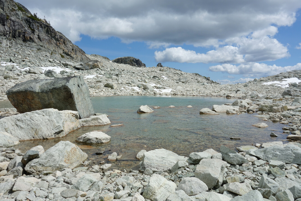
I returned to the saddle on my way back, then bashed down the large south-facing talus basin to intercept my up-route from Ring Lake. While somewhat longer than descending from summit to the lake directly, this route avoids much of the steep heather and grass side-hilling horror stories I'd read about while researching the route. Back at Ring Lake, I followed an intermittent trail now on the north shore, wishing I'd done so on my way in. From there it was just a matter of blindly following the trail back the way I came, eventually reaching the car about 10 hours after having left it that morning. Bit of a long haul getting in there with some tricky route finding, occasionally tedious travel over loose rock and of course the unrelenting mosquitos, but worthwhile nonetheless.
It would be very much appreciated if you please ask before copying and/or re-publishing content from any part of these pages. To do so, please click here to send a message via feedback form.


 as seen from Face Mountain.")


