


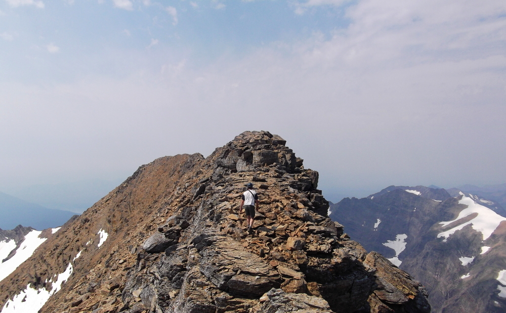
Mount Jackson - Northeast Ridge, August 2012
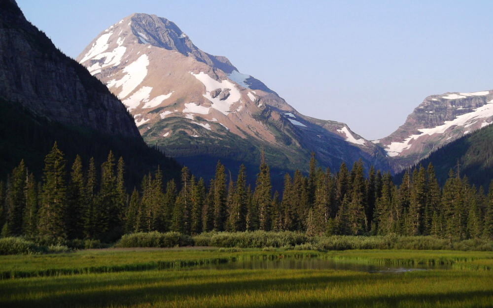
 as seen from the summit of Mount Siyeh with glaciated Blackfoot Mountain at left and pointy summits of Gunsight Mountain at right.")
The fourth tallest peak in Glacier National Park, 10,052 ft Mount Jackson is both easily seen from the Going-to-the-Sun Road and cradles what may be the largest remaining glacier in the park - Harrison Glacier. Jackson is the only 10'er in Glacier situated on the Continental Divide, which as some suggest implies that the term "Crown of the Continent" was coined by George Bird Grinnell to describe the peak itself. In any case, it was Grinnell who named Mount Jackson in the first place, so it doesn't seem all that far fetched to me. Naming rights aside, it is unclear who first climbed the mountain though a familiar name once again appears in the list of earliest recorded parties. Like Mount Cleveland to the north Frank B. Wynn, this time joined by his son James, climbed Jackson in August, 1912.
7.5 trail miles plus an additional 2.5 off-trail miles lie between the trailhead (at the Jackson Glacier Overlook) and Mt. Jackson's summit. Paul and I had hoped to climb the peak starting from a camp at Gunsight Lake, however given the predictabe lack of available camping permits we decided to make a day trip of it. Our route, the Northeast Ridge, is probably the most aesthetic of the routes on Jackson but doesn't change the fact that it is a long, tedious and often loose grind to the summit no matter which way one goes. We 'enjoyed' all of 5 minutes up on top thanks to what appeared to be rapidly-growing thunderclouds (which never materialized) in the smoky air that surrounded us and quickly turned back to descend the way we came. Changing to running shoes for the trail hike back to the car certainly spared my feet from much pain and suffering, but I think I speak for the both of us in saying that I could have done without that final crippling mile back UP to the trailhead!
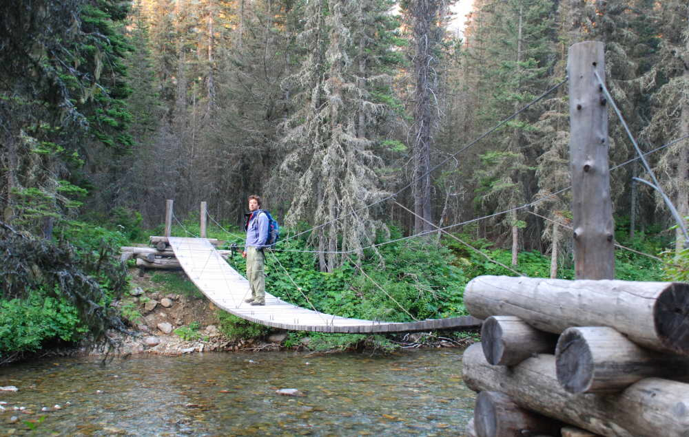
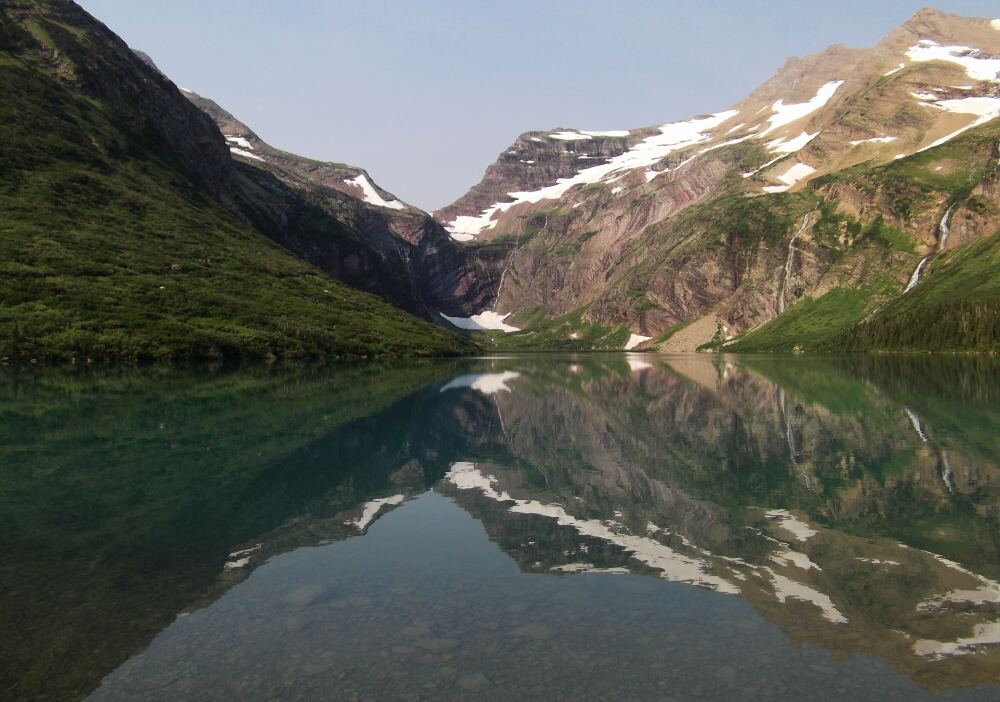
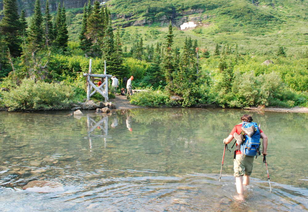
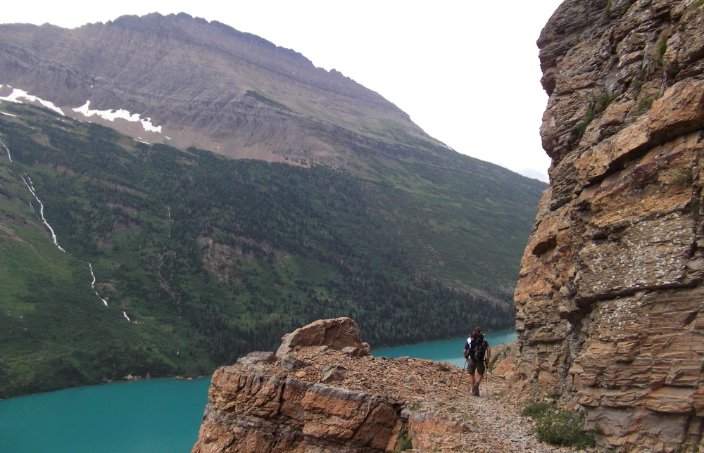
Still sore and tired from the Cleveland climb only two days prior, Paul and I made a pre-dawn departure from our 'hobo camp' outside Saint Mary. Driving back west on the Going-to-the-Sun Road, we parked at the Jackson Glacier overlook, shouldered our packs and proceeded on trail downhill (yes, downhill) from the road. Turing right at a junction after about a mile, we crossed the North Fork of the Saint Mary River before proceeding up the Saint Mary River Valley proper. The bridge spanning the Gunsight Lake outlet creek was under construction with a crew already at work by the time we arrived that morning. Off come the shoes, roll up the pants and if I wasn't awake yet the frigid ford certainly did the trick! Once across, the trail turns right and climbs along the broad lower Northeast Face of Mount Jackson. A good Portion of the trail high above Gunsight Lake had clearly been blasted out of the rock using explosives. Needless to say, it is difficult to imagine where else the trail would have gone to reach Gunsight Pass without the use of TNT!
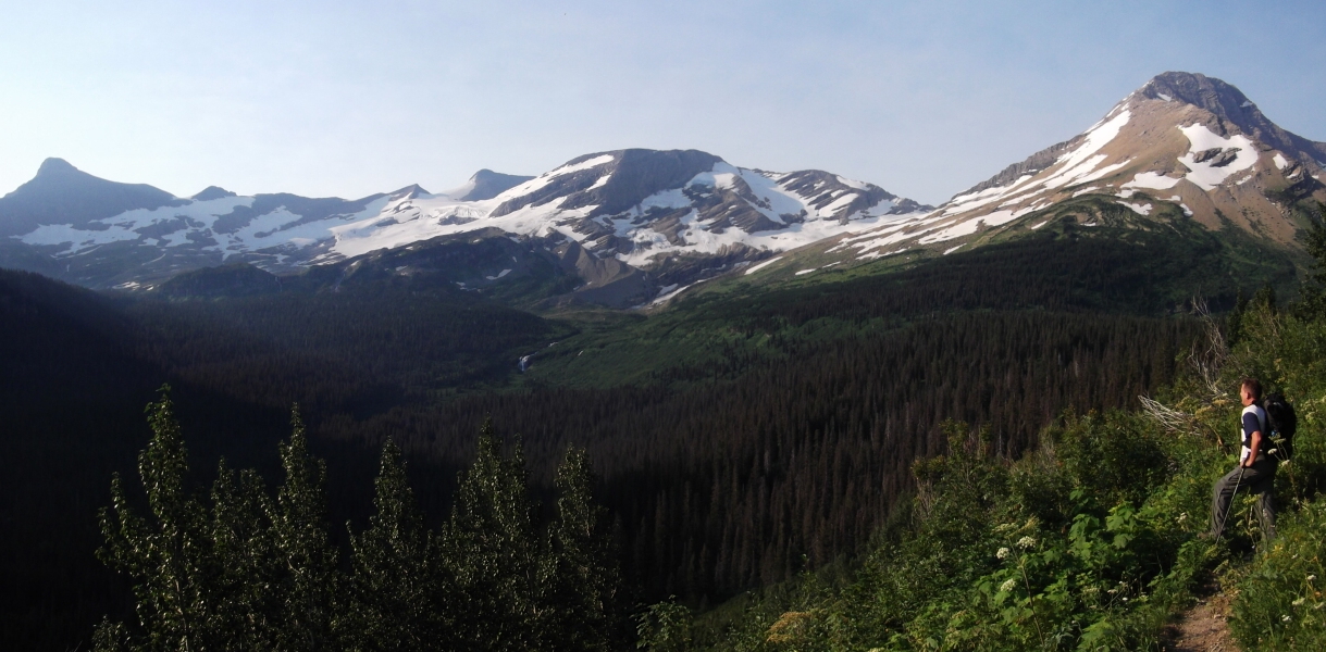
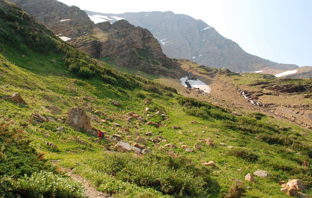
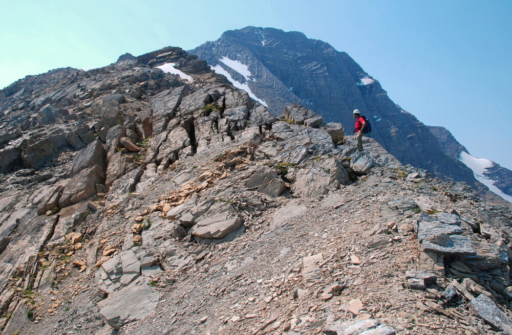
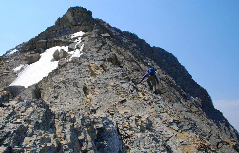
The trail switchbacks through meadows below the North Basin of Jackson and continues to Gunsight Pass. We left the trail at the third or fourth switchback, and proceeded up an interminable scree and talus slope before finally gaining broad Northeast Ridge crest. Staying closer to the ridge crest obviously meant better rock and more interesting scrambling. Going left of the crest really wasn't an option and going right generally resulted in looser rock and less scrambling. The ridge lays back quite a bit more than it seems from a distance, making for long stretches of uninteresting hiking.
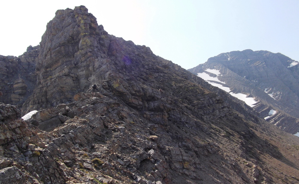
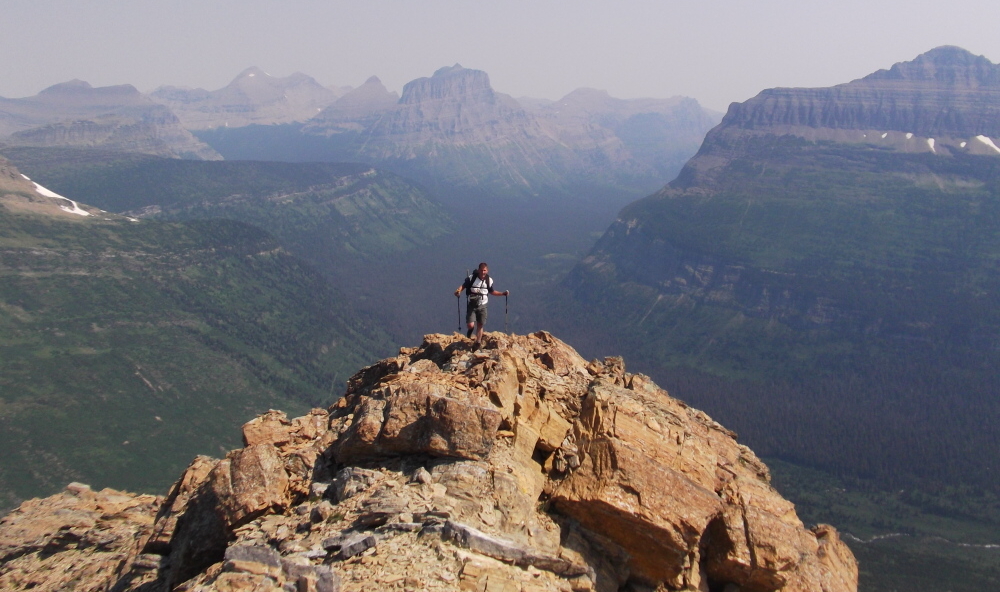
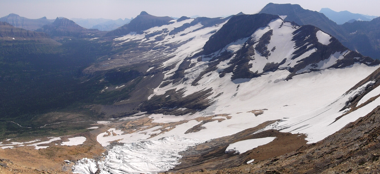
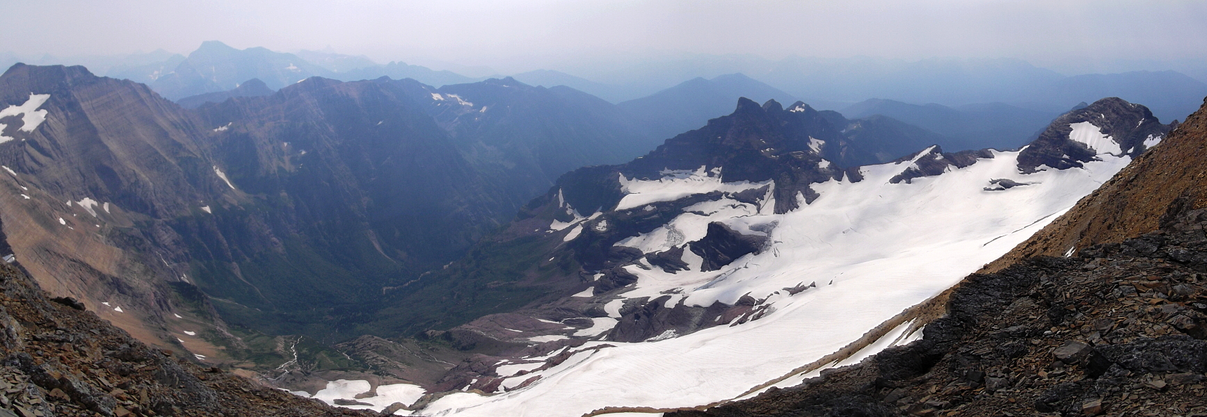
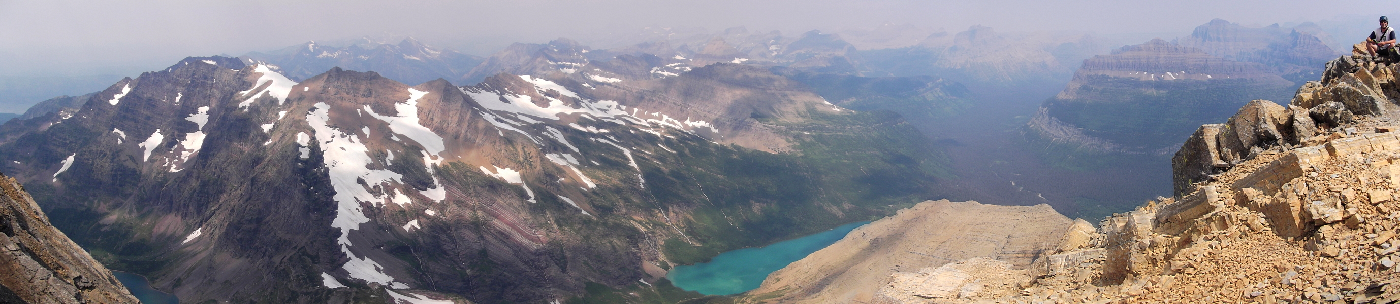
The route finally gets a little more interesting as one nears the upper third or so of the ridge. As before, stay right for easier scrambling or proceed as close to the crest as possible for more of a challenge. Despite the increasingly smoky skies, the view from high on the ridge was spectacular with an impressive panorama overlooking Jackson Glacier and Blackfoot Mountain just off to the east. A short walk along the mostly horizontal summit ridge with thunderclouds seemingly building overhead finally saw us to Jackson's true summit. There's a great view of the seldom seen Harrison Glacier on south side of Mount Jackson from the summit. I'm curious how this glacier measures up against some of the other large glaciers (by GNP standards) in the northwest corner of the park, such as Kintla and Agassiz glaciers.
We hightailed it back down from the summit as thunderclouds were building and we didn't want to get zapped! Hiking the trail back to where we parked, we saw a large moose in a marsh in the distance. Adding it all up, so far we've seen countless deer, a pair of weasels at Logan Pass, a grizzly (plus dead grizzly) on Cleveland and now a moose. Oh, and let's not forget those annoying cows at Hobo Camp! But it wasn't over yet and there would be more *wildlife* encounters during the upcoming Mount Siyeh climb!
Click here to view photos.
![]()


