Last Updated: April 17, 2024


Start

Recent content updates are viewable under what's new.

Reports in the queue for posting are coming soon!

Upcoming reports & photos:

Oh my! Quite the backlog here...

  • American Mountain & Mount Lincoln - hike/snowshoe (May 2023)
  • Mount Mclean Attempt, Red Rock Trail, Dragons Back Trail - hike (May 2023)
  • Stawamus Chief (South, Middle & North) - hike/scramble (June 2023)
  • Flint & Feather - hike/scramble (June 2023)
  • Goat Ridge (Squamish) - hike (June 2023)
  • Grouty/Mortar Peaks - hike/scramble (June 2023)
  • Pebble-to-North Creek Traverse incl. Pebble, Thiassi, Wesley & Sugus - hike/scramble (July 2023)
  • Mount Truax - hike/scramble (July 2023)
  • Blackcomb Buttress - rock climb (July 2023)
  • Whitecap Peak - hike/scramble (July 2023)
  • Mount Hanover - hike/scramble (August 2023)
  • The "Long Traverse" incl. Long, Tynemouth, Arrowhead, Tabletop & Anemone - hike/scramble (August 2023)
  • Armchair Traverse - hike/scramble (August 2023)
  • Snowspider Mountain - hike/scramble (September 2023)
  • Mount Trorey - hike/scramble (September 2023)
  • Macleod Peak - hike/scramble (September 2023)
  • Ben Lomond - hike/scramble (September 2023)
  • Mount Killam & Gambier Island - hike (September 2023)
  • Lone Goat & Snow Camp Mountain - hike (September 2023)
  • Isollilock Peak - hike/scramble (October 2023)
  • Manson - Hatfield Traverse - hike/scramble (October 2023)
  • Gargoyles & Columnar Peak - hike/scramble (October 2023)
  • Opal Cone and Lava Glacier - hike (October 2023)
  • Park Butte (WA) - hike (October 2023)
  • Trappers Peak (WA) - hike/scramble (October 2023)
  • Rattlesnake Ledge (WA) - hike (November 2023)
  • Sauk Mountain (WA) - hike (November 2023)
  • Mount Daniel & Pender Hill (Sunshine Coast) - hike (November 2023)
  • Mount Dickerman (WA) - hike (November 2022)
  • Winter's End (Verona Peak) - hike/snowshoe (November 2023)
  • Dolomites (Italy) - snowboarding (December 2023)
  • Red Rock Canyon (NV) - hike (January 2024)
  • Flute & Oboe - split tour (February 2024)
  • Whistler misc. (Train Wreck, Loggers Lake, Shadow Lake etc.) - hike (February 2024)
  • Mount Underhill - hike (March 2024)
  • Bombtram Mountain - hike/snowshoe (March 2024)
  • Steep Peak - split tour (March 2024)
  • Ruby Mountain (WA) - hike/snowshoe (April 2024)
  • Blustry Mountain - hike (April 2024)
  • Sowerby Peak (Barr East) - hike (April 2024)

*As of 04/21/2024


Database

Query the reports database, selecting from criteria which include name, location, type, season etc.

Quick Links

Essential links & whatnot:


Jump To

Select from list below to jump to a specific area on this site.


| Featured Trip Report |


Last Updated: Nov. 6, 2012

Mount Siyeh - South Slope, August 2012


*Report by Paul Klenke

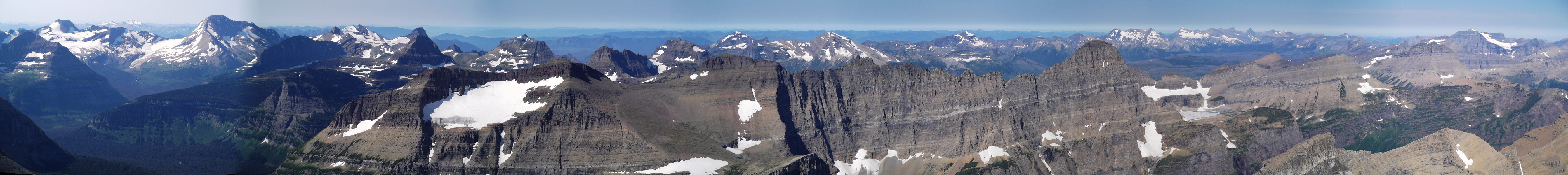
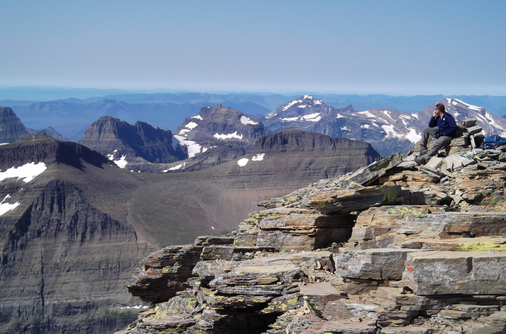
The last 10,000-ft peak Sergio and I planned to do during our Glacier National Park visit was Mt. Siyeh, which comes in at 10,014 ft. This peak is the easiest 10,000-footer in the park to climb so it was a welcome change from the grueling nature of Mt. Jackson two days prior. It also apparently has the best view of the lay of the jagged land in the park owing to its central location. For us it would also have much better views than we were able to experience on Mt. Jackson due to forest fire smoke. Plus the air would be easier to breathe. The mountain resides really close to Going-to-the-Sun Road. From where the road makes a pronounced horseshoe at Siyeh Bend (5,850 ft), the summit is less than 1.5 miles away as the crow flies. The mountain can be seen from the road there and is actually somewhat picturesque even with all of its scree slopes.

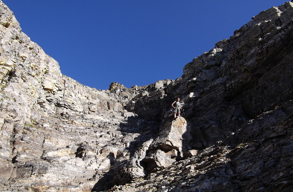
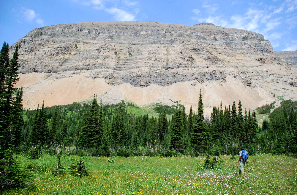
At the early hour we started out we were the first car in the parking lot, which isn't really a lot but pullouts on the side. It would seem like we'd have the whole valley and mountain to ourselves. But I think we knew better. Siyeh Bend is really close to Logan Pass and Logan Pass becomes a zoo of homo sapiens sapiens (or God's creatures if you're a creationist) exhibits during the middle of day. We made really good time hiking the roundabout trail toward the peak. The first mile of trail goes the wrong way, but whatever. We eventually got to the trail junction for Preston Park and went eastward up the intermittent meadows and forest bands. Mt. Siyeh rises to the left of Preston Park and the Edwards guidebook says to look out for a particular set of features marking the easiest route through Siyeh's lower cliff band. Edwards' guidebook is not very useful in this regard, most notably because you can't really see these features he's talking about from the trail due to the forest bands getting in the way. It would have been better if he had just said where (how far up the valley) to leave the trail. (more...)

Click here to view photos.
home | email | copyright

All photos and text for sverdina.com are copyright © 2002-2024

It would be very much appreciated if you please ask before copying and/or re-publishing content from any part of these pages. To do so, please click here to send a message via feedback form.

Thank You.

©2024 sverdina.com |