


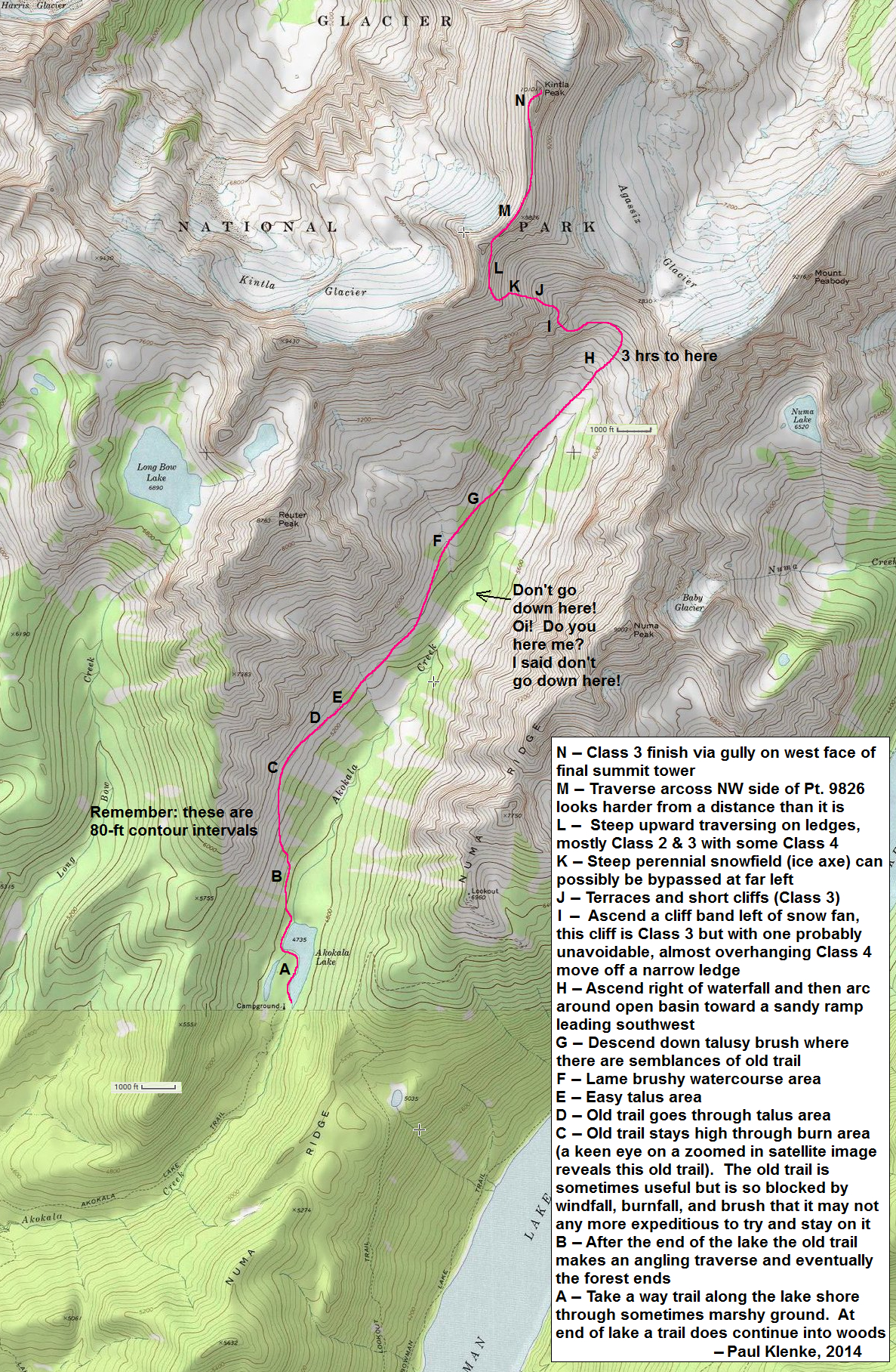
Kintla Peak - South Ridge (via Akokala Lake), August 2014

Kintla peak is the highest point in the Northern Livingston Range and the third tallest in Glacier National Park. The standard approach and route is for most mortals a 4-day trip either from the west via Kintla Lake or from the northeast via Waterton National Park in Alberta, Canada. However, having found a report online describing a long day-trip via a relatively unknown but significantly shorter approach from the WSW, we figured we'd go try some variation of that route ourselves. While this so-called Akokala Lake route (map...) is shorter, it isn't well travelled and entails brushy cross-country travel to the reach the head of the valley from where we hoped to find a route past a series of potentially troublesome cliffs and headwalls. We secured a permit for one night at Akokala Lake (6 miles, all trail) and from where we would make our summit attempt the next morning. We figured we'd either hike out after returning the next afternoon, or if it came down to it just camp another night by the lake sans permit.
In the end, we succeeded in climbing Kintla via this route but it took longer than expected and darkness descended on us by the time we made it back to the upper basin at the head of the valley. It was a rather circuitous route with lots of route finding challenges. Dealing with all that ate up much of the day. From the head of the valley, about 3 miles of cross country bushwhacking stood between us and camp at Akokala Lake - an impossible task in the dark, and so we resigned ourselves to a night out in the open. Fortunately it had been a warm day and evening, so it wasn't that bad of a night curled up in fetal position attempting to 'sleep' in the meadow. If anyone's counting, this is now my third unplanned bivouac. We finished the bushwhack back to camp the next morning, ate the food we didn't get to eat the previous night and retired to the tent for a couple hours of sleep. We then packed up camp later that afternoon and hiked the easy 6 miles back to the trailhead.
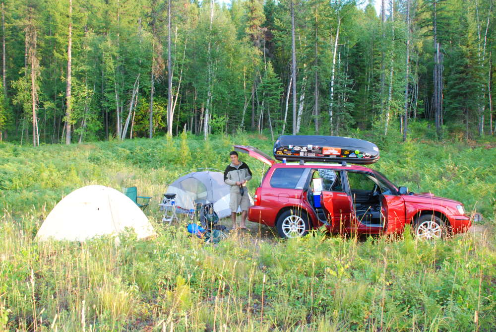
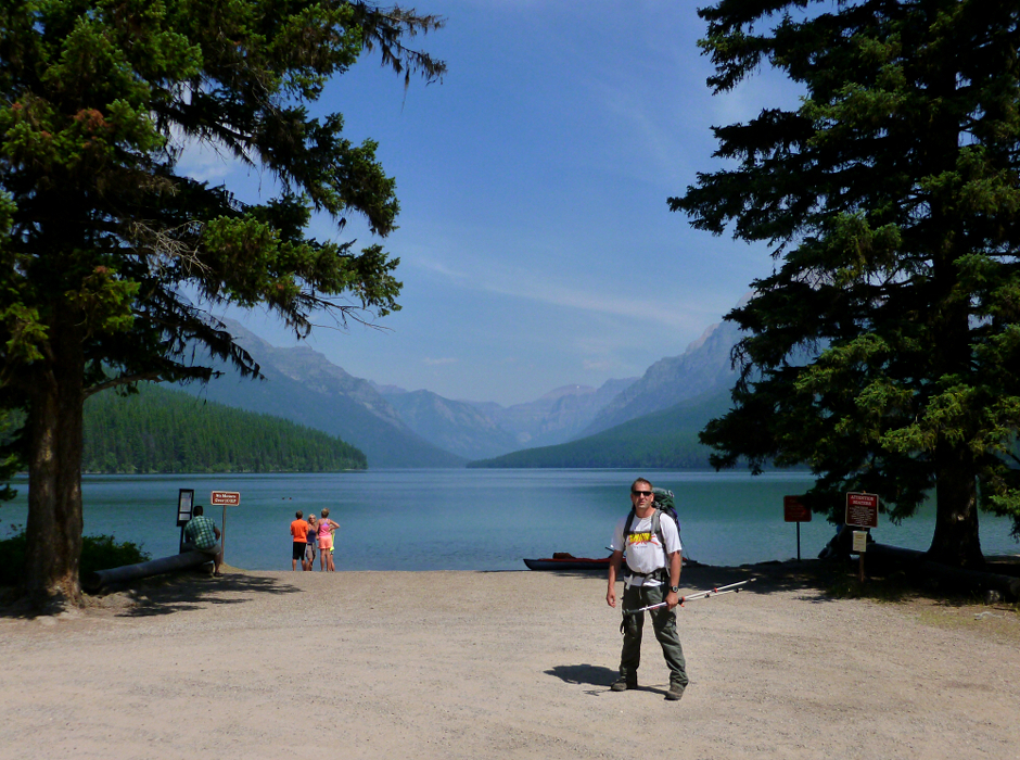
Having driven over from Seattle the previous day, we broke down our unofficial camp outside West Glacier first thing that morning and made a beeline for the Apgar Ranger station. Now, with a permit in hand for one night at Akokala Lake (we were unable to secure two consecutive nights), we continued on towards the small community of Polebridge located outside the northwest corner of the park. Leaving Polebridge, we crossed a bridge over the North Fork Flathead River and promptly re-entered the park. We continued on a rough road for about 6 miles to Bowman Lake and unknowingly parked about as far from the trailhead as possible. We spent the next 10-15 minutes walking along Bowman Lake and through the campground before finally locating the West Lakes Trailhead behind site #22.
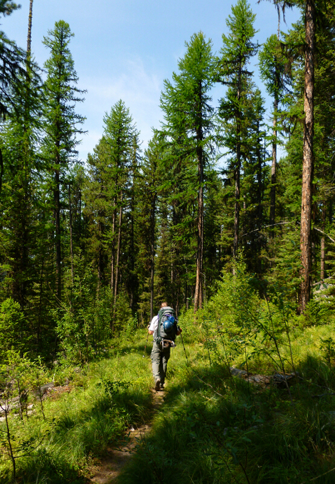
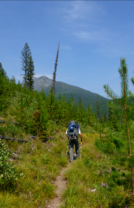
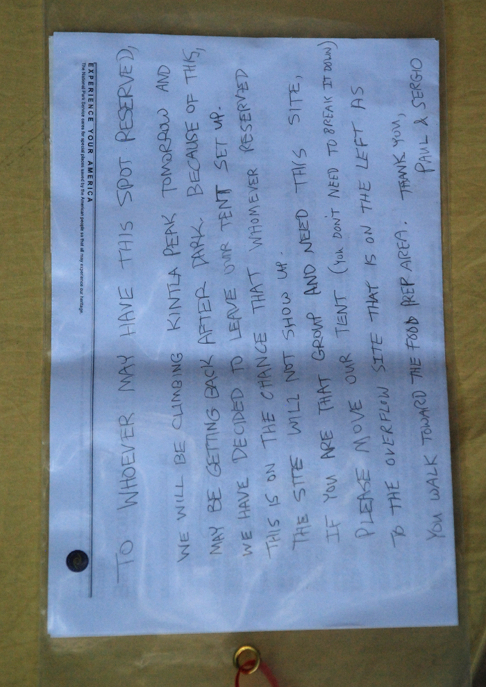
The hike to the Akokala Lake Trail junction is mostly a boring forest slog up and over a couple timbered spurs of Numa Ridge and down finally to intersect with Akokala Creek. Mosquitoes were particularly bad on the initial part of the hike shortly above Bowman Lake, but weren't too much of an irritation beyond that or at the Akokala Lake camp for that matter. The views finally improved about a couple miles before Akokala Lake with glimpses of high peaks rising up before us. There are two approved sites at the Akokala Lake camp, one of which can be reserved weeks or months in advance plus a third 'overflow' site. We felt lucky to have secured the one walk-in site, that is until later that evening when it became apparent that nobody else was going to show up. We weighed this fact against the likelihood that we'd end up spending another night here in deciding not to break-down our tent the next morning. But, just in case we left this note asking any would-be campers with permits to simply move our tent.
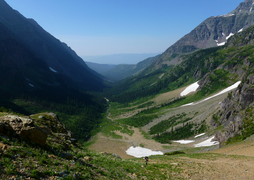
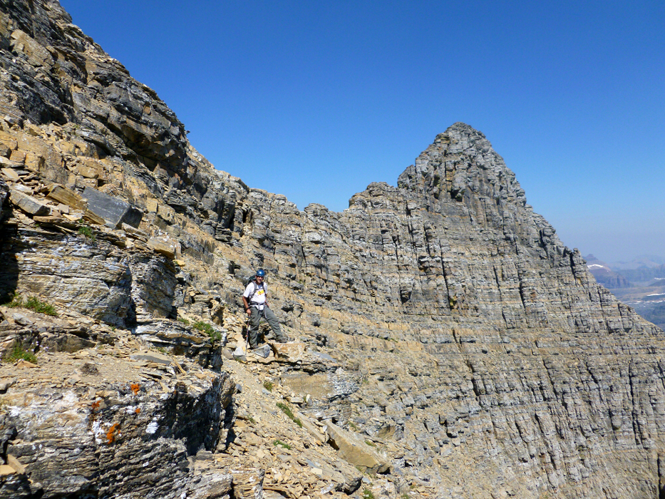
We got going around dawn the next morning, following a path that parallels the marshy western shore of the lake. The path disappeared as we neared the north end of the lake, at which point we began angling upwards through brushy forest. In hopes of avoiding the worst of the brush, our plan was make a mid-level traverse above Akokala Creek linking avalanche swathes, meadows and talus along the left (north) side of the valley. All in all, this strategy worked well for us as we soon located an old, overgrown trail of sorts that we were able to follow more or less to the basin at the far end of the valley. That being said, we repeatedly lost the trail especially where it crosses the avalanche swathes, but generally managed to pick it back up again on the opposite side.
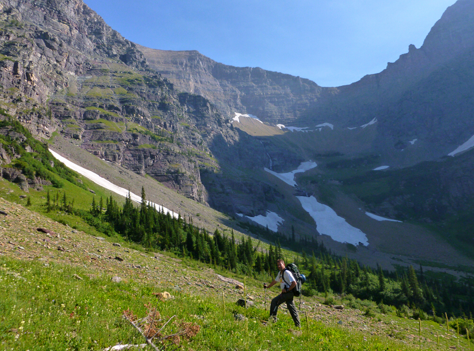
It wasn't all easy going, as traversing the avalanche swaths entailed much tediousness and slow travel. There also was a particularly unpleasant section of low brush with rocky streambeds and slippery boulders lurking beneath that we carefully picked our way across before finally reaching more ankle-friendly terrain beyond. Here we located the trail one final time before descending a couple hundred feet to reach the gravely cirque at the very head of the valley (3+ hours to here). We then re-gained those feet and then some on a steep grind into the upper-basin beneath the Peabody-Kintla Saddle.
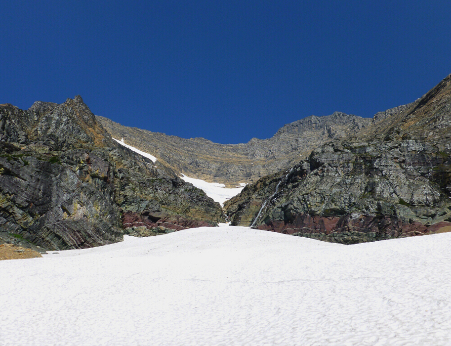
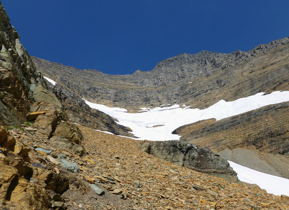
Passing a dramatic waterfall off to our left, we continued up and contoured towards the base of a prominent snowfield with a large cliff above and the imposing SE Face of Pk. 9826 higher still. Skirting along the edge of this snowfield (photo), we continued up towards a short cliff at far left as getting to it was snow-free (no moat problems) and seemed to offer the easiest way through. Following the path of least resistance, we soon encountered a short step of exposed 4th to low 5th rock adjacent to an obvious chimney/gully feature (at right). Once above this step, we continued up for about 30 feet on 3rd class terrain before being forced right into the aforementioned gully. Fortunately the gully lies back at this point and soon transforms into scree slopes that make up much of the middle portion of the SE Face.
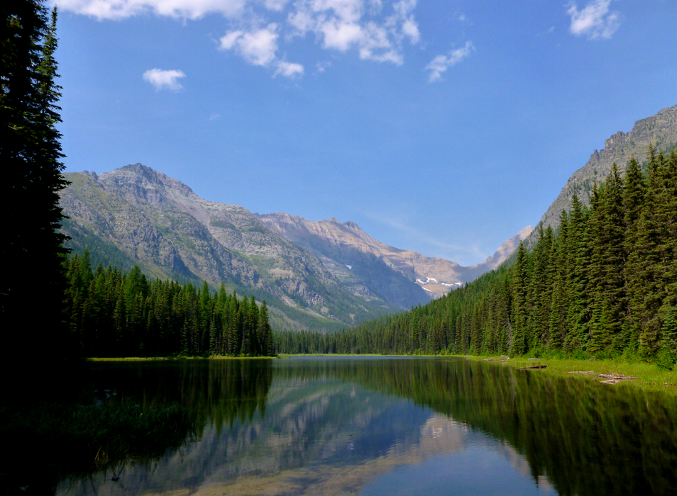
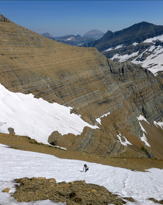
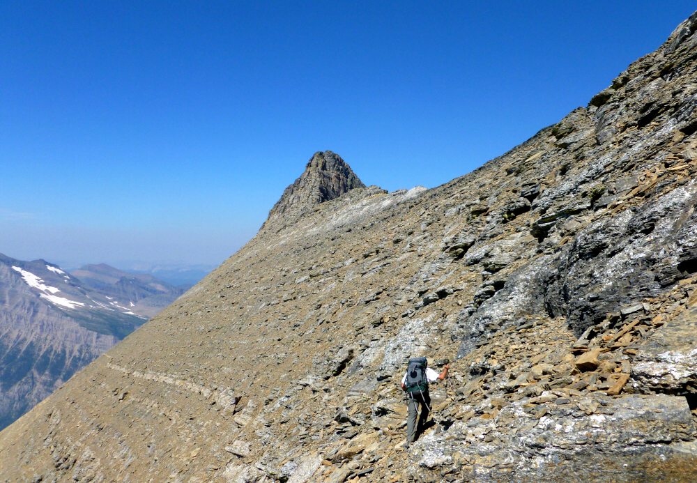
Steep rock above and to the left forced us rightwards once more. Here a large scree slope led to the base of another set of cliffs about halfway up the SE Face. Contouring along the base of these cliffs from left to right to near the 'glacier's' edge, we located a weakness that enabled us to easily zig-zag up along ramps, ledges and wet slabs to reach a large gravel bench beneath the uppermost snowfield. We removed ice axes from our packs and donned crampons for the first and only time of the entire trip prior to booting up this snowfield. As the pitch got steeper, we escaped to the spur that defines the left (south) edge of the upper amphitheater. From the crest of this spur we could finally look out over the entire length of Akokala Valley with Reuter Peak at right and Akokala Lake surprisingly far off in the distance.
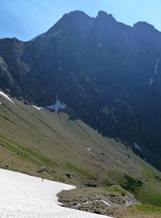
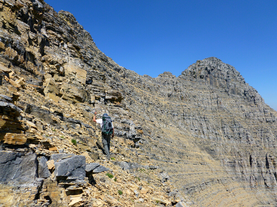
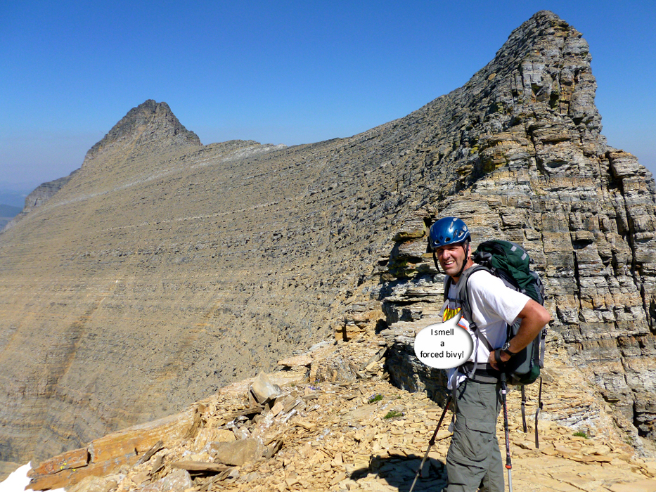
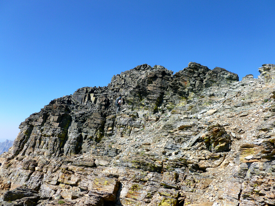
We scrambled up along the spur until being forced right yet again and at which point we could no longer avoid the final headwall difficulties. Making an ascending traverse across the headwall on steep and occasionally loose 3rd - 4th class rock, we eventually gained the large saddle atop the SE Face. Having silently worried about our progress for much of the day, I think it was at this point that I first expressed concern over the time and how long it would take us to get back to camp. Despite my wanting to turn back, Paul ultimately put the matter to rest by saying something to the effect of "we've come this far, at this point I'm prepared to do a forced bivy." And with that, I reluctantly continued on.
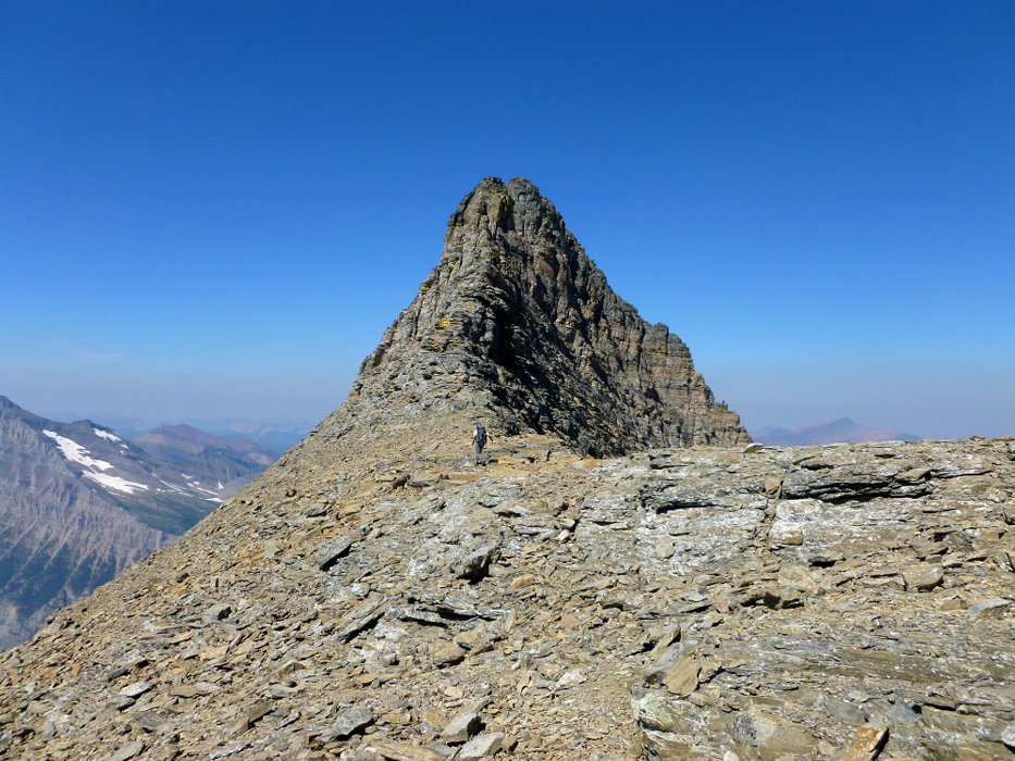
We laid eyes on the true summit of Kintla for the first time from the saddle. We also laid eyes on the seemingly endless traverse between the saddle and the South Ridge of Kintla proper. I believe my words to Paul at that moment was "that looks awful", expressing my contempt for what lay ahead. To be fair, the traverse over from the saddle to the South Ridge wasn't all that bad. We were able to follow rubbly ledges most of the way across and it wasn't long before we found ourselves contemplating the seemingly difficult finish via Kintla's West Face. A well-traveled path follows the crest, up and over a ridge hump and traverses closely beneath the West Face to reach a large talus gully descending from the summit area.
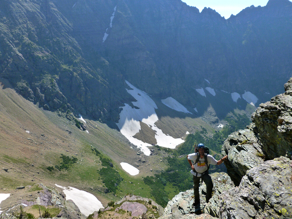
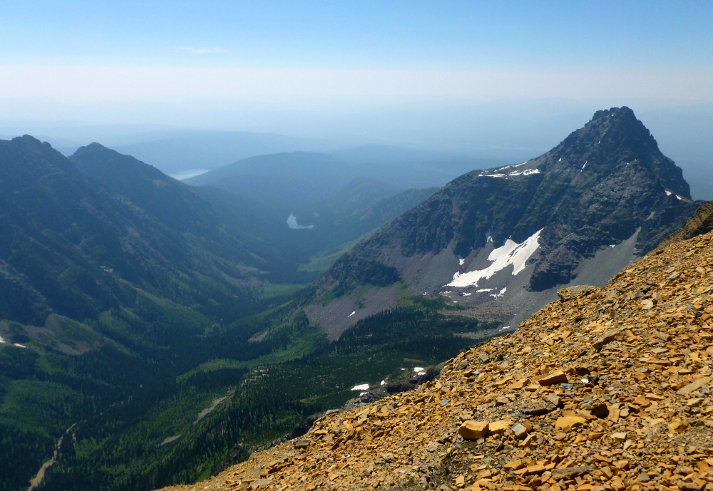
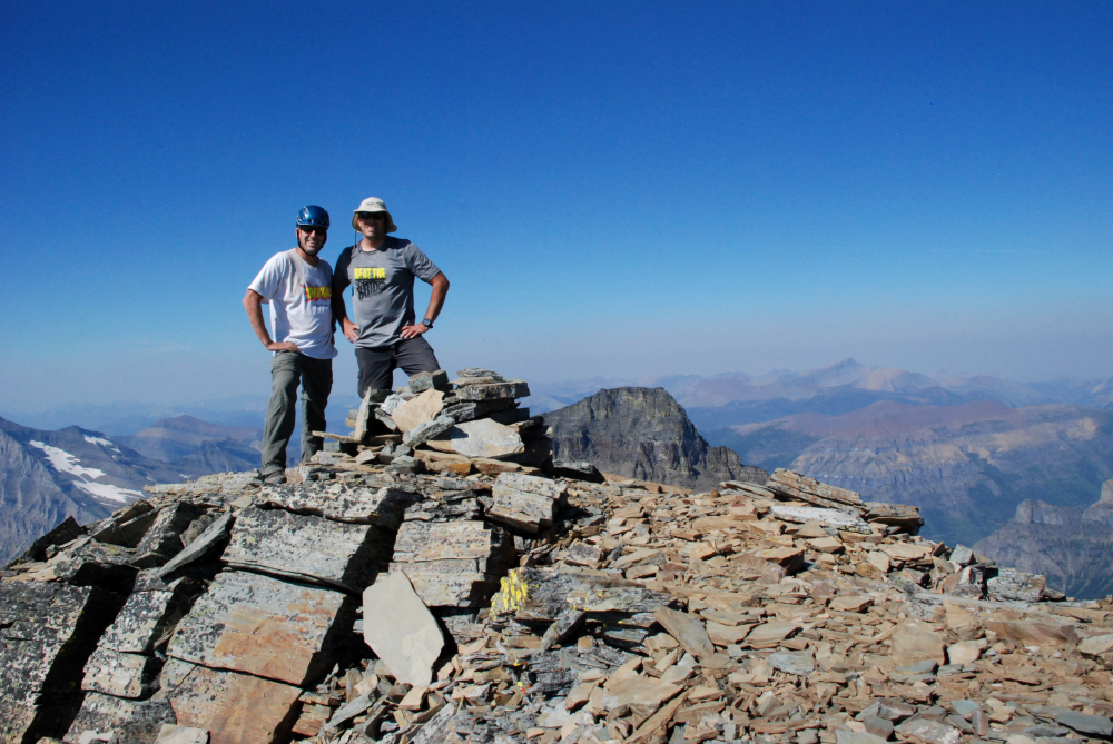
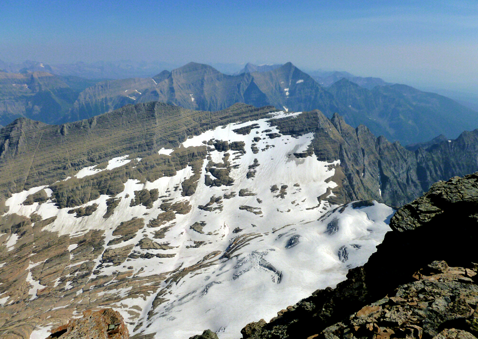
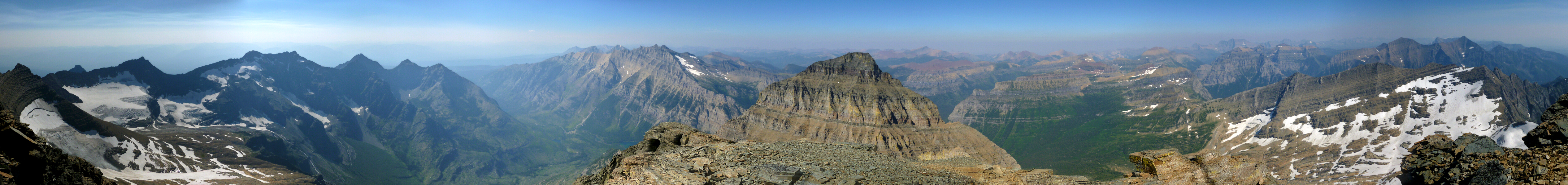
The rotten gully seemed to go on forever and care had to be taken not to dislodge boulders and send them crashing down onto unwitting parties below. Not that there were any other parties considering we hadn't seen anyone since our first afternoon at Akokala Lake, but at least that's what I hoped was on Paul's mind as he was well ahead of me at this point. We regrouped just below the summit ridge, dropped our packs and completed the remaining scramble to the very top of Kintla Peak. It was about 4pm or later by the time we reached the summit-well past our turnaround time-but then we'd already resigned ourselves to a forced bivy, so it mattered not. The views were incredible, though somewhat obscured by smoke from forest fires burning in Idaho and Washington State (we were told). Way off in the distance we could make out Mount Cleveland, the tallest peak in the park and also from where we first spied Kintla almost two years ago to the day!
Determined to descend as far as possible before dark, we spent only about 15 or 20 minutes on the summit before making our way back down. Reversing our route down the summit gully, across the South Ridge and to the saddle above the SE Face, we initially planned on bivying on the bench below the uppermost snowfield. But we had at least one hour of daylight left and so continued on with the descent. Reversing the step at the first cliff was the crux of the day for me, but it wasn't long before we found ourselves contemplating a night on a patch of flat grass below the lowest snowfield. A chilly downdraft from the cirque above would have guaranteed a night of violent shivering here, so I lobbied for making 'camp' farther down.
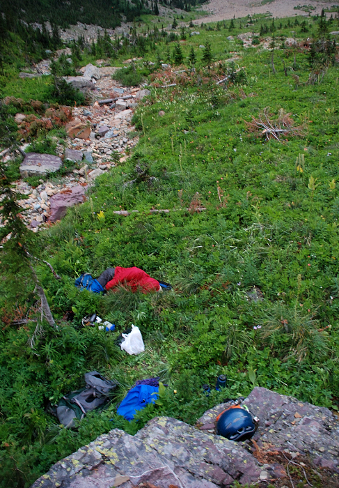
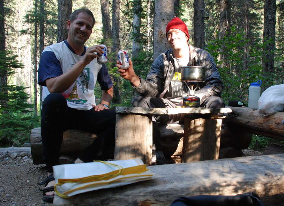
We finally bedded down shortly after full dark in the tall grass adjacent to Akokala Creek about a 10th of a mile down-valley. Wearing every stitch of clothing and with emptied packs pulled-up to our knees, we tried our best not to think about possible bear encounters and settled in for a mostly sleepless night under the stars. Actually, Paul was blissfully snoring away not 5 minutes after hitting the hay, so the sleeplessness was all mine to enjoy that night! We made the mistake of being suckered down the gravely creek bed the next morning and suffered some of the worst brush of the trip as a result. We rendezvoused with the valley "trail" at some point after a grueling thrash up from the creek, and finally stumbled back into camp in a little over three hours from where we had bivied. Lo and behold, still no other campers at the lake, which was fine with us for we had PBRs to pound and some serious z's to catch-up on. Sweet dreams!
Click here to view photos.
![]()


