


Mount Siyeh - South Slope, August 2012
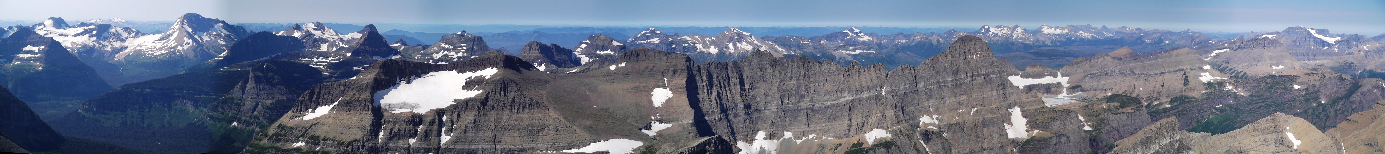
 as seen from the summit of Divide Mountain.")
*Report by Paul Klenke
The last 10,000-ft peak Sergio and I planned to do during our Glacier National Park visit was Mt. Siyeh, which comes in at 10,014 ft. This peak is the easiest 10,000-footer in the park to climb so it was a welcome change from the grueling nature of Mt. Jackson two days prior. It also apparently has the best view of the lay of the jagged land in the park owing to its central location. For us it would also have much better views than we were able to experience on Mt. Jackson due to forest fire smoke. Plus the air would be easier to breathe. The mountain resides really close to Going-to-the-Sun Road. From where the road makes a pronounced horseshoe at Siyeh Bend (5,850 ft), the summit is less than 1.5 miles away as the crow flies. The mountain can be seen from the road there and is actually somewhat picturesque even with all of its scree slopes.
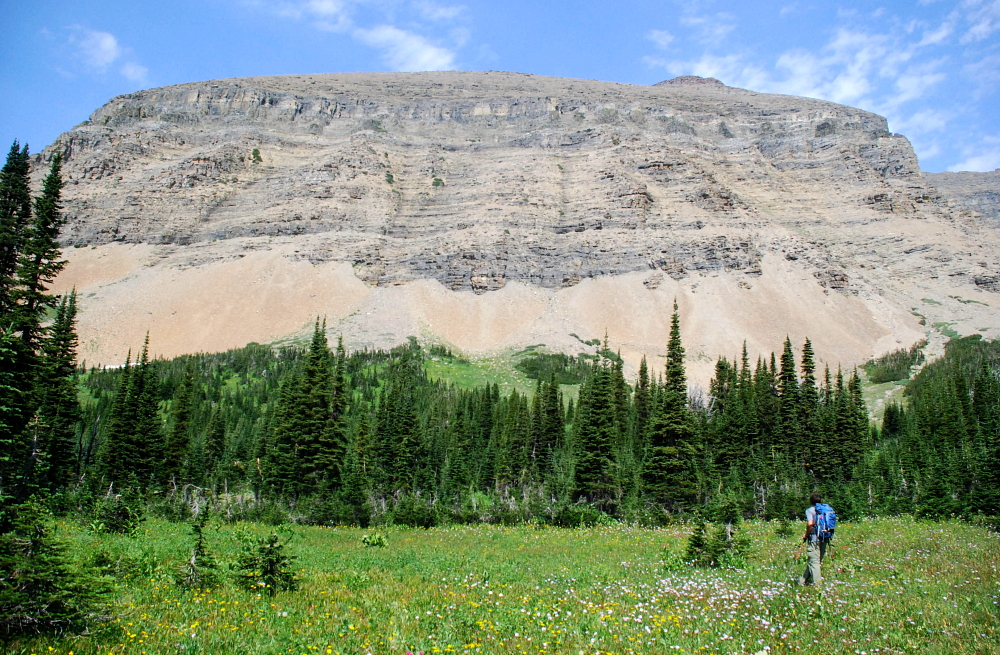
At the early hour we started out we were the first car in the parking lot, which isn't really a lot but pullouts on the side. It would seem like we'd have the whole valley and mountain to ourselves. But I think we knew better. Siyeh Bend is really close to Logan Pass and Logan Pass becomes a zoo of homo sapiens sapiens (or God's creatures if you're a creationist) exhibits during the middle of day. We made really good time hiking the roundabout trail toward the peak. The first mile of trail goes the wrong way, but whatever. We eventually got to the trail junction for Preston Park and went eastward up the intermittent meadows and forest bands. Mt. Siyeh rises to the left of Preston Park and the Edwards guidebook says to look out for a particular set of features marking the easiest route through Siyeh's lower cliff band. Edwards' guidebook is not very useful in this regard, most notably because you can't really see these features he's talking about from the trail due to the forest bands getting in the way. It would have been better if he had just said where (how far up the valley) to leave the trail.
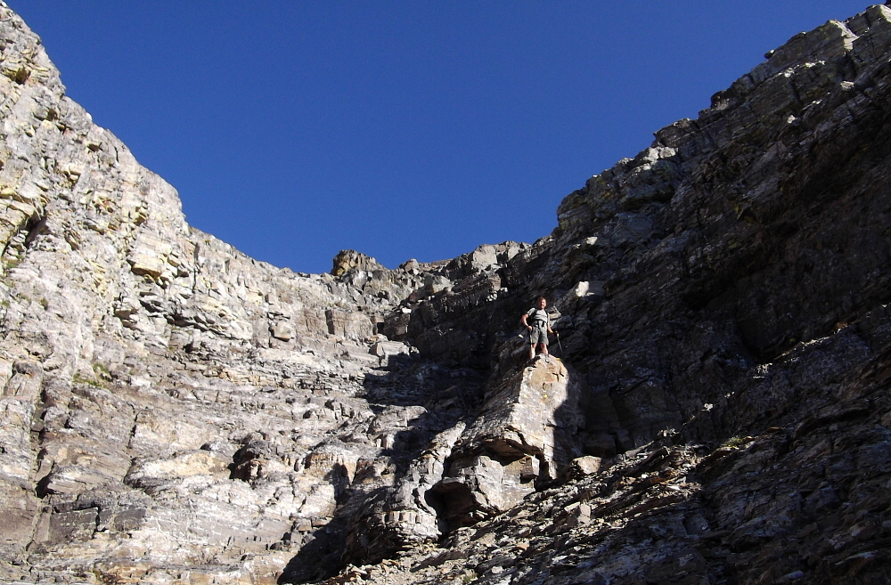
The mountain on this side can be divided into two halves: a lower cliffy and gullied section and an upper scree monotony section. After filling water bottles at a lovely low-angle cataract and taking care of other 'natural business' we arrived at the base of the mountain proper where an alluvial fan comes down from a broad concavity in the lower wall. Finally some real climbing after about 90 minutes of trail "work." We worked our way up ugly gullies of increasingly loose rock under foot, taking the initiative to scramble on more solid, but more difficult rock wherever possible. Eventually we got to the top of the lower cliffy half where further upward progress is guarded by the most difficult cliff band. And even this isn't really much, maybe 10-15 feet of all-fours spider climbing. But it is enough to get you to concentrate. Sergio defeated the cliff in the next indentation over from me. (We would wind up going back his way on return from the summit.) My way was Class 4 but featured your usual obnoxious pile of loose rock on a shelf just above the hardest moves. I hate that. It was enough of an unenjoyment for me to readily accept Sergio's route up for our later descent.
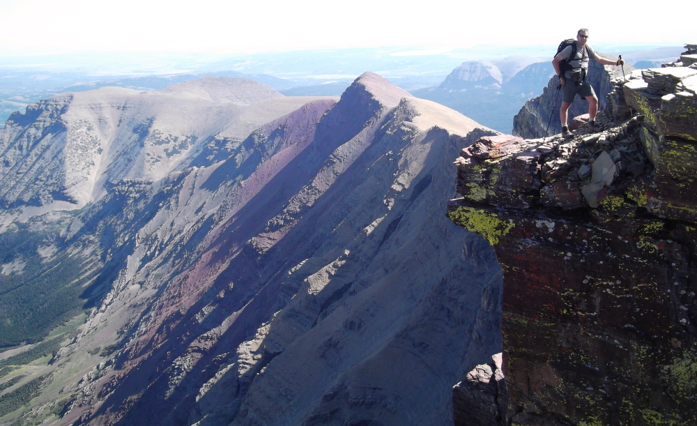
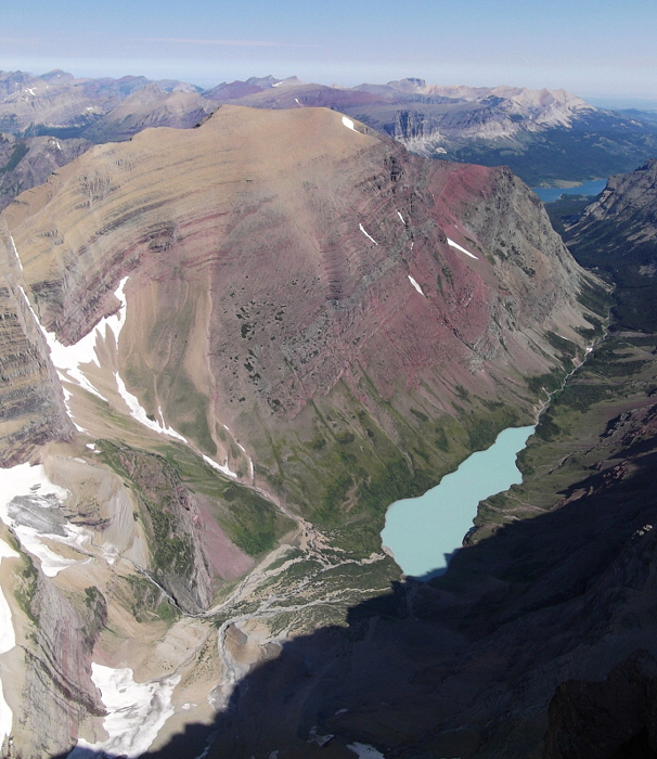
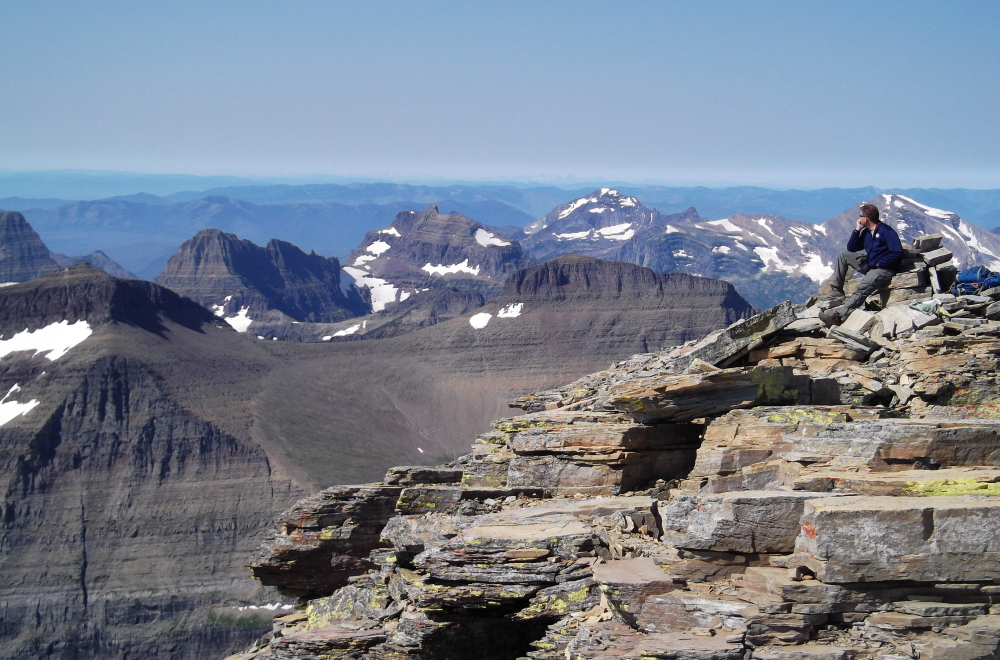
Now after the difficulties of the last cliff were dispatched, and more of nature's business was completed, we suffered the endless scree slope. I don't remember much because there isn't much worth remembering. There is one snow patch that is easily bypassed (it's a little less steep on its left side). The final climb (it's now a hike at this point) goes up the West Ridge on a faint set of climbers' trails to the rocky bastion that makes up the summit rocks. These are scrambled rather easily to the top. We made it up in just over four hours, I think, and were treated to the awesome views I already spoke of. The North Face of Siyeh is a spectacular drop (I characterized it as looking like vertical dirt) and standing on the rotting summit gave me a sense of uneasiness. The summit rocks look like they could break away and tumble down the face at any moment. The relief on Siyeh's 4000-ft North Face is impressive and is considered one of the highest rock faces in the Lower 48. The top 3500-ft are nearly vertical...calling all base jumpers!
It has of course also been climbed, the very idea of which makes me cringe considering the rock quality on this peak. The August, 2005 second ascent party followed roughly the same line as the first ascent party, free climbing the entire route which they rated 5.10+ R with much loose rock and poor protection. I think that pretty much says it all! On a recurring basis (every 15 minutes?) we saw a tour helicopter pass through the gap west of Piegan Pass just below us. The juxtaposition of the tiny helicopter in front of the large cliffs of the East Face of Bishops Cap was an interesting sight. It was also nice to be up on a summit in clear weather and we spent several tens of minutes gawking and camera clicking. After spending about five minutes on Mt. Jackson on account of a falsely threatening thunderstorm, the time we spent on Mt.Siyeh seemed like an epoch.
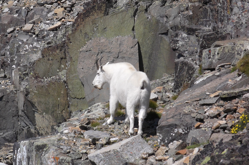
We pretty much returned the same way we went up. We cautiously downclimbed Sergio's up-route through the guarding cliff (low Class 5) and then progressed downward, saying hello to a very large male mountain goat about halfway down the steep gullies. He wasn't much interested in us, even when we got to within 20 yards. I'm telling you, that was the biggest mountain goat I've ever seen in person! Only a few minutes later Sergio spotted a grizzly bear (our second of the trip) but it was not close to us. It was rapidly exiting the bottom of the gullies and heading out to the forest bands of Preston Park. We could see him foraging in the woods for many minutes as we descended. We could also see other people coming up from a different angle. It's funny how the bear and the people could be so close to each other (100s of yards) and never know of each other's existence, and yet here we are looking down on them both. Also, the bear was going back through the forest in the exact place we had emerged from the forest earlier in the day. So it's interesting how convergence with a beast in the woods is as much about being in the same place as it is being in that same place at the same time.
After avoiding the goat and the griz we got back to the valley and made our way back to the trail. We informed folks of the bear's presence. One young man, when told of the bear (which was still a quarter mile away from him up the valley) proceeded to hurry to get out his bear spray as if he was in imminent danger. Later on down the trail we saw more wildlife-in the form of a trio of pretty young ladies ooo'ing and ahhh'ing at the first view of Siyeh on where the trail comes over a hump. The trail was now full of hikers on this hot day. And when we got back to the trailhead about 8 hours after leaving it, the homo sapiens sapiens zoo (I mean the Cathedral of the Creatures of God) had apparently moved on down the road to us at Siyeh Bend. Or so we thought, for when we drove up the road to Logan Pass, the zoo there had expanded to the size of a bona fide wildlife park!
Click here to view photos.
![]()


