


Mount Stimson - Southeast Spur (via Buffalo Woman Lake), August 2014
 as seen from Hwy 2 SE of West Glacier.")
*Report by Paul Klenke
What do you do when you budget a dozen days to climb three big peaks in Glacier National Park and it's already halfway through that dozen and you've only got one peak done and you're bit chomping for more and you don't want to go home empty footed and you've paid out money to make it happen but the weather sucks? Well you suck it up and weather the storm. And we thus descended into the valley of brushy death and feared no evil. For we are peakbaggers and we cower to no one (that's a dig at Mr. McNerney). Well, we did cower in deep brush that's so tall I think I saw the Swiss Family Robinson tree houses perched in it. Or were those just mirages? And so it was that Sergio and I made an epic journey into the deep, dark Nyack to climb Mt. Stimson. "In the Nyack, no one can hear you cry!" was Sergio's refrain in a moment of murky reflection.
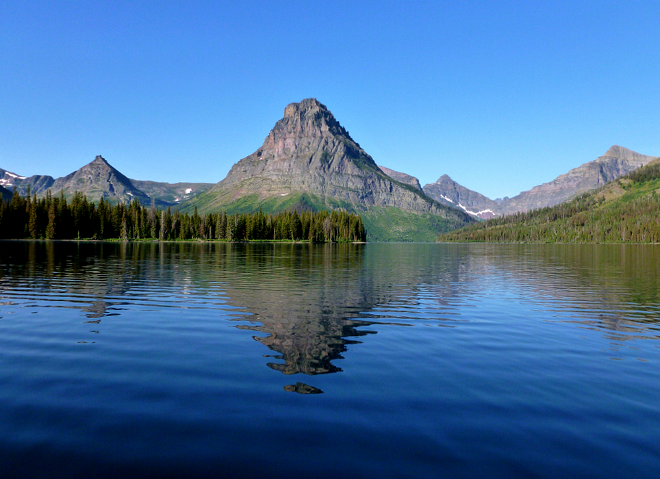
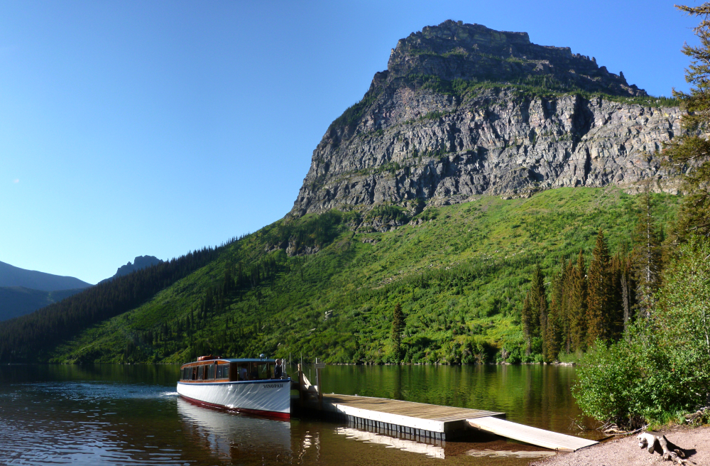
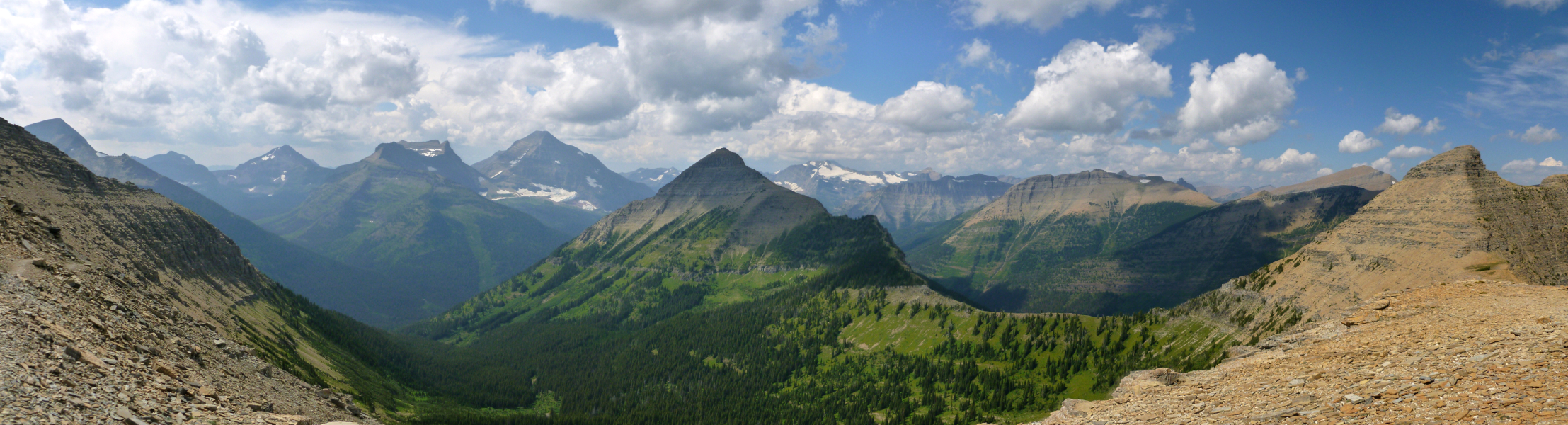
The trip started out well: a pretty boat ride across Two Medicine Lake with a pretty boat captain and some pretty weather and we were pretty sure at the time we were going to have an outstanding backcountry climbing adventure. We set out up the trail to Dawson Pass in nearly cloudless skies. But as anyone who climbs in the Rockies knows, cloudless doesn't always end with rainless. The hike to Dawson Pass begins from the North Shore Trailhead located in the campground at Two Medicine Lake. However, one can shave about 2 miles (one-way) by taking the shuttle boat across Two Medicine Lake. It's about 4.7 miles of easy trail from the boat dock to Dawson Pass. Looking east from just below the pass we could see Lone Wolf Mountain rising prominently at left with Two Medicine Lake far below and Appistoki Peak in distance right-of-center. Appistoki is the name for the Indian god who looks over everything and everyone. It was applied to the peak after a topographer who worked in the park during its early years asked a local Blackfoot Indian to translate the term "looking over something." Clearly a case of lost in translation...
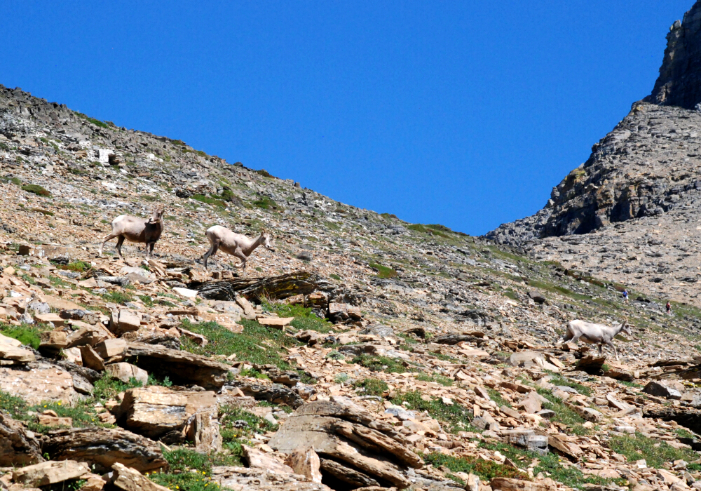
By the time we got to the pass cumuli puffed themselves into bigger cumuli and, what's that? Look at that giant thunderstorm brewing a few miles away to the west! Hmmm, I think we had better get a move on. But wait a sec! We were fortunate to have seen this herd of Bighorn Sheep at the pass; the only wildlife we would encounter on this trip to GNP. I guess we needn't have invested in the relatively expensive bear spray this time around after all. This exposed, treeless ridgeline (the Continental Divide) is no place to be in a huge thunderstorm. So we made haste northward to get to the trail that drops off down Tinkham Creek. It amazed us how many people we passed who seemed to know not or care not at the tempest bearing down on them, many of them unprepared (and unclothed) for it. We made the upper Tinkham Creek valley just as the storm hit us and so found the biggest tree we could find adjacent to the trail (yes, we know that you should not stand under big trees in a lightning storm) and cowered under its lower branches. We were there for about an hour as the echoing thunder passed by. We were there long enough to partake in PBR No. 1 for the trip. We put on rain pants, because we had heard the coming trail be brushy.
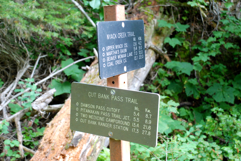
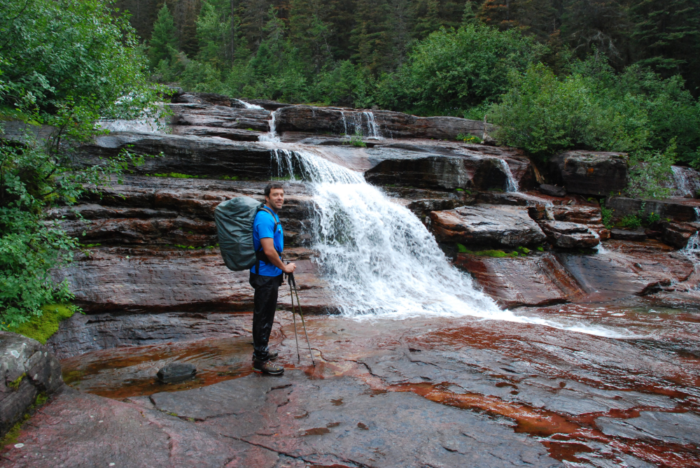
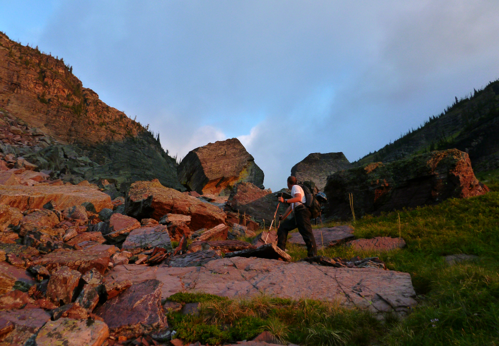
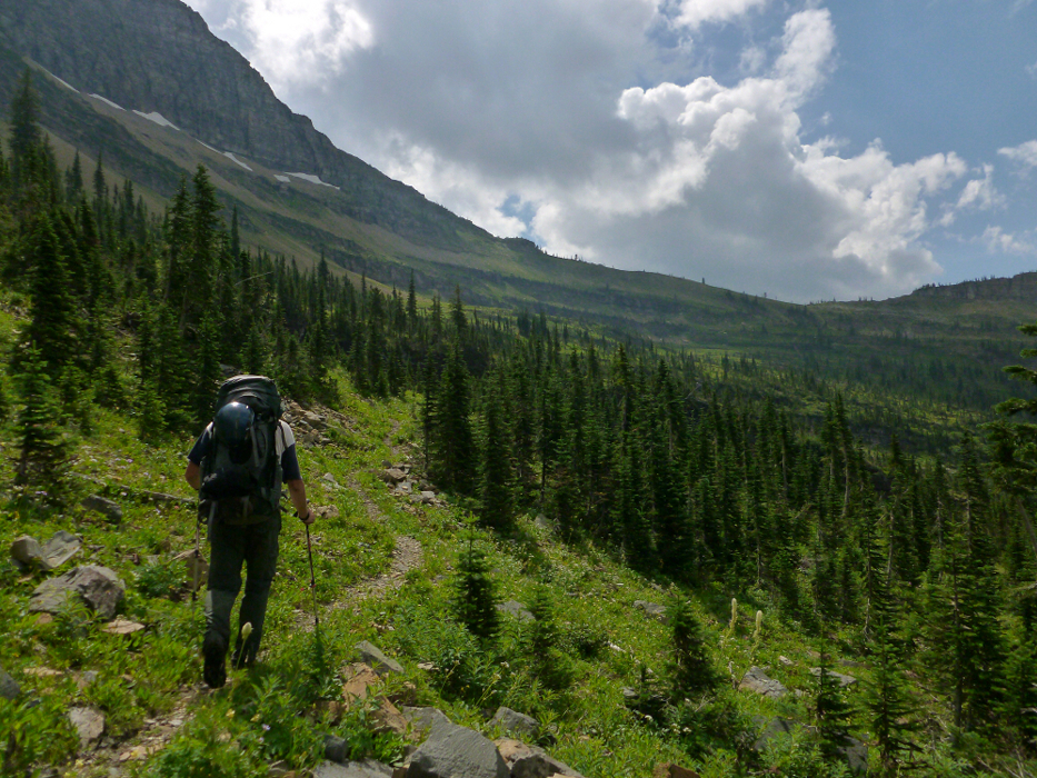
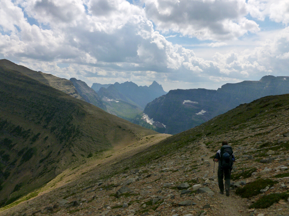
Well before it gets brushy it gets really really steep. I mean the kind of steep that one doesn't want to be going down right after a) it has rained making the tread slippery, b) your legs and knees are still in hibernation mode after loitering under a tree for an hour, and c) its muggy now that the sun has come back out to vaporize the rain from the laden foliage. We made it to the Nyack Creek junction in an hour or so and about 5 hours from the boat. And now, to anyone who might like to come this way, just remember that in the Nyack, no one can hear you cry. It was getting to be late enough in the day that we figured we would find a place to camp-a bivy site off the trail, or maybe even near the trail. But the only place we could find that one might bivy would be directly ON the trail with each of us in a line head-to-foot down the trail. This would have been okay for homo sapien traffic, but not ursus arctos (which, by the way, didn't happen; we saw nary a grizzly the whole trip).
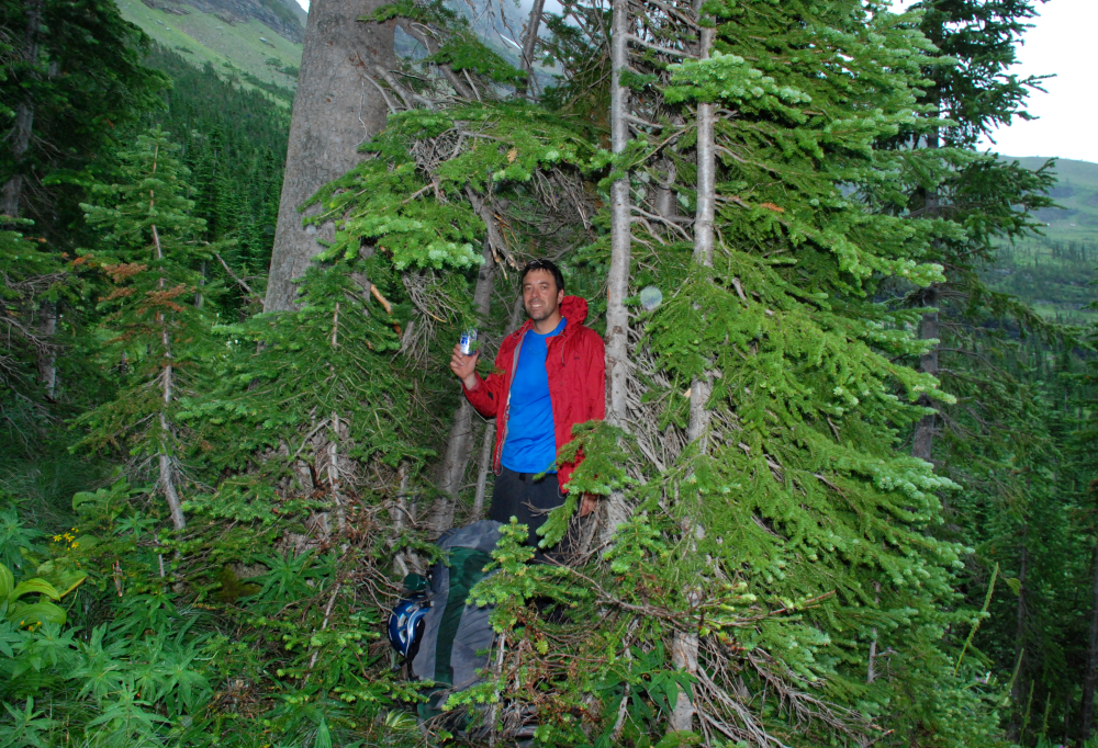
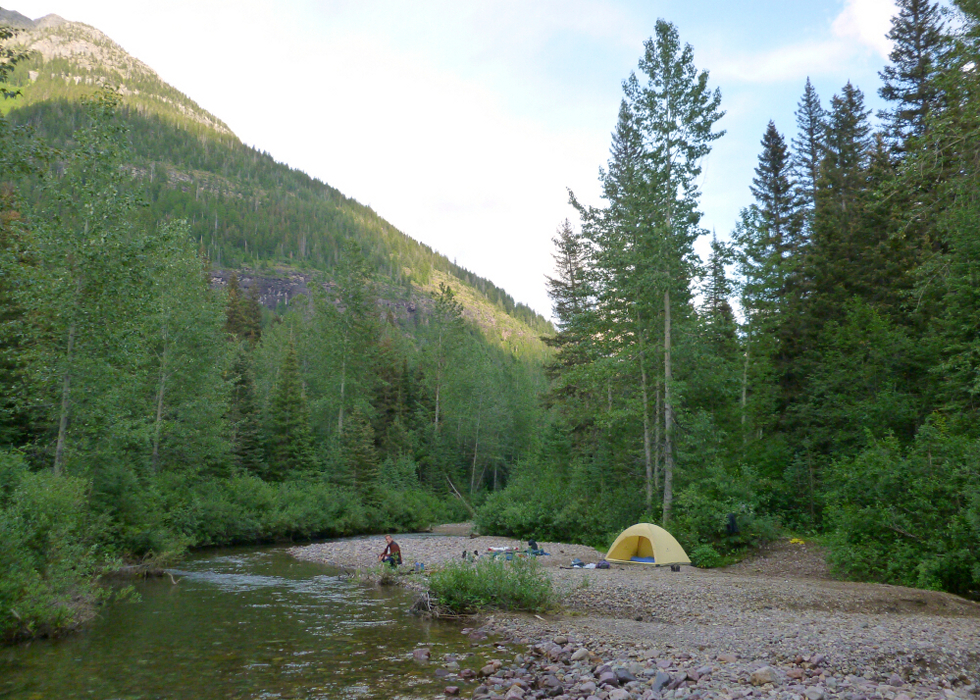
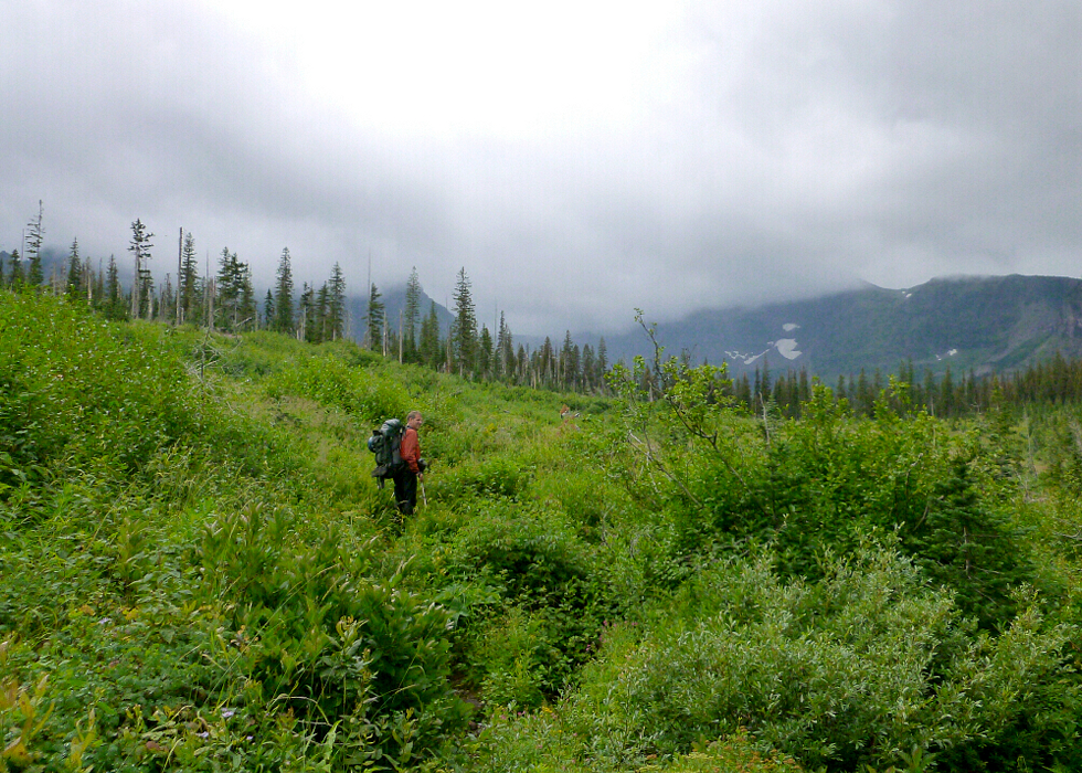
So we carried on and on up the brush tunnel until we came to the gravel bar ford of Nyack Creek. We instantly knew this would be our first camp site....on the other side. While I paused to muse that this was possibly the prettiest gravel bar I ever did done see, Sergio forged ahead through the ford without so much as thinking about taking his boots off. He would later regret this. I did not of course because I decided to take my time and take my boots off. I even tossed them across to the other side just like The Engadi Boot incident but with a better outcome. We had a good time at camp. We had another PBR. And we even made a little fire to warm our souls before the Nyack devils would be claiming them. The next morning all we wanted to do was move camp up to Buffalo Woman Lake, which is about seven miles up the Surprise Pass Trail. Now, I know the Nyack trail we had just walked the day before was pretty bad, but parts of the trail up to the pass were some of the brushiest official trail I've ever been on. And of course it was wet brush. Using one's trekking poles to knock the beads of water off the brush just ahead of one's pace gets old quick, not to mention it makes one's wrists sore. At least 100 yards of trail had brush so tall it would tickle Shaquille's eyebrows.
We got to the pass in about two hours of arduous brush sloshing (as in we had begun sloshing in our boots) and at the meadow there were greeted by a gray wall-an approaching gray wall. And this wall was made of the wet stuff. We raced across the clearing and got to the far end just as the rain began in earnest. It was so earnest that we went for the nearest tallest treest we could cower under. And under that tree we did cower for more than an hour. Three, in fact. We were there so long that Sergio began clearing out the ground beneath it. It was almost a perfect bivy site except for the fact that it was 5'8" long and he and I are 6' tall. We were there so long that we hallucinated a group of young men hiking by. We even hallucinated having a short conversation with them. Now here's where it gets tricky. We could not decide if we should just bail on the climb or push on to the lake or camp under the tree, or head back to the gravel bar camp. It truly was a difficult decision to make. We (or was it just me) decided to head back to the gravel bar. We got 100 yards from the tree when Sergio figuratively twisted my arm and made me turn about. I let out an expletive, cussing him briefly, but I knew I needed him to get me to ditch my sissy mood.
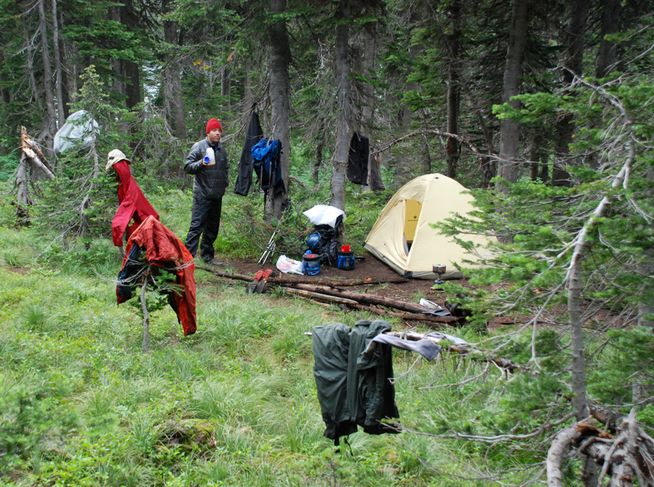
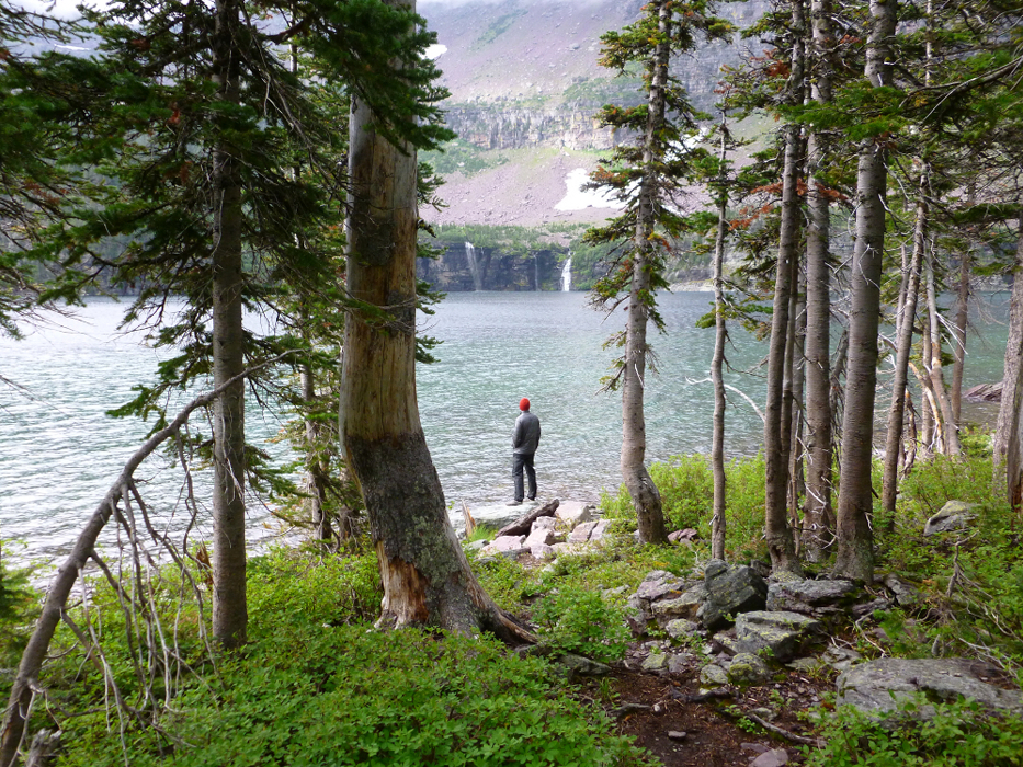
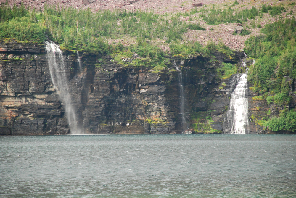
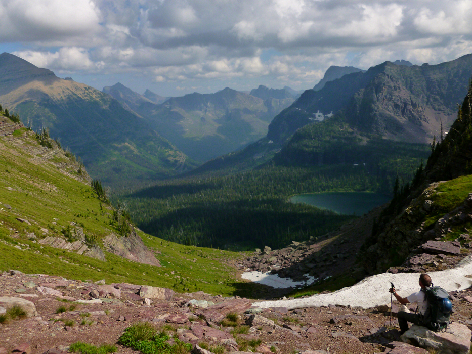
So in another hour or so we got to the 5870-ft lake (note: a Nyack mile is not equal to a statute mile). While we waited out the weather we set to calling the lake Buffalo Bitch Lake. And we waited and waited and waited and waited. We waited two days through leaky tents, leaky trees dripping on leaky tents, and ennui. Although the lake is beautiful with its mountainous surroundings and two neat waterfalls cascading directly into its far shore, it did get old after a while. If only we had brought three times as many PBRs. As stated earlier we saw not a single grizzly on the trip. But not only that but we saw no large wildlife at all in the Nyack. I guess even the indigenous creatures know that in the Nyack no animal can hear itself cry.
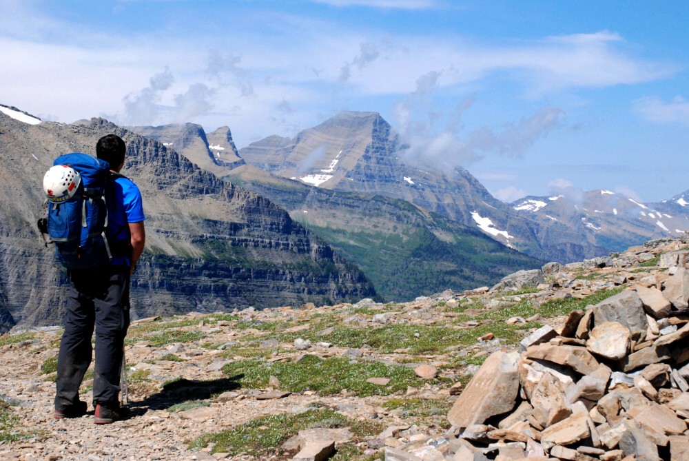
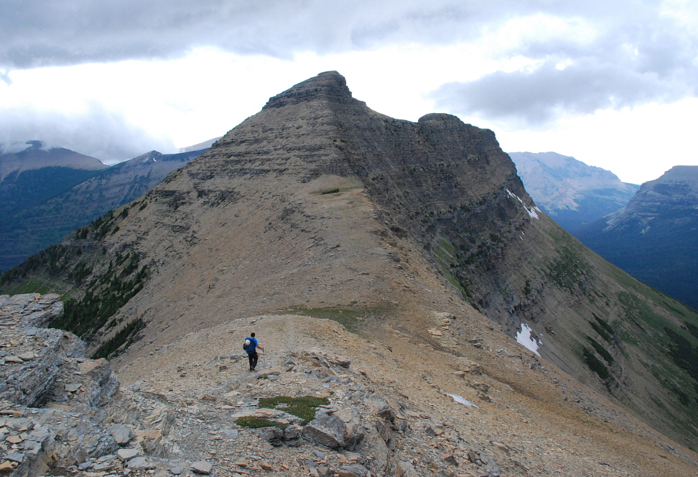
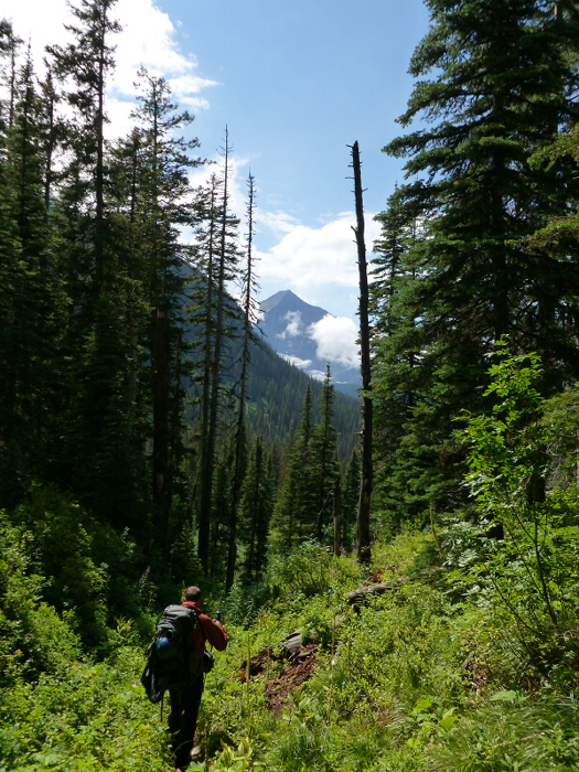
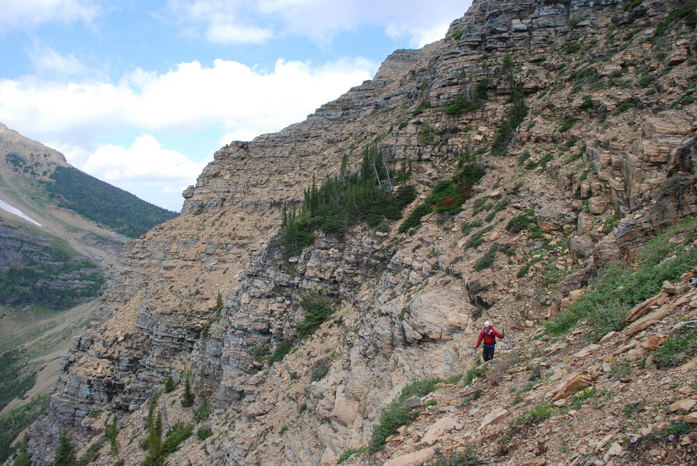
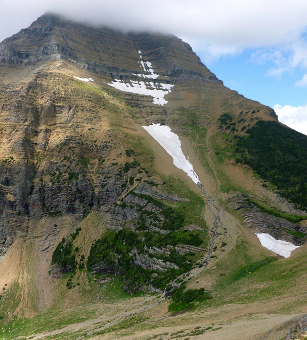
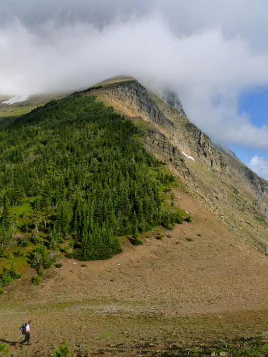
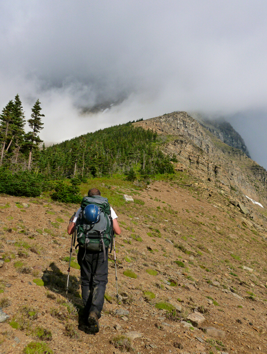
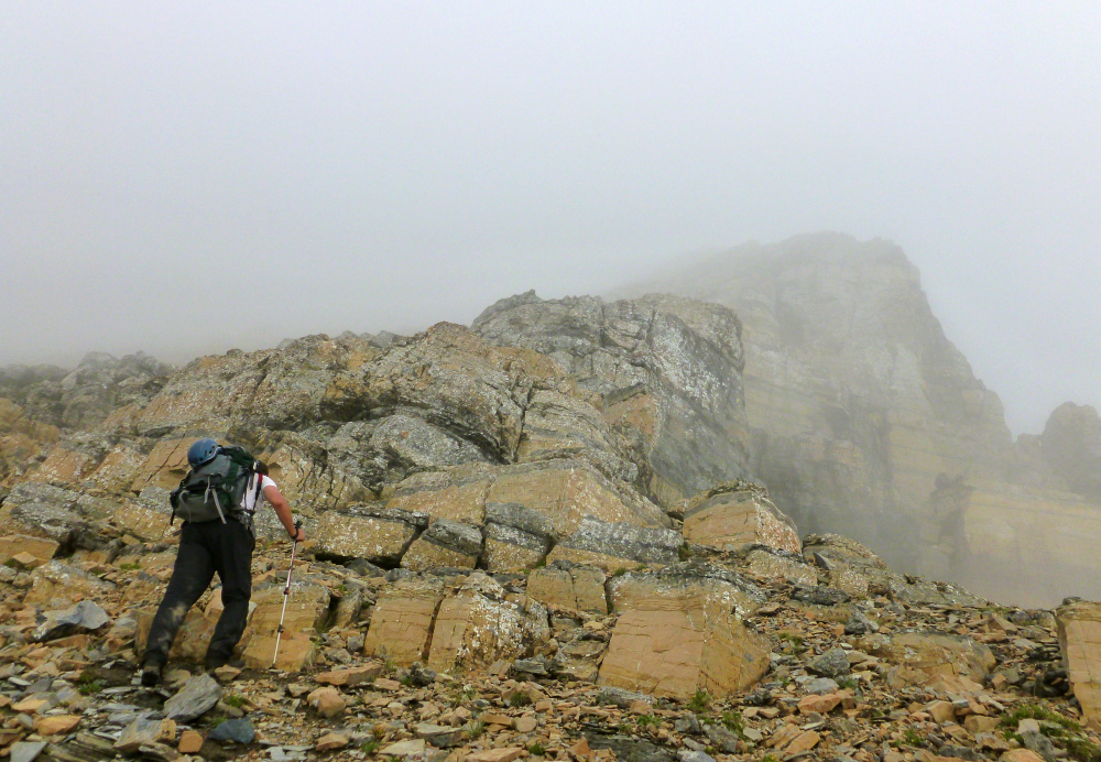
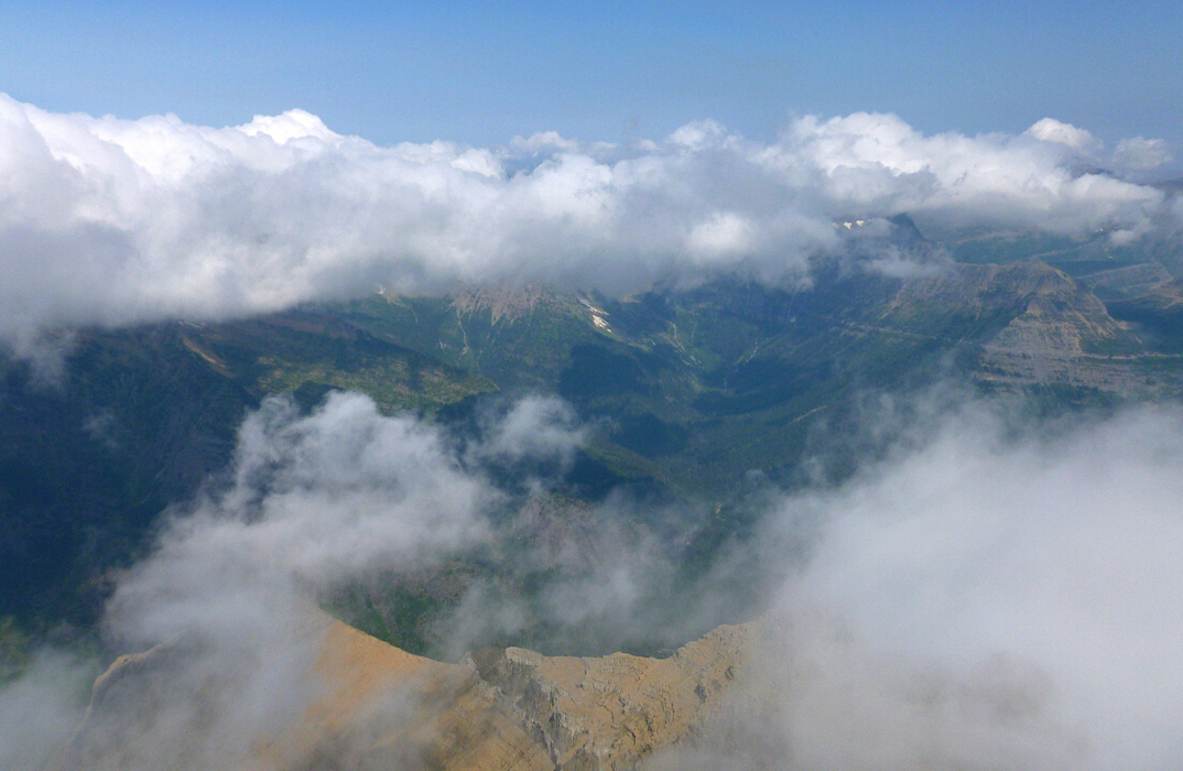
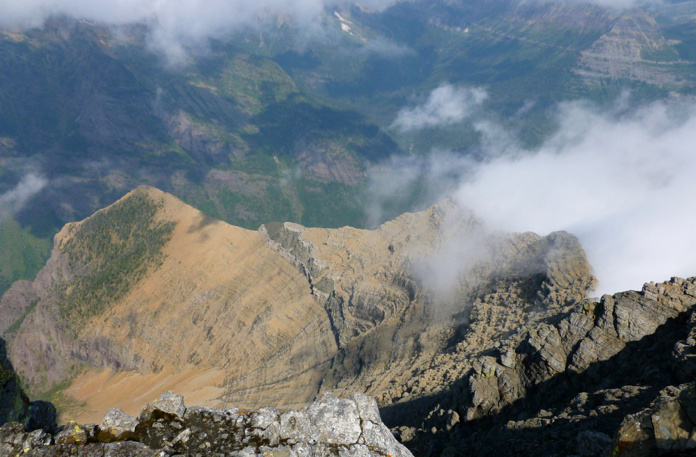
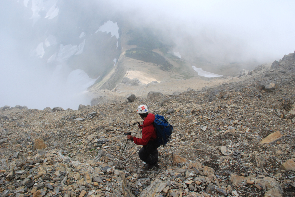
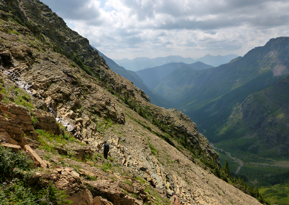
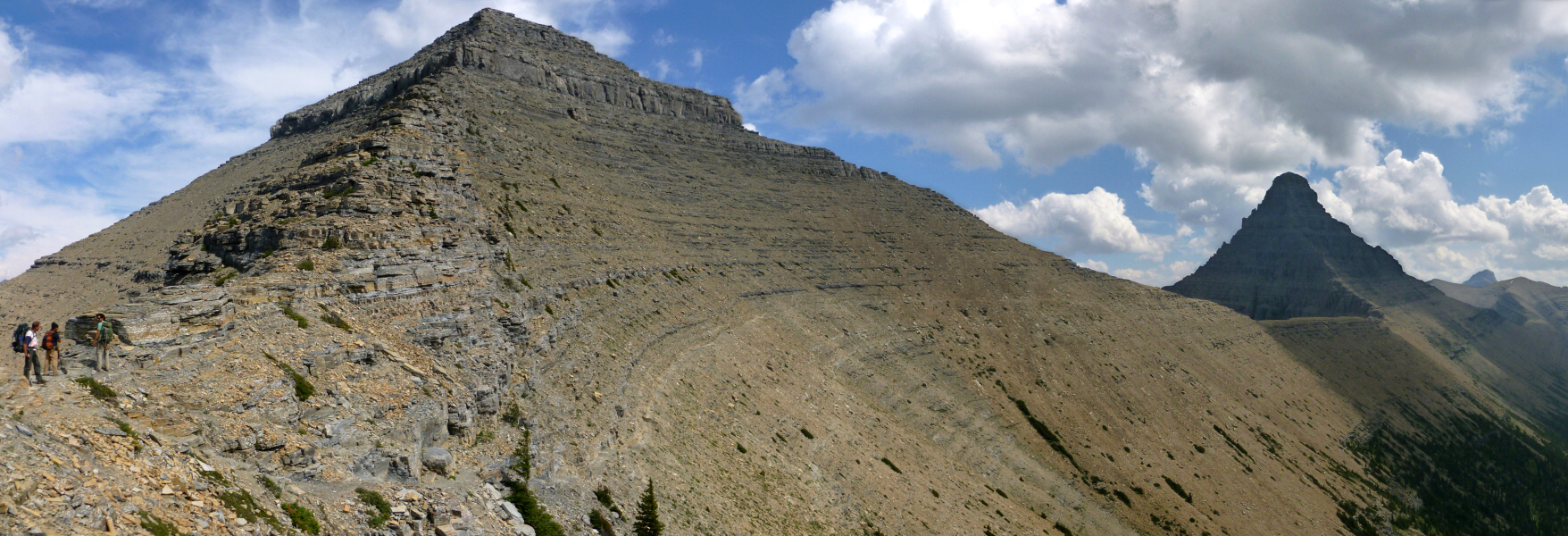
Monday: It's game time. It's climb time. It's no more whining time. The route to Stimson from the lake requires a hike up to the 7500-ft saddle south of Mt. Pinchot. This is pretty straightforward. There is brush around the lake but we did well to avoid the worst of it. The basin just below the saddle has large boulders and talus and is open. After the saddle a level traverse of about half-a-mile is required to round the southwest shoulder of Pinchot. This traverse has some wide gullies to scramble through. At least one of them has running water year round. The real fun begins beyond the southwest shoulder. For the next 0.75 miles the "way" follows a system of ledges (photo taken on return) sometimes so thin it would make a tightrope walker tremble. Sergio did not like portions of this traverse. I wasn't really fazed by it. We followed cairns much of the way and even added a few of our own. It's also on this traverse that the first view of Mt. Stimson can be seen. And let me tell you it looks very steep and uninviting to the casual scrambler. But we knew (from Kintla Peak) that looks can be deceiving. We knew that if the route is truly only Class 3 then there must be ledges unseen from below. The top of the mountain was still in clouds and the upper face/southeast ridge looked almost cliffy.
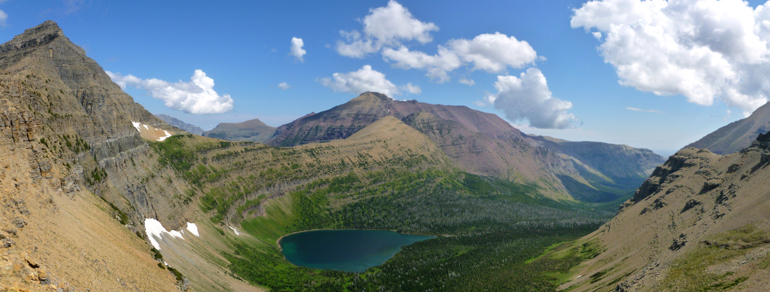
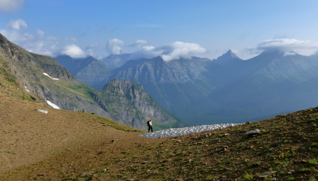
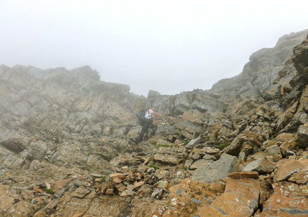
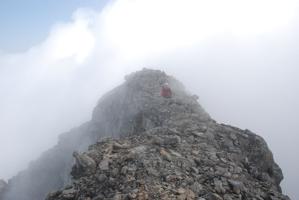
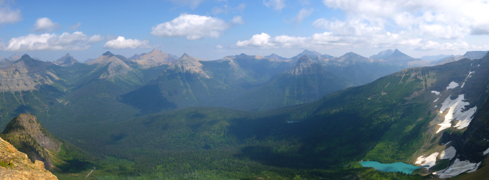
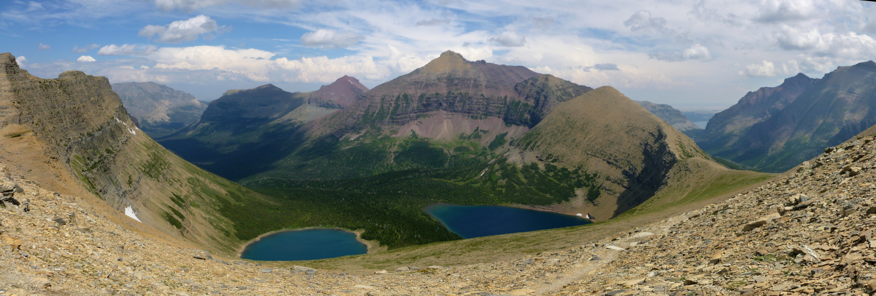
Looking east from the saddle we enjoyed a great panorama of peaks that straddle the Continental Divide. Of these peaks, Triple Divide Peak is perhaps the most noteworthy. Noteworthy because Triple Divide is considered a hydrological apex of the North American continent, where the Great and Laurentian divides meet at the summit of the peak. We arrived at the 7400-ft Pinchot-Stimson saddle within about two hours from camp. We fueled up before heading up. There is still 2700 vertical feet of climbing to do from here. The first part of the Southeast Ridge goes fairly quickly (there's even a boot path to begin). The middle third contains Class 2 transitioning to Class 3 but with minimal routefinding difficulties. It's only the last 500-600 vertical feet that one must take care on. Although the climbing is generally no harder than Class 3, it does require one to pick a winding route up the short cliff bands. Ledges abound but Class 4 lurks, as it did especially for us as we ascended ever higher into the clouds. The occasional cairn helped guide the way through the white-out and we added some of our own just as a precaution. We finally reached the level ridge top a few hundred yards NE of the highest point and did a ridge run, sometimes running into impasses (drop offs) that required end arounds. The summit ridge is an impressive feature, like a sidewalk in the sky I thought. From where we gained the ridge, it's a little over 0.2 of a mile along the crest to reach the true summit.
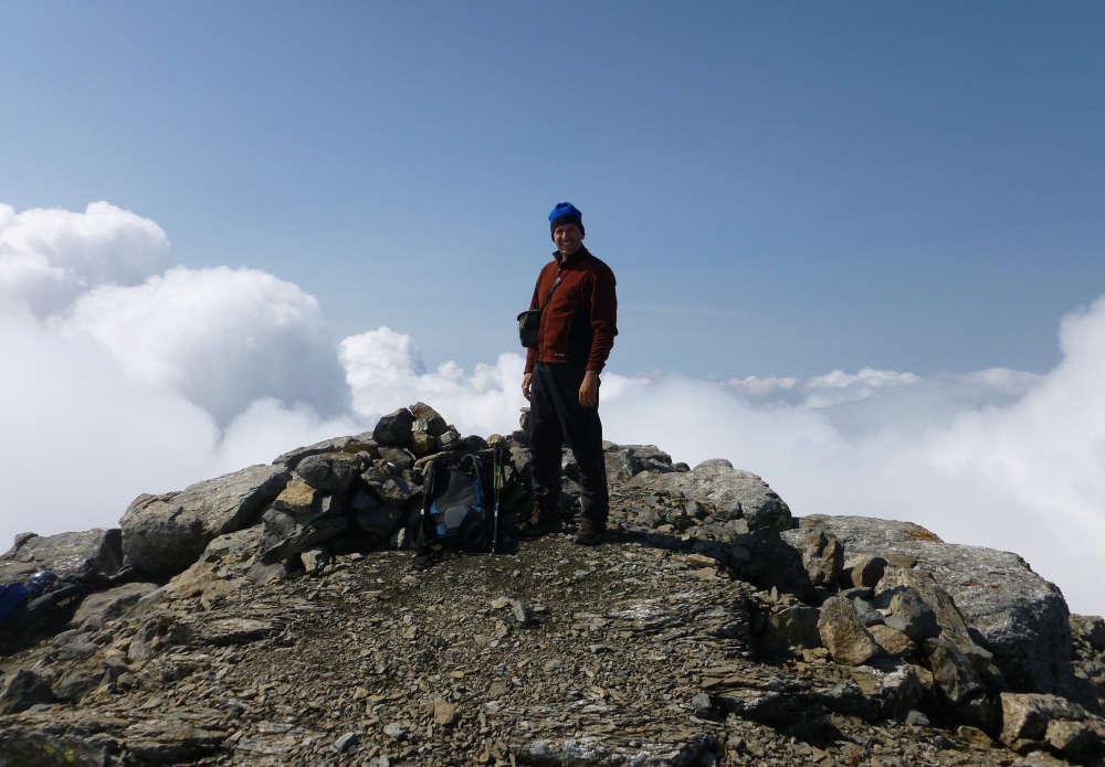
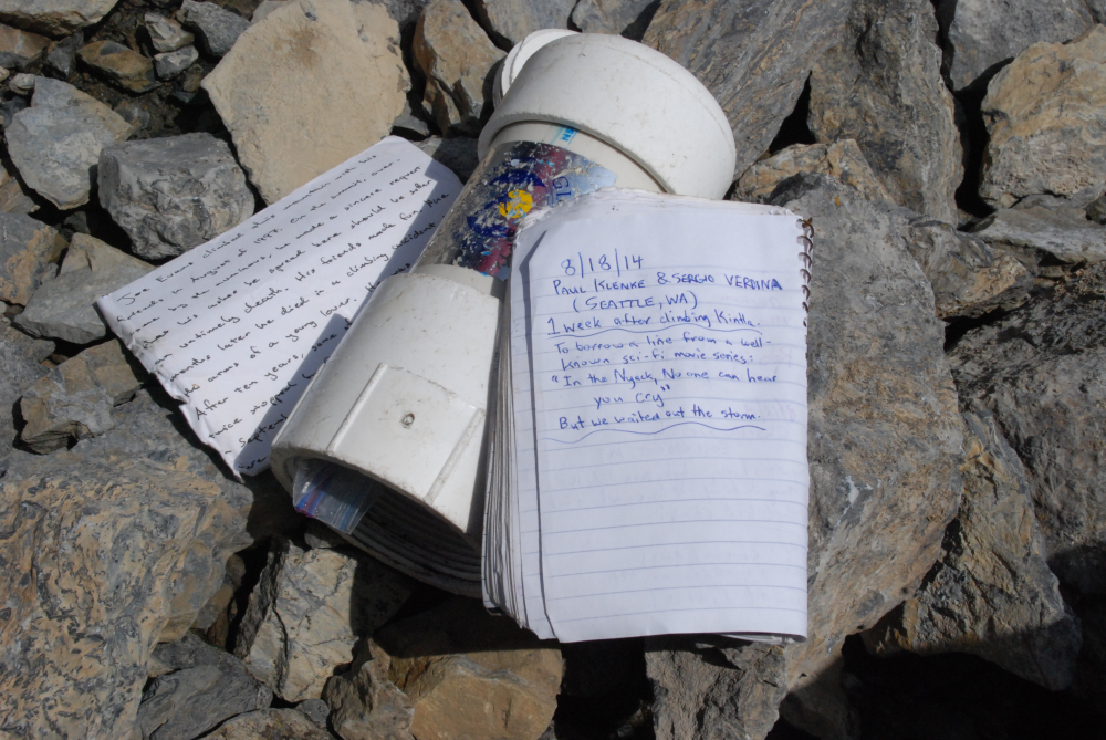
We made it! We each cried out in excitement. But no one heard us. Because in the Nyack, no one can hear you cry. I believe we were the second party to sign in this year. The mountain is not climbed very often despite its status (2nd-highest peak in the park), prominence (4382 ft clean - good for 8th in the state and approximately 99th in the Contiguous United States) We had hoped for enough of a clearing to be able to lay eyes on Blackfoot Mountain and Mount Jackson the latter of which we climbed two years earlier. The views of the Harrison Glacier and Pumpelly Glacier on either of those peaks would have been nice to look at. Instead we had to settle with intermittent sucker holes and momentary glimpses of the precipitous North Ridge of Stimson.
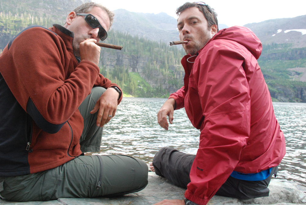
The clouds finally started lifting as we began our descent, which in addition to the cairns really helped with the route finding and revealed more of the surroundings which we were denied during the ascent. We got back to camp at the lake (now Buffalo "Woman" Lake) in about 9.5 hours round-trip with designs on moving our camp back down to the gravel bar. We just barely had enough daylight left. But that would mean suffering the brushy descent off of Surprise Pass. We were a bit footsore from the Pinchot traverse so decided to stick around. My goodness! One more night at the lake! We enjoyed one last PBR each and a stogy. Sergio's cigar was a bit damp but given the location and the circumstances I'm sure he didn't complain.
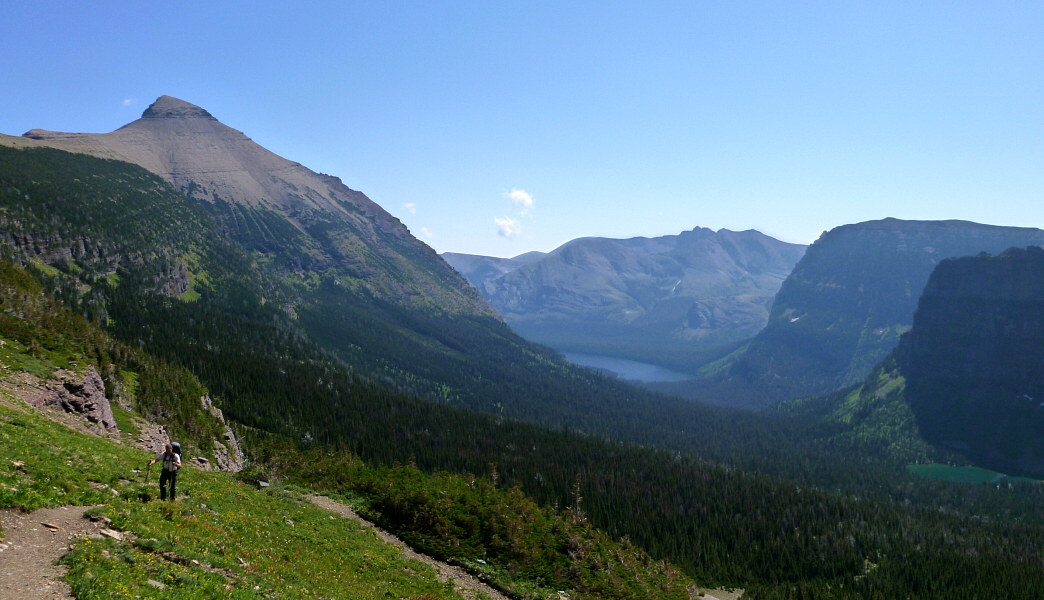
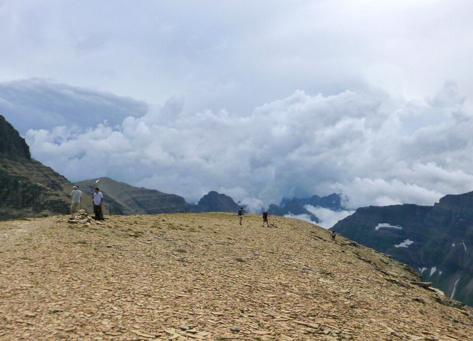
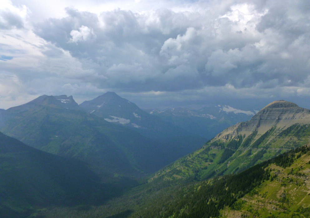
Now it's the next day. And we have a schedule to keep. You see, we're 20 miles from the boat back across Upper Two Medicine Lake and the last boat leaves at 5:00pm. You get the idea. And, oh yes, there's about 3600 ft of elevation gain to grind out to get out of the Nyack. Suffice it to say, we had to get a move on. We actually did pretty well thanks to a methodical pace, though we pretty much arrived at the top of 8000- ft Cut Bank Pass on our last uphill legs. We now had a couple of miles of southward leg scissoring to get to Dawson Pass (for a panorama of this southward traverse, click here). And this too went quickly.
It was while on this traverse that we laid eyes on an impressive thunderstorm out to the NW unleashing the heavens onto all of those tourists in that overcrowded parking lot at Logan Pass. Hmmm, sucks to be those people. When we were at Dawson Pass the second time it was still pretty good weather overhead. There weren't too many cumuli around. People at the pass were merry and we snapped a photo or two of a group of older men. As we descended the long "1.7-mile" 3.5-mile trail to the lake people were continuing up. I happened to look over my shoulder and see that the partly cloudy sky above the pass had mutated to a troubling hue of gray. "Trouble brewing" I said to Sergio to get his attention at the transformation. Trouble brewing indeed. And it didn't take long. In that one hour of descending from Dawson Pass the weather had turned stormy as if all it took was a toggle on a switchboard. We got back to the boat dock ("Pray Shelter") with about 10 minutes to spare, which was just enough time to wade in the lake to soak our achy feet. There was a guy fishing out in the water. He said he hadn't caught anything yet. There were kayakers out on the water. Meanwhile, the storm behind us was growling with thunder that was getting louder. I mentioned to the fisherman that maybe standing in the lake wasn't such a wise thing to do in a thunderstorm. We all got out of the water.
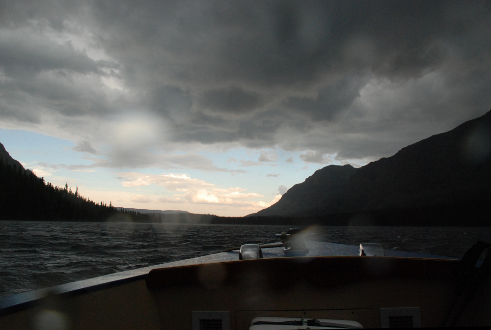
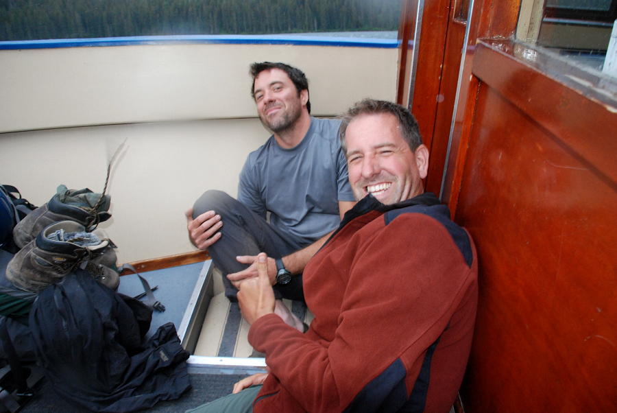
Amazingly (and unexpectedly) there were almost 100 people waiting for the boat. But the boat's capacity is less than 50. We at first thought we would be screwed, that we'd have to hike around the lake (another 3 miles), be we discovered that the boat will make multiple runs back and forth across the lake (which is a twenty-minute transit) until everyone has been ferried. Then we found out that prepaying customers (that was us) got to be first in line. So we were on the first boat. We weren't in the first boat. We were on it. As in out on the front stoop, outside because we gave up our seats for an older lady and her husband. This meant we would be exposed to the weather. And yes, it started to rain, actually quite hard, and with lightning tasing the mountains around us. But we didn't really care. Because we had just conquered Mr. Stimson. I let out a Nyack scream, a Nyack scream of satisfaction, as we disembarked the boat and made haste through the cold rain to our nearby car-the car with the PBRs inside. We had only to find a way to rid ourselves of our bear barrels. This involved finding a ranger at a particular location that shall remain a secret. I really do think the park should institute a sort of return bin, like a glorified U.S. Mail box, so that folks can return their barrels after hours.
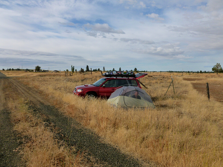
Speaking of hours, we had many more of them to burn to get home. But Sergio was driving. More t-storms and one of the more impressive lightning shows in recent memory on the drive back from Kalispell, across Idaho and back into Washington. We pushed on making it as far as Cheney by 2 am at which point we pulled over and pitched the tent for a few hours of sleep. Even here distant flashes of lightning could still be seen both to the east and south of us, but we had finally slipped the Nyack devils' grasp and could at last enjoy some much needed shut eye. Clearly angered by our having sneaked up Stimson right under their noses, we were chased across 3 states before eventually being let go! So long Nyack, this is goodbye. May we never set foot in your soggy, green hell again! Oh, and it bears mentioning that the park got its first significant snowfall of the season less than 10 days after standing atop Stimson. Prospective GNP climbers take note - the weather window for high alpine climbing in the park can be quite short and unpredictable!
Click here to view photos.
![]()


