


Mount Cleveland - Stoney Indian Route, August 2012
 as seen from the east on the Chief Mountain International Highway.")
Rising to 10,466 ft, Mount Cleveland is the highest mountain in Glacier National Park and therefore an obvious climbing objective for Glacier novices such as Paul and myself. The peak is also the highest point in the Lewis Range, which spans part of the northern portion of the Park and extends into Canada. It is located approximately 5 miles south of the US/Canada border, and in fact is best accessed coming from the north via the province of Alberta. The first recorded ascent of Mount Cleveland was in 1920 by Frank B. Wynn. The easiest route on the peak is the West Face route, starting from the Waterton Valley. The other popular route is the Stoney Indian Route, from Stoney Indian Pass to the south of the peak, first descended by noted Sierra mountaineer Norman Clyde and party in 1937.
With its breathtaking position along ledges traversing Stoney Indian Peak, our preference was to climb this intriguing Stoney Indian Route. Unfortunately, the standard basecamp at Stoney Indian Lake acommodates just three parties of which only one is reserved for walk-ins. Given the relative scarcity of permits, securing one here on any given peak season day is a tall order to say the least. However, being among the first awaiting the West Glacier ranger station to open certainly helped and we miraculously managed to secure the only available permit within a day or so of when we planned to do the climb. With the permit business finally sorted out, the rest of our Cleveland itinerary fell neatly into place. We planned on catching either the 1pm or 4pm sailing of the Waterton boat cruise to Goat Haunt on the south end of Upper Waterton Lake, and from where we'd start the approach. As such, we had plenty of time to make our way across the park via the Going-to-the-Sun Road and checking out the sights before continuing north across the border into Alberta.
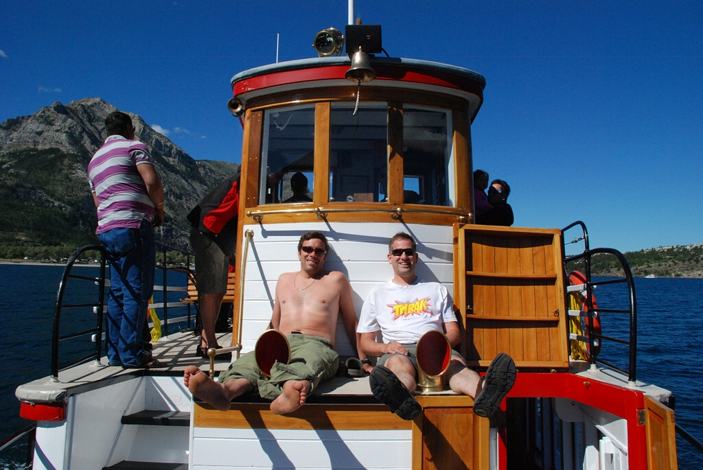
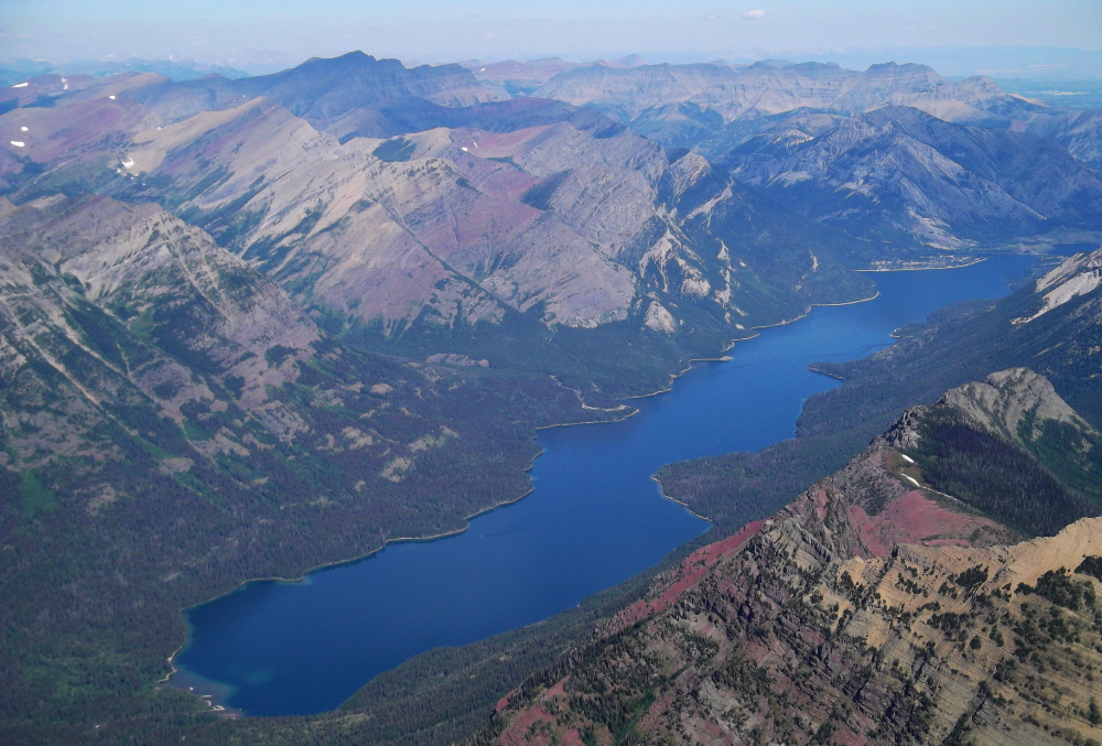
Having secured our tickets for the 4pm sailing, we had ample time mill about, sort and re-pack our gear, locate the Waterton liquor store...that sort of thing. Finally, with our gear stashed down in the hold, we took our 'seats' at the front of the boat for the ~1 hour cruise south to Goat Haunt. While not of great absolute elevation (Granite Peak, the highest peak in Montana is over 2,300 ft higher), Mount Cleveland is notable for its large, steep rise above local terrain. For example, its west flank rises over 5,500 ft in less than 2 miles; the northwest face, steepest on the mountain, rises 4,000 ft in less than 0.4 miles!
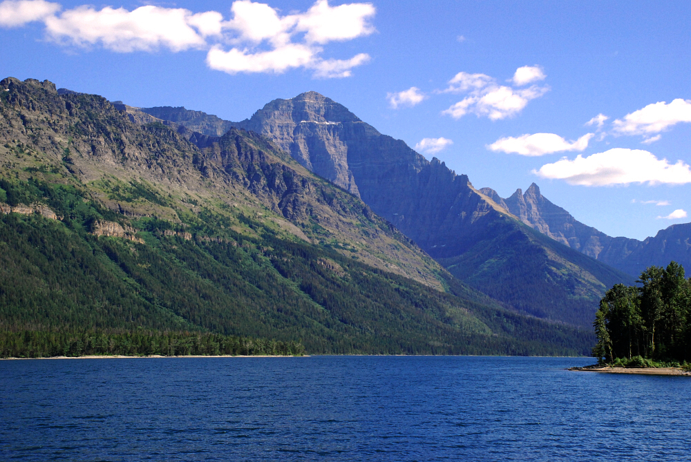
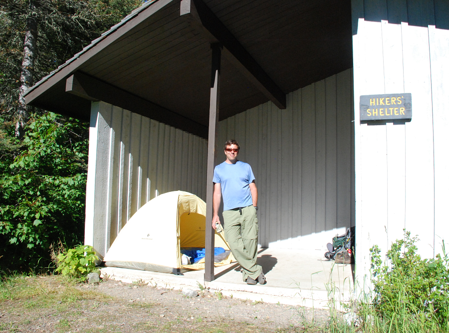
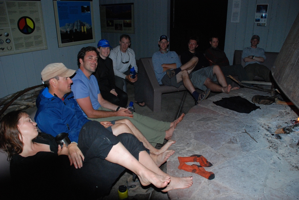
Crossing the international boundary about 2/3rds of the way down the lake, Goat Haunt is technically in the US. There's not much here other than a tourist shelter dedicated to International Peace Parks complete with placards describing various aspects concerning the history of such parks around the globe. After about a half hour or so, most of the tourists got back on the boat for the return to Waterton. Being that our Stoney Indian Lake permit was for the following day, Paul and I would be spending our first night here at the Goat Haunt hikers' shelter. From the shelter, a 10-minute walk on a paved trail leads to the south end of the lake proper, where both the Park Service and Border Patrol will want to see your papers. Note that the checkpoint closes at 5pm and opens at 11am, so be sure to take care of official business sooner rather than later (especially if planning on departing before 11am the following morning).
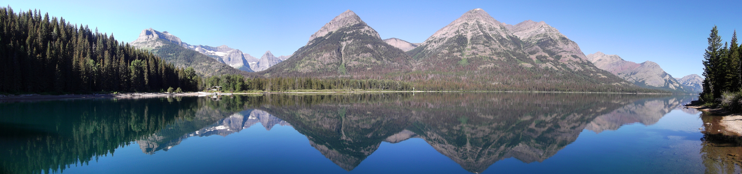
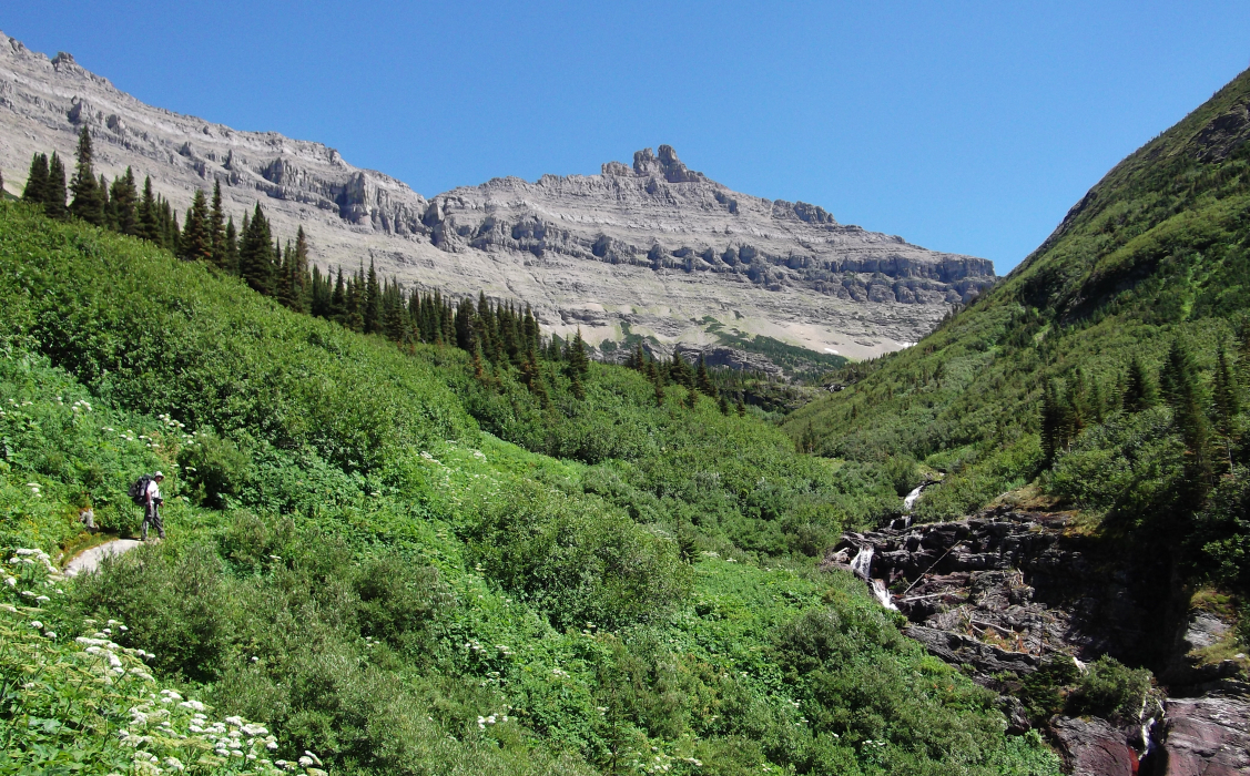
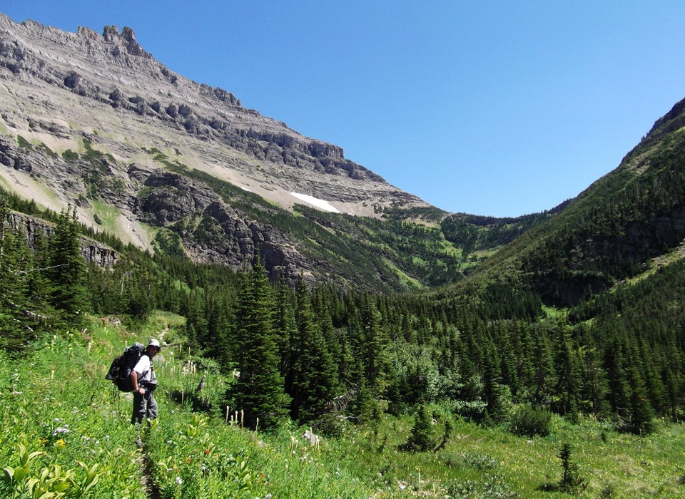
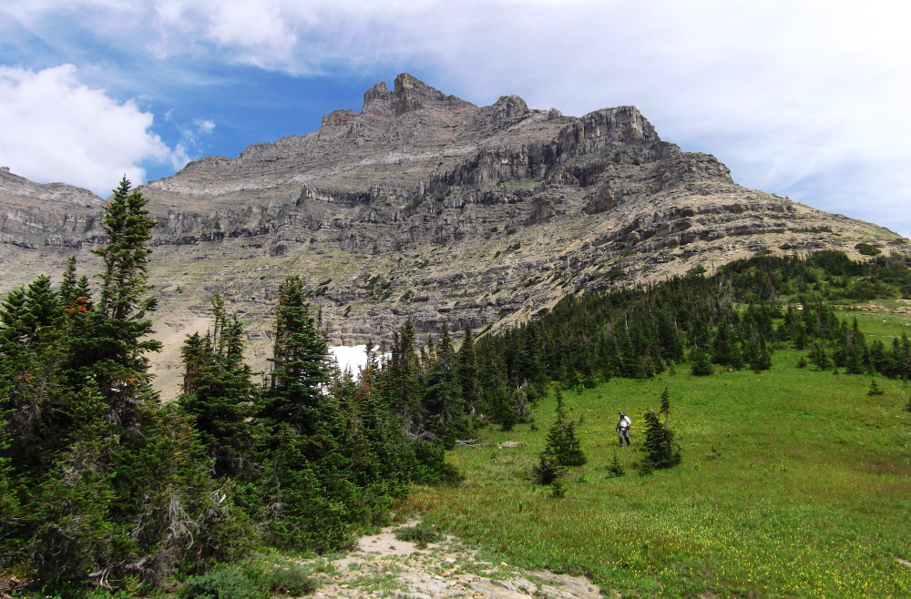
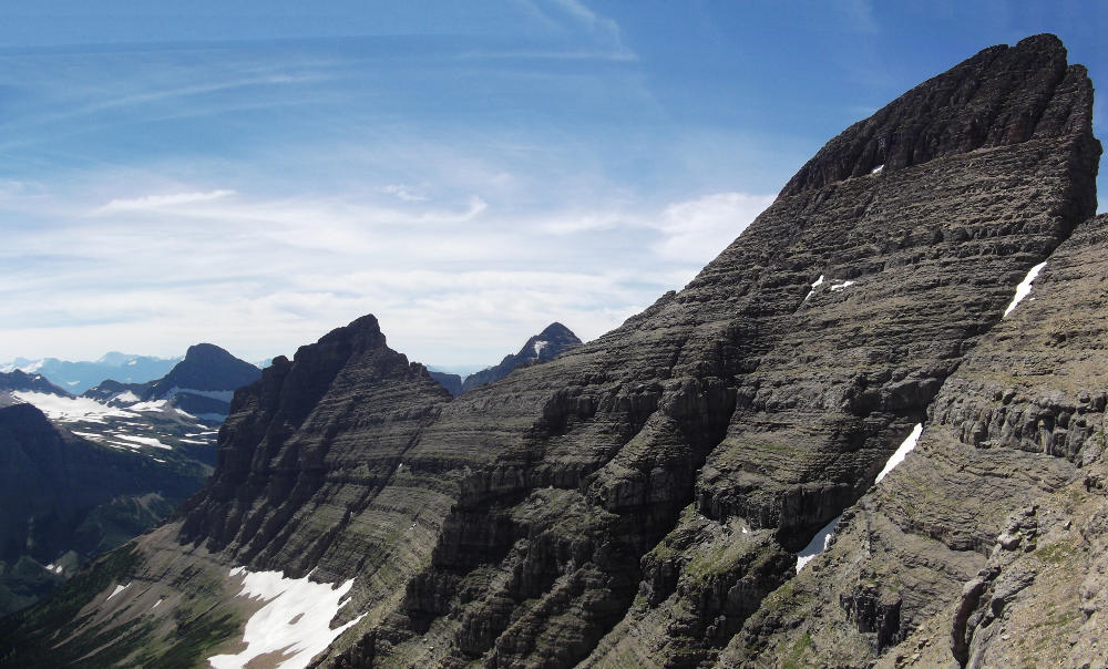
After a night of stories and merrymaking by the fireplace, we arose to a perfectly clear and calm morning. Having sorted our passport and permit business with the authorities the day before, we made our way past the unmanned border patrol shack and proceeded on a meandering trail up Waterton River Valley. Turning left (east) off of the Waterton River Valley Trail after about 6 miles, we proceeded up the bushy Pass Creek Valley Trail. It was a slow, sweltering hike up scenic Pass Creek Valley. Looking up at the ridge looming above, the initial part of the Stoney Indian Route traverses ledges from right to left above the large dark colored cliff band, but below the smaller light colored band. There's a gully below the obvious low point in the ridge that leads up to a notch which must be gained on order to cross over to the other side of the ridge crest. With only about 8 miles total to reach Stoney Indian Lake, we had ample time to lounge and soak in the scenery. It took all the discipline we could muster not to drink all the beer at once and instead save a couple for when we returned from Cleveland the following afternoon.
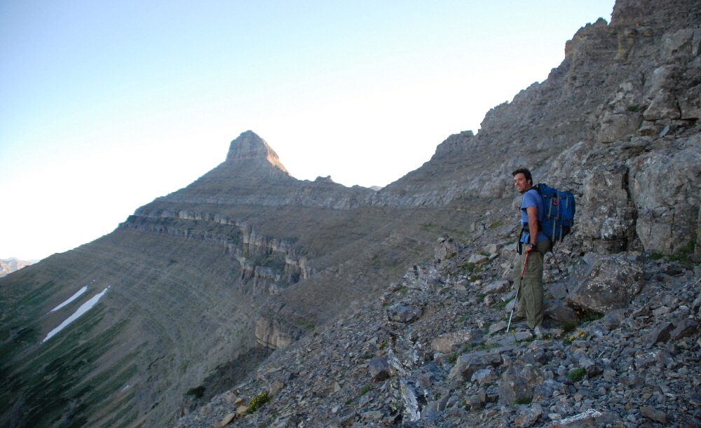
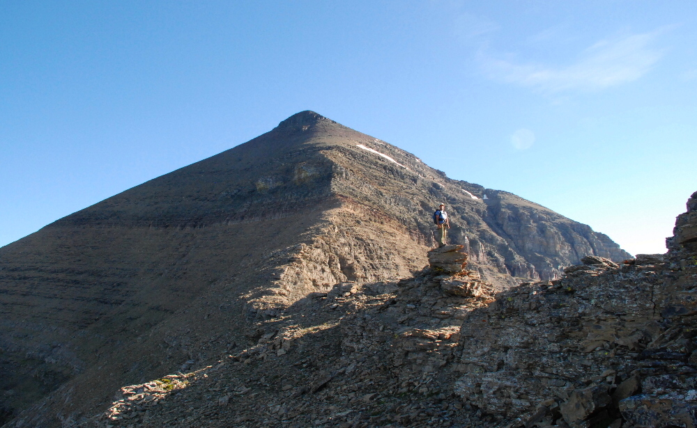
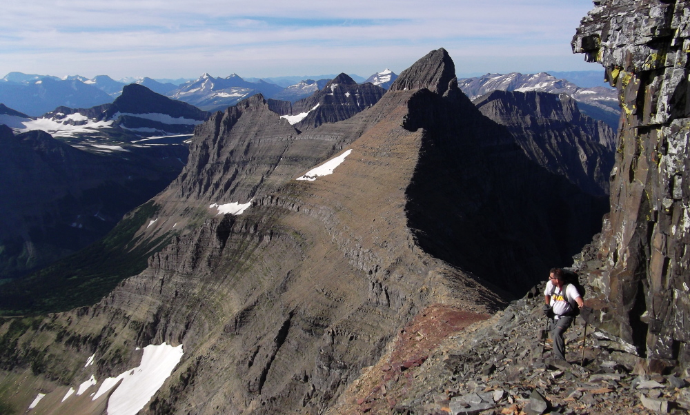
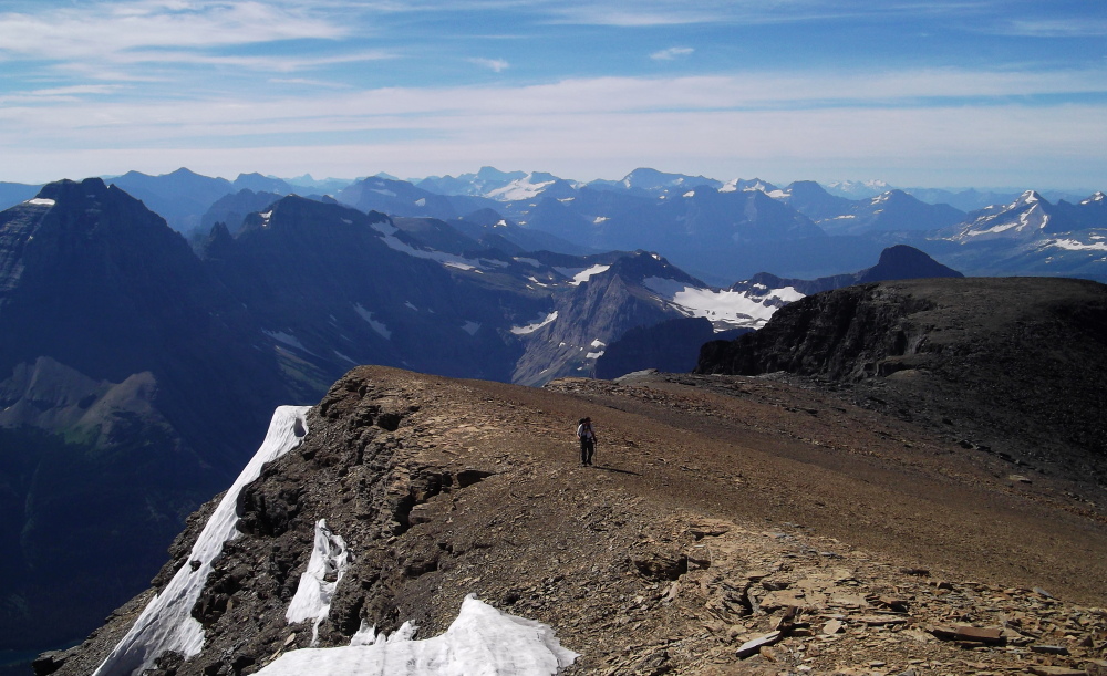
The route follows ledges between the dark and lighter rock band above it. In order to get there we had to endure a tedious rising traverse across chossy slopes up and right from the pass, passing various cliffs as necessary before finally working back left once above the aforementioned dark colored cliff. We eventually reached the aforementioned gully, taking care to transition from the narowing ledge into the gully proper. Some scrambling soon led to a notch which allowed us to cross over to the east side of the ridge. Here we finally enjoyed our first good view of Mount Ceveland as well as the rest of the Stoney Indian traverse! Beginning the traverse on east side of Stoney Indian peaks, the ledge we followed stays above a gray limestone band. En route we encountered a couple narrow spots, complete with down-sloping hardpan and exposure. The ledge eventually fades into a large scree slope beyond which lies the prominent saddle between Stoney Indian Peak and Mount Cleveland proper. This is the ideal spot to pause and look around before the final grind to the summit.
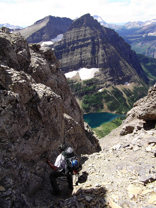
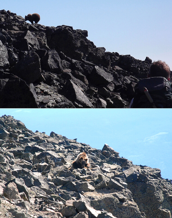
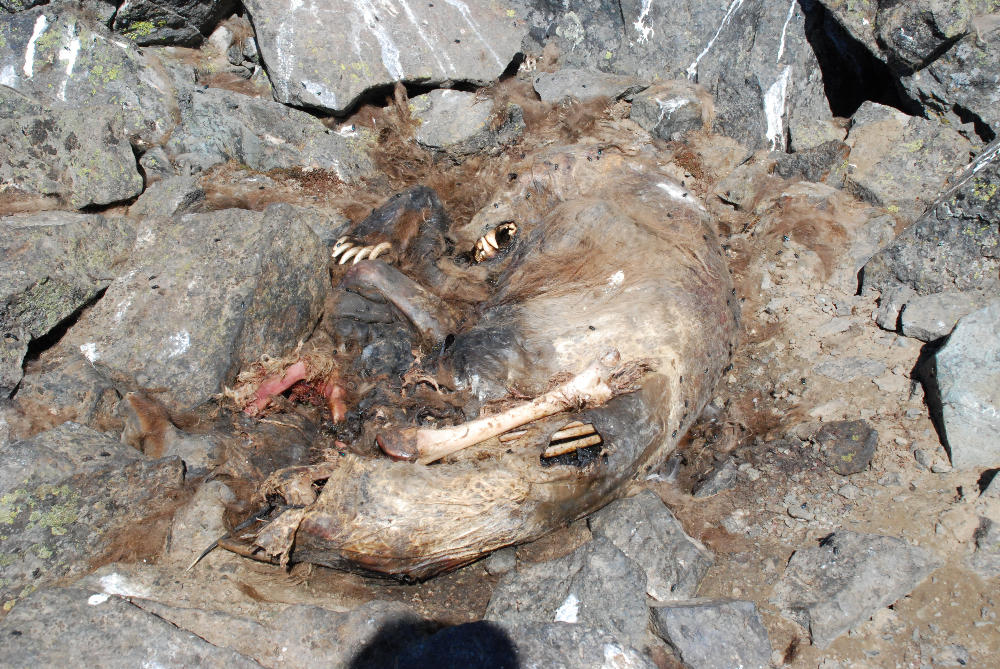
Heading up from the saddle, we worked a bit to right of the crest to avoid a steep rock step. Following a narrow ramp beneath a cliff, we stopped for a moment to absorb the stunning views unfolding before us. It was a well-deserved rest, for the up ahead was a tedious talus slope where every stone we touched disturbed a small swarm of moths. Of course, moths would soon be the very least of our concerns. Head down, picking my way up this moth-ridden talus slope, I stopped momentarily to catch my breath and looked over towards Paul about 100 feet off to my right. Oh shit! Oh shit! In a hushed but panicked voice, I call over to Paul, "...dude, there's a f'ing grizzly over there!" Fortunately it was a juvenile grizzly and showed little interest in us as it proceeded to walk away.
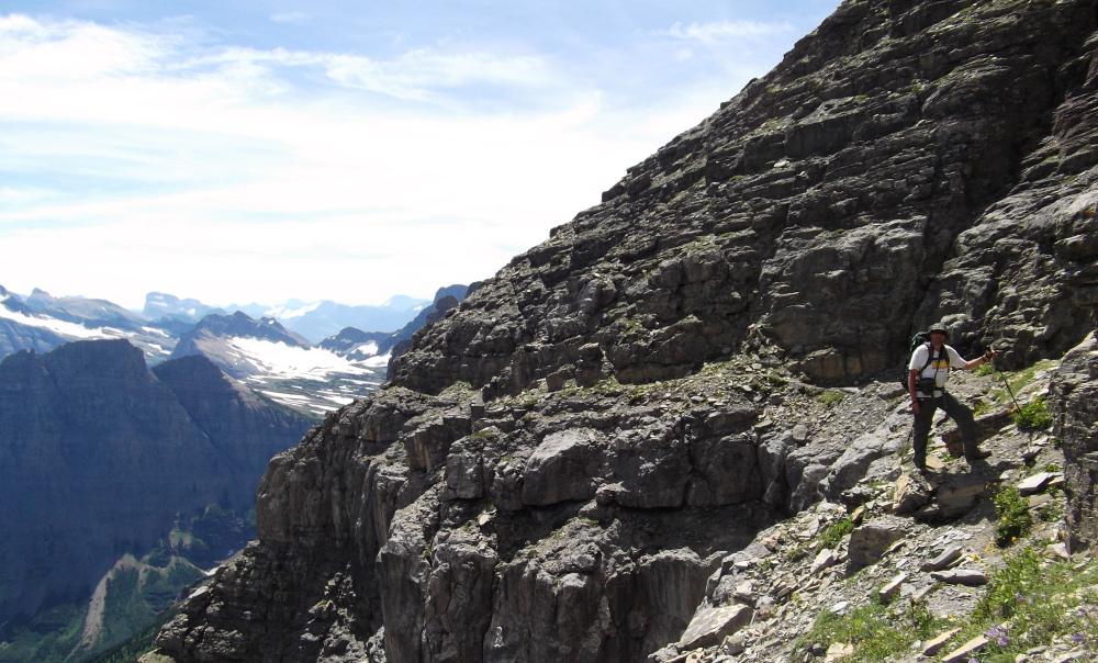
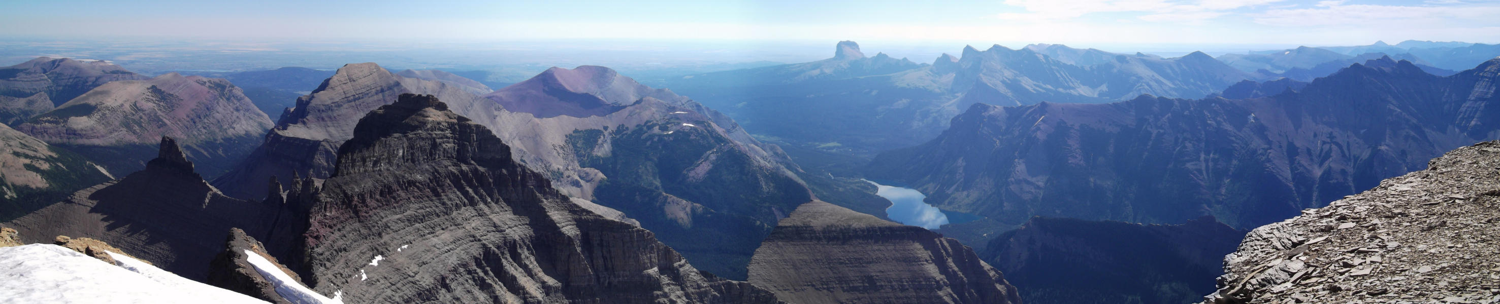
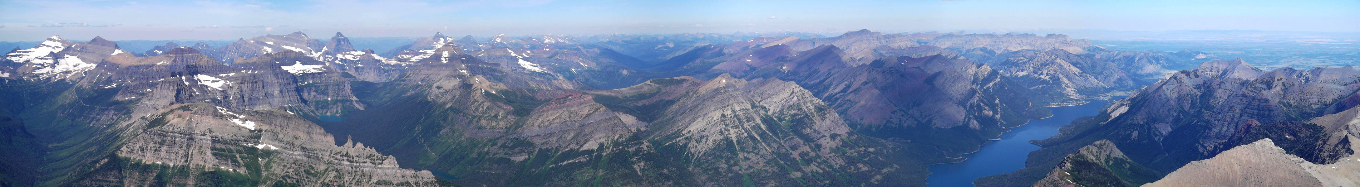
Something seemed odd about what it was feeding on however, so upon returning from the summit Paul went over to where we had last seen the bear. Never in our wildest imaginings did we expect to see the carcas of another long dead bear! Finally with the tedious talus slope behind him, we made our way across the expansive summit plateau. As an aside, it seems theoretically possible to approach Mount Cleveland from the Chief Mountain International Highway shortly before the Belly River Campground and immediately before the border crossing. This approach would take one past Cosley Lake and Glenns Lake, eventually leading up to Stoney Indian Pass. I'm not sure of the mileage here, but suffice to say that this approach is considerably longer than the Waterton Valley approach.
Thunderclouds were building farther west as seen during our return to camp. And yes, regardless how nice it would be to stay another night at camp and make a leisurely hike back to Goat Haunt the following day, we were obligated to pack up and leave. Stoney Indian Lake permits are ONLY issued for a single night at a time, which not surprisingly makes for a rather long and exhausting day if climbing Mount Cleveland. Hobbling in to Goat Haunt later that evening, we had over an hour to spare before catching the 8pm sailing back to Waterton (the 7pm boat was full). The rangers also took an interest in our dead grizzly story, suggesting that there have been shootings by parties unknown in recent years. We didn't dawdle once back in Waterton and made it back into Montana minutes before the 10pm border closing. Nevermind the lack of a meal or resisting the overwhelming urge to nod off, avoiding the cows on the Chief Mountain International Highway was easily the crux of the drive back to Saint Mary!
Click here to view photos.
![]()


