Select from list below to jump to a specific area on this site.
| Latest Posts |
Tuesday, November 27, 2012
Cathedral Peak - Southeast Buttress, September 2012
With arguably some of the best backpacking and rock climbing Washington has to offer, the Pasayten Wilderness is rather unlike the rest of the Cascade mountain range. Particularly in the area of the 49th Parallel, views of the surroundings closely resemble what one might expect to see from the high peaks of the Teton or Wind River ranges. To quote Alan Kearney, like a little slice of Wyoming.
While neighboring Grimface Mountain in Canada is taller, Cathedral Peak is the next highest Pasayten summit just south of the USA-Canada border. And like its taller neighbor to the north, the granitic rock on its sheer faces and buttresses features an abundance of quality climbs. Joined (or should I say led?) by long-time Pasayten Wilderness backpacker, accomplished climber, and (as of this this writing) AMGA Rock Guide Tod Bloxham, we set out to scale the peaks classic Southeast Buttress over three days in early September. Tod had climbed the route already several years ago, but was forced to abandon the headwall picthes for the 5.6 chimney bypass courtesy of a passing October snowstorm. While he was keen on finally dispatching the omitted pitches, I privately worried if I could even make it up these on top rope...
Wednesday, November 14, 2012
Joffre Peak - Southeast Face, September 2012
With Labor Day weekend to myself for the first time since I can remember, the moment had come for a return to The Duff and to stand atop Joffre Peak. Following the same driving approach as when Eric H. and I came this way to climb Mount Matier, I barely managed to sneak my car around the gate at the start of Cerise Creek Road this time. Was there a gate here back in June 2004? Also, the road continuation past the gravel pit/quarry was pretty overgrown last time, but is now impassable for all vehicles except perhaps an M1 Abrams. Okay, an ATV would work too In any case, it was just an additional ~2 joggable miles from here to the trailhead without much elevation gain.
Having been replaced by a new trail that starts from the highway (same as winter route?), my approach apparently isn't used much anymore. It joins the Cerise Creek Road somewhere just south of the now demolished bridge over Cerise Creek-a bridge I was intending to cross the following morning. In the absence of a bridge however, I was faced with yet another chilly ford my third one this summer!
Friday, November 10, 2012
Azurite Peak - std. via Azurite Pass, August 2012
Steve T. and I abandoned our previous Azurite climb thanks to a horribly overgrown trail with enough downed trees to make even the most seasoned Cascade peakbagger turn back in disgust (we climbed Mount Robinson instead). We had been misled by an outdated claim on SummitPost suggesting that the peak makes for a reasonable day trip. The area was ravaged by forest fires in 2003 and the once bikeable Methow River Trail clearly had fallen into disuse and disrepair. In all fairness, the SP report does make mention of the forest fire and warns that the trail could become quite burdensome in a few years. This was certainly the case and I vowed not to return until the trail was cleared and brushed-out.
Perusing the Methow Valley Sport Trail Association website (MVSTA.com) for MTB trail beta this summer, I came upon an unexpected and fortuitous bit of news. An Evergreen crew had been working on the trail and planned on completing the 8 miles of trail work to the junction with the PCT by mid-August. This would be the first time in several years that the full length of the trail was again rideable without interruption and I intended to take full advantage of it. Joined by Aberdeen-based John L, the plan was to combine the long drive and a short approach with a camp near the PCT before completing the climb the following day.
Tuesday, November 6, 2012
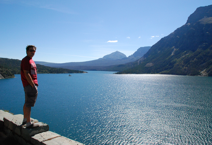
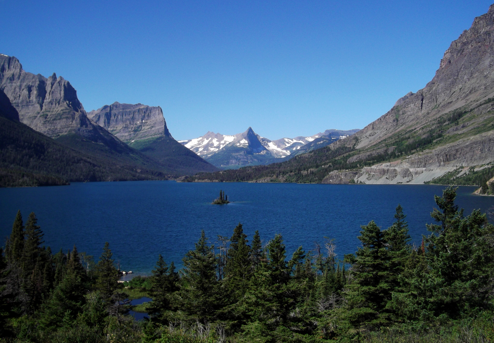
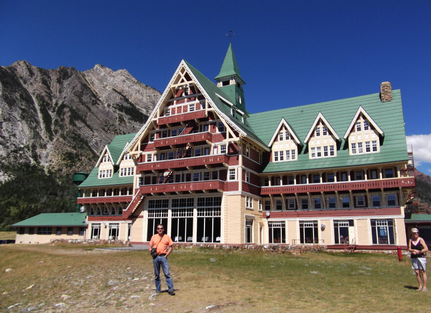
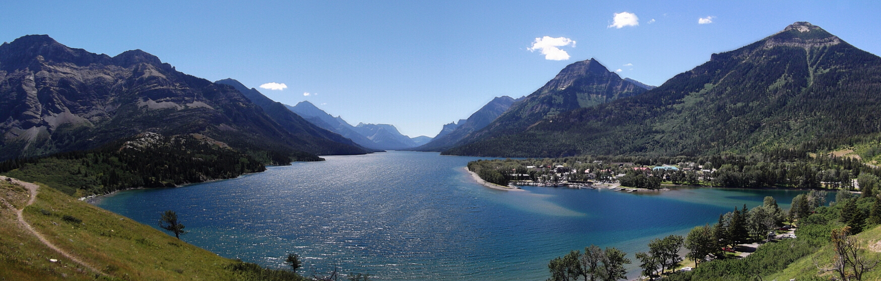
Glacier/Waterton National Park, August 2012
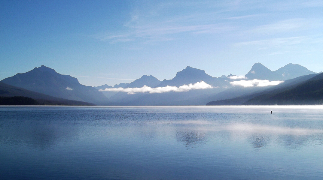
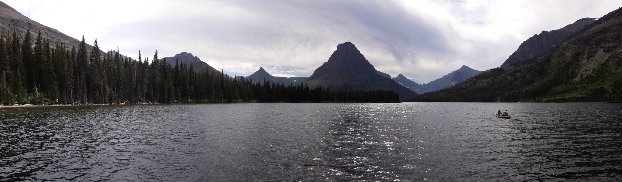
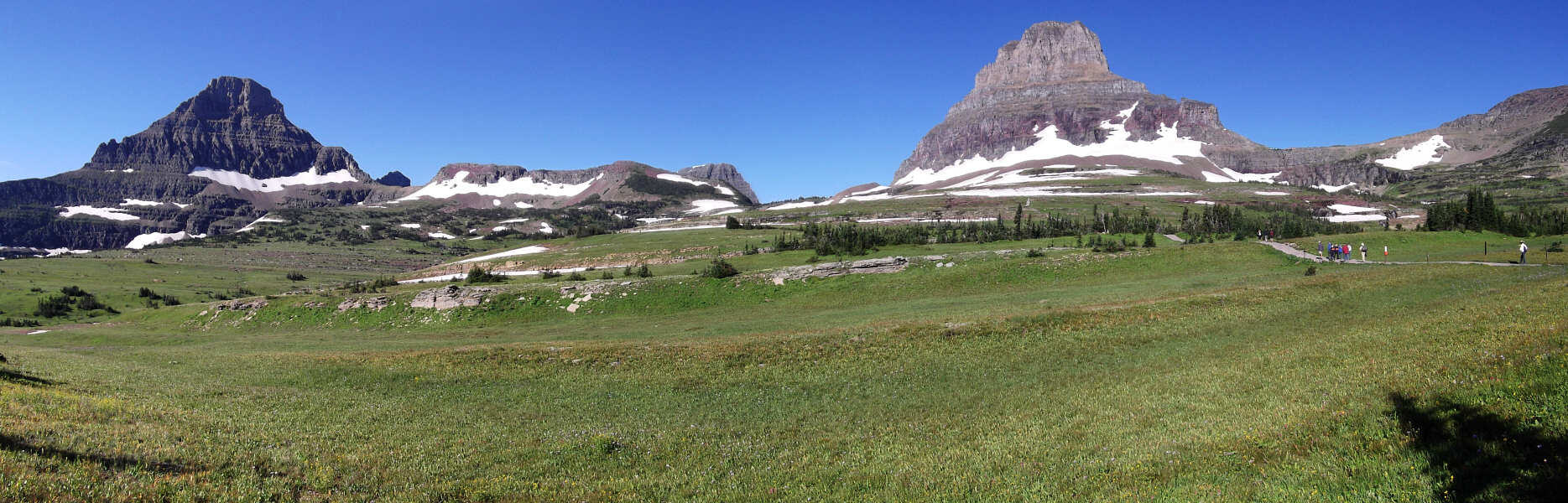
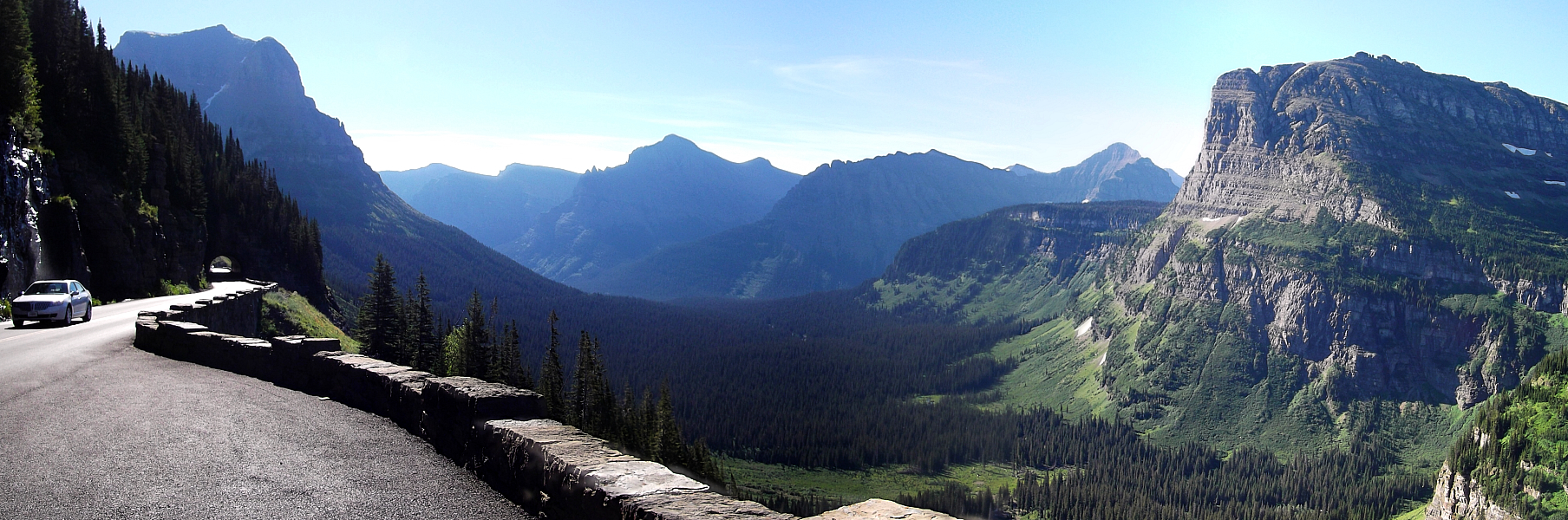
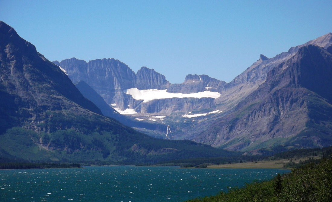
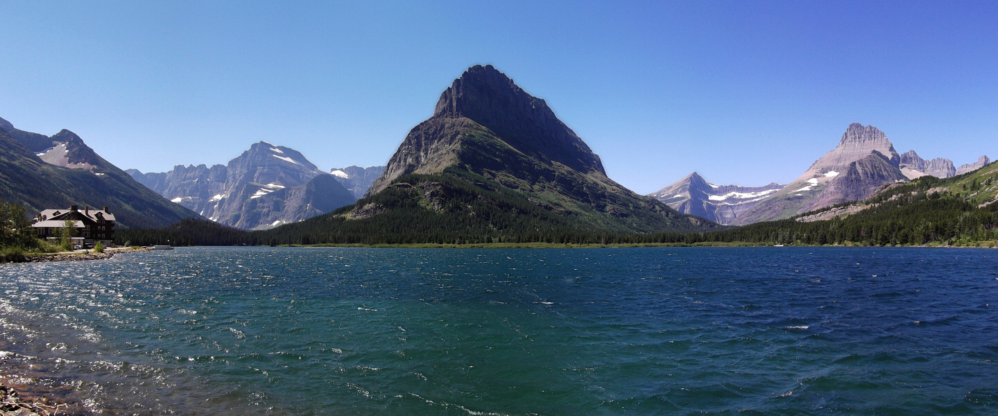
Dubbed Crown of the Continent by the naturalist George Bird Grinnell in 1901, the area that today encompasses Glacier National Park and the adjoining Waterton Lakes National Park in Alberta is a land of alpine majesty likely without equal anywhere else in the lower 48 states. Unique for mountain ranges in the US, these mountains bear a strong resemblance to the taller peaks of the Canadian Rockies far to the north, with large u-shaped valleys and outflow lakes radiating like fingers from the base of the highest peaks. In more recent times of course the park has been the poster child for the phenomenon of glacial retreat and of the 150 glaciers known to have existed around the time the park was founded only 37 remained by 2010. Motivated in part to bear witness to the last of these dying glaciers and bag a few peaks along the way, Paul and I set out to climb 3 of Glaciers 6 ten thousand footers Mount Cleveland, Mount Jackson and Mount Siyeh, plus a quick bonus hike up Divide Mountain just outside the park.
With a good 7 days spent in and around Glacier, we afforded the luxury of rest days between climbs and made the most of it visiting various attractions at a rare (for me) unhurried pace. However, the park being overrun with tourists as it typically is during the summer months, campsites and backcountry permits were few and far in between making both for grueling day climbs and...um...flexible dirtbag camping situations.
But alas, all good things must come to an end. Just as wed grown accustomed to falling asleep with the faint aroma of manure wafting in the evening breeze and the nightly procession of concerned cattle lumbering through our camp en route to nearby grazing fields, it was finally time to head back home. Detouring through Whitefish, we continued west on a slow but scenic route across the northern Idaho Panhandle and northeast Washington. The visibility from Hart's Pass and Slate Peak Lookout the following day was quite good despite the many forest fires burning in The Cascades, and made for a fitting finale to a memorable road trip that sadly now seems like forever and a day ago.
Reports for the Cleveland, Jackson and Siyeh climbs, Divide Mountain and general sightseeing around the park:
It would be very much appreciated if you please ask before copying and/or re-publishing content from any part of these pages. To do so, please click here to send a message via feedback form.


.")


.")
.")


.")

.")
. Nearby peaks on left half of panorama are Bauerman Ridge, Wolframite Mountain, Windy Peak (in background), Apex Mountain, Amphitheater Mountain and Remmel Mountain (left-to-right).")


 as seen from the Duffey Lakes Road near Joffre Lakes parking area.")


.")
 way to go is to follow the trail through trees up and right from the hut. A cairned trail will lead easily to the glacier's edge and avoids the scree and talus of the moraine.")


 guarding the easy upper slopes.")

.")
")


 as seen from Tower Mountain.")


.")
.")
.")


