Select from list below to jump to a specific area on this site.
| Latest Posts |
Thursday, February 27, 2020
Statimcets Peak - Southeast Face, August 2019
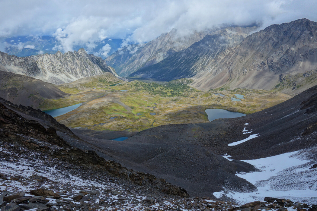
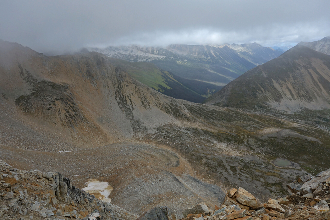
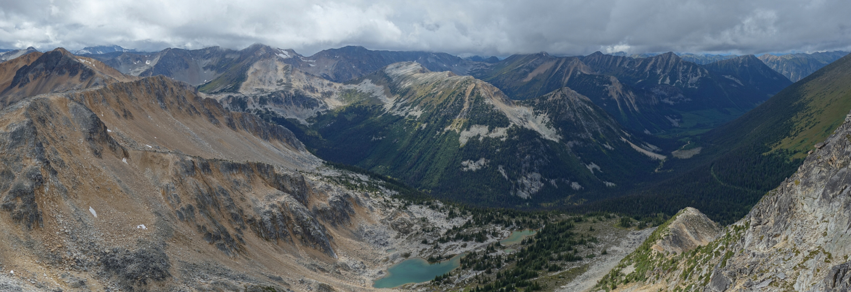
Downton Creek Peak, Peak 8700, Statimcets Peak, whatever one chooses to call it, is a rounded summit of shattered shale in the northern Duffey Lake Road region. Enclosed within the concavity of an arc of lakes and rivers near the eastern edge of the South Coast Mountains, the area here is characterised by craggy ridges and large cirques dotted with a profusion of scenic alpine lakes and tarns. Glaciers aren't nearly as prevalent here as are the high plateaus and tundra one commonly finds in some parts of the Rocky Mountain ranges of the US. If you take delight in this type of environment, you'll certainly enjoy climbs in the Front Range, San Juans or the Beartooth Range for that matter.
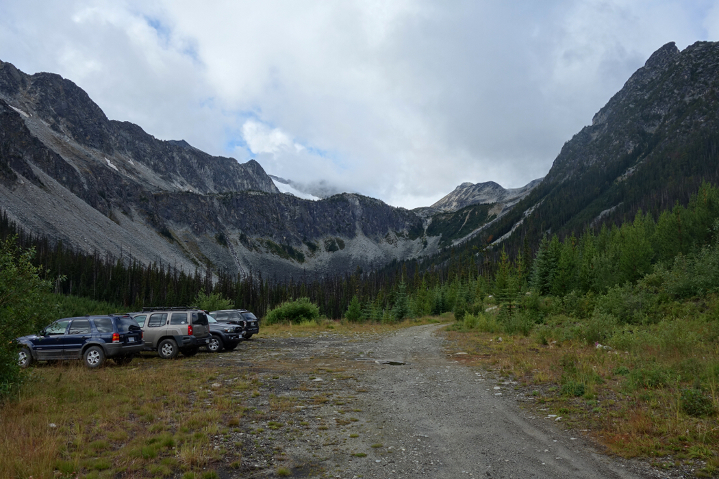
This trip was part 2 of a two-part weekend of "peak bagging" under less than ideal weather conditions. Having climbed both Gott Peak and Gotcha Peak the day before, the idea was to visit another reasonably popular objective further along off the highway. I say, "reasonably popular" but that may change soon based on the deteriorating condition of the numerous bridges that cross Downton Creek en route to the trailhead. Already there's a sign posted right before the first bridge indicating that the Downton Creek FSR is officially closed, despite the absence of barricades or enforcement of any kind. The FSR drive takes a bit of faith to be honest, especially towards the end where the it narrows with deep waterbars and sections where the roadbed is eroding away and slumps downslope. Just as I concluded that I had gone the wrong way, the road opened to a large landing with a half-dozen vehicles parked on the side. The trail starts up through a cutblock a bit further up the road.
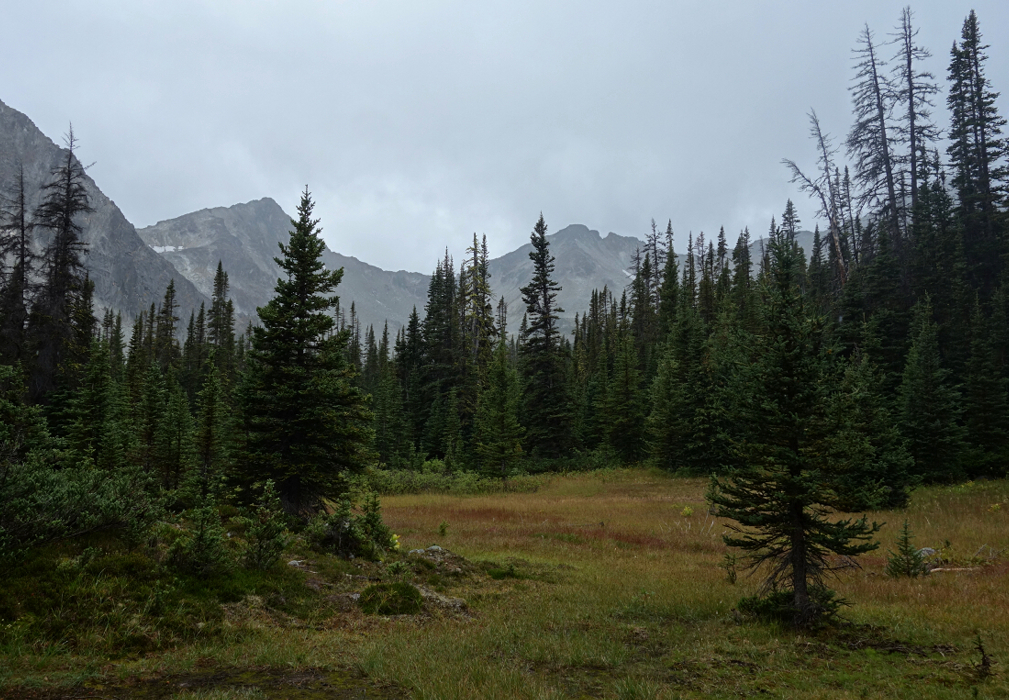
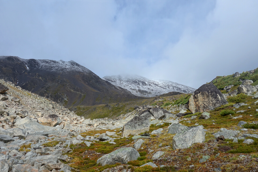
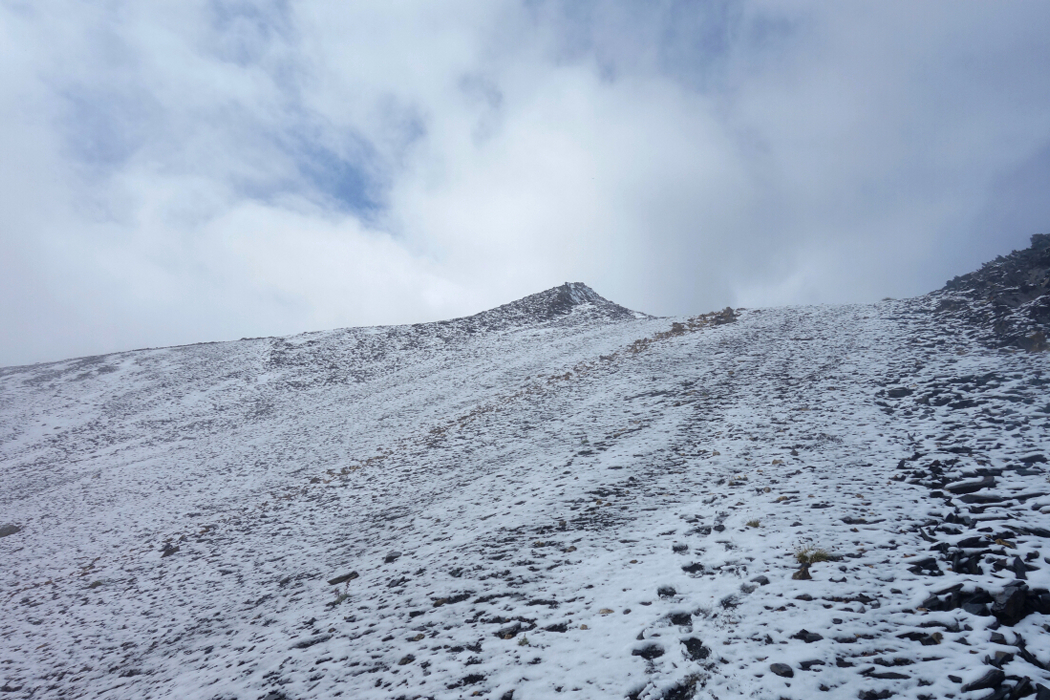
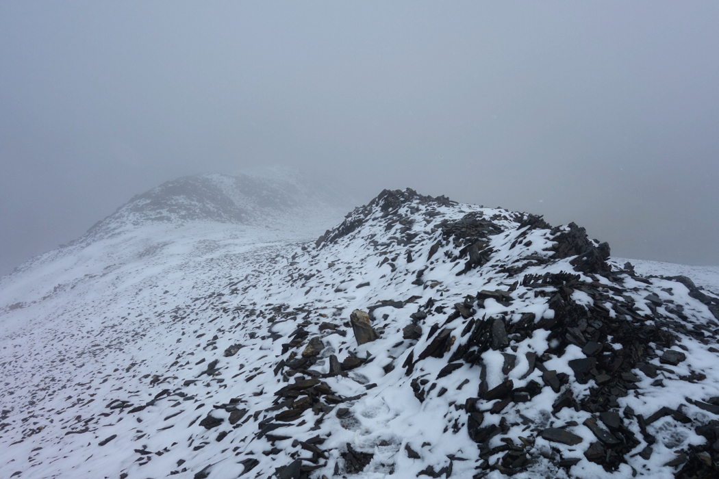
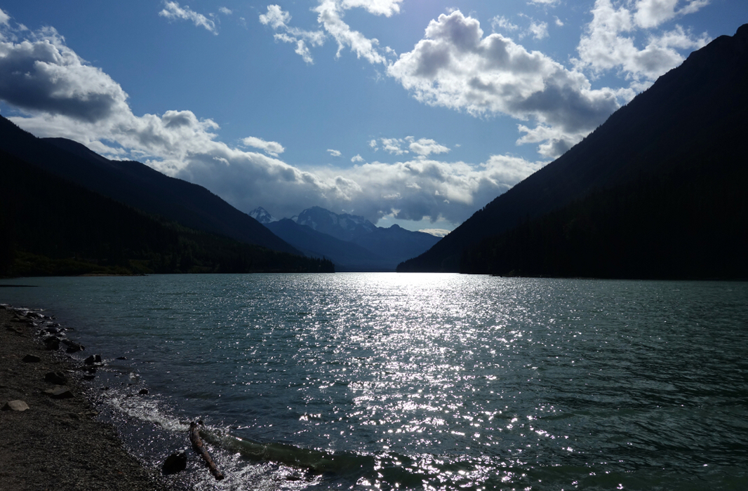
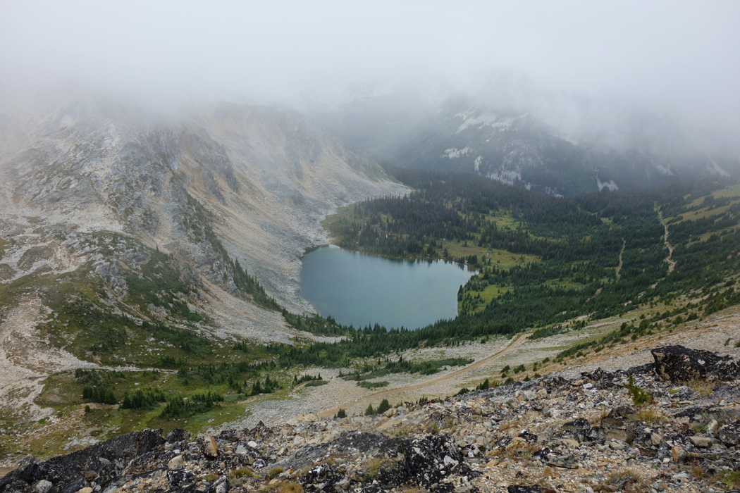
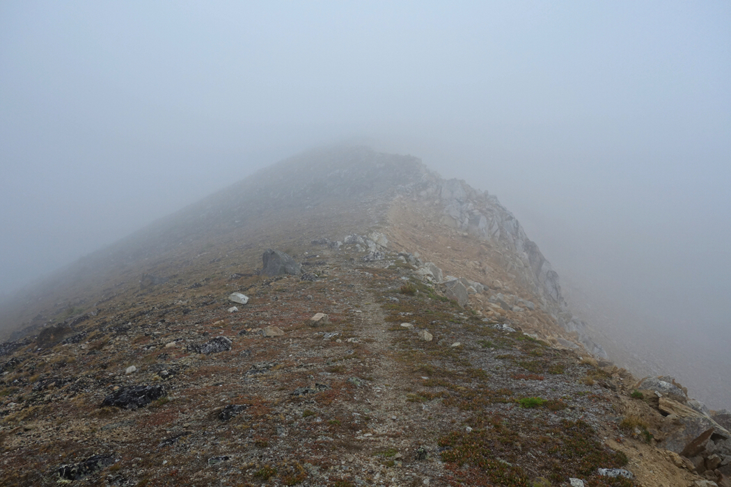
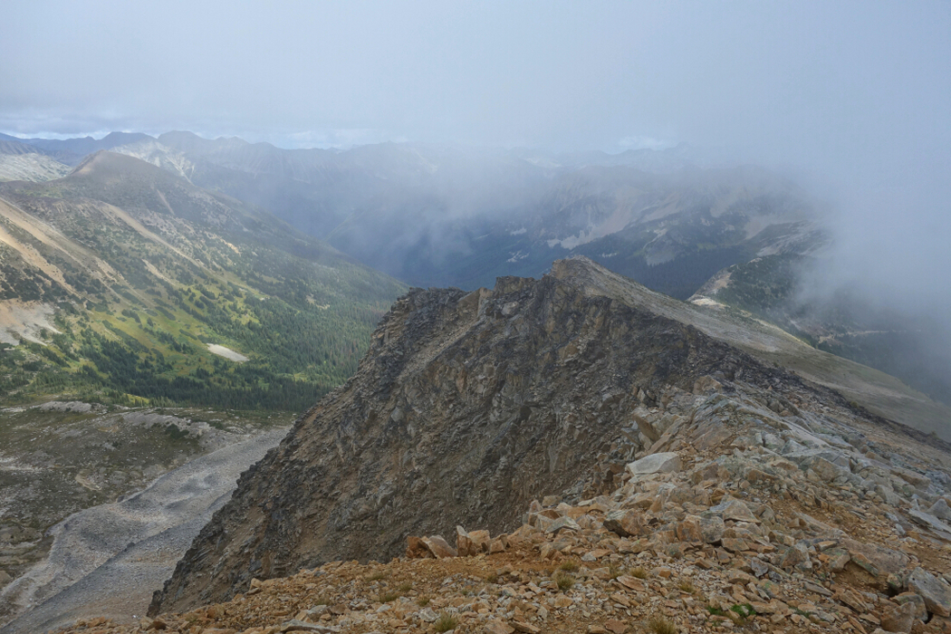
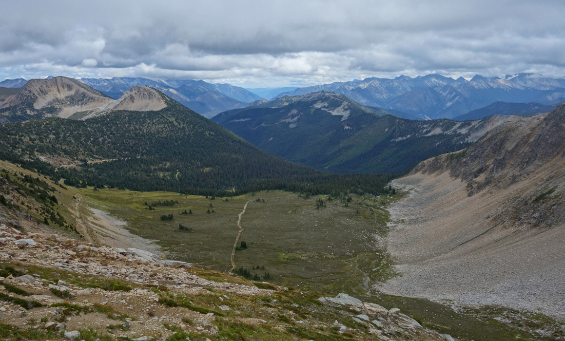
Hiking up the trail now in a light rain, I soon reached a camping area in a meadow near a lake. Everyone I encountered here was either packing up camp or just starting to hike back down apparently after having endured a day and night of continuous rain. Hmm...what was I getting myself into? Unable to make sense of the route description in SSWBC at this point, I instead just followed the trail as it contoured along the lake and continued up into the cirque cradled between Mount Schroeder and Linus Mountain. The trail eventually petered-out at a large heather bench at which point the large rounded Southeast Face of Statimcets first came into view across a wide basin at right. The rain had stopped by now with intermittent breaks in the clouds revealing a good dusting of fresh snow on Statimcets' upper flanks. I turned right, walking along the bench aiming for a prominent crooked thumb of a peak protruding from Linus' Northeast Ridge. With the "thumb" now close to my left, I followed the path of least resistance up a series of heather steps to eventually reach a tundra flat of sorts with a tarn in the middle. I turned up here and two-steps-forward-one-step-back my way up loose, steep choss on the SE Face. Through a small band of cliffs then an upward traverse to eventually intersect the trail coming up the East Ridge. From there it was just an easy hike to the summit rocks.
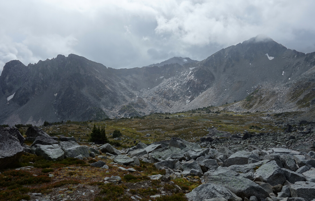
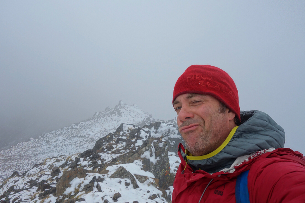
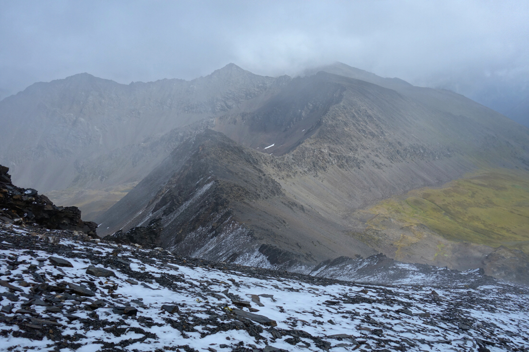
Whiteout and the occasional blizzard guaranteed no views, despite my hopeful waiting around to at least get a glimpse of what lay on the opposite side of the mountain. Naturally, by the time I returned to the heather bench the clouds parted once again to reveal a snow dusted Statimcets cast against a deep blue sky. Grr! In better conditions there's lots of extra-curricular peak bagging to be had out here: Statimcets-Linus-Schroeder Traverse or Soprano Peak for instance. Nearby Mount Seton is the highest in the Cayoosh Range and seems like a reasonably interesting objective as well. Something to keep in mind for the next Downton Creek adventure, assuming the bridges hold out!
Oh joy, another weekend of marginal weather in August. Agata at least had the good sense to schedule her annual trip visiting friends in Wenatchee, WA for this time, rain shadow and all. Hoping to discover a rain shadow of my own here in the South Coast, I gambled with the forecast and set my sights on a couple mildly interesting objectives off the Duffey Lake Road. Specifically, I was curious what all the fuss about Blowdown Pass was, having read reports of folks driving 4x4s up there, doing short afternoon scrambles on nearby peaks and generally enjoying the mountains without too much of an agenda. Similar to Harts Pass Road near Mazama in the WA Cascades, Blowdown is one of the highest driveable passes in these parts and offers quick and dirty access to a collection of peaks of which Gott and its slightly lower neighbor Gotcha are probably the most visited. Both are really just hikes starting from either side of the pass, but the area was new to me and seemed like a reasonable objective considering the weather. In other words, I wasn't going to be too upset if all I saw up top was the inside of a milk bowl.
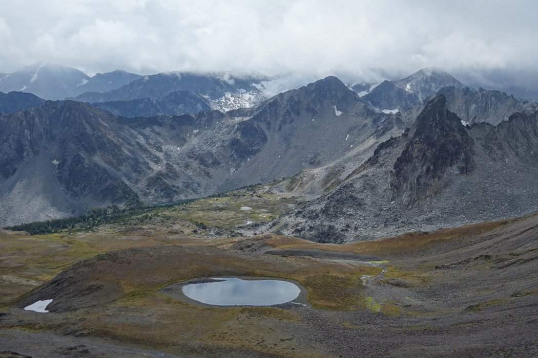
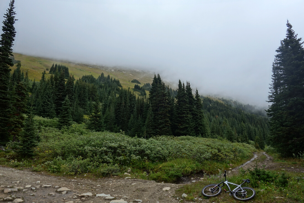
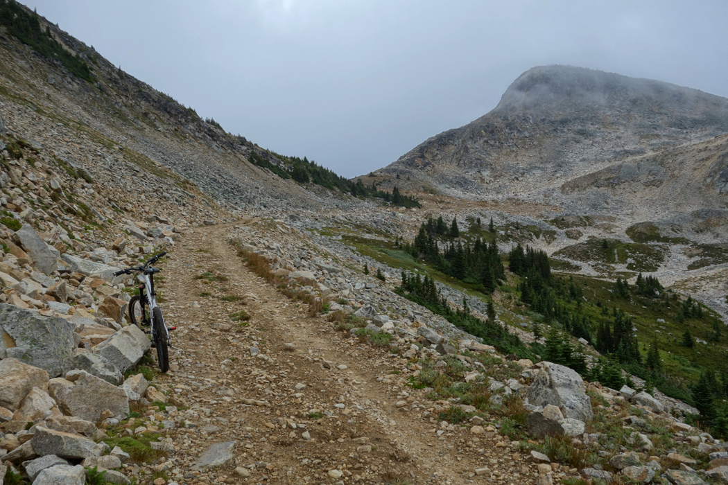
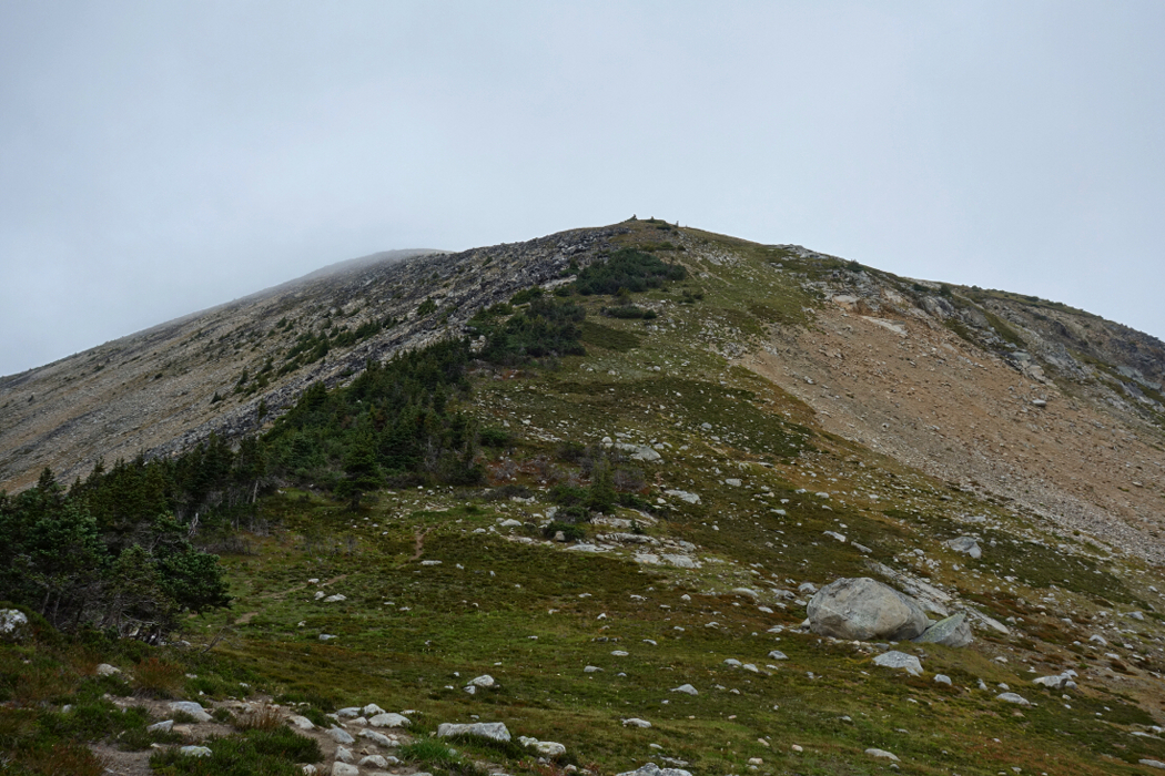
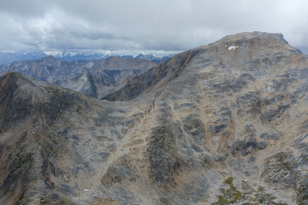
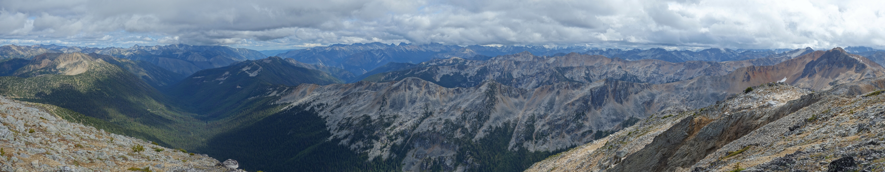
In the interest of preserving the paint on the freshly detailed truck, I parked on the side of Blowdown Creek FSR directly opposite the spur road leading to Blowdown Pass and biked up. I stashed the bike in some trees at the pass, and waited around hoping the low clouds would lift. The stunted trees didn't offer much respite from the cold west wind and so I didn't linger for long before heading up into the murk, starting with Gott first. A climber's path leads up the grass slope from the pass and more or less goes over a false summit before continuing along the now more defined ridge to Gott proper. Visibility was practically nil when I got there but gradually improved over the course of the day, especially after I departed from the summit. Figures! Interestingly, Gott is really just a sub summit of Moomin Peak a good ~2 miles and countless ups and downs further along the ridge. Whatever, not on the agenda for this day.
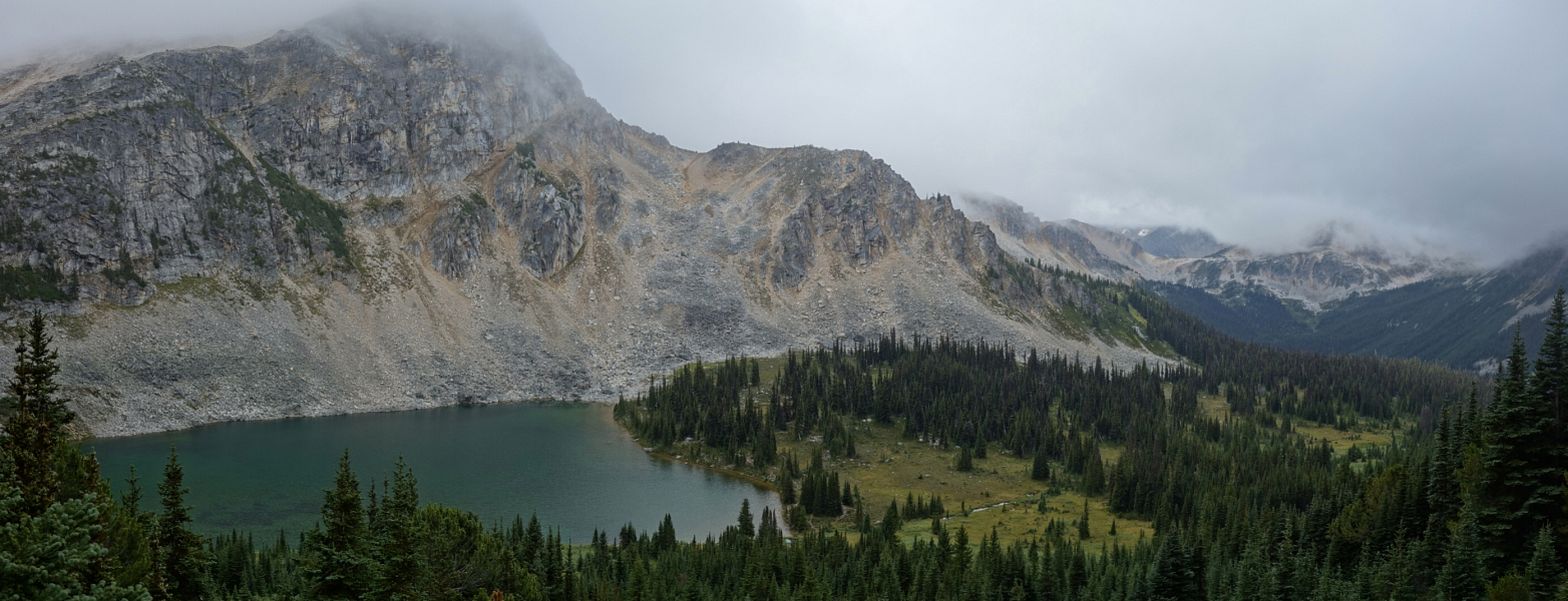
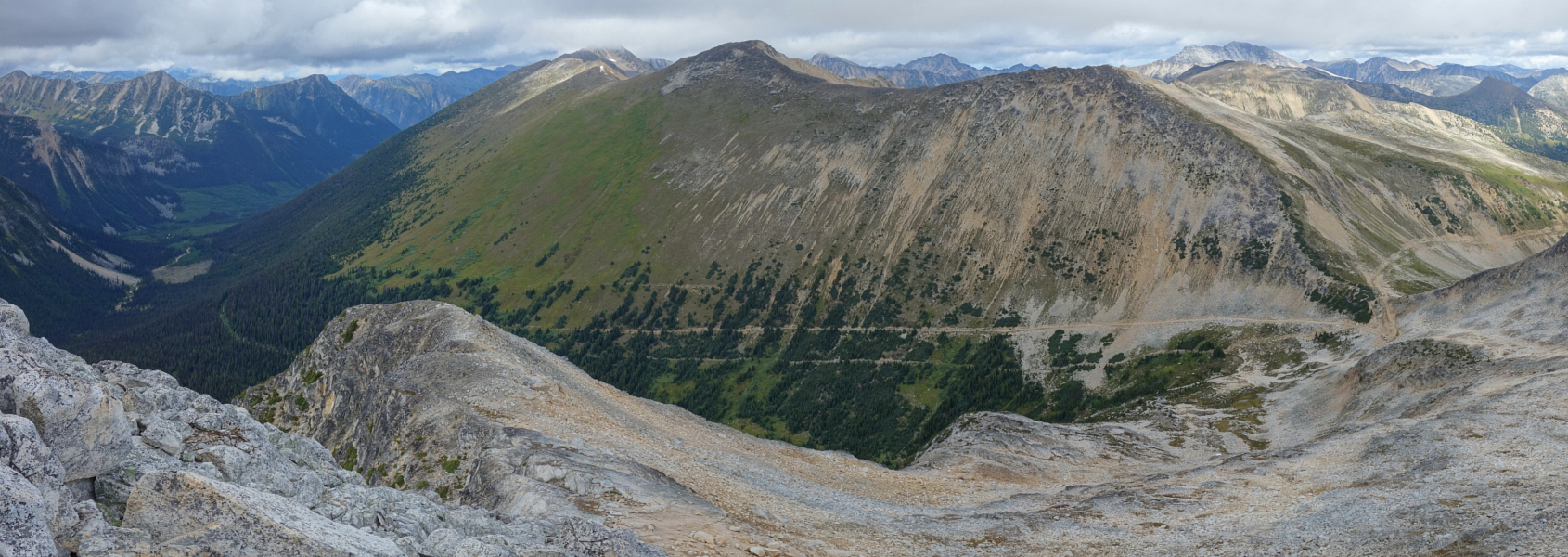
The clouds had lifted by the time I returned to the false summit, revealing a range of distant and mostly unfamiliar peaks and glaciers in the remote Stein Valley area. Southwest BC's tallest mountain, Skihist Mountain, is located here and it was an unexpected surprise to finally lay eyes on it. It is reportedly a royal pain to get to and sees very few ascents, if any, on a given year. The peaks here boast SW BC's eastern-most glaciers, which given their size is remarkable considering the source of all that snow and ice, the Pacific, is some 250 miles to the west! Back at the pass, I walked down the road a short distance before starting up Gotcha. Upon reaching a saddle at left, I turned up and followed a wide talus crest up through a bit of a headwall to reach lower angled terrain of Gotcha's broad summit area. More good views towards Stein Valley and beyond, across towards Gott Peak and down Blowdown Creek Valley from where I started earlier that day. Apart from the jeep that drove up to the pass while I was ascending Gotcha, it was just me up to this point. But that was soon to change considering the countless parties plodding up the road with overnight gear as I was riding back down.
The "freedom camping" spot off of the highway where I had spent the previous rainy night was unfortunately already occupied by the time I got there, but this ended up being a good thing. I located a better site adjacent to the river and bathed in the afternoon sun; a perfect spot to dry out the tent. It was also close to the Downton Creek FSR turnoff, which I'd be using for the following day's misadventures in the clouds, rain and snow!
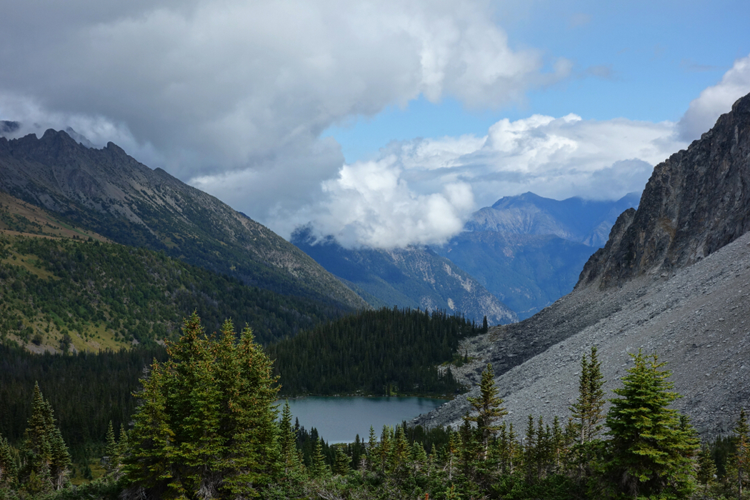
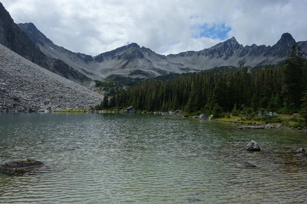
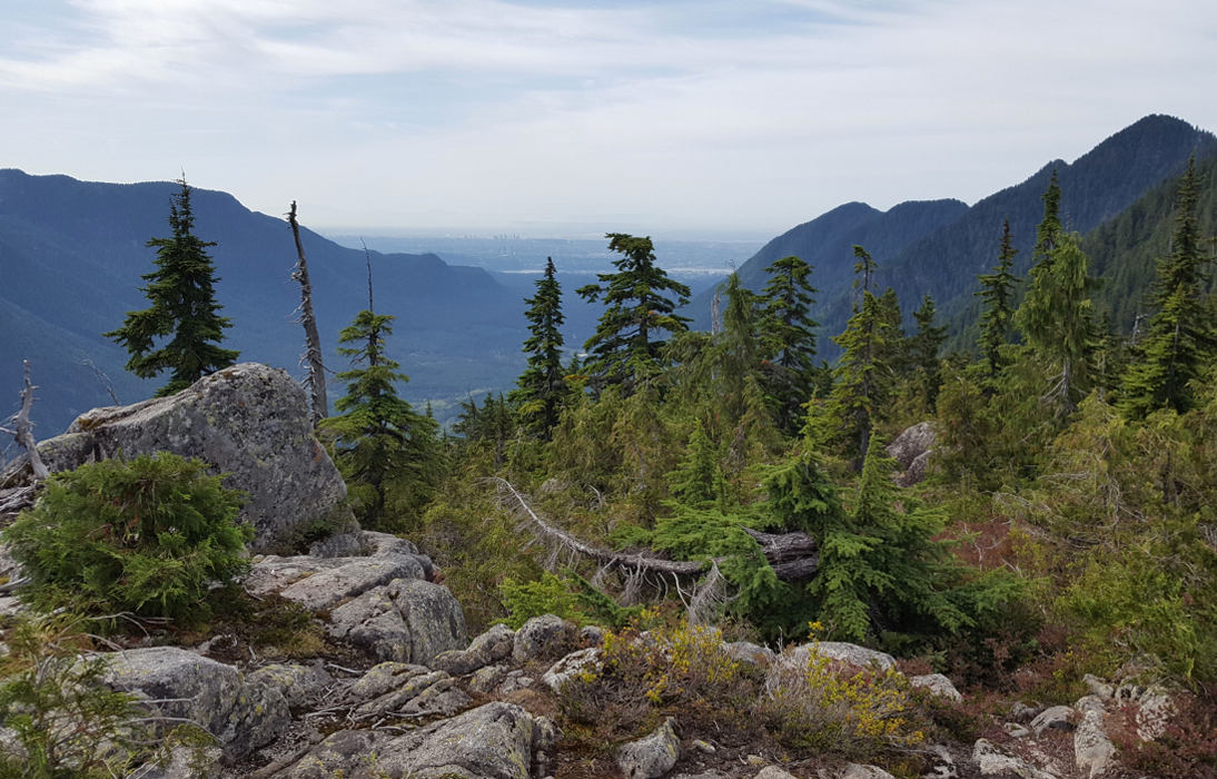
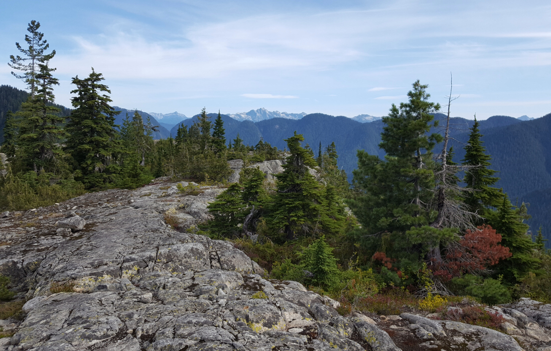
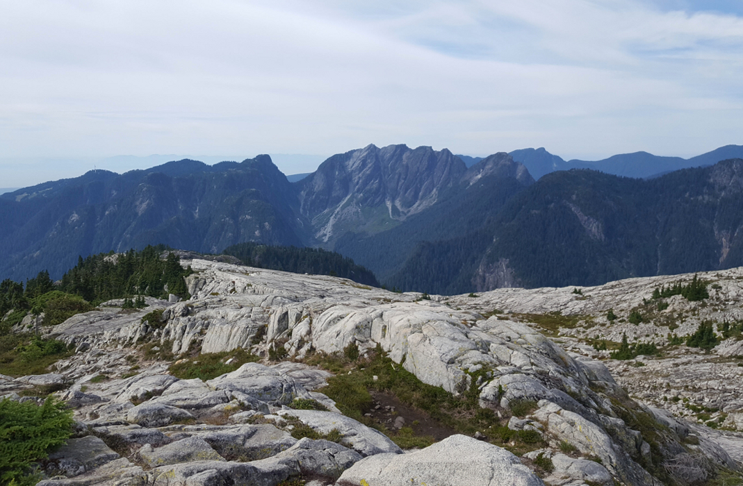
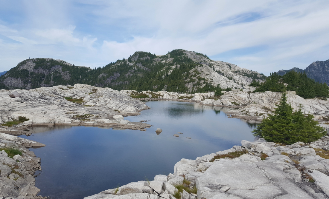
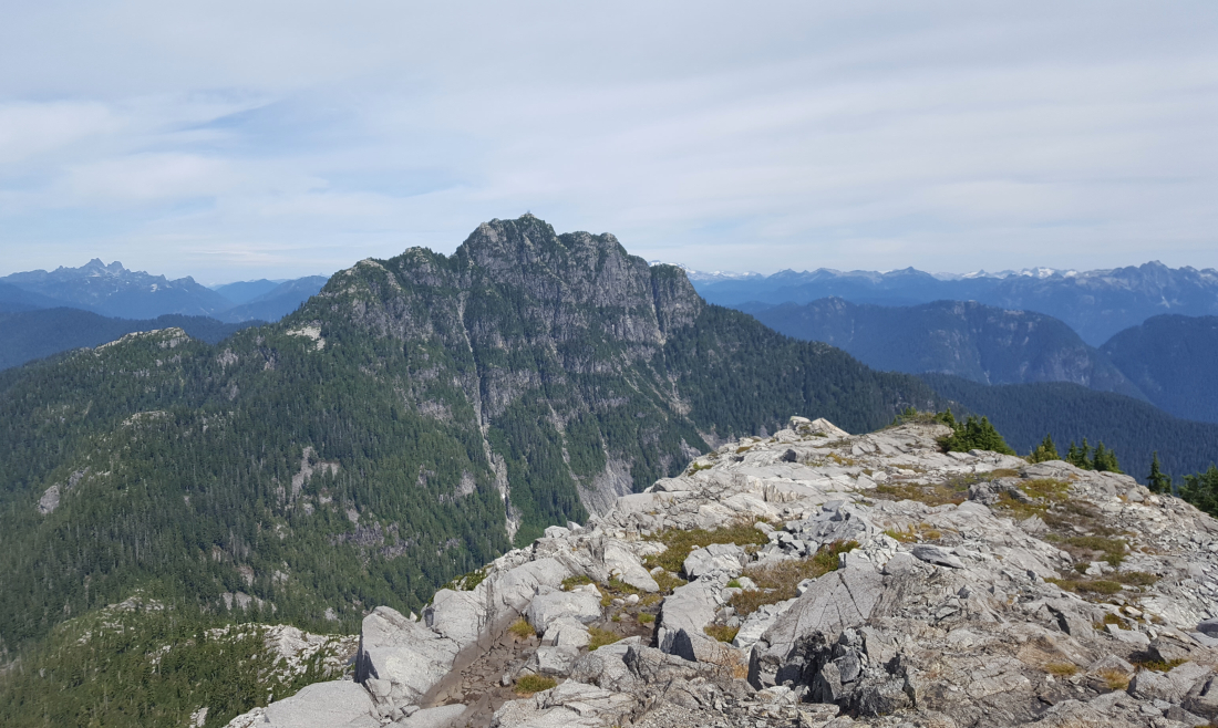
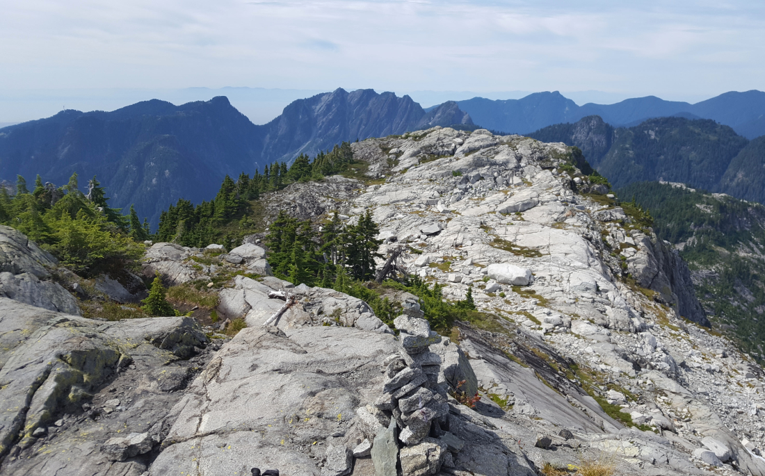
Mount Burwell is the tallest of the North Shore peaks described in SSWBC, not including those in the Howe Sound corridor, and amounts to low-hanging-fruit for many Vancouver-based peak baggers. Located on the divide between Lynn Creek to the west and Seymour River to the east, Burwell is easily visible from various spots in Vancouver's Lower Eastside, the Burnaby area or when driving across the Ironworkers Bridge. Closer in, nearby Mount Seymour, Crown Mountain and Goat Mountain offer differing perspectives on the peak. Similar to Seymour, the area is characterised by extensive exposed granitic bedrock that extends between Burwell and it's sub summit Coliseum. For me this was one of the main attractions for visiting the peak.
I've previously hiked up to Paton's Lookout (aka Seymour Valley Lookout), utilizing the same approach via the Seymour Valley Trailway. As far as I'm concerned, ~5.5 miles by bike (one-way) on a paved trail certainly beats the alternate and longer Hanes Valley hiking approach. It's also hard to beat the 5 minute drive from my house! Were I to do it again, I'd forego the car and just bike to the trailhead. From the summit, there are good views overlooking the Lower Mainland to the south and the NS peaks in Burwell's immediate vicinity, not to mention the usual suspects farther out in the North Cascades and South Coast. The outing makes for a surprisingly full 8-hour day, considering it's just a "backyard" hike!
It would be very much appreciated if you please ask before copying and/or re-publishing content from any part of these pages. To do so, please click here to send a message via feedback form.


