Select from list below to jump to a specific area on this site.
| Latest Posts |
Thursday, February 25, 2021
Mount Currie - South Face, September 2020
With an impressive 7800+ feet of vertical relief over a scant 5.5 km, Mount Currie towers over the confluence of the Green and Lillooet Rivers where the Village of Pemberton is located. From the imposing North Face rising at the edge of town to the aesthetic glacier cirque at the headwaters of Gravell Creek, one's eyes will inevitably be drawn to gaze upon the peak when approaching Pemberton via three of it's four main arteries - Pemberton Meadows Road, Pemberton Portage Road and Duffey Lake Road. It's also a prominent mountain and easily identified from various spots both near and far, be it Rendezvous Lodge on Blackcomb Peak 20 km to the south as the crow flies, the significantly more distant Railroad Group to the northwest (Face Mountain, Locomotive Mountain) or the Joffre Group right across the valley to the northeast (Mount Matier, Mount Joffre, Slalok Mountain and Tszil). Basically, if you spend any amount of time hiking, biking, skiing or simply driving up and down the Sea-to-Sky Corridor, you've noticed Mount Currie.
Far from it being my first sighting, Currie got my attention in a big way back in January 2017 when I had the opportunity to enjoy a ripper day heli-boarding her glaciers and those of neighboring Hibachi Ridge. Since then, I hadn't really considered bagging the peak on foot, that is until I got wind of a "new" trail having been sponsored by Pemberton's tourism board in an apparent attempt to attract more tourist dollars. Granted, the trail had been in existence for about 6 years prior to my learning of it, but this was just the nudge I needed to make a go of it. But first I had to endure an epic 7-hour backup just south of Whistler thanks to a serious crash involving a totalled Gallardo and a couple other mangled vehicles. Finally reached my usual "freedom camping" spot off the highway overlooking the Green River at dusk, abandoning any hope of hiking in to camp as I had intended. A 7500-ft day trip it would have to be, I guess!
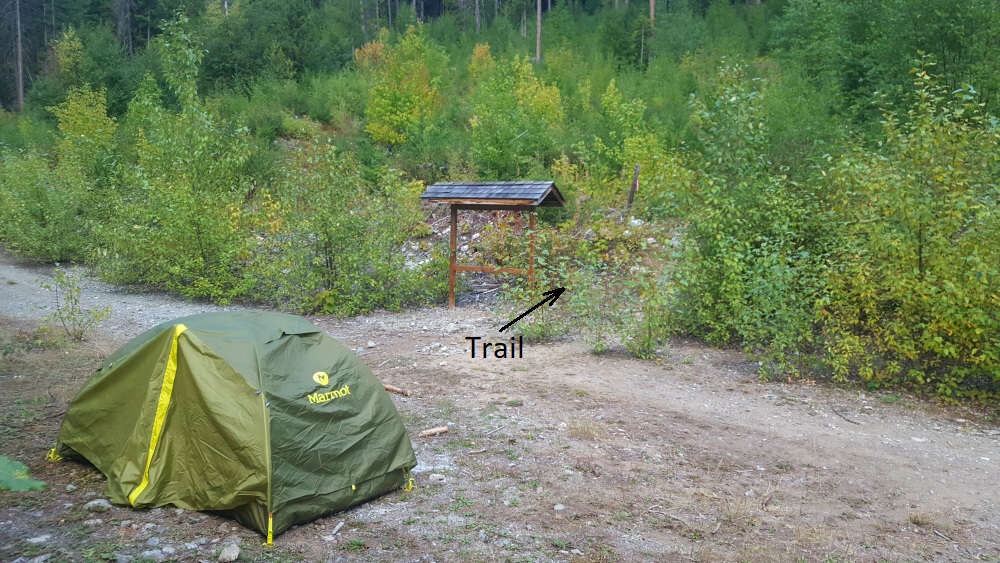
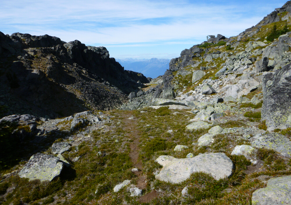
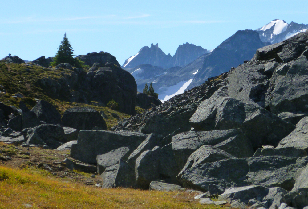
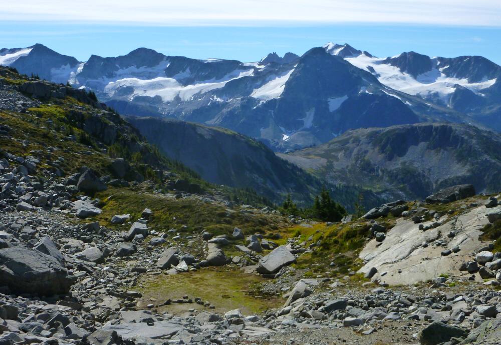
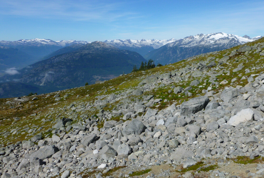
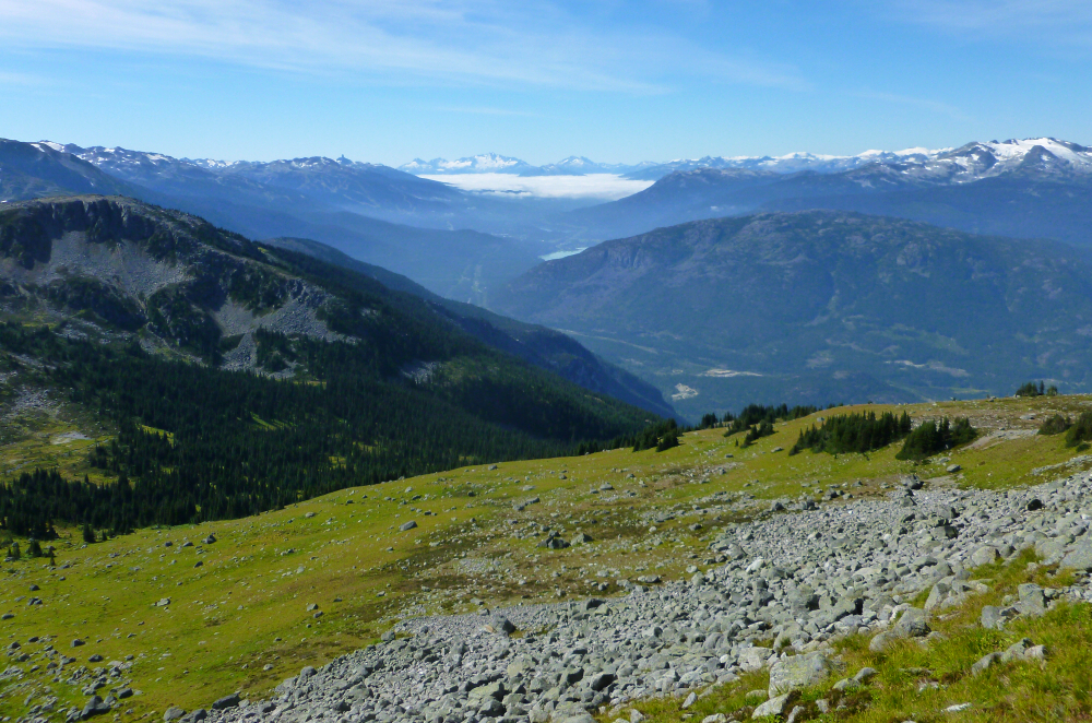
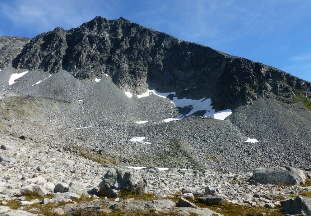
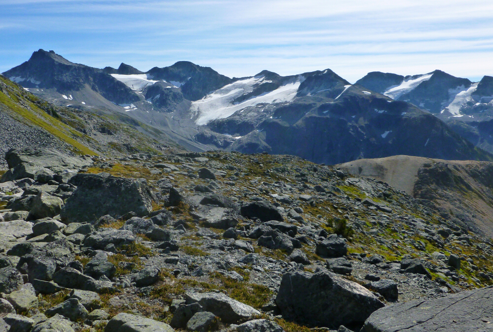
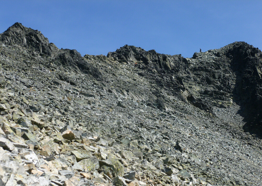
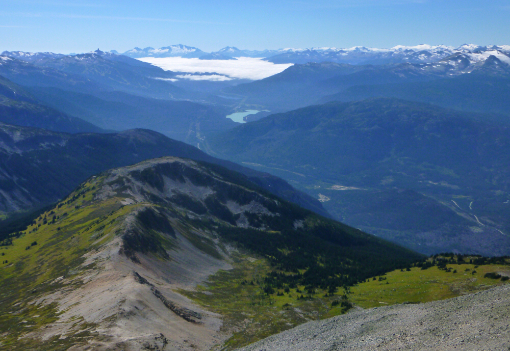
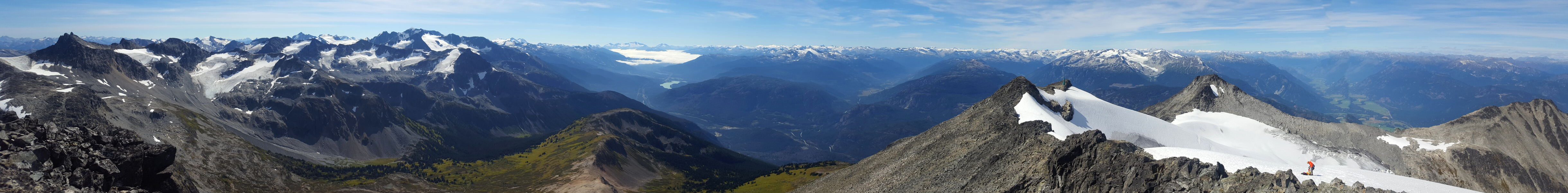
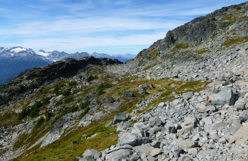
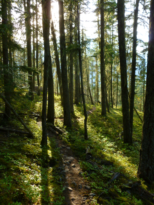
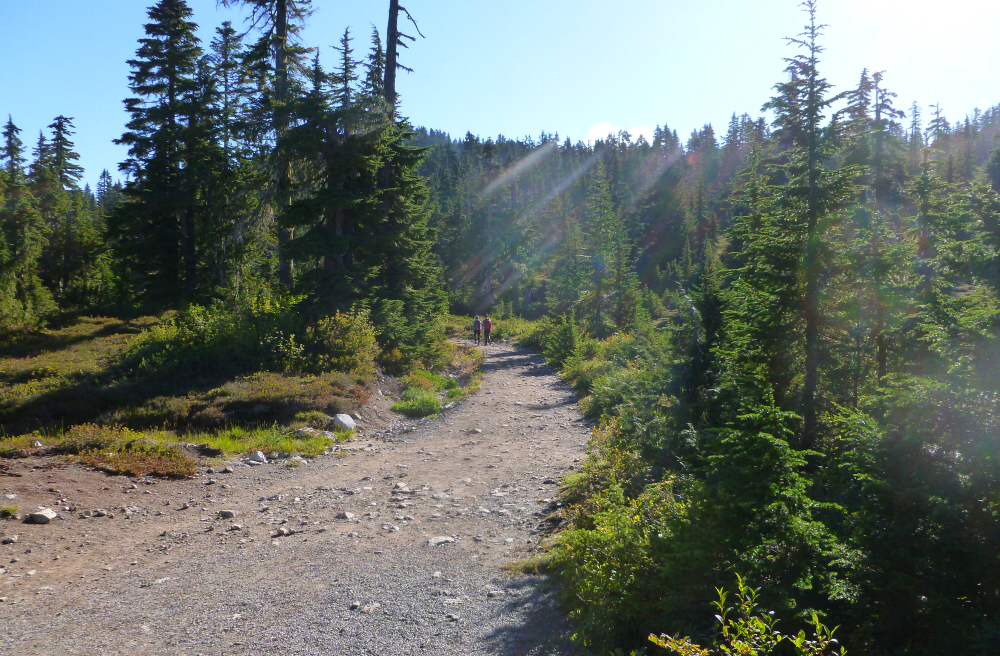
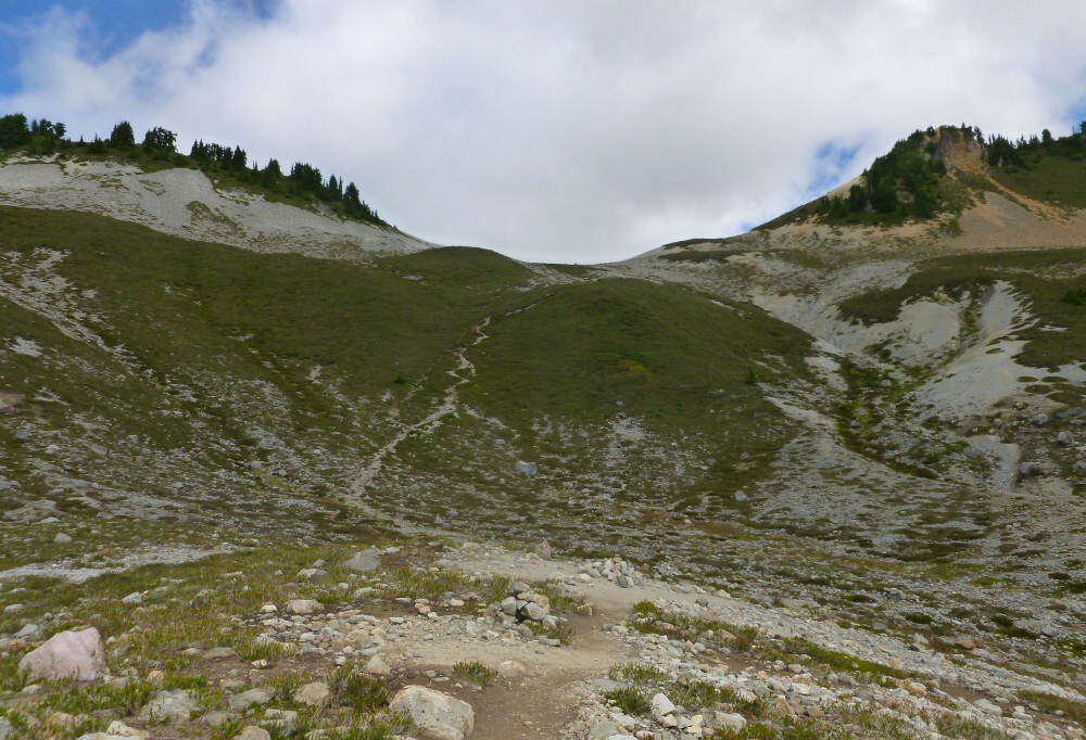
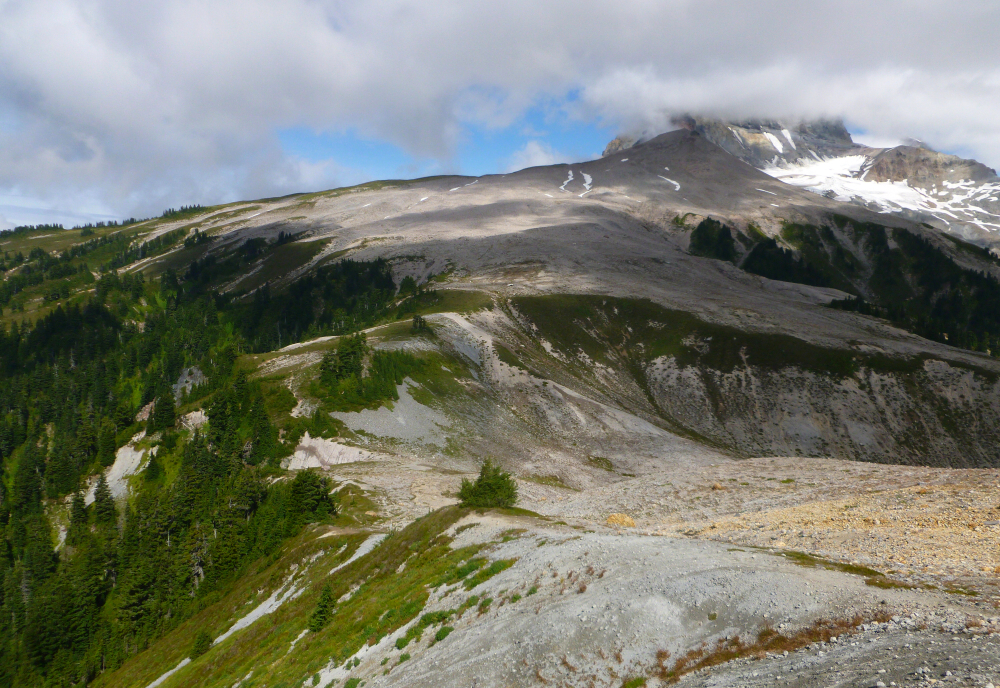
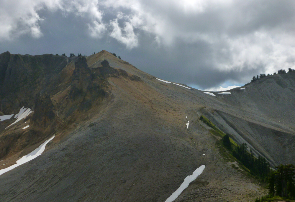
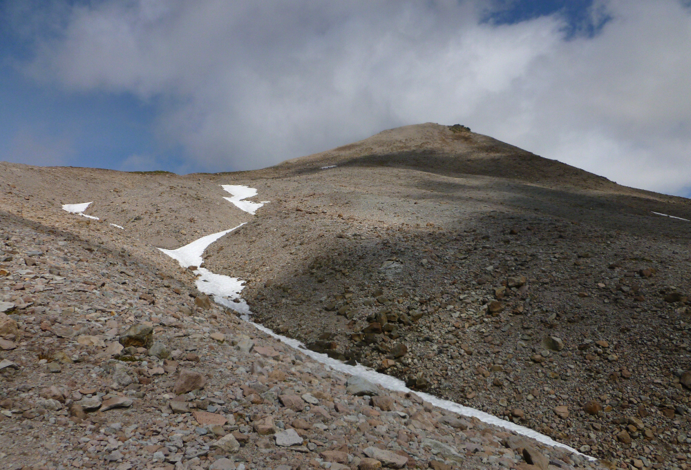
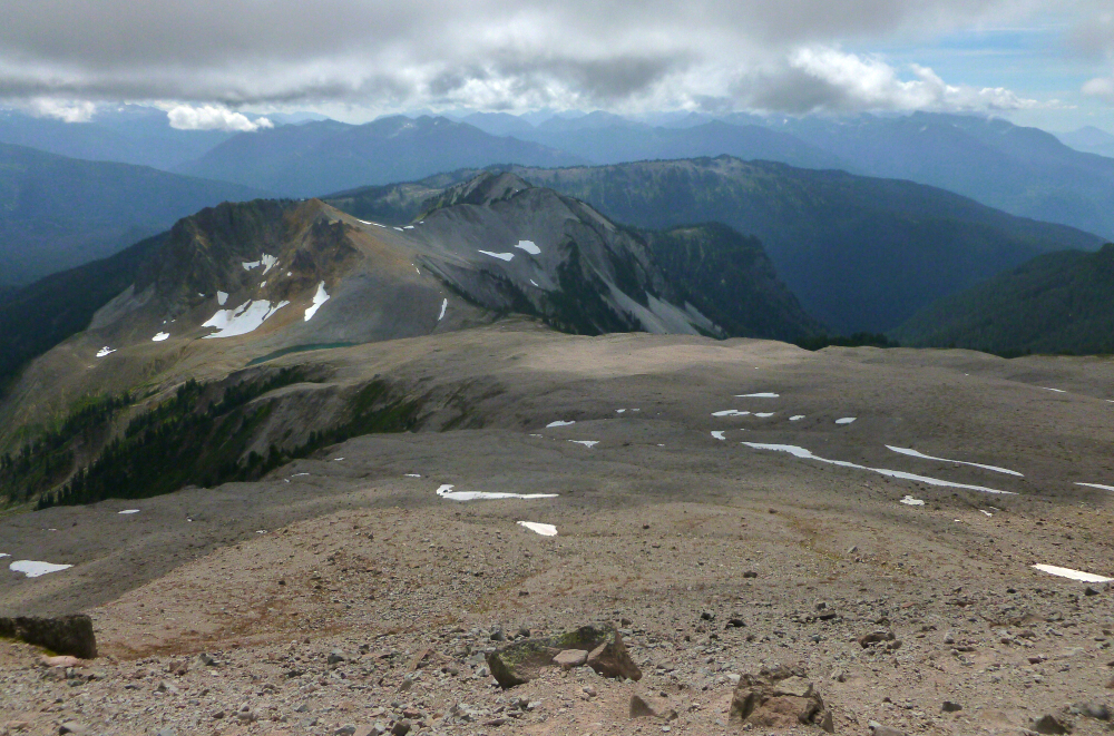
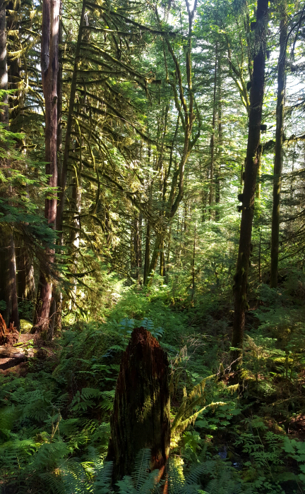
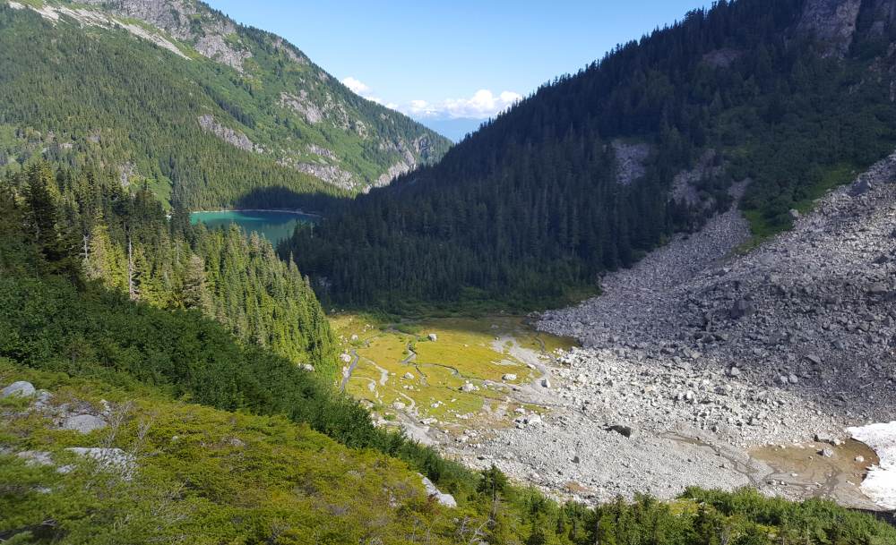
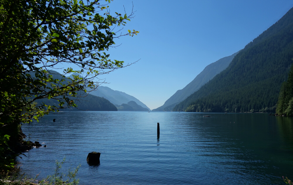
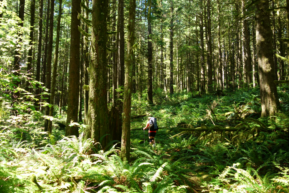
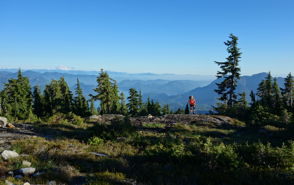
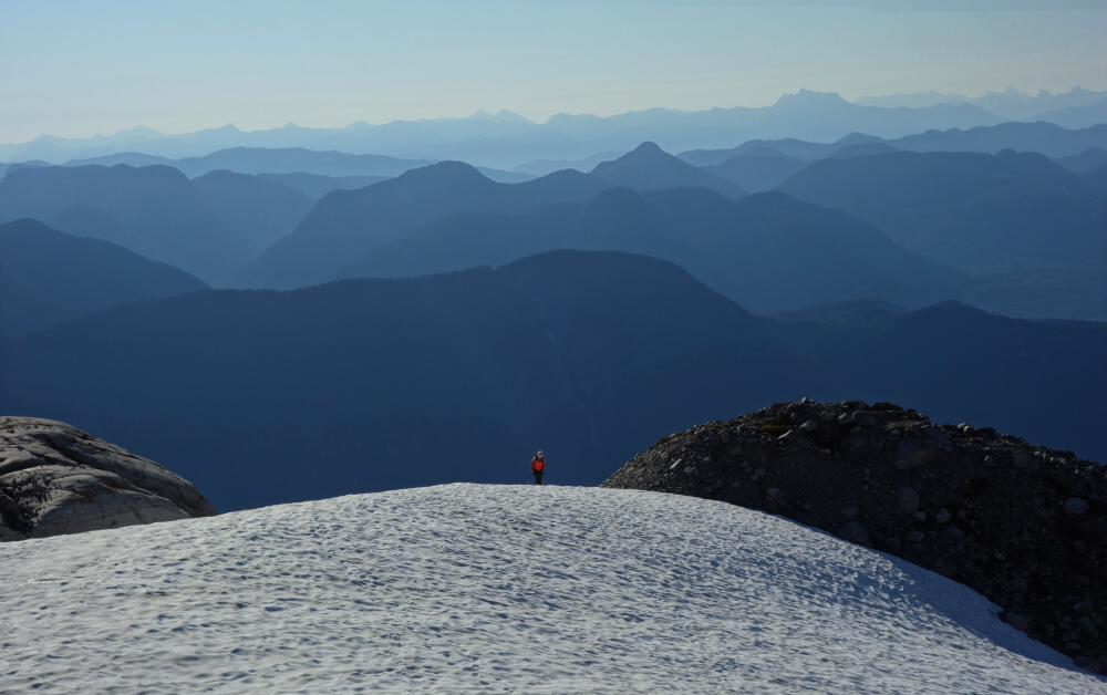
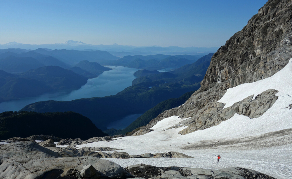
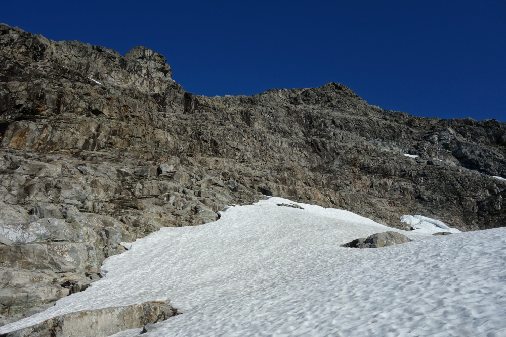
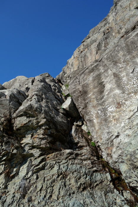
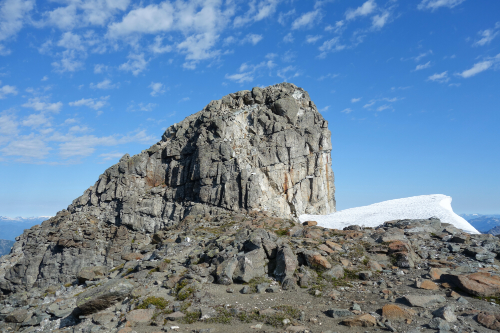
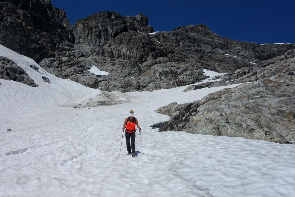
Got going at first light and finished the short drive over to the "trailhead". Chickened out and parked a kilometer or so shy of where I should have and then walked another kilometer more from there along what remains of the road to an abandoned trail kiosk. The trail starts here in earnest, initially climbing up through a cutblock before entering forest and making a long leftwards traverse above a lake. Surprisingly quick going on smooth tread up some 4000-ft, passing another smaller lake and fork (leads to a lookout) to reach an open heather-and-slabs camping area beneath the peak's West Summit. Following intermittent paths and the odd cairn here and there, I made my way up through a small canyon to reach a grassy bench now on the south side of the peak. Turning east, I traversed along the bench for a while before descending a bit to avoid the worst of the talus. The idea here is to aim for the toe of the large Southwest Spur that descends from the summit area, staying low to minimize side hilling on steep grass. Turned up the large talus apron at the base of the spur, following an exposed path up through a grassy gully system to finally reach an immense talus slope spanning the upper South Face. The grind up from there seemed to go on forever but made it to the ridge crest in good time, enjoying the final scramble to the top.
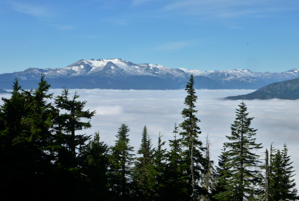
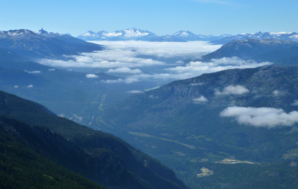
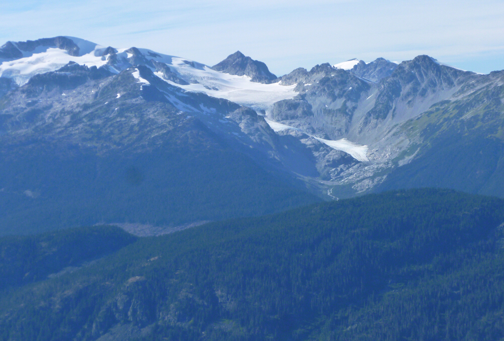
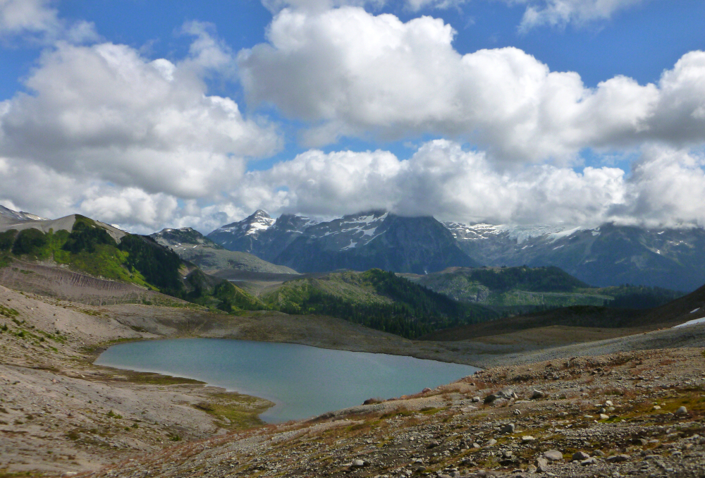
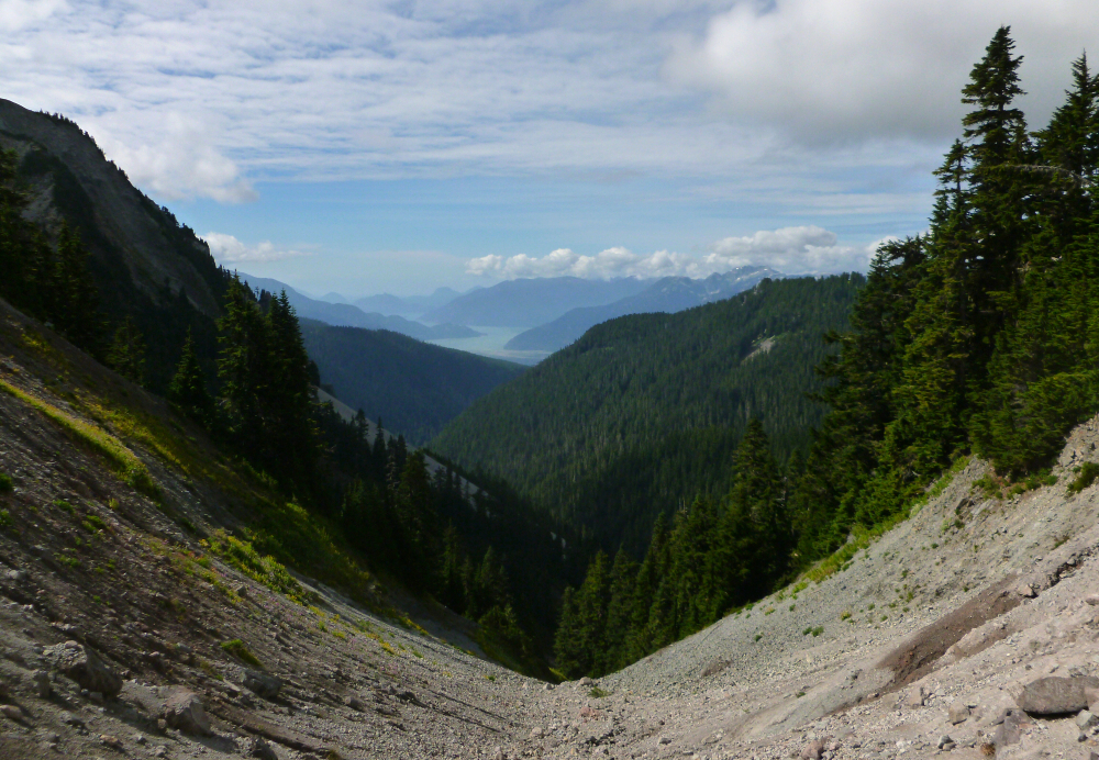
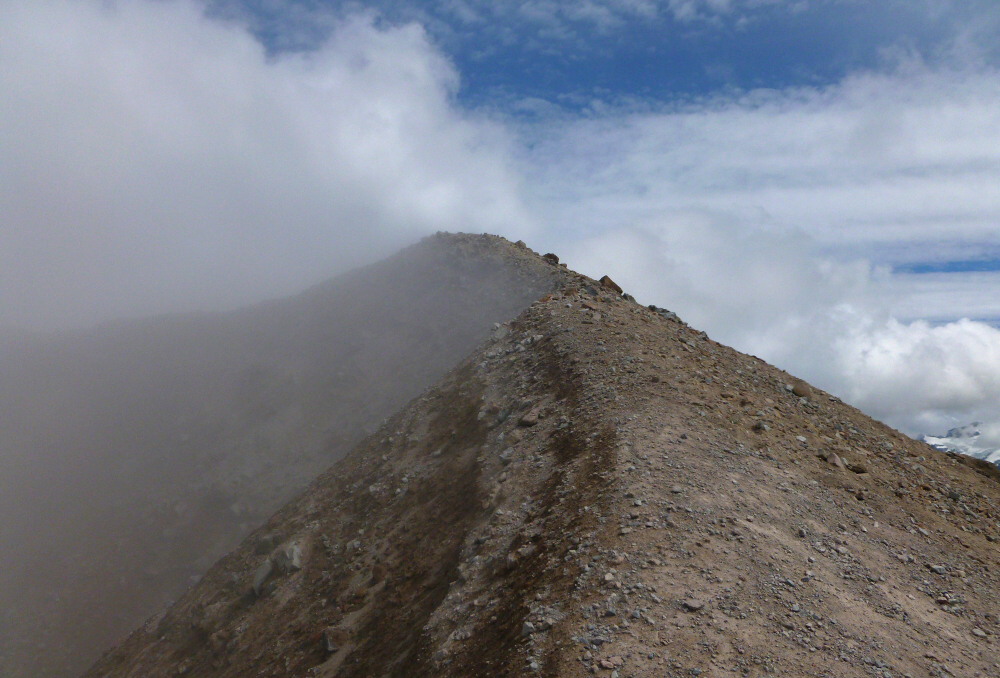
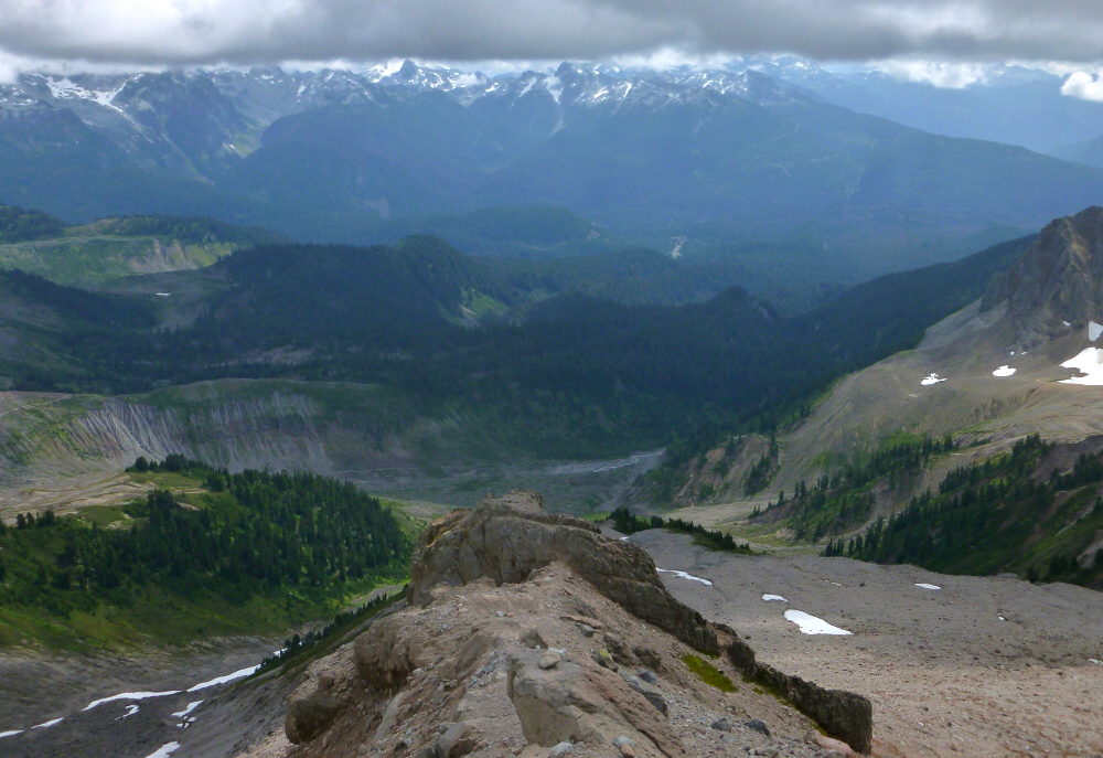
Morning clouds had mostly burned off by then, revealing phenomenal views looking down the Green/Cheakamus River Valley towards Squamish and Lillooet River Valley to Pemberton Meadows and beyond. Fantastic! Lotsa peeps out on the mountain this day, most of whom had started from the camp area that morning. Also, not sure if the winds ever turned favorable for the paraglider I briefly chatted with up there, but boy was I envious! Okay, enough stalling, time to go down...all 7500-ft of knee-knackering DOWN! Which, much to my surprise went far quicker and far less painful than I was expecting. Back at the kiosk in a very satisfactory ~10 hours round-trip, but dammit Sergio for not parking at the trailhead!
Diamond Head - South Route via Elfin Lakes, August 2020
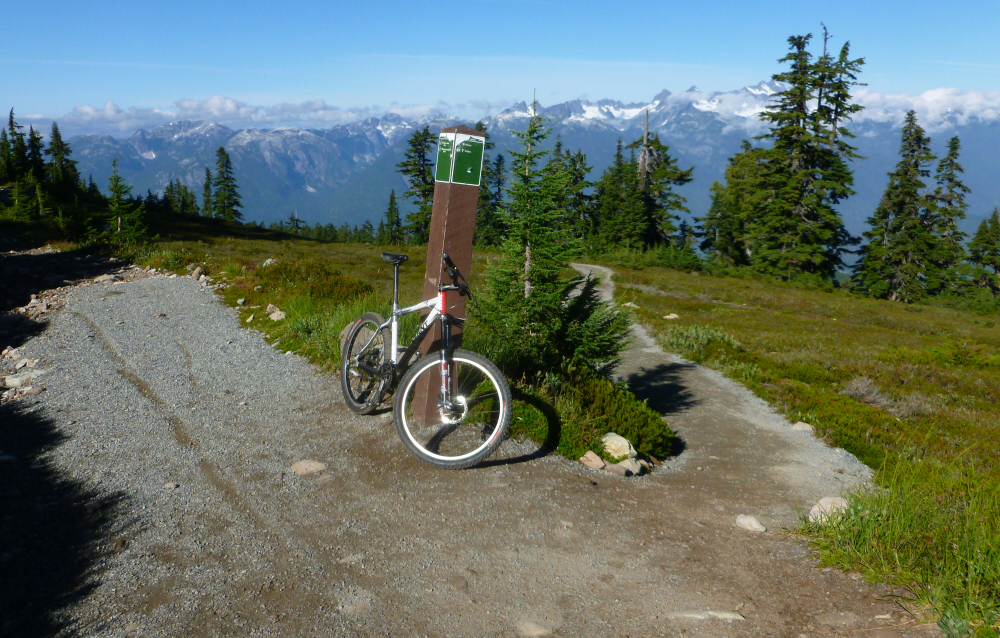
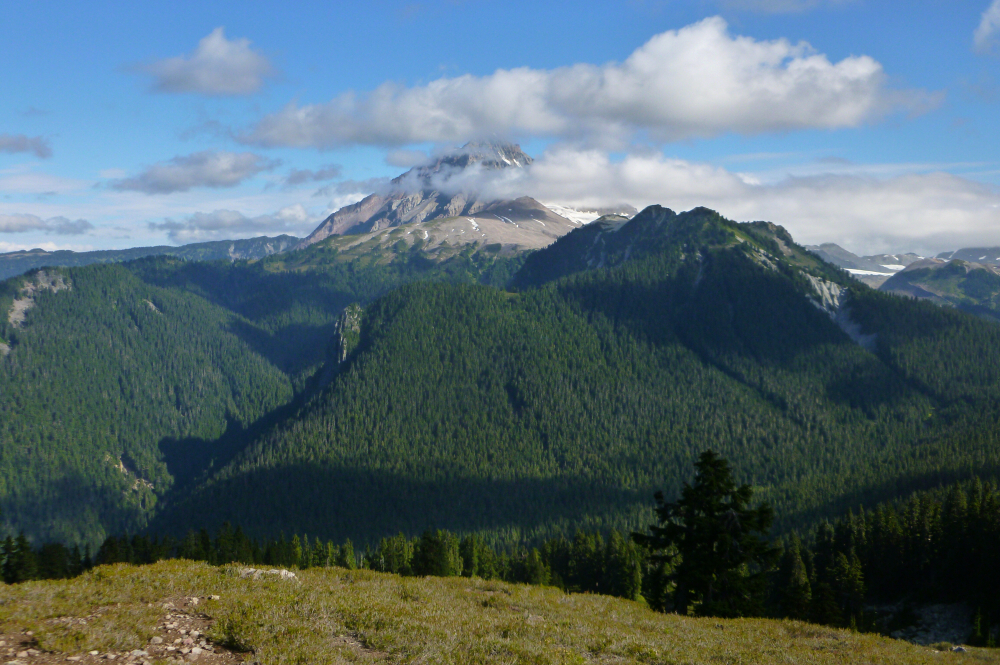
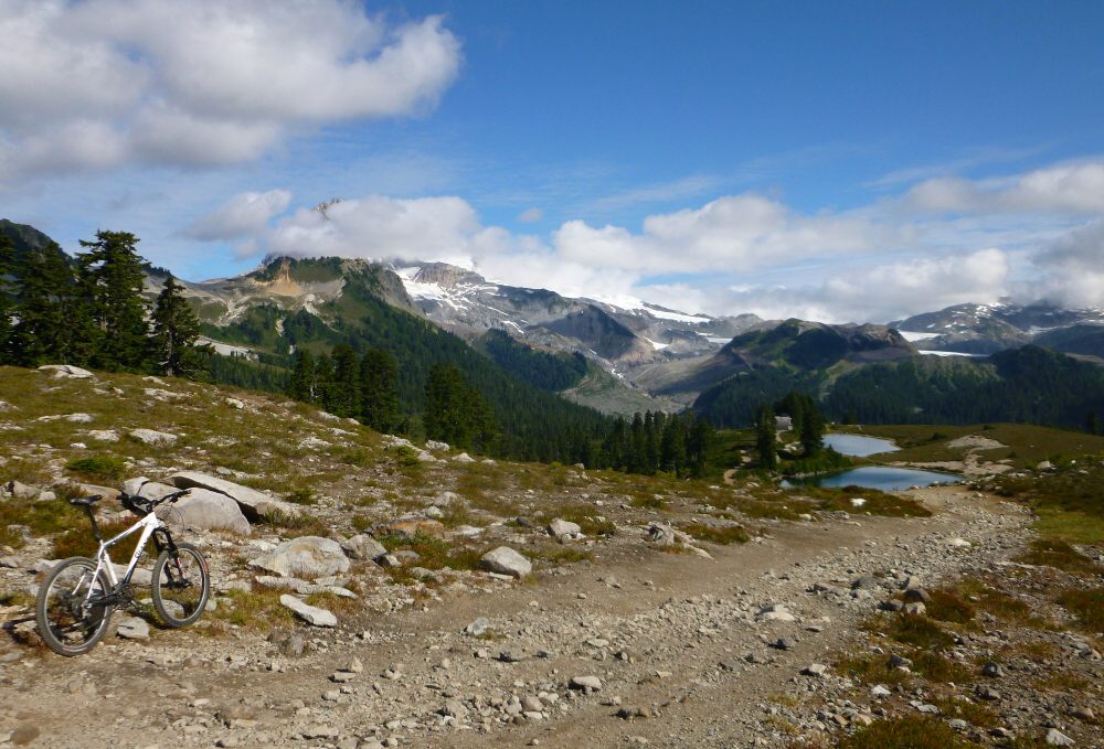
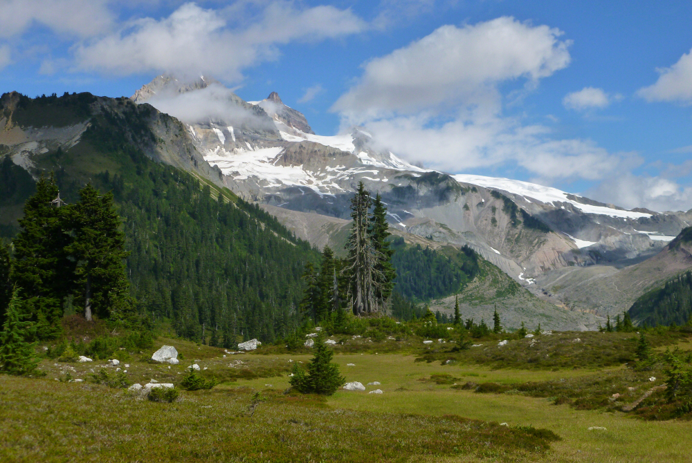
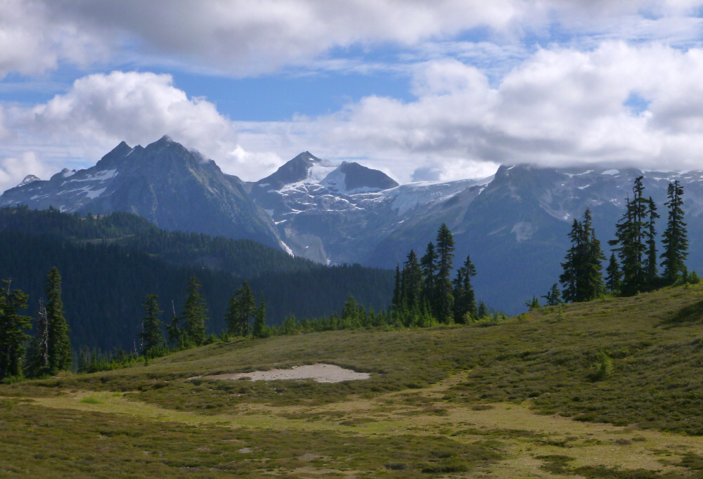
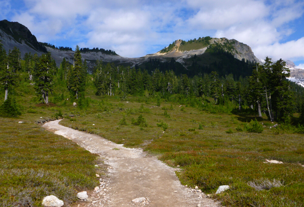
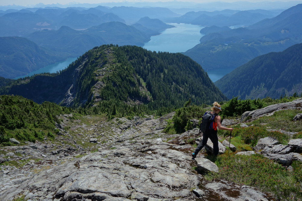
Not to be confused with the infamous volcanic tuff cone on the outskirts of Waikiki, this Diamond Head is a satellite of BC's iconic stratovolcano, Mount Garibaldi. Its position and composition remind me somewhat of Disappointment Peak adjacent to Glacier Peak in the North Cascades - a gently sloped pyramid of pumice and other igneous rocks beside a large, heavily glaciated volcano. But there the similarities end. Nobody seeks out Disappointment Peak other than a means by which to tag the real prize next door, whereas Diamond Head arguably makes for a worthy objective unto itself. This is in part because it benefits from easy access via a mostly bikeable trail making for a very reasonable day trip. For the ambitious, it offers a launching off point for those seeking the summit of Atwell Peak, the second tallest of Garibaldi's three summits. For everyone else, it is a destination that offers a unique perspective of the country on the south side of the Big G including the uber-popular Elfin Lakes area. Trail runners, mountain bikers, hikers and ski-tourers have enjoyed this corner of Garibaldi Provincial Park for generations. The time had come for me to add my name to the list.
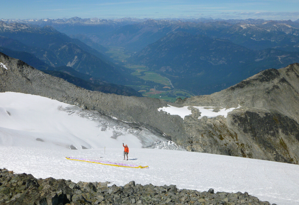
By far the crux of the outing was obtaining the recently implemented and universally hated day-use permit the morning of. I drove on up to the trailhead empty handed, hoping not to get turned back by Larry the Tool. Lo and behold, a very reasonable park ranger exercised discretion and allowed me to proceed! My faith in humanity restored, I hopped on my bike and cranked up the trail to Paul Ridge on what is a wide gravel road by any other name. A short descent saw me to Red Heather Hut near Elfin Lakes, whereupon I stashed my bike and continued on foot along the Mamquam Lake Trail to the junction with "Saddle Trail". This I followed to the Gargoyles-Columnar Peak Saddle then descended the opposite side to a pass of sorts before making the final ascent of Diamond Head's rubbly south slope. Enjoyed great views ranging from the Garibaldi Neve to the cascading glaciers of Mamquam massif and the silty water of Howe Sound some 21 kilometers to the southwest. Clouds had been gradually building all day with a forecast for precipitation late that afternoon or evening. I started back down after about 30 minutes up top and abandoned my plans for bagging The Gargoyles and Columnar Peak on the way as it looked like rain was coming sooner than I expected. Encountered the first drops upon my return to Paul Ridge with steady showers by the time I reached the parking lot shortly thereafter. Timed this one exactly right! Lovely scenery, easy access, and spit sizzling brake rotors to wrap things up attest to an enjoyable "biathlon" kind of day!
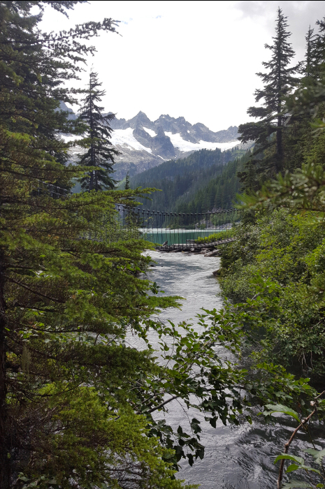
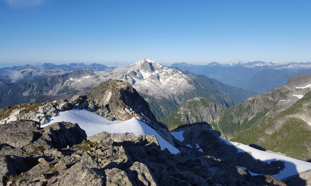
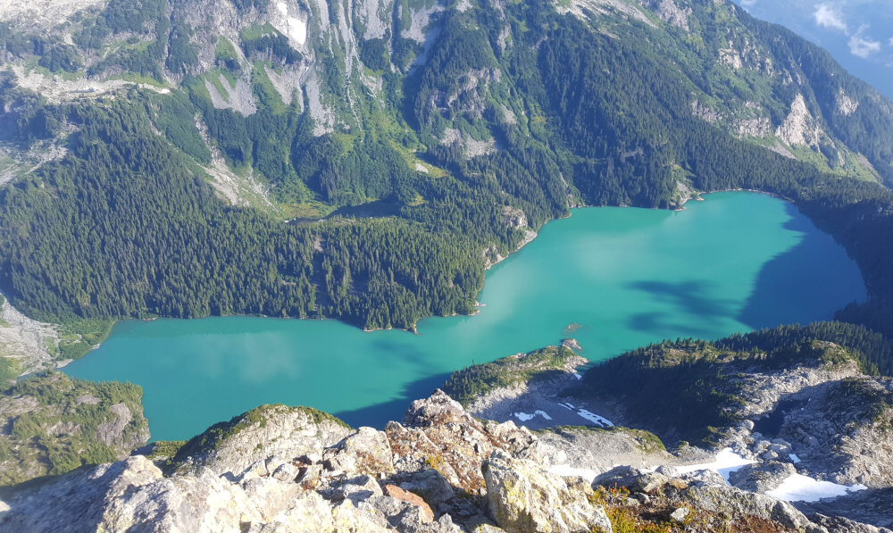
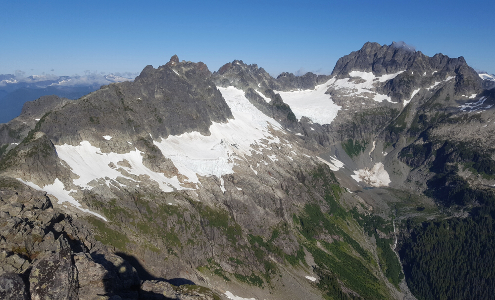
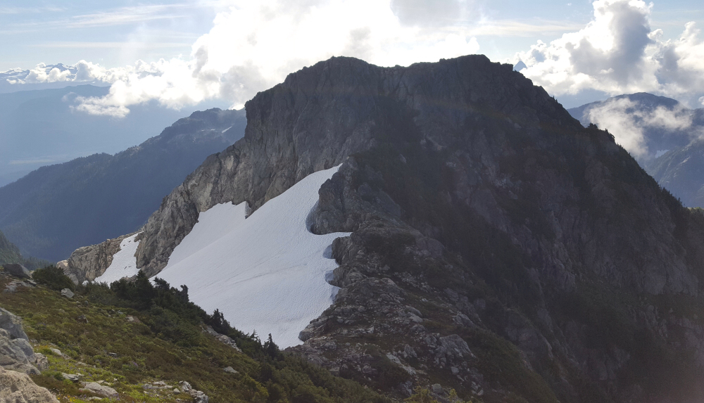
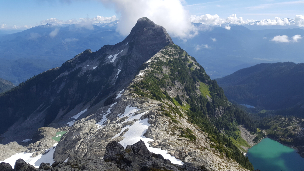
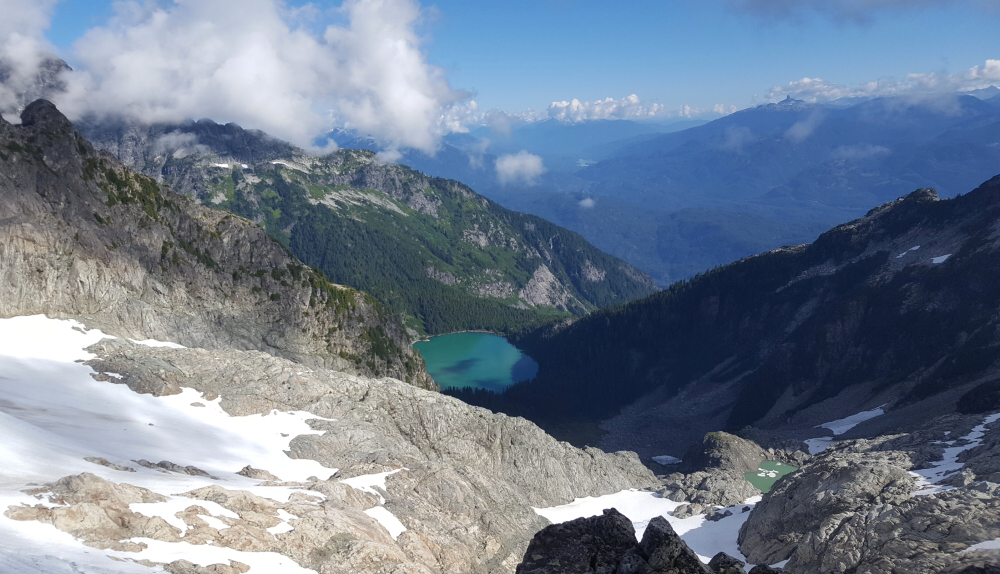
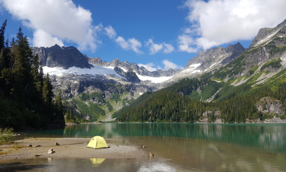
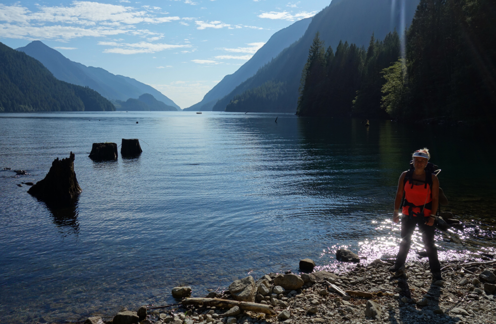
A gem of the South Coast, Lake Lovely Water lies at the southern end of the Tantalus Range and makes for a great base for bagging peaks such as Alpha, Omega, Pelops, and Niobe, just to name a few. Having previously flown over the lake on return from adventures elsewhere in the range, most recently this past August after climbing Mount Tantalus, I've long had it in the back of my mind to visit this area. As with some other local mountain destinations, thanks in large part to the scourge of social media, LLW has unfortunately suffered from a popularity explosion in recent times. Not sure what it is exactly, the otherwise lovely Tantalus Hut situated at the east end of the lake or convenient float plane access from downtown Vancouver; either way everyone seems to have a weekend of 'glamping' here on their bucket list. But enough about the conformity of the insta-herd.
I arranged for a canoe shuttle across the Squamish River and pick up the following afternoon at 4 pm. With my sight set on Niobe (incl. Iota and Pelops), I had to hustle to make it back in time for my return shuttle and ended up with a mere 15 minutes to spare. But I'm getting ahead of myself. The hike up to LLW from the east bank of the Squamish is a beautiful albeit steep affair with rushing creeks and countless waterfalls to distract from the 3800+ vertical feet plus overnight pack required to reach the lake. I planned on pitching a tent at the now infamously overused Sandpit Camp, and so passed the hut and adjacent camping area after a quick look-see and continued along the southeast side of the lake for another 30 minutes or so before reaching my home for the night. To my pleasant surprise, a rather large group was packing up and preparing to leave when I arrived, though it wasn't immediately obvious how they were planning on hauling their various coolers back down the trail. No sooner did I recognize a bartender from one of the local breweries that I frequent, than a floatplane suddenly appeared above the lake, landed, and taxied over to the beach where the mob was congregating. I've taken a floatplane a few times to and from the dock at Stehekin and Chelan in my day, but this was something else entirely and to be honest pretty darn cool to see. Nevertheless, I was relieved to see only a couple parties and their tents remaining after the plane and its passengers departed, and enjoyed a peaceful afternoon and evening before turning in.
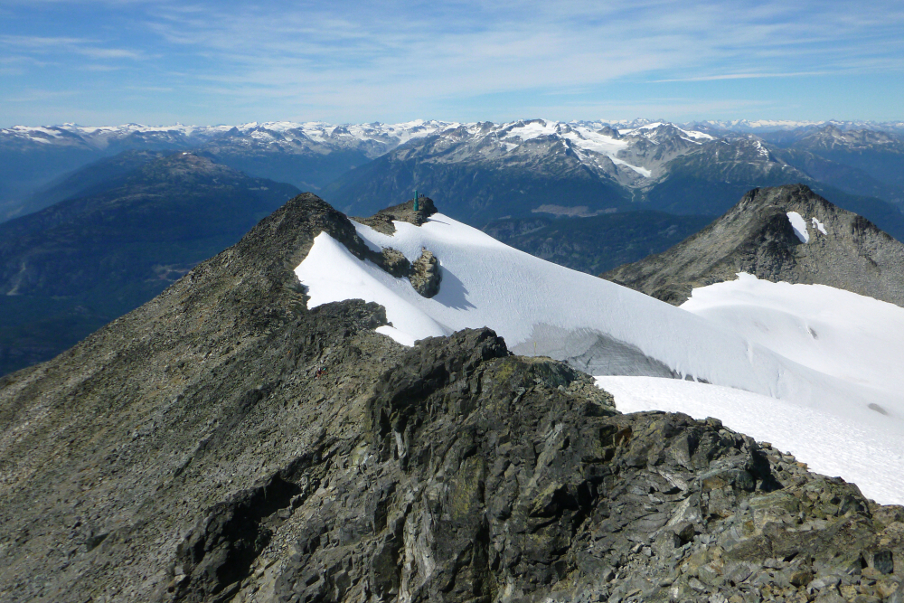
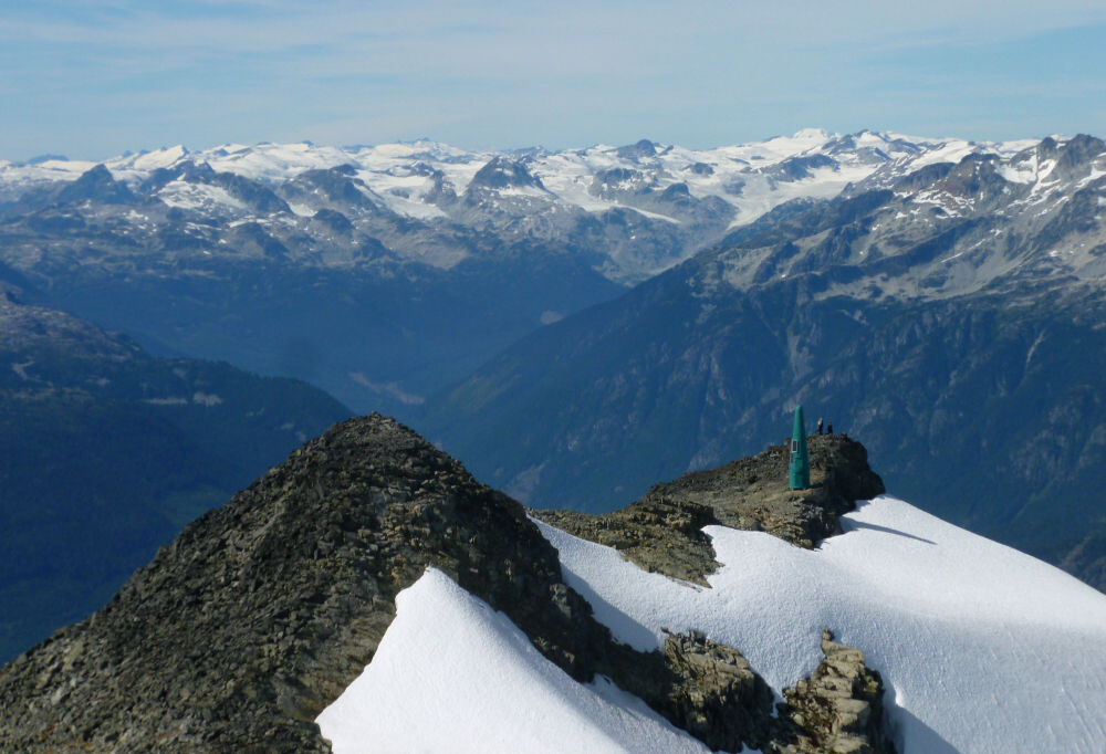
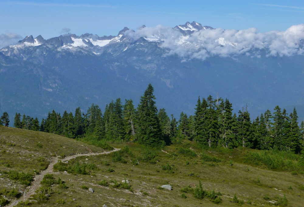
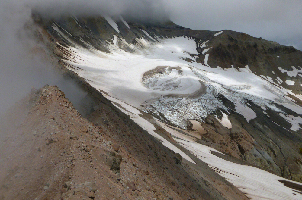
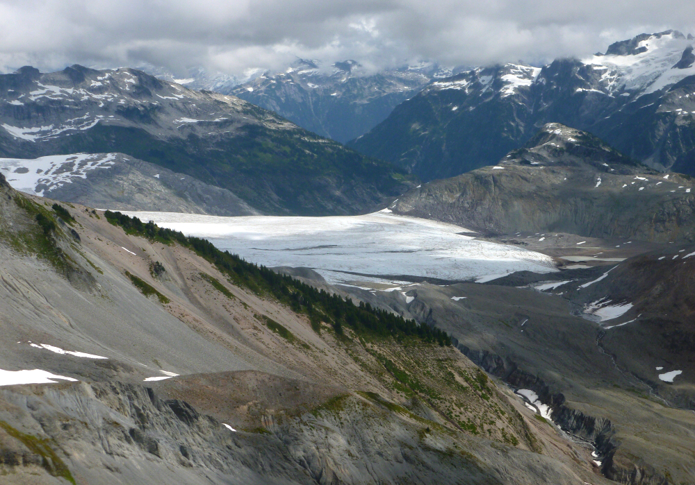
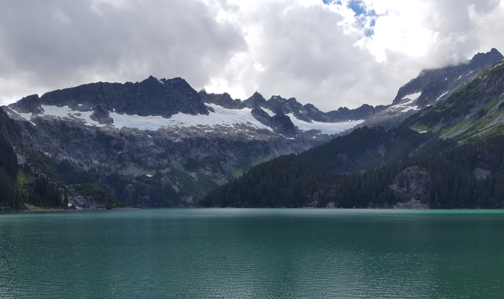
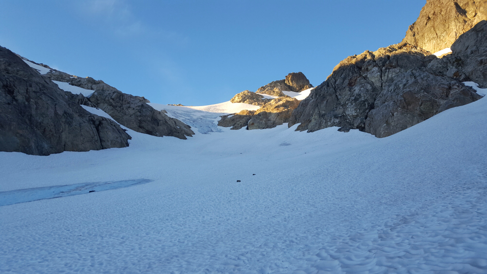
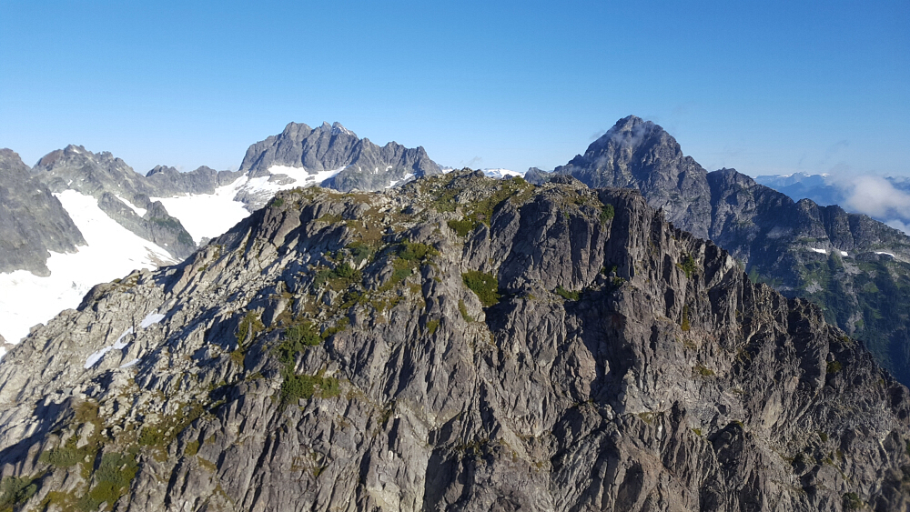
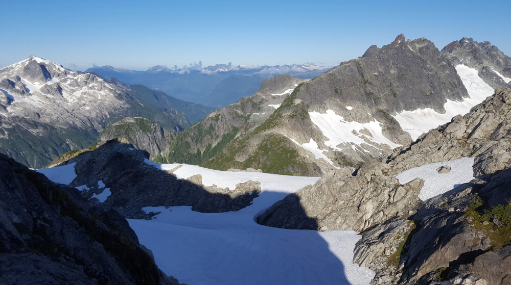
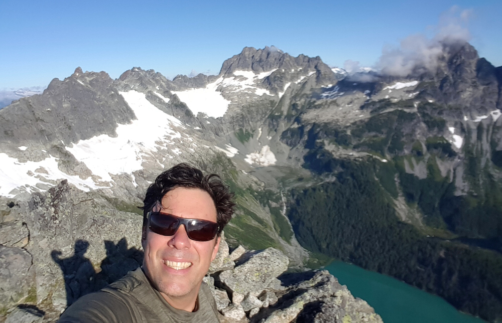
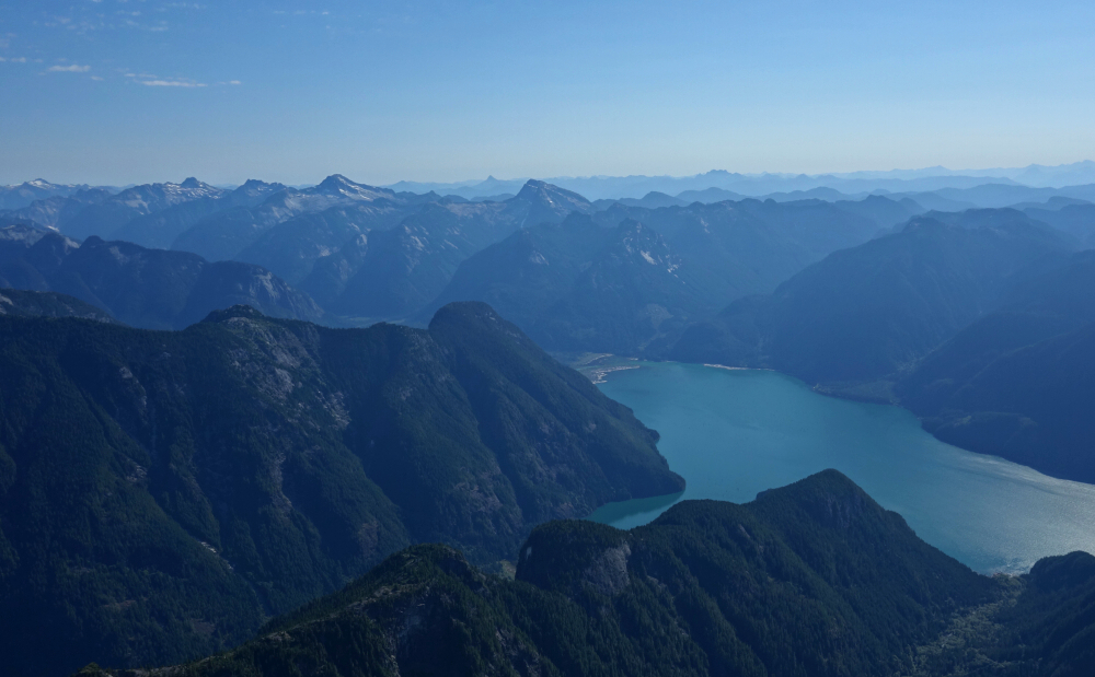
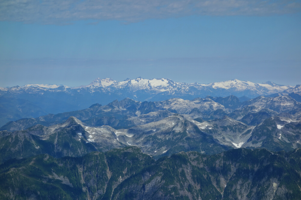
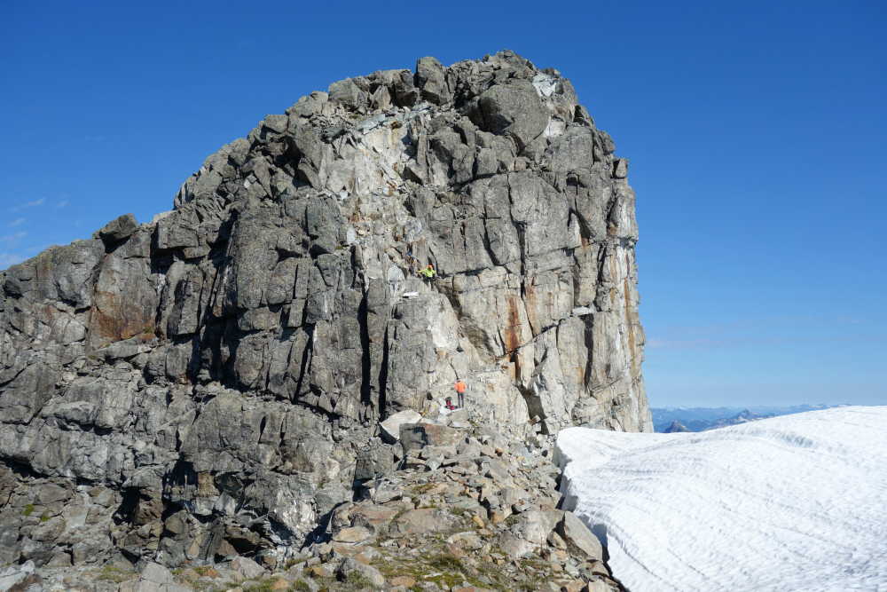
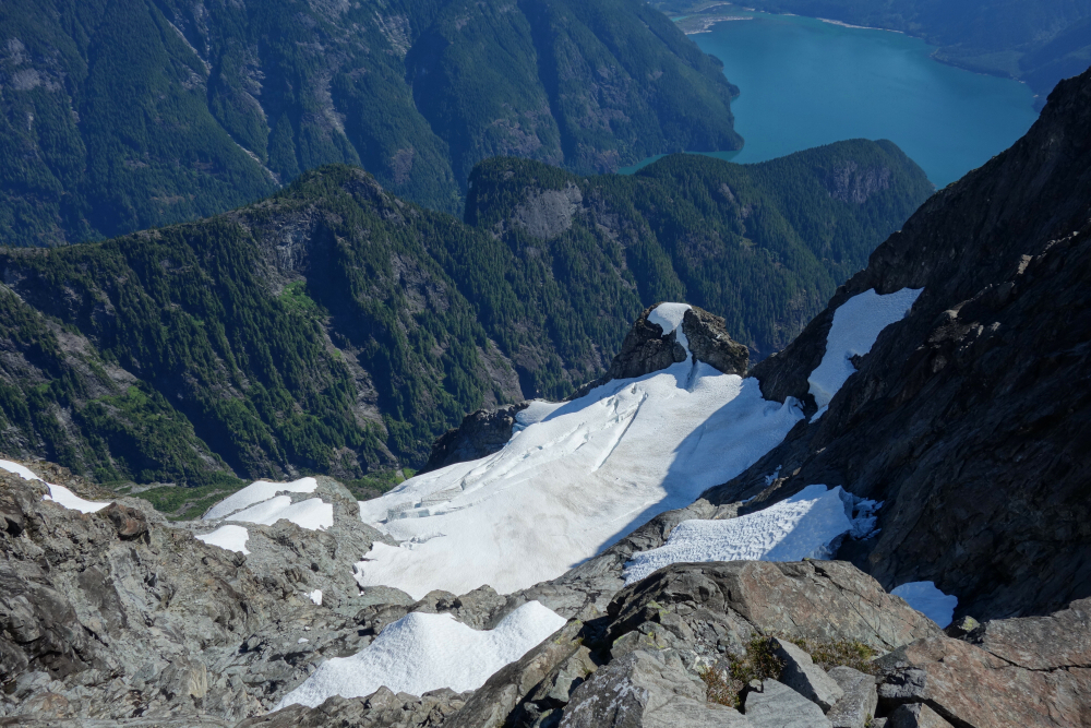
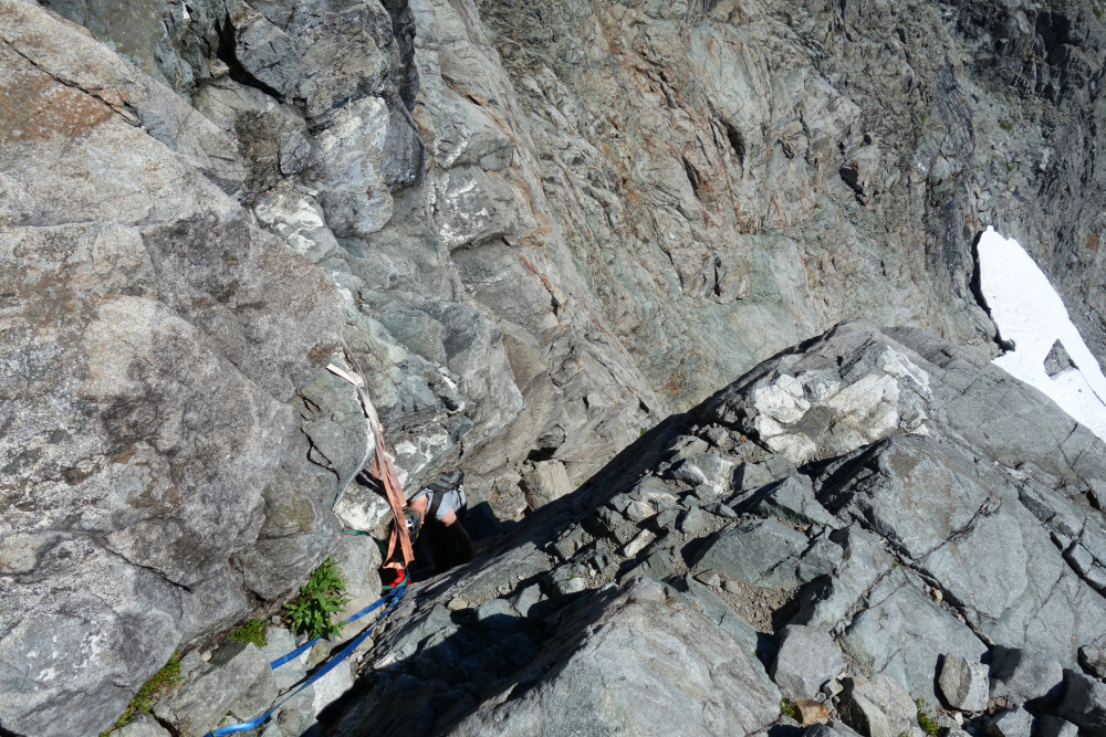
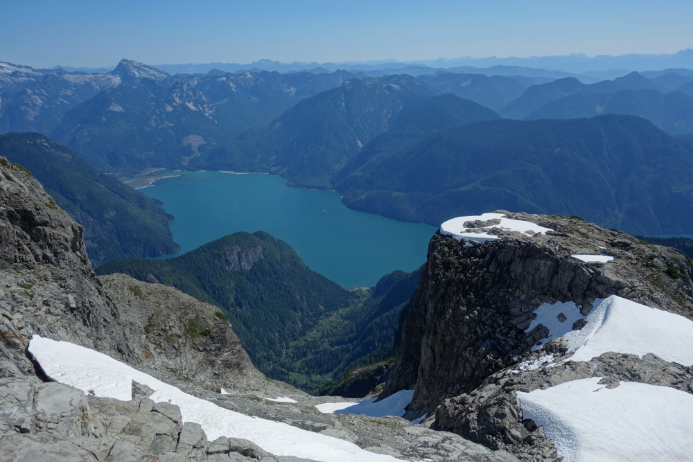
Got moving at dawn and made my way up along the creek that flows down through camp, scrambling over slippery boulders to reach a meadow. Then up from there to the crest of a lateral moraine which I followed to eventually reach a headwall. A funky move or two got me through a tight slot at the very back of this feature but found easier travel over ledges just to the left on return. A short descent along a ramp then led to the 'glacier' below Iota and Pelops, which I booted up before exiting left onto slabs just before where the ice pitches up. On return, I donned crampons and simply descended the right margin of the glacier down through this area of steep snow and ice and had an easy time of it. Got back onto snow after scampering up the slabs and continued to the Omega-Iota Col without further difficulty. Up n' over Iota, then down to the saddle between Iota and Pelops, before climbing again this time up Pelops. Then down the opposite side of Pelops to the col between it and Niobe and where a short brush bash guards easy heather slopes leading to Niobe's summit, and where a fantastic view overlooking the LLW basin and surrounding peaks awaits. Behold Alpha, Serratus, Ionia, and Red Tusk! And then there's the elusive Mount Sedgwick standing there all by itself to the WSW tempting me to contemplate a traverse over Mount Conybeare as a means by which to bag it. Hmm...that's not a bad idea, but I'll be reserving my seat with Harbour Air the next time I head up this way!
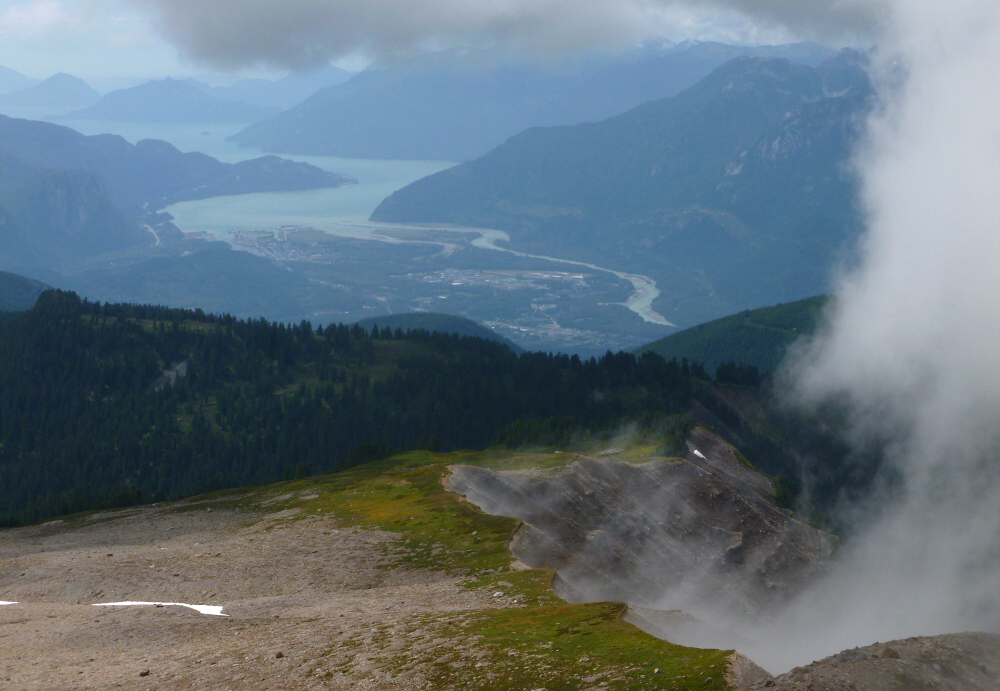
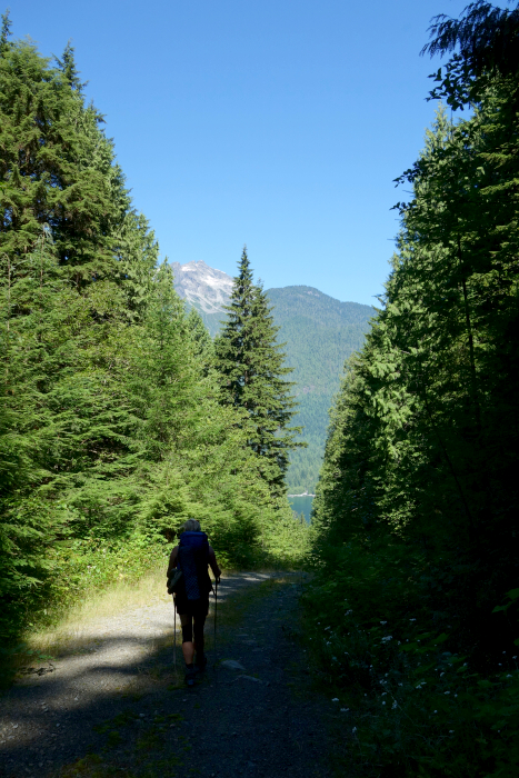
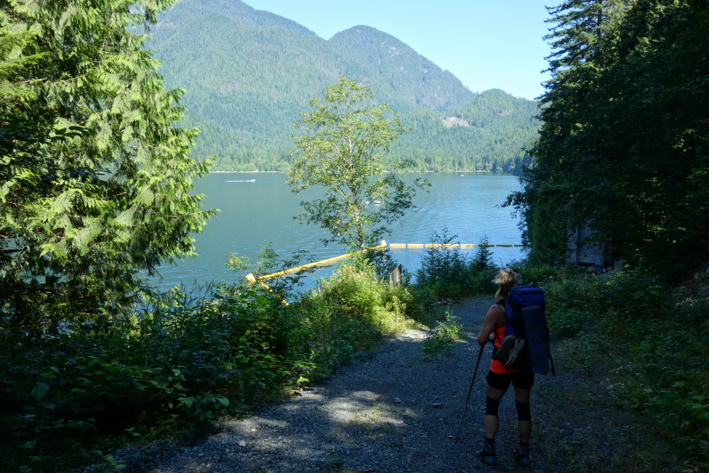
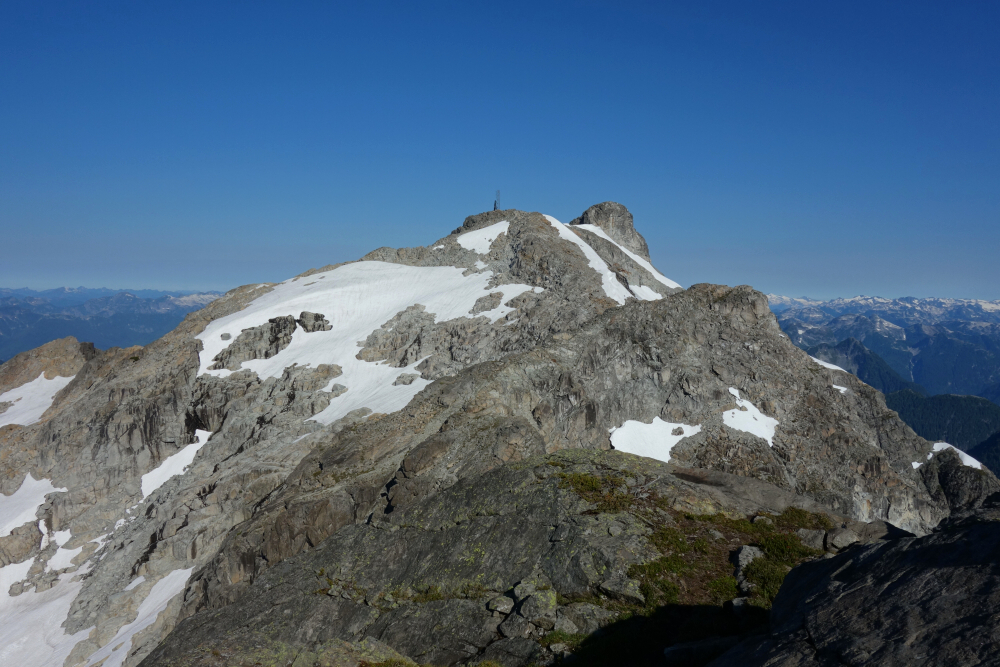
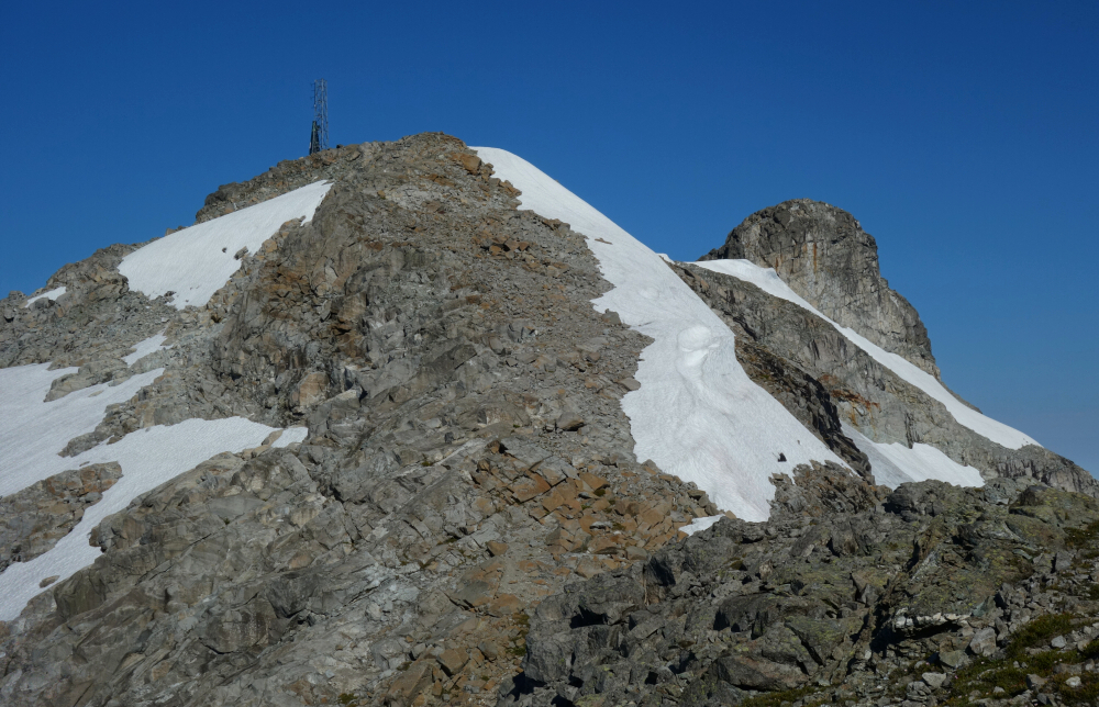
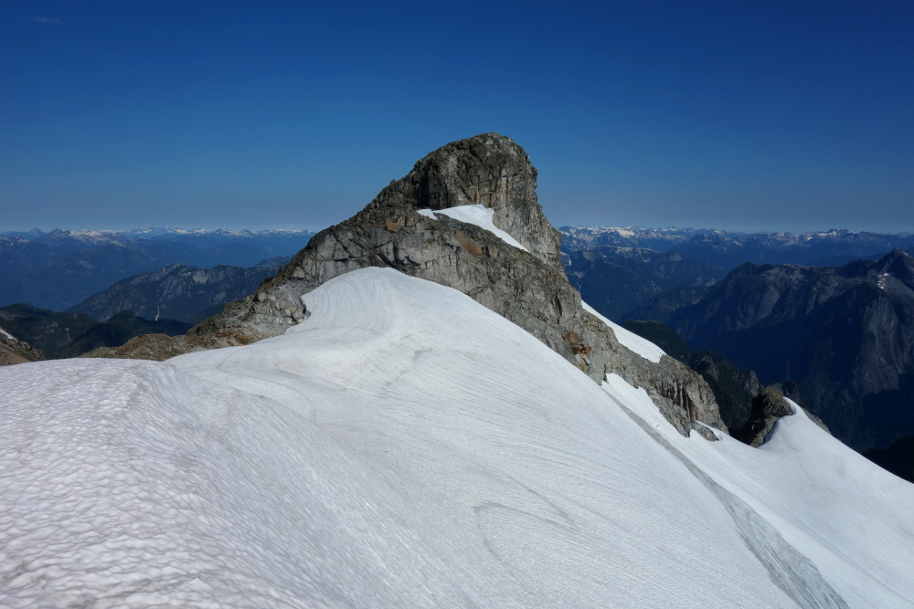
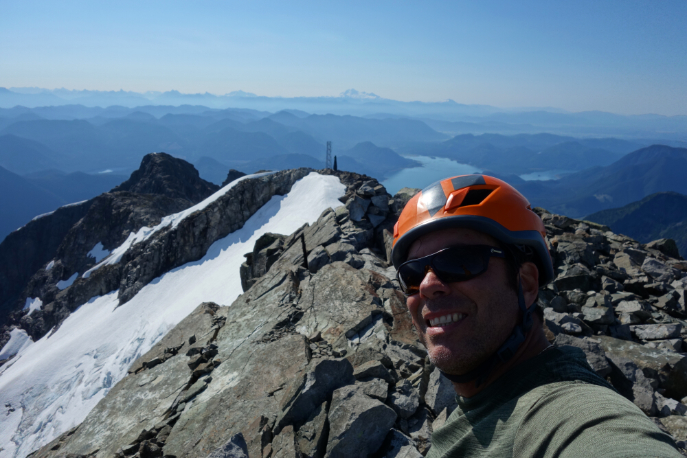
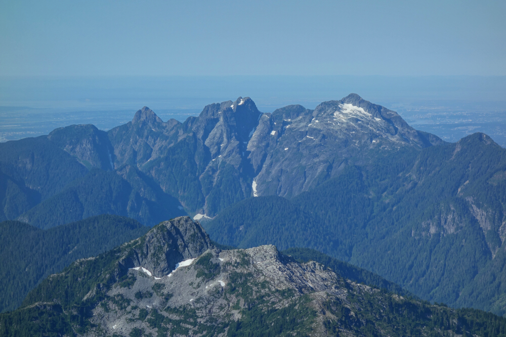
Driving northbound on I-5 through Bellingham, the highway crests a minor hill as it crosses over Lakeway Drive to reveal a tantalising glimpse of the land north of the 49th parallel. During the dark Winter months one can see the glistening lights of ski resorts Grouse and Seymour from this location and in daylight a pair of towering peaks are visible - the iconic Golden Ears and Mount Robie Reid! Sighted from this spot over my 20-some odd years of commuting from Seattle for adventures in the North Cascades and beyond, the time would inevitably come for me to explore this enigmatic duo overlooking the Fraser Valley. The highest of the former, North Ear was dispatched as an easy day trip back in Summer '06 leaving pesky Robie Reid for me to scale years later. Unfortunately, most reports from that time described the approach as being a royal pain, requiring a ~10-mile paddle in a canoe followed by brutal mosquito-infested brush bash up some 4000-ft over about 3 miles to reach high camp. The peak didn't seem to get much traffic back in those days, which, approach considerations aside, was unusual considering its prominence and proximity to a major metropolitan area. All that changed at some point in the intervening years, with today's good forest road access and a steep but well-established trail leading to the alpine. And so, it came to pass that Team Verdina would finally make a go at the mighty RR!
True to form, we set out on the hottest and most humid day of the summer yet and staggered into camp after a good 7+ hours of blood(letting), sweat and tears. A word to the wise - although it amounts to a stout ~7-thousand-foot day, I HIGHLY recommend foregoing the overnight pack and doing this as a day trip. Also, there's no water to be found shortly after leaving the lakeshore, so don't skimp on weight as I did and assume a single liter is anywhere near enough! On the other hand, we could have left the sleeping bags behind it was so warm that night. Shoulda, woulda, coulda... Got rollin' shortly after sunup and caught up with a Chinese party whom we shared the "tarns" camp with just before the crux chimney. The chimney entails a short but stiff(ish) move right off the deck, followed by a somewhat easier move aided by a handline at a second crux a bit higher up the same gully system. I soloed up through these but rapped both cruxes on return (30-meter scramble rope is plenty). Crossed over a notch at the top of the gully and followed a somewhat exposed ledge at right to eventually gain the crest of the Southeast Ridge. Easy travel from there, past the radio repeater towers, to the base of the final summit tower and where a short scramble up steep, blocky rock led to the glorious summit.
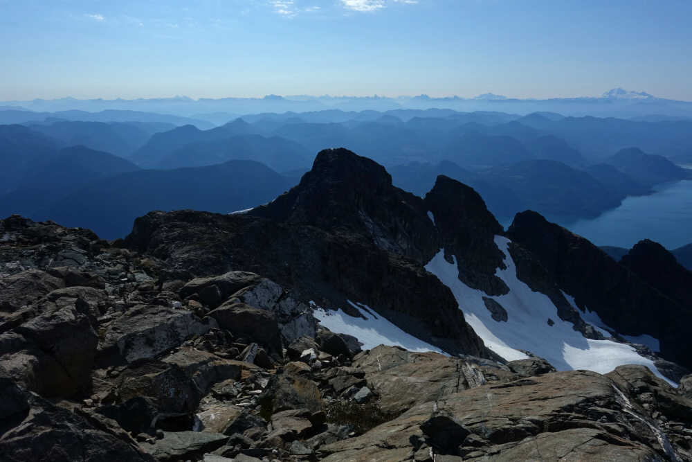
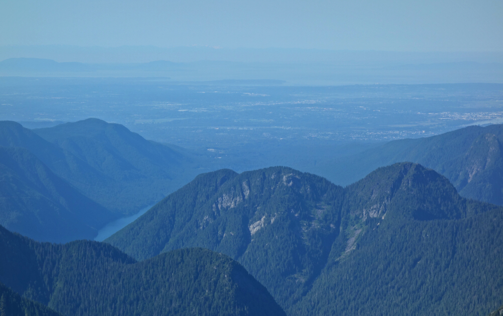
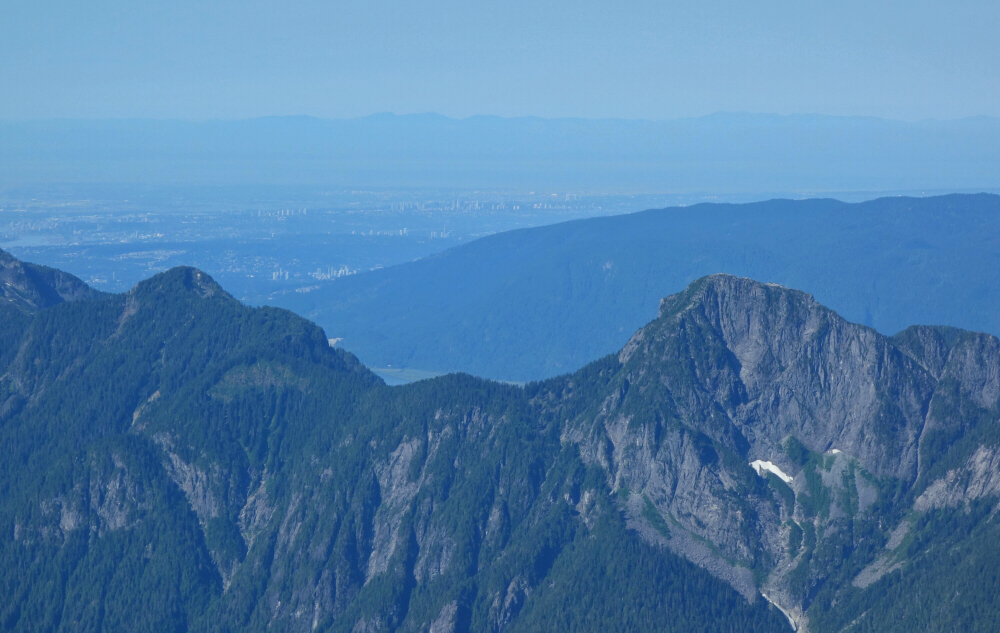
The view from up there was outstanding of course with a stunning panorama of the Fraser Valley to the south and a sea of peaks to the east, north, and west. Mount Judge Howay rises conspicuously from across the valley and beckons to be climbed, if only it wasn't so difficult to access. Sound familiar? I didn't linger up top for long as Agata was waiting for me back on the slabs below the crux chimney. Back to the tarns where the swarming mosquitos expedited our breaking down camp in preparation for the dreaded descent. And oh, how jealous we were of the day hiker who started out from the trailhead at the same time as us but wasn't seen again thereafter. With a rather tardy mid-morning departure, I remarked privately that he'd not get back to his car before midnight. My aha moment came after spotting a private helicopter land near the summit the following morning. Well played sir well played! As a poor consolation, we took a refreshing dip in Alouette Lake on our way back before the cursed uphill road walk to the parking area. Stoked to have finally gotten 'er done, but I sure ain't coming back for seconds!
It would be very much appreciated if you please ask before copying and/or re-publishing content from any part of these pages. To do so, please click here to send a message via feedback form.


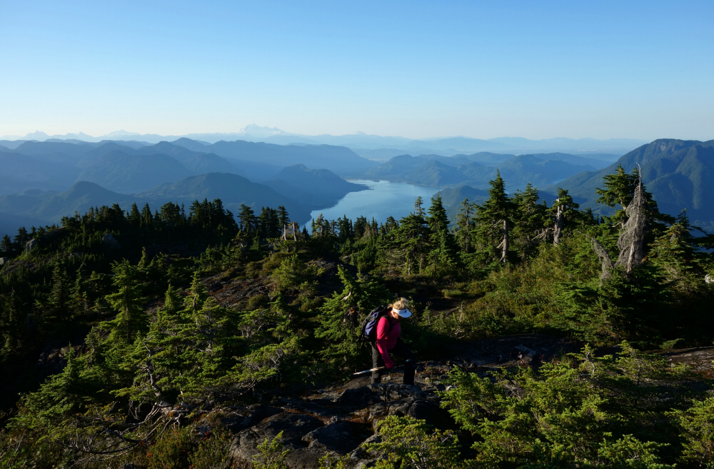
 as seen from south slopes of Alpha Mountain.")
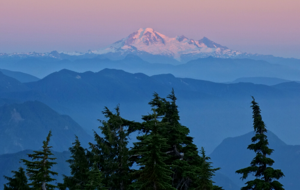
 as seen from North Ear.")


