Last Updated: April 17, 2024


Start

Recent content updates are viewable under what's new.

Reports in the queue for posting are coming soon!

Upcoming reports & photos:

Oh my! Quite the backlog here, eh?

  • American Mountain & Mount Lincoln - hike/snowshoe (May 2023)
  • Mount Mclean Attempt, Red Rock Trail, Dragons Back Trail - hike (May 2023)
  • Stawamus Chief (South, Middle & North) - hike/scramble (June 2023)
  • Flint & Feather - hike/scramble (June 2023)
  • Goat Ridge (Squamish) - hike (June 2023)
  • Grouty/Mortar Peaks - hike/scramble (June 2023)
  • Pebble-to-North Creek Traverse incl. Pebble, Thiassi, Wesley & Sugus - hike/scramble (July 2023)
  • Mount Truax - hike/scramble (July 2023)
  • Blackcomb Buttress - rock climb (July 2023)
  • Whitecap Peak - hike/scramble (July 2023)
  • Mount Hanover - hike/scramble (August 2023)
  • The "Long Traverse" incl. Long, Tynemouth, Arrowhead, Tabletop & Anemone - hike/scramble (August 2023)
  • Armchair Traverse - hike/scramble (August 2023)
  • Snowspider Mountain - hike/scramble (September 2023)
  • Mount Trorey - hike/scramble (September 2023)
  • Macleod Peak - hike/scramble (September 2023)
  • Ben Lomond - hike/scramble (September 2023)
  • Mount Killam & Gambier Island - hike (September 2023)
  • Lone Goat & Snow Camp Mountain - hike (September 2023)
  • Isollilock Peak - hike/scramble (October 2023)
  • Manson - Hatfield Traverse - hike/scramble (October 2023)
  • Gargoyles & Columnar Peak - hike/scramble (October 2023)
  • Opal Cone and Lava Glacier - hike (October 2023)
  • Park Butte (WA) - hike (October 2023)
  • Trappers Peak (WA) - hike/scramble (October 2023)
  • Rattlesnake Ledge (WA) - hike (November 2023)
  • Sauk Mountain (WA) - hike (November 2023)
  • Mount Daniel & Pender Hill (Sunshine Coast) - hike (November 2023)
  • Mount Dickerman (WA) - hike (November 2022)
  • Winter's End (Verona Peak) - hike/snowshoe (November 2023)
  • Dolomites (Italy) - snowboarding (December 2023)
  • Red Rock Canyon (NV) - hike (January 2024)
  • Flute & Oboe - split tour (February 2024)
  • Whistler misc. (Train Wreck, Loggers Lake, Shadow Lake etc.) - hike (February 2024)
  • Mount Underhill - hike (March 2024)
  • Bombtram Mountain - hike/snowshoe (March 2024)
  • Steep Peak - split tour (March 2024)
  • Ruby Mountain (WA) - hike/snowshoe (April 2024)
  • Blustry Mountain - hike (April 2024)

*As of 04/17/2024


Database

Query the reports database, selecting from criteria which include name, location, type, season etc.

Quick Links

Essential links & whatnot:


Jump To

Select from list below to jump to a specific area on this site.


| Latest Posts |


Wednesday, December 29, 2021

Cloudburst Mountain - North Route via Chance Creek FSR, May 2021


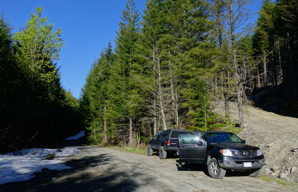
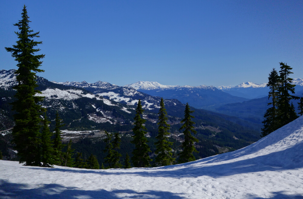
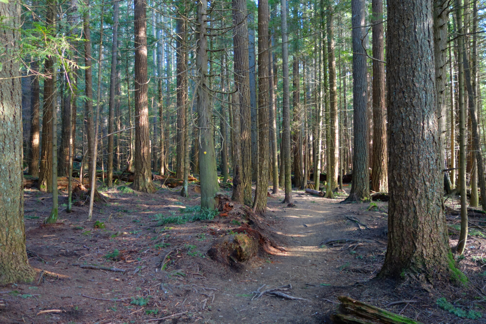
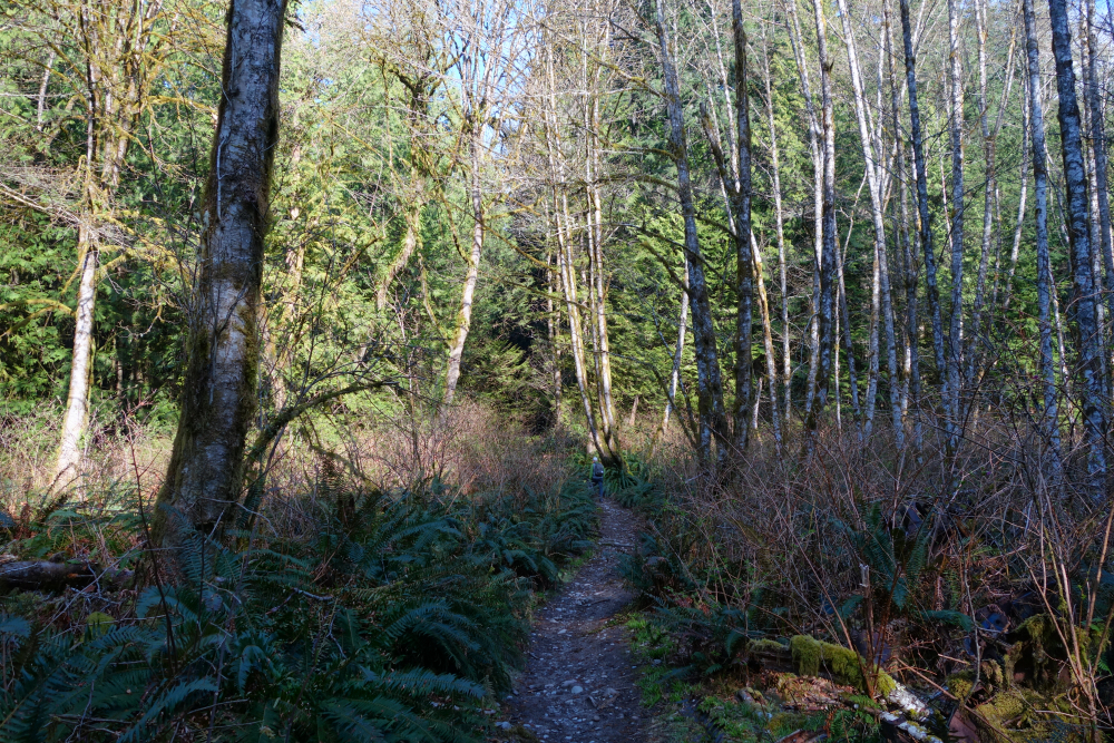
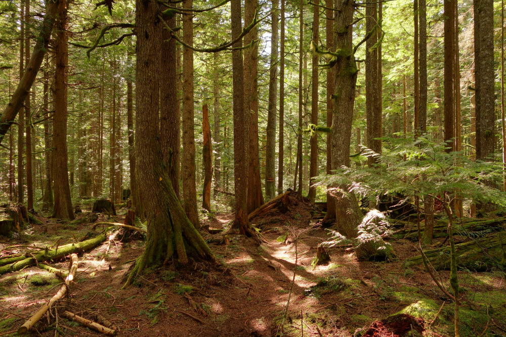
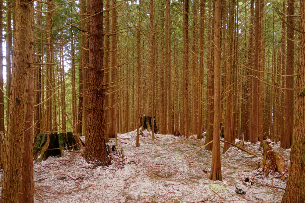
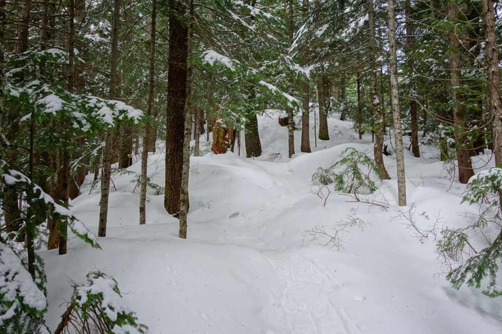
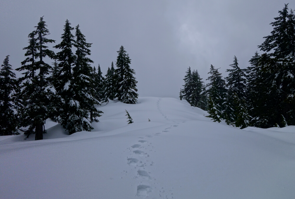
Cloudburst Mountain joins a handful of other prominent peaks plainly visible from the Sea-to-Sky Highway between Squamish and Whistler. Spend enough time commuting up and down this corridor and the peak will inevitably find itself on your tick list. At least that's how it happened with me. That, and I was looking to capitalize on the great weather without much driving or suffering for that matter. Timing is everything, and done right Cloudburst makes for an ideal Springtime venue with mostly snow-free FSR access but still plenty of snow down low to bury all the annoying brush. This "window" usually occurs in late April to early May, depending on how far up Chance Creek FSR one can drive. In my case, I was stopped by snow no more than a kilometer from an obvious fork and from where the trailhead more or less begins.

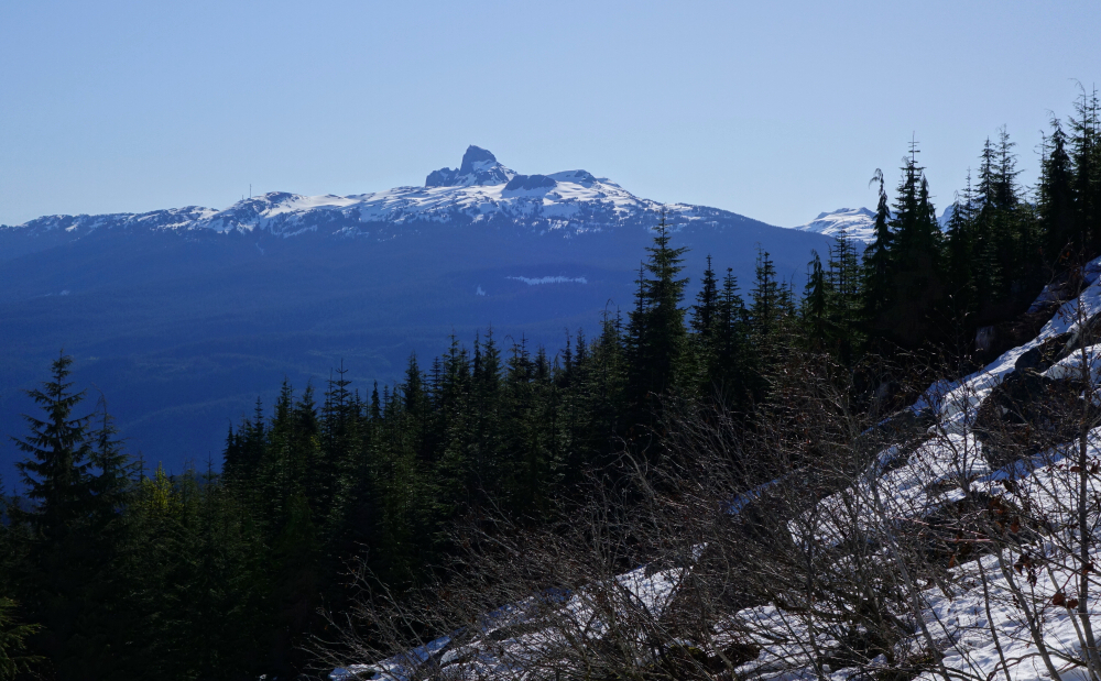
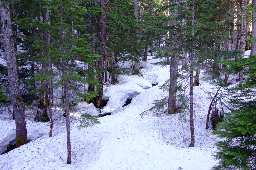
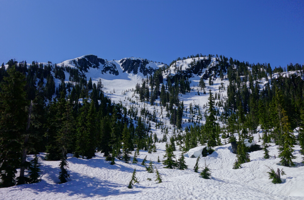
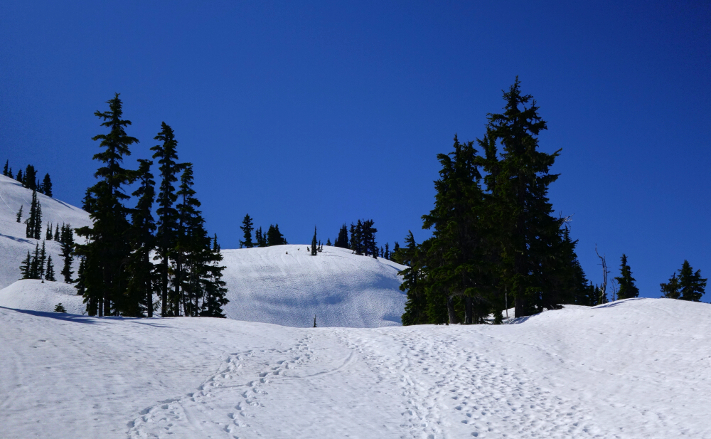
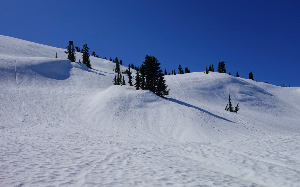
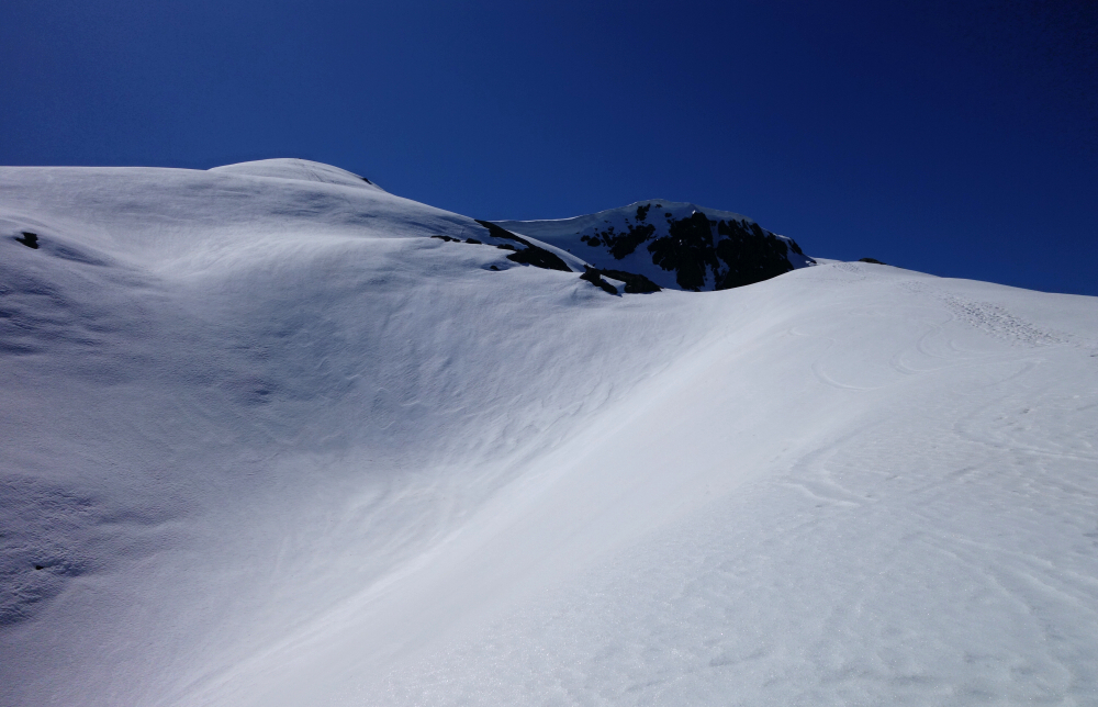
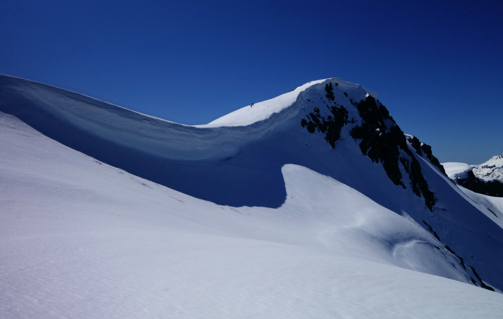
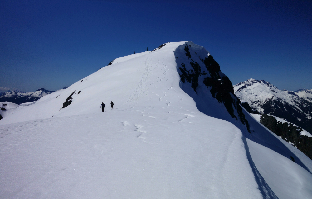
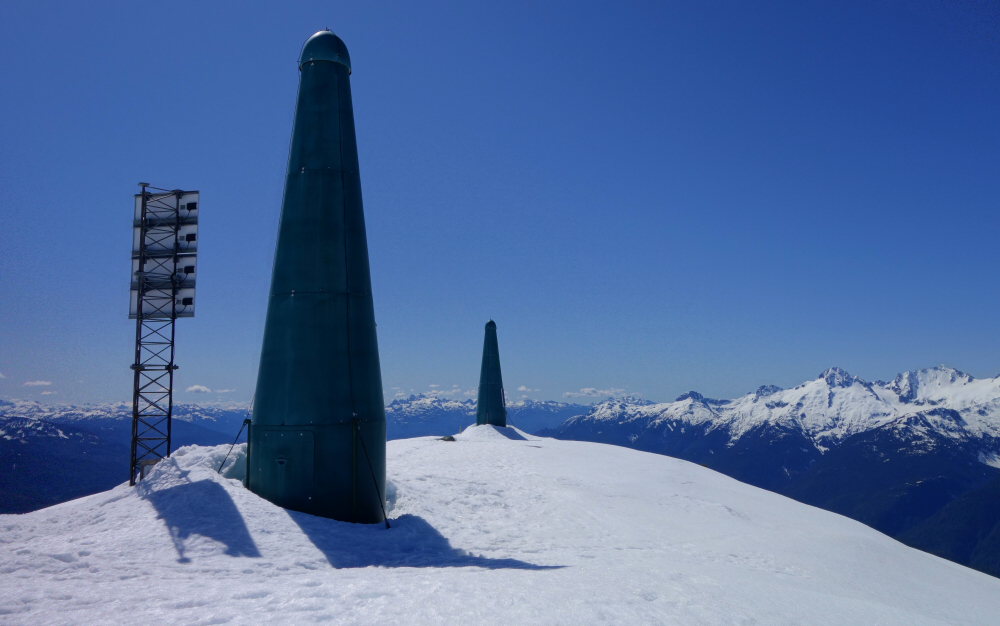
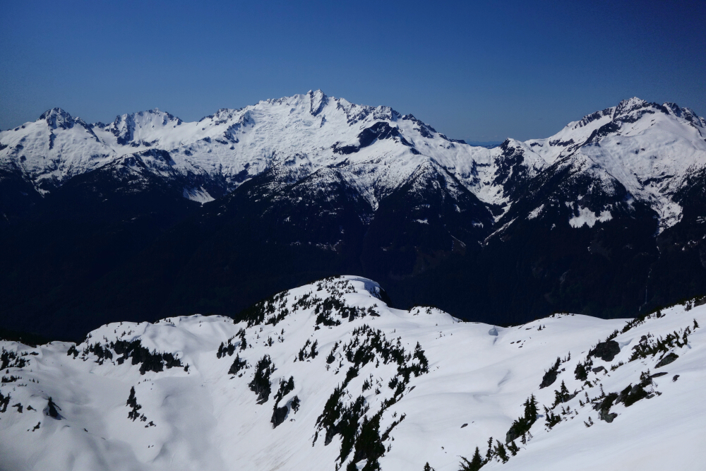
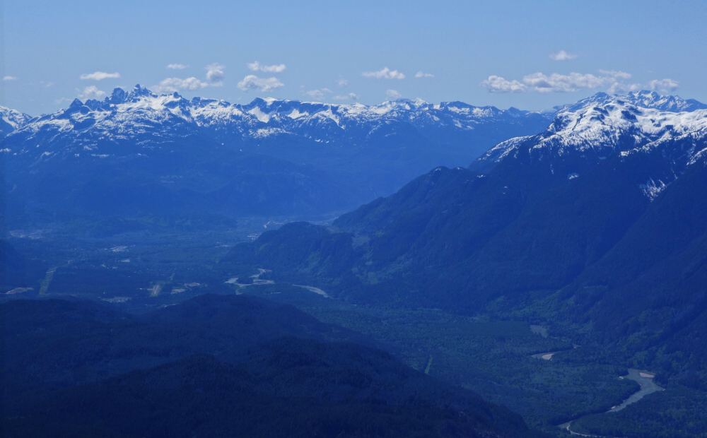
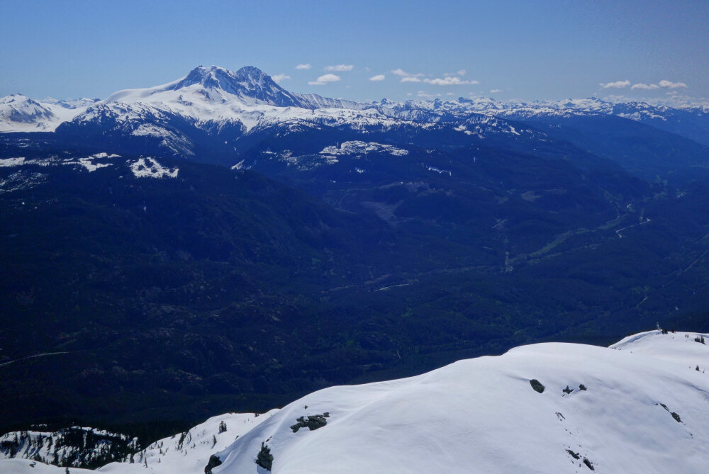
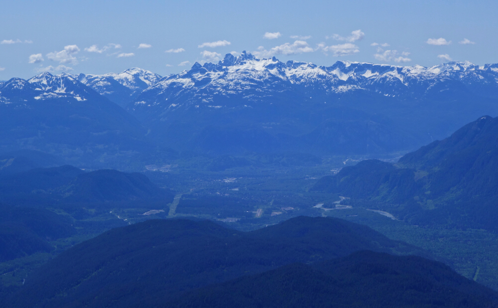
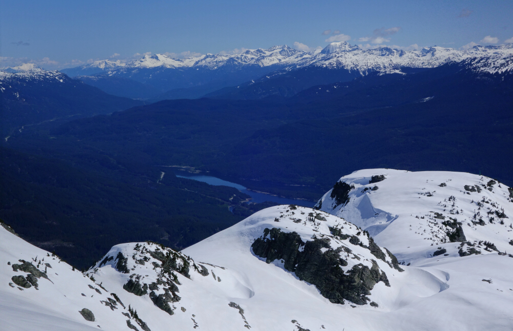
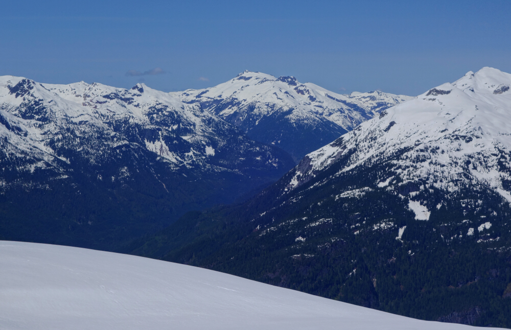
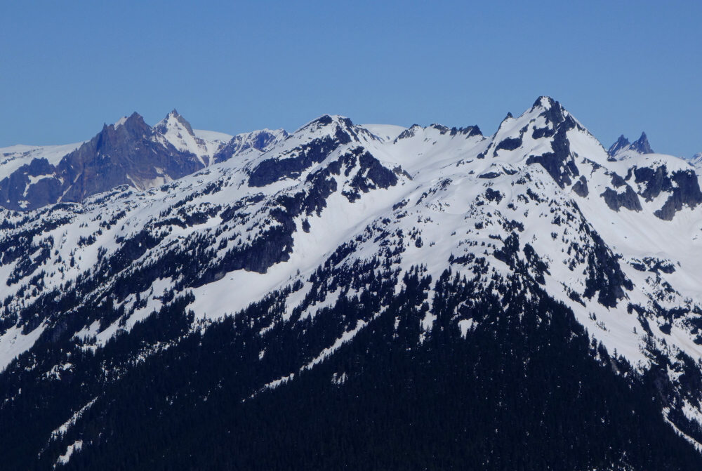
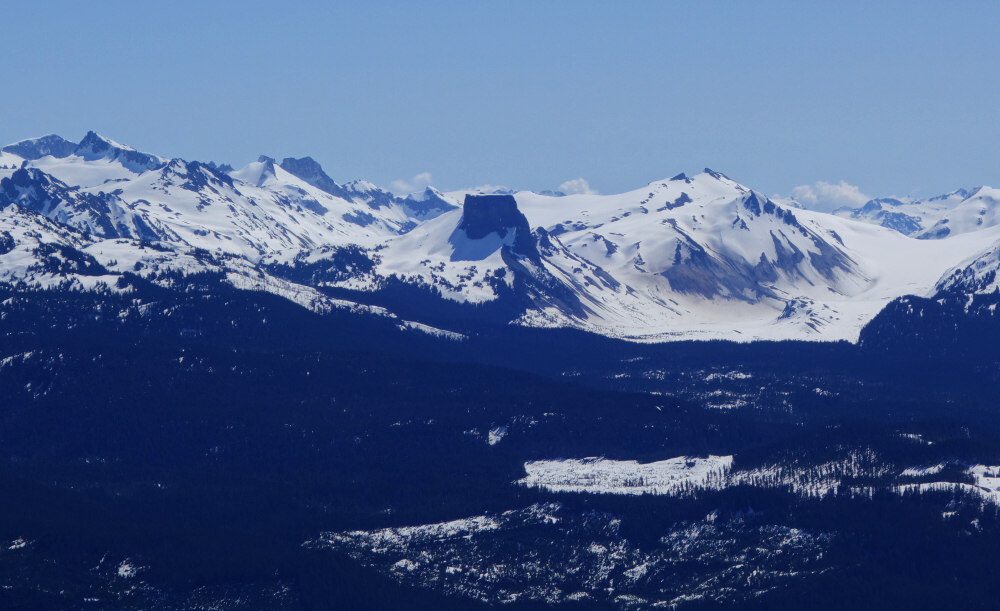
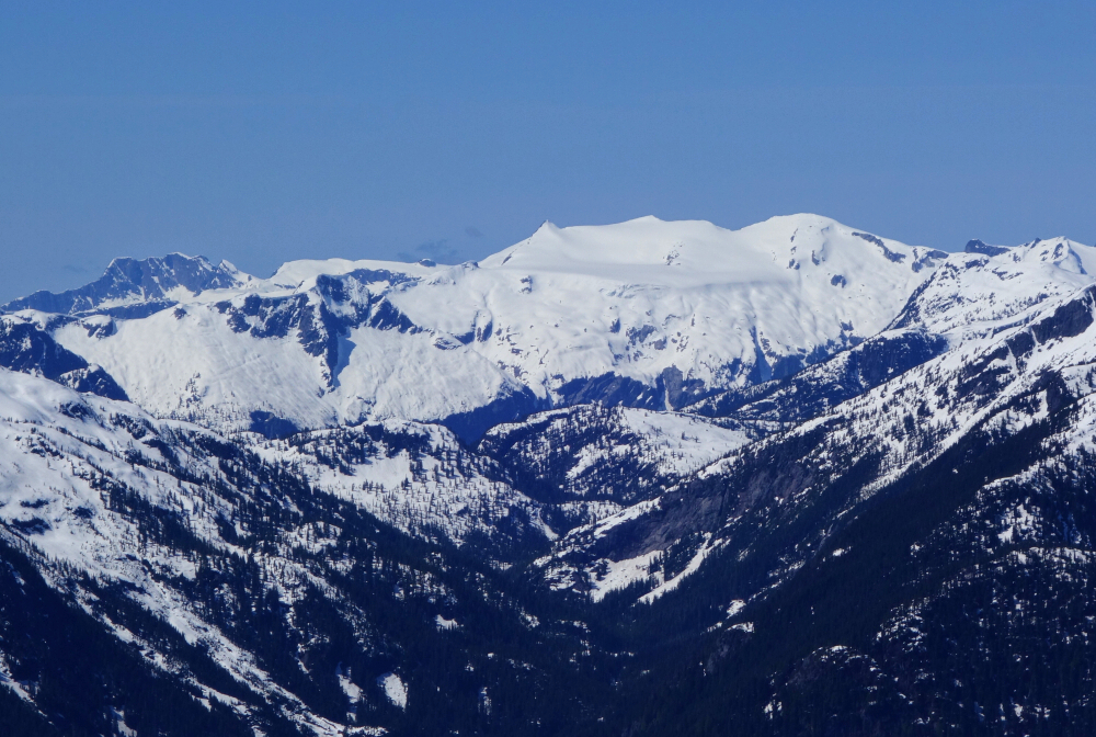
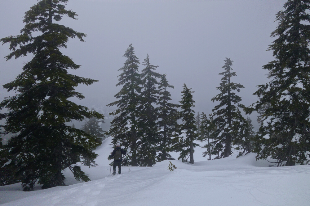
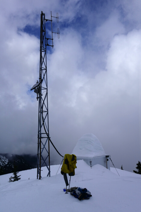
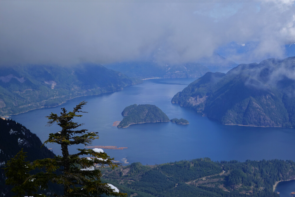
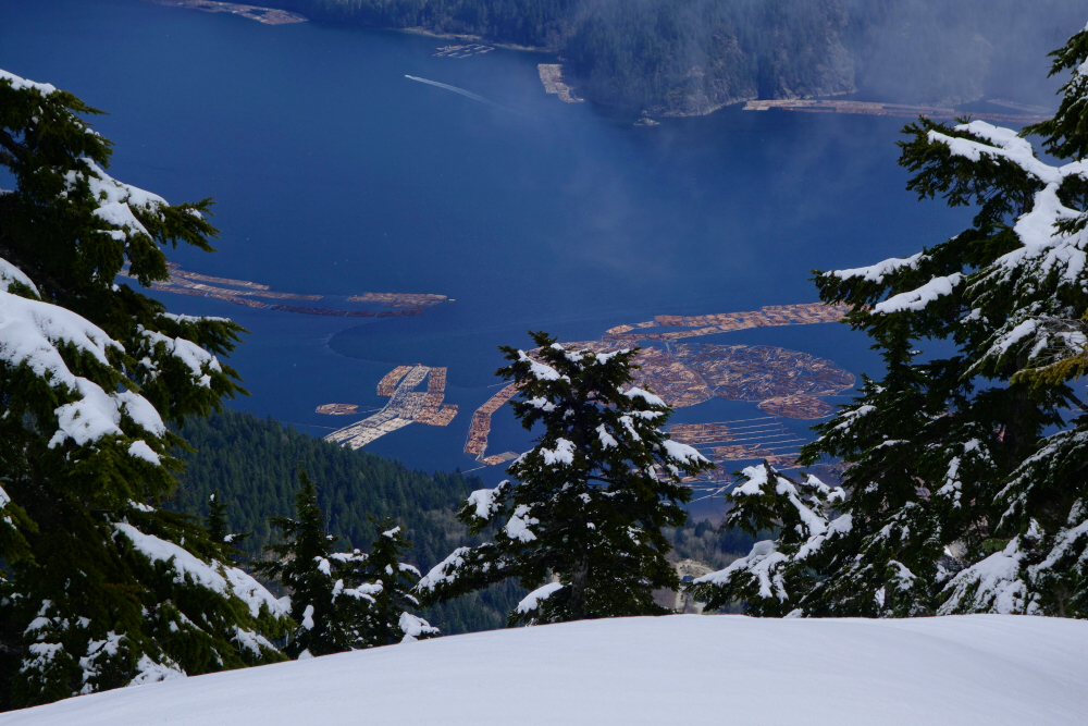
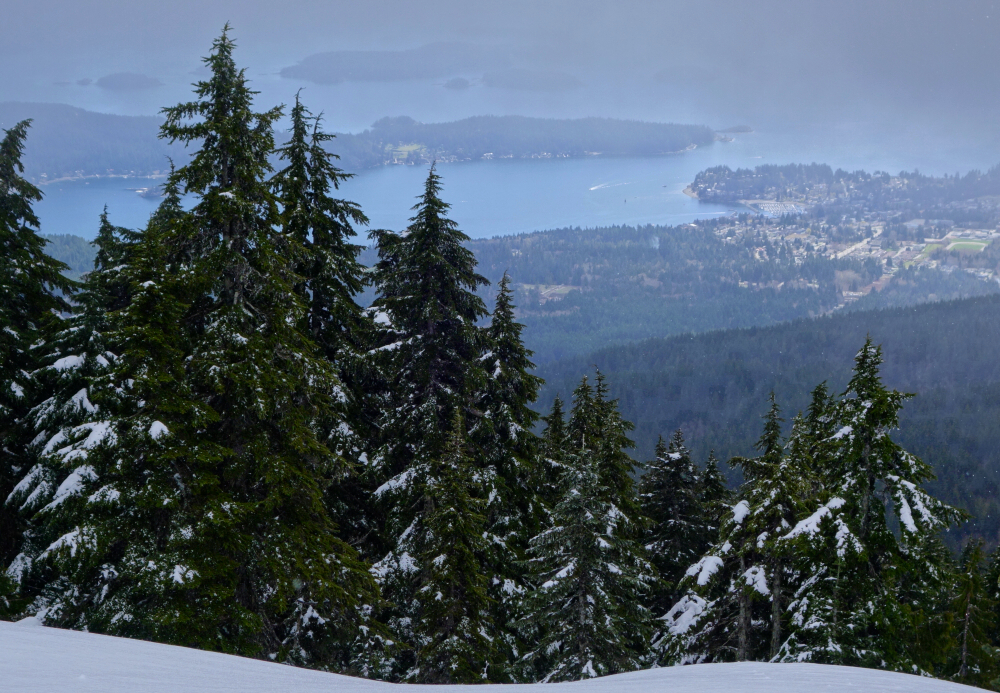
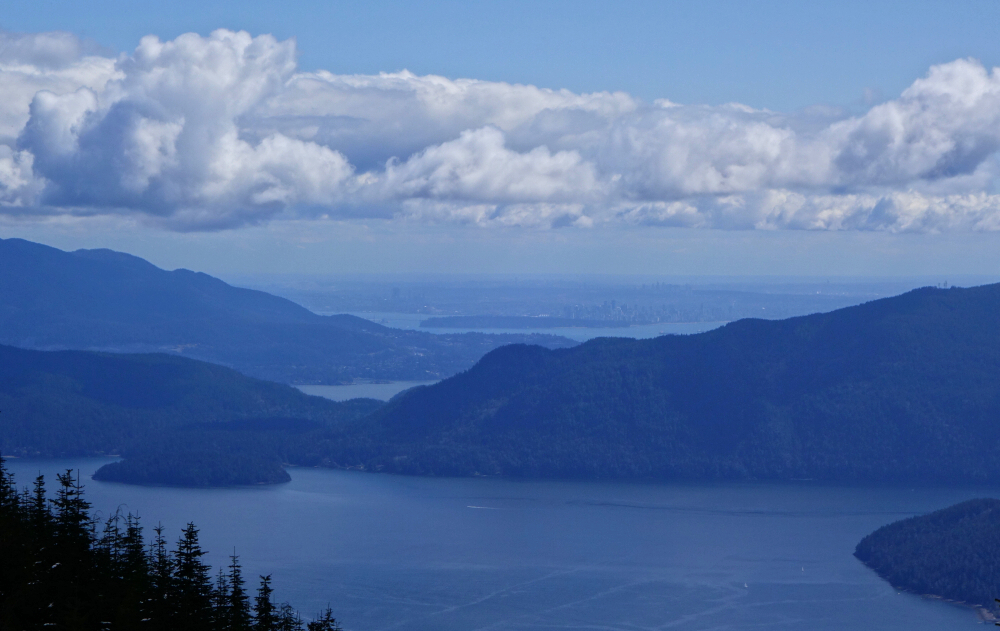
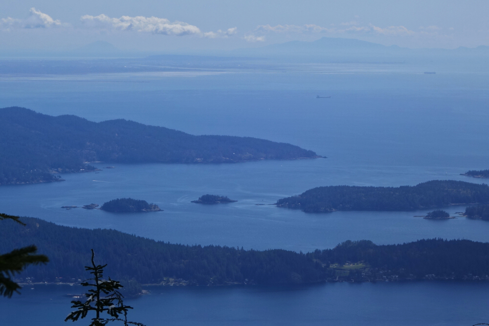
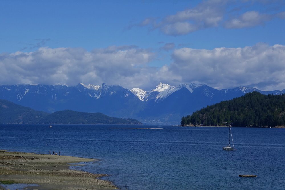
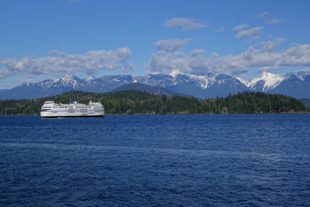
Turning left off the lower fork, I followed tracks along a lesser and very overgrown road before proceeding up an old cutblock aiming for a line of trees above. Made a tricky stream crossing and continued up to enter the forest, finding much easier travel from here on out. The forest soon gave way to a gladed area below the peak's northern flank. Still following tracks, I continued up and right to gain a wide bench with rolling snow slopes ahead. Into the alpine shortly after and where the angle pitched up to reach a shoulder with corniced summit ridge visible above. Gained this ridge and turned right for the final plod to summit proper. As the southernmost peak on the Squamish-Cheakamus Divide, Cloudburst offers an outstanding perspective on the confluence of these rivers with Sky Pilot Mountain towering just beyond. This view is complemented by the stunning Tantalus Range at right and the peaks surrounding Garibaldi Lake at left. Looking due north, there are the spires of Tricouni, Fee and Cayley with the glaciated summits of the Ashlu-Squamish Divide at left and the more familiar Whistler area peaks at right. Such a great view for so little effort! Returned the way I came for a very agreeable round-trip time of about 5.5 hours. Highly recommended!

Click here to view.

Wednesday, December 1, 2021

Mount Elphinstone - Mt. Elphinstone Trail, April 2021


Having satisfied myself of Fraser Valley hikes for the time being, I ventured west once again in search of a "backyard" mountaintop I'd not been to yet. And by backyard, I mean about 38 km as the crow flies from my front door, even if a short ferry crossing is involved. With an established trail all the way to the summit and the prospect of great views overlooking the mouth of Howe Sound as well as a portion of its lower midsection, Mount Elphinstone out on the Sunshine Coast fit the bill perfectly. Averaging about 13 km round-trip this is a very reasonable day hike just a mere 3 clicks from the Langdale ferry terminal. If for no other reason than to avoid potential ferry delays, I might suggest just leaving the vehicle at Horseshoe Bay and walking on with a bike instead. Either way, the trailhead is just to the right of a T-intersection off the Sunshine Coast Highway, following signs for SprocKids Mountain Bike Park. I parked on a gravel shoulder adjacent to a yellow gate marked as "private" and proceeded up the wide trail directly opposite the parking area.

Bit of a maze of trails down low here but I found the yellow "summit trail" markers relatively easy to follow. Soon enough I came upon a small clearing with an automotive relic or two slowly being reclaimed by nature before proceeding up through a pleasing grove of second growth. Came upon a few more junctions along the way, but had no issues staying on course. After about 3.5 km I encountered a sign indicating that the trail ahead is both dangerous and difficult in winter, just the way it ought to be! Continuing up, a dusting of snow quickly turned into a foot or more, warranting the use of snowshoes. At some point the trail traverses right following what I assume must be an old forest road, briefly interrupting what up until this point had been a monotonous forest plod with the first views of the day. Then back into the forest for the final ascent to the summit, now in deep powder snow. Following tracks, I came upon a short, steep headwall that I found somewhat tricky to ascend with snowshoes. Easy going once above this spot to reach a bench area where I encountered the first and only party out on this day. Tracks stopped here despite the summit being just 5 - 10 minutes beyond. Kept going, now in whiteout conditions ever hopeful for the miracle of a clearing.

Reached the summit antenna station and lo and behold a sucker hole almost immediately appeared overhead. It was a short-lived window, but one that nonetheless afforded a partial view north up Howe Sound overlooking Gambier Island and smaller Woolridge Island. Also managed to sneak in some views to the south over Keats and Bowen Islands with Salish Sea beyond before the clouds rolled back in. Hopeful for an encore that never came, I hung out up top long enough to get cold and reluctantly started back down. Back down the trail to my car without incident, other than the slap in the face of the clouds having vanished entirely by that time. T'was a perfect spring afternoon on the return sailing to Horseshoe Bay, all peaks with their winter blankets out on full display. Damn glorious this backyard is, clouds or not!

Click here to view.
home | email | copyright

All photos and text for sverdina.com are copyright © 2002-2024

It would be very much appreciated if you please ask before copying and/or re-publishing content from any part of these pages. To do so, please click here to send a message via feedback form.

Thank You.

©2024 sverdina.com |