
As with some other peaks in the area, Sugarloaf Mountain is a peak I've previously visited thanks to the aid of a Bell 407 in blue and white livery. Sugarloaf's sheltered north-facing bowl made for a very enjoyable ski/snowboard descent and was the highlight of a fine day of shredding back in December 2015. From an LZ just below the summit, we enjoyed a nice long run down into the valley stopping finally in the basin immediately west of Mount Ross. Not an inkling did I have of my future human-powered trek to the peak, but then this along with most of everything nearby was still very much a mystery to me.
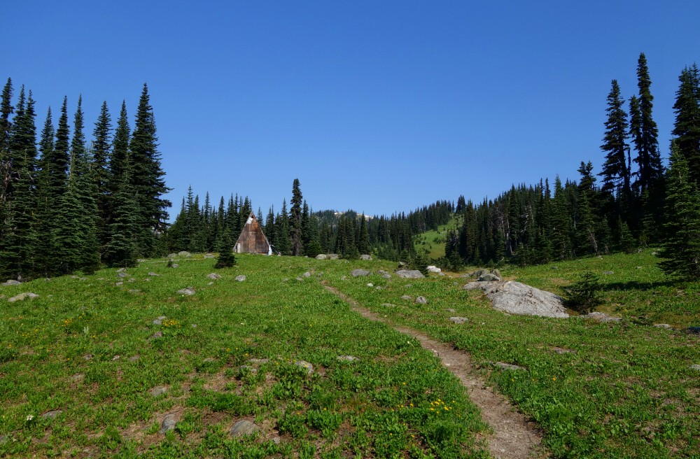
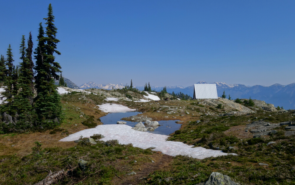
Six years on and ever on the lookout for day trips that meet my criteria for location, access, views and aesthetic. Sugarloaf stood out, which was surprising really as it isn't featured in any of the guidebooks or appeared to be much talked about in the online forums I routinely scour for trip ideas. That said, with a couple primitive shelters situated along the (east) approach ridge and forest roads that end just below tree line, the only one for whom this is something new is obviously me. I get the sense that this zone is popular with Pemberton area snowmobilers in Winter and is used as a launching-off point for paragliders in Summer. It also happens to feature on the "P600M" BC prominence list, which makes it a required summit for the observing peakbaggers that then spray about it on Facebook, which is finally how I got wind of it.
Anyway, it took me two attempts to reach the summit, thanks to the unbearable heat we experienced during the June - July "Heat Dome" event. I've never turned back for fear of heat exhaustion before, but with the onset of dizziness and fatigue, I reluctantly aborted the hike in a desperate hurry to find shade. Presumably due to the sudden and unseasonable heat, the swarming mosquitos were also unlike anything I've experienced before; worse even than my previous experience in the Wind River Range en route to Wyoming's Gannett Peak, and that's saying a lot! I returned on my second attempt not two weeks later armed with a white pressed button-down shirt soaked in deet and a headnet. It was still stupid hot that day, but not nearly as bad as my previous attempt.
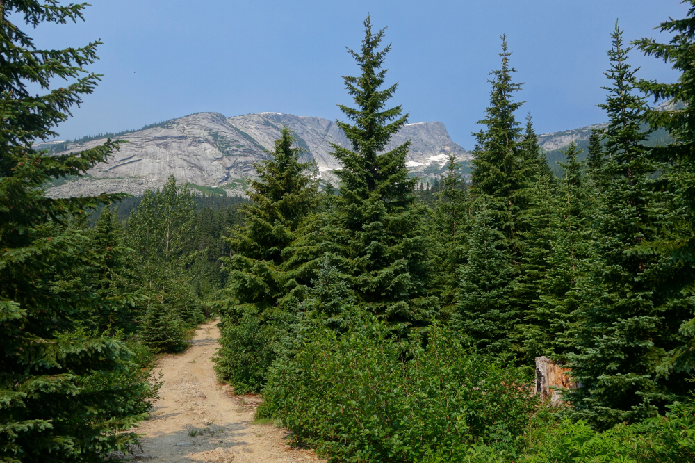
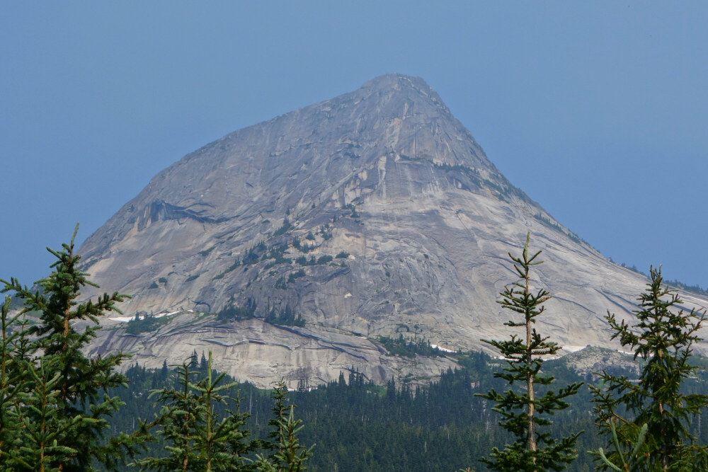
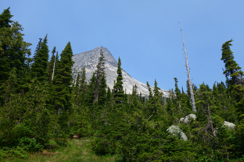
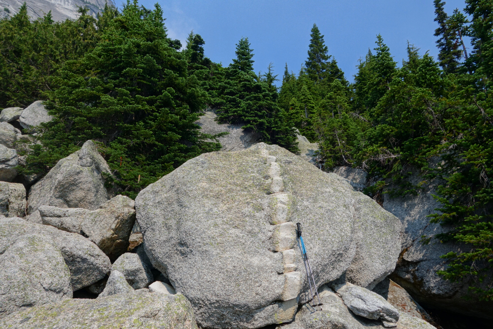
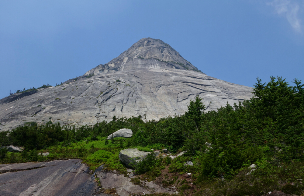
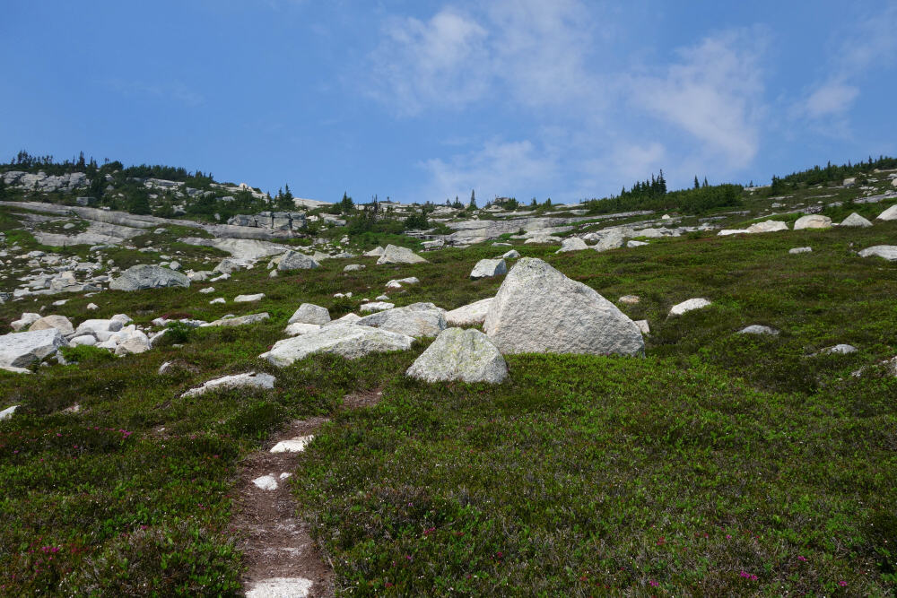
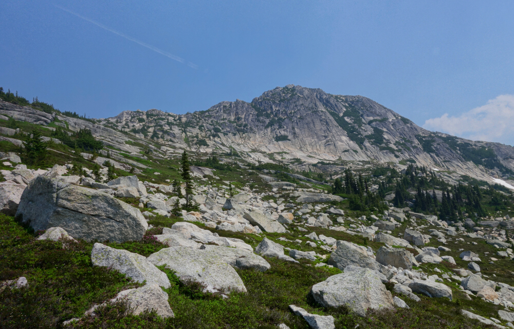
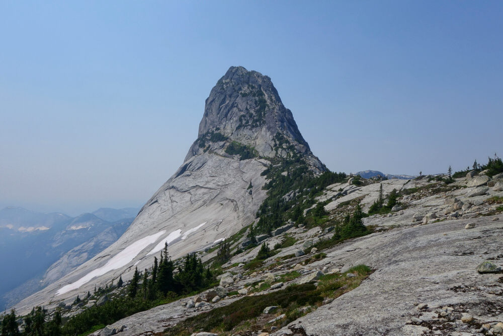
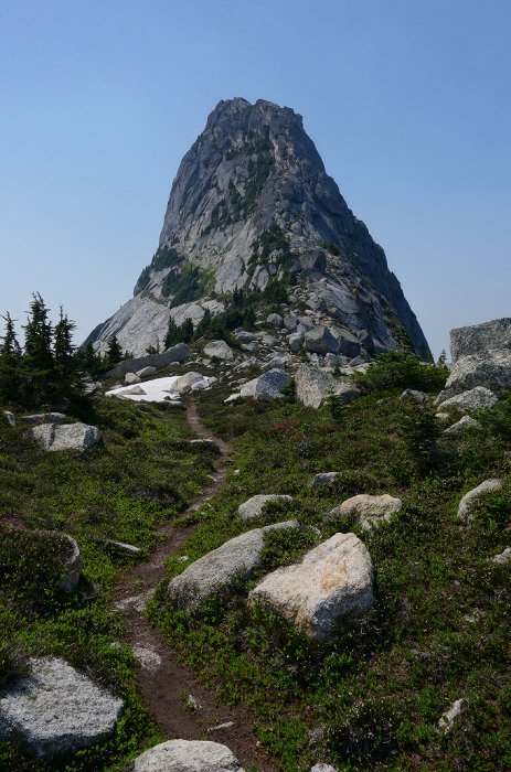
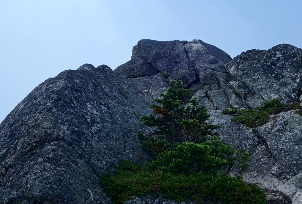
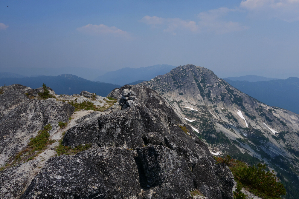
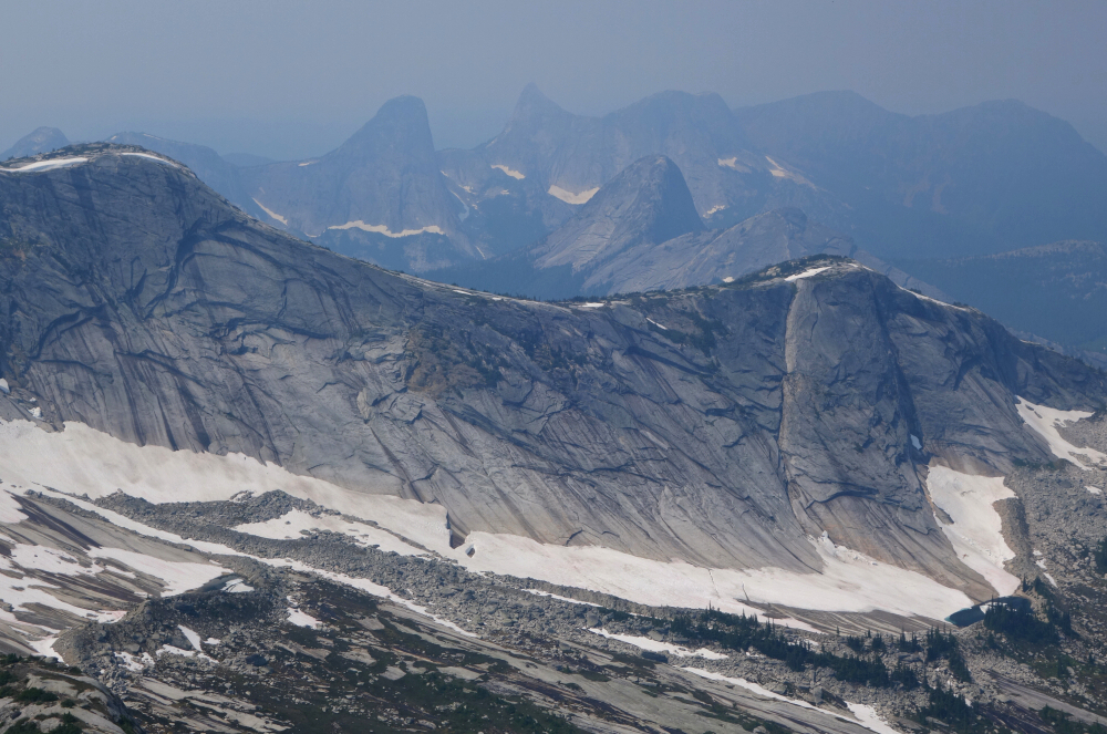
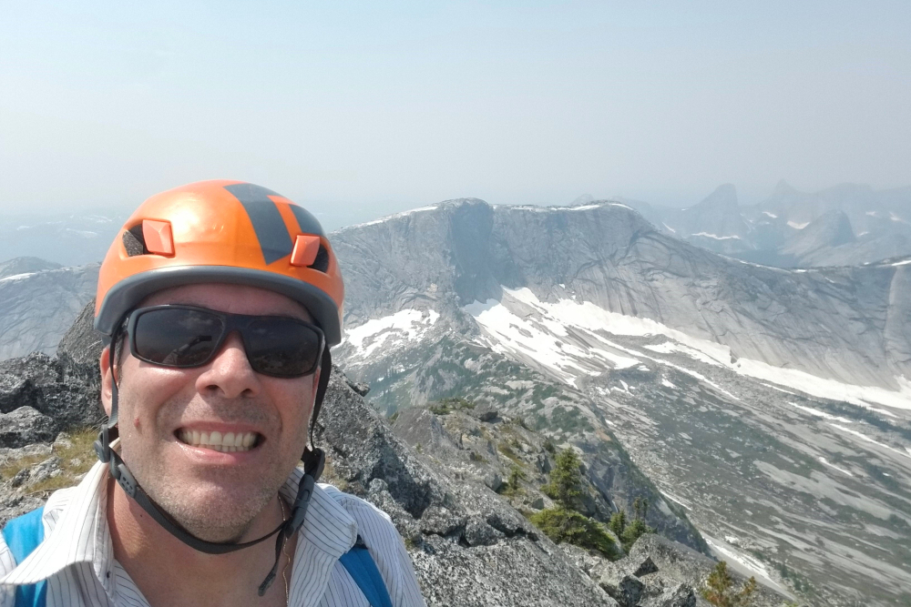
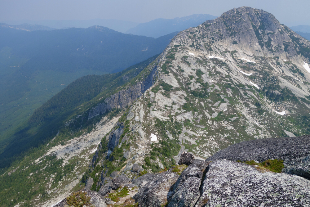
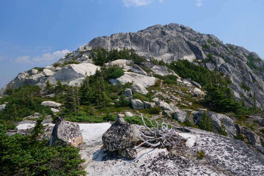
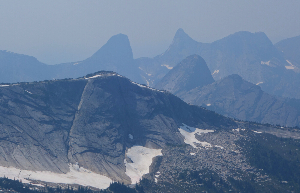
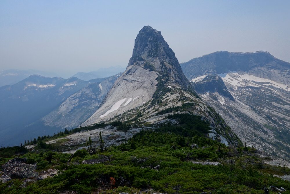
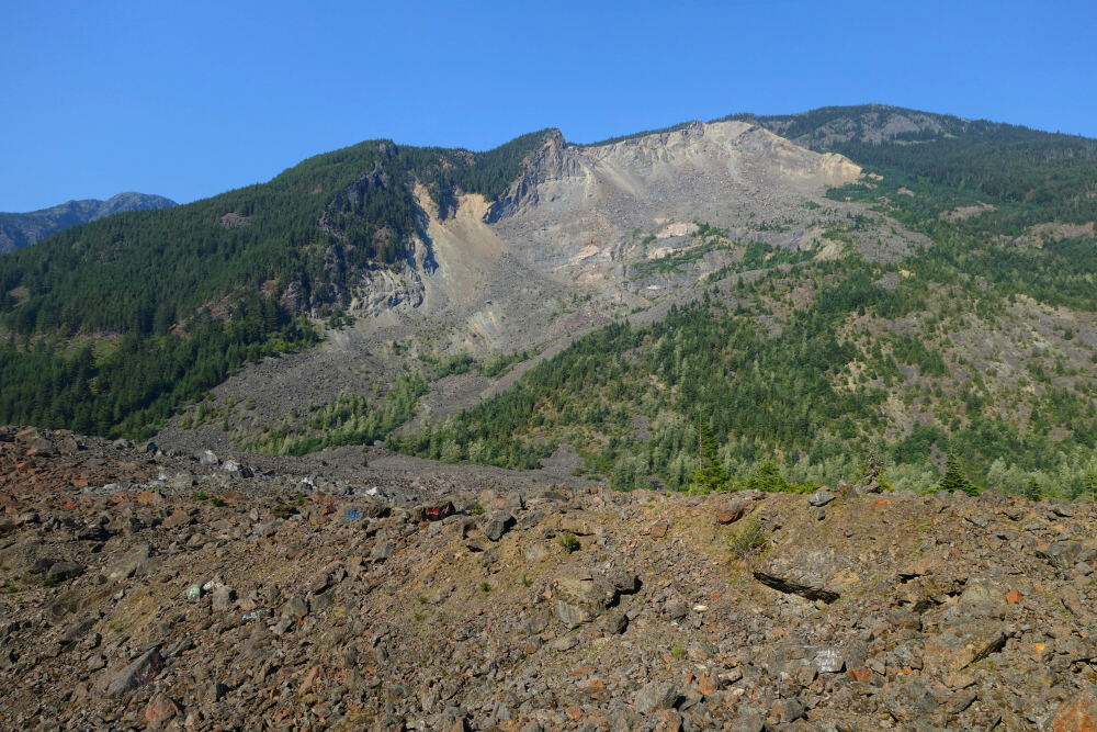
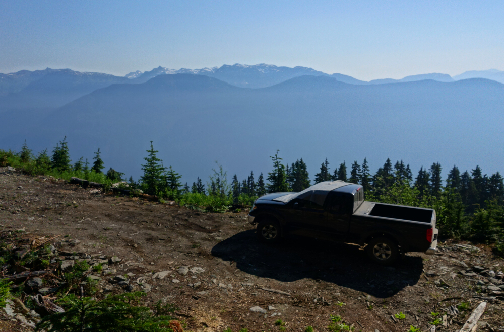
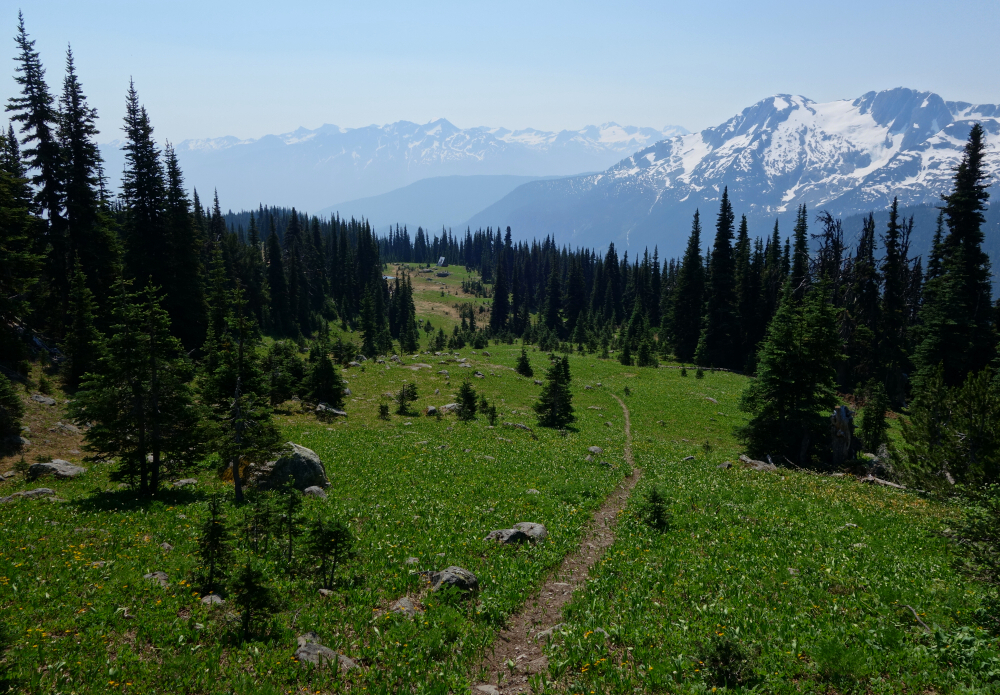
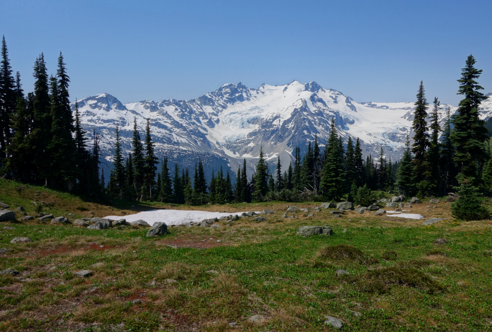
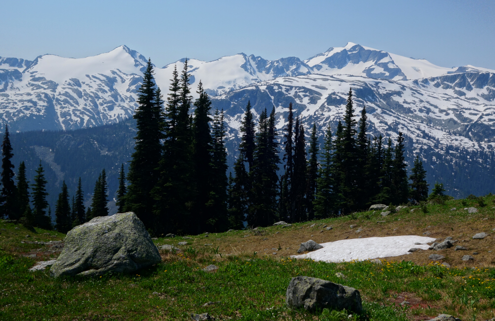
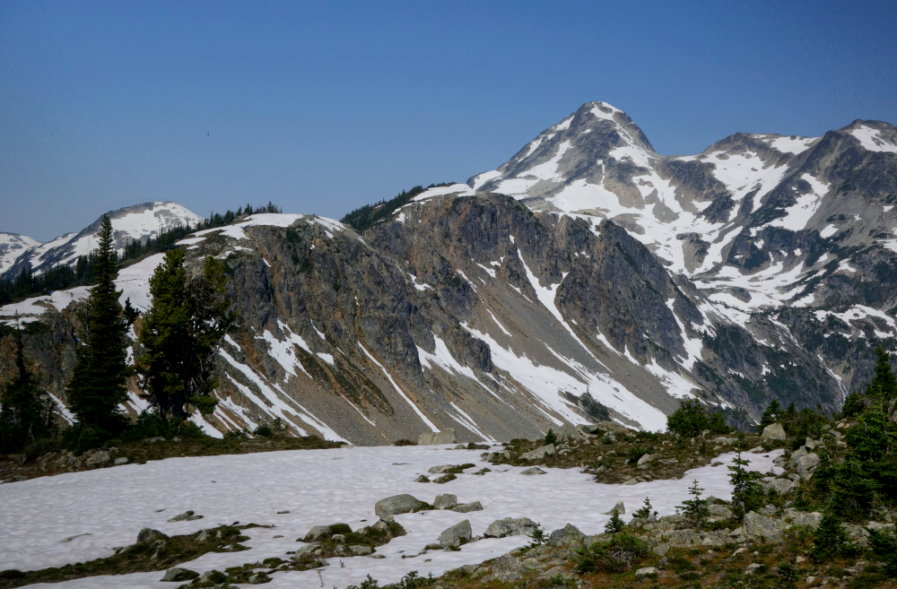
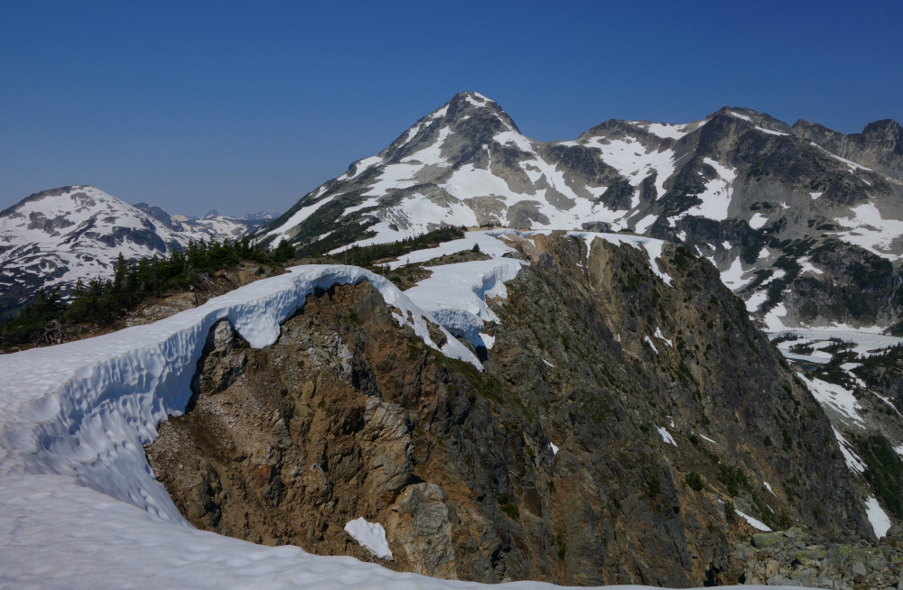
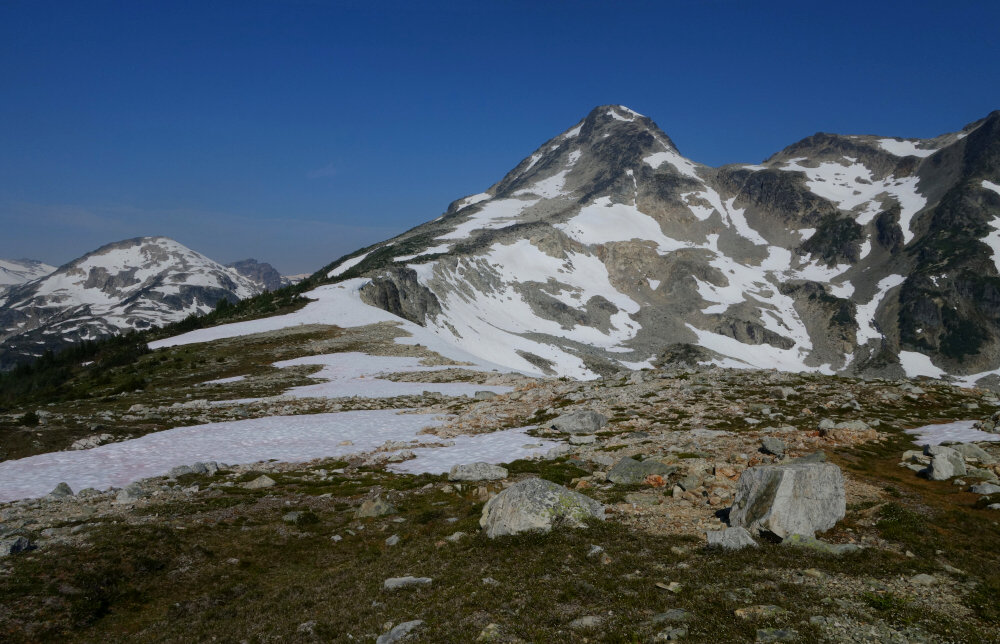
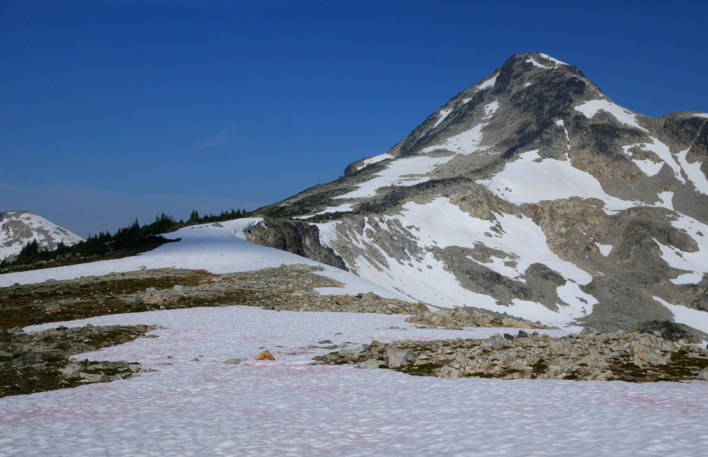
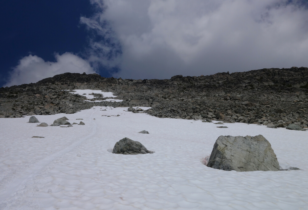
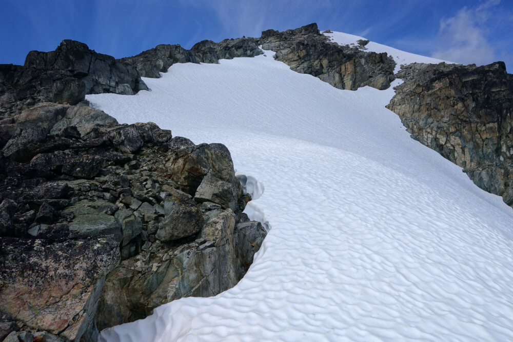
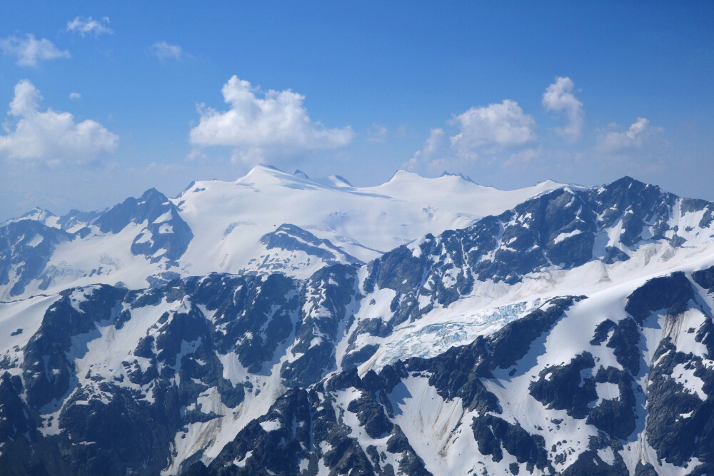
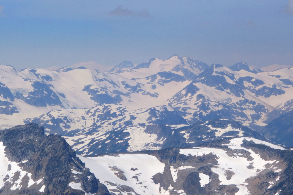
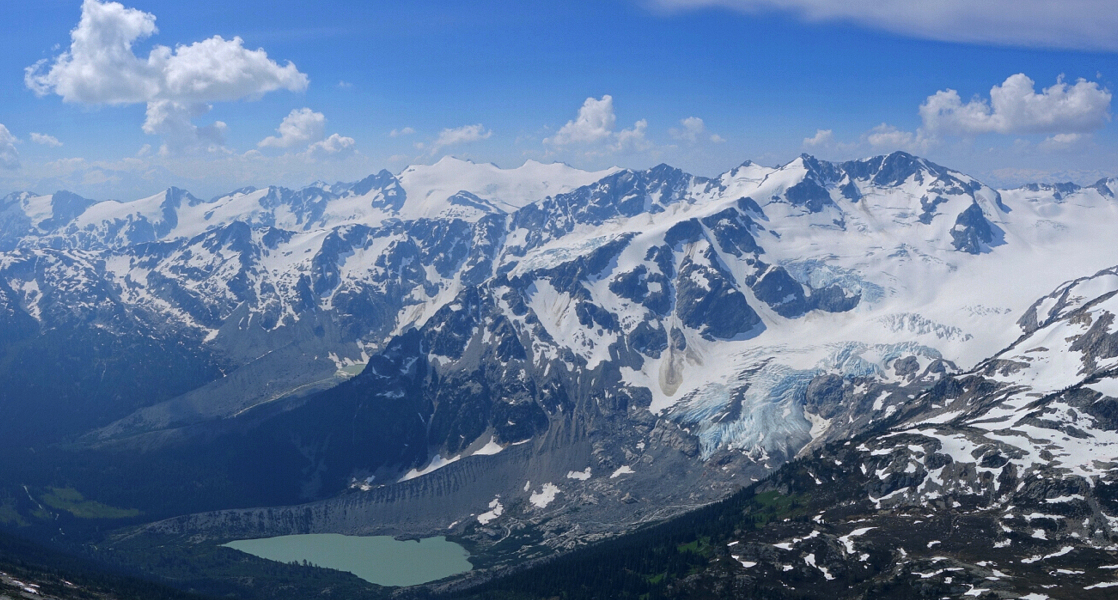
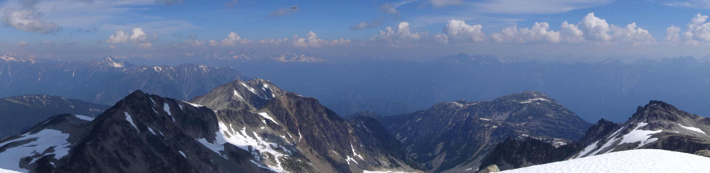
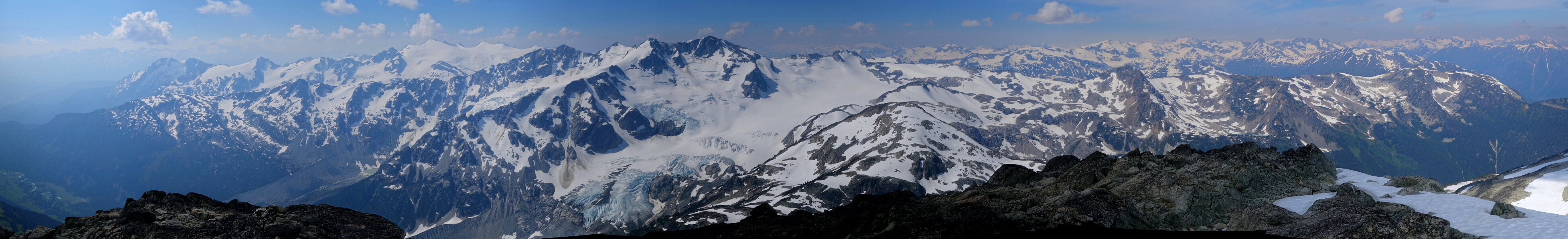
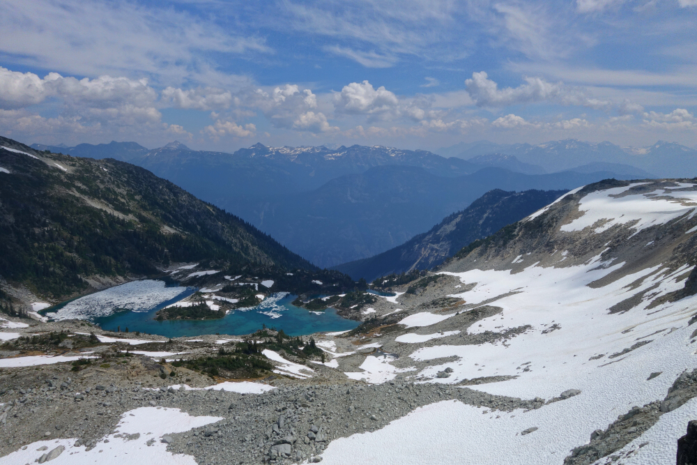
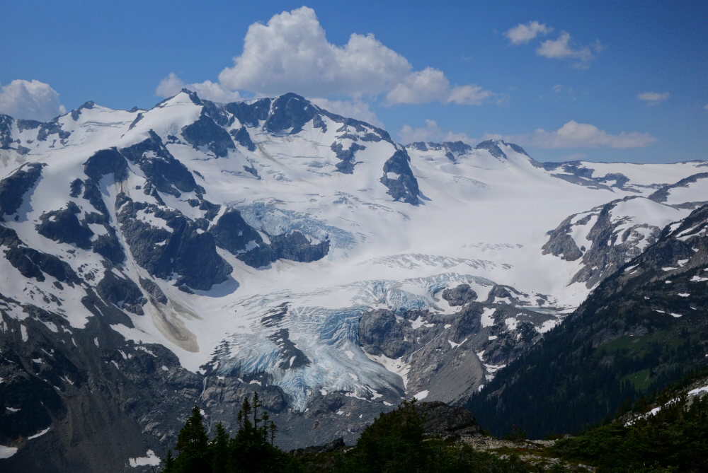
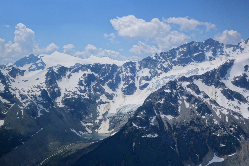
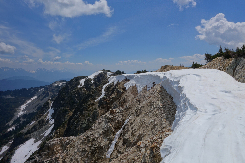
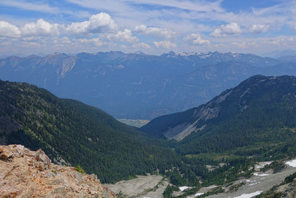
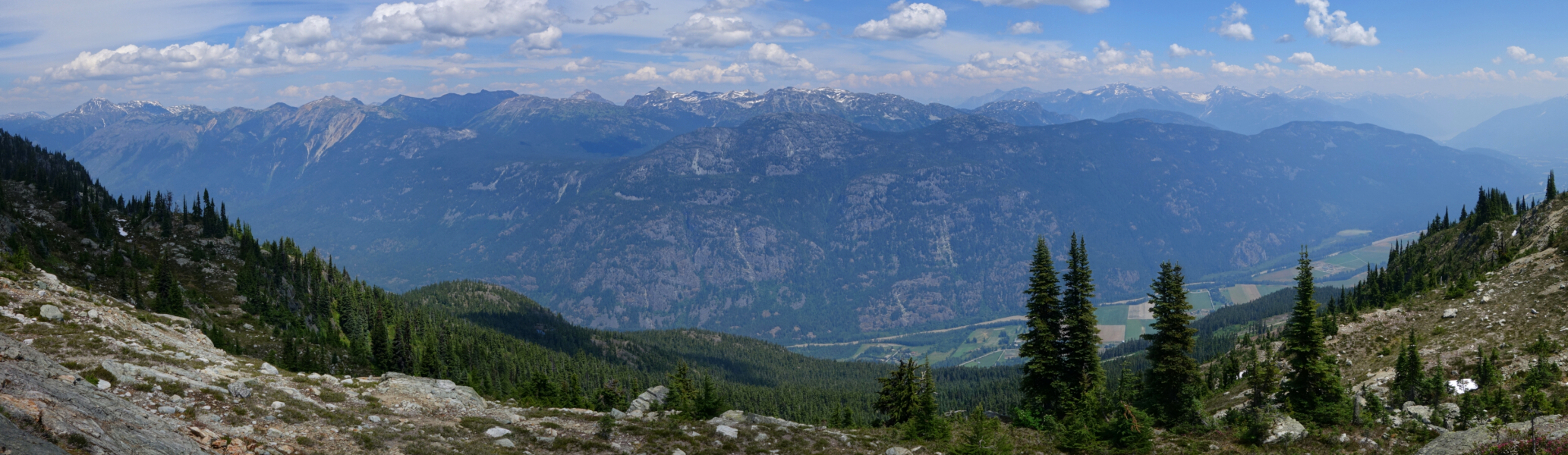
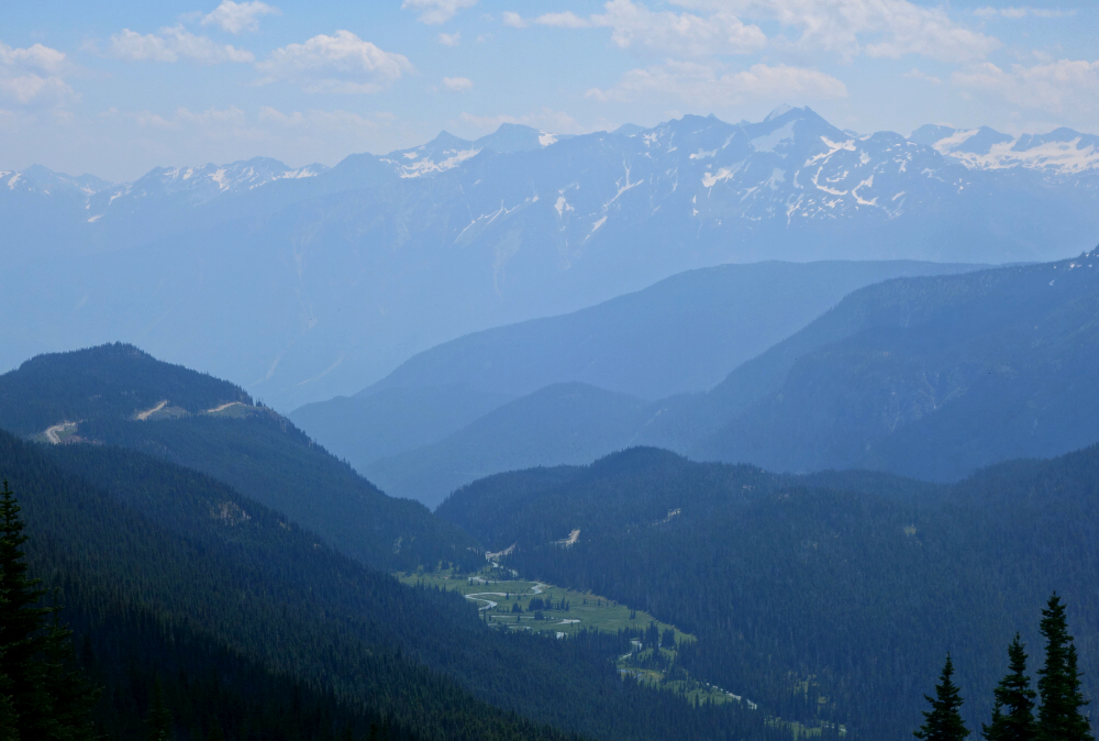
The details: to get there, simply leave the Pemberton Meadows Road shortly after the bridge over Miller Creek, taking a left right before the bridge over Ryan Creek. Follow the unpaved road parallel to said creek for a bit before it begins climbing, and following the main branch (left, right, right, left) to where it ends near the forested crest of Sugarloaf's lower East-Southeast Ridge. An obvious trail starts here and follows the ridge up to tree line where the shelters I mentioned are located. Here the trail ends, but the way forward is obvious - follow the ridge towards the peak just beyond. Up'n over a bump or two before it is straight sailing to the large snow patch on Sugarloaf's SE Face. Up the snow patch for a while, then right over talus and ledges to reach a spur on the peak's east side, which I followed to the summit. Hot damn are the views wicked from up there! Icefields to the west and towering peaks flanking the mighty Lillooet River Valley to the north and east with majestic Rhododendron and Ipsoot stealing the show to the south. Some smoke unfortunately as well, and sadly only the beginning of yet another active fire season, but great bang for the buck given only a 7-hour day round trip!
Click
here to view.
sugarloaf
sugarloaf
sugarloaf
sugarloaf
sugarloaf
sugarloaf
sugarloaf
sugarloaf
sugarloaf
sugarloaf
sugarloaf
sugarloaf
sugarloaf
sugarloaf
sugarloaf
sugarloaf
sugarloaf
sugarloaf
sugarloaf
sugarloaf
sugarloaf
sugarloaf
sugarloaf
sugarloaf
sugarloaf


