Select from list below to jump to a specific area on this site.
| Latest Posts |
Saturday, February 26, 2022
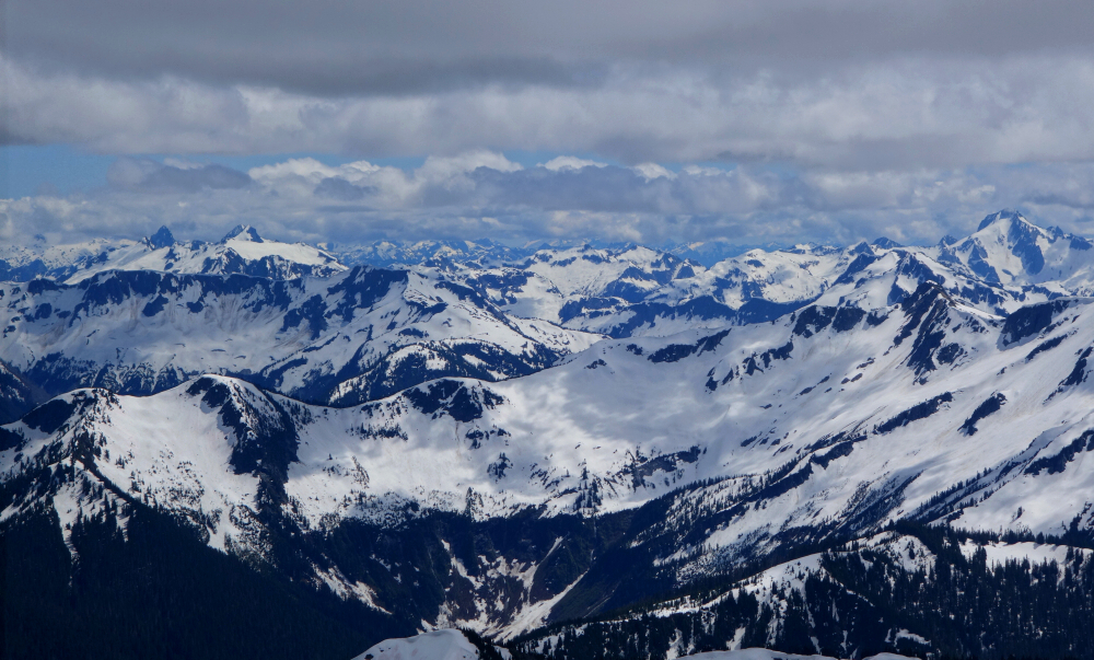
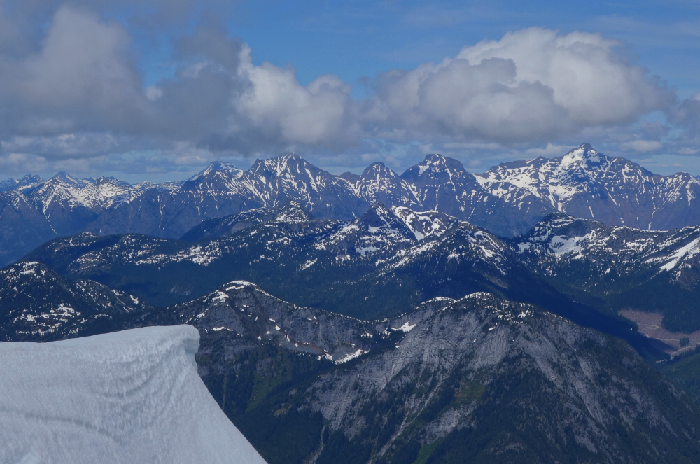
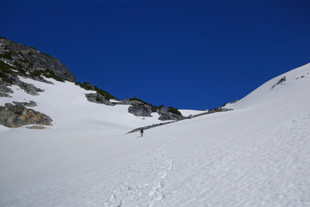
Mount Lindeman - North Route via Center Creek FSR, June 2021
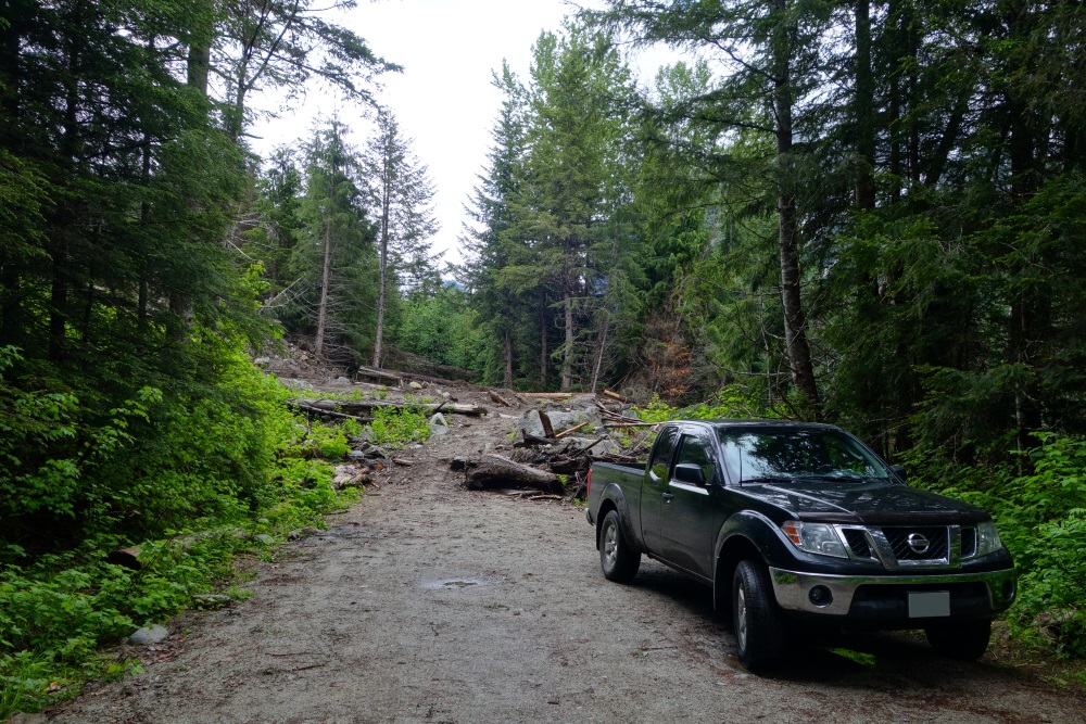
As any avid peak bagger in these parts knows, forest roads amount to essential infrastructure critical to the pursuit of our favorite pastime. Without active logging operations keeping the roads drivable, it's only a matter of time before they fall into disuse and are reclaimed by nature. Further deterioration caused by an increasing number of extreme weather events certainly doesn't help, and serves to remind us how fleeting this "infrastructure" can be. And so, motivated by reports of recent trail maintenance courtesy of the Chilliwack Outdoor Club, I jumped on the chance to tag Mount Lindeman. No time like the present given the FSR is (was?) still drivable, and the brush temporarily subdued!
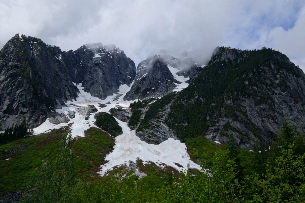
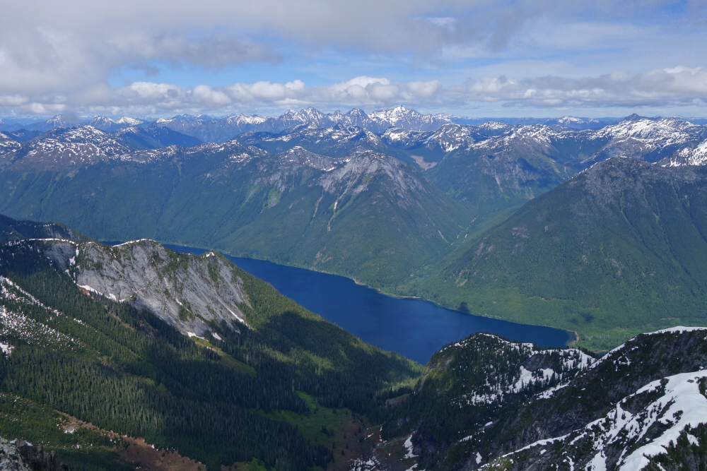
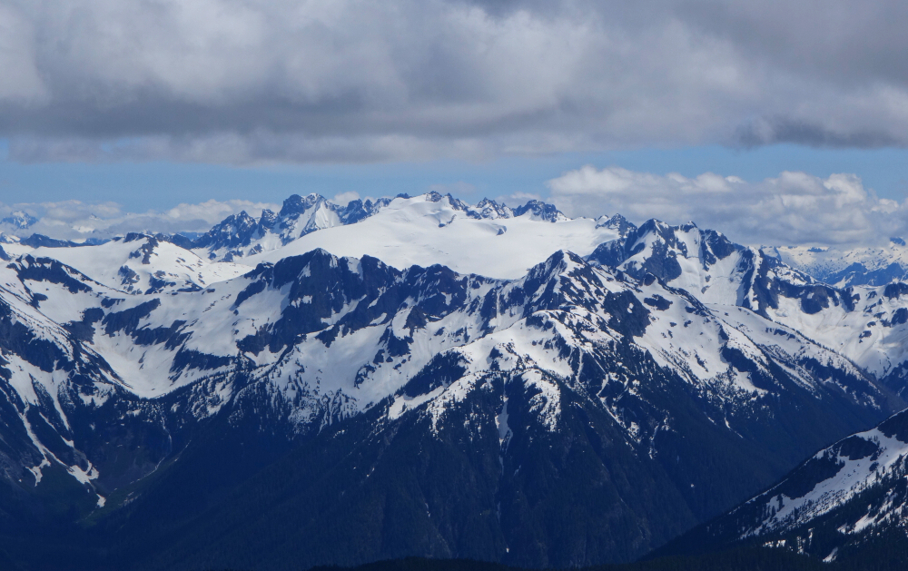
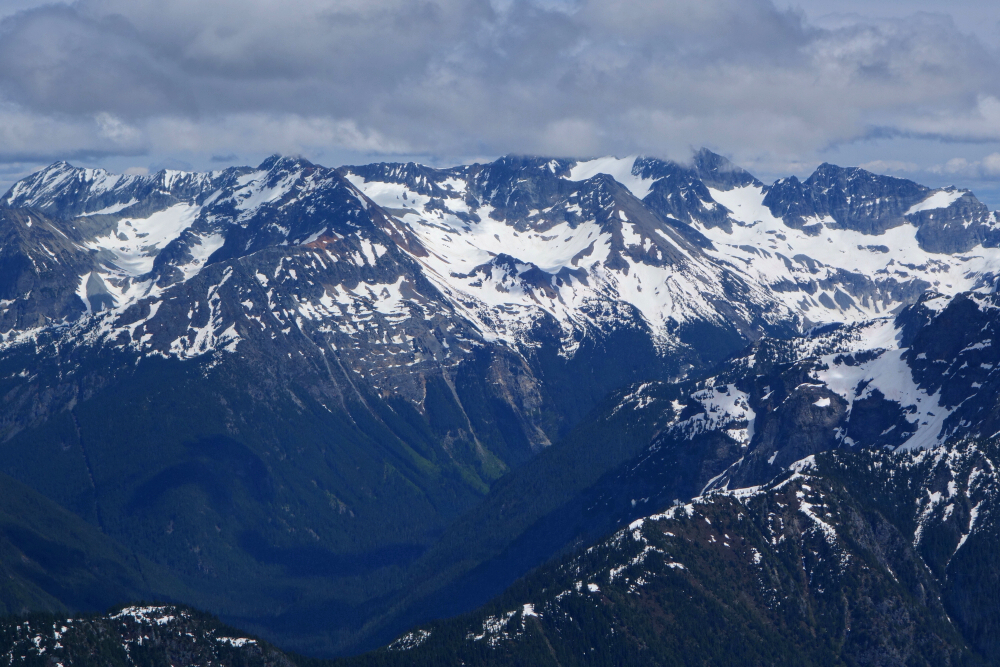
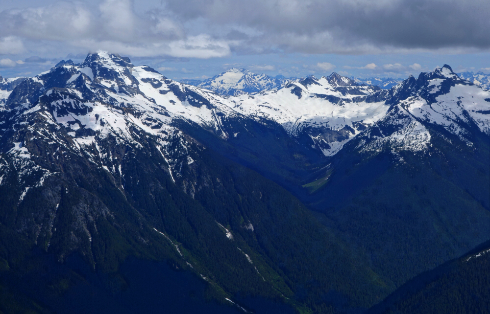
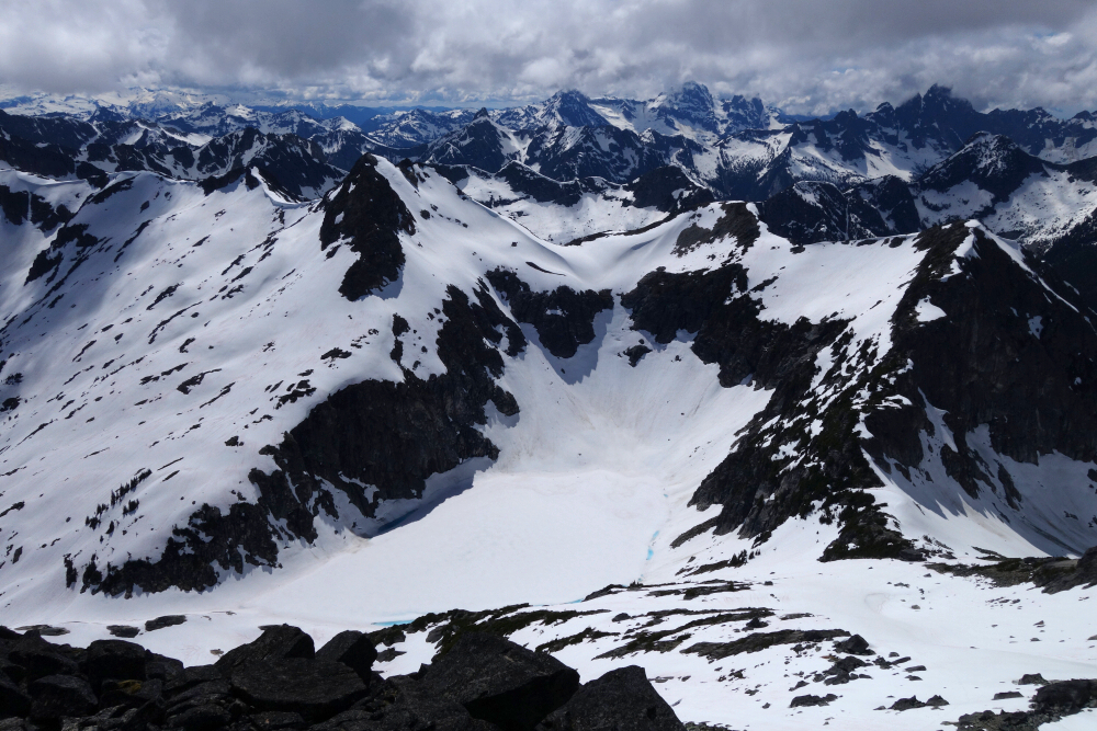
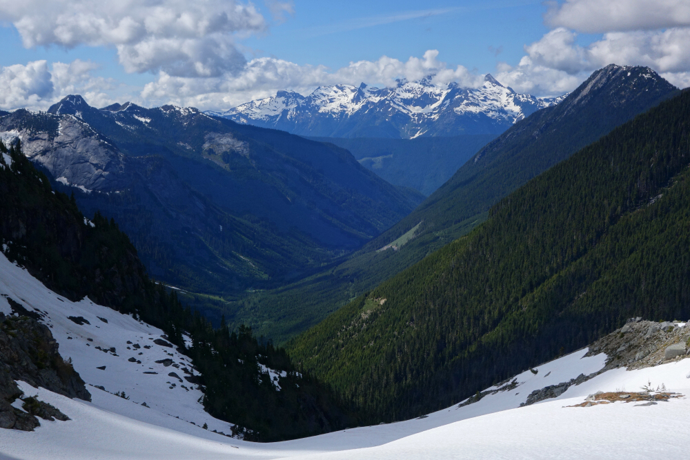
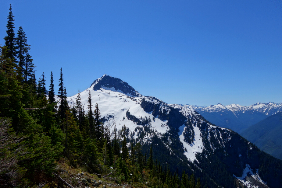
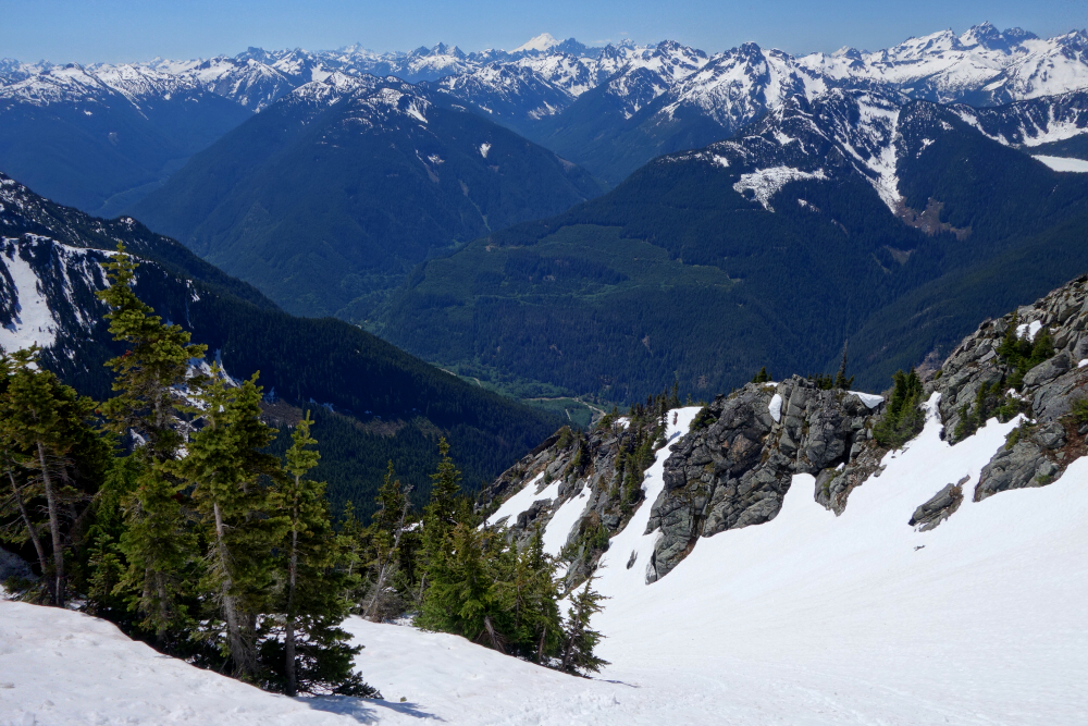
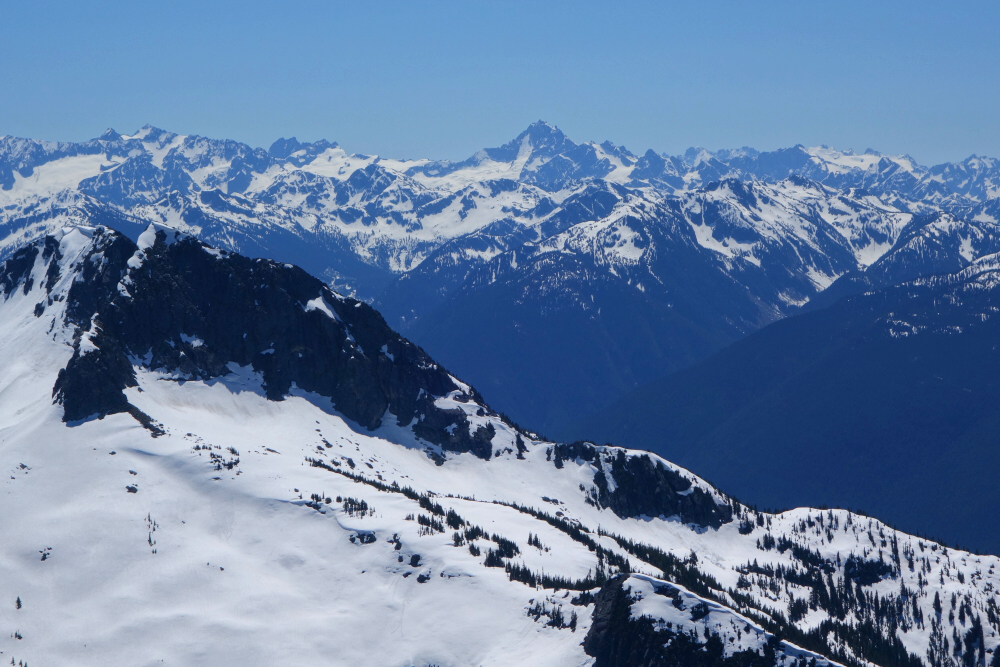
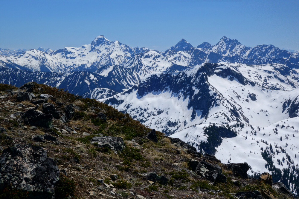
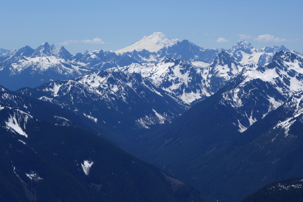
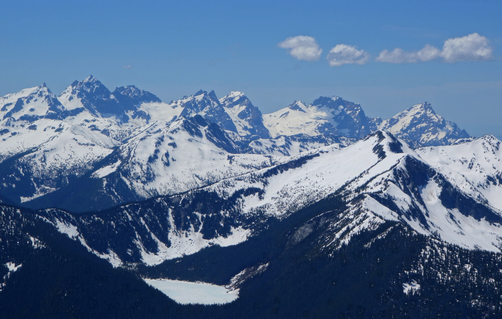
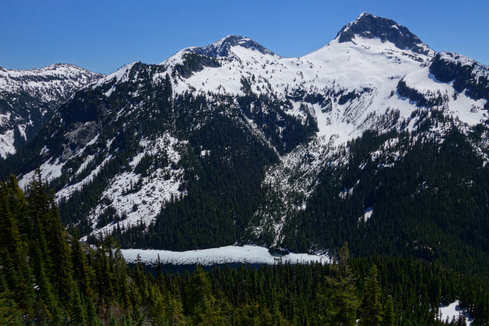
Not my first time in the general area, having scrambled nearby MacDonald Peak the previous summer. MacDonald (and adjacent Webb) are popular local objectives given their inclusion in SSWBC and good trail access from the Chilliwack Lake Provincial Park day-use parking area. Popularity aside, Lindeman is the highest and southernmost peak on the Center Creek-Chilliwack Lake Divide where both Mac'D and Webb are also found. Knowing this, it should come as no surprise that the views from Lindeman are considerably better than those from either of the others. The summit is about a mile as the crow flies from the US border, south of which an unobstructed panorama of familiar (to me) peaks and glaciers in the North Cascades National Park and beyond are be beheld! Won't rattle them all off this time - photos speak for themselves.
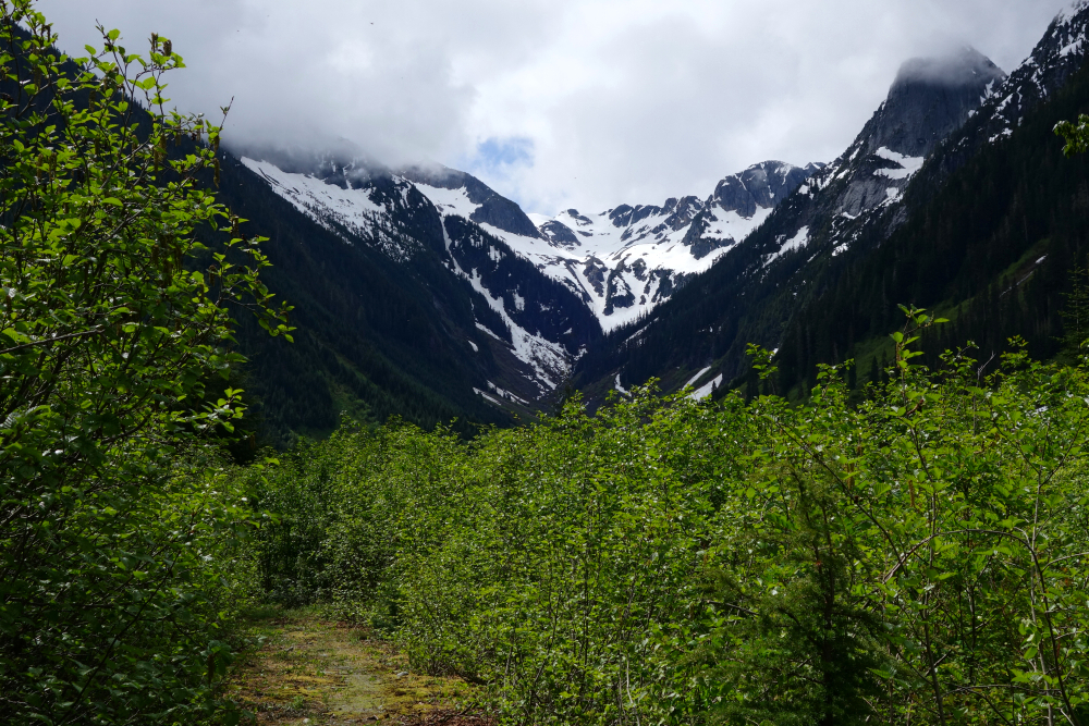
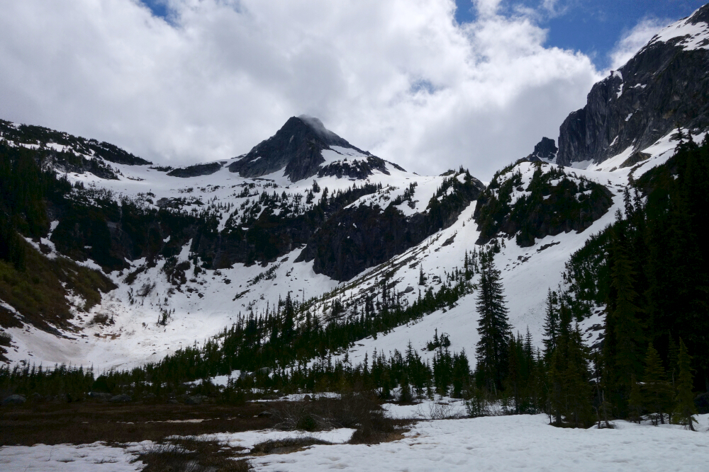
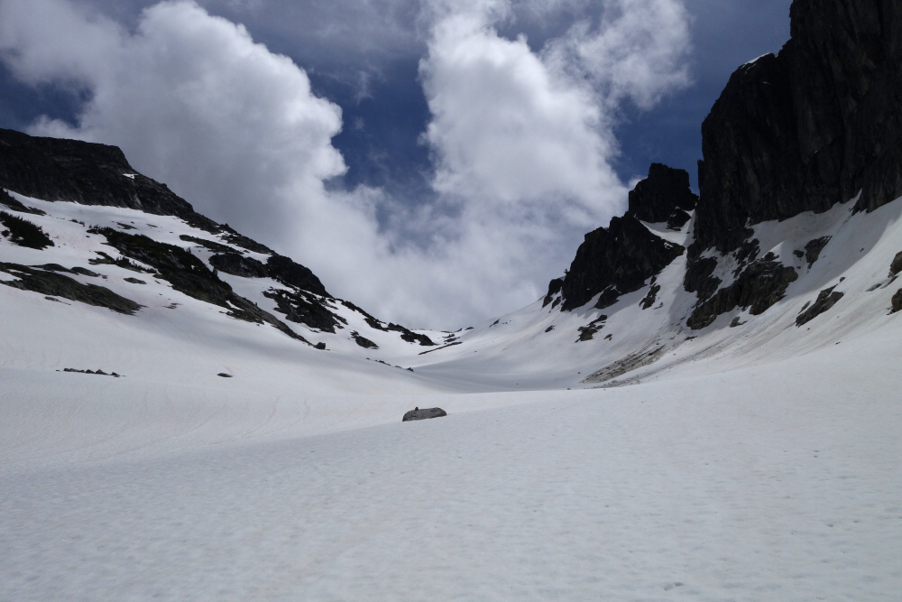
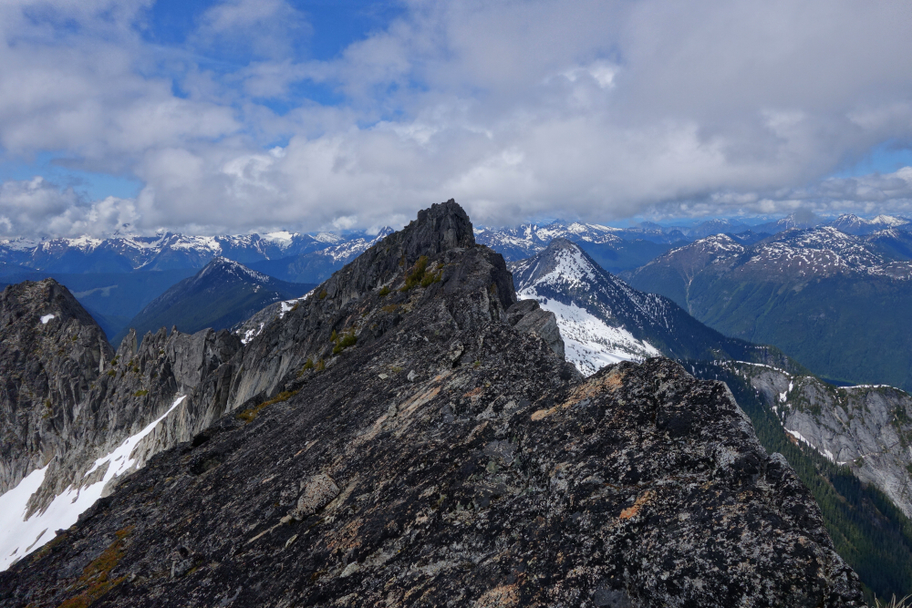
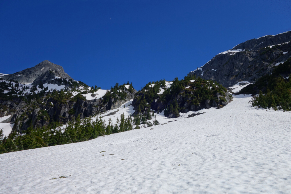
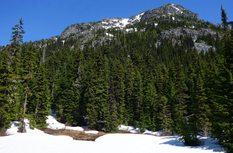
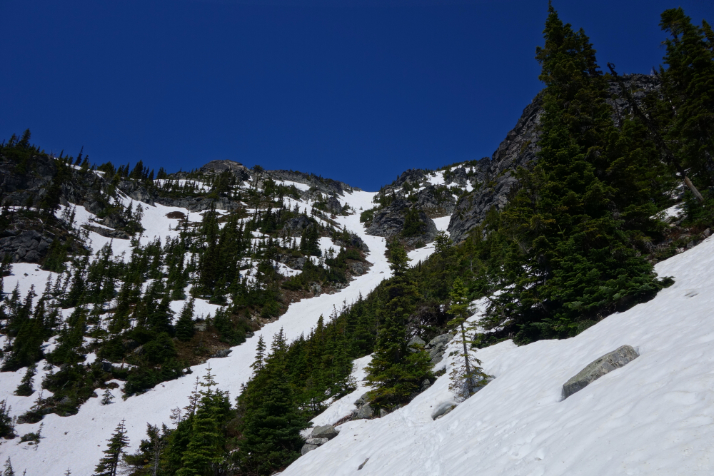
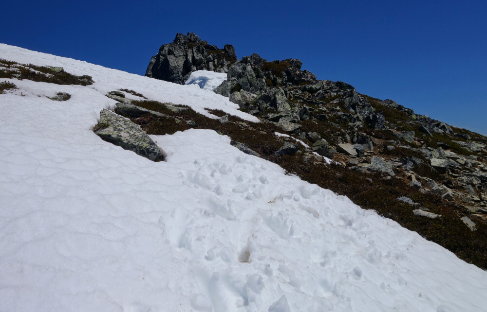
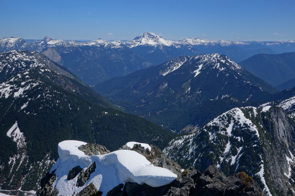
Straightforward navigation as far as approaches go starting from the current parking area at a large washout (passable to ATVs). Just follow the deactivated FSR up the valley for several km's to its end, then turn left up a worn path steeply through forest to reach a meadow in the hanging basin below Lindeman's north cirque. Up an obvious gully at right side of the headwall to reach the alpine bowl above, after which it's an easy cruise to the stunning west col. Then finally, up and right across the West Face aiming for the spot where the South Ridge pitches down and meets heather and rock slopes. Just a short scramble from there up along the ridge to summit proper. A point further north on the summit ridge seemed slightly higher (it apparently isn't), so I went over to check it out. Turns out that it is guarded by a very exposed notch that likely requires technical climbing to get in and back out of. Not today, or ever, so back to the true summit where I enjoyed a snack with a killer view! Around 8 - 9 hours round trip at an average pace and my customarily short(ish) summit stay.
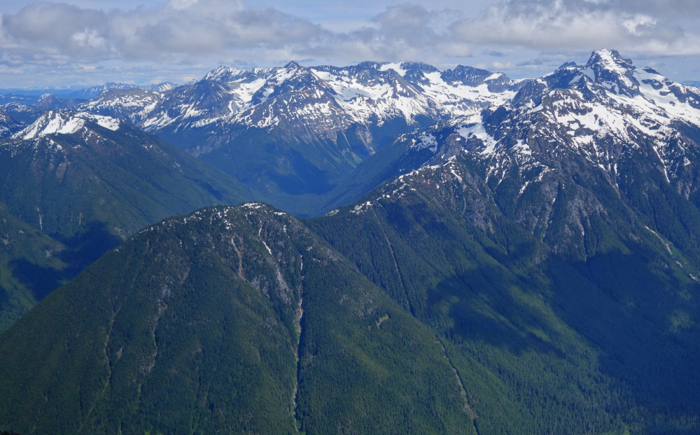
Mount Grant - South Route via Eaton Lake, June 2021
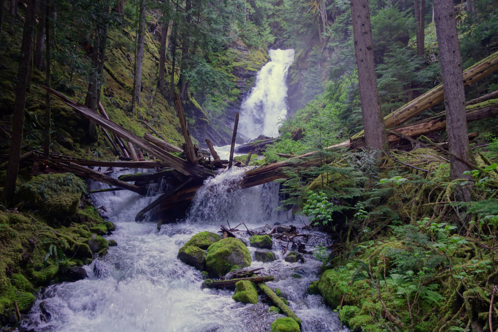
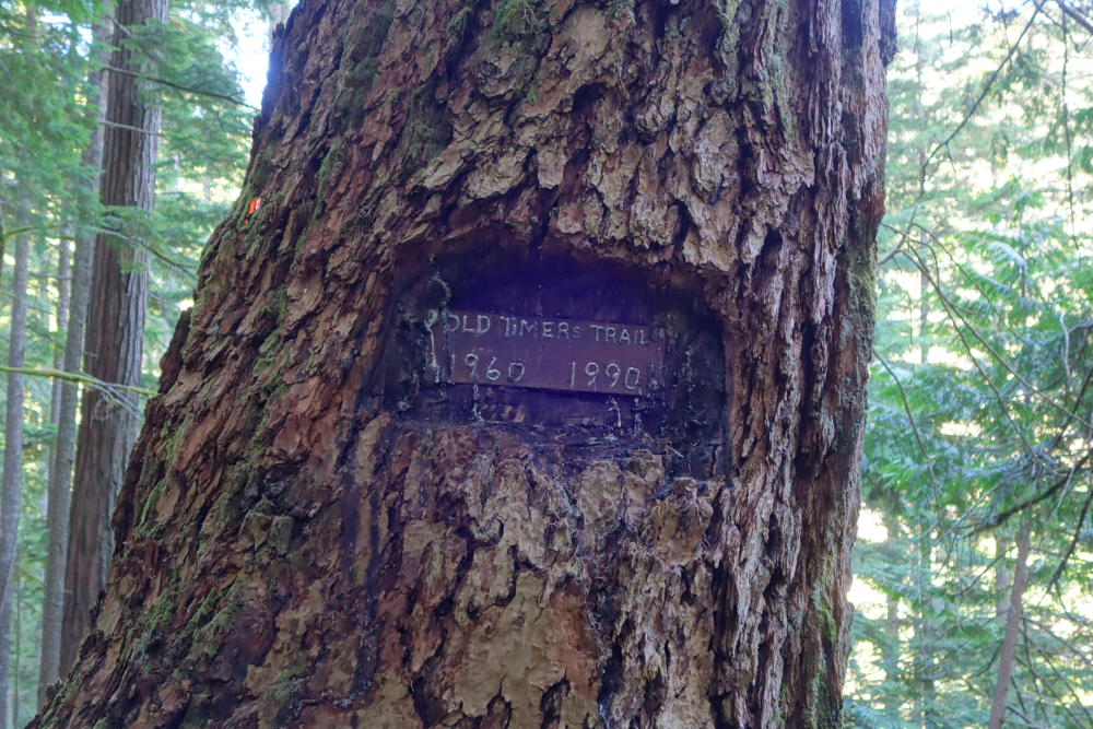
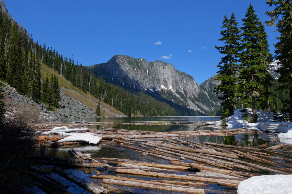
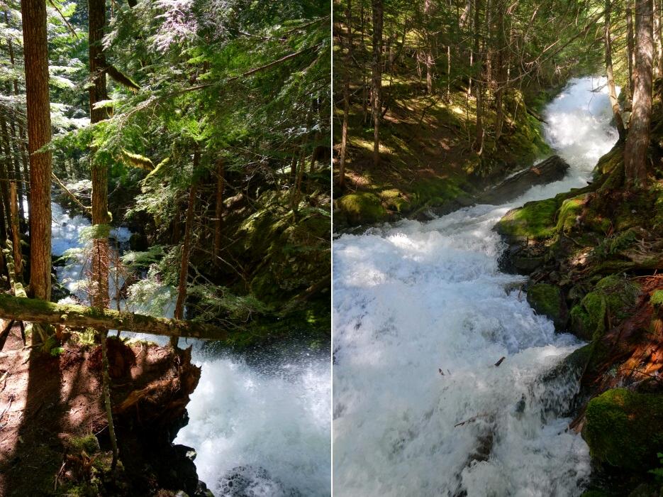
Headed for Mount Grant at the crack of June for a fine Springtime romp up a prominent North Cascades peak. Drive up to the trailhead doable in any car, as of this writing at least, but do beware the abandoned homeless encampment there. It's like a small piece of the Lower East Side complete with drug use paraphernalia and garbage strewn about right here in Silver-Skagit country. How quaint! Beautiful trail from there up to Eaton Lake, complete with a raging creek and numerous waterfalls to break the silence. Crossed said creek on a couple good footbridges, right then back left, before encountering continuous snow. The third and final bridge, no more than a glorified footlog, sustained some damage over the course of the Winter and was a bit too sketchy for my liking. Up along the embankment I go, soon finding a submerged handline straining against the force of the rushing water. Probably as good a place to cross as any, so boots off for an icy creek ford! Picked up the trail on the other side and followed it to the lakeshore. Scenic place with some nice flat camping spots. Sun was reaching its apex too, and boy was it a scorcher of a day!
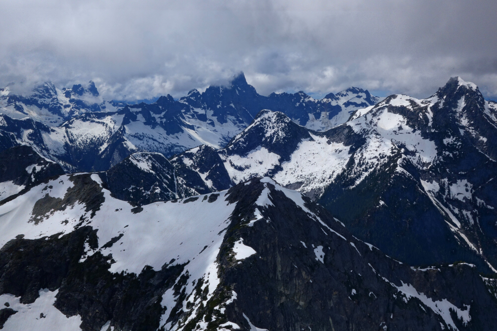
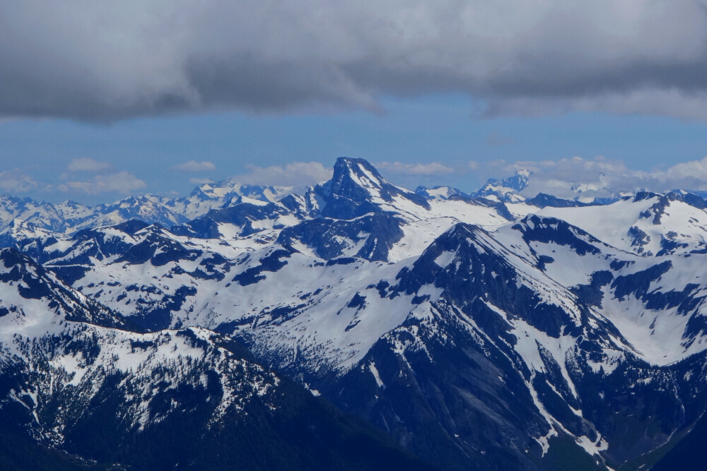
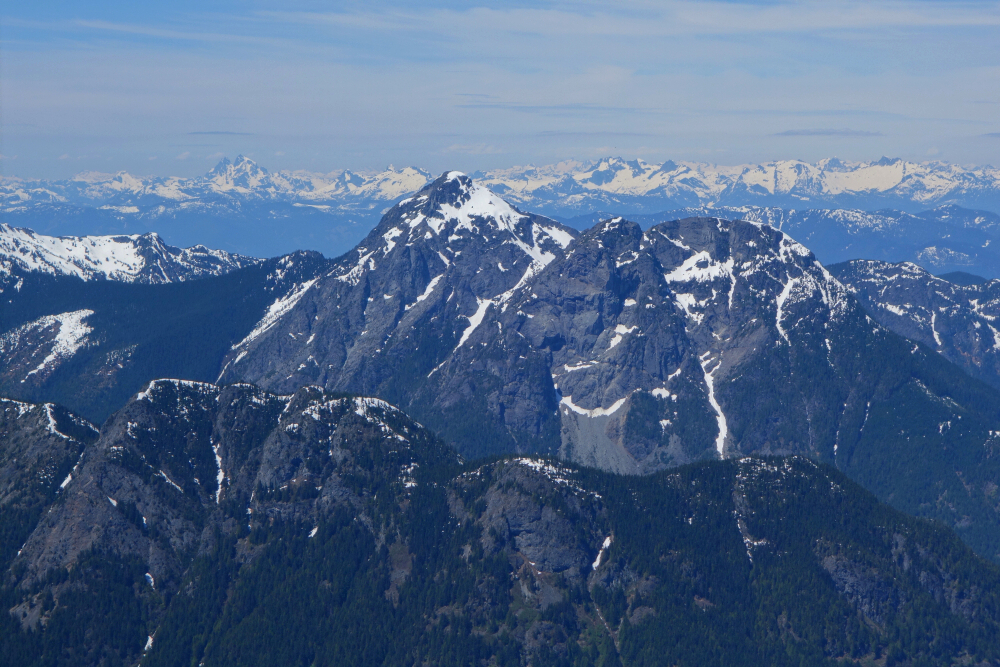
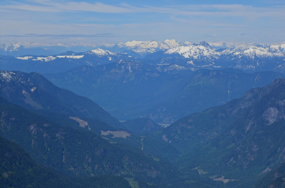
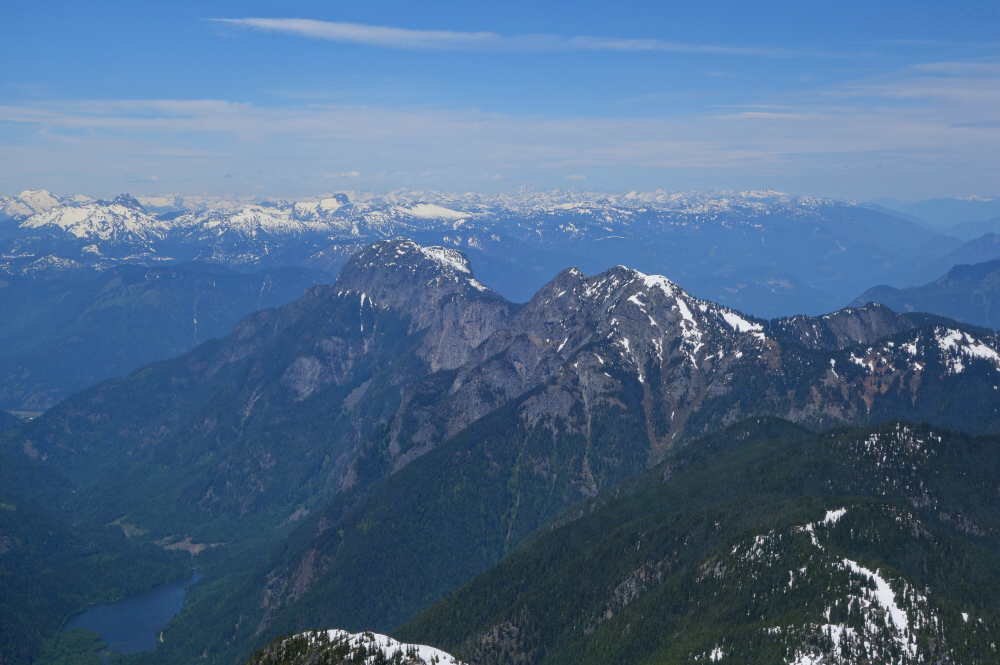
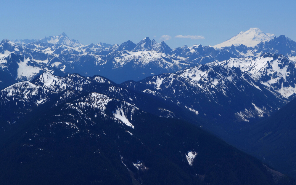
My objective was off to the left, so back across the creek I go once more, crossing at the lake outlet where snow met a logjam. Soon picked-up some newish flagging, which with care I was able to follow to the obvious south face gully described in SSWBC. Encountered local peakbagging phenom Steven Song and party returning from the summit at bottom of said gully. Aha! I thought that might have been his red Toyota Tacoma at the trailhead! Shared some pleasantries before going our separate ways. Crampons on and followed Steven and co.'s boot track up soft snow to reach the summit area and from where there's oh-so much to see! Shuksan, Baker and the Border Peaks to the south along with the rest of the prominent "Chilliwacks" - Redoubt, Spickard, Mox Peaks, Rexford, Slesse, Lindeman etc. Great perspective on the north wall of the Cheam Range to the SW as well as the Payne-Rideout-Silvertip Group to the SE. Hope and Wells easy to make out looking north as well as Isollolock Peak looking across Silverhope Creek Valley. Judge Howay and the Chehalis Range to the NW with the unmistakable Outram massif to the NE. Darn good views in this neck of the woods folks! About 8 hours round trip and a very satisfying day in the BC Cascades!
It would be very much appreciated if you please ask before copying and/or re-publishing content from any part of these pages. To do so, please click here to send a message via feedback form.


