Select from list below to jump to a specific area on this site.
| Latest Posts |
Monday, September 19, 2022
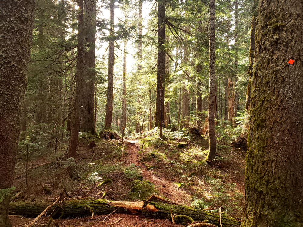
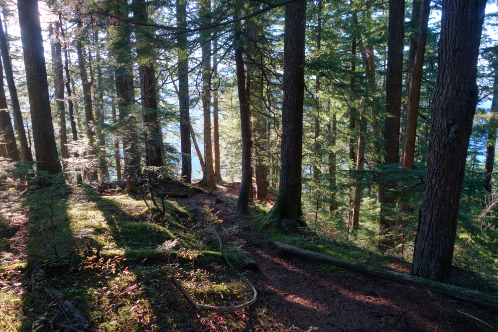
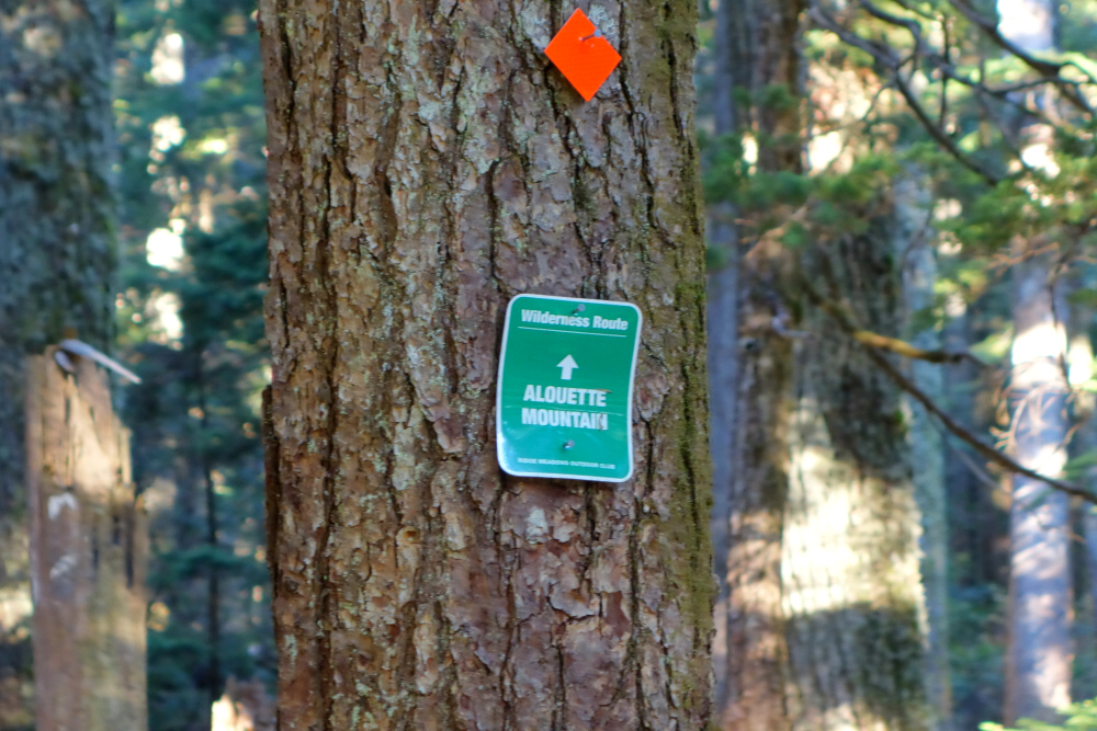
Alouette Mountain - Alouette Mtn. Trail, November 2021
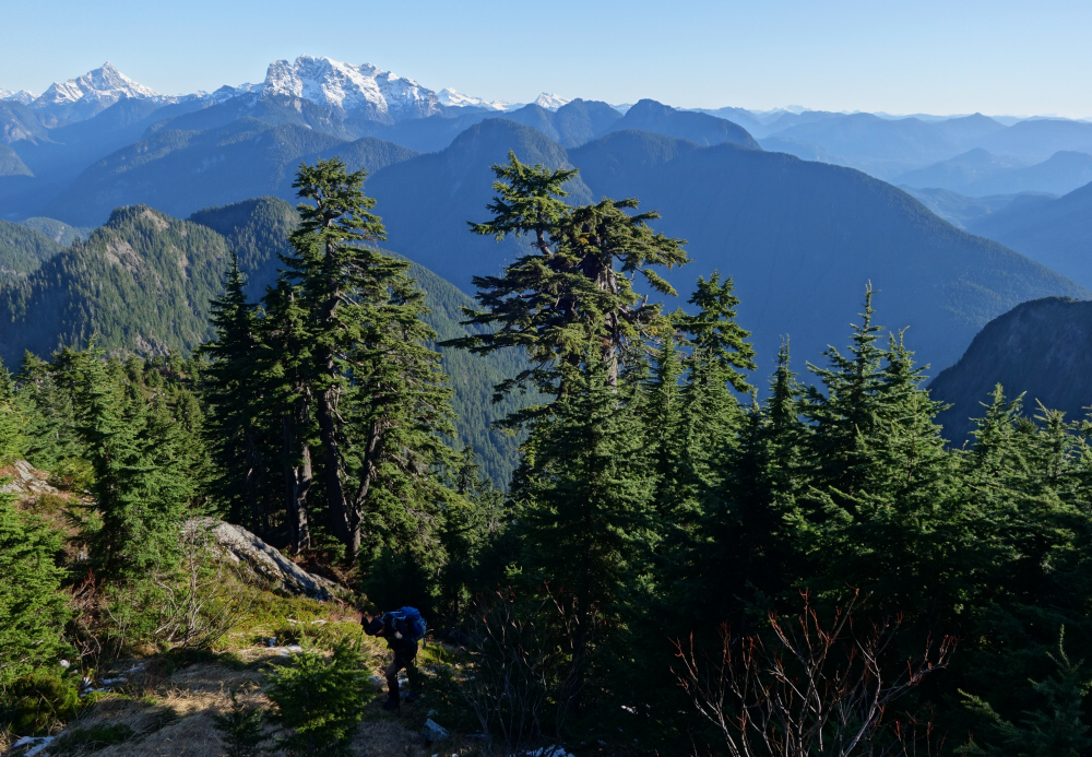
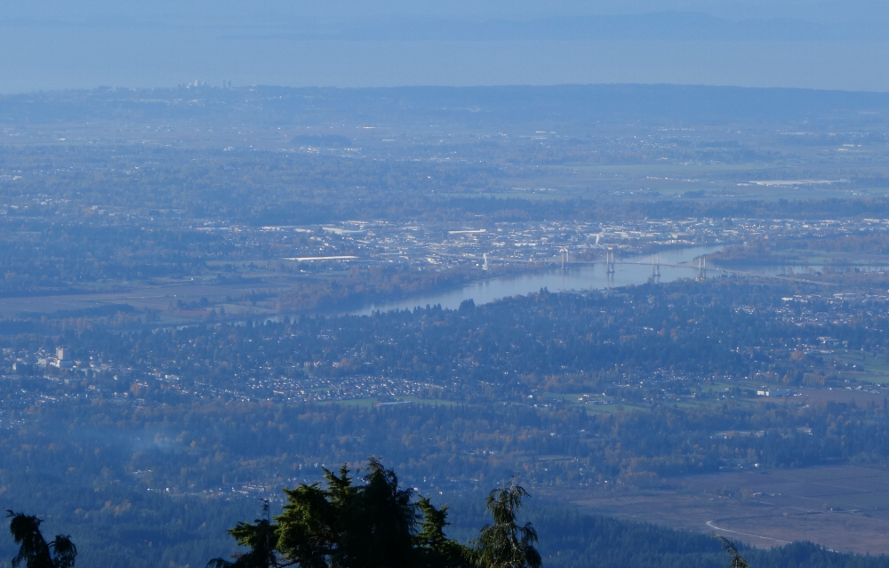
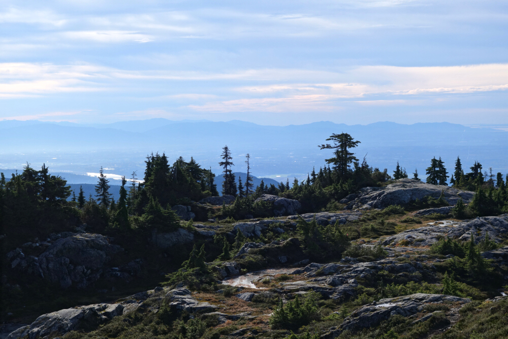
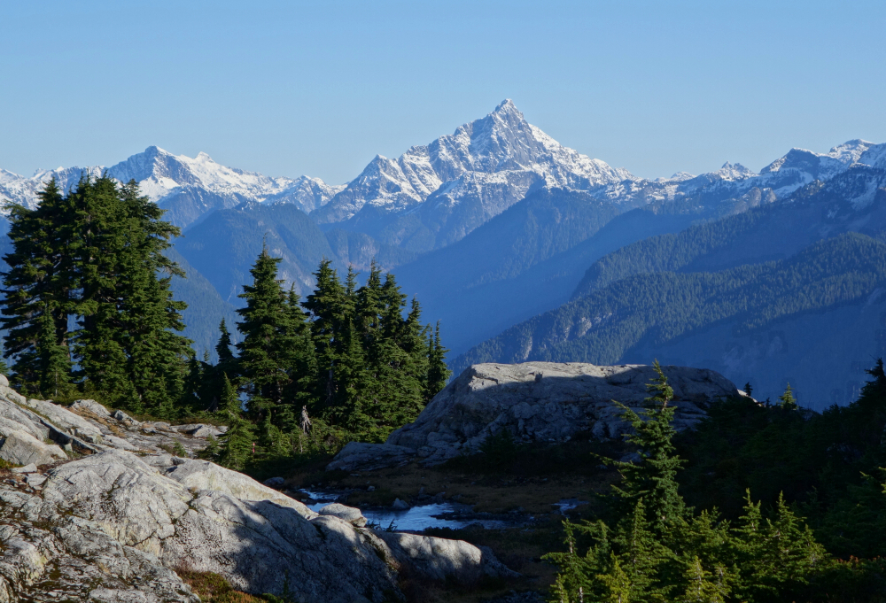
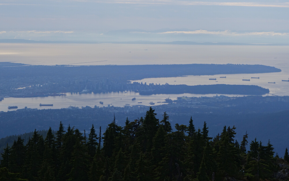
With a good dusting now at the higher elevations and ski season just around the corner, I made my way back to Golden Ears Provincial Park for one of my final sub-snowline hikes of the season. Like with Evans Peak, Alouette Mountain offers a good workout, suitable for the shorter days of Fall albeit with better views overlooking much of the Lower Mainland. Granted, the view is nothing like that from Golden Ears (North Ear) proper, but that was a whopping 16 years ago now and much has changed down there in there in the flatlands during that time!
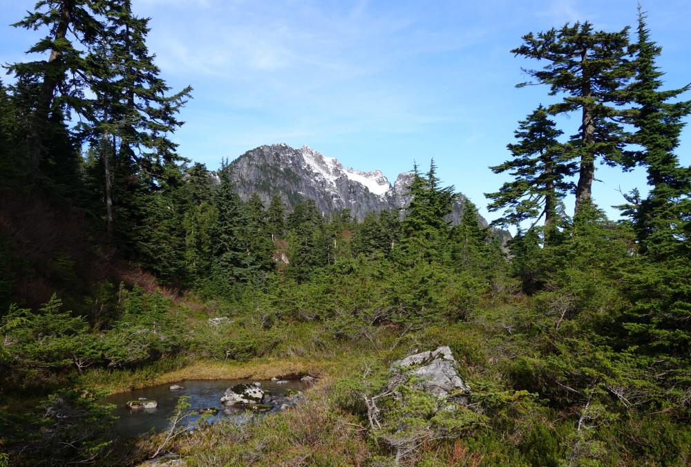
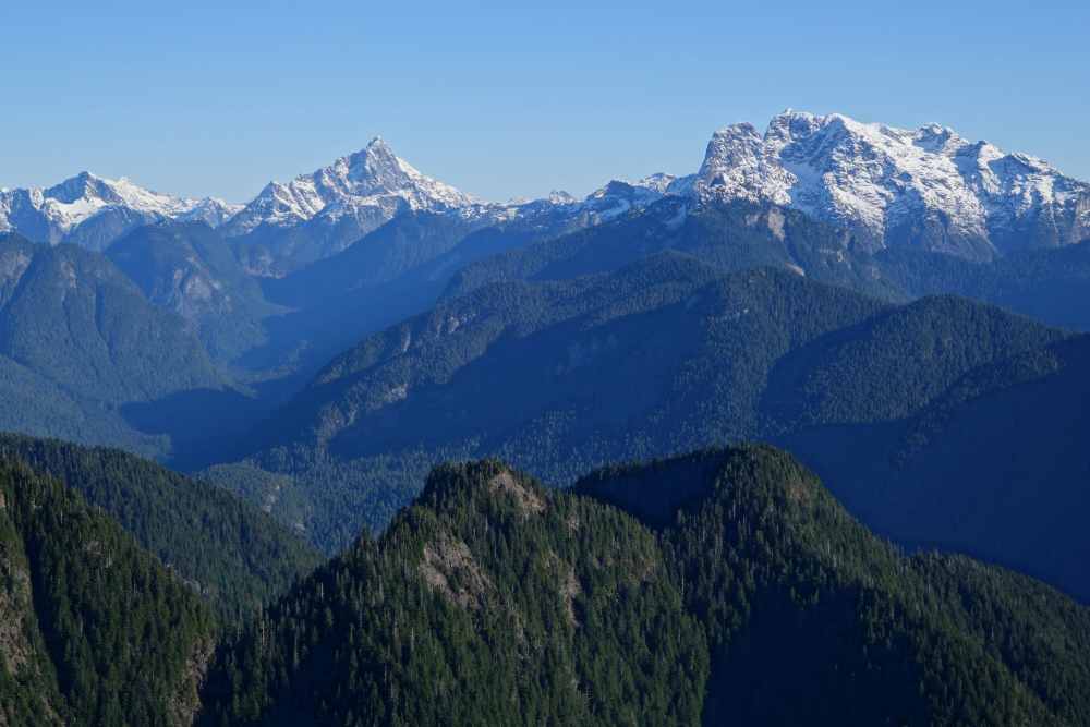
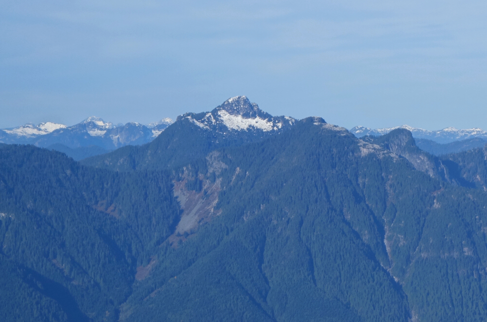
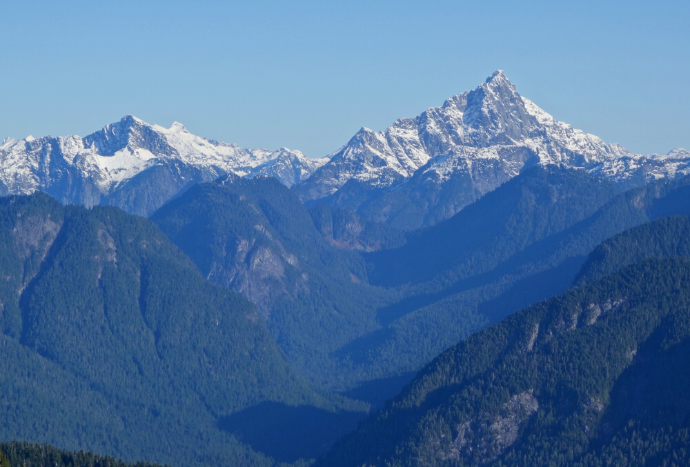
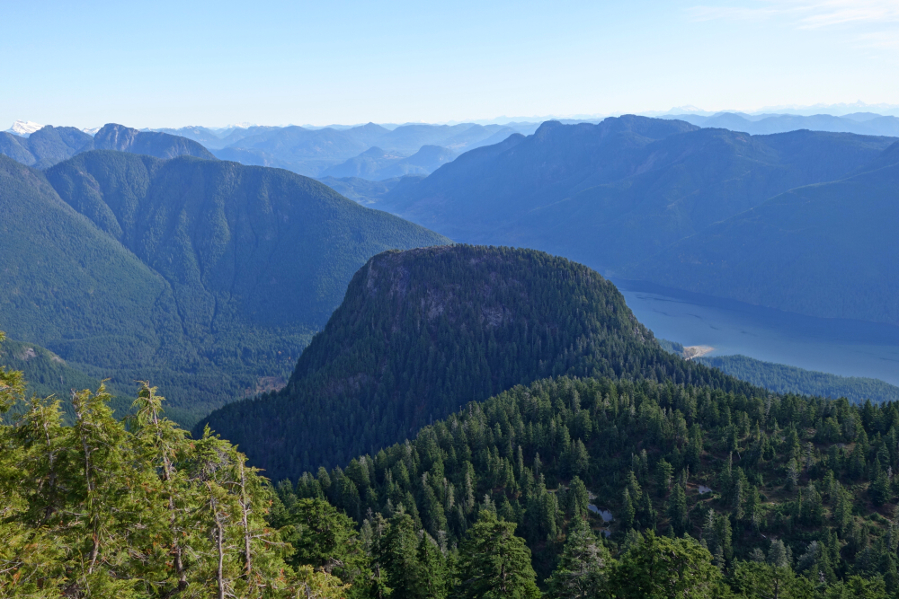
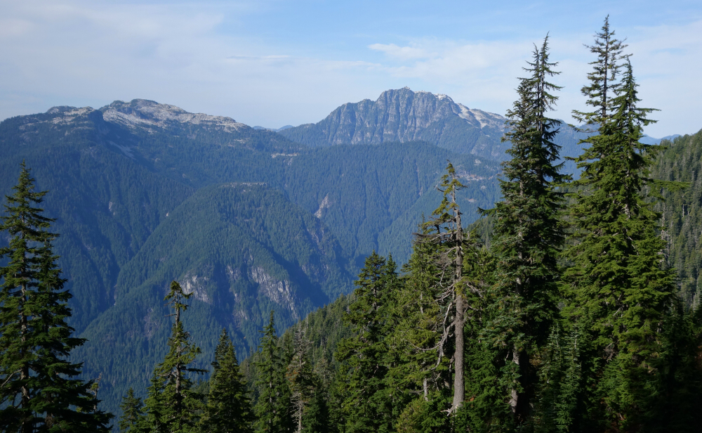
The approach is the same as that for Evans, just take the signed fork to the left for Alouette and follow the marked trail up to the summit plateau with commemorative cairn with plaque thing there on the highest point. Just one other soul hiking up there on this day - a day where rain was forecasted to move in later that afternoon, so best to move quickly and not linger for too long! Wandered around the summit area for a bit, searching for the best photo ops overlooking the urbanized expanse spread out below. Great views also to the north of Robie Reid, Judge Howay and co. Interesting perspective on Alouette Lake, one of the prettier "front range" bodies of water in my opinion. Then of course there's the Golden Ears massif itself, its neighbor Edge Peak and the striking rock thumb of Blanshard Needle. There's an interesting route up that one, with a short 5th-class pitch followed by some fun scrambling - might have to come back for that someday. But not today, 'coz the rain she's a comin'! A satisfying outing with decent views, the first drops holding off just long enough for me to reach the car!
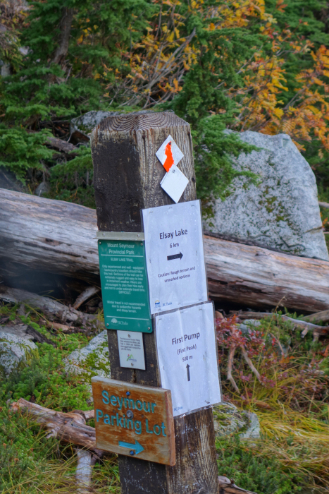
Mount Elsay - via Elsay Lake Trail (loop), October 2021
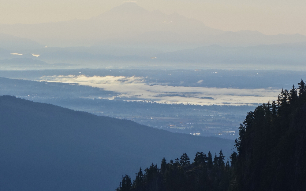
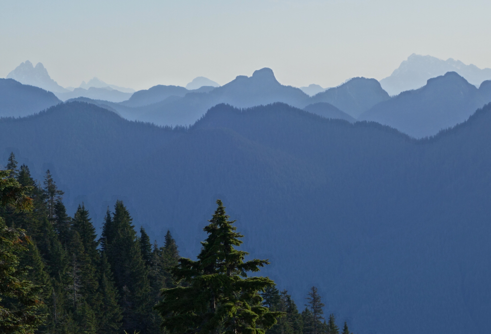
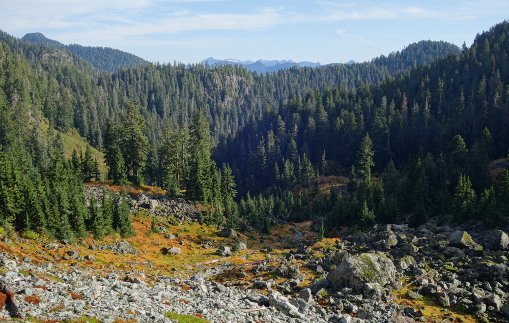
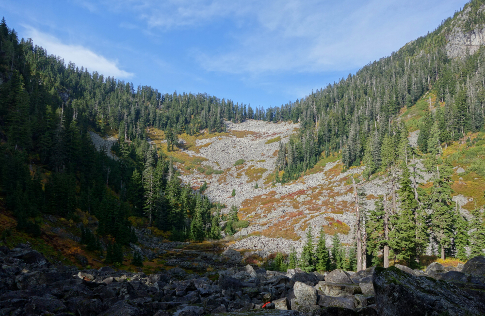
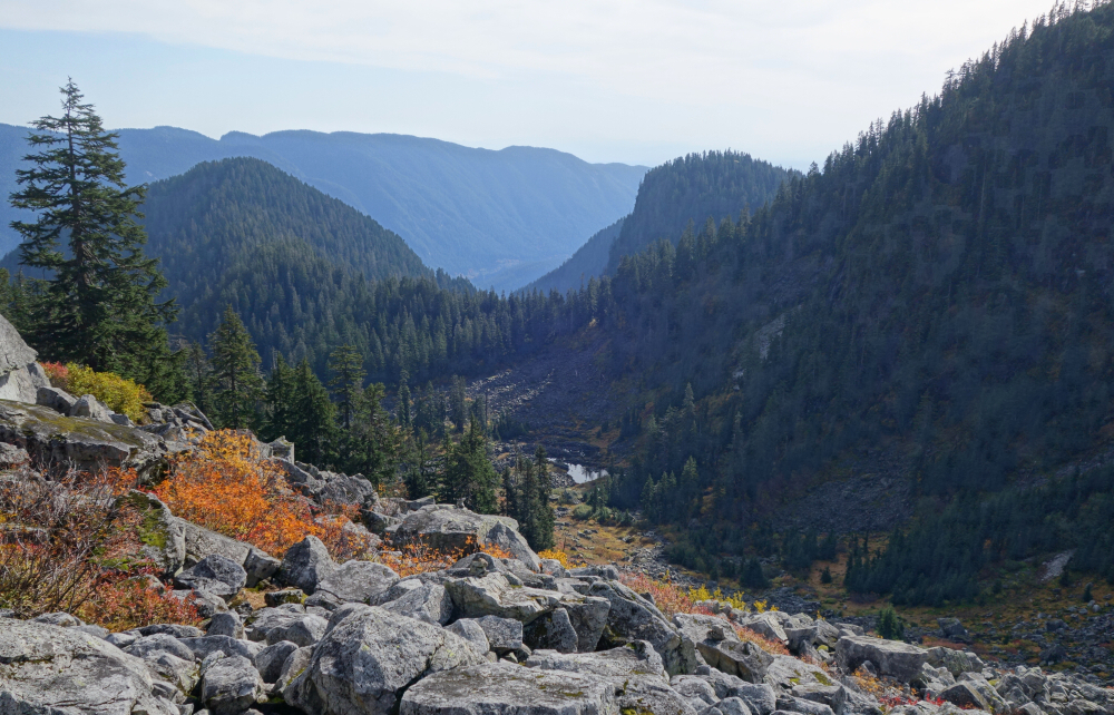
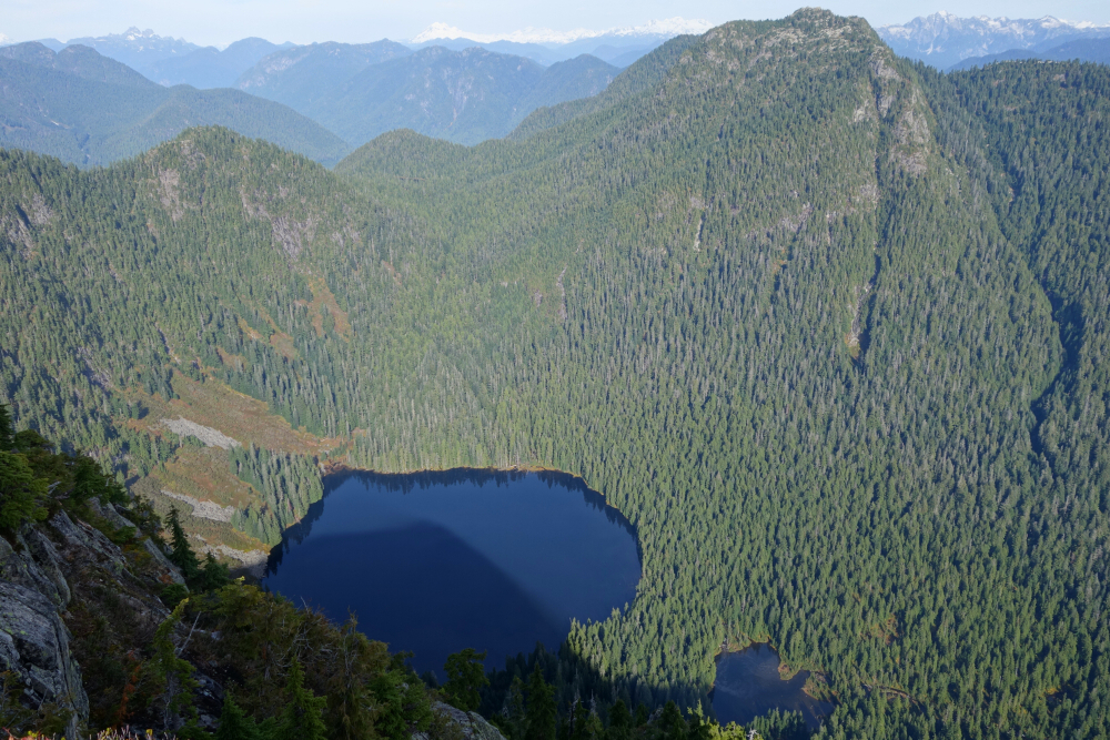
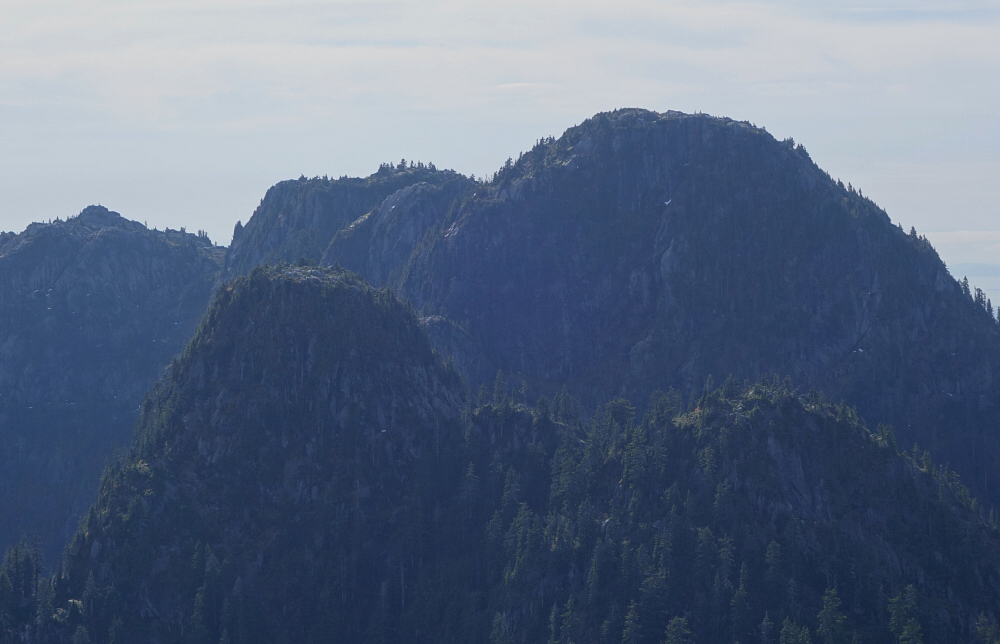
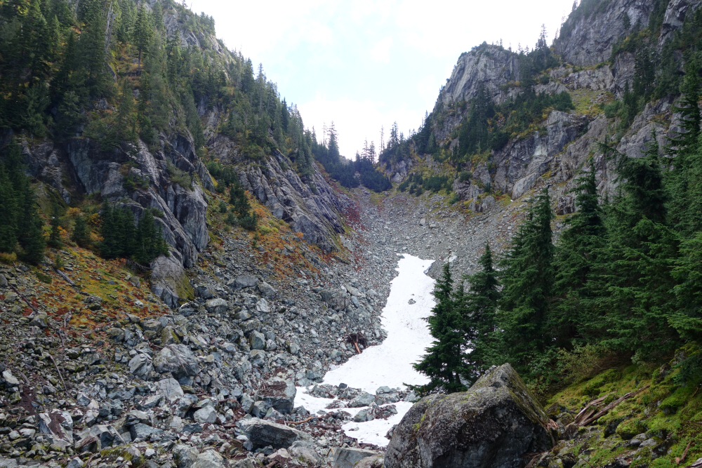
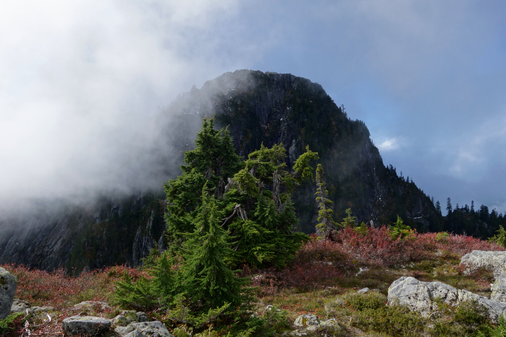
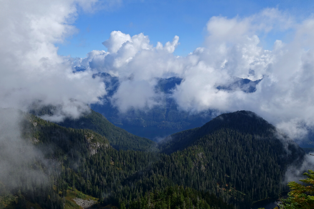
I still had unfinished business with Mount Elsay and so barely a week following my previous feeble attempt, I doubled down for another go. Doing a counterclockwise loop this time, I branched right off the main trail onto Elsay Lake Trail and quickly lost elevation on a stretch aptly named Wes's Staircase. From there I proceeded across the upper Coldwell Creek drainage, immediately below the east-facing cliffs formed by Tim Jones, Seymour, and Runner. Rounded Runner's east shoulder and continued to a boggy area at the edge of a small lake before realizing I'd gone too far. Hiked back up about 10 minutes and soon located the trail fork I had missed. Followed this up into the large talus bowl between Runner and Elsay, hopping boulders for much of the way to the forested ridge crest above. Picked up the Mt. Elsay Trail here. Climbing steeply now, I ignored the Vicar Ridge Trail branching off to the left and continued up to the granite slabs on Elsay's summit area.
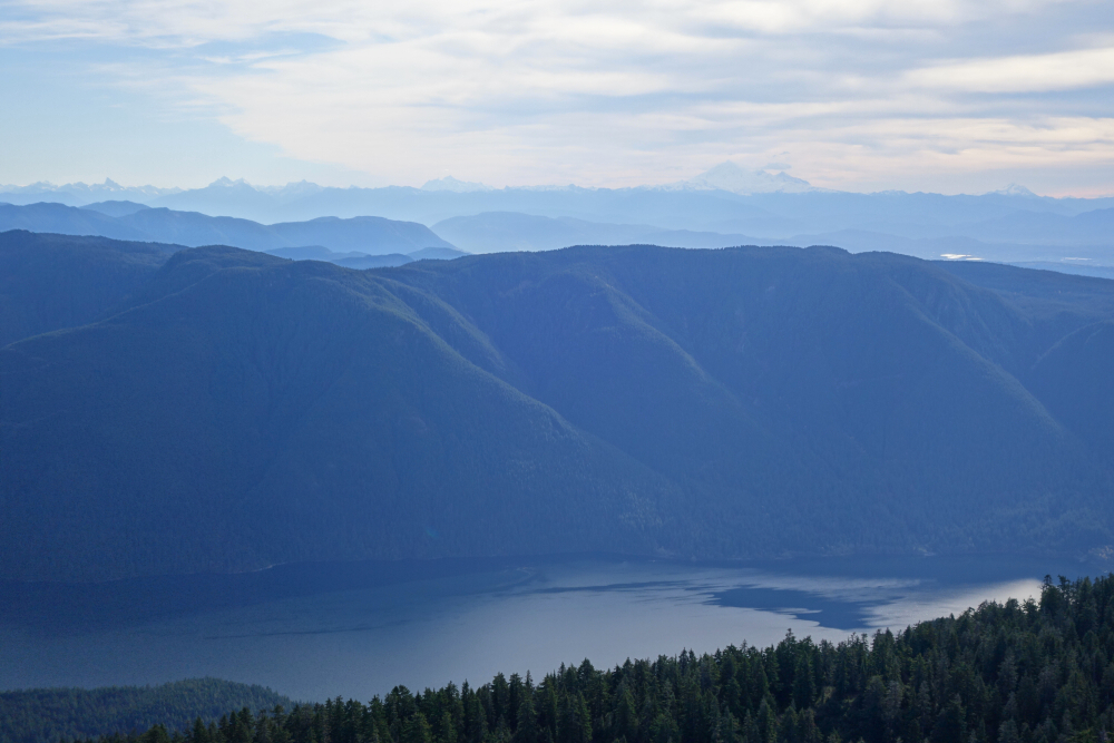
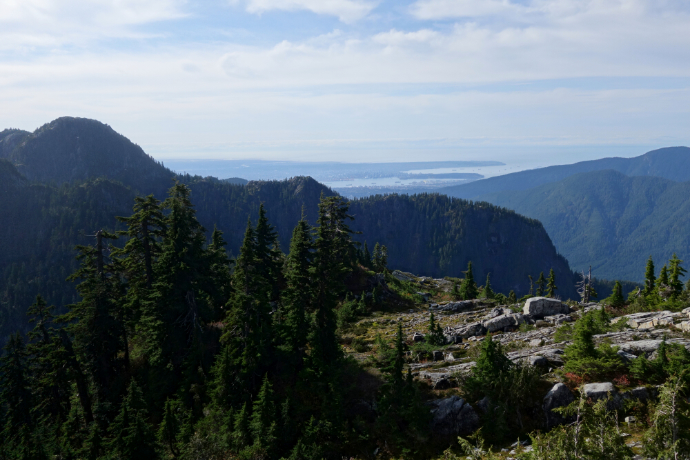
Other than the unique perspective looking due south down the divide as well as deep blue Elsay Lake nestled there beneath Mount Bishop to the north, the views aren't all that different than from Seymour. For the return, I retraced my route along ridge trail directly to the talus bowl on the SW side of Runner. Bit overgrown and steep in spots but otherwise trail is quite easy to follow. From there on out, I was back in familiar surroundings and quickly made my way to the main Mount Seymour Trail. Skipped on any further peakbagging having been up most of the neighboring peaks several times prior and returned directly to my car instead. This is a decent tour of the Indian Arm - Seymour Divide area and North Shore Mountains in general I must say. About 6 hours round-trip with options for a fun multi-peak sweep of the area for those with more time and ambition!
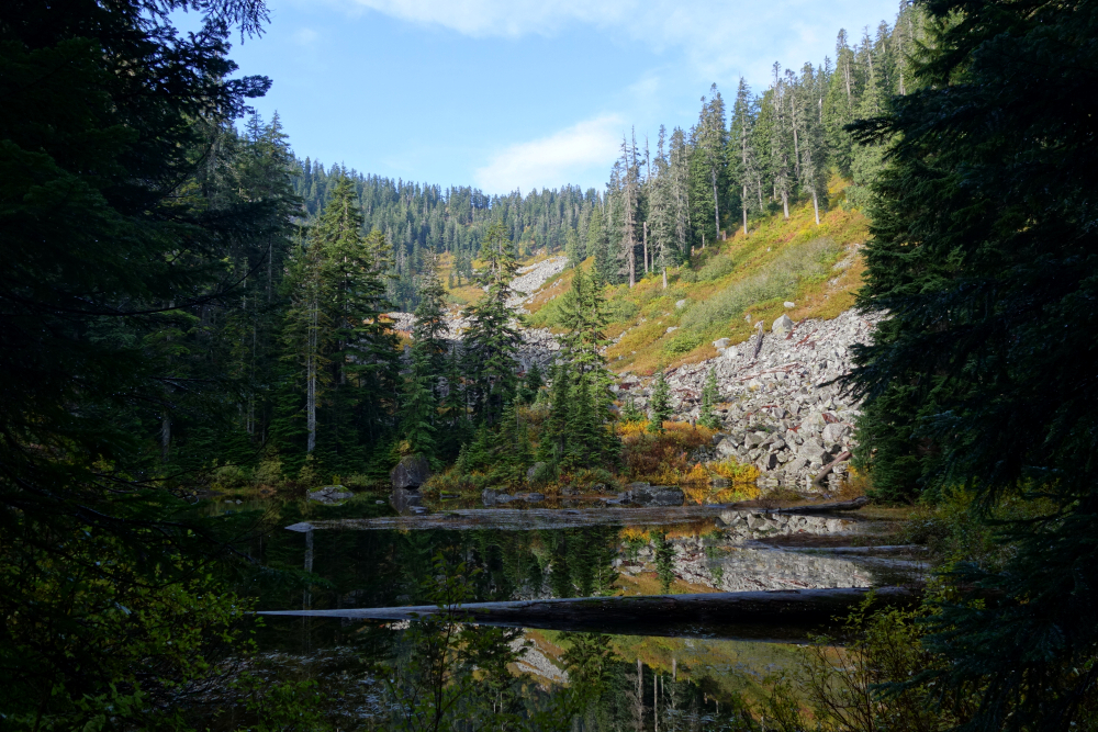
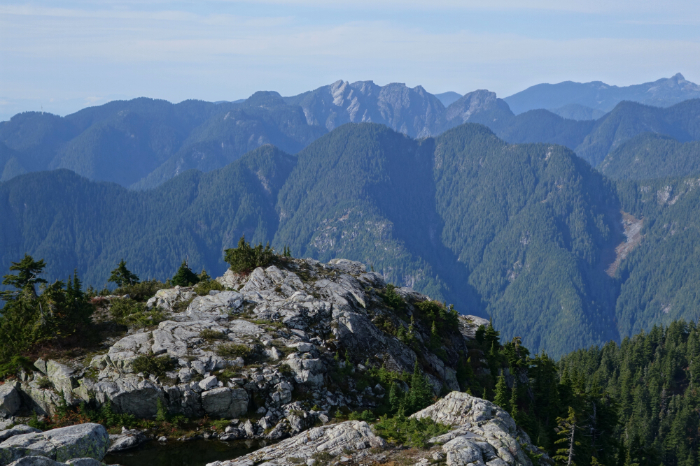
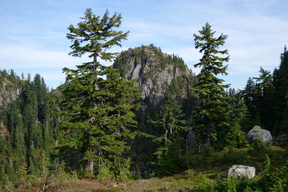
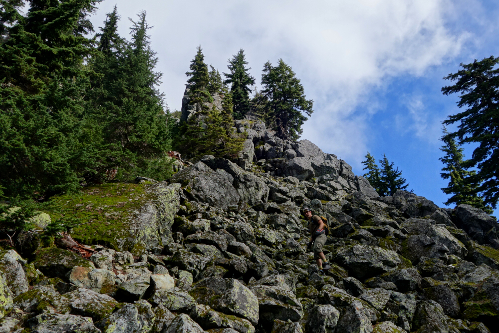
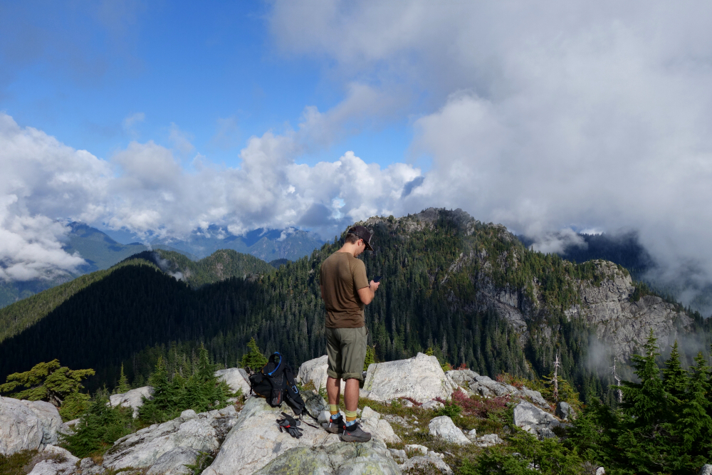
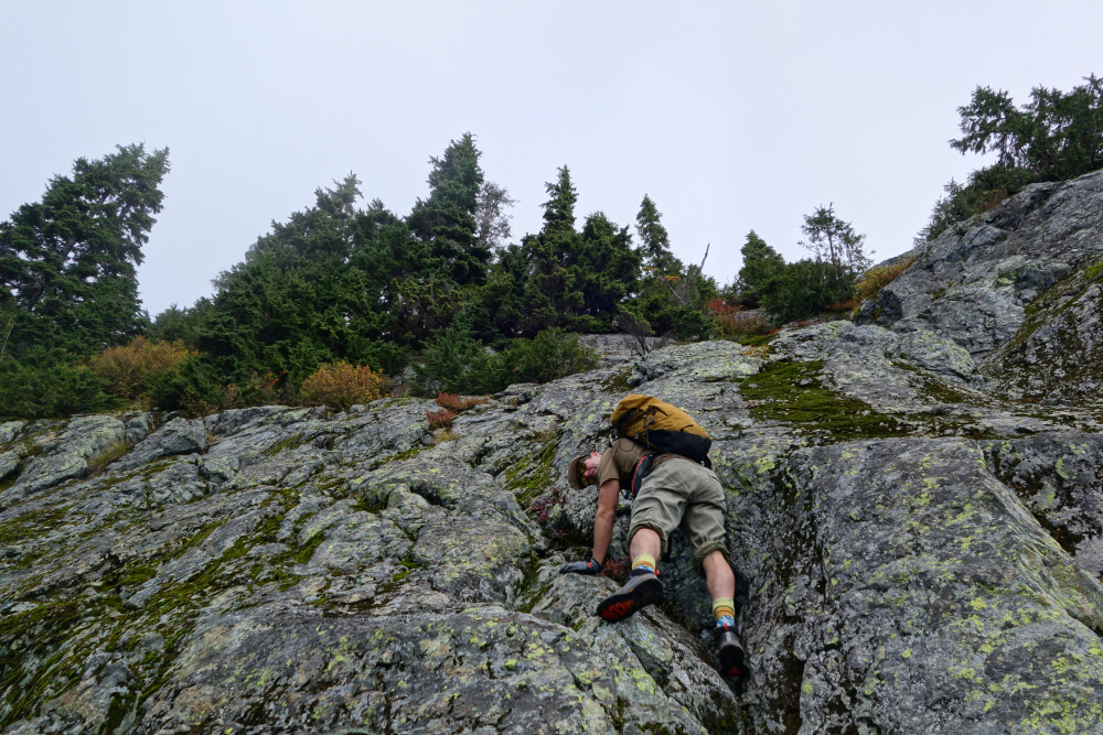
Continuing with the close-to-home, marginal weather, shoulder season theme, I made an easy day trip out to Runner Peak. Situated on the Indian Arm - Seymour Divide, immediately north of Mount Seymour, this is a minor peak popular with the local Bagger Challenge peakbagging community. It is typically hiked in conjunction with nearby Mount Elsay as well as Mount Seymour - an agenda which I initially had in mind for this trip. In this case, a loop starting with the Elsay Lake Trail and returning via the Mount Elsay Trail would be the more aesthetic option, but more on that in the upcoming report. Long story short, a lack of motivation conspired against me, and Runner (plus repeats of Seymour, Tim Jones and Pump Peak) was all that I managed to get my ass up on this day.
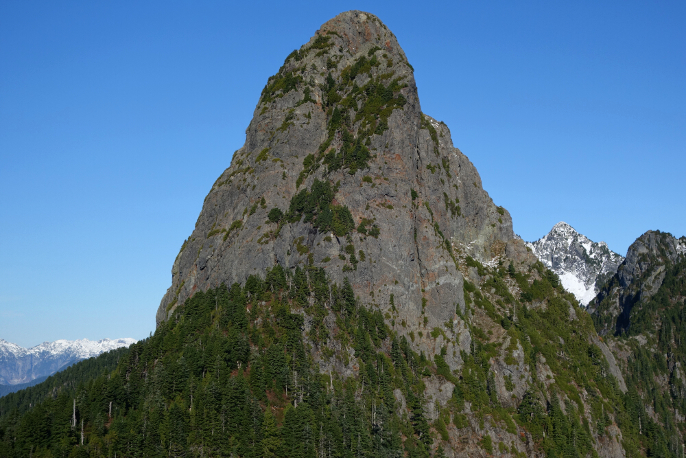
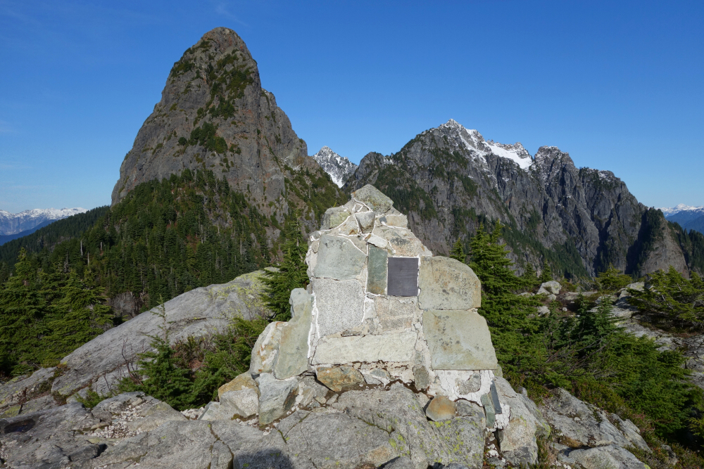
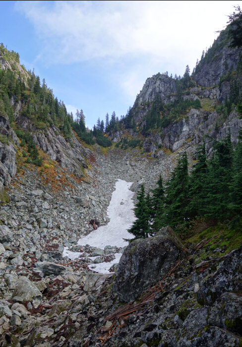
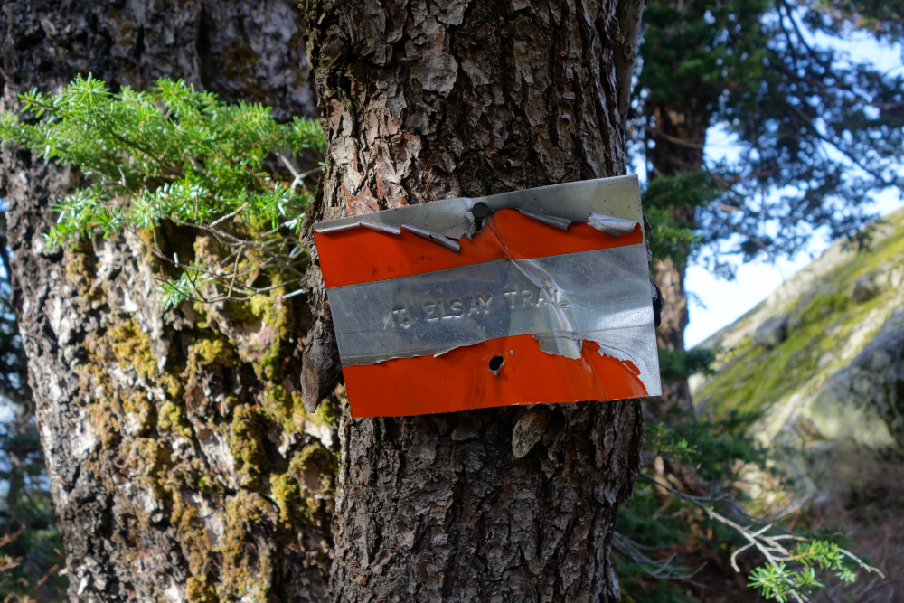
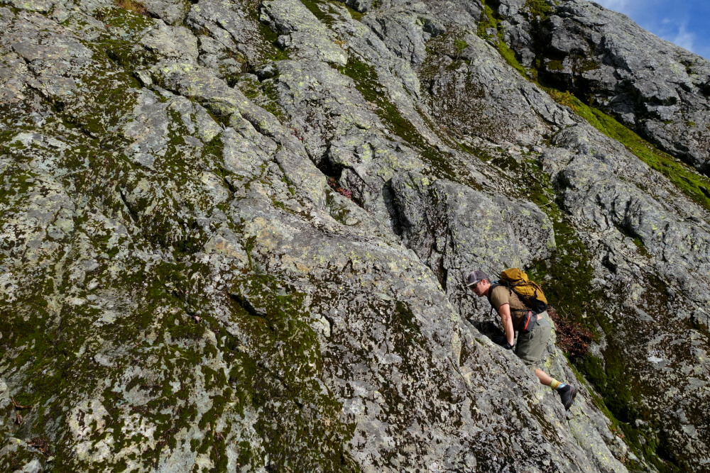
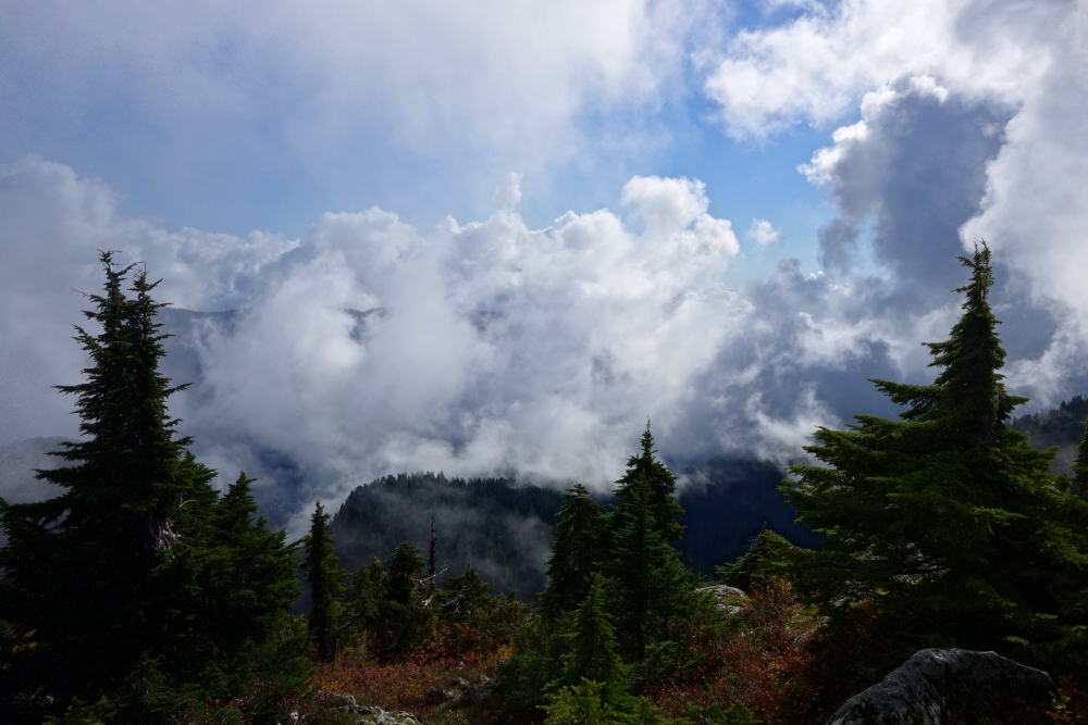
Starting from the notch between Tim Jones Peak and Mount Seymour proper, the trail to Runner descends before traversing north around the west flank of Seymour. For those with a keen eye, this trail is marked with a sign that reads, appropriately enough Mt. Elsay Trail. Bumped into non-bagger Ryan Fehr below said sign just as I was wrestling with my motivational challenges and accompanied him for the remainder of the hike to Runner. Thanks for breaking me out of my funk! We reached the small talus bowl with snow patch between Seymour and Runner and ascended this to the col at top before picking up a faint trail off to the left. In short order, we reached a ledge below the base of a prominent slab with an obvious diagonal groove towards its east end. We immediately recognized this feature from reports/photos as being the crux of the route and started up it. Some exposure here and a bit of delicate foot jamming on dewy rock before finding ourselves on the flat summit area. Local views mainly thanks to clouds, but I wasn't expecting much anyway. Returned the way we came, tagging Seymour once again for good measure - my 4th time in case anyone's counting - as well as Tim Jones and Pump Peaks on our way out. Probably the most chill "four for the price of one" outings anywhere!
It would be very much appreciated if you please ask before copying and/or re-publishing content from any part of these pages. To do so, please click here to send a message via feedback form.


