Select from list below to jump to a specific area on this site.
| Latest Posts |
Saturday, October 29, 2022
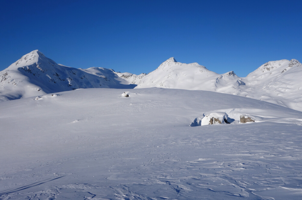
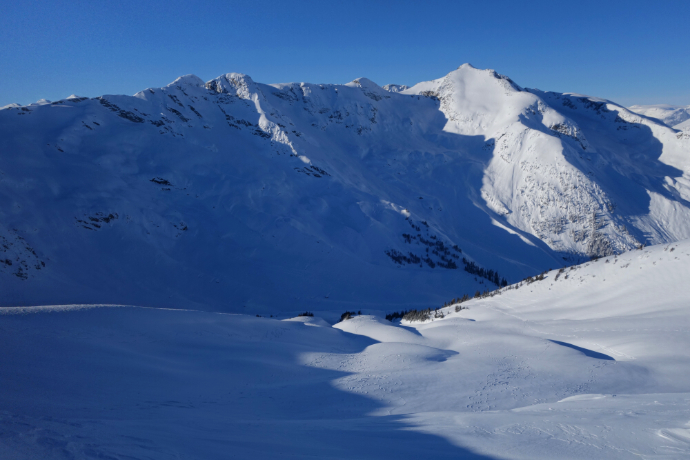
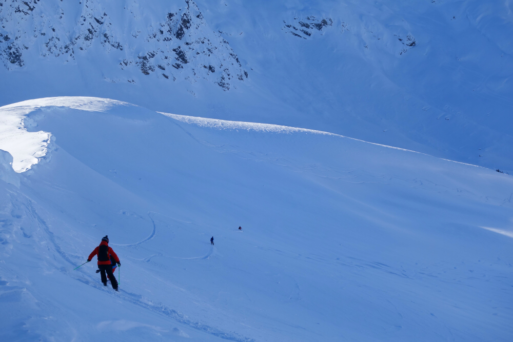
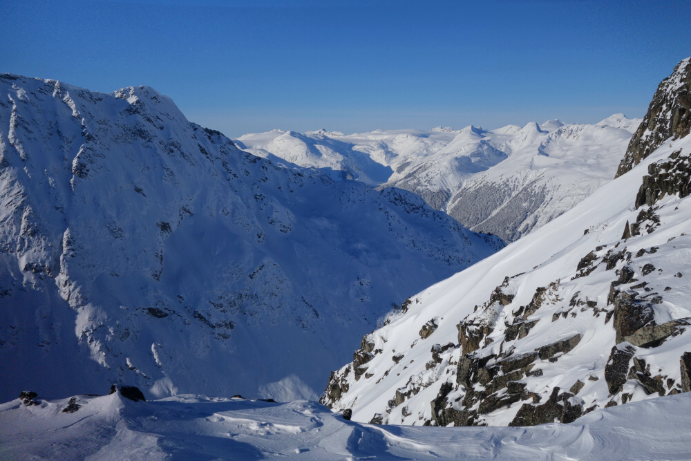
Whistler Heli - Petersen Creek/Wishbone Zone, December 2021
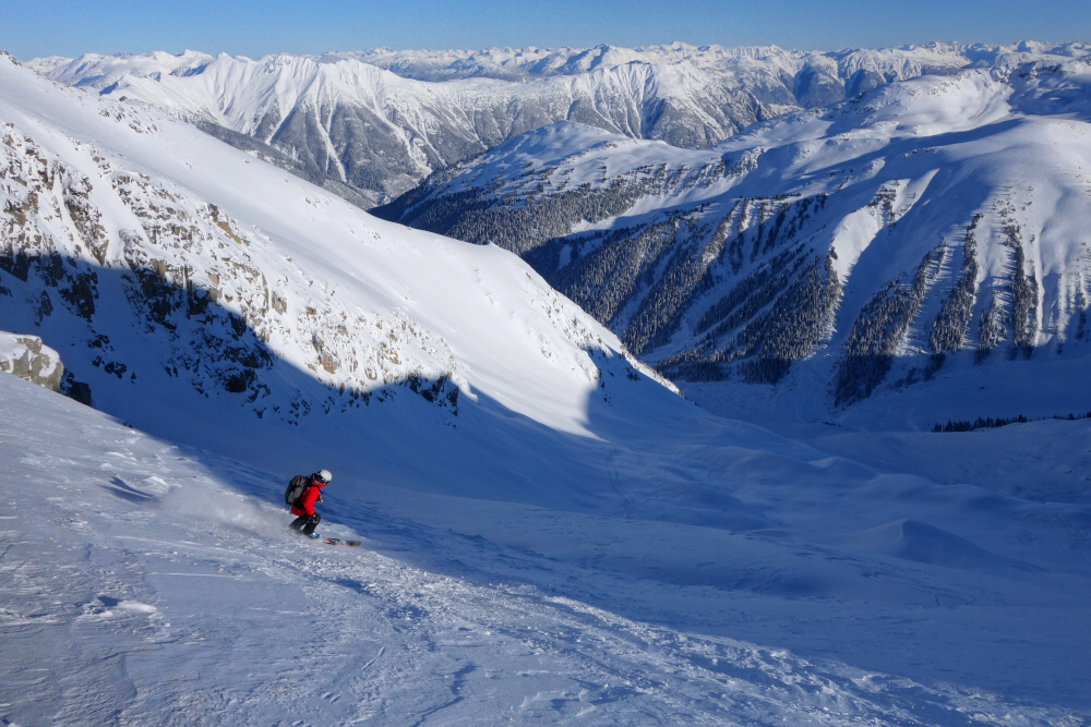
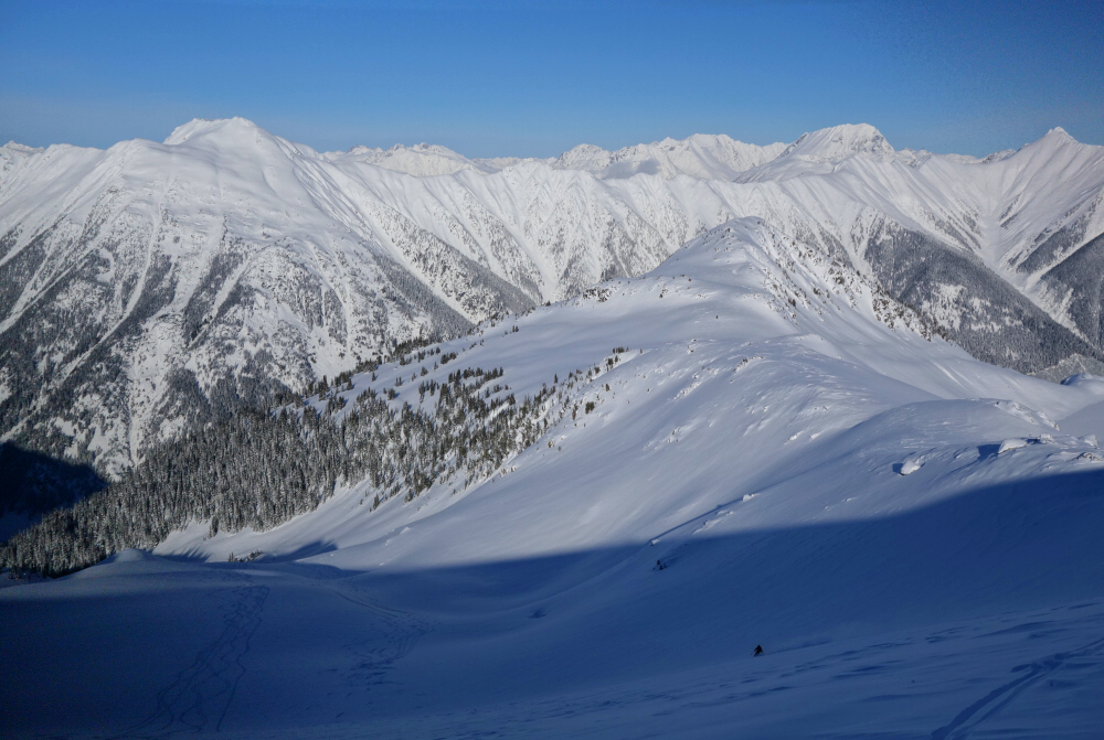
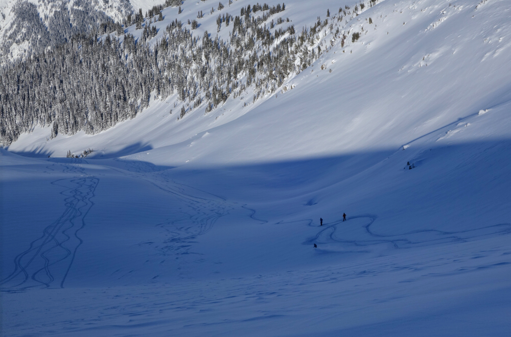
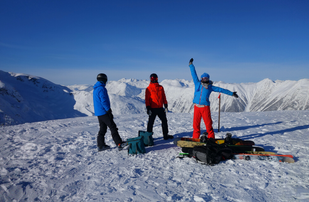
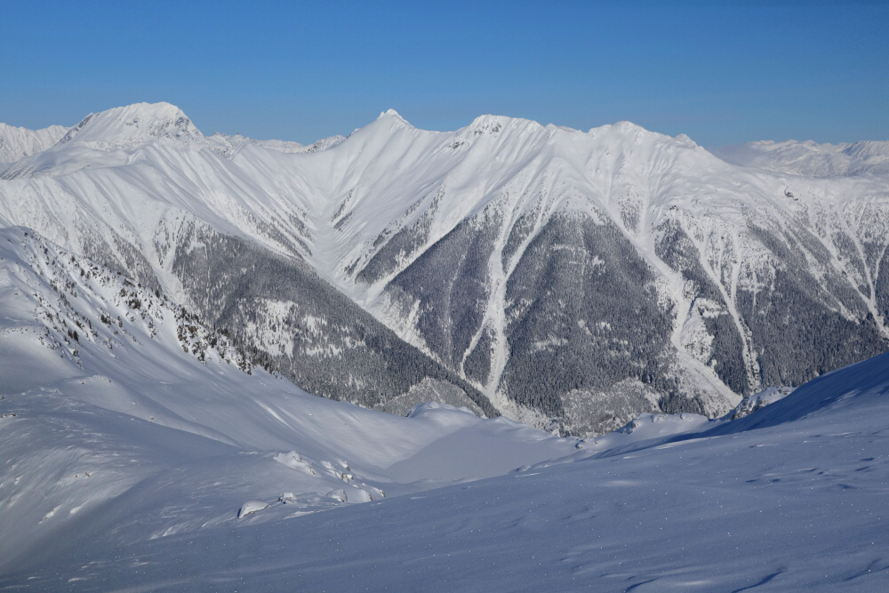
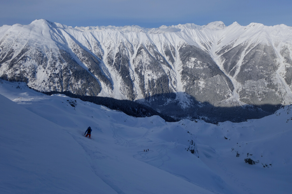
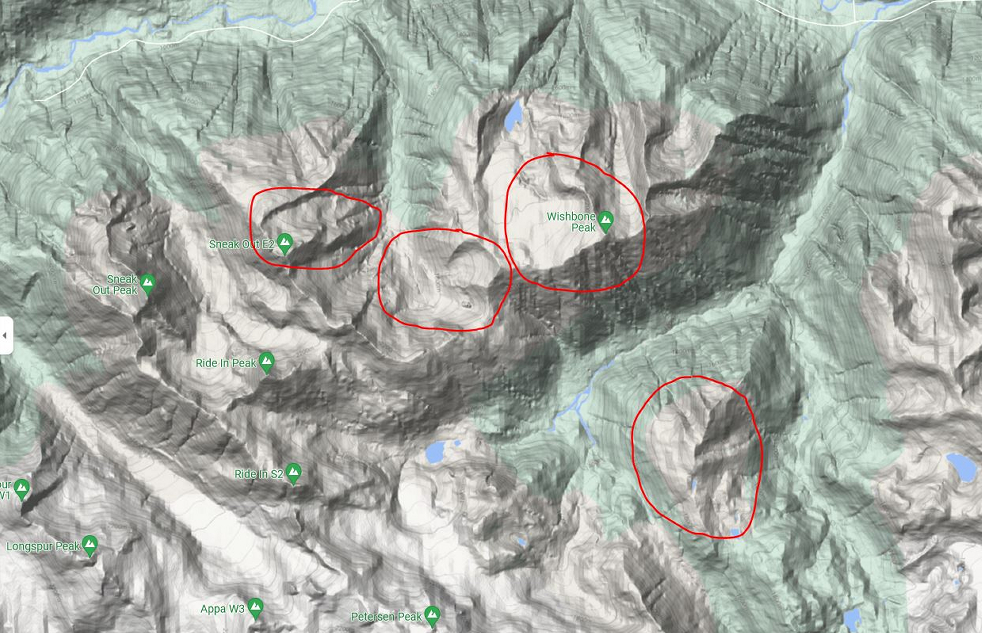
Spent our hard-earned coin on a mediocre day with Whistler Heli last December. Best as I could tell, we sessioned slopes around Wishbone Peak and Sneak Out E2, descending drainages towards Petersen Creek and Ryan River Valley. Conditions were a mix of wind buffed pow up high and blower on more sheltered aspects below, with much of the zone having been hit already by previous parties. Had a bit of drama right before our first lap when I snapped a critical ankle strap, the plastic having gone brittle in the -18 C temps, not including windchill. Fortunately managed to MacGyver a fix out in the field, as it were, salvaging the day for myself. Note to self, a heli day is no time to gamble with "antique" bindings no matter how loved they might be! Noteworthy were the couple runs from Wishbone's summit ridge down the glacier (Ryan Glacier?), although this too was a tad conservative and low angled for our liking. Excellent scenery as usual and good times had by all, but our guide's zone and run selection, not to mention the sloppy seconds left much to be desired! It's been 4 years since we last rode with Whistler Heli, probably be another 4 before memories fade enough to convince ourselves to give them another try.
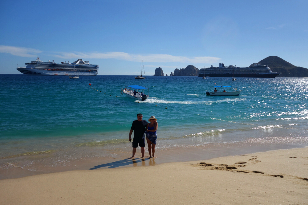
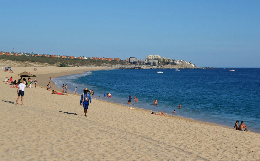
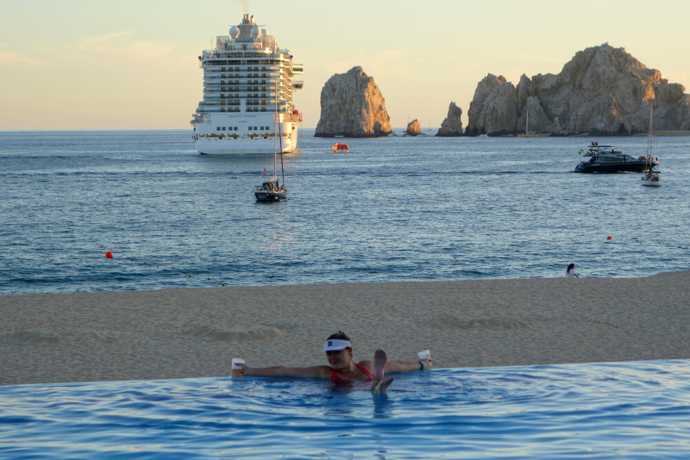
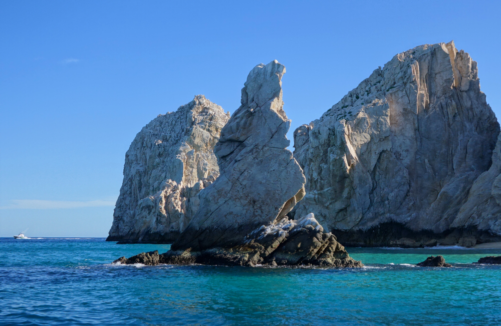
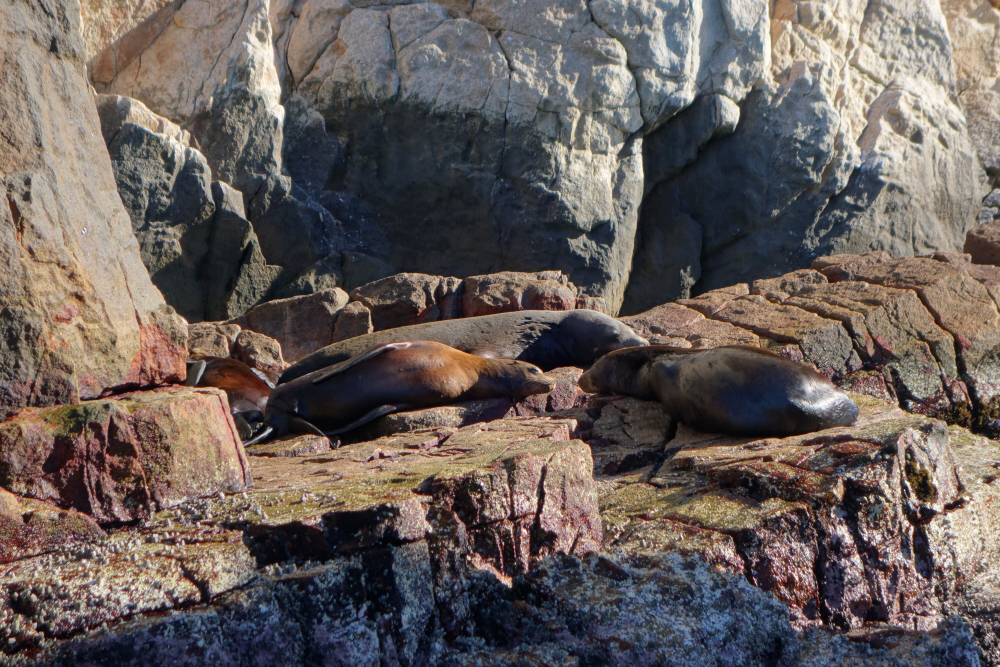
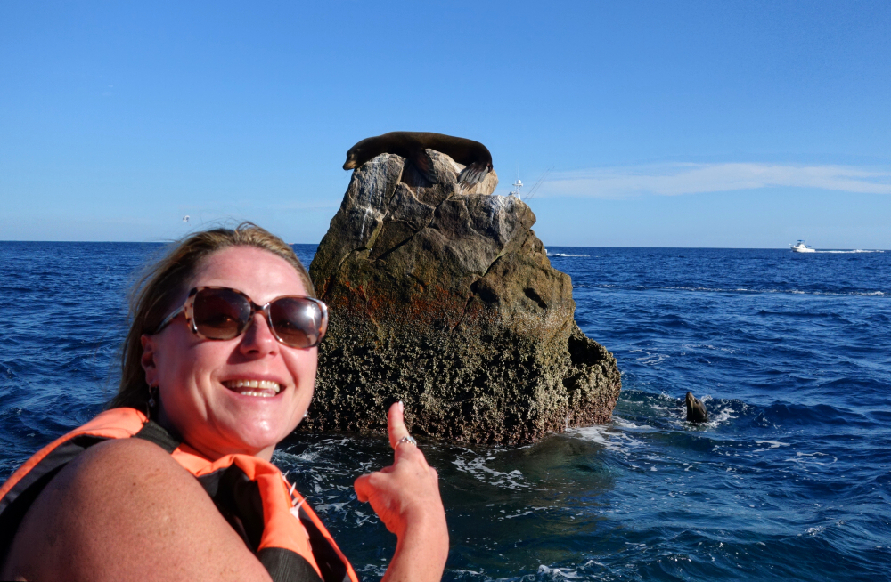
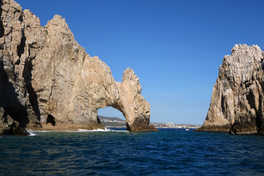
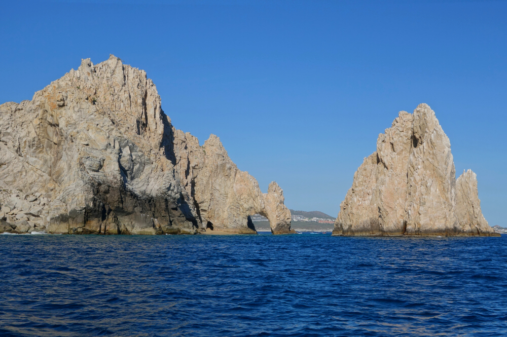
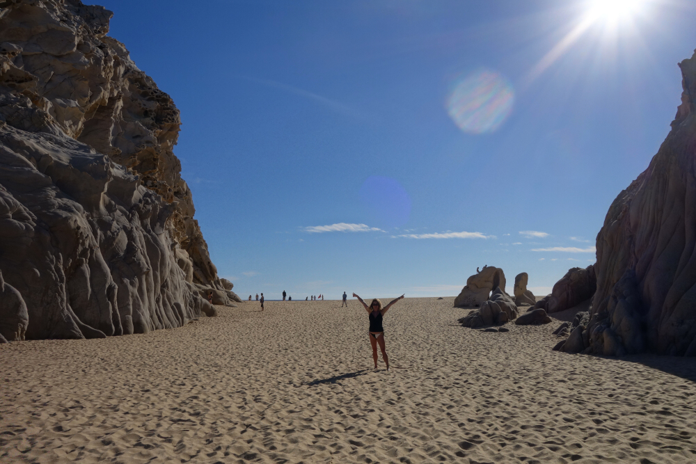
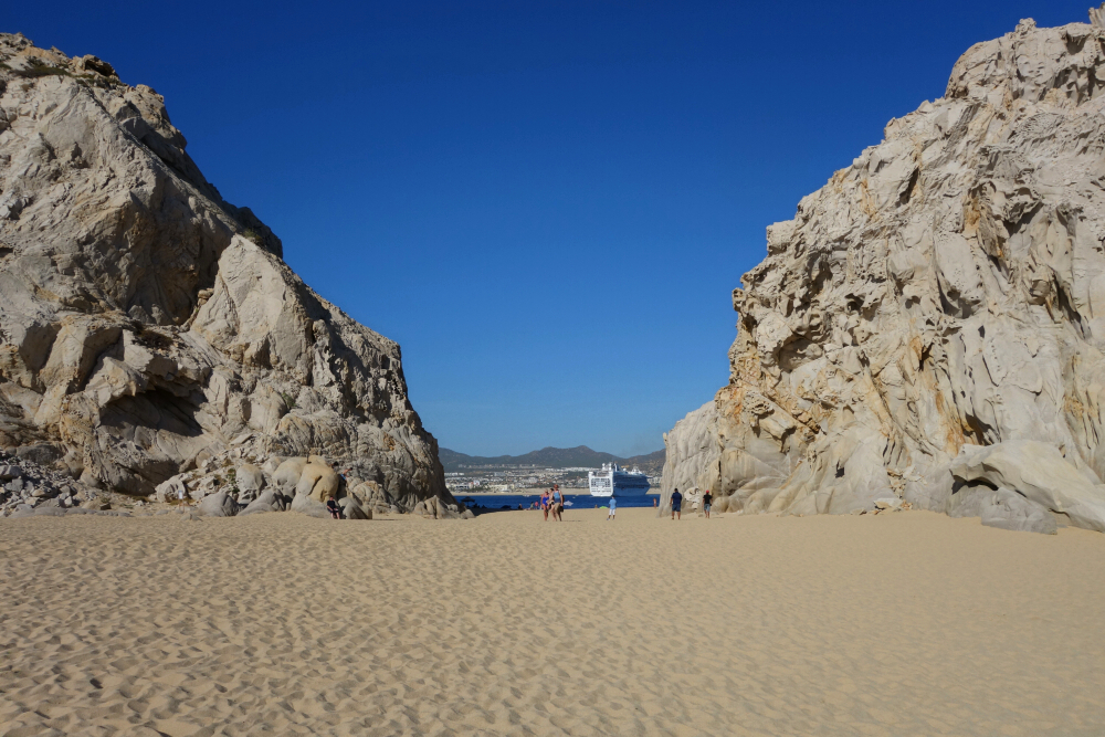
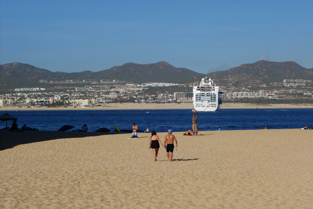
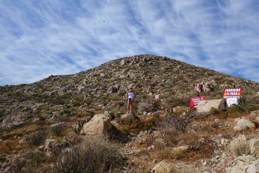
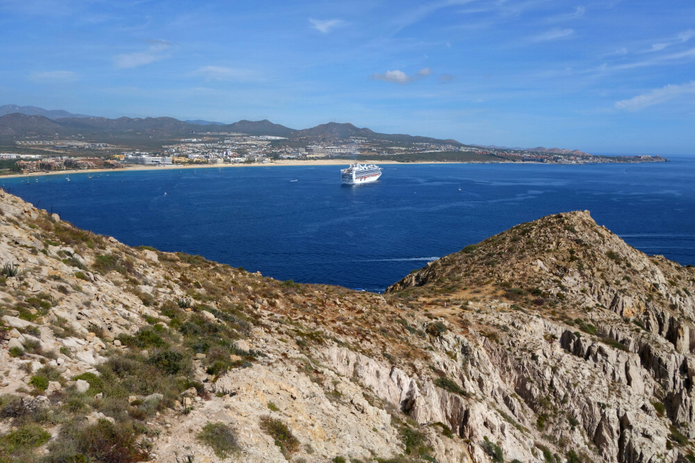
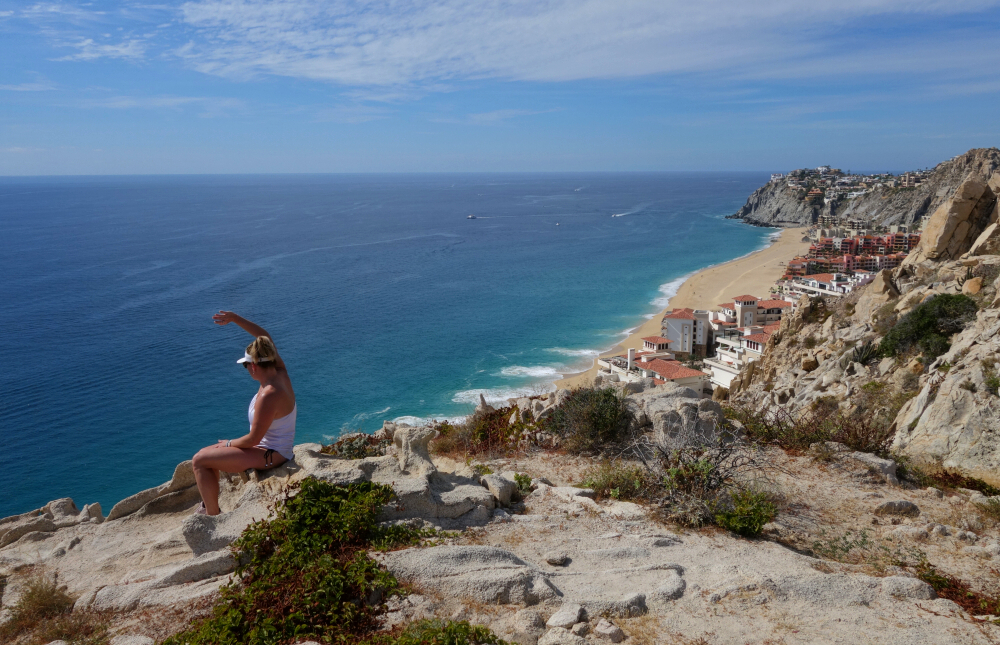
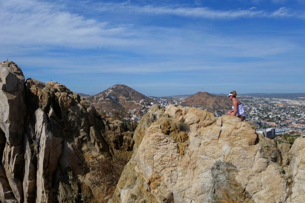
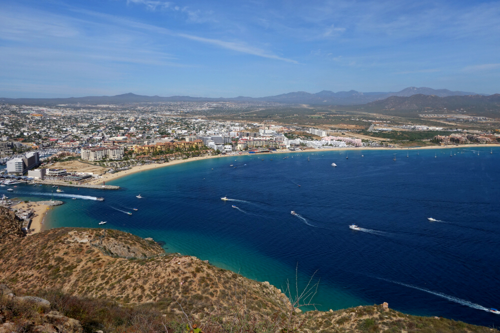
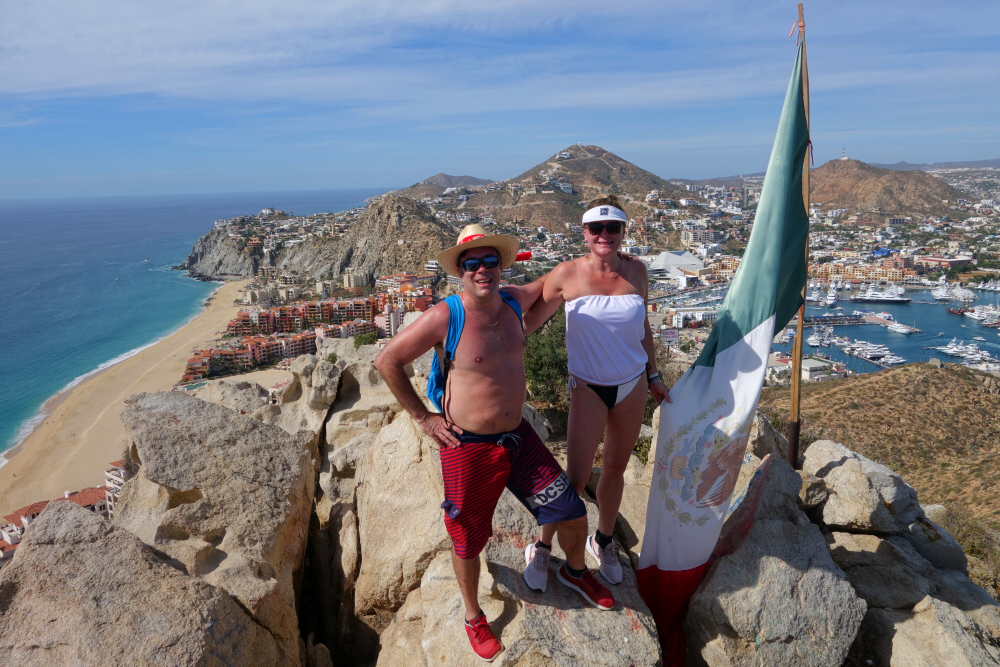
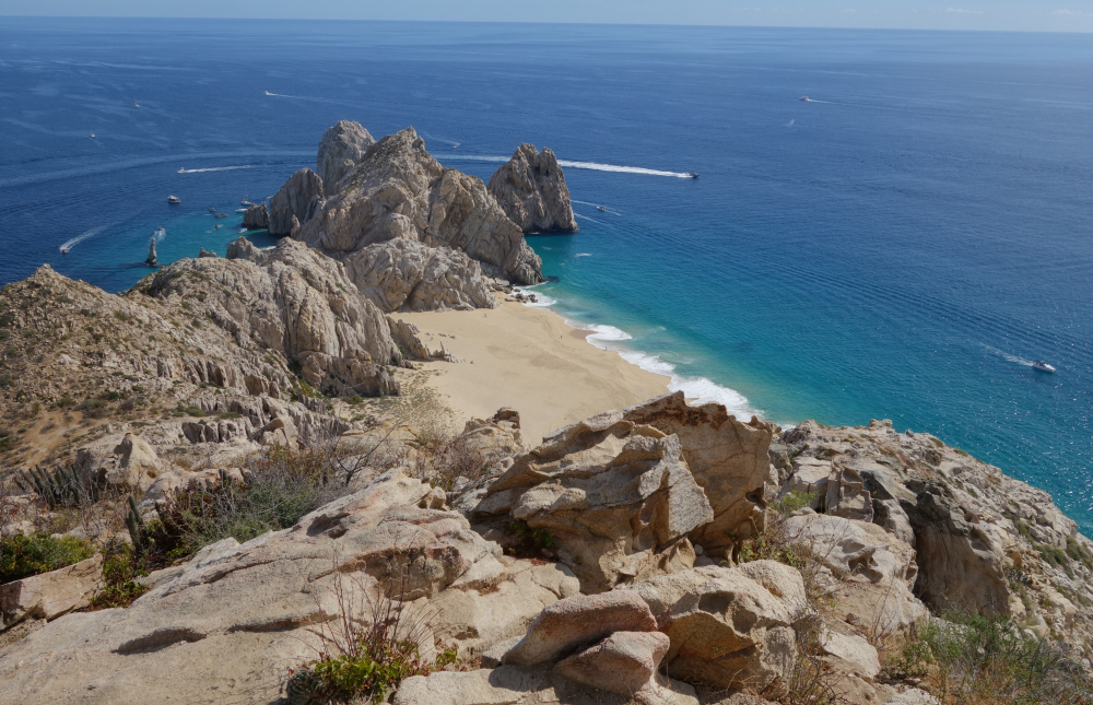
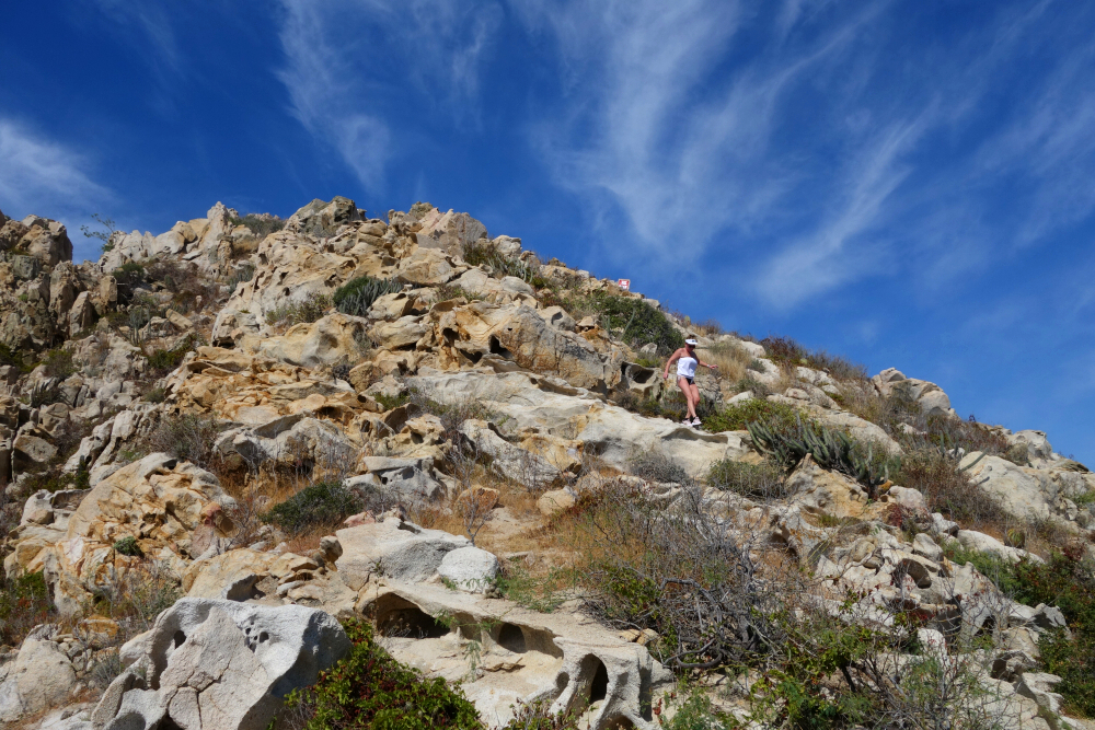
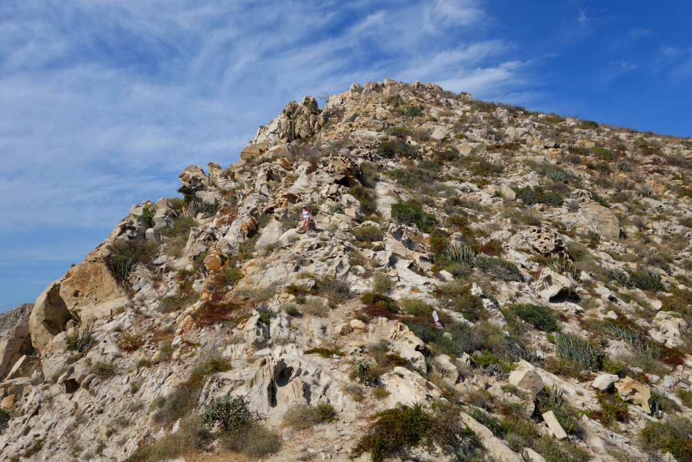
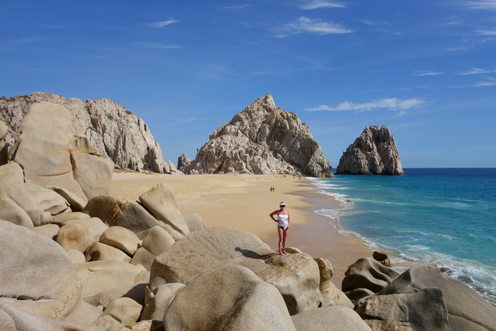
A few days in Cabo San Lucas for a surprise 70'th birthday celebration. No big agenda exploring the beaches and surf up the southeastern tip of the Baja Peninsula as I did back in '96, just kept it "local" and never too far away from the tequila bar. Seeing whales breach in the bay from a parasailer's perspective was a highlight! As usual, I "discovered" a small hike to do that promised some nice views. Normally accessed from the marina at the south end of Cabo's harbor, Mount Solmar is a short hike ending at the highpoint of the rocky outcrop known as Lands End. This approach crosses private property, and one must first register with some fellow named Enrique who apparently leads guided excursions to the summit 2x/day. Seemed like a bit too much red tape for us. Fortunately, the peak can also be reached from Lovers/Divorce Beach; conveniently served by water taxi starting from the beach directly in front of our resort. Like everyone else that visits Cabo, we had plans to do a boat tour around the famous arch and explore the beaches nearby anyway.
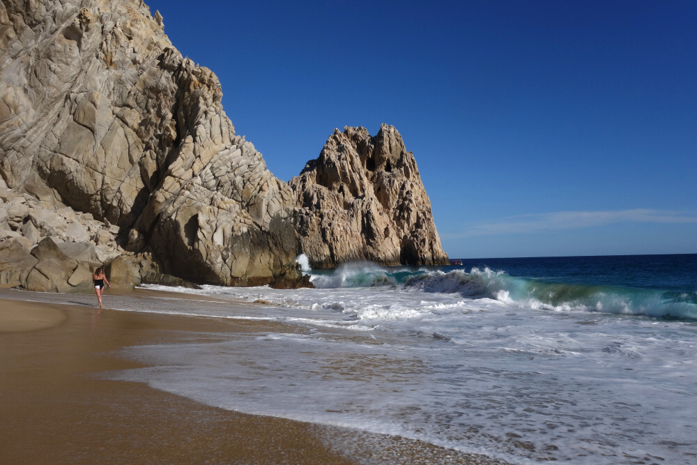
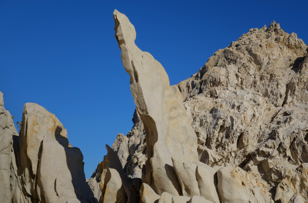
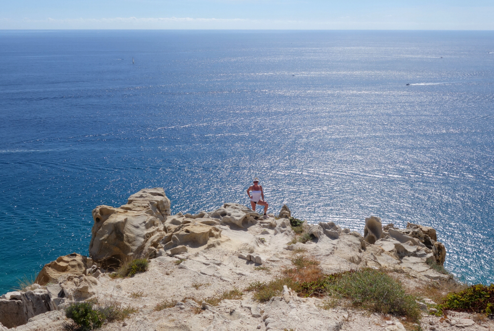
With the Pacific to our backs, we followed a twosome from Texas to a saddle on Solmar's East Ridge. Continuing up, we immediately encountered no trespassing signs and warnings that the area is surveilled by drones. Hard to tell if the signs are merely to discourage people from approaching cliffs on the north side or from hiking the peak in the first place. Whatever. Followed a well-worn trail that angled up towards the southern edge of the ridge before turning up the final steep pitch to the summit. Fantastic views all around as expected! Met a couple local youths up top, had a quick chat and our photos taken before I started to worry about them ratting us out. Didn't linger and made it back down to Divorce Beach in no time, whereupon we ran into the Texans from earlier and had a celebratory snort of tequila from a bottle they'd brought with. Wrapped up a fine Baja afternoon, toes in the hot sand watching the shore break with setting sun behind. Salud!
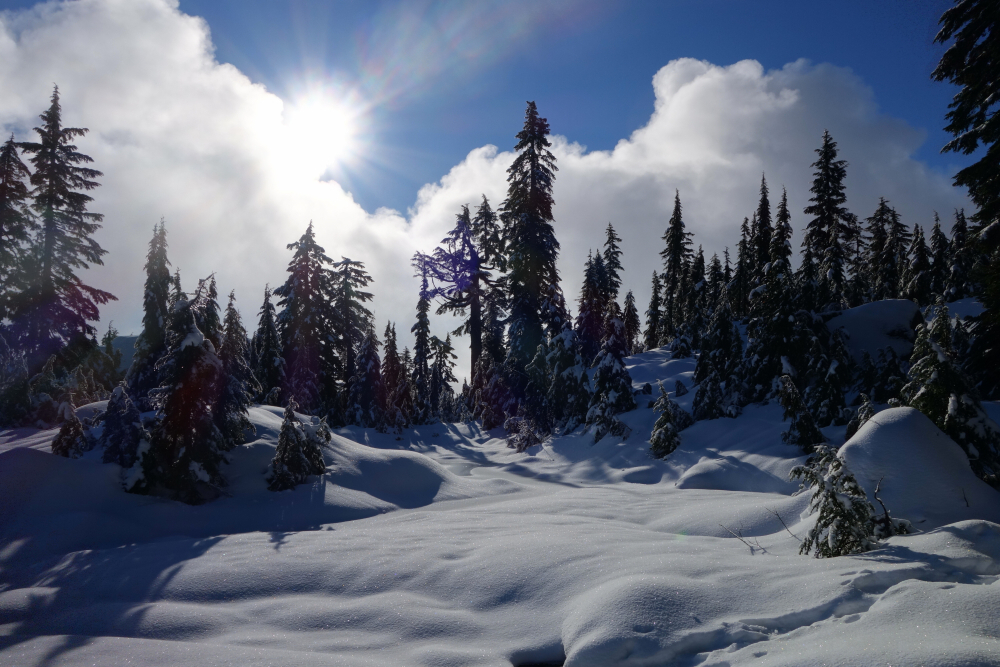
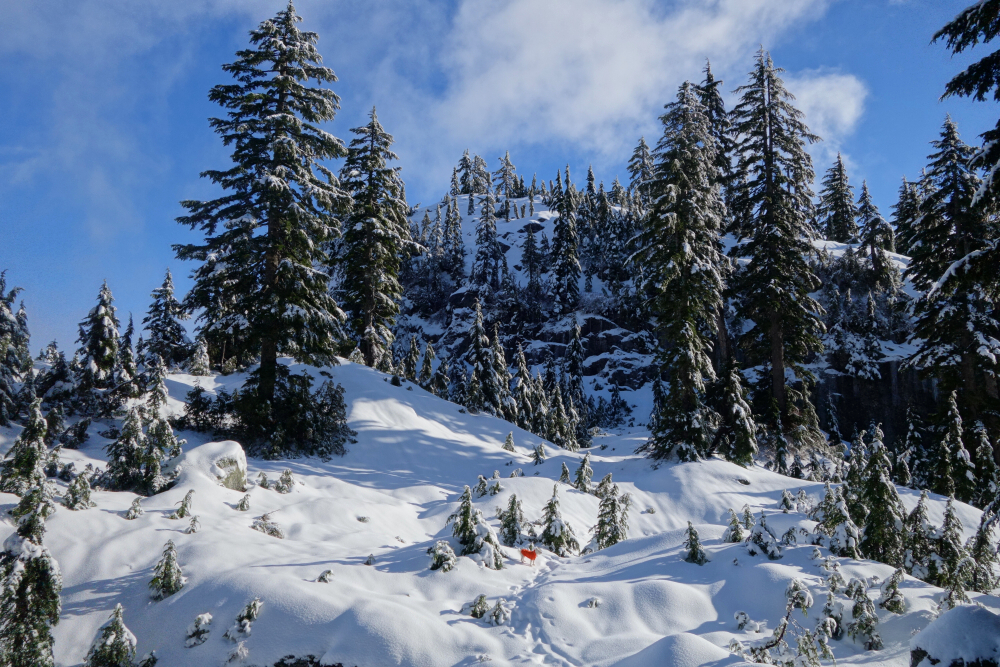
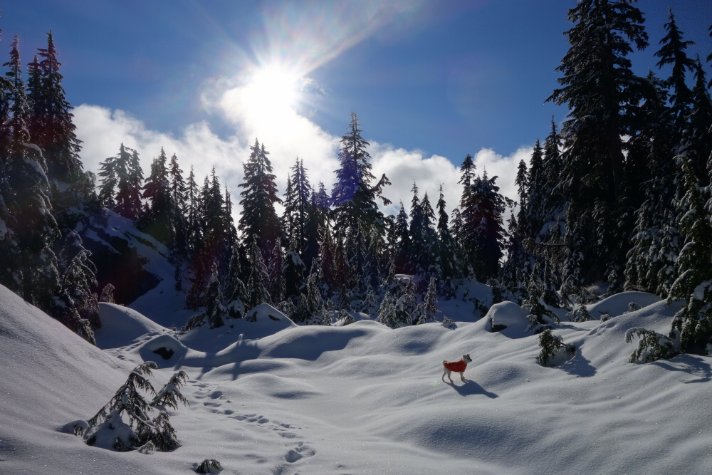
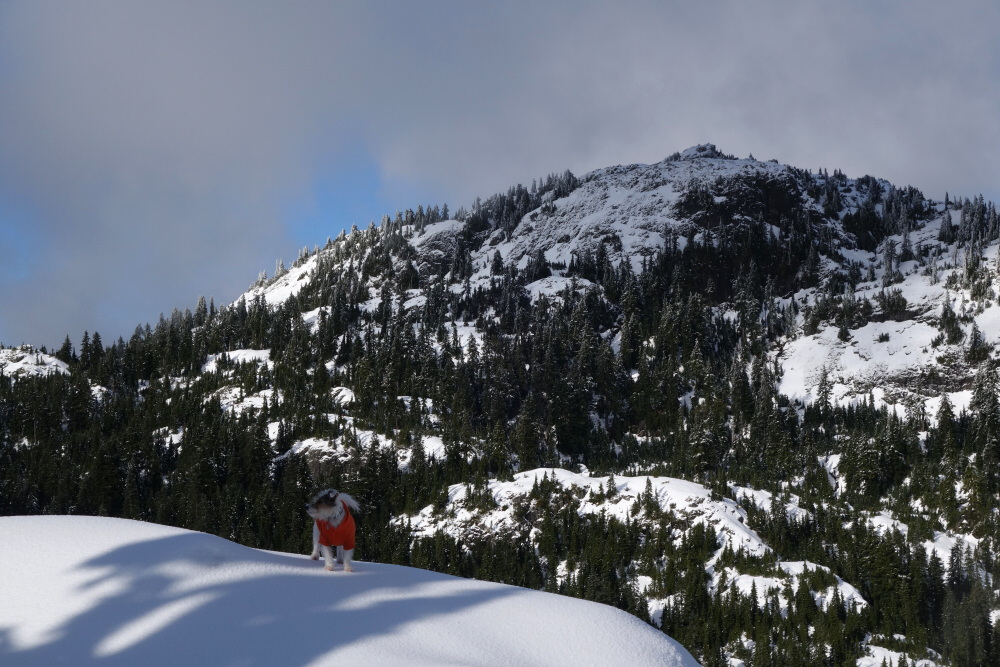
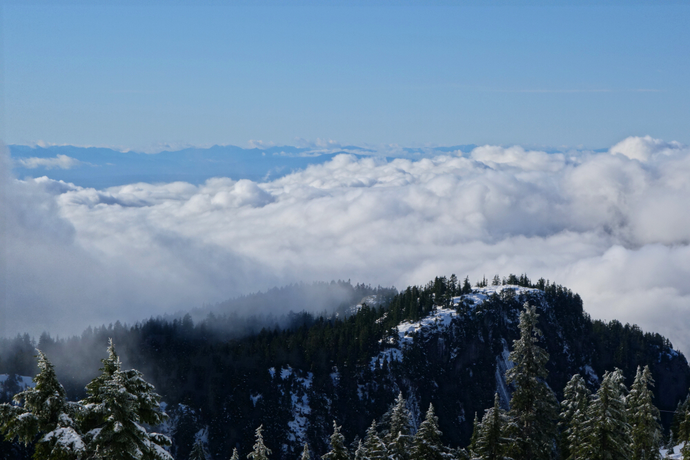
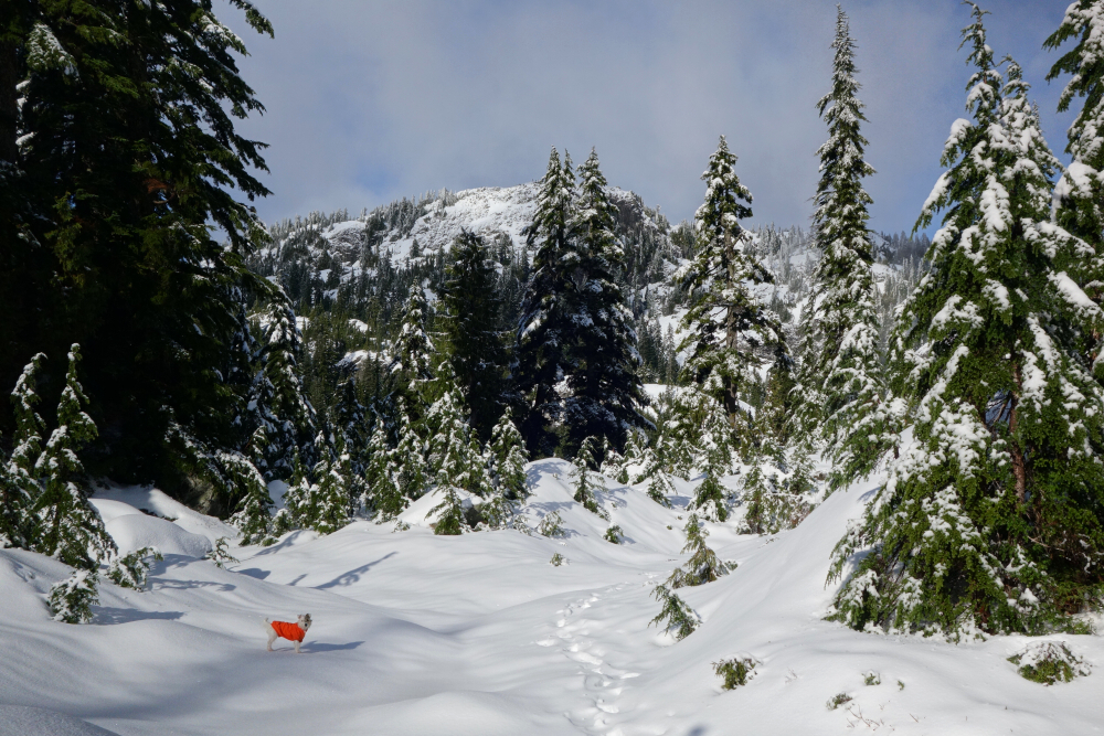
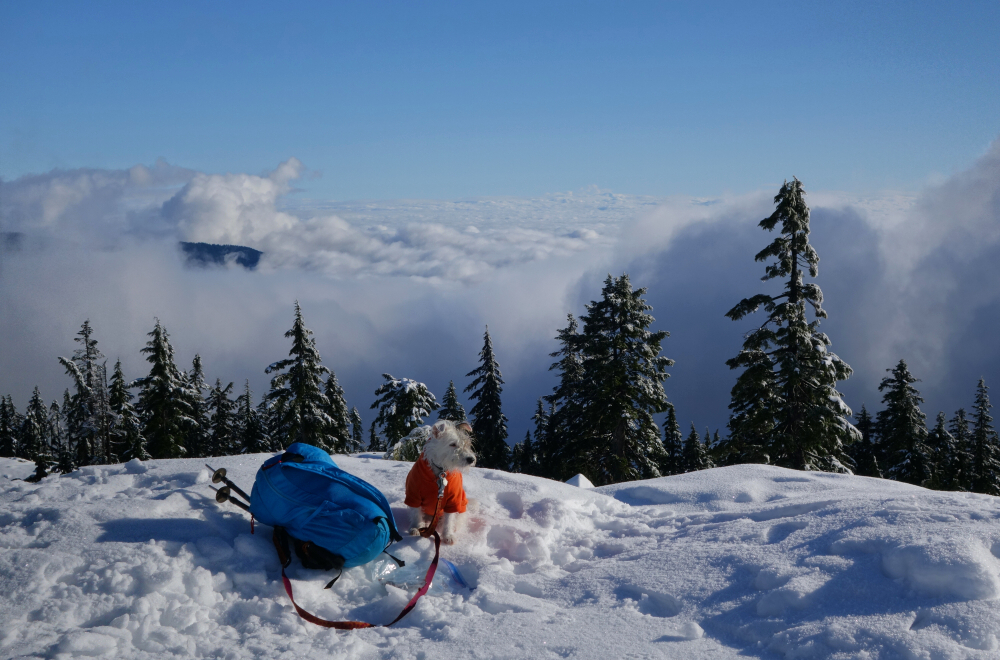
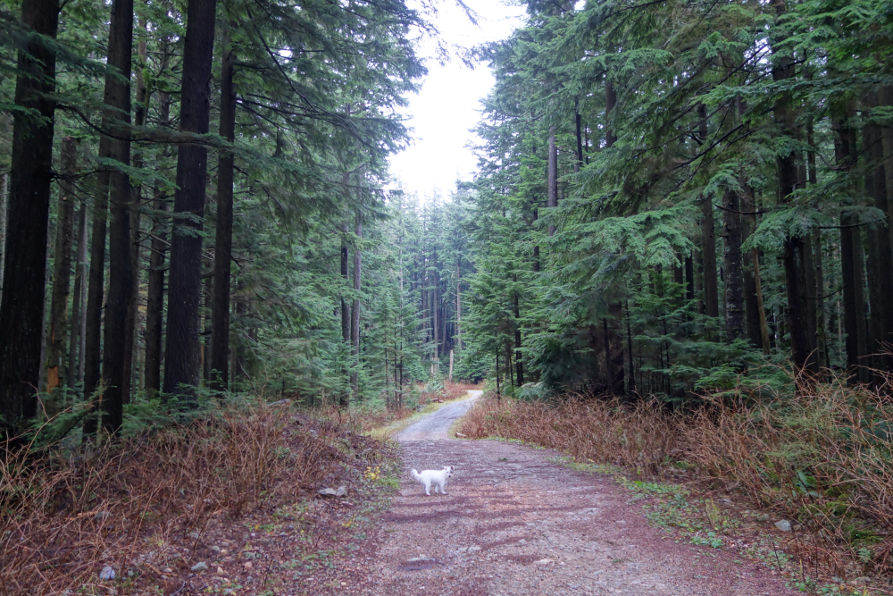
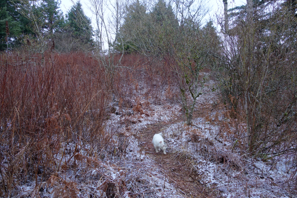
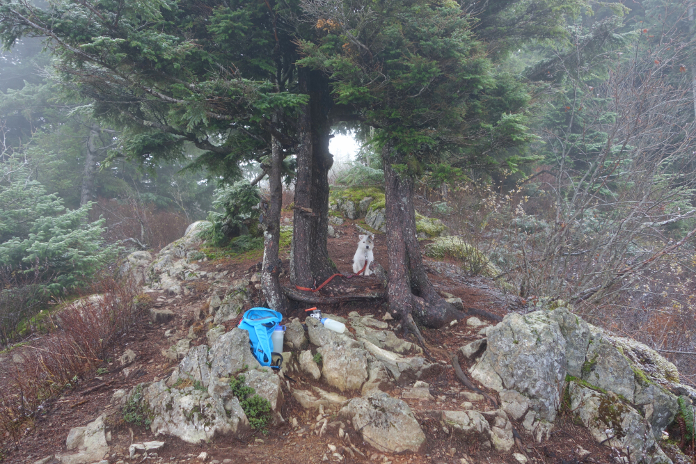
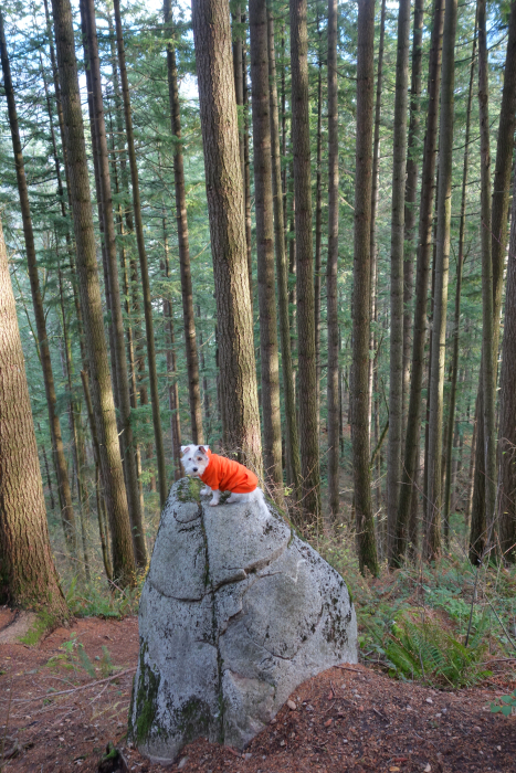
Biding my time in anticipation of the snow piling up and the lifts to start spinning, Pepper and I dashed out to Seymour for an afternoon of wandering about the various lesser bumps. My main motivation was to tag Le Pencier Bluff, a minor knob popular with the Bagger Challenge crowd. The trail, now buried under a thin blanket of snow starts just right of the Mystery Peak Express chair and leads to Mystery Lake. Contouring around the lake's east shore, we proceeded up to a saddle between Mystery Peak and Brockton Point. Then went east, around a bump towards another saddle this time beneath De Pencier Bluff itself. Short boot up and we were there, contemplating the mostly cloudy view. Pepper, off leash, gave me a bit of scare as she was excitedly running about dangerously close to the steep cliff edge on the bluff's north side. No drama fortunately and soon we were once again on our way to see what else we could get ourselves up.
Brockton Point was nearby, so might as well. Getting there brought back fond memories of the time Agata, Dominic and I sessioned a booter there beneath the Brockton Chair - my first Frontside 540! Once on top, Pepper ever the terrier, expressed her disdain for the touring party about to ski down. Can't blame her as their skiing, assuming one can call it that, was quite painful to watch. Weren't quite done and Mystery Peak was right in front of us, so off we went to tag it. The clouds continued to part and finally got some views by the time we reached the top. Hung out for a bit soaking in the warmth before calling it a day, detouring up and over Dinkey Peak, now back in the clouds for one last named bump to add to the day's tally. A satisfying pre-ski season romp in the snow not 20 minutes from the house!
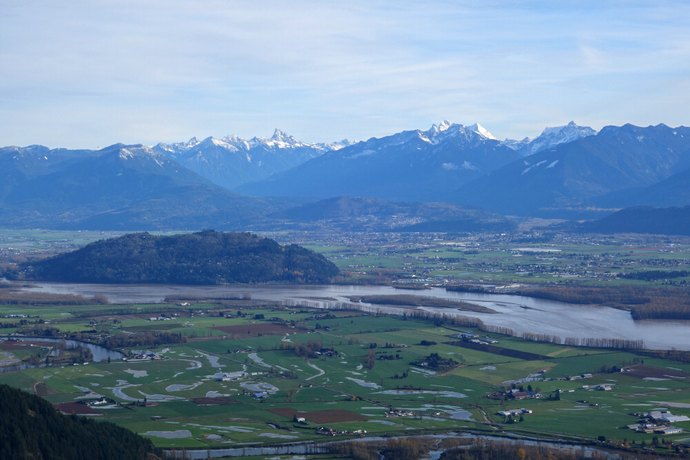
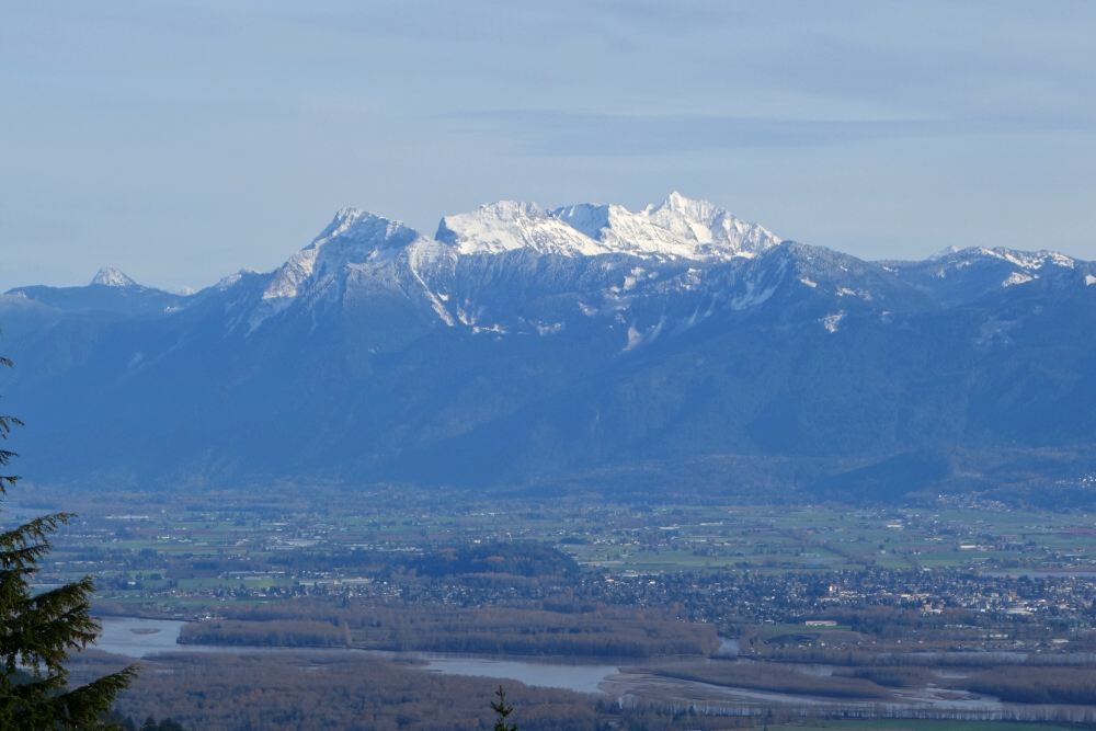
Sumas Mtn. & Dewdney Pk. - Std. Routes, November 2021
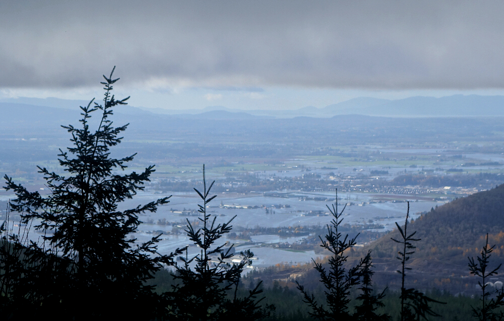
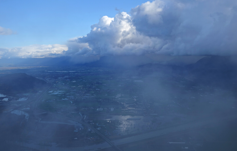
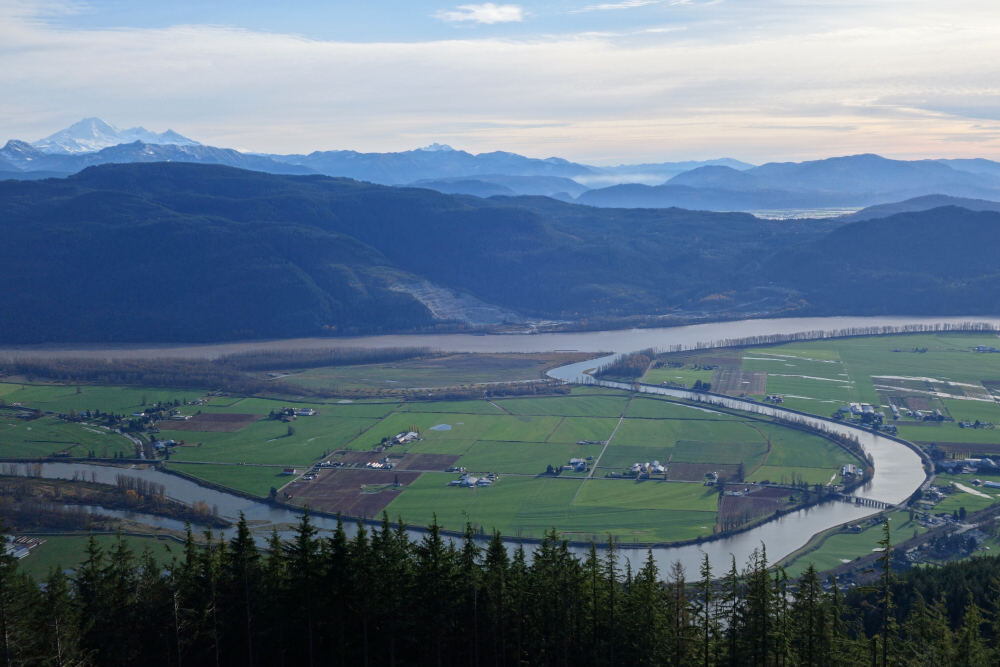
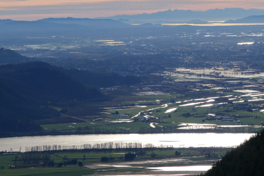
Following the unprecedented rains and flooding last November, I made my way towards the inundated areas of the Fraser Valley to get a closer look. No better place for this than from the lookout on Sumas Mountain, and besides, the last time I was up there all I could see was fog! Not quite satisfied, I next hiked up nearby Dewdney Peak for another perspective on the floods. Both hardly qualify as "peaks" if you ask me, their lowly treed summits festooned with communications towers (Sumas) and slopes laid bare by logging (Dewdney). In other words, a couple dumpster dives - except these two boast some impressive views!
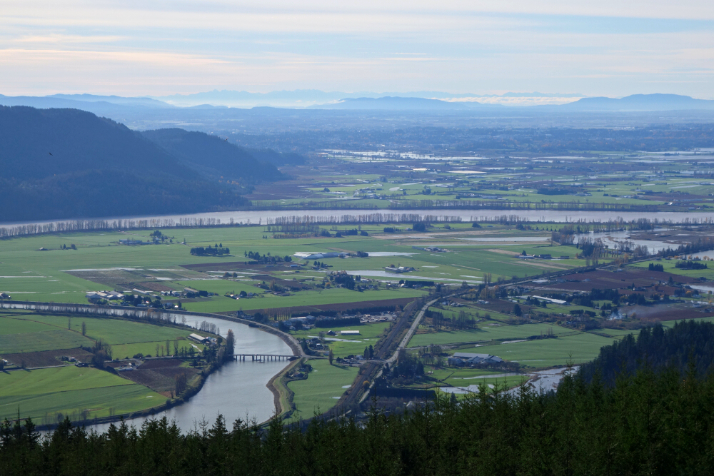
For my second go at Sumas, I opted for the quickest possible route to the summit, foregoing the Centennial (Chadsey Lake) Trail this time and instead hike up the access road from the west. Took a rather indirect route to get there as many roads were closed due to flooding obviously, but eventually arrived at the Sumas Mountain Regional Park entrance and started hiking up. Here too is a nice trail that shortcuts the first major switchback and avoids the road for most of the remaining way to the top, no more than ~45 minutes from where I parked. Then continued to the familiar lookout spot overlooking a very swollen Fraser River. Lots of clouds still drifting by, so not as good a view as hoped for but still good enough - Sumas Canal spilling its banks, the highway submerged and the flooded agricultural pains which prior to the 1920's laid beneath a now nonexistent Sumas Lake. What a mess!
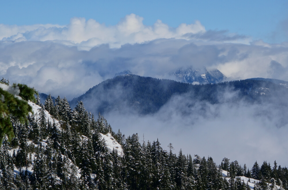
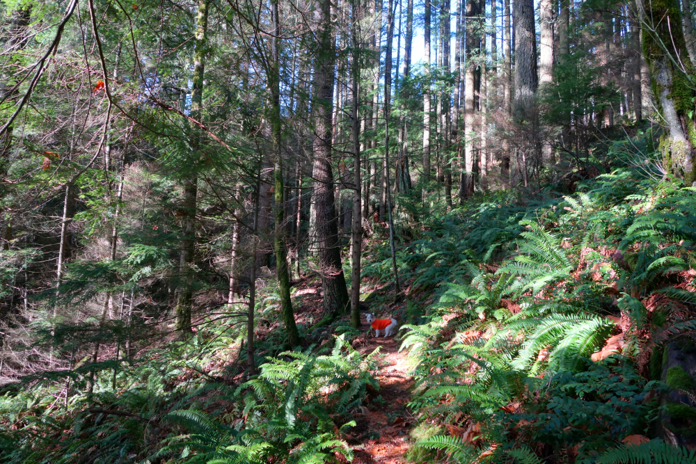
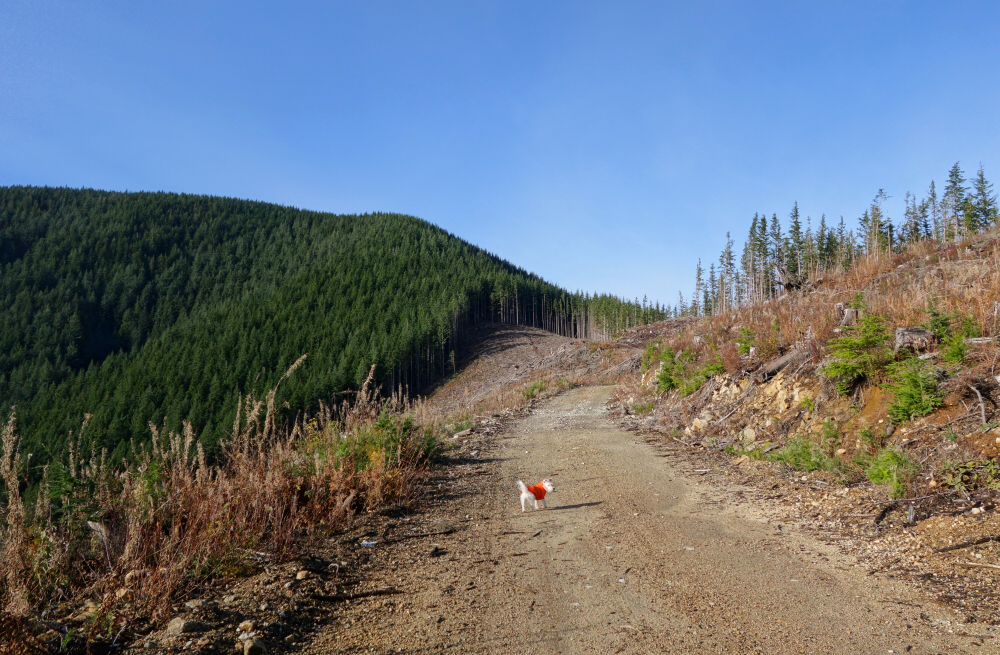
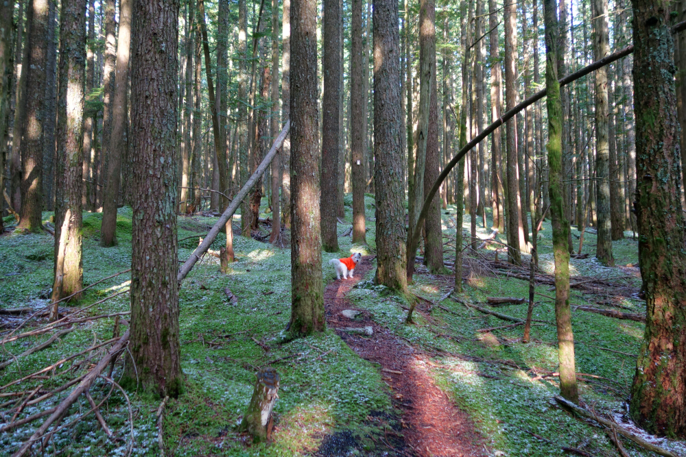
Dewdney Peak next, just a hair over 9 km to the NNE as the crow flies over the Fraser River Valley from Sumas. Starting from a bend on Norrish Creek FSR just after the gravel pit, the Dewdney Grind Trail, as it's called proceeds steeply up through forest to reach the edge of a large clear-cut area spanning much of the peak's south-facing slopes. Then back into the woods for a bit, passing a small cabin overlooking the valley far below before emerging once again at the edge of a cut block. The rest of the way to the summit continued in this fashion, alternating between open forest, FSR and cut block, which thanks to the lack of obstructions, offered up some stunning panoramic views along the way. A short descent from the "true" summit leads to yet another swath of freshly felled forest and arguably the best views of the day. From the giants of the Cheam Range far to one's left, to Chilliwack Valley, its peaks, and the fertile plains at its mouth, to the geographic constriction traversed by the Nicomen Slough and Fraser River directly below one's feet, to finally the flooded plains of Abbotsford with the San Juan Islands and peaks on the Olympic Peninsula far in the distance - that's one heck of a view for such an otherwise unremarkable peak!
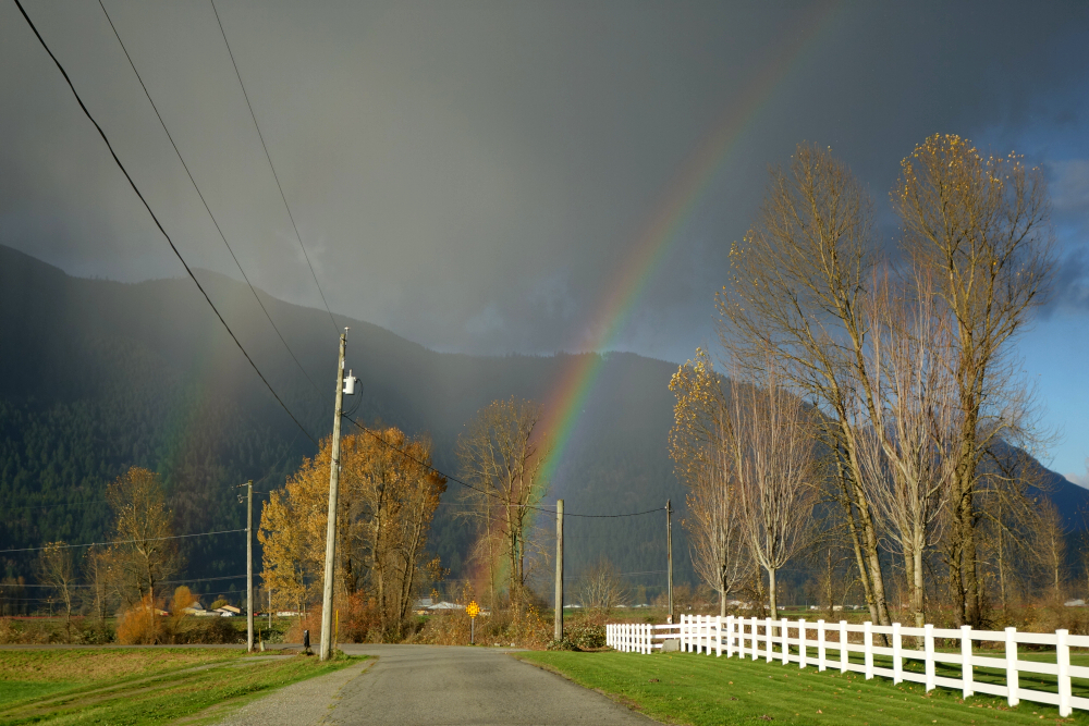
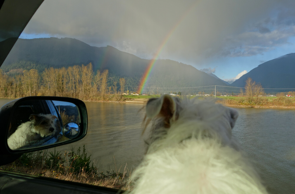
Anyway, yup shit was indeed flooded. Let's hope for no encore in 2022!
It would be very much appreciated if you please ask before copying and/or re-publishing content from any part of these pages. To do so, please click here to send a message via feedback form.


