Select from list below to jump to a specific area on this site.
| Latest Posts |
Tuesday, July 30, 2024
Mount Truax - Southeast Face/East Ridge, July 2023
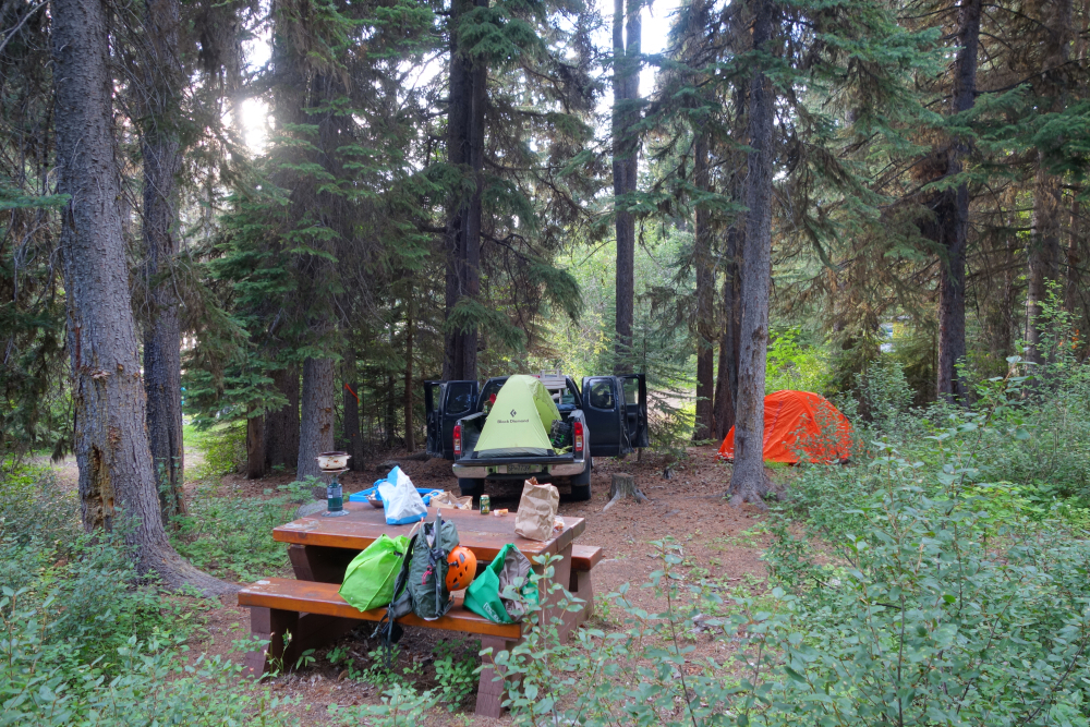
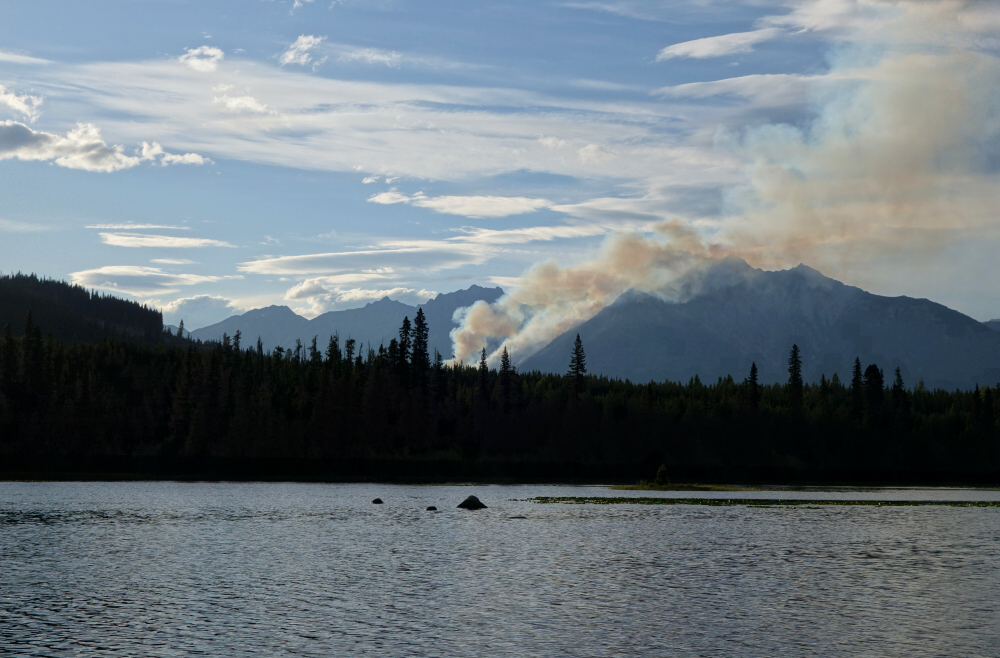
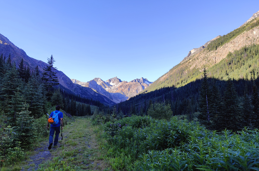
Kevin and I redeemed ourselves on Truax after an aborted attempt the previous year. We were punked by active weekday logging along the Truax Creek FSR en route to the "trailhead". Went and salvaged the day hiking up nearby Green Mountain, so at least all was not lost! Fast forward a year, and we once again found ourselves bouncing down the Hurley FSR towards Goldbridge. Due to the long drive, we departed North Vancouver later in the afternoon the previous day and car camped along the Hurley at Gwyneth Lake Provincial Park. Quaint little campground with a healthy resident mosquito population and great view looking out across the lake towards the Downton Lake Wildfire burning on the south flank of Mount Penrose. This would grow out of control and burn about 56 properties along Gunn Lake. I'm still baffled why it wasn't tended to while it was still a relatively small fire; resources probably stretched too thin with all the other fires burning in BC that year I assume. Anyway, not only was it a weekend this time, but it seems that logging had ceased up there along Truax Creek FSR. Great news for us, except the recently cut water bars spaced every couple hundred feet apart were a royal pain! They also got progressively deeper the further we drove (4x4 recommended), the only relief coming after the final switchback where the road makes a long water bar-free straightaway into the valley.
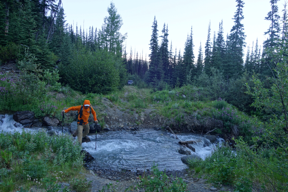
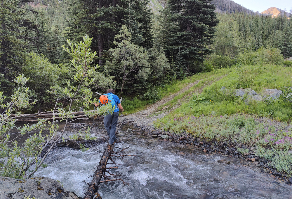
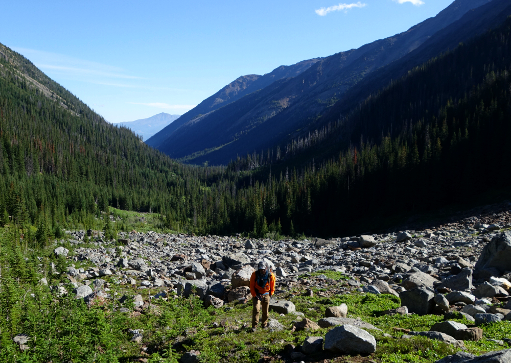
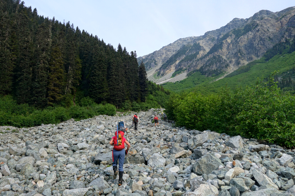
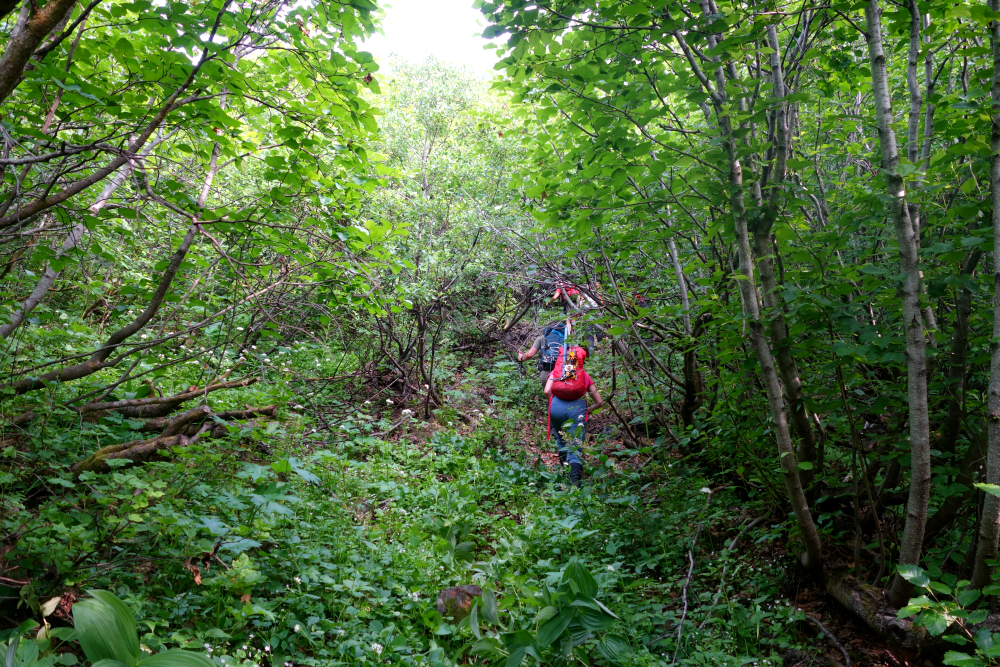
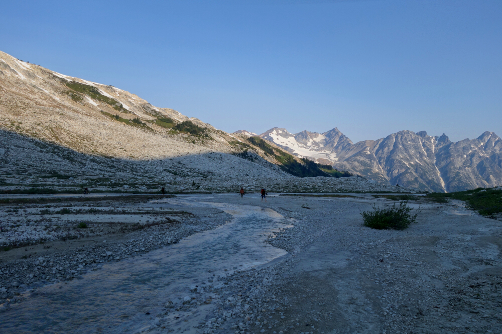
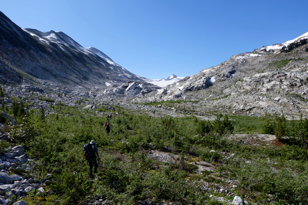
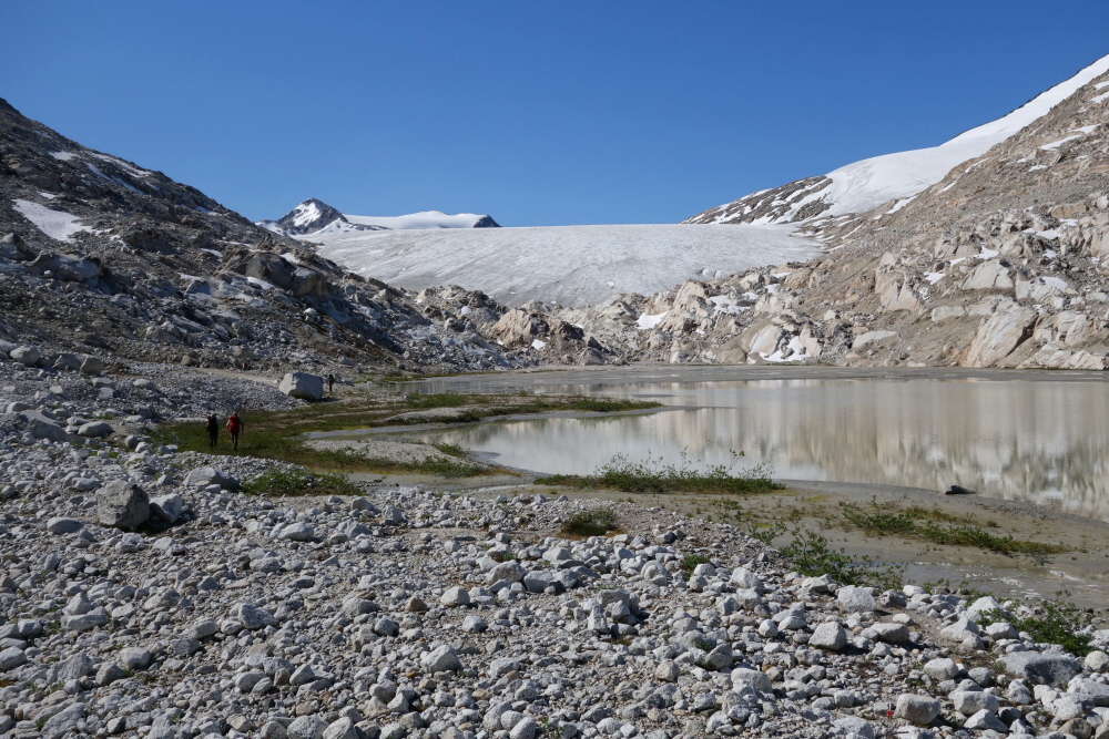
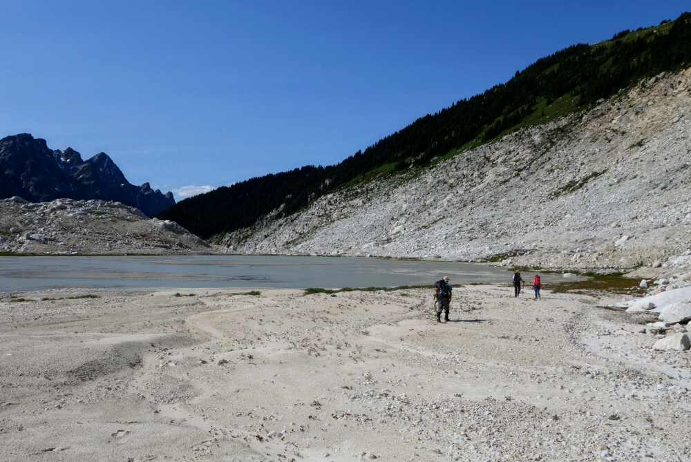
We parked just before a washout and started hiking the remaining few kilometers towards road's end. We left the road at a point where it makes a sharp turn to the left, and proceeded straight into the forest ahead of us. Bits of flagging and a very faint path suggested others had come this way before us. It wasn't long before open forest gave way to a swath of debris left behind from an avalanche that ripped down from Truax's east slopes. The snow was long gone, leaving behind an unstable pile of fallen trees and dirt with a creek still flowing underneath. Travel through here was tedious and slow - went up the middle, taking care not to punch a foot into the creek, but returned via the forest along the left (east) edge on return for a somewhat better experience. Bugs were horrendous! Continued up from here soon reaching a large talus slope which we followed up and right towards the headwaters of Truax Creek. Like so many other places around Goldbridge, there used to be an active mine tucked away in the mountain here with an old road zig zagging up the talus slope and metal cables and such strewn about. It was called the Gray Rock Mine and they were mining for gold.
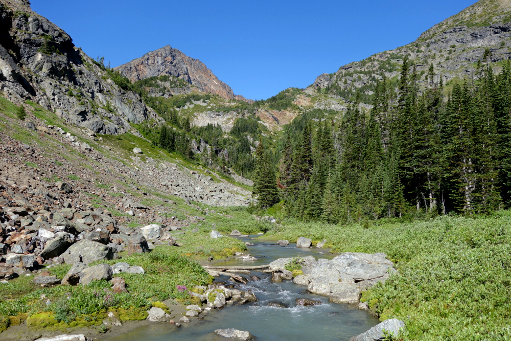
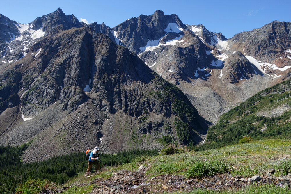
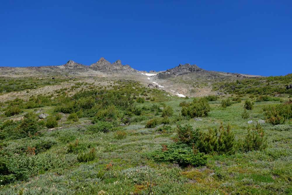
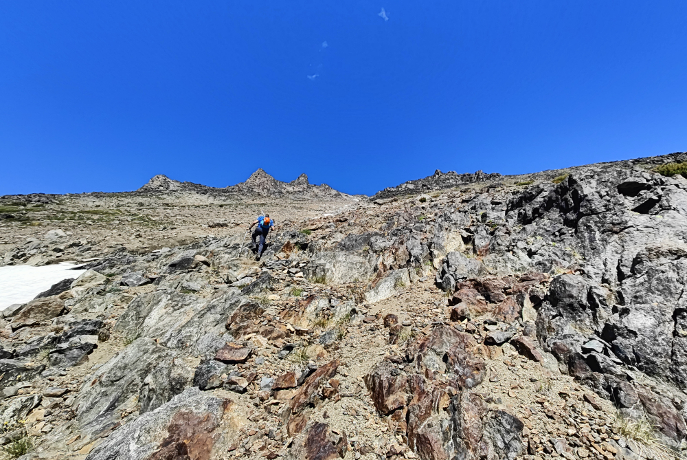
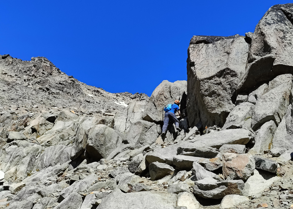
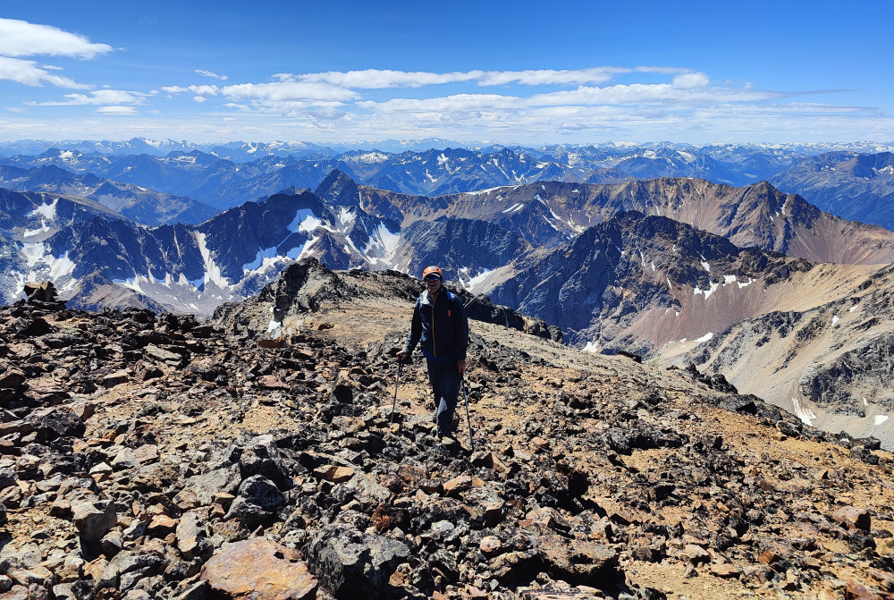
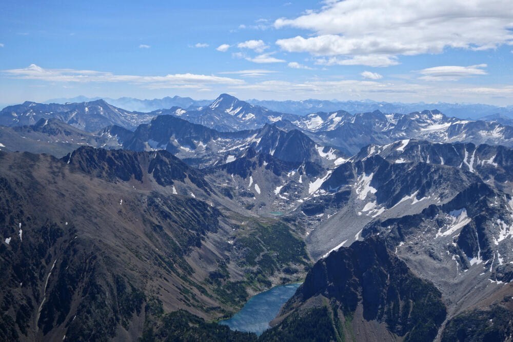
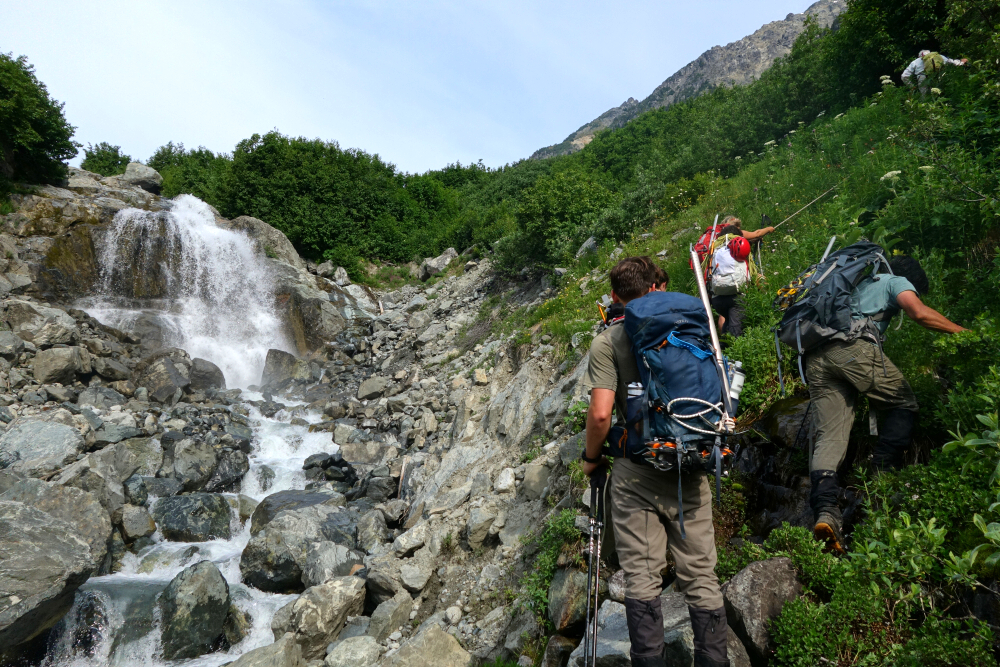
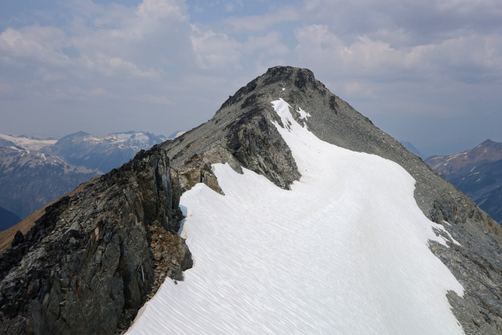
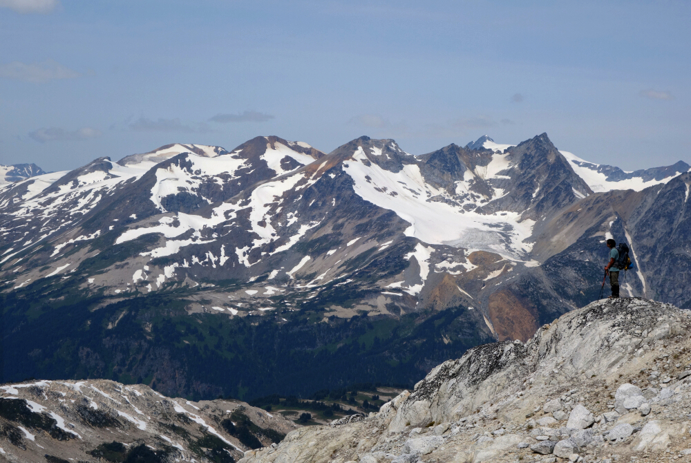
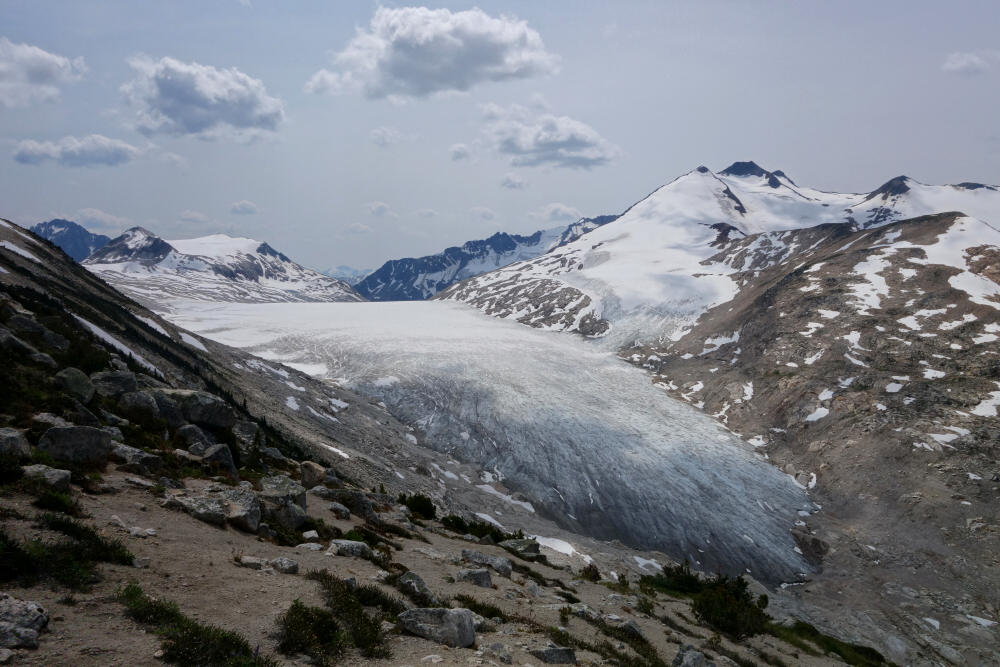
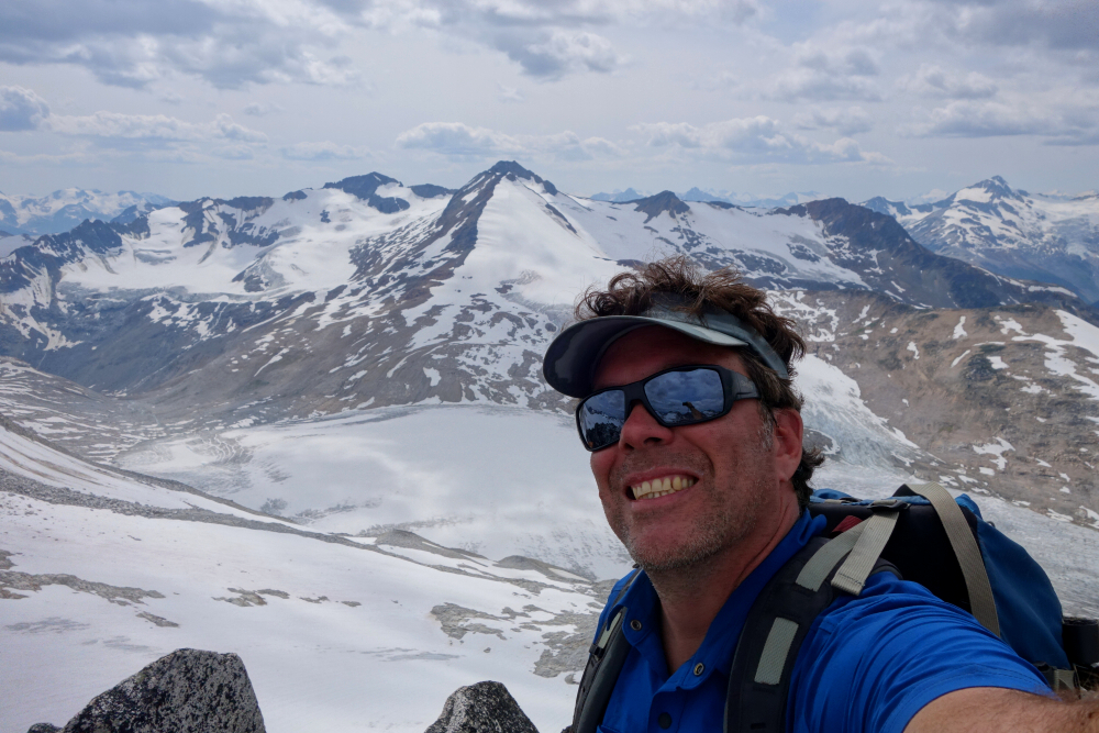
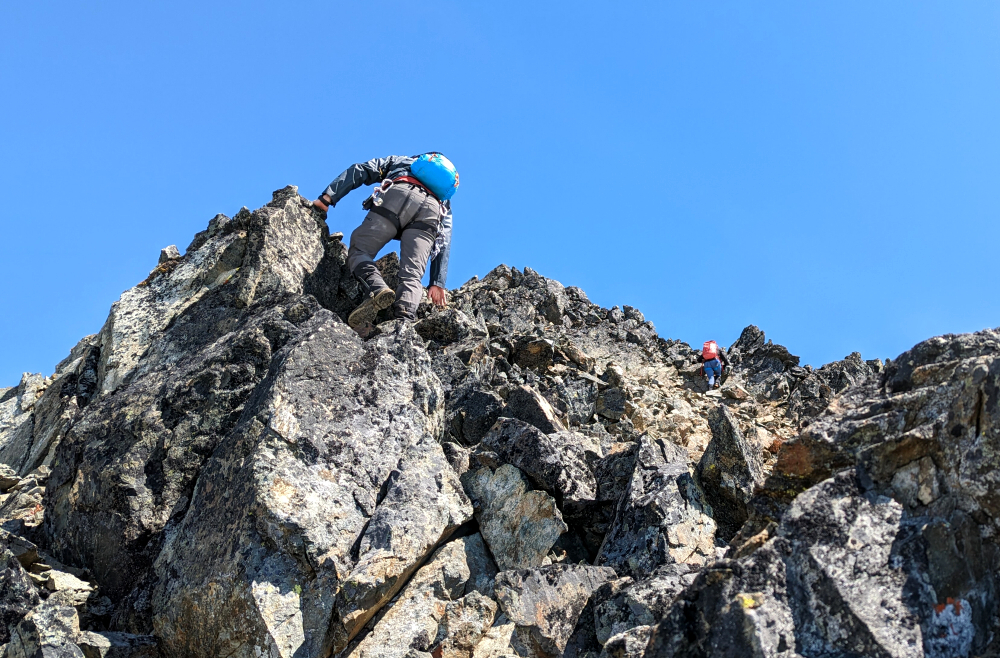
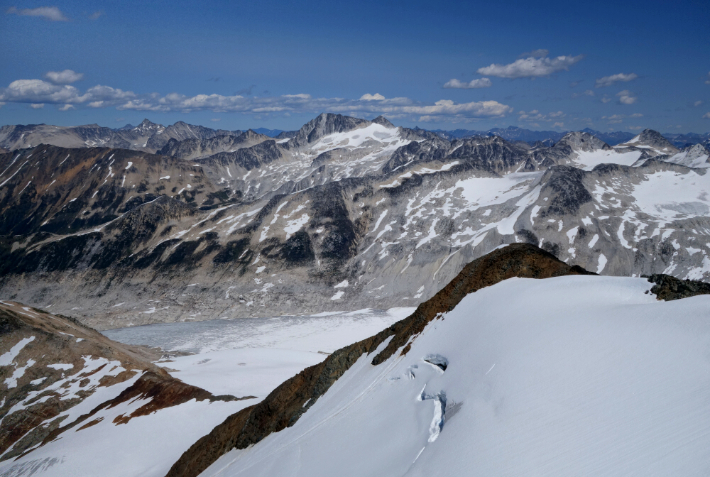
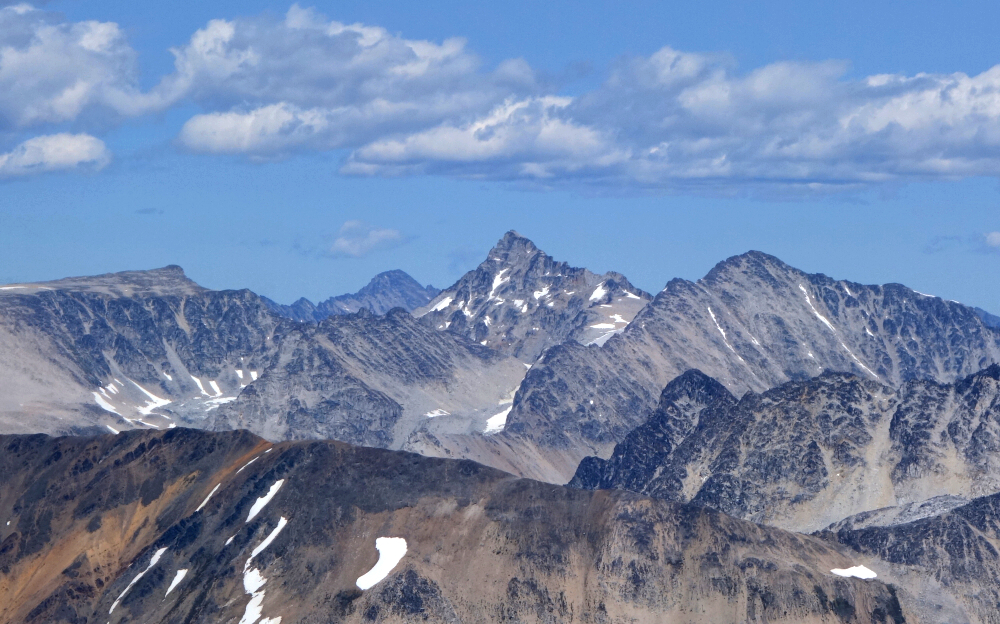
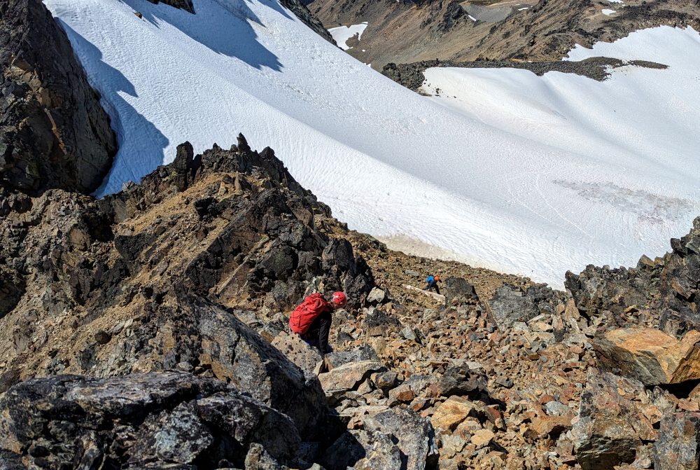
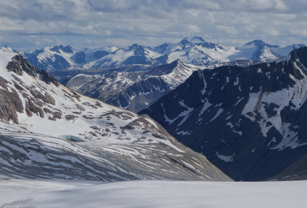
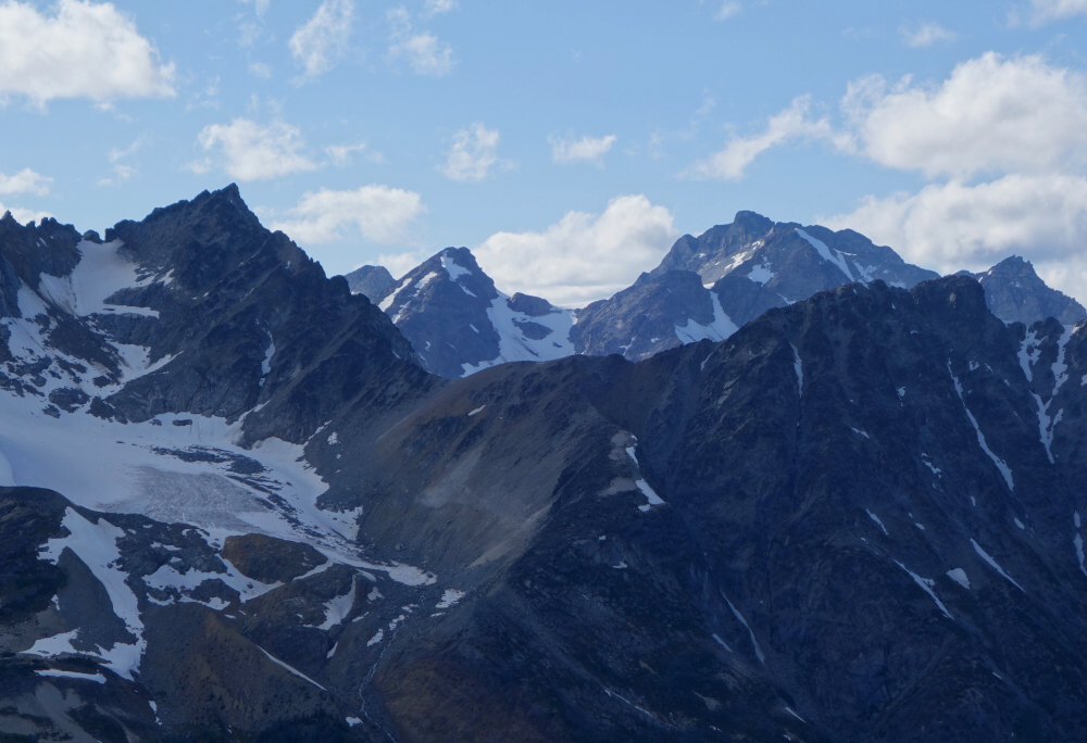
With Truax's South Ridge before us, we descended to the creek and crossed over to the north side. Looking up the Southeast Face, the summit seemed tantalisingly close with only a short bit of forest between us and the open slopes above. Decided that the "direttissima" was the way to go and proceeded straight up from the creek. A short bash through forest and we soon found ourselves working up grass and heather slopes. Looking back, the views were now starting to open-up, revealing a collection of craggy peaks in the Bendor Range to the south along with a large hanging lake shimmering in the mid-morning sunshine (Truax Lake). Grass and heather soon gave way to scree and talus, which we followed up into a granite amphitheater above. Fun scrambling though some steeper rock saw us to the crest of the broad East Ridge, which we followed on up to the summit plateau. A short walk later and we were on the summit where a cool breeze and stunning views awaited us!
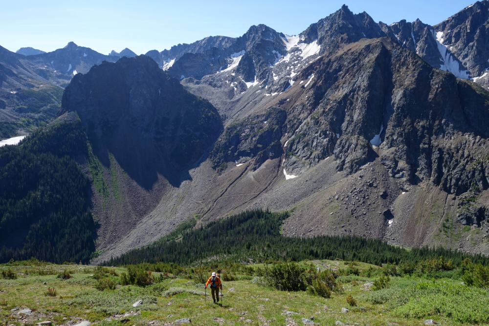
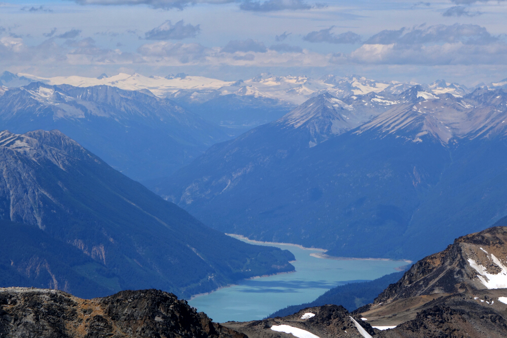
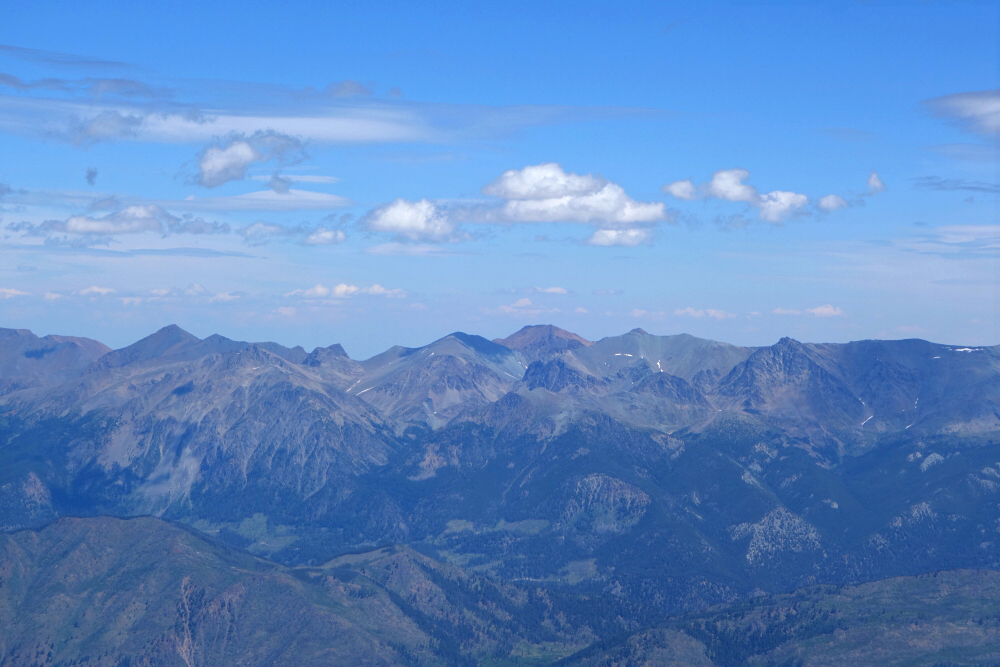
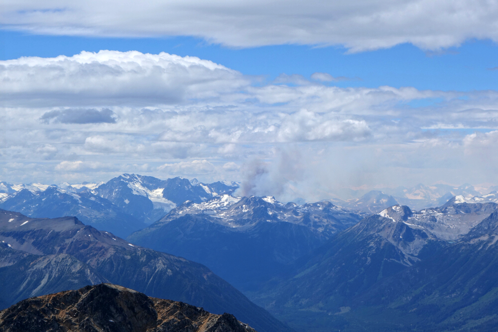
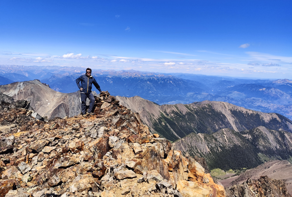
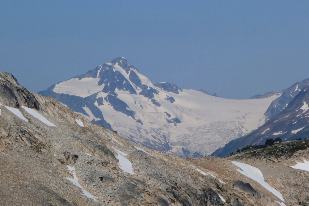
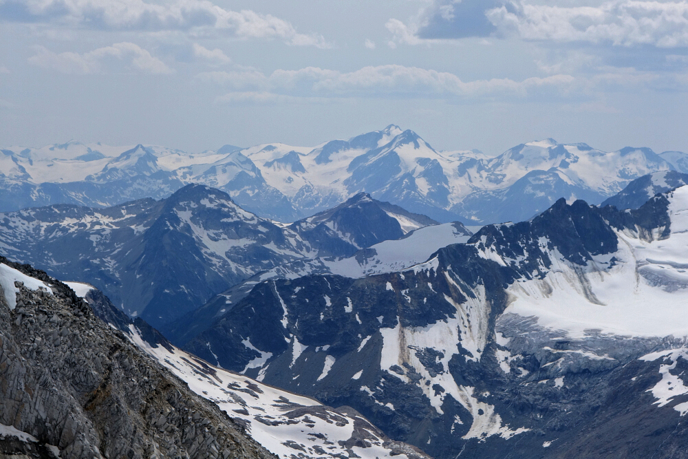
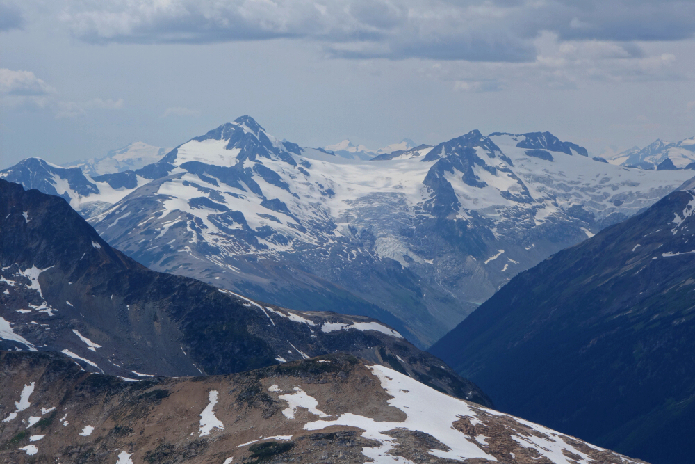
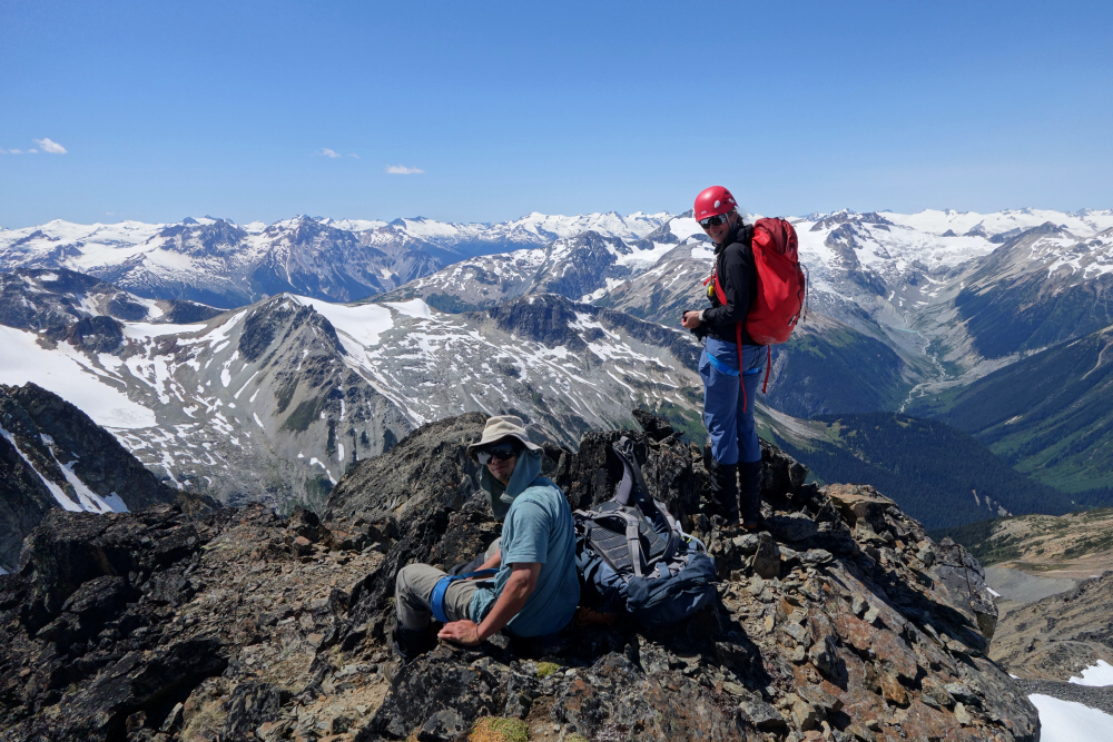
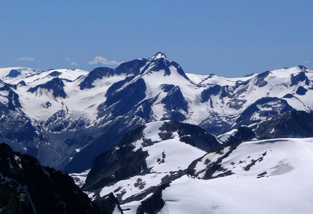
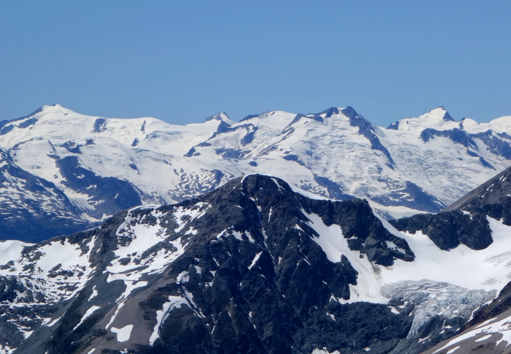
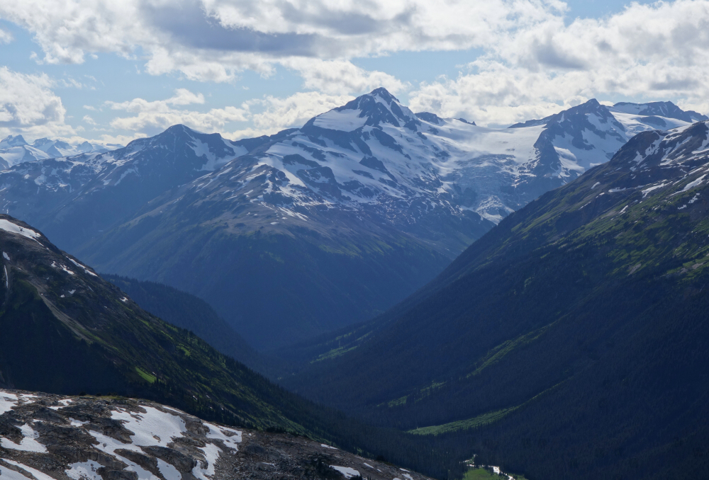
All the usual Goldbridge-area suspects were on full display - Shulaps, Dickson, Penrose, Sloan, Cadwallader, Whitecap, and farther out we could make out Sampson, Ipsoot and even The Black Tusk way back in the distance! Great perspective on the Lillooet Icefield to the west with a ridiculously turquoise Downton Lake in foreground as well. Unfortunately, we also had front row seats to not one, not two but three wildfires burning around us - Downton Lake, another somewhere along the upper Hurley River and the third just north of Whitecap Mountain. 'Tis the season as they say! Had us a good hour or so up top before returning to the truck where cold beer was waiting! About 8 hours round-trip for a most satisfying redemption hike up the 7th tallest peak in SWBC!
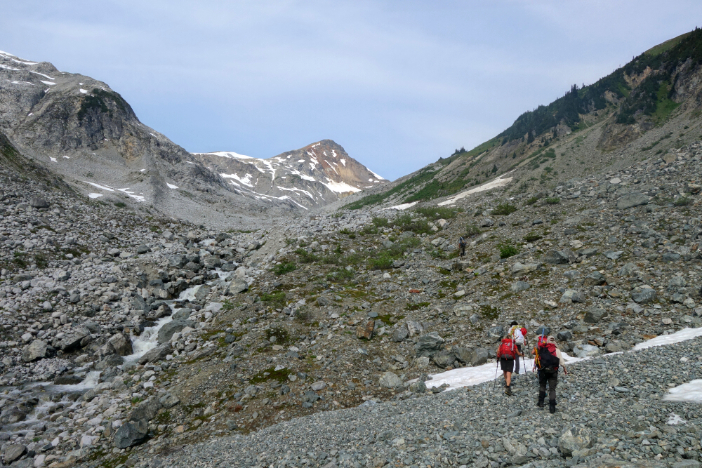
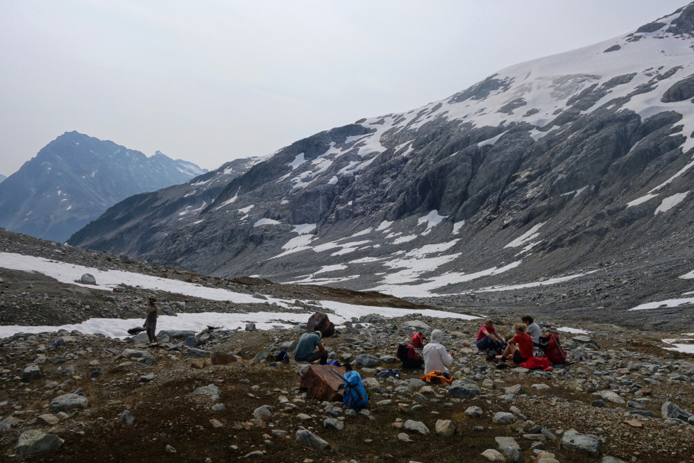
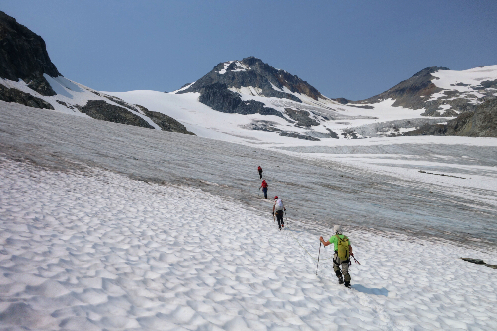
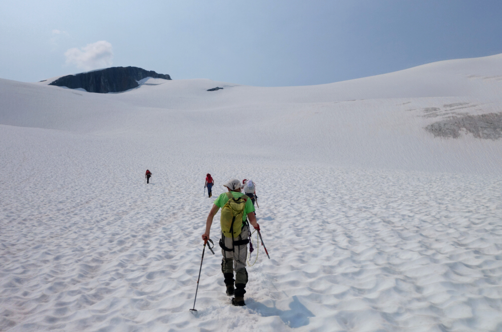
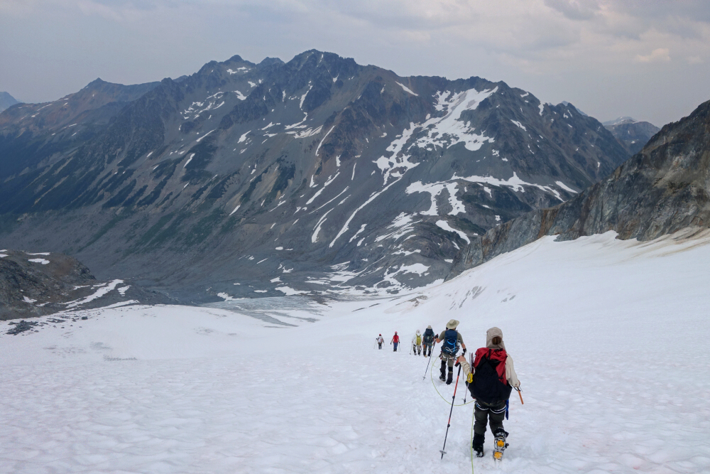
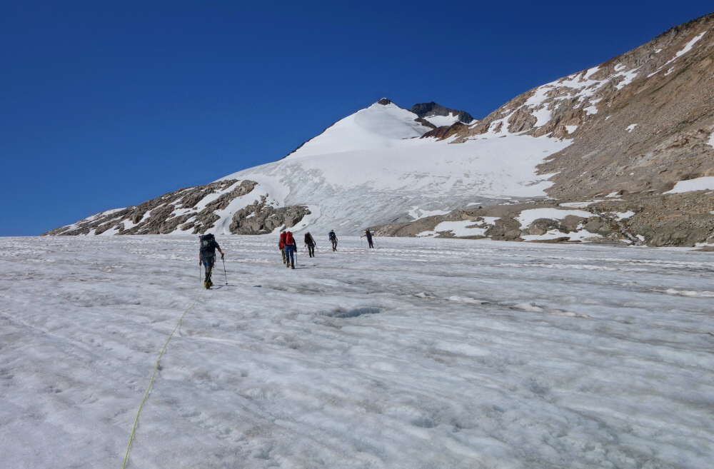
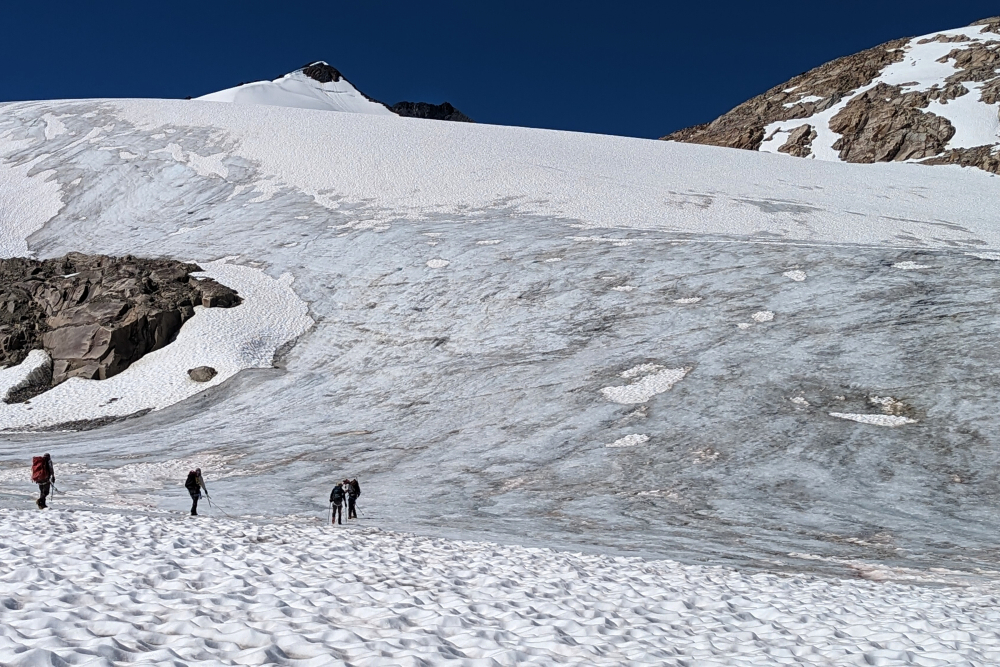
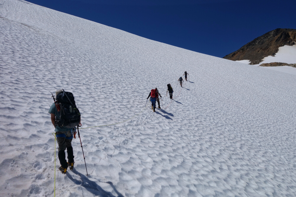
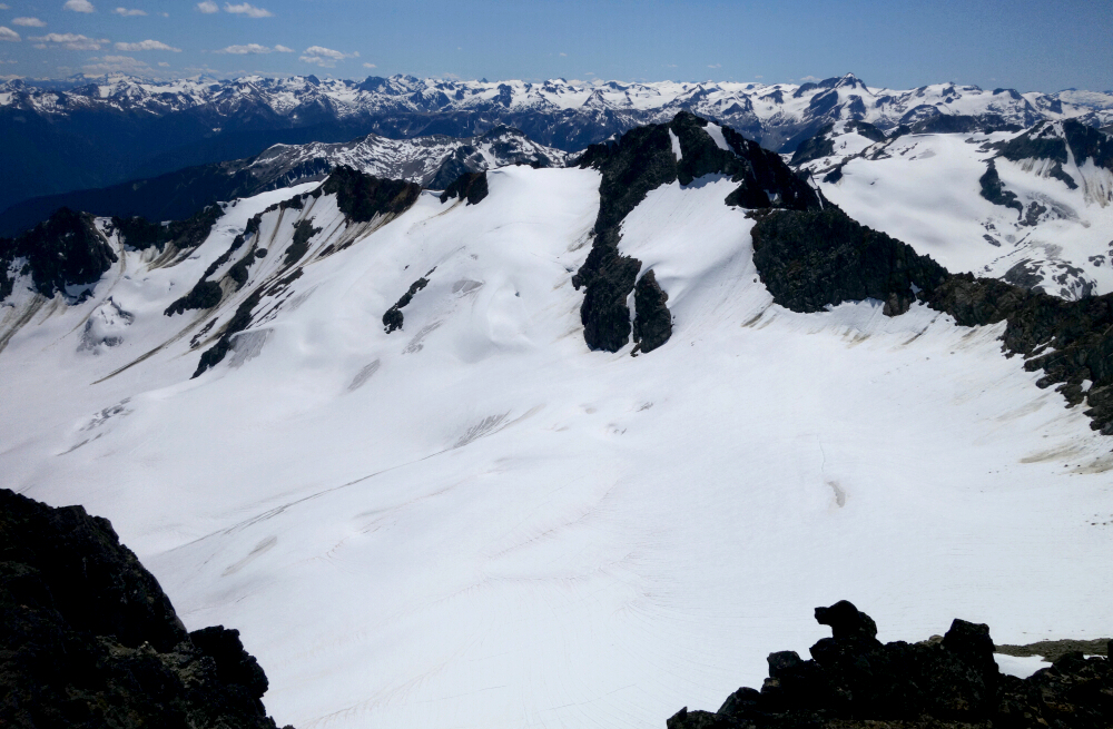
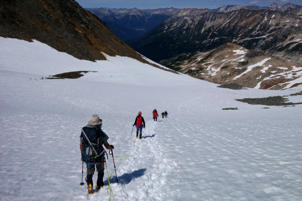
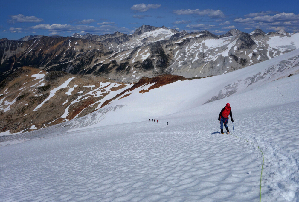
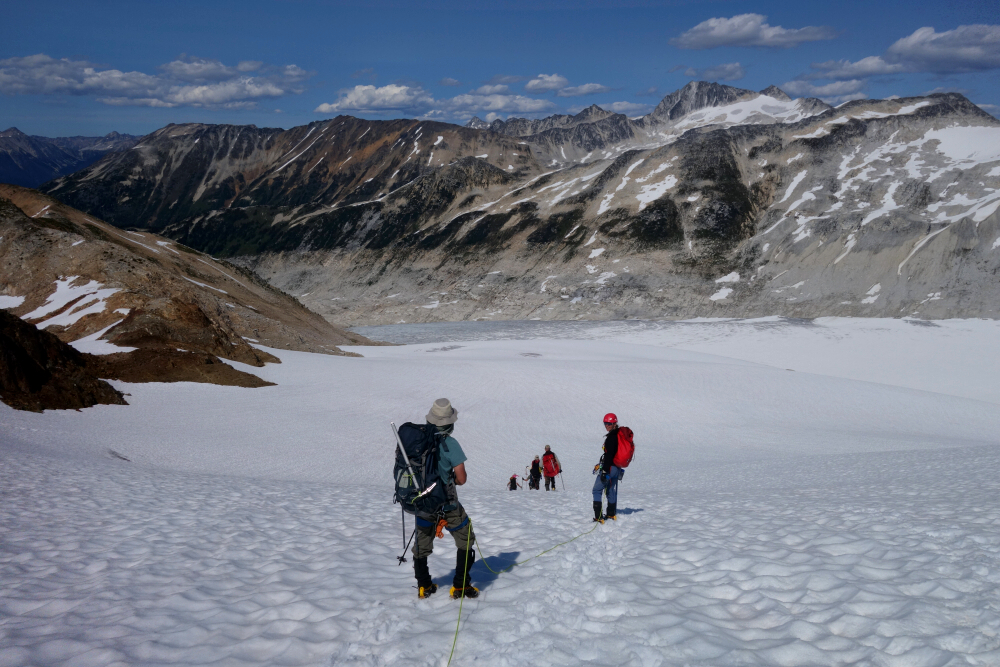
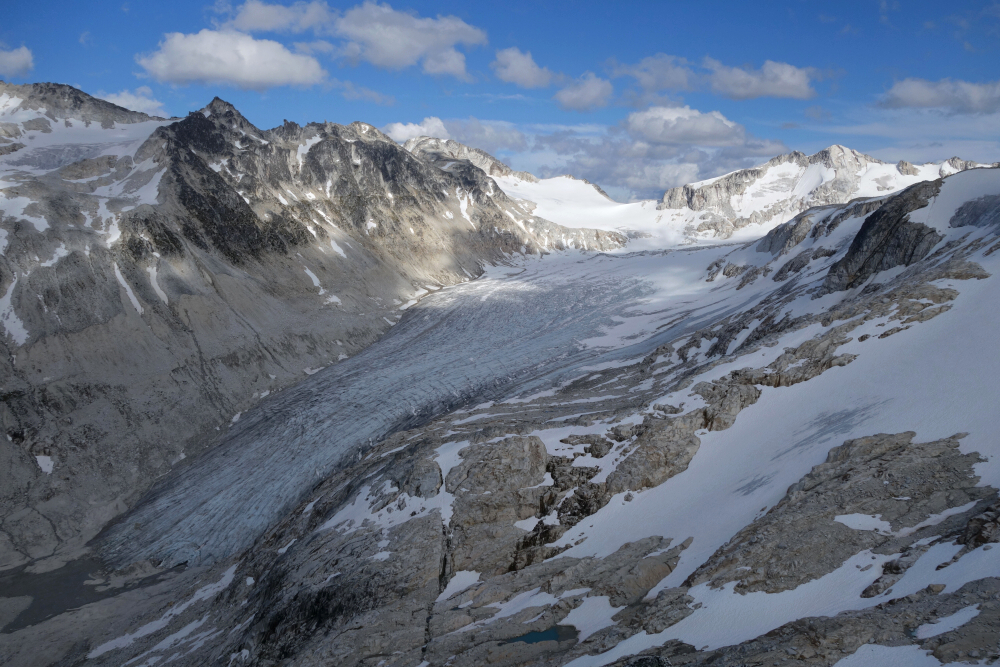
The 4th and final objective of the Pebble-to-North Creek traverse. Departed the North Creek hut with Ian in the lead followed by a merry band of 7, me included. Good trail from the hut to the bouldery creek outflow draining a minor valley directly to the west. Up along the right (north) bank into some bush for a bit before exiting onto open slopes that lead on up to a crest at the head of the valley, with a large glacier on its opposite side. A short, shitty descent to the glaciers edge, where we stopped to rope up. Paired up as 2 teams of 4 with one of our party and a couple other gals from Ian's taking issue roping up with me because I'm apparently too "heavy" for their liking. Just as well I figured as the rest of us were getting fed up with the ongoing verbal sparring between these three hens since the evening prior. Far too much ego for my liking. Ian graciously ended up taking the rear of that team while I led the other group. The others got their gear sorted first and started up with us following. Came to a full stop shortly thereafter, those in front now bickering about where to go and overcome by a severe case of analysis-paralysis. Lots of squawking and not much listening as expected but miraculously after several agonizing minutes a consensus was reached, and we all began moving forward again. Up to the large glacier plateau at mid-elevation, then a sharp left towards its east margin before turning up and continuing to the upper slopes. Right up the middle or better yet along the far right looked good as well - options abound.
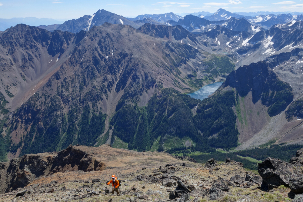
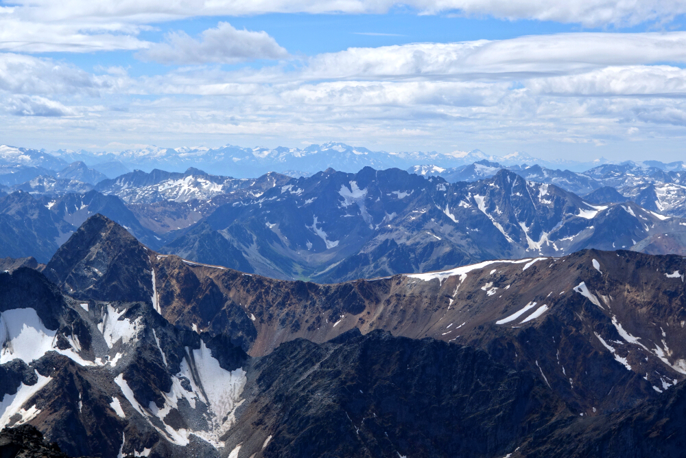
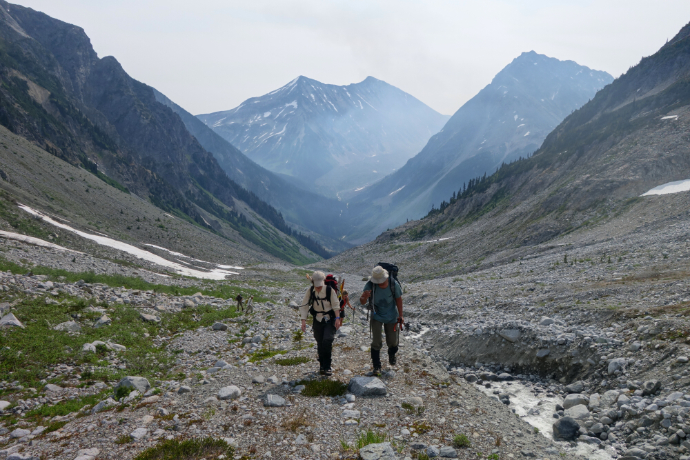
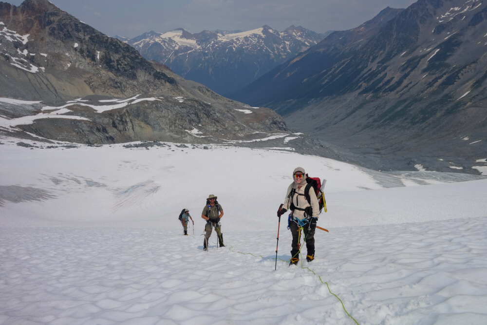
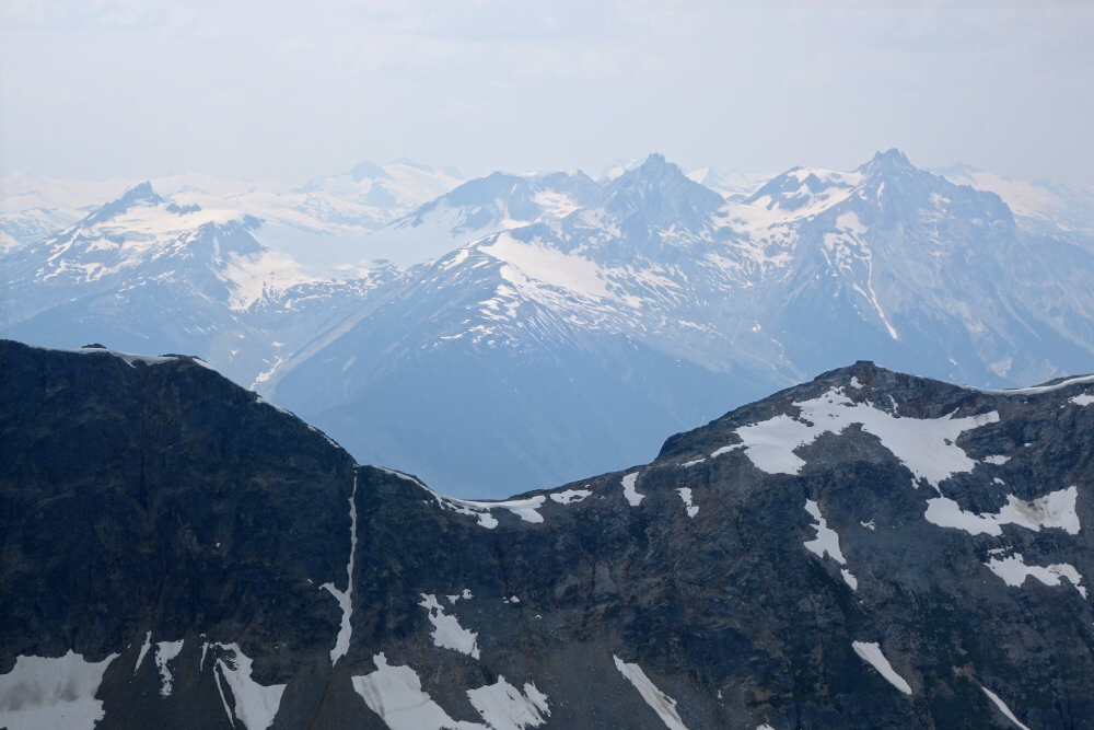
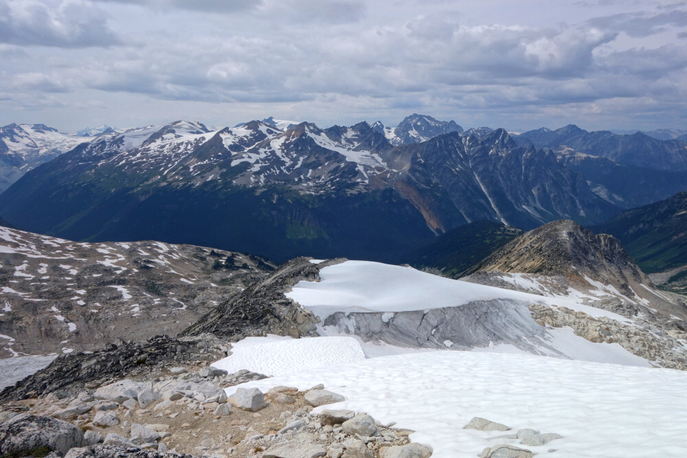
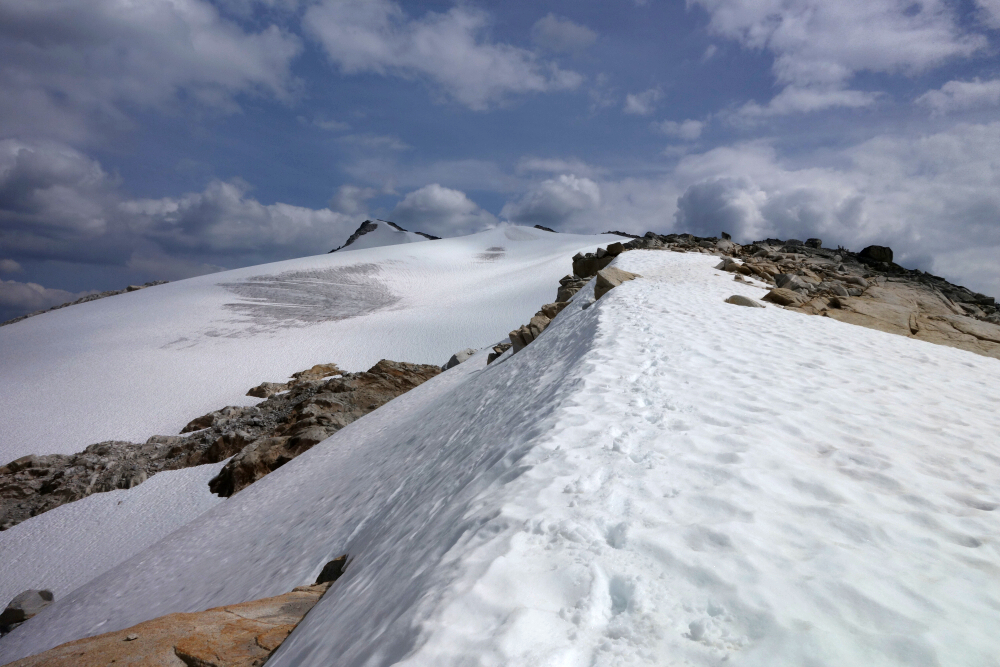
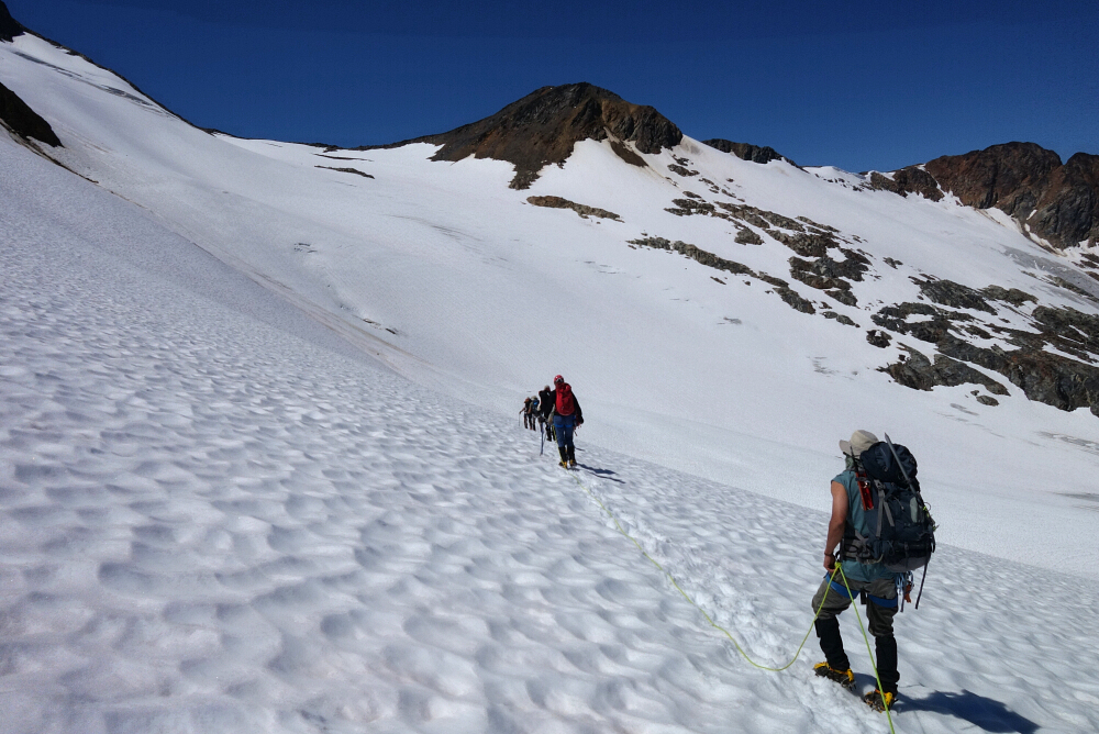
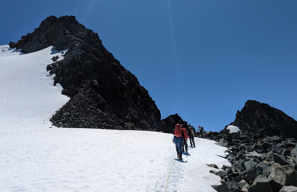
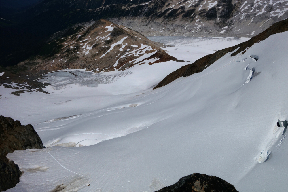
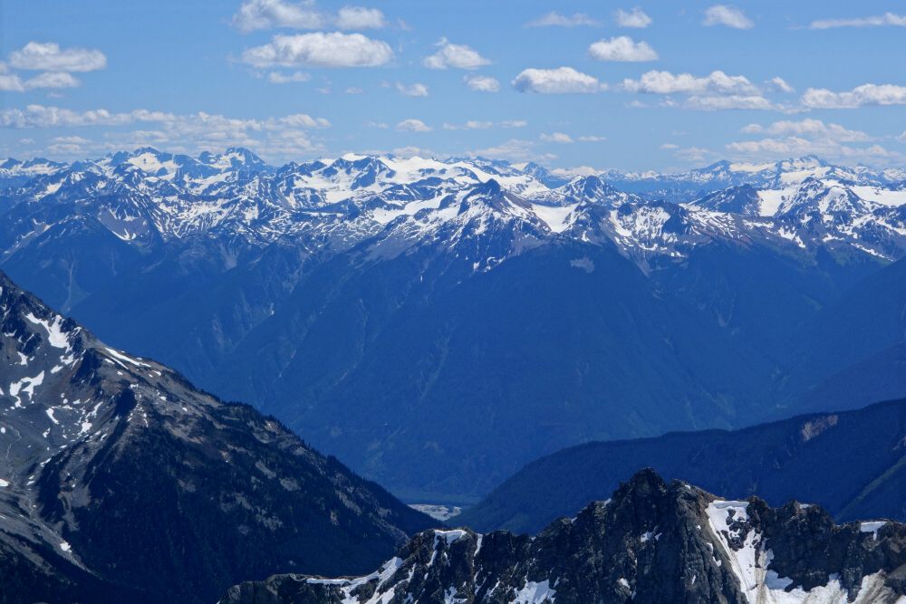
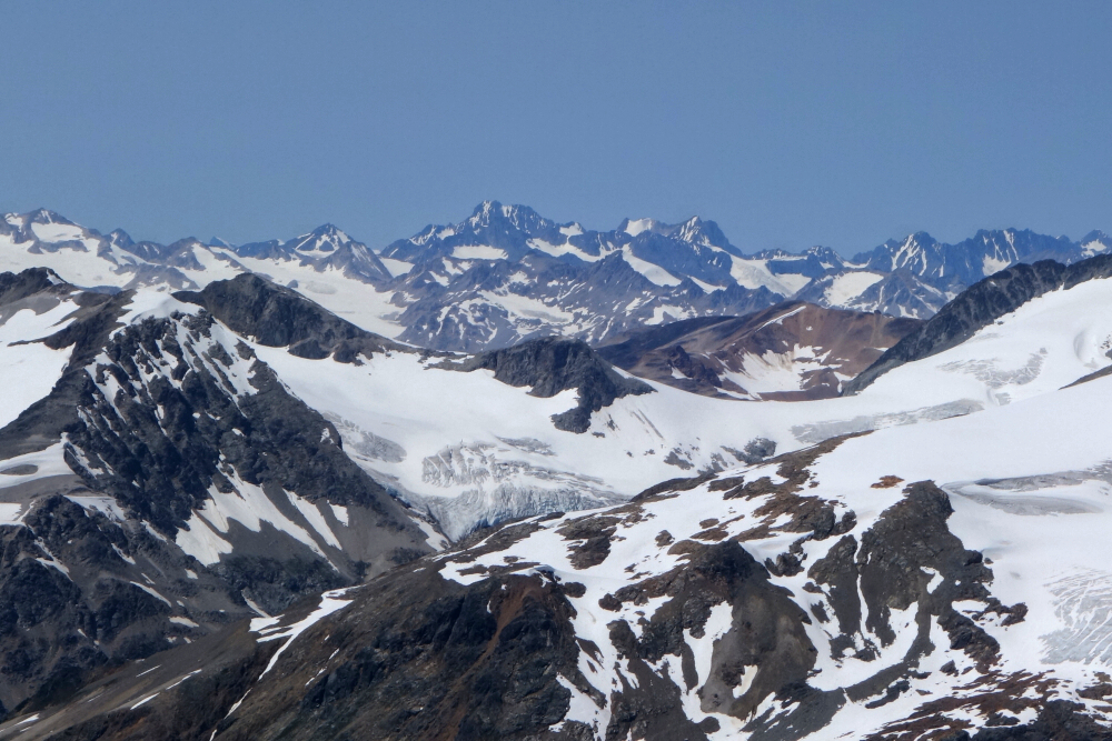
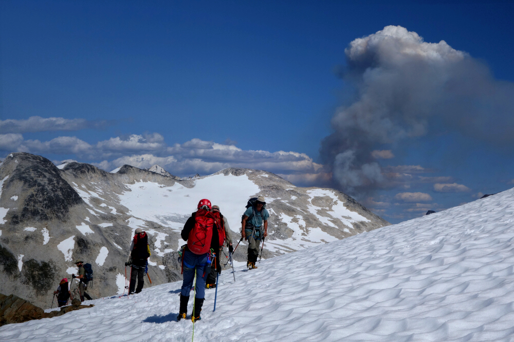
The leading party stopped for a rest at a rock outcropping at the upper left head of the glacier, with our group now continuing in front. I found this portion of the climb to be quite enjoyable as it ascended a series of large steps on a broad glaciated ridge. A quick turn to the south and we soon found ourselves untying and ditching our glacier gear before stepping on to dry rock on the South-Southeast Ridge. From there an enjoyable and easy scramble along the ridge leads to the summit. By then, the blue skies from earlier in the day had given way to some high cloudiness mixed with smoke presumably from the forest fire we had seen while descending Pebble Peak days earlier. Views were a bit murky therefore, but no complaints! Cut our stay short as it looked suspiciously like a thunderstorm was brewing overhead, returning to our stashed gear shortly thereafter. Back down the glacier following our up-route, with the other party soon opting to for a different route, making a large jog to the left for reasons unknown. We instead simply followed our tracks from earlier, with me taking up the rear this time.
Easy cruise back down, until the bonehead in front somehow lost the track and blindly forged his own, oblivious to any hazards that may lie ahead. The large crack coming in on from the right was apparently of no concern or not seen as a foot punched through into the unknown. No mention of this of course, endangering those following to do the same or worse. Into the hole our #2 goes, with only a backpack to stop from falling in completely. Able to self-extricate thank God after which we retreat to where we'd lost our tracks from earlier and then proceed down without further drama. Fucking idiot hour at its finest! At any rate, back to the hut after another longish day where all is forgiven for the final evening of our trip. Polished off the rest of the warm beer revelling in our successes, failures but most importantly the great experience. Lots of learning to go 'round and a damn good way to spend 7 days in the hills if you ask me!
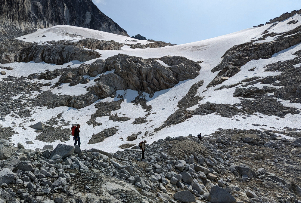
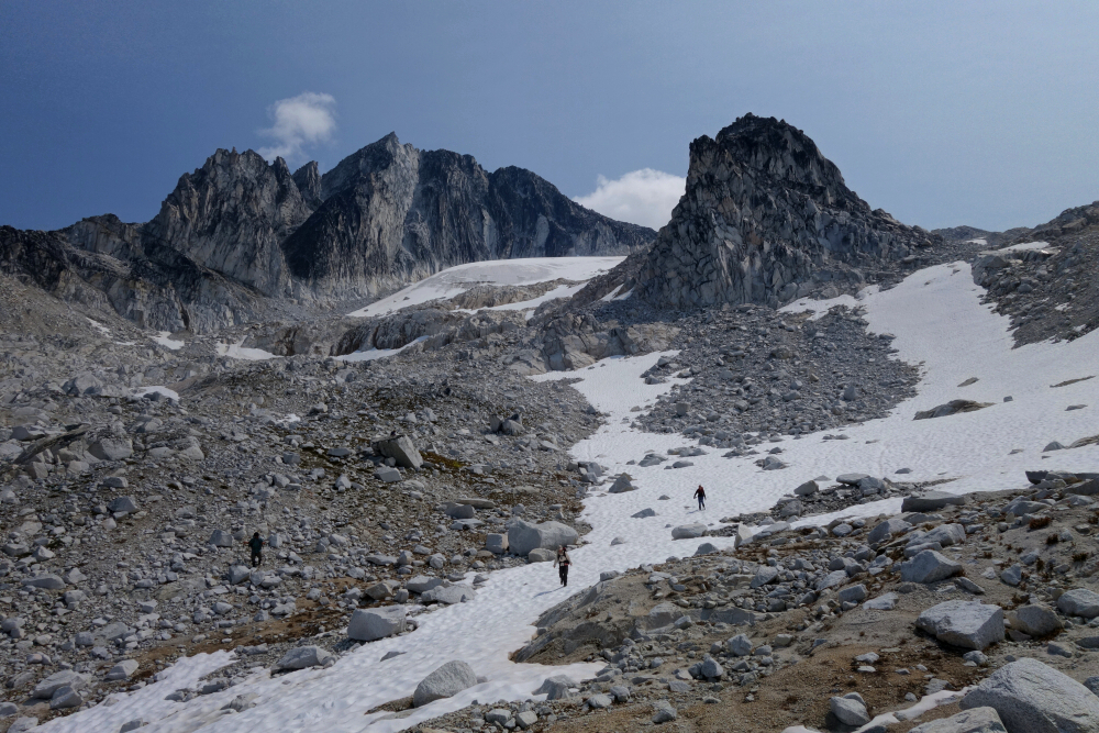
Peak #3 on the July 2023 Pebble-to-North Creek traverse. With an early(ish) start, Miranda, Sarah, Alex, Wes and I woofed down a hasty breakfast and set out for the mighty Mount Thiassi. Started up the same trail used for Mount Sears, which by now we were familiar with having been up and down it a couple days prior. Dropped off Sears' NW Ridge where it made sense and lost about 700 feet of hard-earned vertical into upper McParlon Creek Valley, bottoming out just north of the McParlon Glacier snout. Then back up the other side over heather, snow and increasingly steep and unstable talus for about 1700 feet stopping finally at glacier's edge below Thiassi's imposing East Face. Travel by this point had slowed to a crawl, navigating over and around teetering blocks and talus resting on friable glacial till and scree of the type only a recently receded glacier leaves behind. We were a good 5 hours into the undertaking by this point and two of our party members were noticeably out of their element if not terrified by the terrain we suddenly found ourselves in. Moving safely here required a kind of wariness that comes with experience, and when asked if these two had had enough, both seemed greatly relieved by the suggestion.
Kinda new to this group leadership thing to be honest, but in the absence of anyone else recognizing the predicament we were in, I offered to hang back and guide the two back down to relative safety. Coulda turned around after doing this, but by then I'd lost my verve with the group dynamic and pursuit in general. Miranda and Wes were still keen on pushing on, which was fine by me, but despite some hemming and hawing seemed to lack confidence in proceeding without me. Curious how when things took a turn for the worse, success or failure somehow rested on my shoulders. The next time I agree to joining a party of 4 or more on objectives such as Thiassi I'll insist on a sober conversation beforehand to hash out what the expectations are of each party member and who, if anyone is in charge etc. So anyway, back down we go as a group about 800 feet and probably a good couple hours from the summit. Turns out we weren't technically on route after all and should have begun traversing lower to the SE rather than continuing up so close beneath the East Face. Unfortunately, this wasn't obvious to me at the time and none of the route beta I'd looked at prior to the climb was clear about how exactly to approach the saddle on Thiassi's SE Ridge, where the real climbing was supposed to begin. Live and learn.
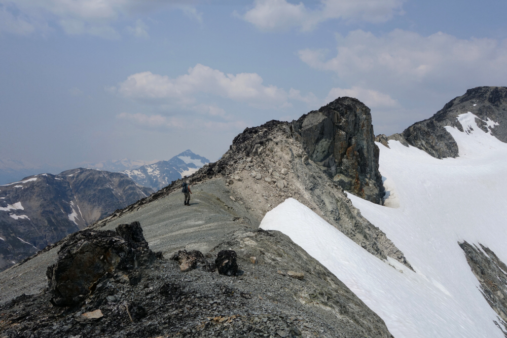
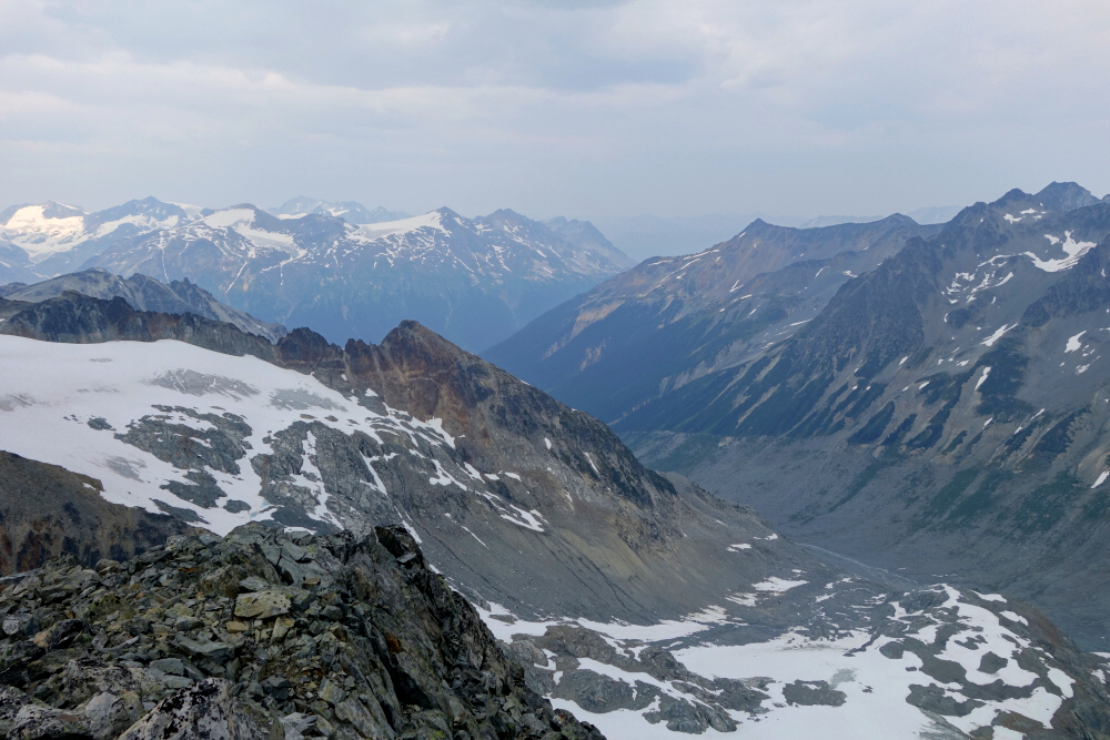
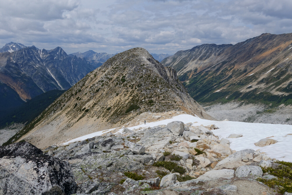
Once back down on the valley floor, Wes and I decided to at least tag Mount Wesley-the continuation and highpoint of the ridge on which Mount Sears lies. We had to regain the ridge to return to the hut anyway and might as well get our butts up on top of something we figured. With the rest of our party confident they could navigate their way back independent of us, off we went up a relentless talus slope in the blazing sun towards the base of Sears to near where we did our crevasse rescue practice days earlier. Rather than continuing up and over Sears and back down the other side, we elected to traverse its east slope to reach a prominent saddle to its south. This worked out well, after which an easy but aesthetic ridge ramble on snow and finally some rock saw us to Wesley's summit. A cairn here confirmed we weren't the only ones who had come this way, despite a dearth of information on the peak to be found online or otherwise. Views were superb, like Sears only better and a decent consolation prize all things considered. Back to Pebble Hut without further difficulty for our final night before moving on to North Creek the next day. Pity about Thiassi as it is quite a trophy peak to stand atop of - perhaps someday I'll head back that way, helicopter or not!
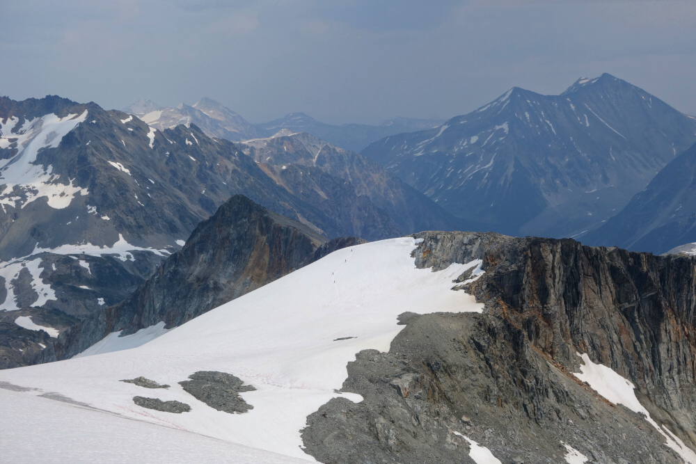
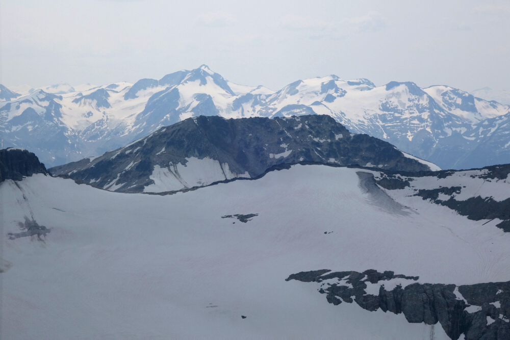
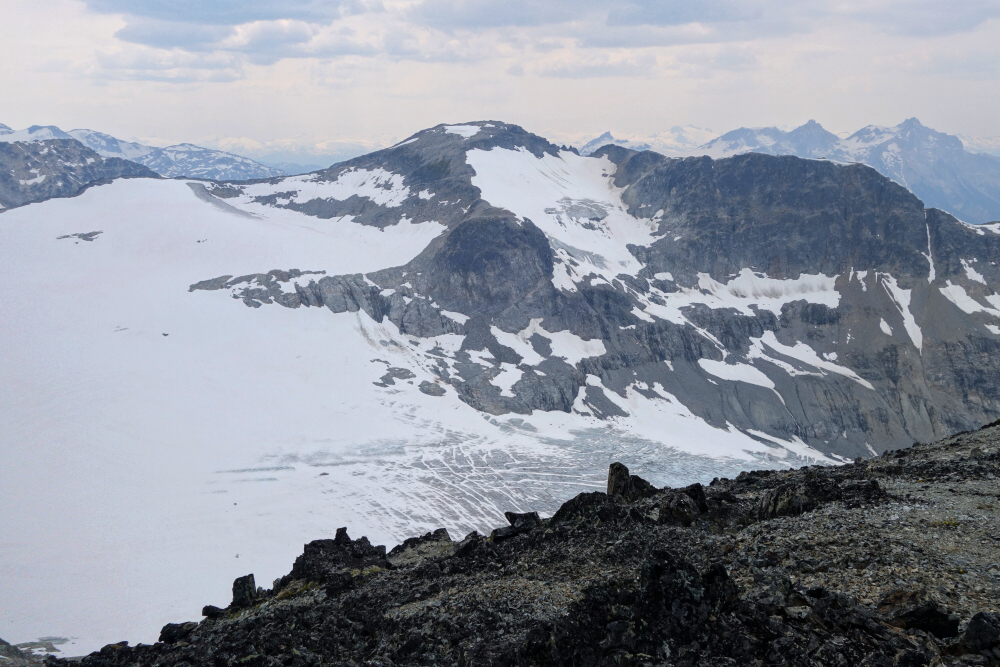
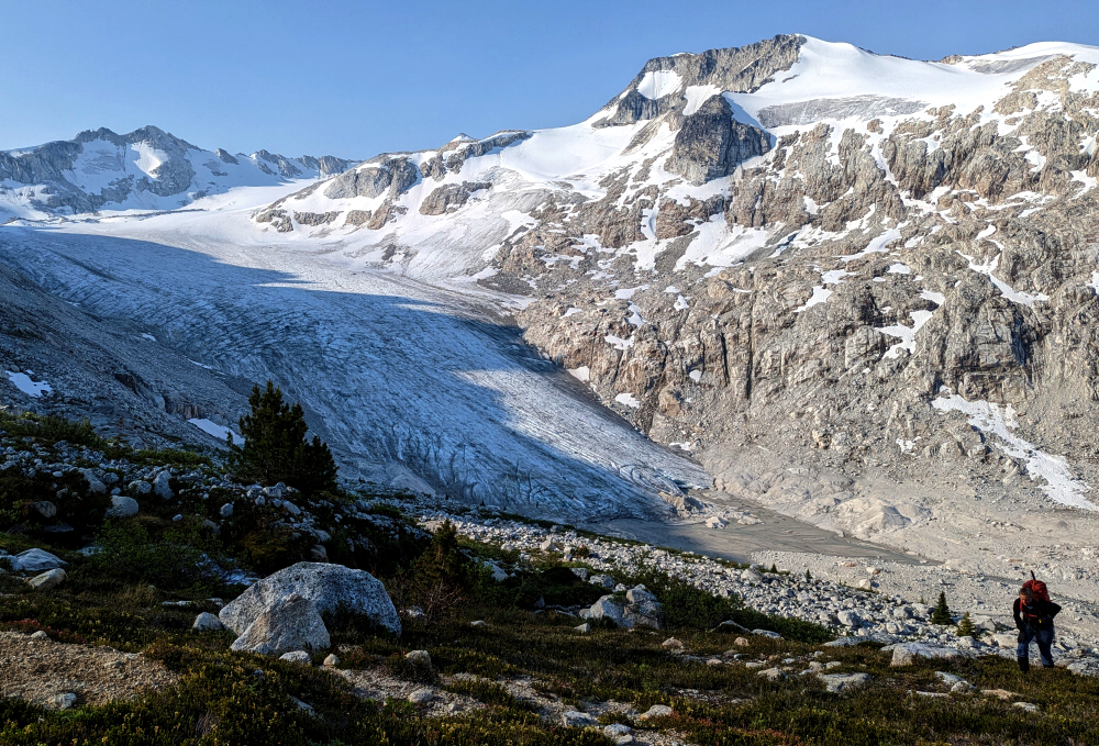
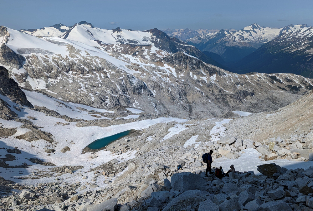
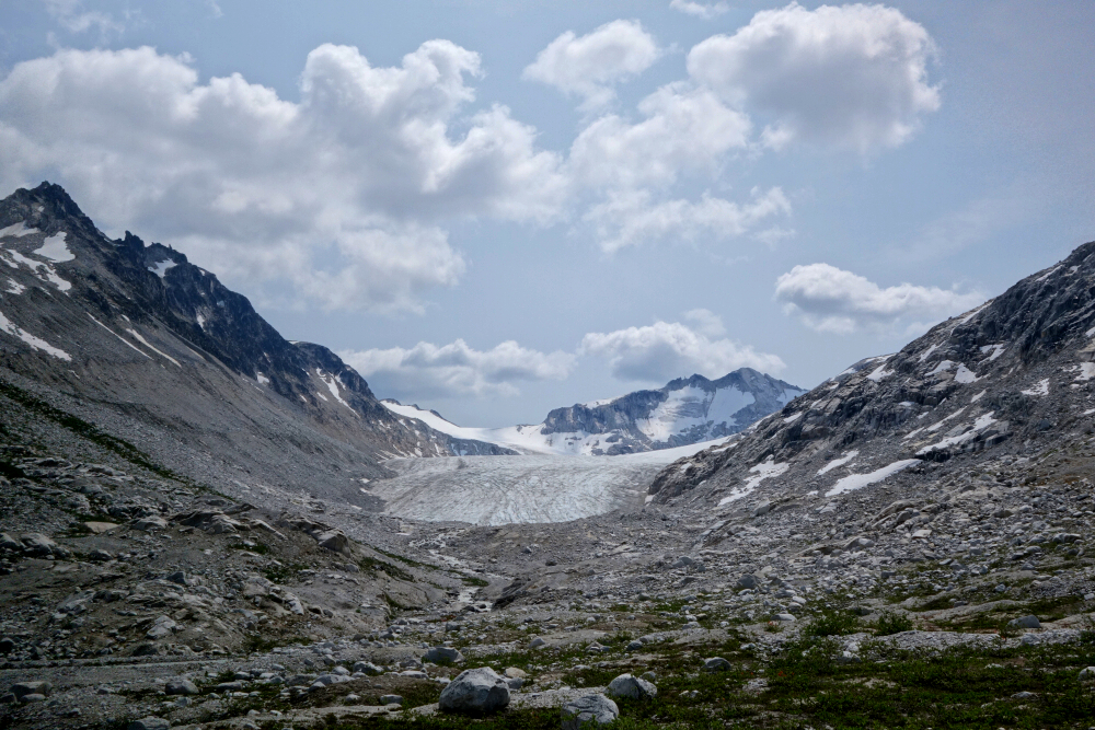
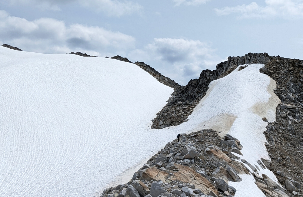
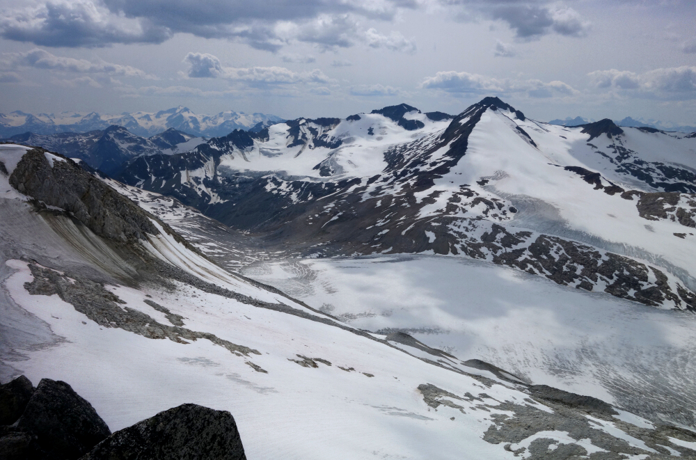
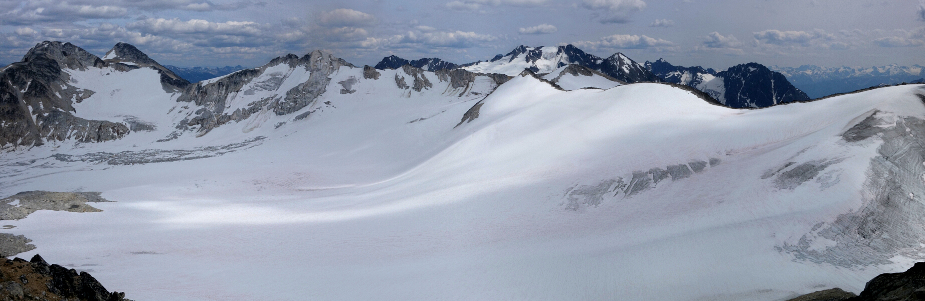
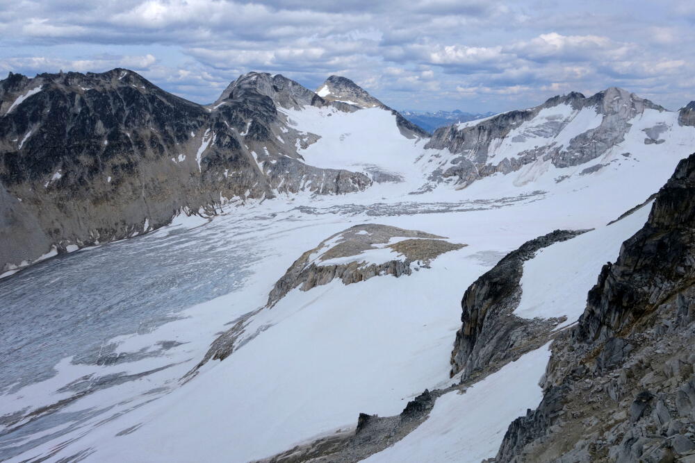
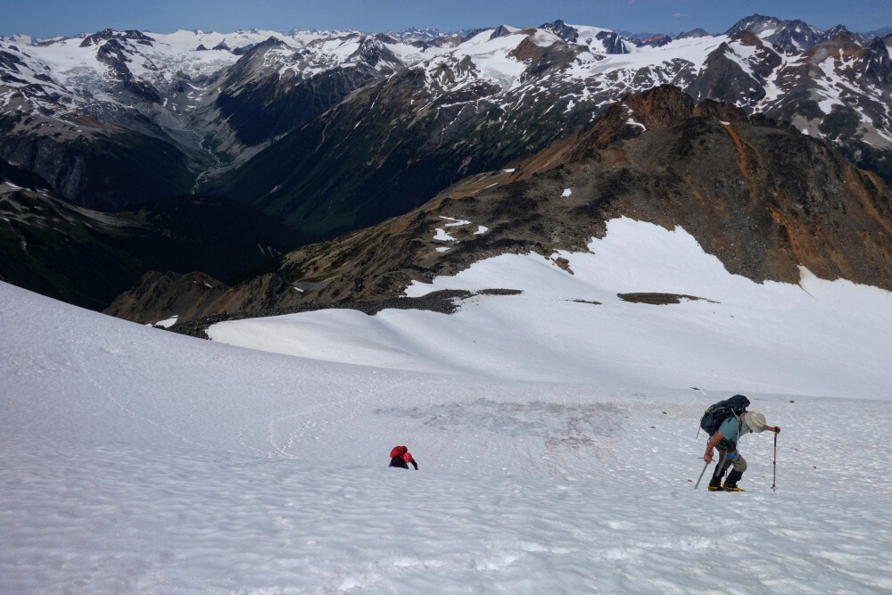
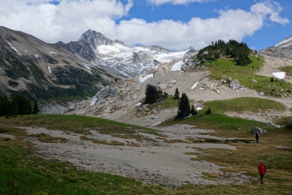
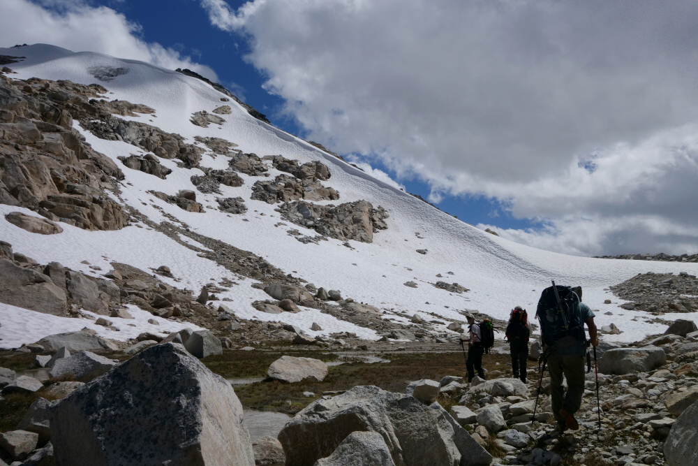
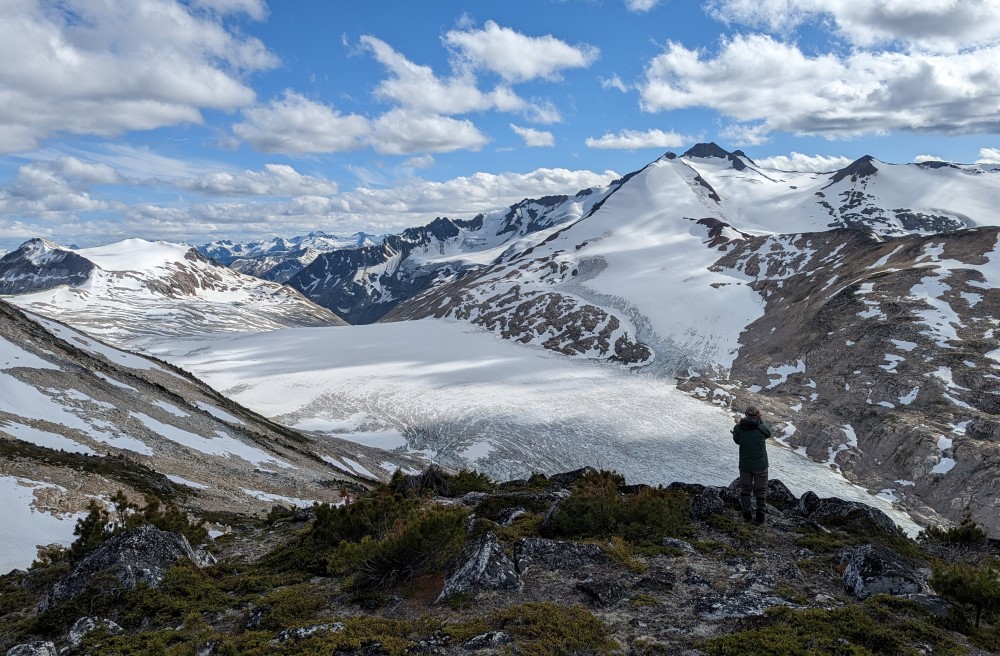
Pebble Peak was the second objective of the Pebble-to-North Creek traverse trip I went on last July (see previous "Pebble to North Creek" post). Approached via Pebble Glacier, it amounts to a basic glacier climb finished with a steep pitch of rotten rock where one needs to be mindful of the potential for party induced rockfall. Starting from Pebble Hut, the hike initially follows the same trail as that used for Mount Sears, but quickly branches off to the right following a somewhat faint path towards the large basin below the glacier. We gained the glacier on the left side of its snout, roped up and started up bare ice aiming for the large glacier lobe at right. This we followed beneath Pebble Peak on its north side to reach a rocky saddle high on the NW Ridge.
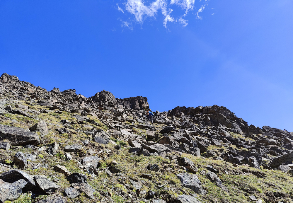
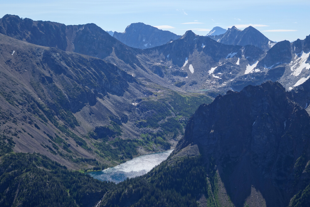
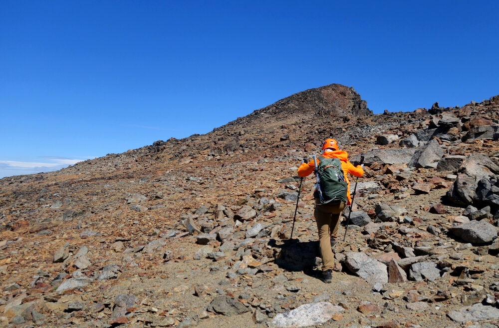
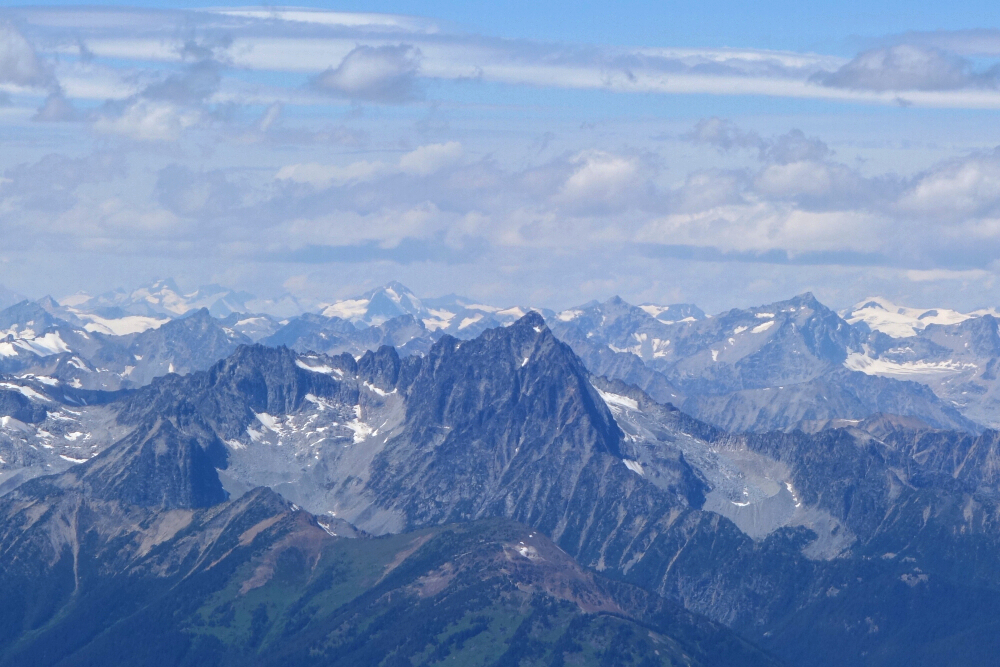
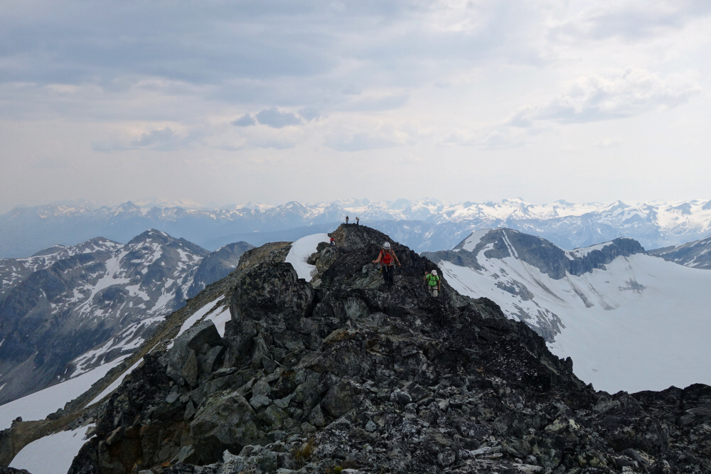
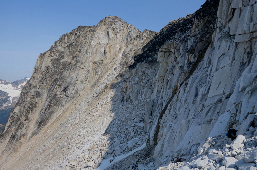
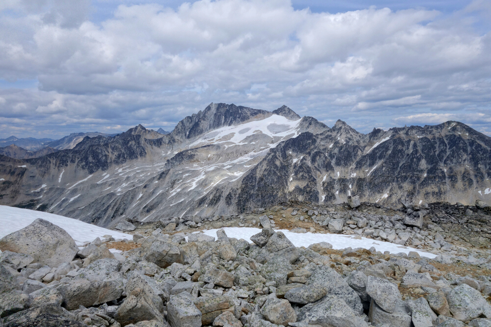
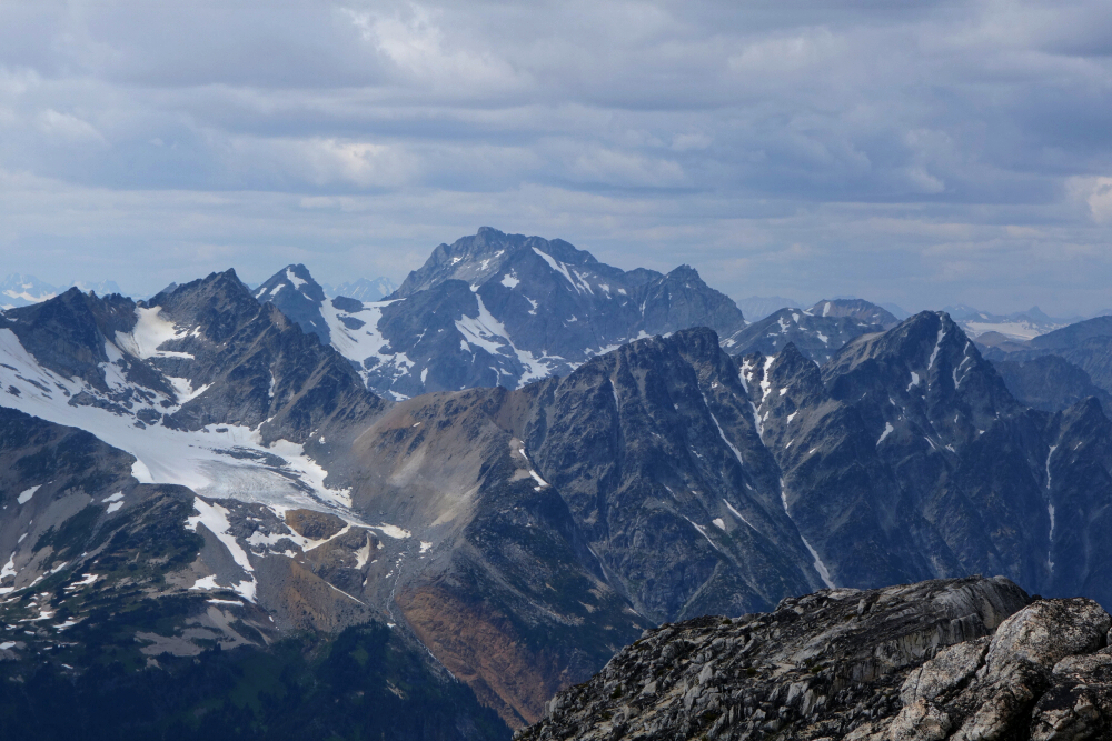
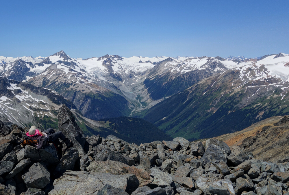
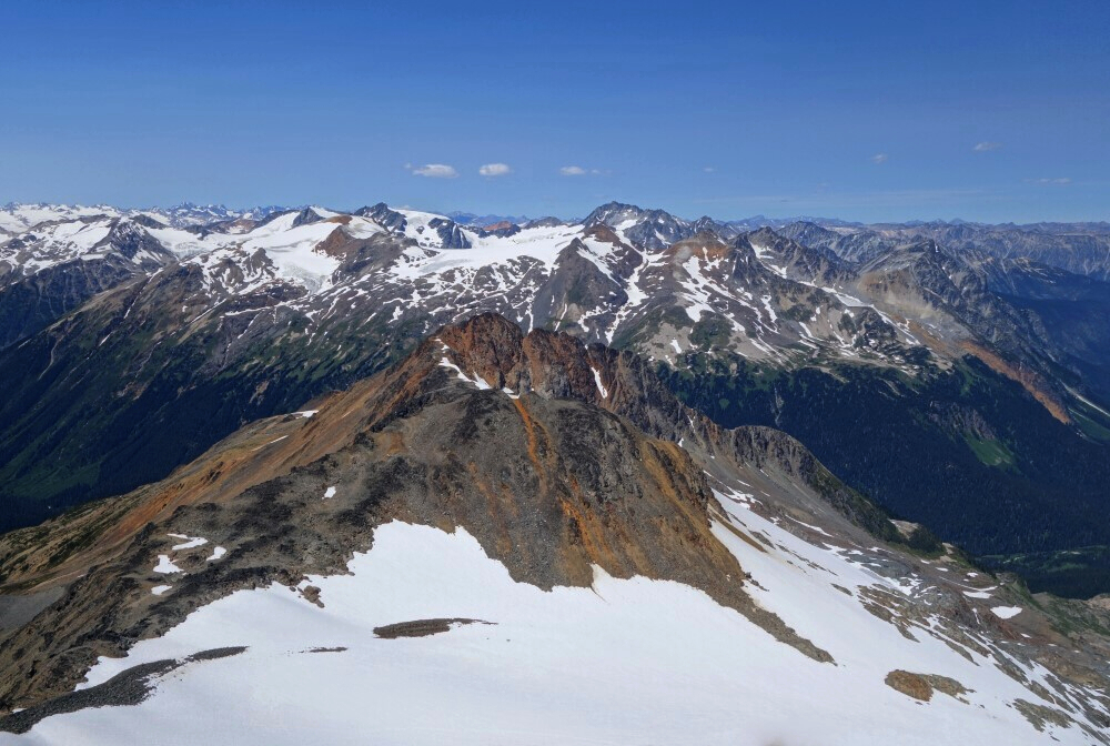
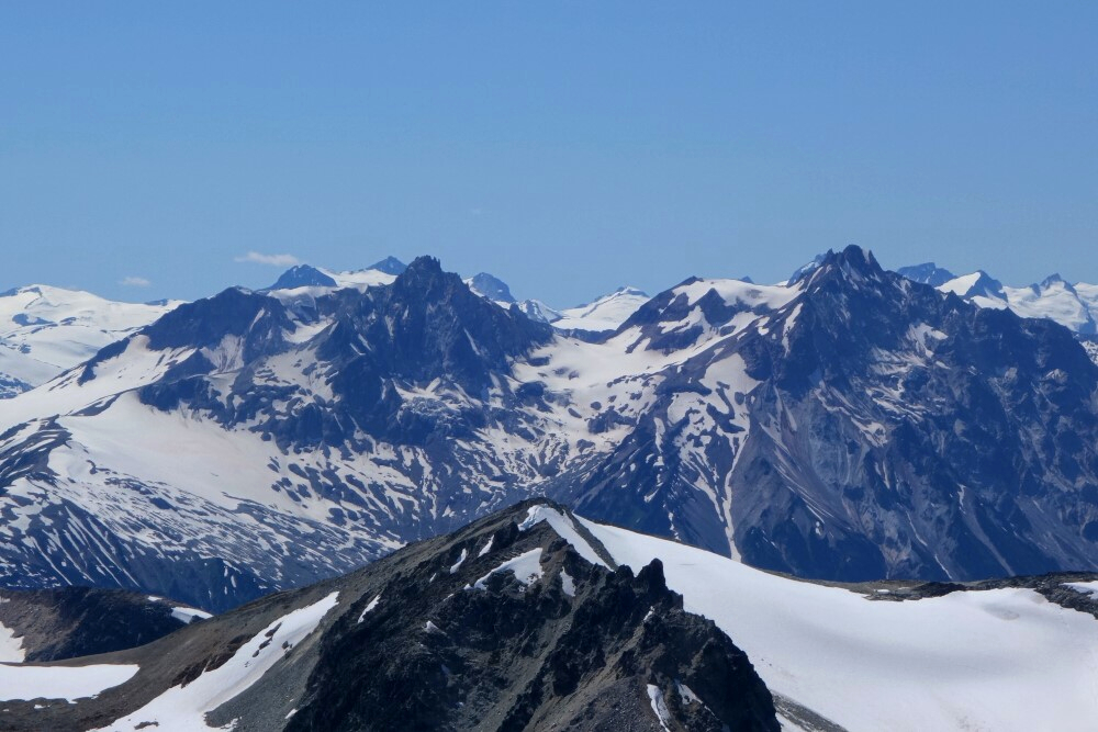
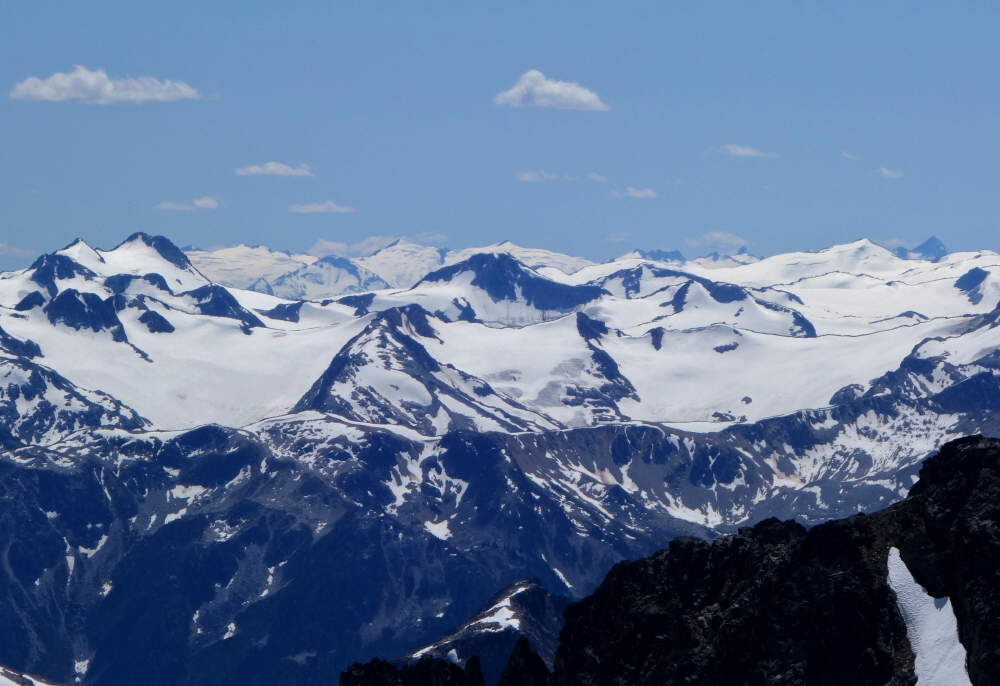
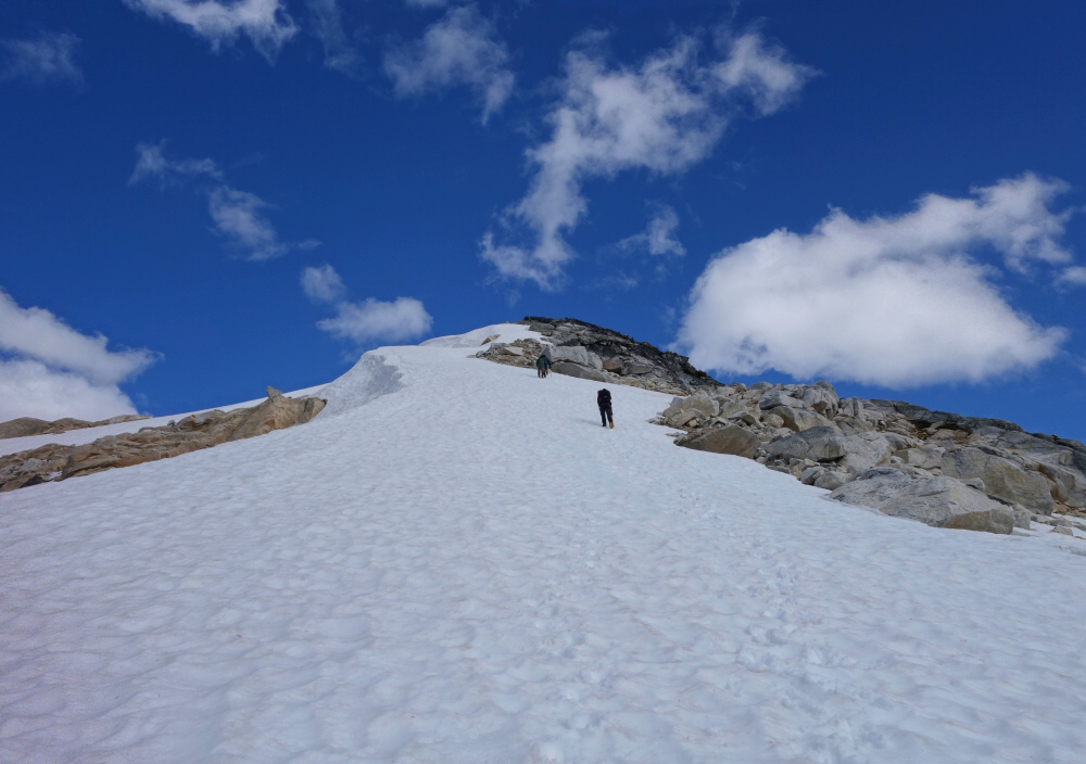
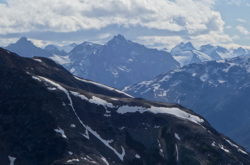
With the rest of our party hanging back at the saddle, Miranda, Lawrence, Wes and I continued up the final glacier headwall to the base of the chuting gallery. We ditched our crampons and ice axes here and started scrambling up the gully. Not feeling the loose rock here, Lawrence promptly turned back while the remaining three of us continued up. Great care had to be taken not to send rocks tumbling down on each other, but it wasn't long before reaching the summit where outstanding views were ours to behold! North towards Ethelweard and company, Thiassi to the NE, Sampson Group to the SE, south looking over Sugus towards the mighty Overseer, the Meager Group to the SW and finally beautiful Athelstan to the west. Something entirely new for me and pretty darn awesome to see!
Made back to where the rest of our party was lounging at the saddle without incident, then roped up again for the slog back down the glacier. I was careless there for a moment and managed to punch a leg through a small crevasse lower down where the snow transitioned to firn and I believe Alex did the same earlier in the day. Oopsy! About halfway into the return, we noted a mushroom cloud from a fire burning nearby. Strange how there was no sign of this from the summit and skies were clear without any thunder or lighting in the days prior. Anyway, packed up all our glacier gear once back on terra firma and returned to the hut for a ~10-hour day at a fairly casual pace.
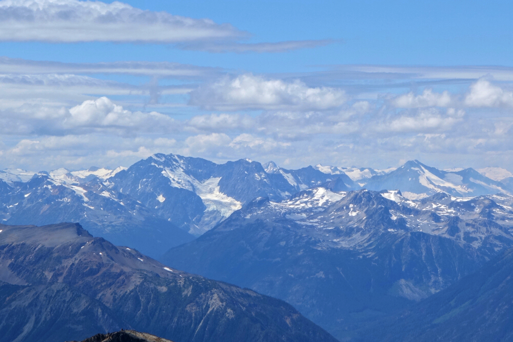
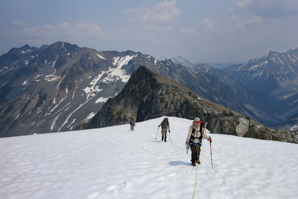
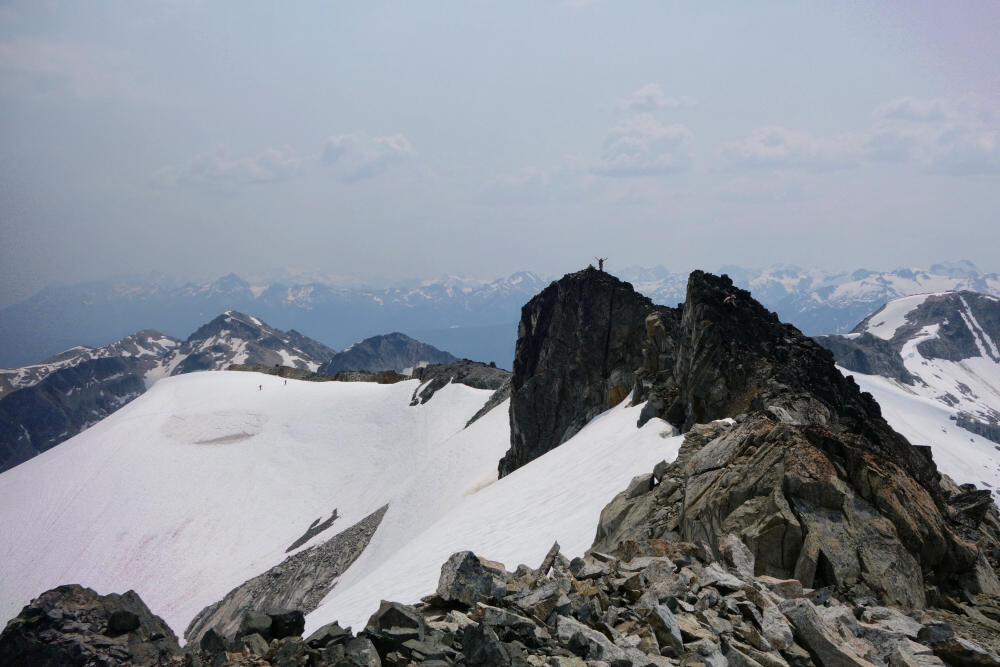
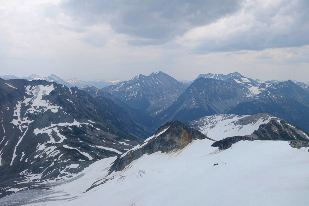
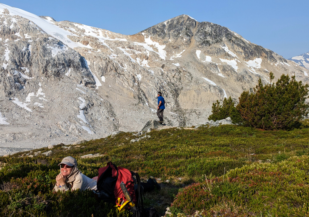
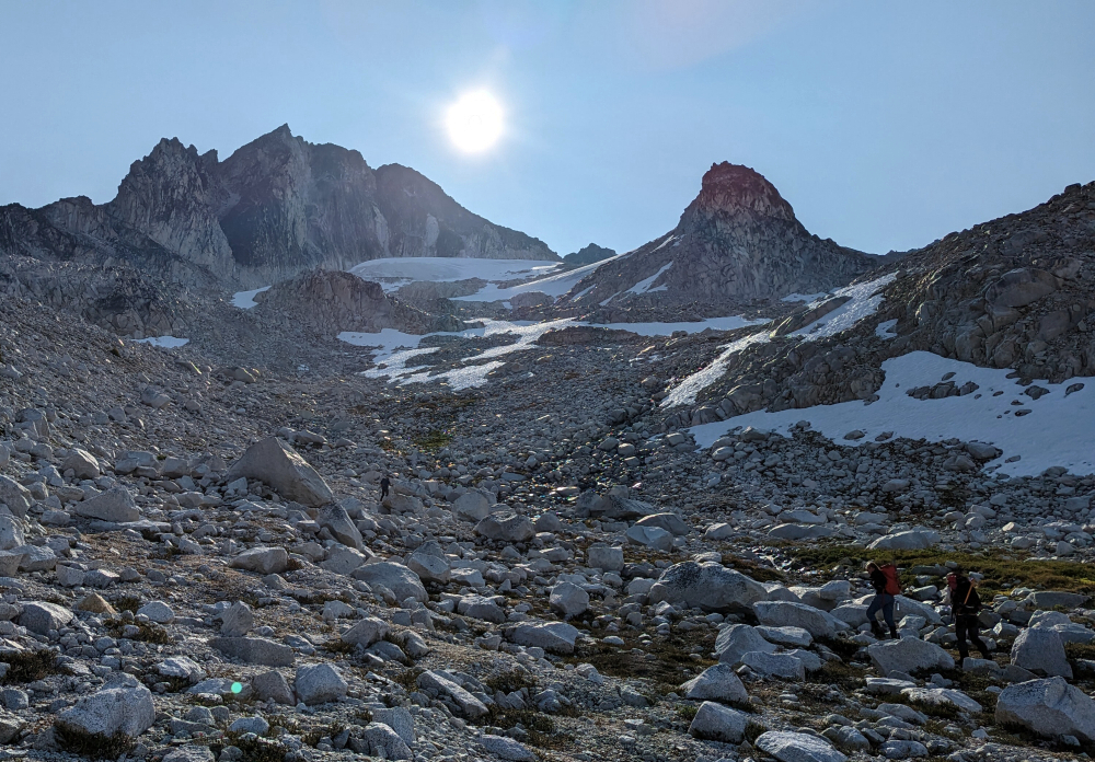
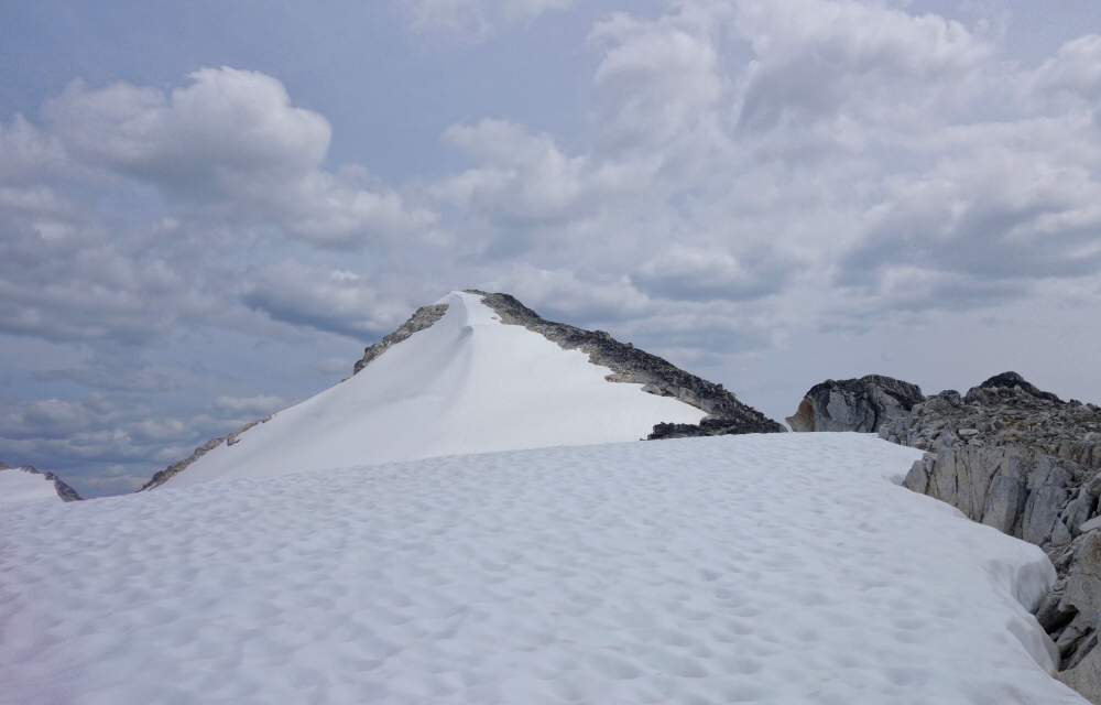
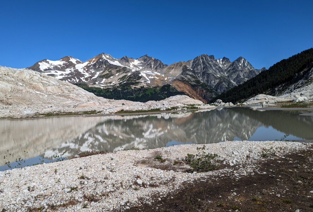
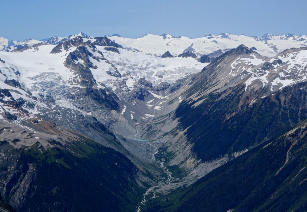
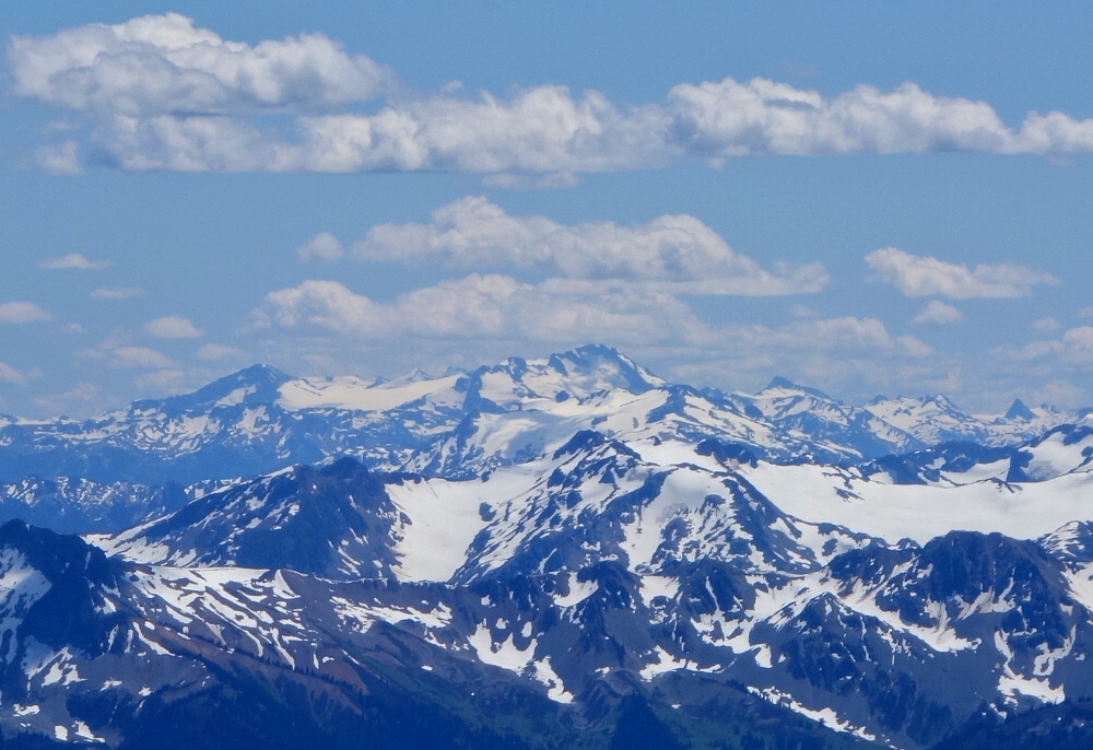
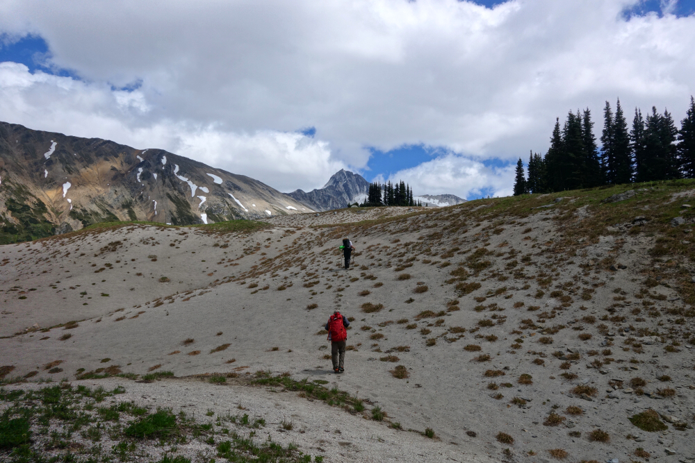
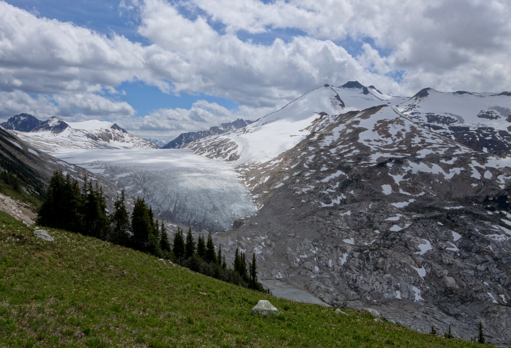
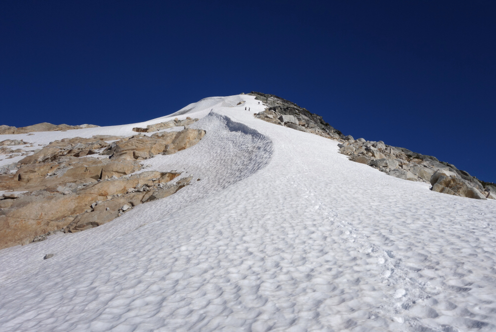
This is the first peak bagged on the Pebble to North Creek Traverse trip (see previous post). As previously mentioned, Laurence, Wes, Alex and I went up to Sears' summit following an impromptu glacier rescue exercise lower down at a minor bowl on the peak's NW flank. We helicoptered in to Pebble Hut earlier that same day. It is a very easy hike that finishes with a wide but somewhat steep snow-covered ridge (or take to the rock at right if preferred) leading to the open summit area where incredible views abound! The peak is flanked by the Pebble and McParlon glaciers on the west and east sides respectively, with Pebble Peak and Mount Thiassi rising dramatically from the far edge of either. This was the first good look we got of the area we would be spending the next week exploring and needless to say we were awestruck!
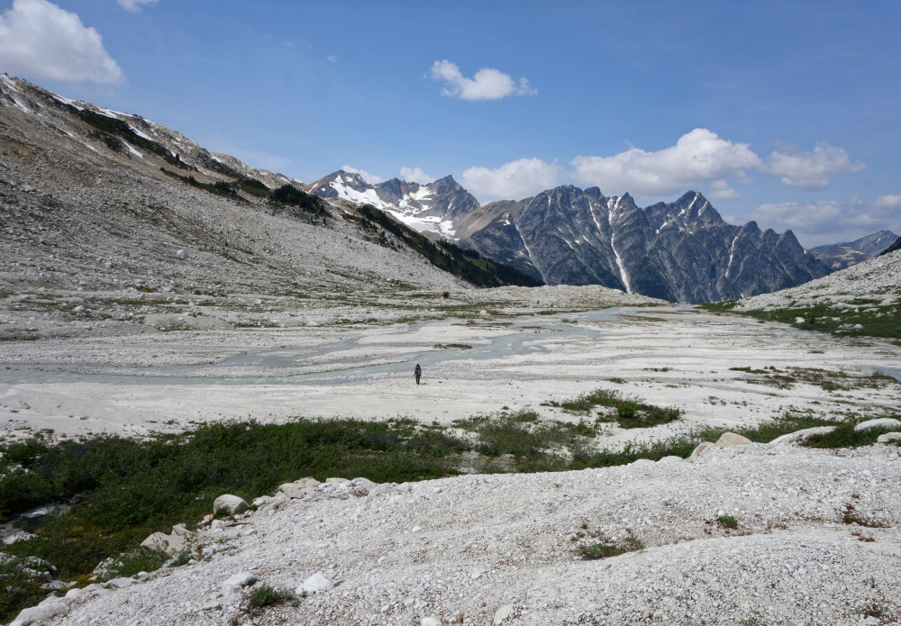
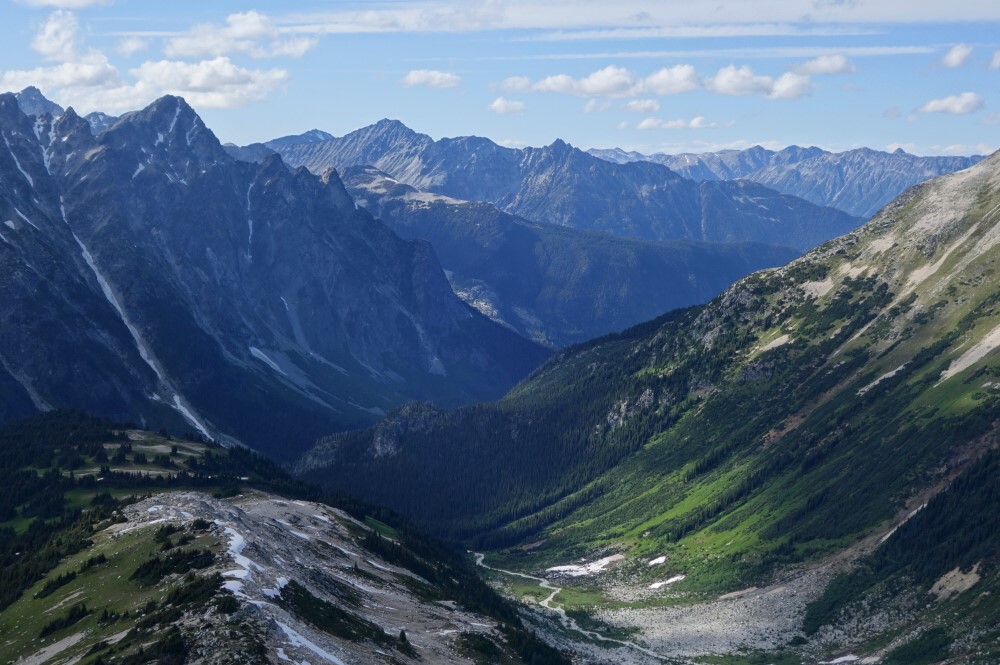
The return from the peak to the Pebble Hut follows the gentle NW Ridge to where meadow gradually transitions to forest and where one wants to work slightly left (west) to intersect a flagged and somewhat bushy climber's path that descends steeply towards Ash Pass. The path eventually enters a minor gully/drainage (slight right) and follows that to forest and meadows at the valley bottom. The hut is just a short distance beyond where a welcoming party of starving mosquitos eagerly anticipated our arrival. Be sure to hurry and "shut the damn door" when entering!
It would be very much appreciated if you please ask before copying and/or re-publishing content from any part of these pages. To do so, please click here to send a message via feedback form.


