Select from list below to jump to a specific area on this site.
| Latest Posts |
Tuesday, October 29, 2024
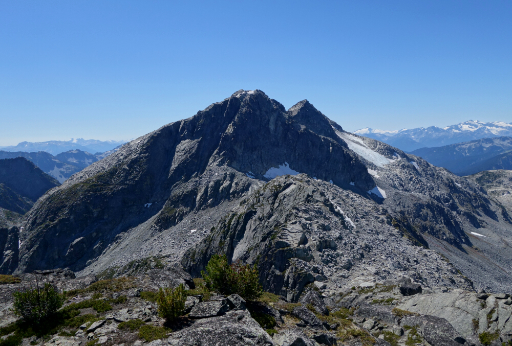
Snowspider Mountain - Northeast Ridge, September 2023
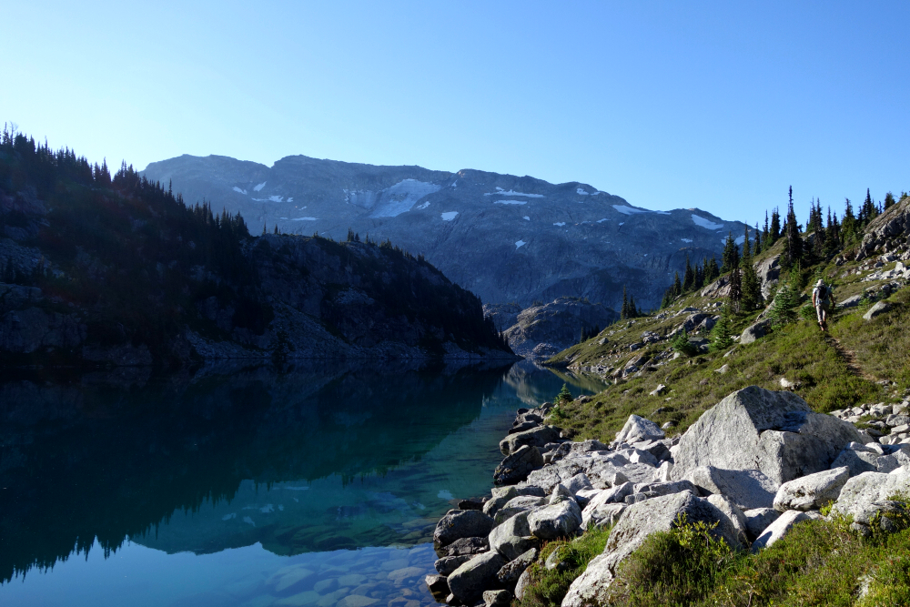
I'd written this one off, considering the peak's worsening access via the Van Horlick FSR since Gunn's Scrambles book was first published back in 2005. I believe a bridge or two had been pulled or washed out and thus never gave it much thought. More recently, I considered an alternate approach via Twin One FSR (from the east) following reports of renewed logging activity up thataway. Laughably, no sooner did I begin looking into it, reports of a new washout on that road began circulating and so the peak was once again stricken from my tick list. Just wasn't trophy enough of an objective for me to bother with the extra km's of road walking, I guess. The relative lack of reports in recent years would suggest that others were of a similar opinion. Whatever the case, all this suddenly changed following a late August 2023 social post describing a successful climb of Snowspider via the original Van Horlick approach. Turns out that new logging roads had been pushed further up into the valley directly below the peak complete with repairs to the damaged and/or deactivated bridges. To Andrew and me, this was a drop everything and git er' done while the gettin's good kinda moment!
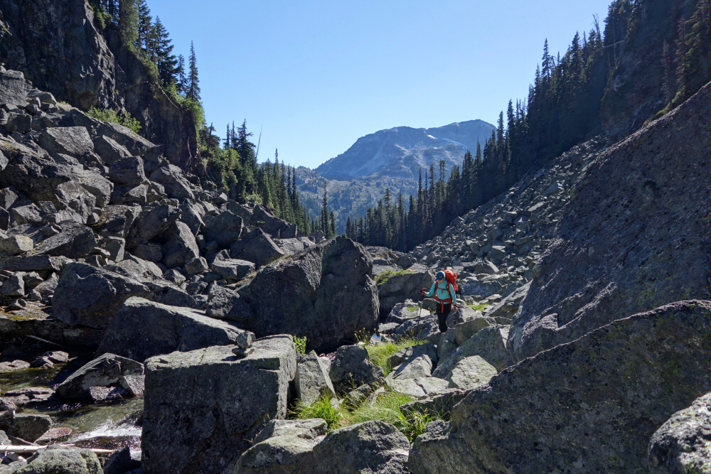
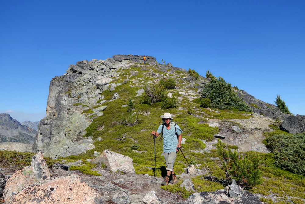
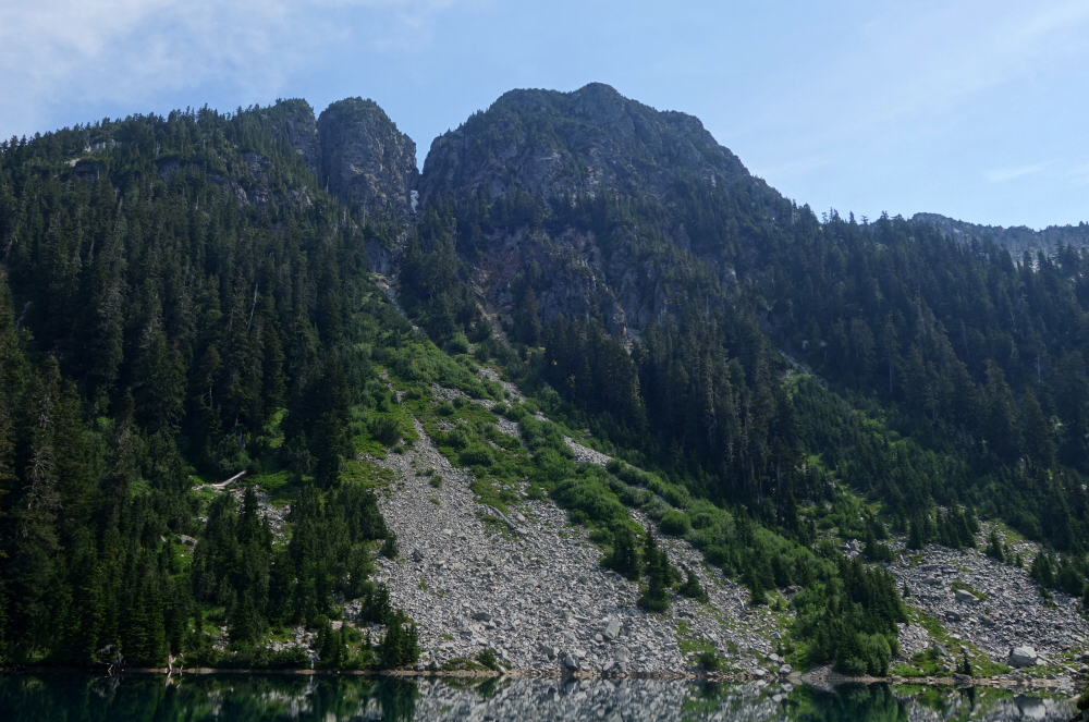
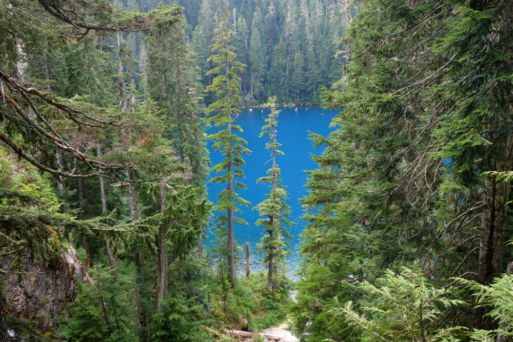
As Andrew has places to be the following evening, we drove up the eve prior, calling it a night at the large gravel pullout off Duffey Lake Road next to the bridge over Cayoosh Creek (y'all know the one). Moving again shortly after first light, turning onto the FSR a couple clicks from where we'd camped and proceeded up valley on a well-graded gravel road. Followed the main branch for about 13.5 km before taking a right onto the Snowspider East Spur. This we followed to near its end, directly below a large brushy slope bound by a forested rib at left and the NNW-tending shoulder at right. A strip of exposed boulders descends from high on this slope well into the valley below and provides welcome respite from the impenetrable bush that guards the alpine. Setting our sights on this feature, we dove into forest off the side of the road and descended to the valley bottom. Fairly easy going without much bushwhacking, across a minor meadow before starting up towards the lower boulders we could see immediately above us. Just as I was beginning to think to myself what a piece of cake the approach was, we entered some of the heaviest bush imaginable and spent the next while painstakingly thrashing up the mountain. It wasn't a particularly long stretch, just gruelling and slow going. By the time we reached the boulders, we were soaking wet both from sweat and the morning dew, and our arms were nicely scratched up from thorn bushes we waded through.
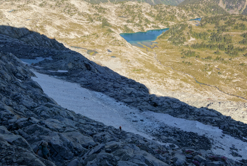
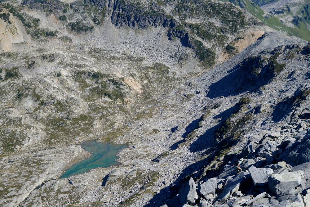
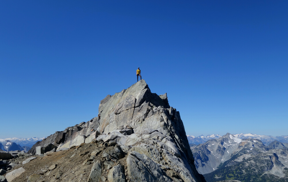
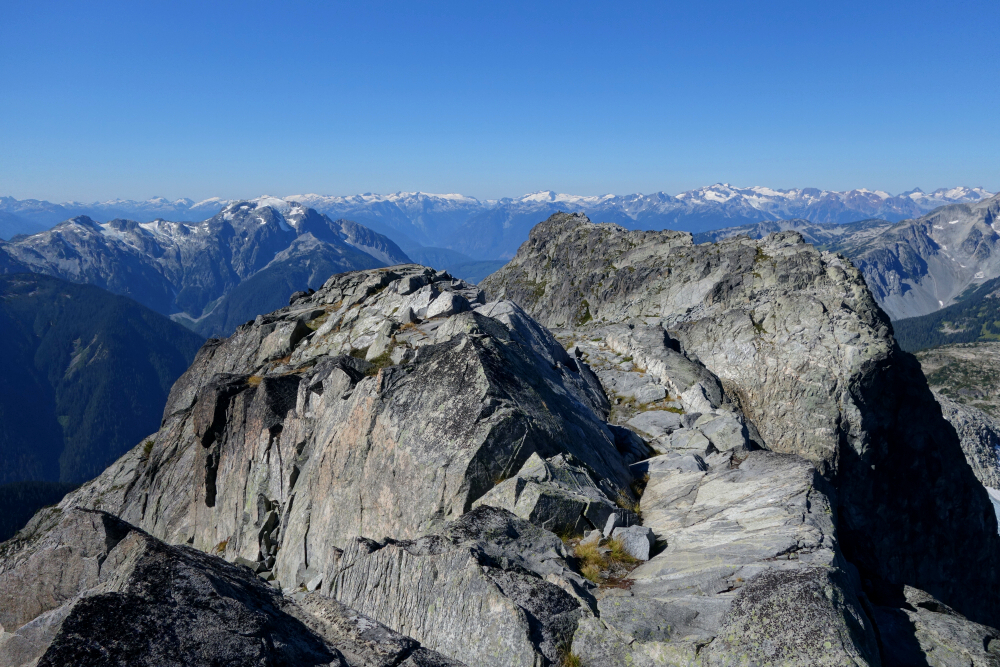
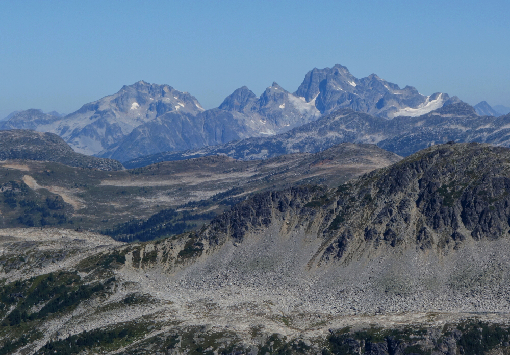
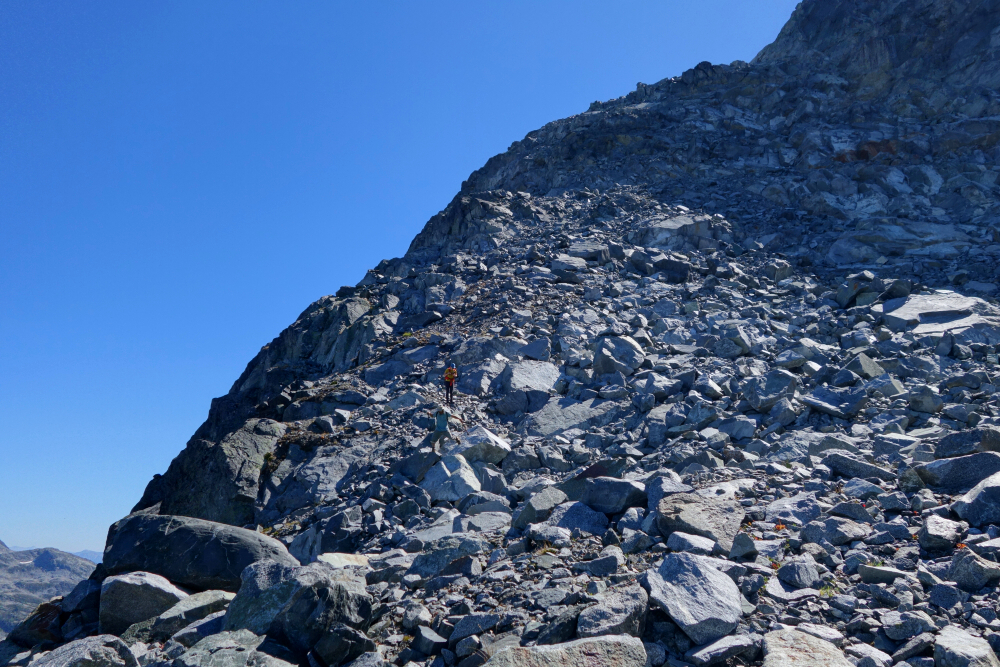
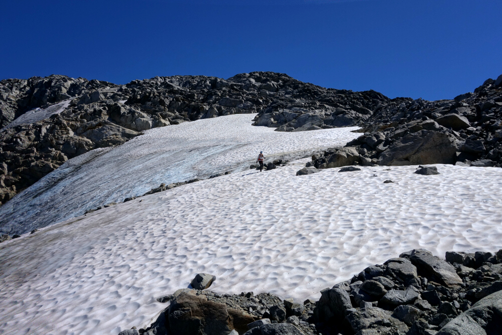
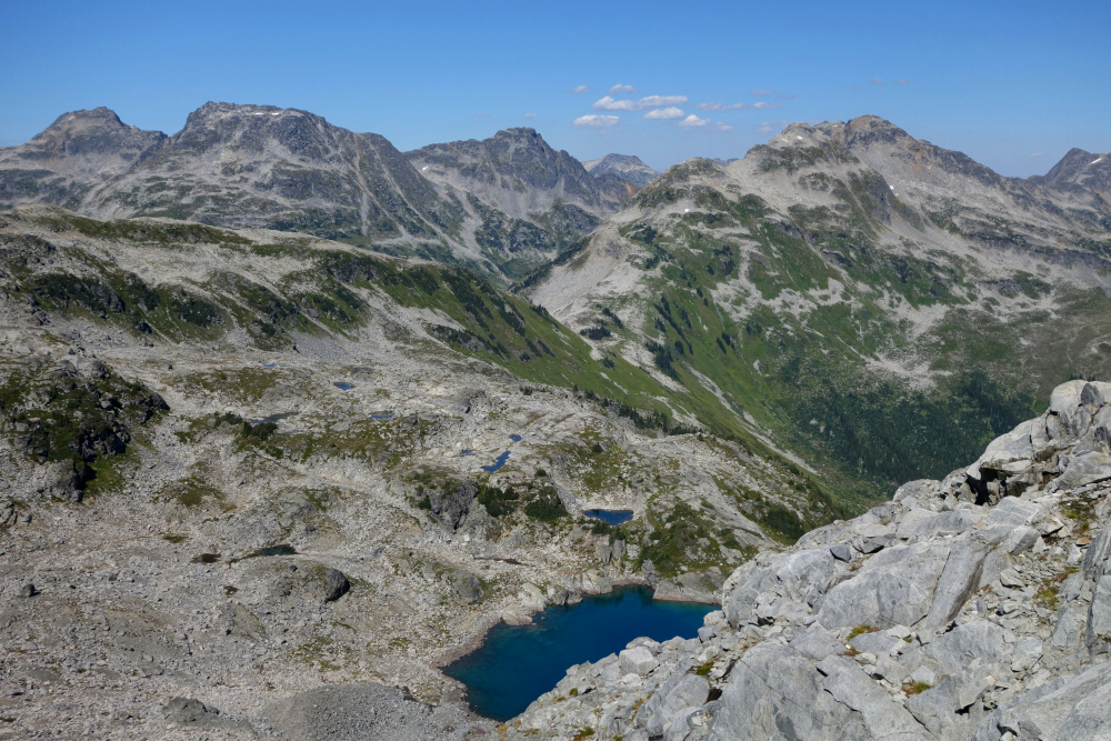
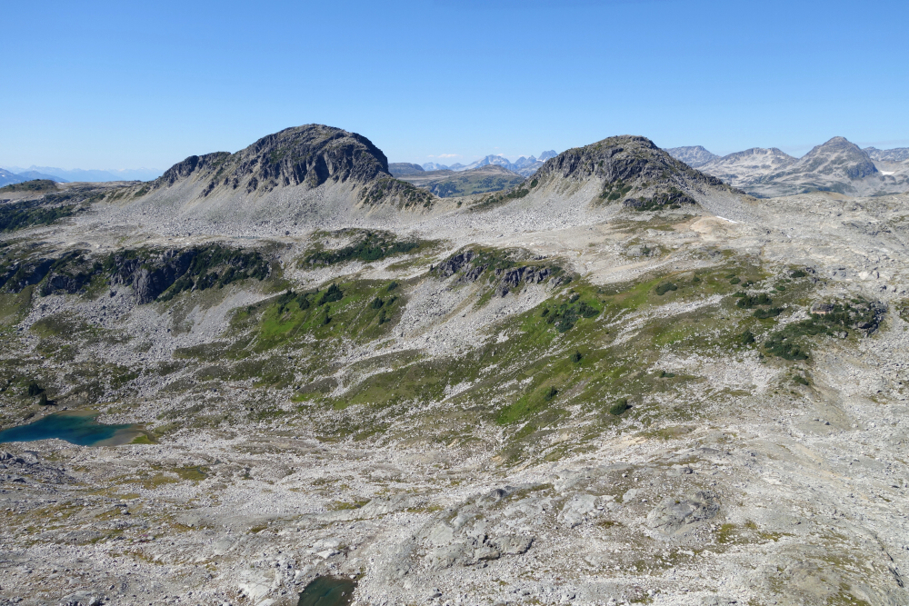
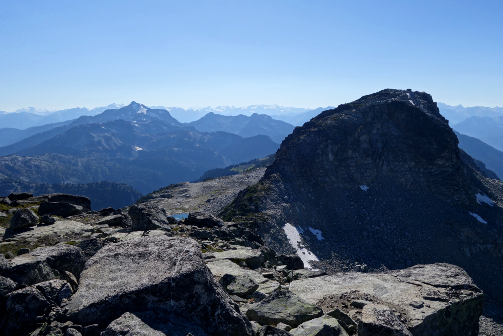
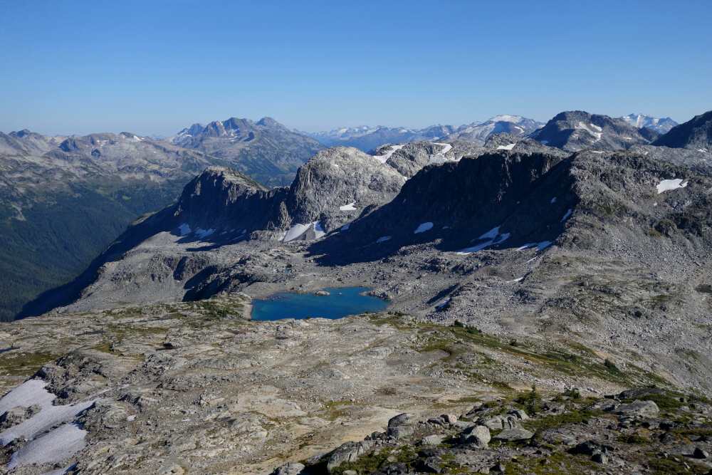
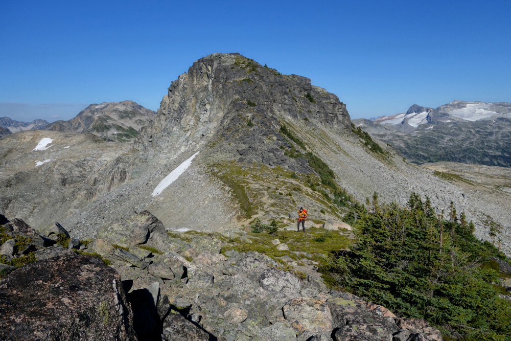
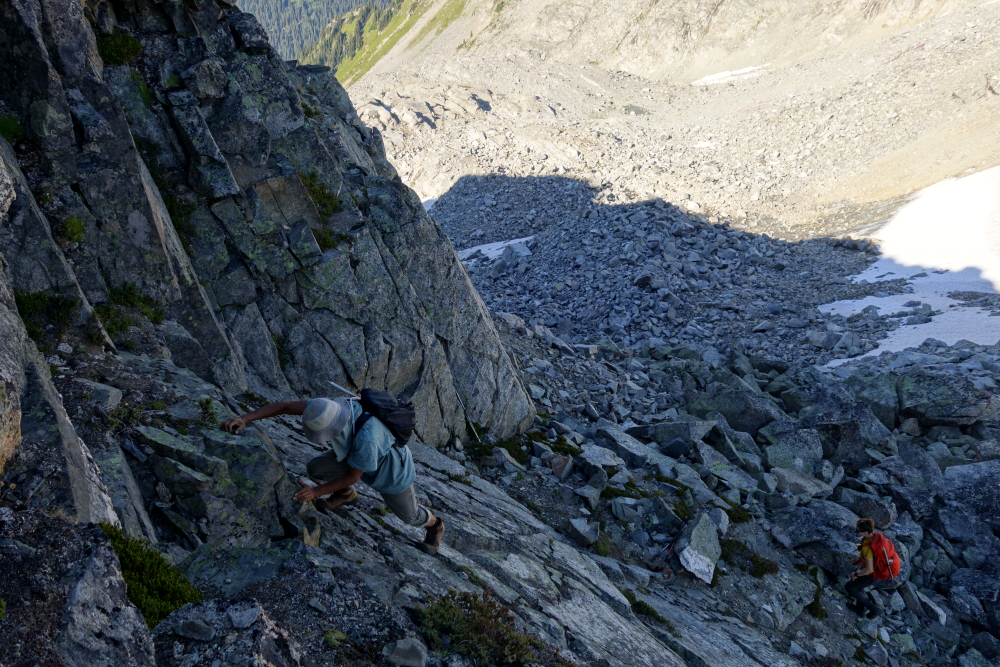
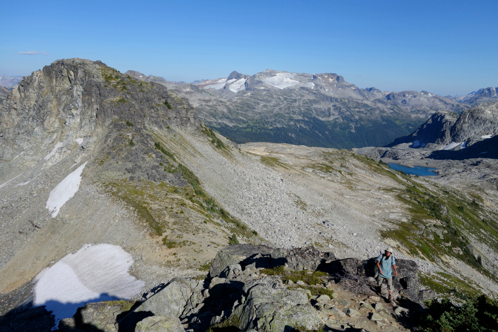
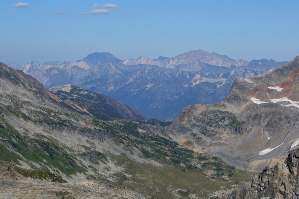
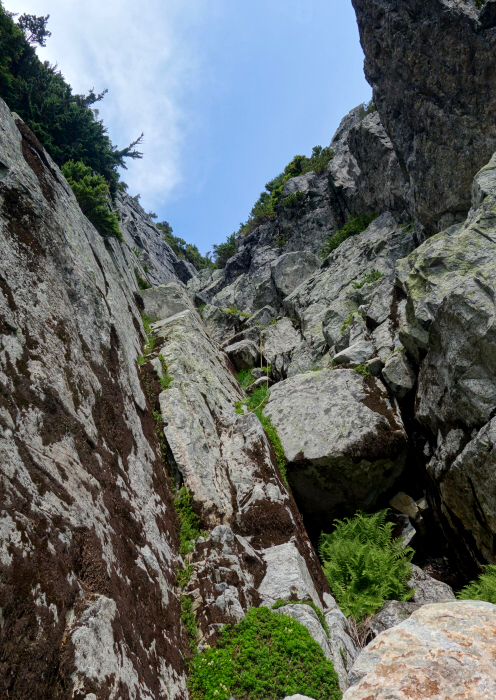
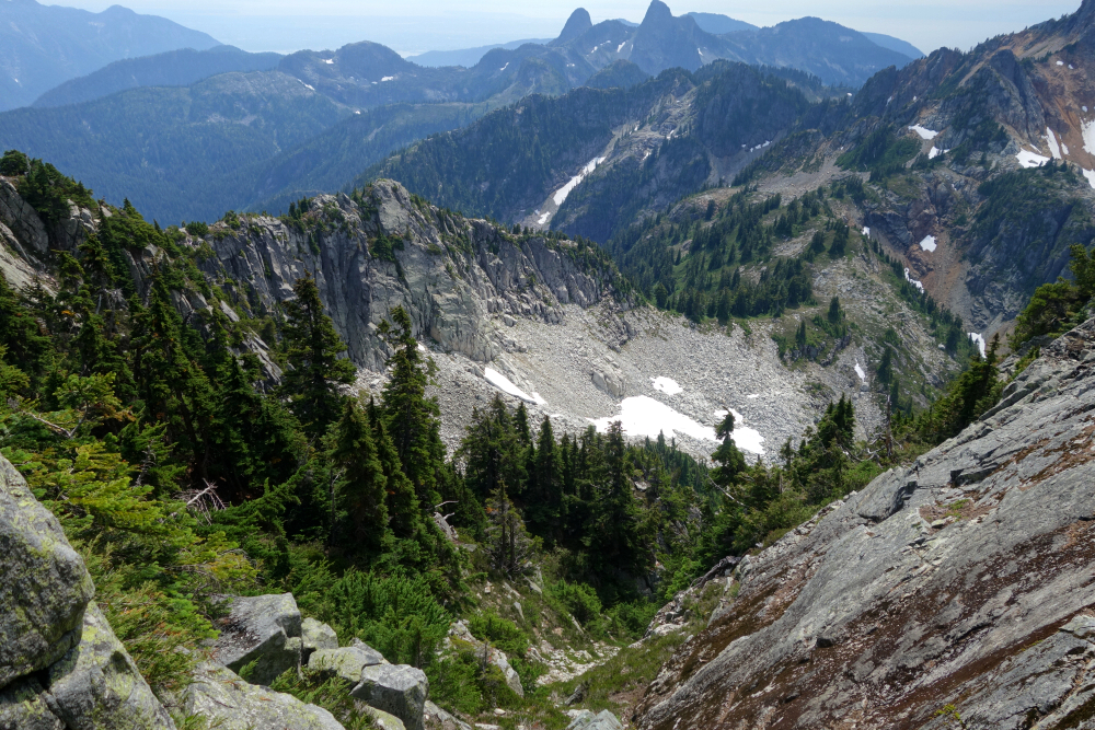
With the worst now behind us, we proceeded up the talus, eventually veering off to the right to gain a bench low on the NE Ridge. On to the wide crest shortly thereafter with the summit now in view directly ahead. Easy travel on the ridge, mostly over grass and heather with some minor ups n' downs and a couple small headwall sections to scramble through. Higher up, the terrain transitions to talus and polished slabs as we proceeded into an amphitheater-like feature now on the left side of a prominent tower. Turned right near the top here and scrambled up a brownish dike comprised of friable rock before continuing to the edge of a small glacier. Crampons on and ice axes out for the short bit of snow and ice to a notch at left, whereupon we ditched the glacier gear for the final scramble up the summit block. Fairly easy going up this, with a step of steeper rock requiring extra care before finally reaching the large summit area.
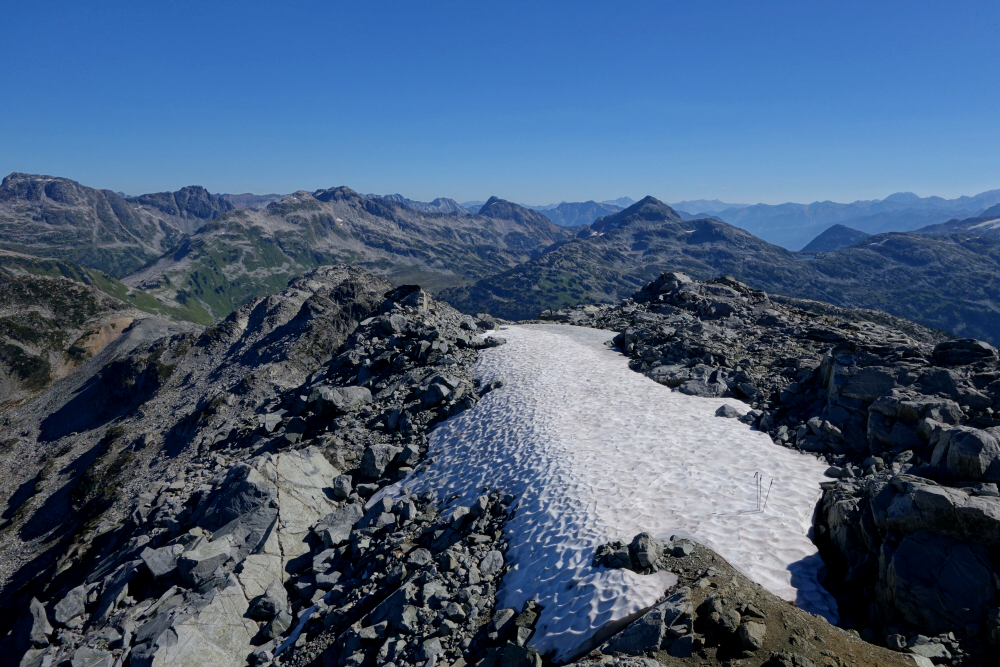
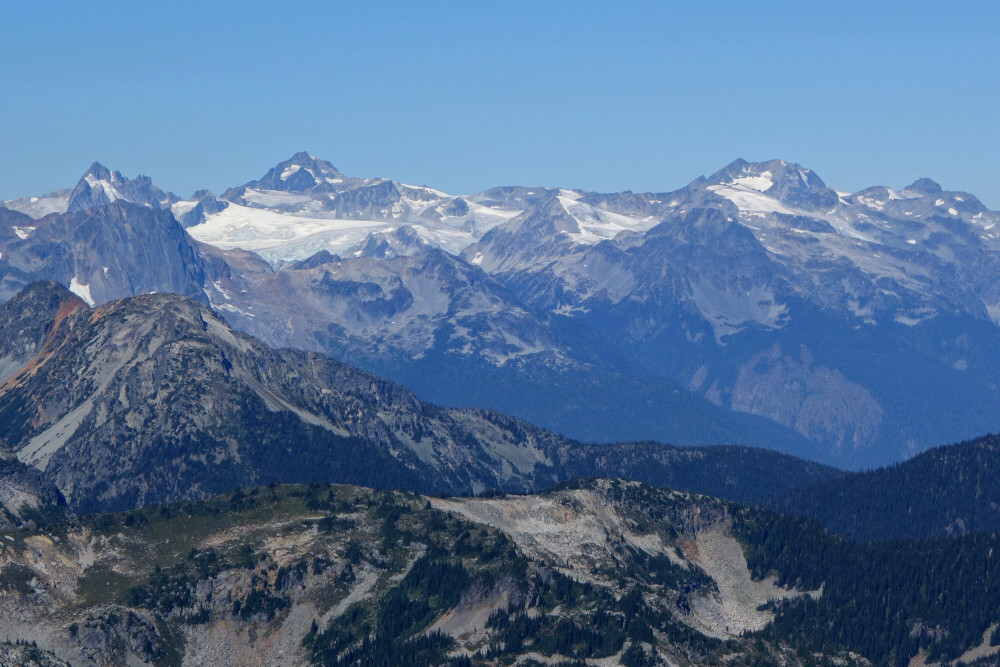
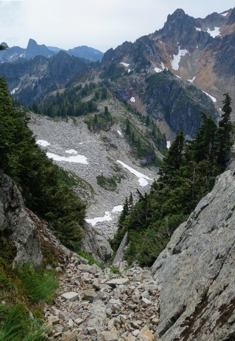
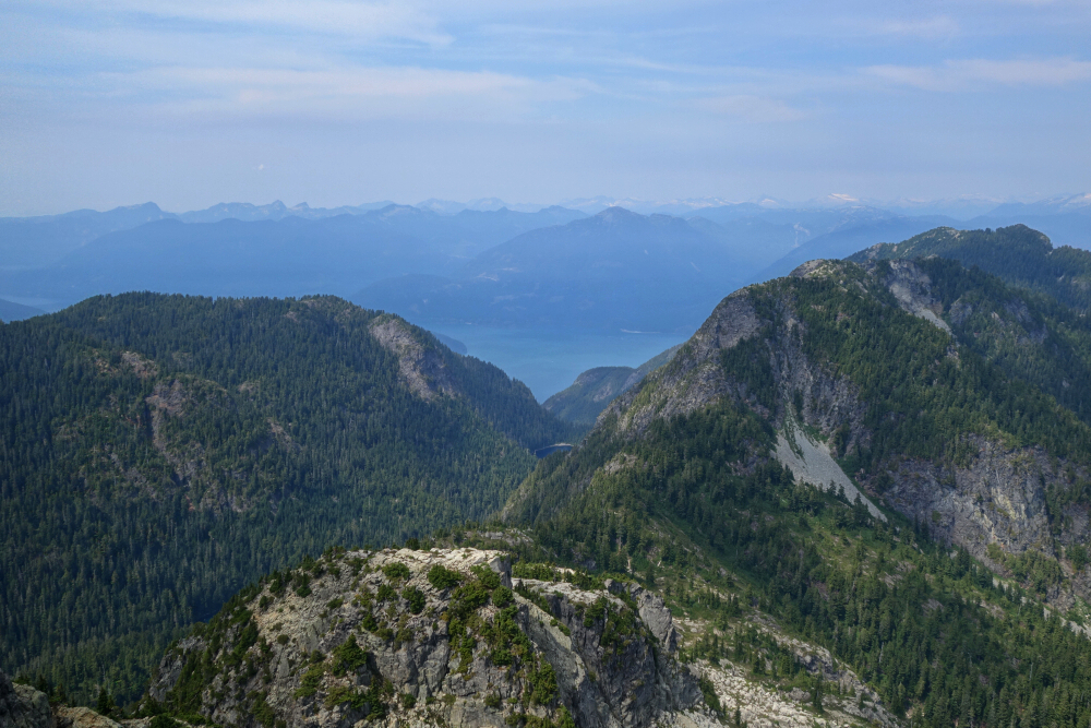
Excellent 360-degree views from up top, including the seldom seen SE side of the Joffre Group, Vantage Peak and Twin One Lake. Also, good views looking to the SE in the direction of the upper Stein area as well as the Saint Jacobs/Gideon area to the east. Pretty stoked to be up here on top of a peak we both for various reasons had doubts of ever making it up! Didn't linger for too long on account of Andrew's dinner obligations, and so returned the way came, foregoing the rotten dike pitch for an equally unpleasant descent down a loose gully. Then finally back down the dreaded bushwhack section before regaining the road for the short walk back to where we were parked. About 8 hours round-trip and a very reasonable day trip all things considered. Access is/was the best it's been in years, so if this one's on your radar best get on it sooner rather than later!
Armchair Traverse - Mount Cook to Mount Weart, August 2023
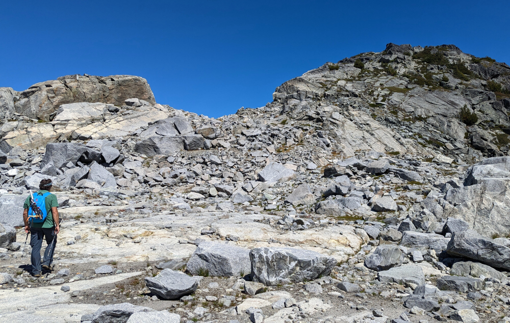
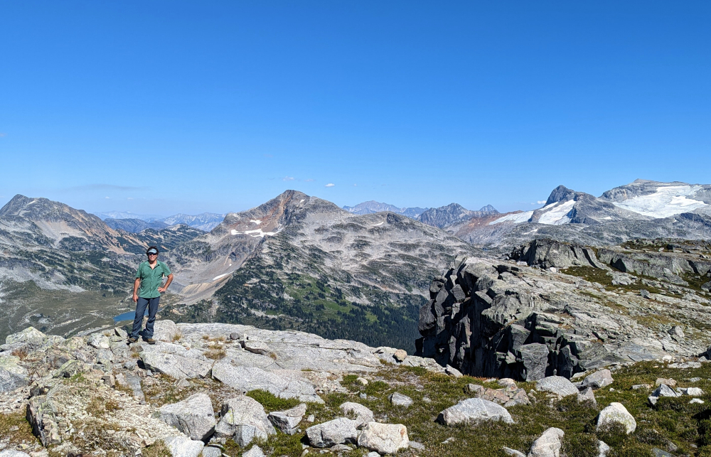
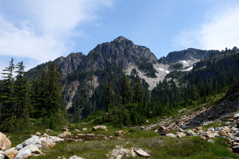
The Armchair Traverse is a Whistler-area classic that connects Mount Cook and Mount Weart via the rugged and at times airy ridge that lies between the two. The unusual name likely stems from the Armchair Glacier that is cradled in the south facing Cook-Weart Cirque. Typically climbed NW to SE starting from Wedgemount Lake, the route crosses over the summit of Cook followed by a series of saddles and towers before reaching its culmination on top of Weart. One's journey however is far from over though, as there's a tedious and potentially treacherous descent from Weart back to Wedgemount Lake to contend with. More on that later. Technically speaking, the climbing should never exceed 3rd class and possibly some 4th, with the option for bypassing portions of the exposed crest by traversing loose gullies on the south and west sides. Wes and I elected to stick to the crest as much as possible, bypassing it just once shortly after the first large saddle beyond Cook. The ridge narrows and steepens considerably at this point, requiring one to pull on large, unstable blocks which I quickly deemed not worth the risk. That aside, the rock quality on the ridge is generally quite good with fun movement and of course awesome position!
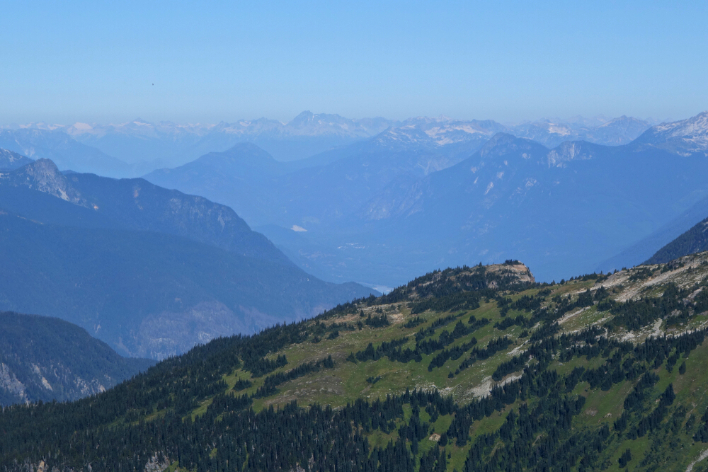
As it makes for a rather big day round trip from the parking lot, we elected to hike to camp the afternoon prior, then complete the climb and return to the car the following day. No issues getting camping permits, presumably because it was a weekday. Also, quite smoky that afternoon from all the forest fires burning around us both near and far. This was my third time up to Wedgemount Lake, following previous trips to Wedge Mountain (2003) and Mount Weart (2018). Nevertheless, I still found myself awestruck by the impressive view of the lake basin when first cresting the bluffs above Wedgemount Creek Valley. As overrun as the place is, it is still an undisputed gem of the South Coast! Pitched our tents on the sandy flats by the lake and went about our usual camp routine prior to turning in for the night.
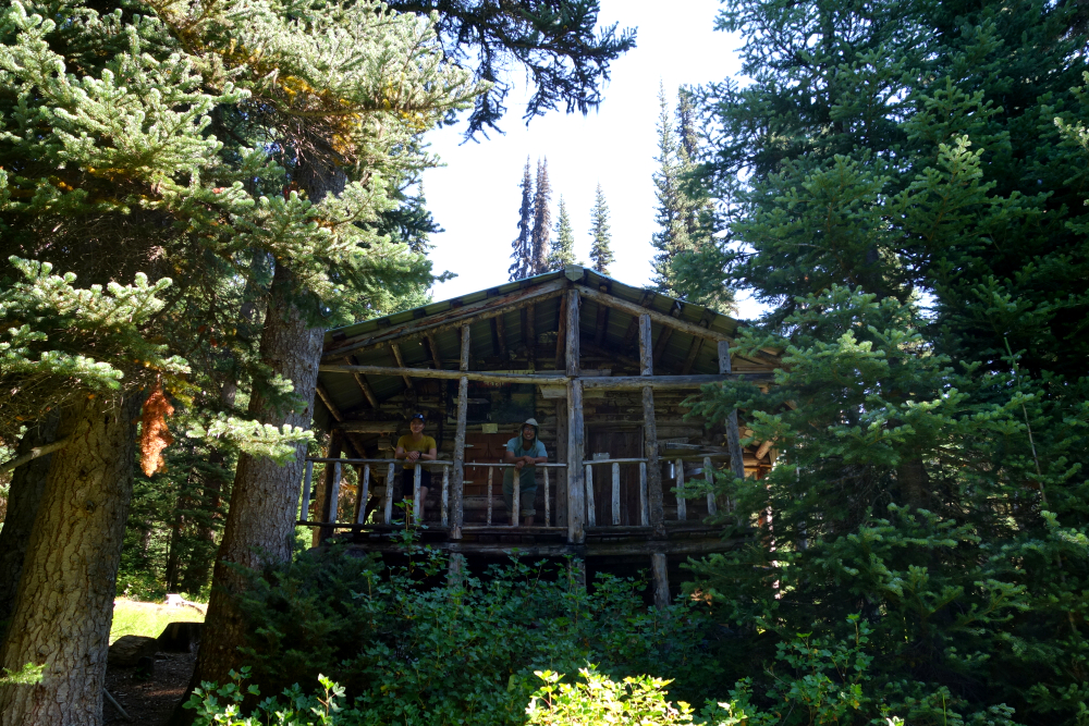
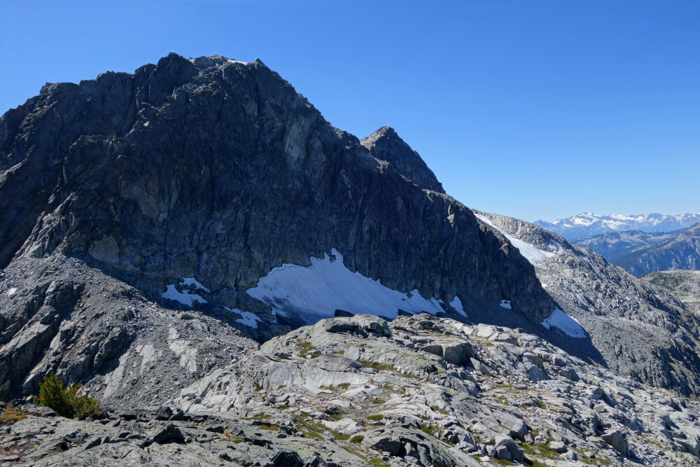
We awoke to thick fog the next morning and set out for Cook hopeful that it would burn off. Up the trail towards the hut/shelter we had passed the day prior before following a path at right that led into the gloom above. A vast talus slope eventually saw us to a broad shoulder, whereupon we finally broke out into glorious sunshine. Adorned with a large cairn, Cook's summit isn't much to get excited about as it amounts to little more than a rounded bump on the northern terminus of the Cook-Weart Ridge AKA "Armchair Ridge". The view, however, is spectacular with large cascading glaciers on either side of a sharp, jagged crest. Continuing past Cook, we descended to a large saddle before starting up a large tower and enjoying our first hands-on scrambling of the day, with much more to come. Skipped the unstable blocks I mentioned earlier by traversing right into a loose gully, then upwards before exiting the opposite side and regaining the ridge. Up and over this tower, encountering what one might consider the crux on the descent from here. Exposure wasn't bad and there are probably easier ways around if you go looking (I was just having too much fun to bother).
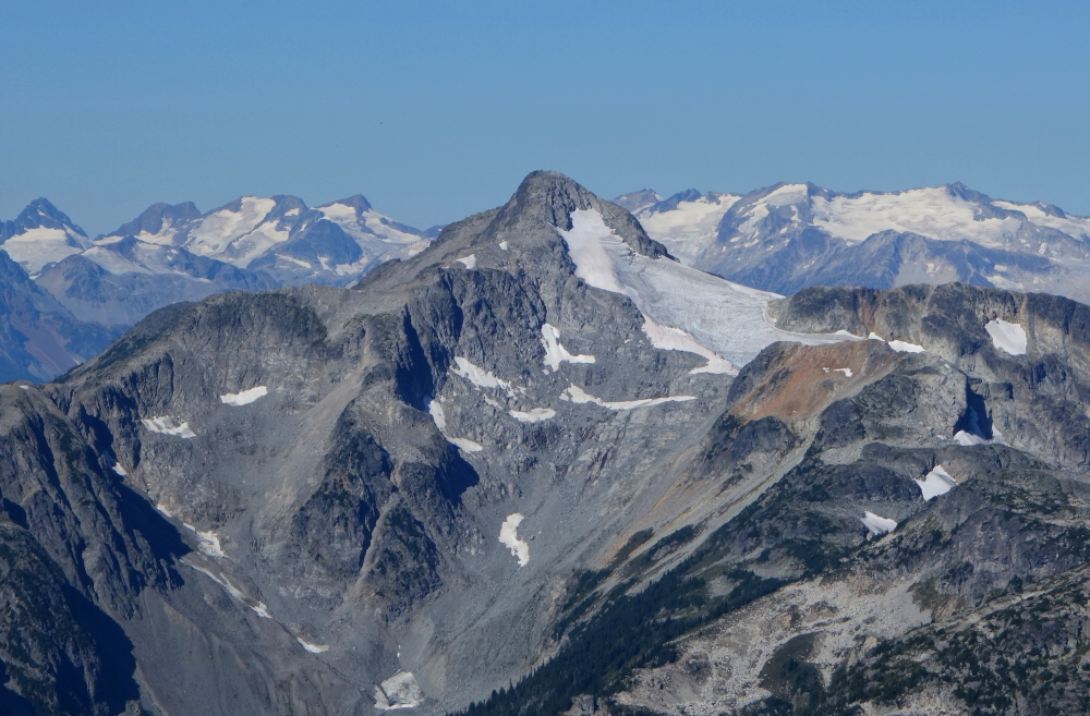
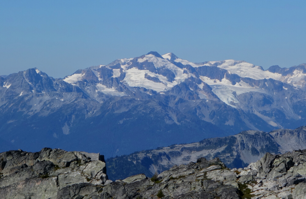
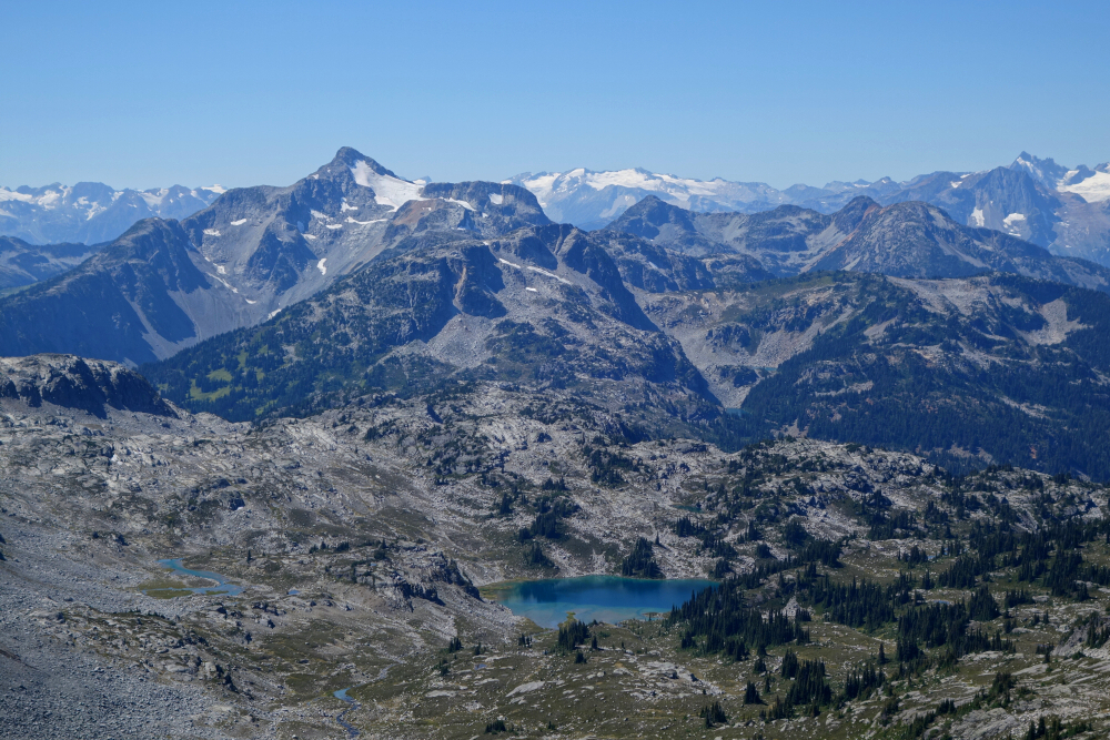
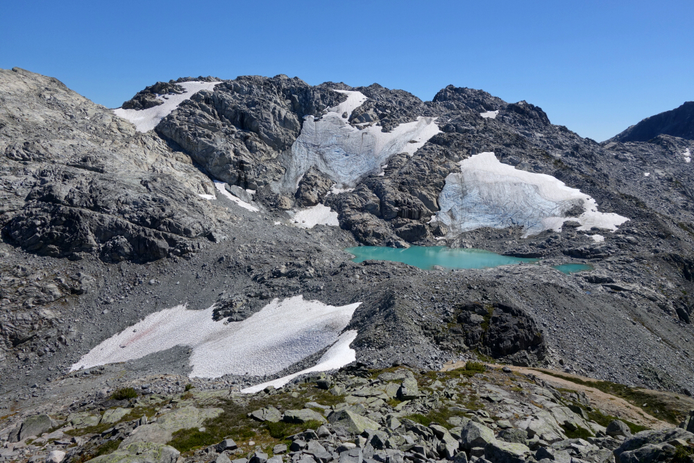
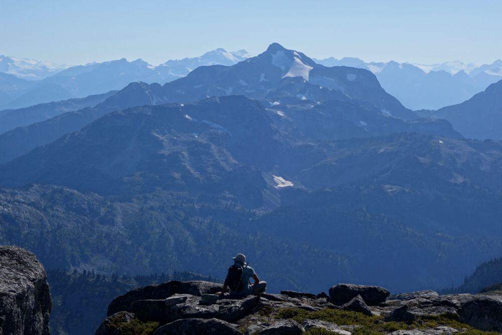
Up again from the next saddle, the ridge soon eases back and continues due south to reveal an exhilarating, if not intimidating view of the finale via Weart's North Ridge. Classic foreshortening over distance here, as the climbing turns out to be nowhere as steep as it appears from afar. That said, by staying on the crest as we did, you will encounter a couple funky moves with significant exposure. It did seem possible to avoid these spots again by traversing below to the right but note that it looked loose and ultimately not very fun. Made it to Weart summit in time to enjoy a stunning vista overlooking the mighty Weart Glacier to the east, whereas the Armchair Glacier Cirque to the west was completely engulfed in cloud. The contrast was quite an interesting sight to behold! Even the mighty Wedge Mountain with its tumbling icefall revealed itself to us if only for a minute or two! Alas, the day was far from over and we had a long, tiring descent ahead of us, and so down the SE Ridge we go. Endless talus tedium, particularly into the large basin below Weart's South Face before crossing the remnant of a much larger glacier that once spanned said basin from end to end. And then down the next headwall, this time over unstable refrigerator-sized blocks that threatened to crush us more that once as we were hiking down. This was all snow or partly glaciated when I was last through here in July 2018, making for much easier and safer travel. Many of us know the unpleasantness often left behind by a retreating glacier and suffice it to say this was every bit of that and then some!
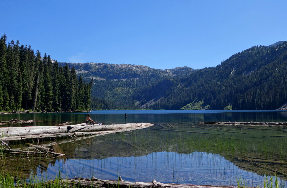
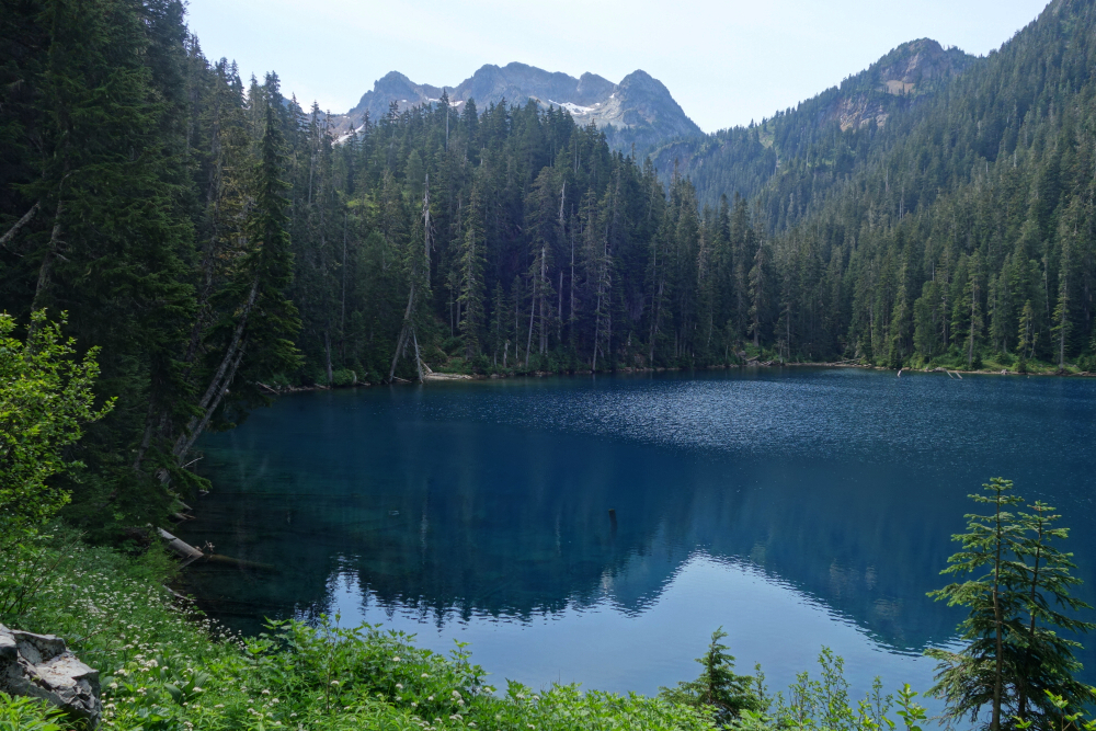
Made it through thankfully avoiding any "Aron Ralston" moments, reaching easier terrain with a pair of lakes laid out before us. Yes, I said "pair" as there's now a decent sized one uphill of the main lake named Tupper Lake where, as of my previous visit, the Wedgemount Glacier snout terminated. I was shocked to see that in the 6 years since, the glacier has receded dramatically and now terminates on top of a cliff well above Tupper Lake! And to think that back in the 1990's the glacier reached Wedgemount Lake! The amount of ice lost in that relatively short period of time is depressing and worse yet, appears to be accelerating. Current trends certainly don't bode well for where the snout may end up 6 years (or more) from now. There ain't no denying that we live on a changing planet, folks.
The "Long Traverse" - Long, Tynemouth, Arrowhead, Tabletop & Anemone, August 2023
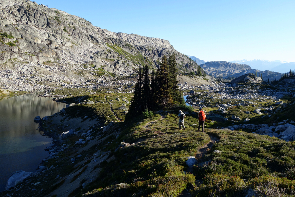
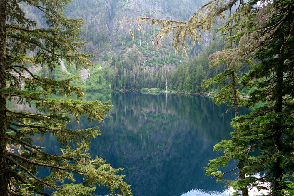
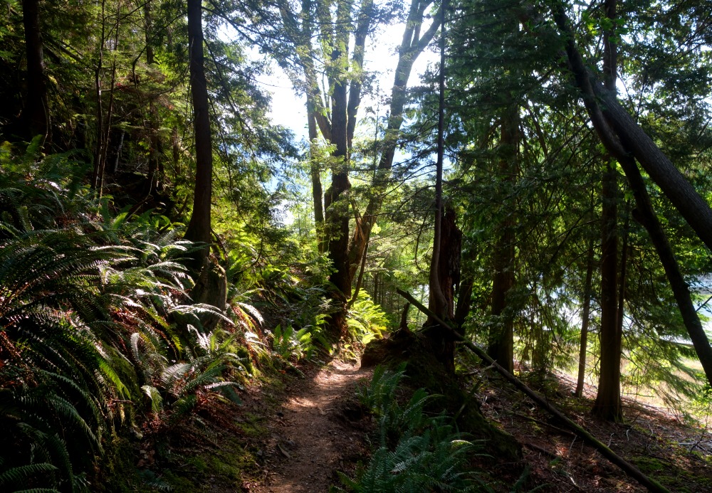
Wes and I had some unfinished business to attend to in the Lizzie Lake area after rain stymied our plans for Long Peak the previous Summer. This time we upped the ante and tacked on Tynemouth Mountain, Arrowhead Mountain, Tabletop Mountain and Anemone Peak for a full-day traverse of the area. Joined by fellow BCMC'er Crystal, our itinerary called for one day approach to the Lizzie Hut, one day traverse, and the final day hike back to the trailhead. Having previously made it all the way out to Caltha Peak, at the edge of the Stein Valley Heritage Provincial Park, our objective this time was to bag the main peaks in the core zone of what many refer to simply as the Lizzie Lake area. Ignoring that fact that in decades past one could practically drive to Lizzie Lake itself, the approach has thankfully seen some attention in recent times and amounts to about 9 km of relatively easy travel mainly on an old forest road. Beyond Lizzie Lake itself it is all trail for about 2.5 km to the cozy but mice-infested Lizzie Hut. Other than some particularly aggressive ground hornets, depending on the time of year of course, it's a mostly pleasant hike up to the so-called Gates of Shangri-La and the hut a short distance beyond. Nobody was there when we arrived, but we did encounter a twosome who'd just completed a circuit like ours. Andrew and partner would stay in the hut with us that night and leave the next day.
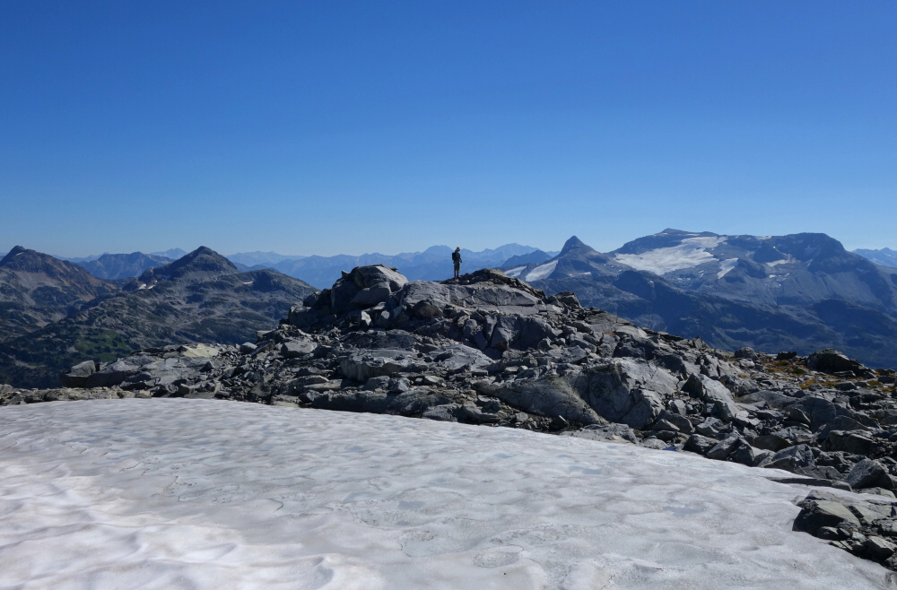
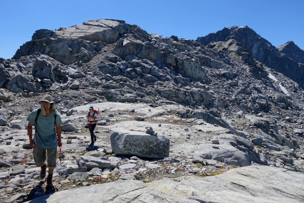
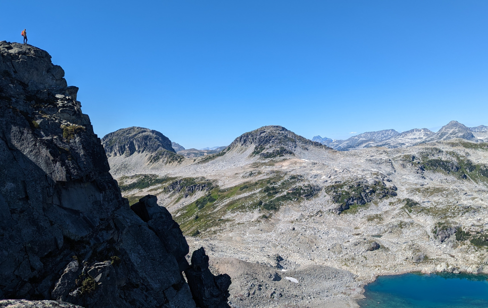
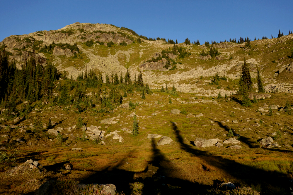
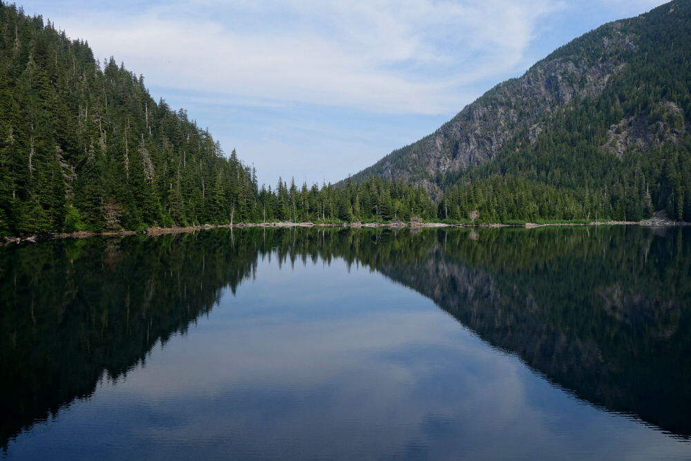
Bidding farewell to our hut mates the following morning, we set out on the path for Long Lake aiming for the Long Peak's broad NW Face. Without the fog from last year to obscure the way ahead, we easily located the rock bands and ramps mentioned in the Scrambles Guide that give access to "snowfields" on the upper part of the mountain. More of an ice remnant than a bonified snowfield nowadays and do beware the occasional refrigerator-size chunk of rock that comes tumbling down from here without warning! Skirting the very edge of what could be described as an old lateral moraine, we snuck past the firing zone and made our way on to the upper reaches of Long. Onto the summit ridge and a move or two up the small horn on the summit proper and WOO-HAA, what a view! So much here to drool over but let me simply say that Cloudraker Mountain the west and Skook Jim to the east are hard to ignore! One down and several more to go, so we didn't linger for long before descending. Back to the edge of the moraine before cutting right over an endless talus slope towards Tynemouth. Trekking poles mighty helpful on a long side-hill traverse over scree and loose blocks here. Crystal was adamant that she didn't need poles and ended up falling far behind - oh the stubbornness of youth!
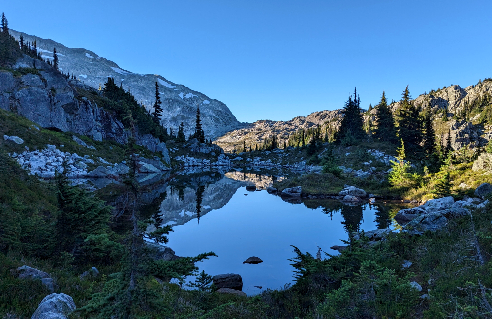
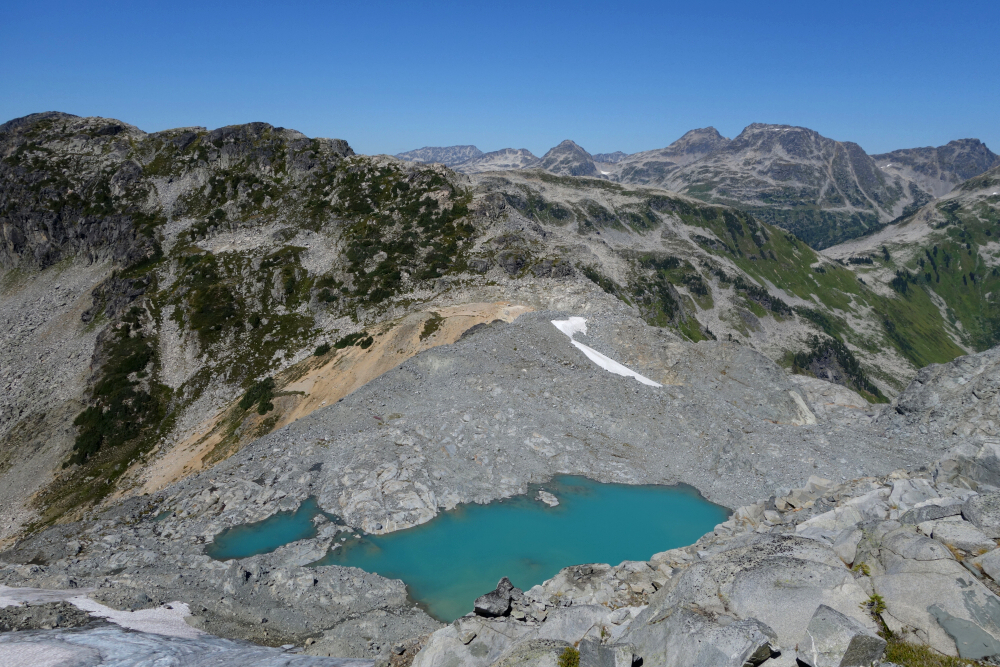
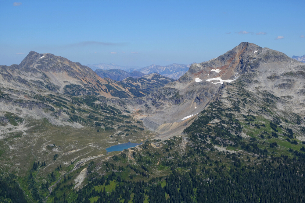
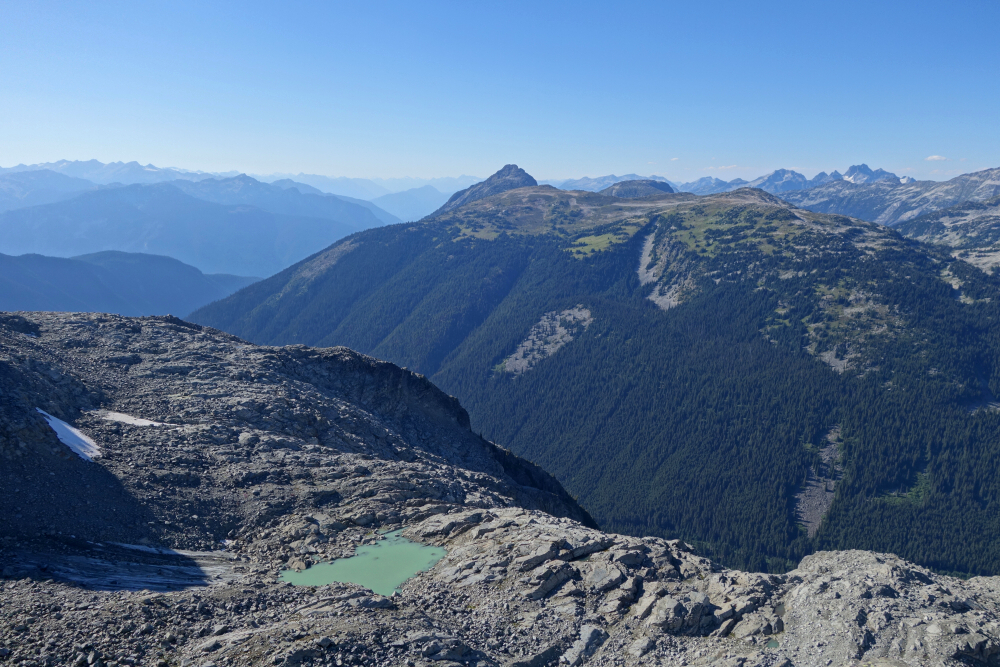
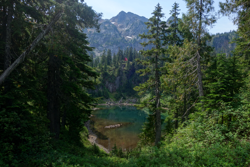
Easy trek up and over Tynemouth's broad summit ridge, then back down the NE Ridge to Moraine Pass. Picturesque glacial lake here, complete with a very evidently shrinking glacier. Crystal wanted to take a swim here, so Wes and I moseyed on for a bit to give her some privacy. On the move again, we dispatched Arrowhead Mountain without much fanfare, taking countless Instagram-worthy photos of us standing on the edge of its east-facing precipice. Leaving the summit, we followed the West Ridge for a bit before descending talus slopes down towards Heart Lake. Some hemming and hawing with what to do next - do we call it or go all-in and bag Tabletop & Anemone? I was neutral, Wes was pro, and Crystal seemed undecided. This went on for a few minutes without consensus, until I proclaimed, "fuck it, let's do it!" And so, off we went, up towards the broad Tabletop-Arrowhead Pass.
We left the trail and followed the path of least resistance up Tabletop's SE Face/Ridge. Rested up top for a bit as Crystal was starting to lose steam. Impatient as always, I started down the West Ridge, the others following. Some scrambling down to the Tabletop-Anemone Saddle, then up Anemone, this time again with a bit more scrambling to reach the large summit area. Took another break on top here, despite the annoying flying ants attempting to enter every facial orifice. Probably not long enough for Crystal, but I'd had enough of the bugs and don't much care for hiking in the dark - so down we went. Cut down from the Tabletop-Anemone Saddle to intersect the main trail and followed that along Heart Lake and Arrowhead Lake. Wes took a dip here, while the rest of us enjoyed a short break before resuming the trek back to the hut. One last night listening to the mice scurry about the hut and over to tops of our sleeping bags, and it was time to go home, very satisfied with another fine adventure in the Lizzie Lake area in the bag!
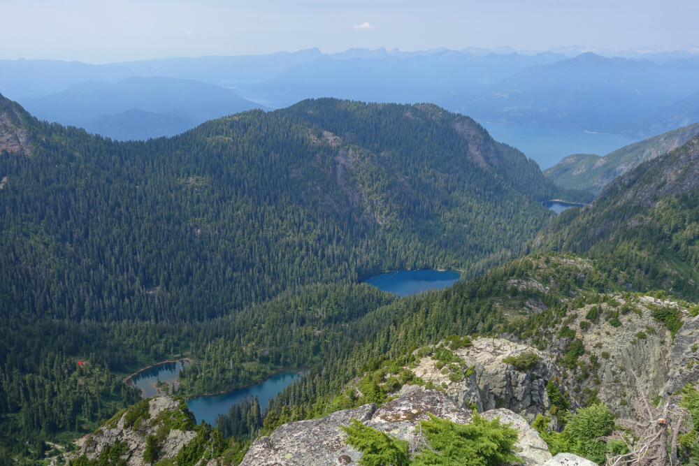
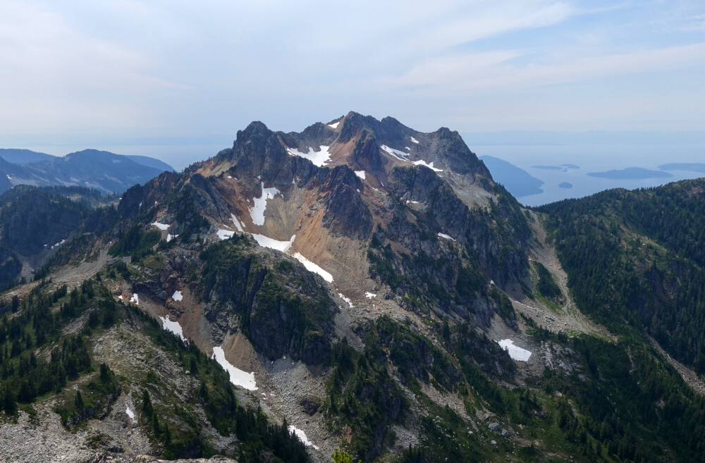
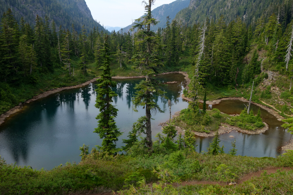
This one had been nagging me for a while. On the one hand, it's featured in the Scrambles Guide and is a short drive to get to. On the other, the stats seemed big(ish) on paper at least and being that I'd already done its taller neighbor Mount Brunswick, I wasn't all that motivated to bother. That said, I'm a sucker for novel and aesthetic approaches and rather fancied the idea of hiking in via the three Deeks Lakes as it is a scenic area and a bit of a hidden gem that's close to home. I was already familiar with the lower and largest of the Deeks Lakes, having hiked to it on the way to Mount Windsor, but that's as far as I'd gone from that side. A shorter approach, albeit with more total elevation gain starting from Lions Bay and crossing over Hat Pass, which incidentally is the same as that used for Brunswick and the Hat/Fat Ass duo, seems to be preferred by some, but I wasn't feeling a third repeat up and down that knee-crushing trail. It's settled then - I would start from Porteau Road and follow the Howe Sound Crest Trail before proceeding up Deeks Creek Valley!
Once past the boring section of old forest road that now serves as a trail, it's a lovely hike up to and along the lakes and I took my time admiring their vibrant turquois colors. But boy was it turning into a scorcher of a day, and based on the sweat pouring off me, very muggy too! This would come to haunt me, but more on that later. Past the third and final lake before proceeding upwards more steeply now towards an unmistakably bright red colored emergency shelter. Continued up to just below Hat Pass and then departed the trail to traverse a heather bench now below Brunswick's North Face. Soon reached a large talus slope with full exposure to the searing, energy-sucking sun now being reflected and intensified by the terrain. My pace slowed considerably as I battled with myself resisting repeated temptations to abort mission. Reached the crux gully and proceeded up though several slabby and somewhat tricky steps aided by at least one handline. I desperately needed some reprieve here and tucked myself into a small alcove shaded from the sun for a brief rest. My head and heart were pounding, and I felt like I was going to pass out if I didn't immediately stop moving.
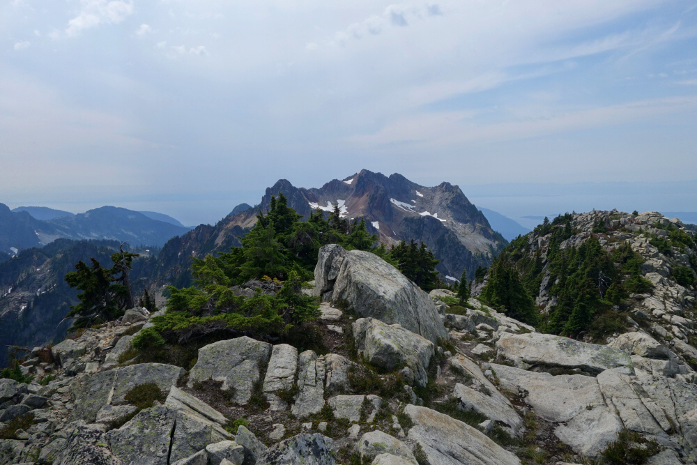
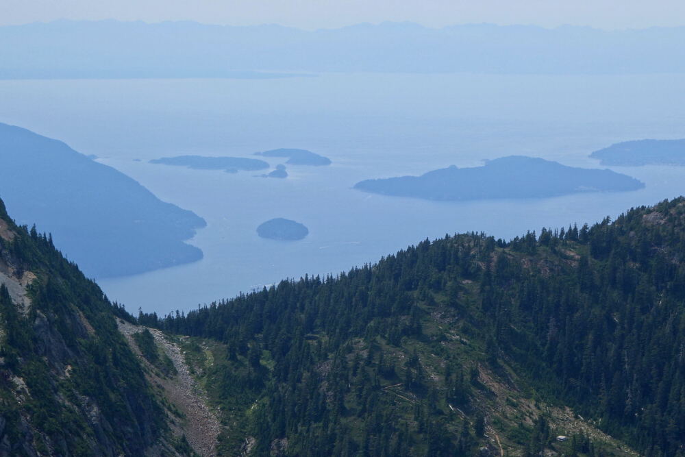
Feeling marginally better a few moments later, I mustered up the will to continue and staggered up the final bit of gully to reach a small cluster of trees near the top where I could sprawl out and take another, longer rest in the shade. So long as I could stop exerting myself, I would be okay and being that I was finally at the top of the gully meant that all the real work was now behind me, and I could rest easy. Feeling more myself at last, I walked on over to the summit proper, thankfully now on a mostly horizontal ridge and took in the fruit of my hard-earned labor! Notables include Goat Ridge, Garibaldi, Sky Pilot, Sheer, Mamquam and Ben Lomond to the north, the Deeks Lakes with a sliver of Howe Sound to the NW, Brunswick and The Lions to the south, and finally a neat view up the channel between Bowen and Keats islands towards Pasley Island and the open water beyond with Vancouver Island on the horizon. Not too shabby if I do say so myself! Back the way I came without further drama, clocking in at around 8.5 hours round-trip and fortunately nothing more than a bit of dehydration to deal with once it was all said and done!
It would be very much appreciated if you please ask before copying and/or re-publishing content from any part of these pages. To do so, please click here to send a message via feedback form.


