Select from list below to jump to a specific area on this site.
| Latest Posts |
Tuesday, April 29, 2025
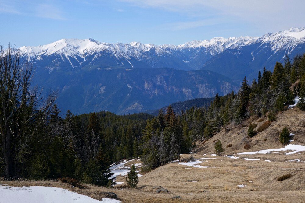
Blustry Mountain - South Route via Rough Creek FSR, April 2024
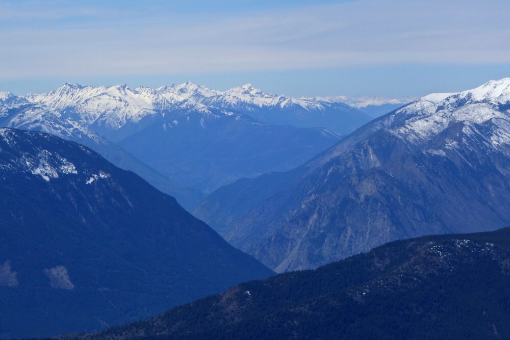
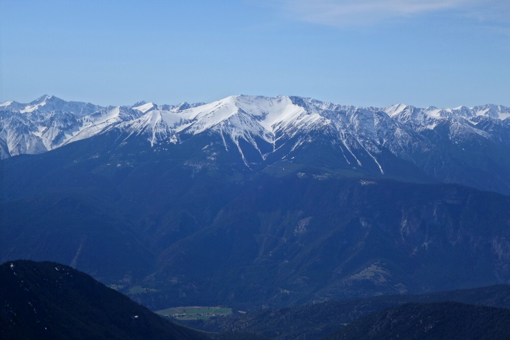
The highest peak in the Clear Range southeast of Lillooet and immediately east of Fountain Valley stands Blustry Mountain. It is a relatively high but flat, plateau-like peak that offers little in the way of mountaineering interest. This fact however belies the fact that the views from the summit are nothing short of extraordinary! From nowhere else, that I have been to at least, can one appreciate the grandeur of the South Coast "big boys" flanking the west shore of the mighty Fraser River. Home to local giants such as Mount Brew, Petlushkwohap Mountain and of course Skihist Mountain, 5th, 2nd and 1st highest in SWBC respectively, the area is remote and infrequently visited by man. While I have been up Brew and have plans someday to bag Skihist, the rest of the peaks here are largely a mystery to me. The view in some ways reminds me of that from the White Mountains in California, overlooking the Owens Valley towards the towering peaks of the Eastern Sierra. This may not be entirely coincidental, as there are likely similar geologic processes behind the similarities - the Grand Tetons stand out as a notable comparable. But I digress...
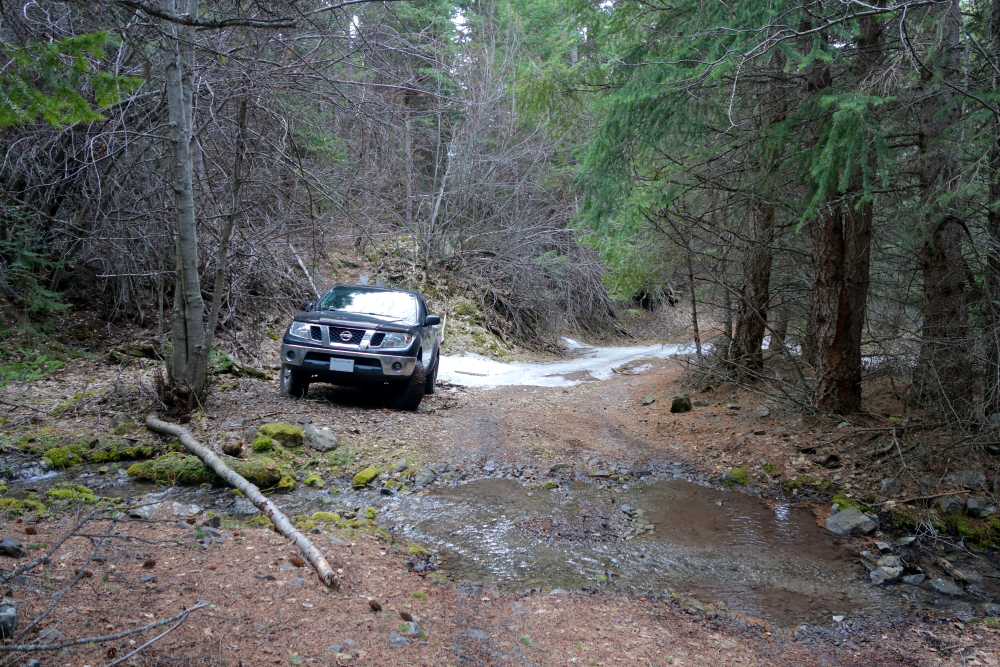
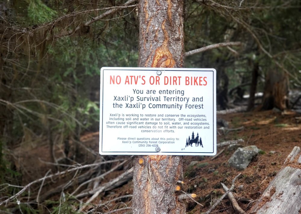
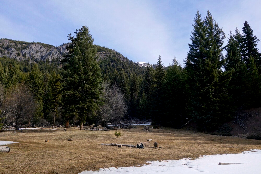
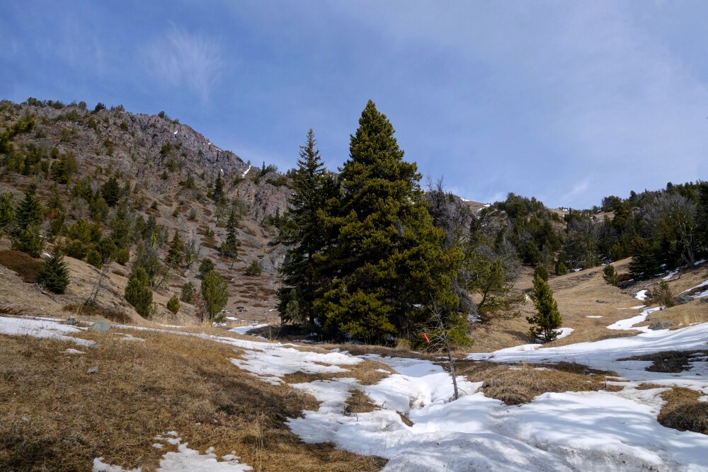
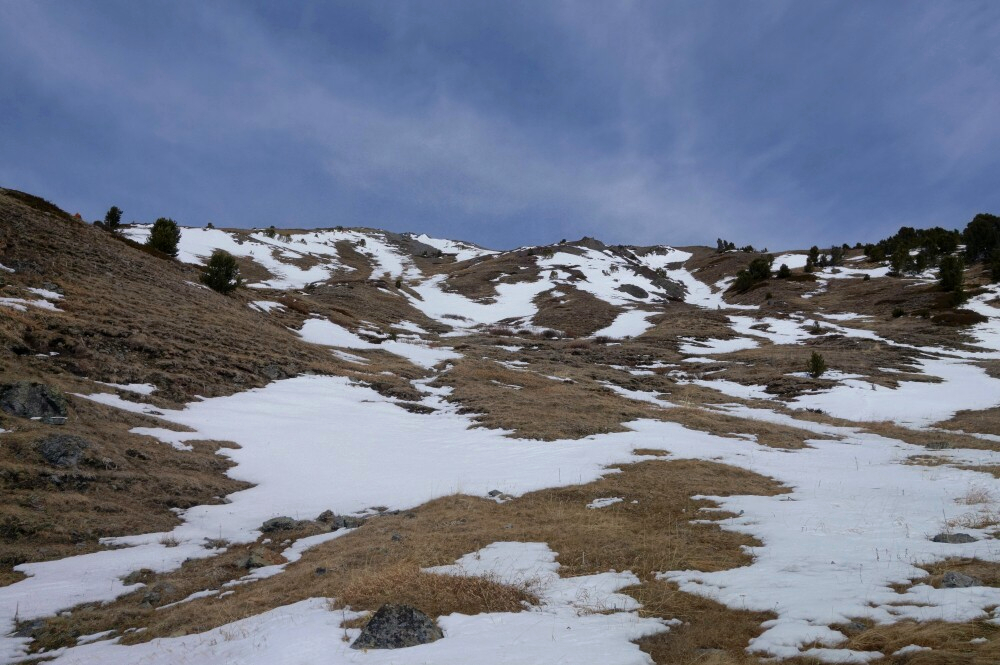
In search of sunshine and hoping to escape the isothermal springtime mush closer to home, I again made the trek out to Lillooet for and early dose of "Summer". As a shoulder-season objective, Blustry is a great candidate as its eastern setting means it benefits from better weather and receives significantly less snow than points west. Turning off Highway 12 south of Lillooet, I proceeded up the Fountain Valley Road for some 6 kilometers before taking a sharp right onto Kirbys Flat Road. This I followed to the turnoff onto Rough Creek FSR and then followed that road several kilometers to where large patches of snow and ice on the road forced me to stop and park. Wasn't more than a couple kilometers from the driveable end of the road by this point, so I shouldered my pack and started hoofing it. Soon reached an open meadow and apparent cowboy camp before picking up the trail on the opposite side. Up through forest, reaching another meadow/corral area now mostly snowbound before locating the trail continuation at left. Followed this to finally reach timberline on Blustry's south slopes.
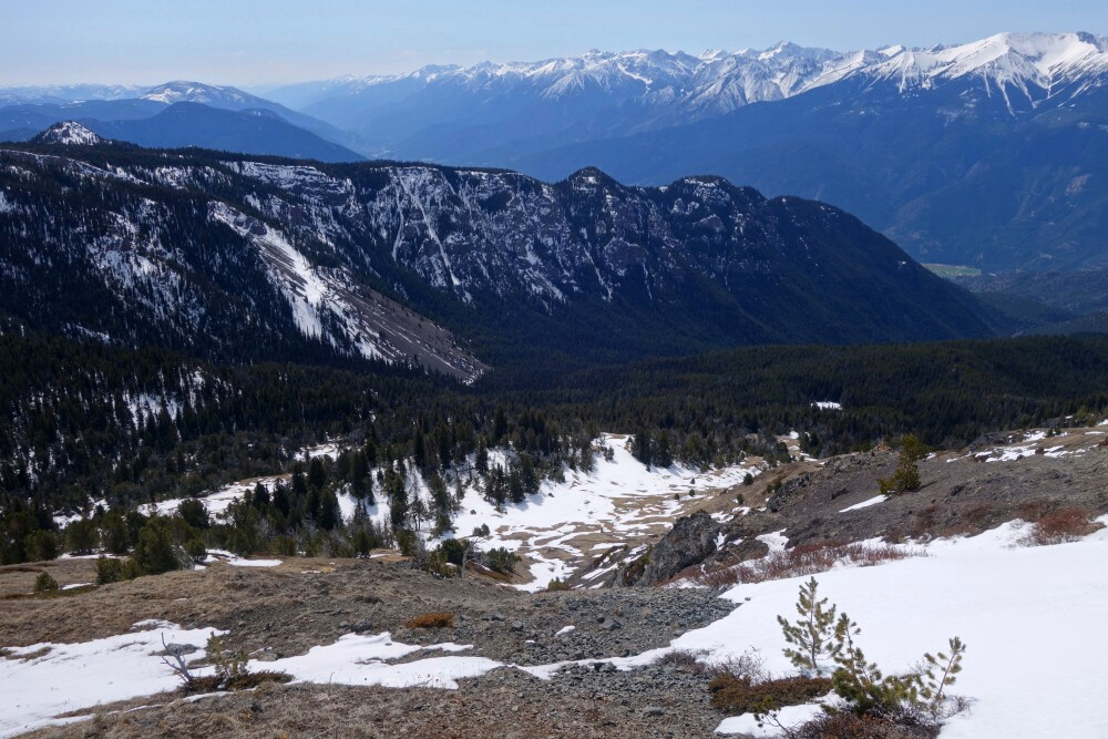
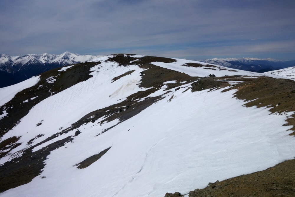
Proceeded up grass slopes, with the odd snow patch here and there to make things more interesting. Looking back, the views were really starting to open up now, with Askom Mountain rising prominently from the opposite side of the Fraser River Valley. Grass gave way to scree and rubble as I crested Blustry's rounded West Ridge. Walked out to the highpoint of said ridge first for some unobstructed views, before turning around and proceeding onto the summit proper. Crossed the "west bowl", traversing over low angled snow to finally reach the top, about 3.5 hours after first setting out that morning. Damn good views as mentioned, particularly of Askom, Brew, Boulder/Onion peaks and co.! The view south down the Fraser was also noteworthy as was the valley confluence of the Fraser and Seton rivers. Finally, having taken it all in I peeled myself away from the decidedly not-blustry summit, on this day at least, and made it back to my truck in a little over 6 hours round trip. All in all, well worth the long drive to experience and exactly what the Dr. ordered!
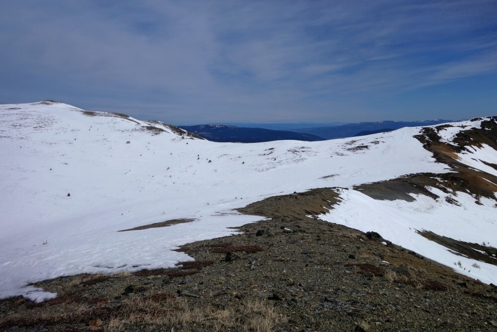
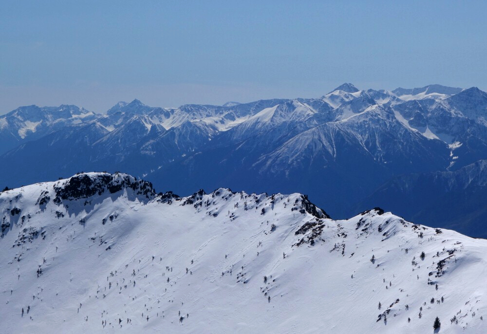
Bombtram Mountain - ESE Ridge via Box Canyon, March 2024
Andrew and I teamed up for a go at Bombtram Mountain following my previous unsuccessful attempt in November with Kevin. The Fall attempt was stymied by insufficient snow coverage down low resulting in annoying travel over damp and slick deadfall through a cutblock to start with. Conditions I feared didn't bode well for what we'd find higher up and so we aborted the mission and went for nearby Winter's End Peak instead. Fast forward 4 months, and there I was punching through the thin snow coverage, determined come hell or high water to get Bombtram done once and for all!
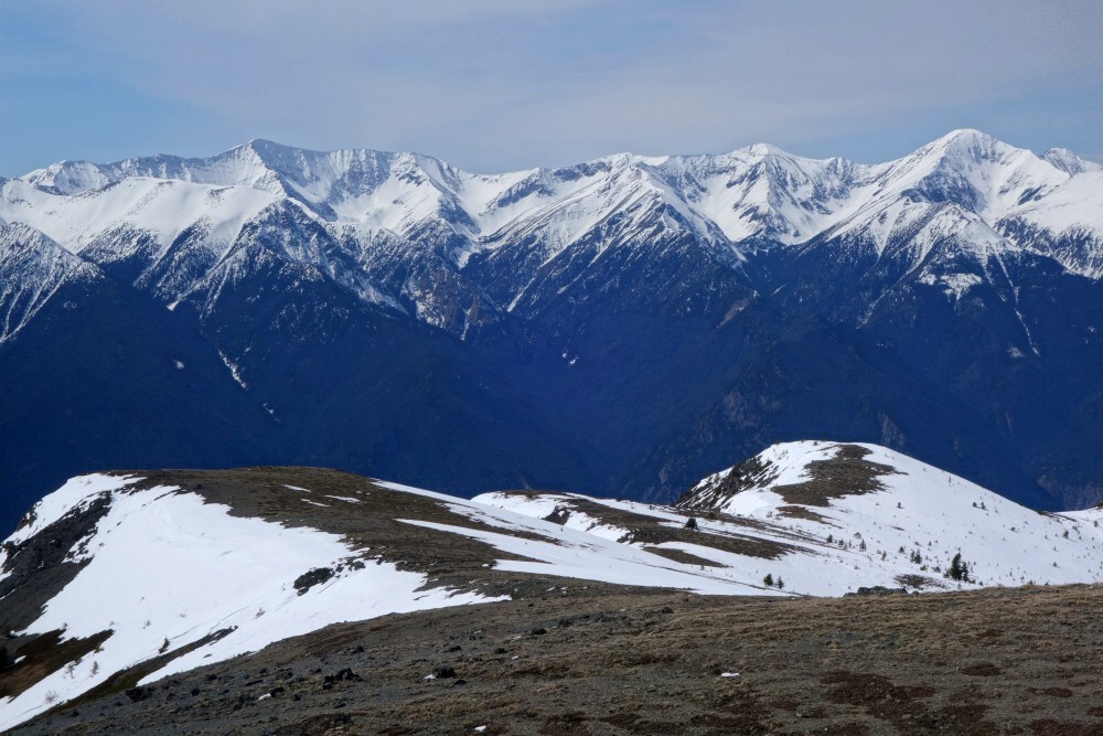
With the Box Canyon "trailhead" only about 7 kilometers shy of Coquihalla Pass, the peak gets its name presumably because the slopes around it are bombed in the winter for highway avalanche control. With the relatively meager snowpack this winter, there'd be no worry of bombing or avalanches for that matter, and so we dove into the cutblock immediately south of said canyon making short work of it to the open forest above. A steep but mercifully brush-free grunt lead us up to treeline on the peak's ENE Ridge. Continuing up this ridge, now with snowshoes we proceeded to a flat "staging" area directly below a headwall. There are number of ways to tackle this feature, with us choosing to traverse out right for a bit before turning up and taking a spur head on. A short but steep pitch soon saw us to a false summit with the true summit just a short and mostly flat stroll away.
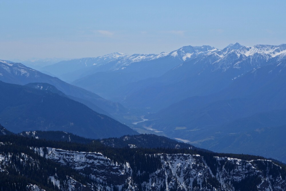
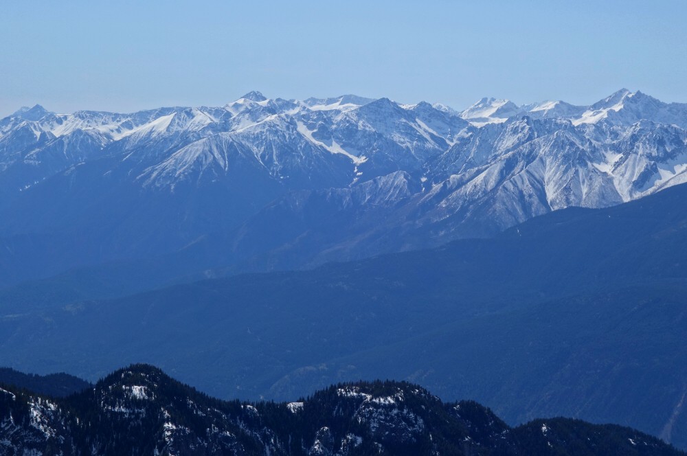
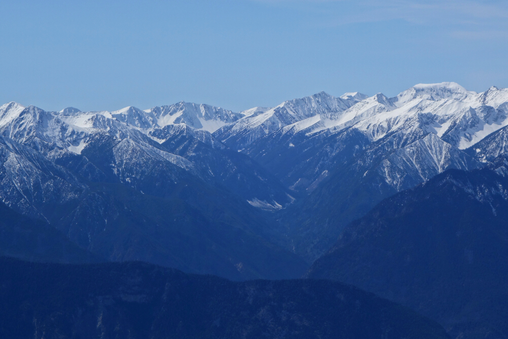
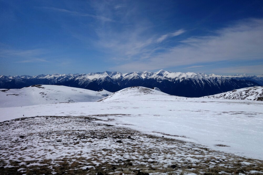
Stellar views from up there and worth the effort for they are notably better than from the adjacent Winter's End. Nice perspective on the Boston Bar Creek Valley traversed by Hwy 5 towards Coquihalla Pass with Yak and co. towering above. Markhor, Needle and Flatiron stand out nicely to the east with the Anderson River Group dominating the view north. To the west and northwest a nice panorama from the Breakenridge area to the remote ranges flanking the west shore of the Fraser Canyon presents itself. Farther south, Tulameen and the Outram Group stand out with an array of the usual BC and WA North Cascade peaks visible beyond. Good stuff!
Heading back, we descended an obvious chute down from the false summit, before rejoining our tracks from earlier in the day. Then back down the ridge, forest and cutblock, now through annoyingly punchy snow to finally reach the forest road below. Back at the car, a quick change and out come the suds and spicy pork rinds to cap off a very satisfying day! All told, it was about 4.5 hours up for about 8 hours round trip.
Mount Underhill - via Old Elsay Lake Trail, March 2024
Finally set the boards aside for the season and got crackin' on my ever-expanding hiking list. With the sudden onset of unseasonably warm March temperatures, I opted to start small by going after one of the countless subalpine bumps in my proverbial backyard. Enter Mount Underhill, a 1480-foot beast of a mountain flanking the west shore of Indian Arm. As with innumerable others on the North Shore, Underhill is included in the Bagger Challenge list and as such sees a fair amount of traffic by its devotees. Lists aside, the peak appealed to me for the network of trails as yet untraveled by yours truly to get there along with the reportedly good views overlooking Indian Arm from the top.
The shortest approach would be by following a trail from near the end of Sasamat Lane and continuing past Brighton Beach. However, being that both the Sunshine Falls Lane and Sasamat spur are private with large no trespassing signs adorning the turnoff from Indian River Drive, I opted to play by the rules and avoid the area entirely...to start with at least. As such, I parked at a pullout on the main drive about a half kilometer past a large parking area below powerlines. Geared up, crossed the street and started up the Franks Plank MTB trail. Followed this and a lesser spur or two to intersect with the main Old Elsay Lake Trail. Ignoring countless spurs now, I stayed on this for about 3.5 kilometers to reach Holmden Creek. Traversing sections of mossy old growth and interspersed with short scrambly bits, I found the hiking here quite enjoyable and well worth the extra mileage to experience.
Took a break to hydrate at Holmden before commencing the final ~0.5 kilometer grunt up Underhill. Nearing the summit, a great view to the south overlooking Indian Arm revealed itself to me as promised. Quite spectacular especially being so close to home! I continued a few minutes more to tag the no-view true summit just for kicks. After a nice long rest, I returned the way I came, making a short detour up the Cascade Bluff Trail to reach its namesake lookout. Views from here were also great, if not better than from Underhill itself! Returning from the bluff, I made a beeline for Sasamat Lane now, choosing for the faster return via the road, trespassing BS be damned. That said, none of the "locals" I encountered seemed to mind, and greeted me as I walked by. All in all, a fine outing and great warm-up for all the adventures to come!
It would be very much appreciated if you please ask before copying and/or re-publishing content from any part of these pages. To do so, please click here to send a message via feedback form.


