Select from list below to jump to a specific area on this site.
| Latest Posts |
Monday, October 20, 2025
Silvertip Mountain - South Route via Silver-Skagit FSR, July 2024
Finally bagged the "ultra" out Silver-Skagit way! Been on the list for what seems like an eternity, having spied Silvertip from so many other peaks over the years. Probably the most compelling sighting for yours truly and the one that ultimately convinced me to climb it someday was that from Hozomeen Mountain. Same as the intro photo, the peak from this perspective rises conspicuously from its relatively low valley footings to form an aesthetic 8,517-foot pyramid that dominates everything else in these parts. With a clean prominence of over 6000 feet and the distinction of being the most prominent non-volcanic peak in the Cascades, Silvertip not surprisingly is also a highly coveted peak, particularly among the prominence-baggers out there. Not really my thing per se, but as someone that has spent a considerable amount of time peakbagging in the Cascades of WA and BC, it simply could not be ignored forever. And so, with Kevin in tow, we set out on a fine July day for this iconic crown of the North Skagit!
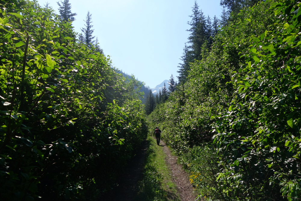
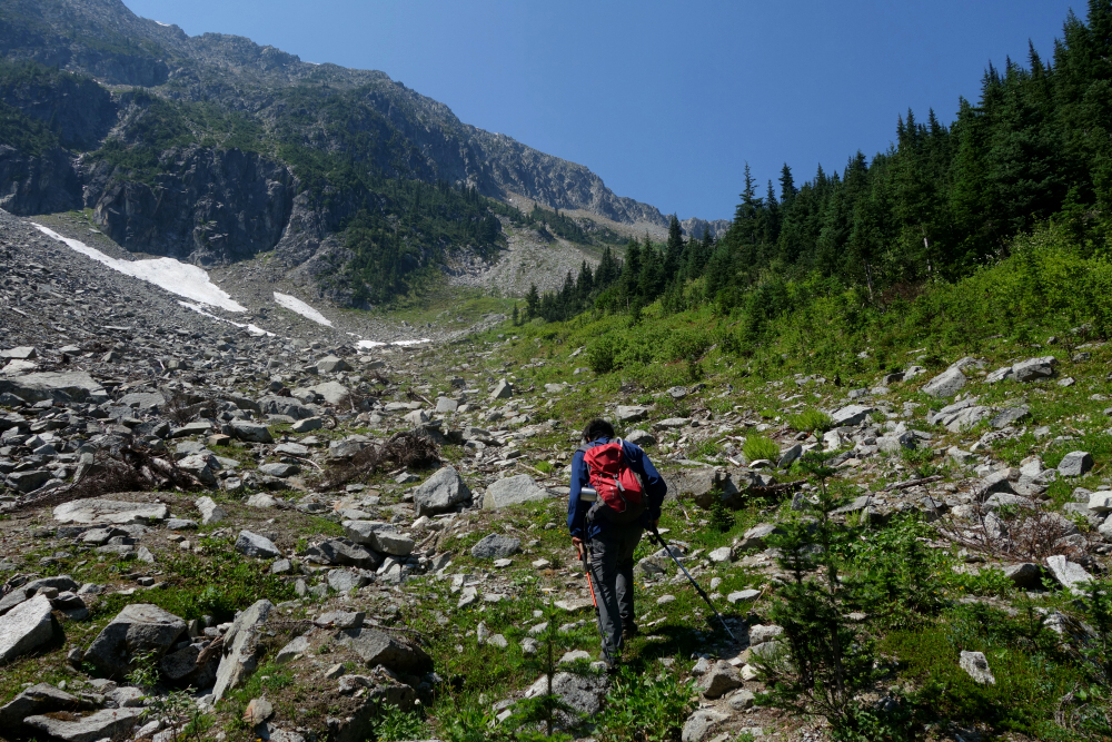
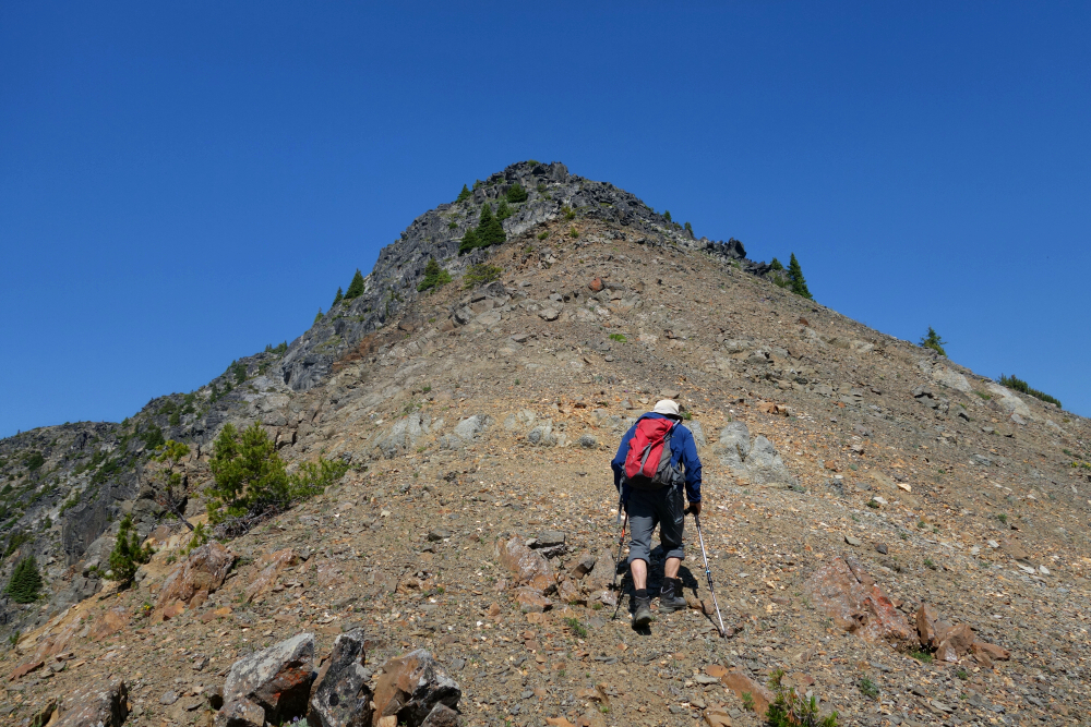
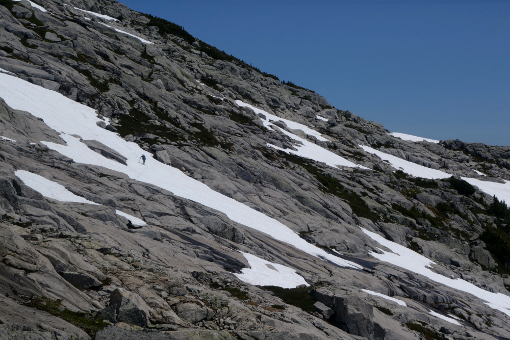
Drove up the morning of, turning off the highway and continuing for some 36 kilometers via the recently repaired Silver-Skagit Road to the unsigned turnoff leading to the "trailhead". Packs on backs and up into the bush at a rather civilized 8:20 am we go. The area here was ravaged by fire some years back and whatever trail that once existed has been thoroughly erased. That said, travel was mostly free of any annoying vegetation save for the occasional blueberry bushes and tall grass. The route initially ascends a swath of forest bound by the south-facing drainages SE of Mount Rideout and SW of Silvertip respectively and amounts to a no-joke 6300+ foot grind over a mere ~3.5 kilometers as the crow flies to reach the summit. It's steep and littered with bluffs, also rather monotonous.
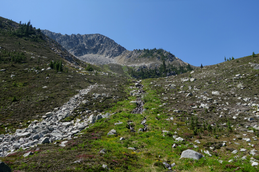
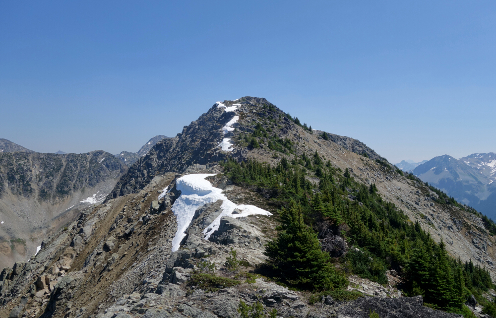
Continuing up, we eventually found our way onto the crest of a spur that bisects the drainages. The grade eased back considerably here, as we worked our way towards some crags ahead. Cut right when we could no longer proceed along the spur without difficulty, now following a faint path traversing steep grass slopes towards a large bowl. No issues for us on this stretch, albeit a bit tedious with all the footsore side hilling; not something I'd want to do when wet. Up a headwall of sorts above the bowl aiming for a prominent saddle just west of a false summit. Then turning right, we continued just below the crest, bypassing this intermediate bump by contouring around on the south side to reach another smaller saddle with true summit just beyond.
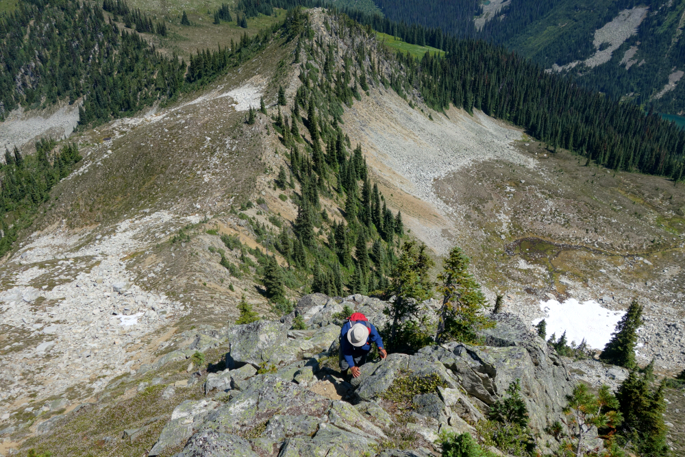
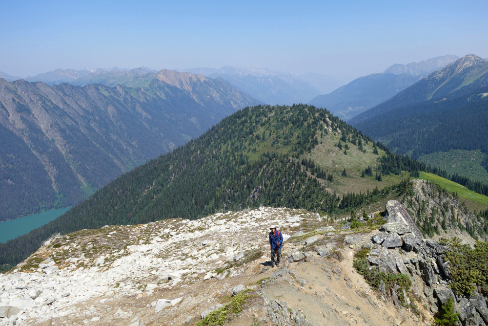
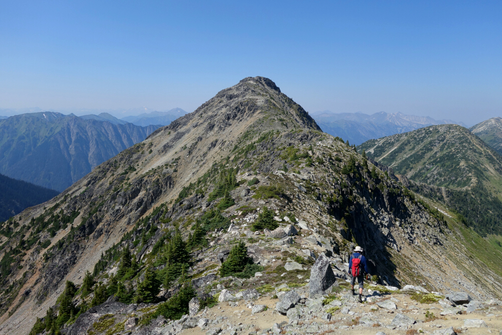
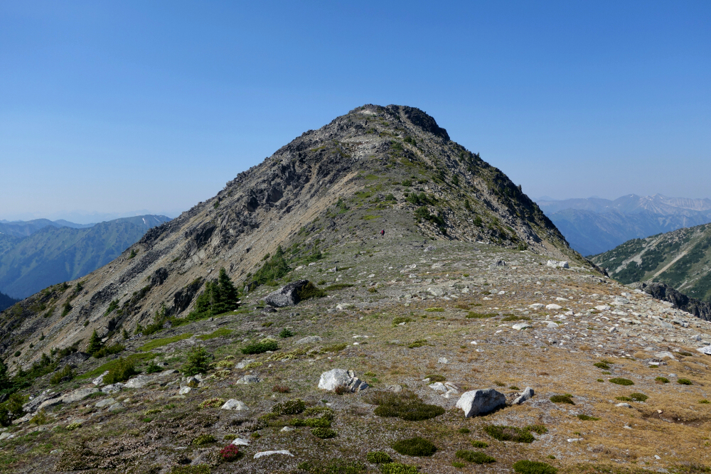
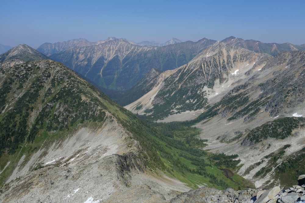
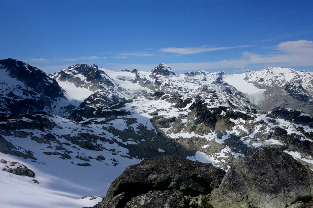
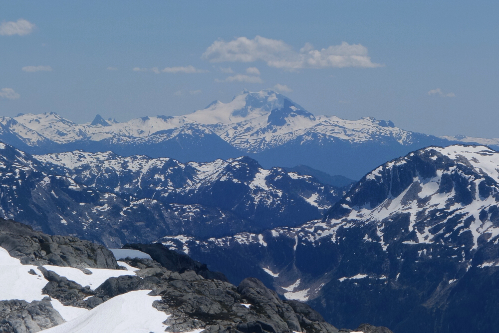
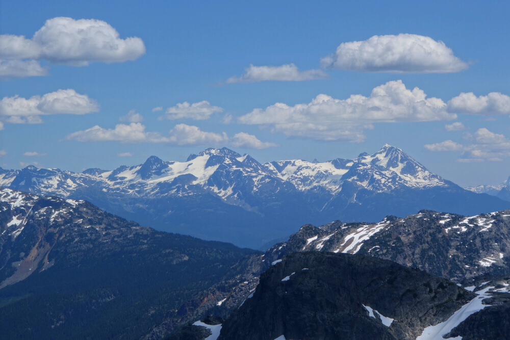
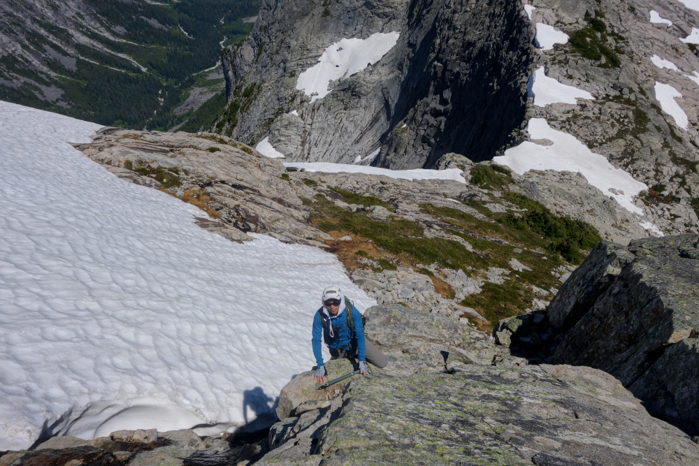
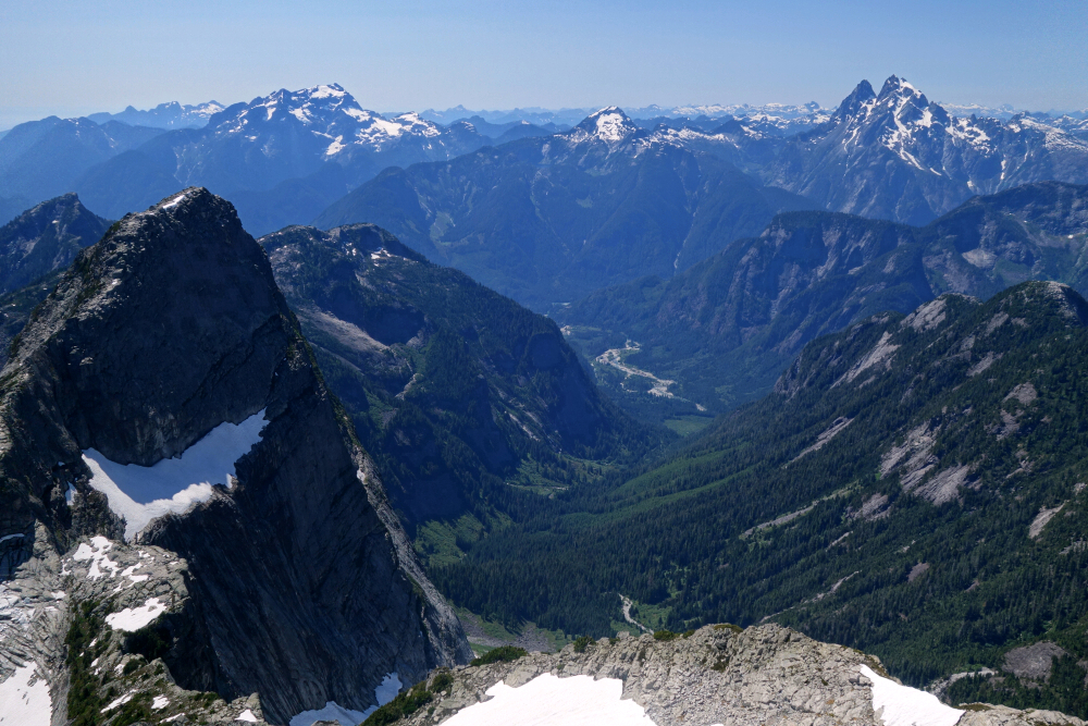
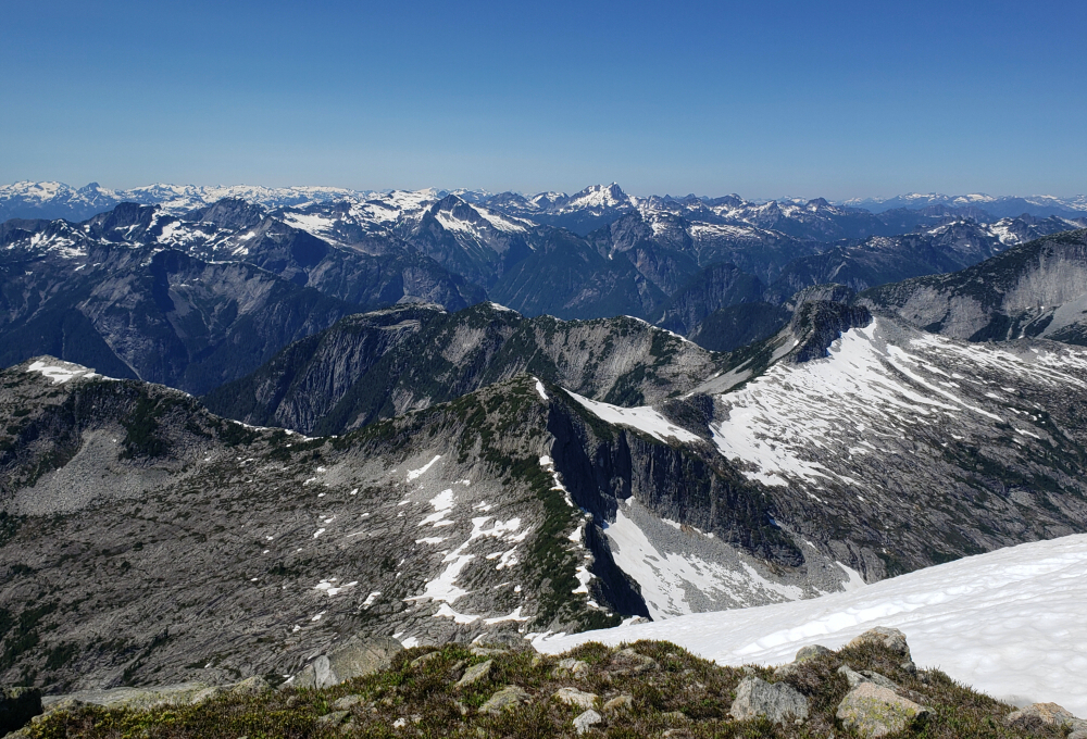
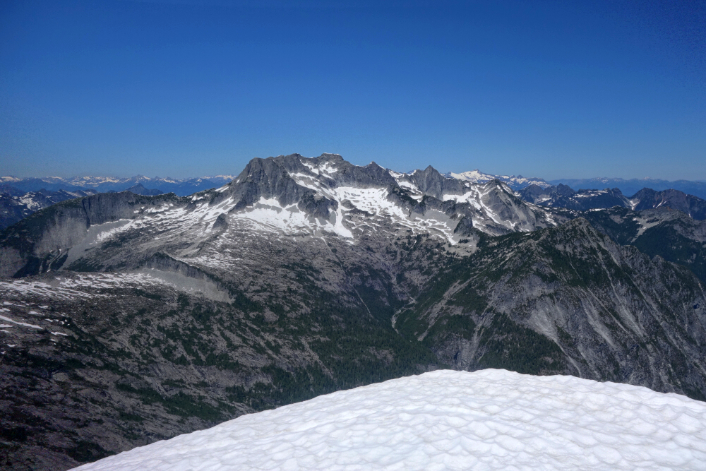
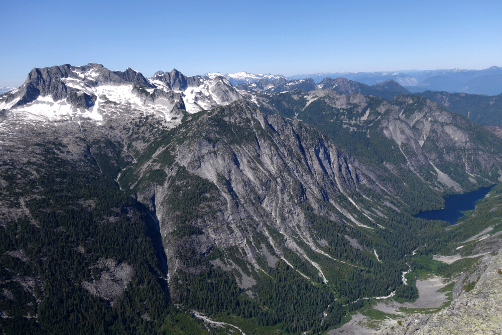
Hoping to avoid the treadmill scree up ahead of us, we stuck to the crest hoping to simply follow that to the top. This proved to be a fool's errand, as others have no doubt experienced as well thanks to steep and technical climbing towards the upper half of the rock ridge. Backtracked for a bit before resigning ourselves to making a tedious ascending traverse of a large scree slope, reaching more solid scrambling terrain after crossing over to the opposite side. Turned left, then a final easy scramble for a total ascent time of just under 6 hours. Outstanding views as expected, especially looking SSE down the Skagit Valley where the river flows into Ross Lake. Also, good views looking west down the ridge towards Mount Rideout, Sumallo Mountain, Mount Payne and beyond.
Spent about 30 minutes up on top before returning the way we came, making our way back to the spur in good time before commencing the long "controlled fall" back to the valley bottom. All told, the hike came out to ~11 hours round trip and despite the stats I found it to be surprisingly less arduous than expected. Easily a classic and well worth the effort; a must-do for all the North Cascades' connoisseurs out there!
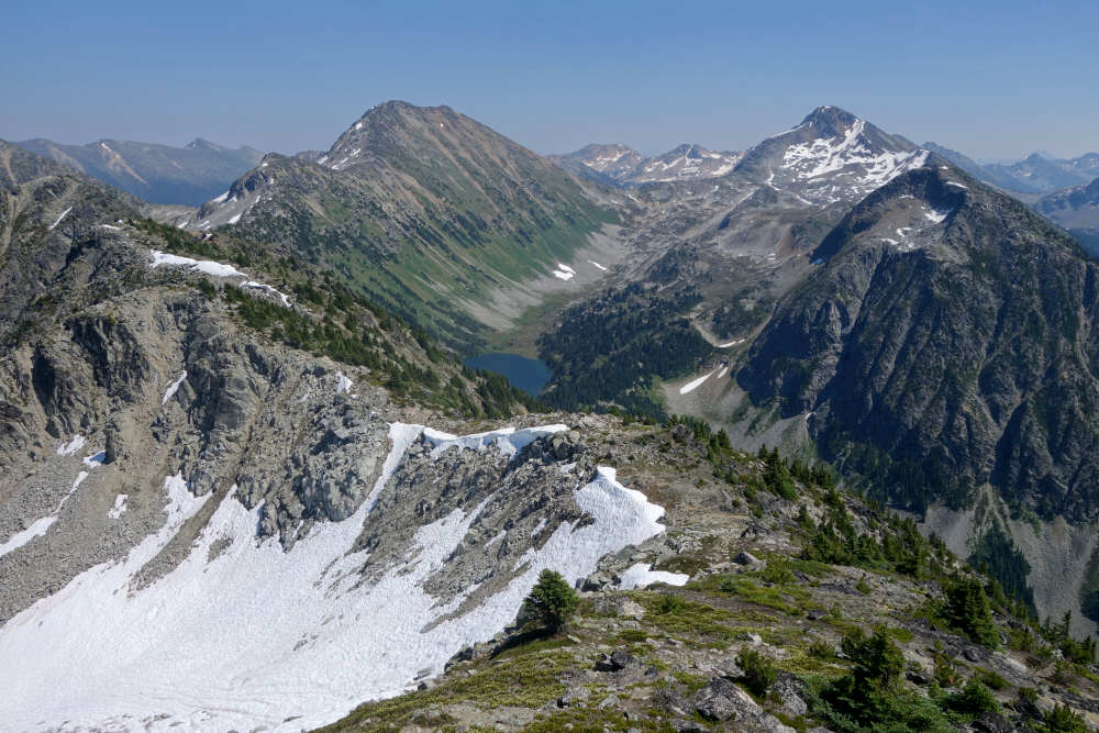
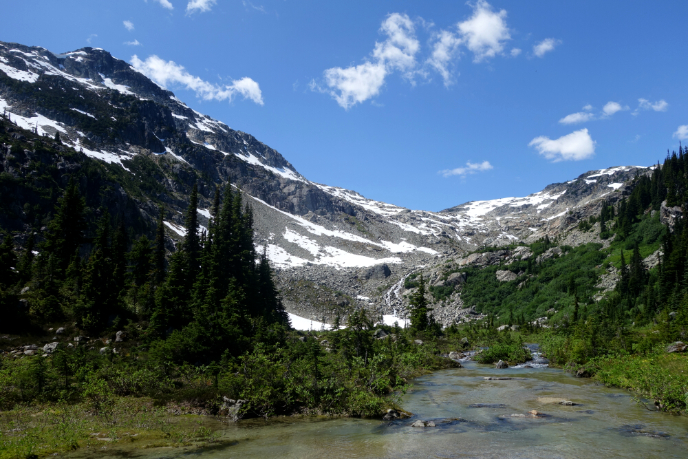
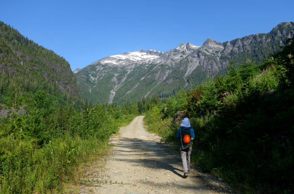
Steep Peak - Darkside Peak Traverse - Counterclockwise via Darkside Lake (plus Emory Falls), July 2024
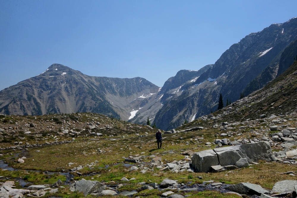
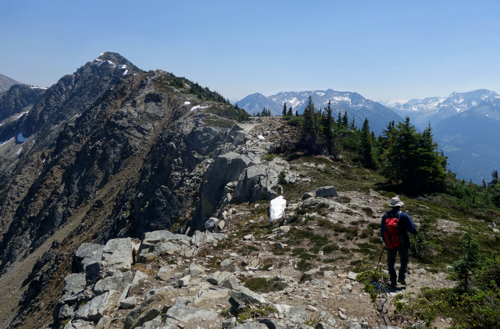
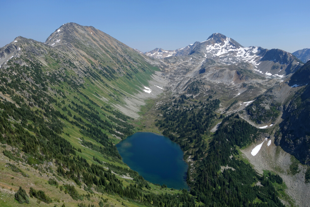
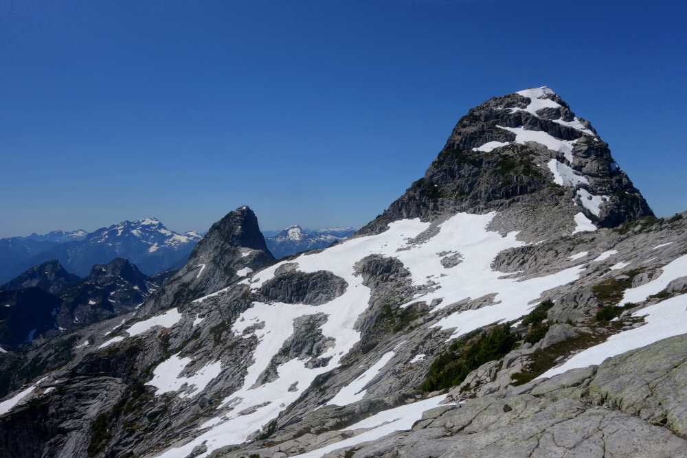
My curiosity for this was first piqued touring around Steep Peak the winter prior. I learned from a couple Lillooet locals who've spent a good amount of time ski touring out in these parts that a summertime hike out to Steep is a pleasantly scenic affair, mostly following a trail with zero bushwhacking before gaining the crest of a gentle ridge that leads to the summit. I hadn't been to the tippy top yet, and frankly type 1 outings such at this are increasingly in short supply for me these days, so why not go see if what they say is in fact true? And so, accompanied by Wes I did. However, instead of stopping there, I thought of upping the ante and making a traverse as it were, linking Steep and Darkside essentially following the crest of the cirque containing Darkside Lake. Note that this is hardly a novel idea, as there are a few reports out there describing exactly this, although practically all are in the spring. Without any brush and a nice open ridge linking the peaks, there's no reason to suggest this isn't as good or perhaps better as a summer outing. Either way, I was determined to find out!
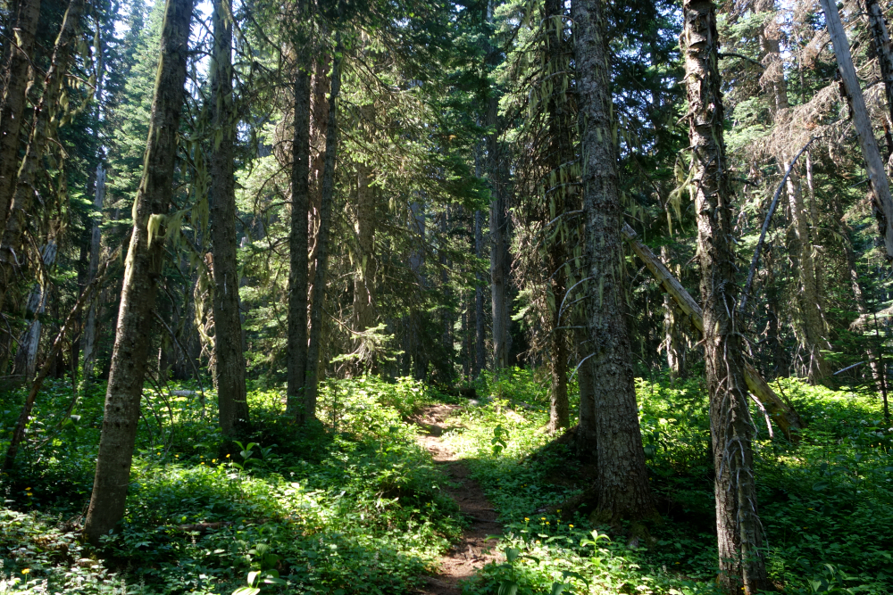
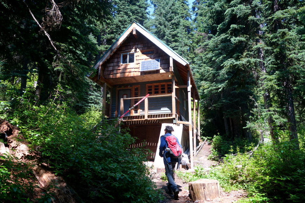
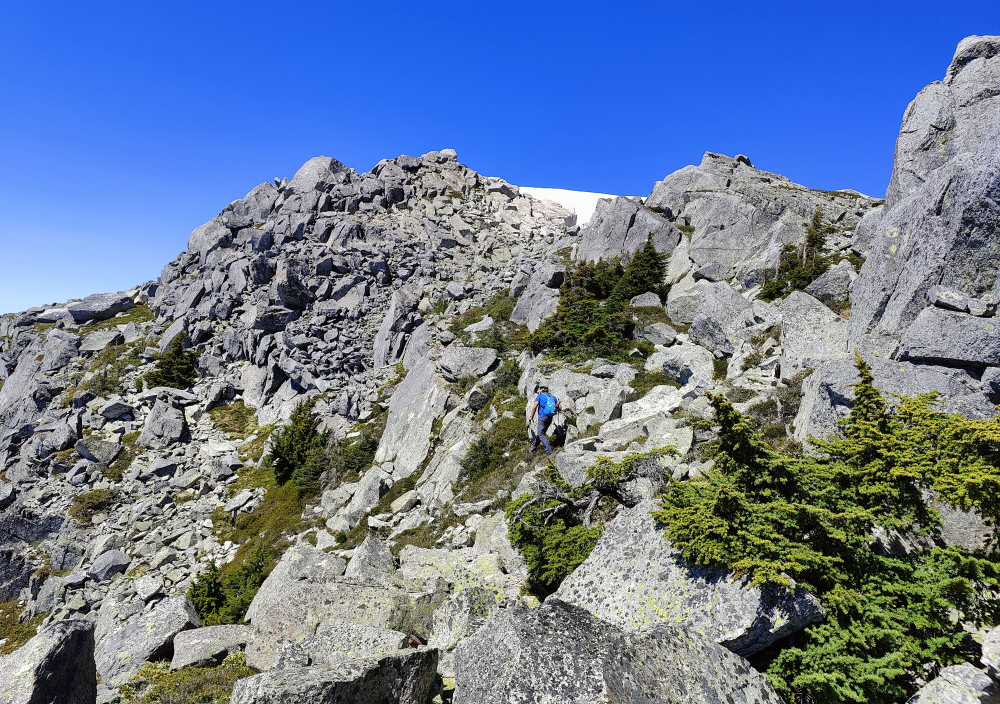
Bit of a late start for us, driving up the now familiar Steep Creek FSR. Right at the one junction and then up as far as my appetite for pin striping allowed, just shy of the upper parking area. Shouldered our packs and started hiking a bit past 11 am. Good trail all the way to the lake and Beeker's Cabin situated near the shore, couple parties already there as we arrived, mostly just hanging out, surprisingly popular place, and even more so upon our return. Followed the shore for a bit before turning up a large open slope below the north spur coming off Steep's WNW Ridge. It was damn hot out already, so our pace slowed considerably. Gained the spur and then on to the main ridge. Easy ramble from there on to the summit proper.
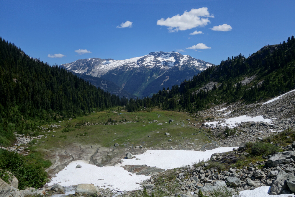
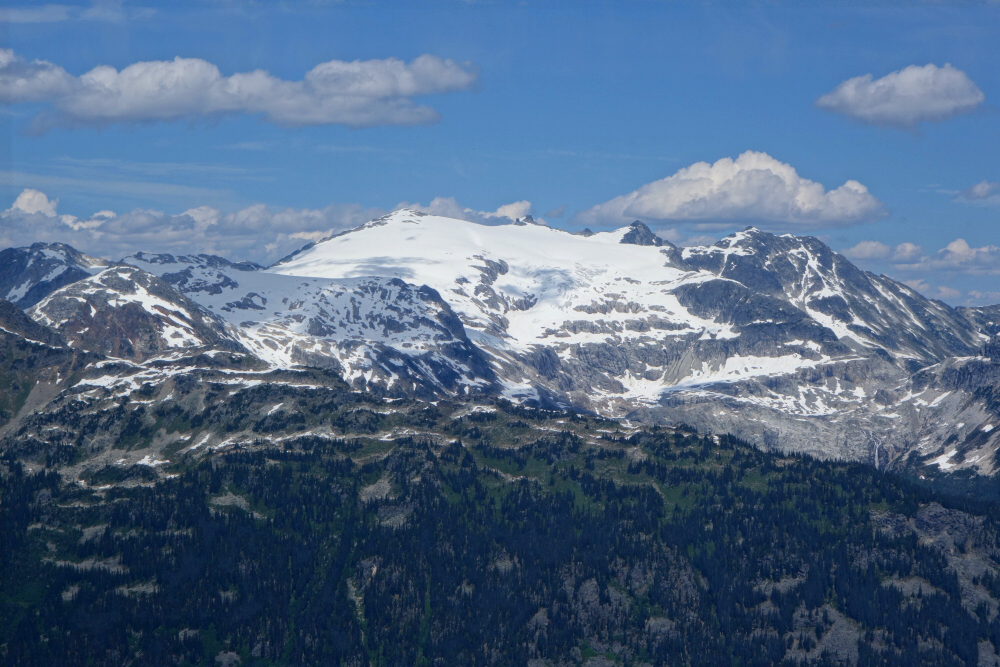
It had taken us a little over three hours to reach the top, leaving time for us to relax and savor the fruits of our labor before pressing on. Despite the haze, we could make out several familiar sights as well as innumerable unfamiliar ones. The view west towards Joffre Group easily stole the show, as it often does in these parts, but what really caught my attention for whatever reason was the view out towards Silent Hub Peak. Caltopo reveals a road branching off the Van Horlick FSR that potentially provides access to a side-valley west of the peak. The utility of this road was later corroborated by reports I managed to dig up indicating the existence of a trail that heads up this valley beyond road's end. Looks like I'd stumbled upon another "low hanging fruit" objective that's ripe for the picking. Who needs a scrambles guidebook for inspiration when all it takes is some imagination and a desire to explore! But anyway, something for another time.
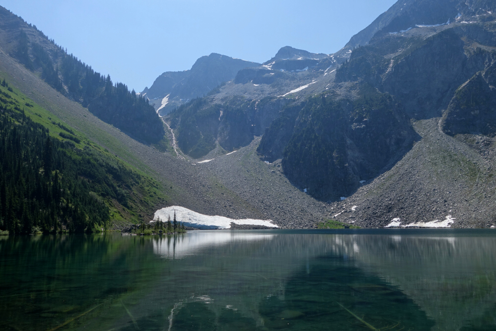
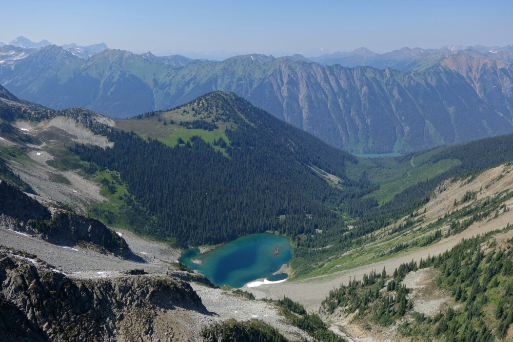
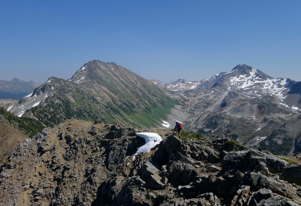
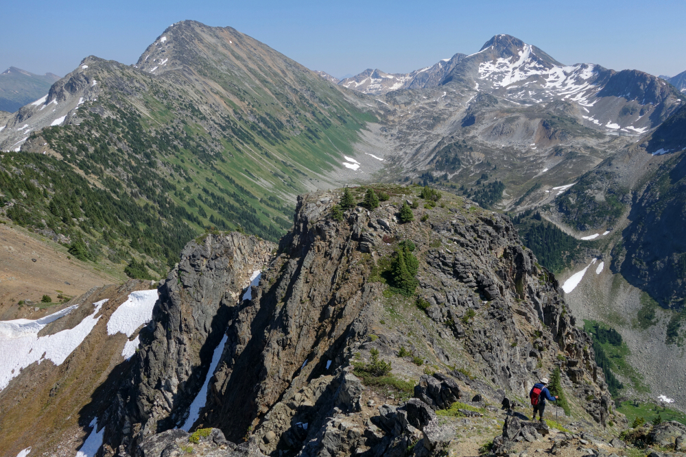
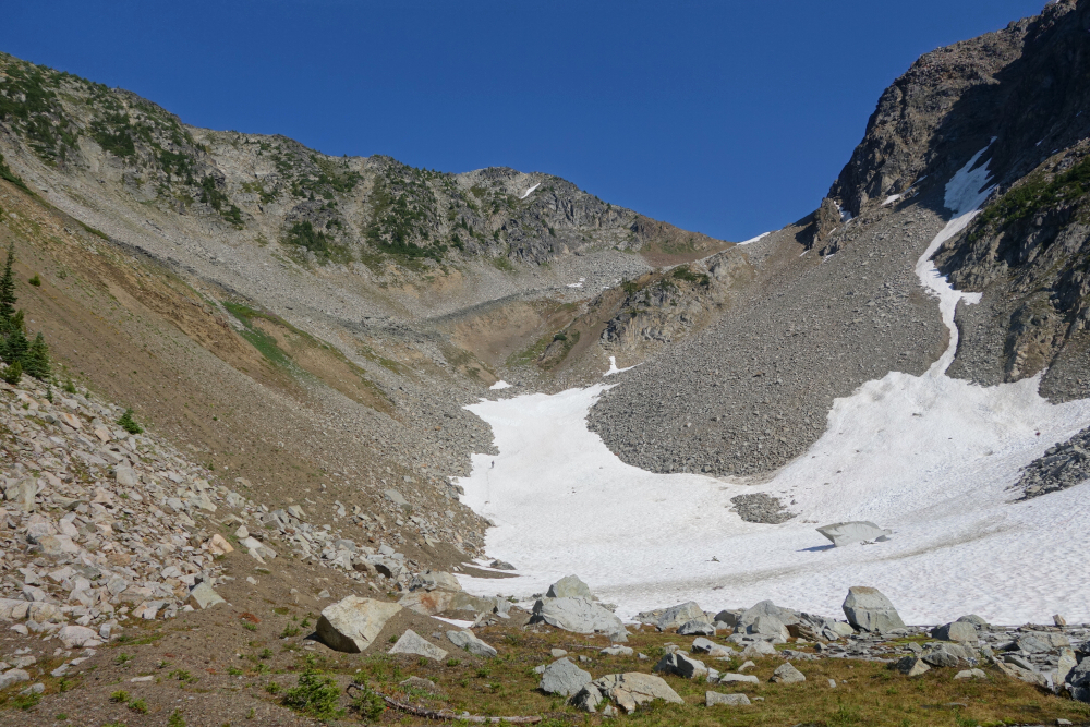
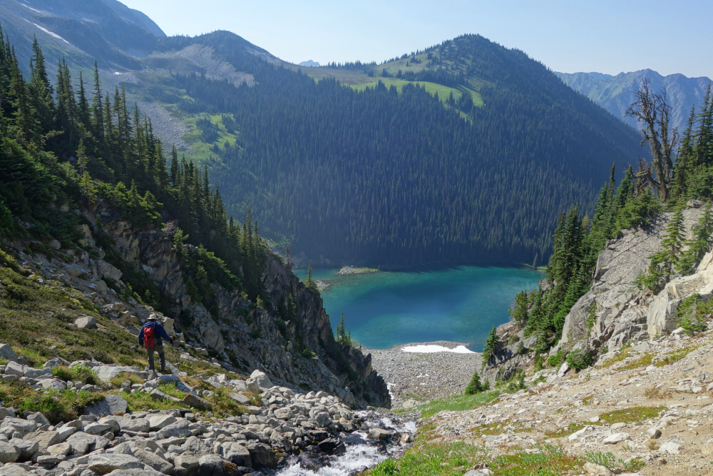
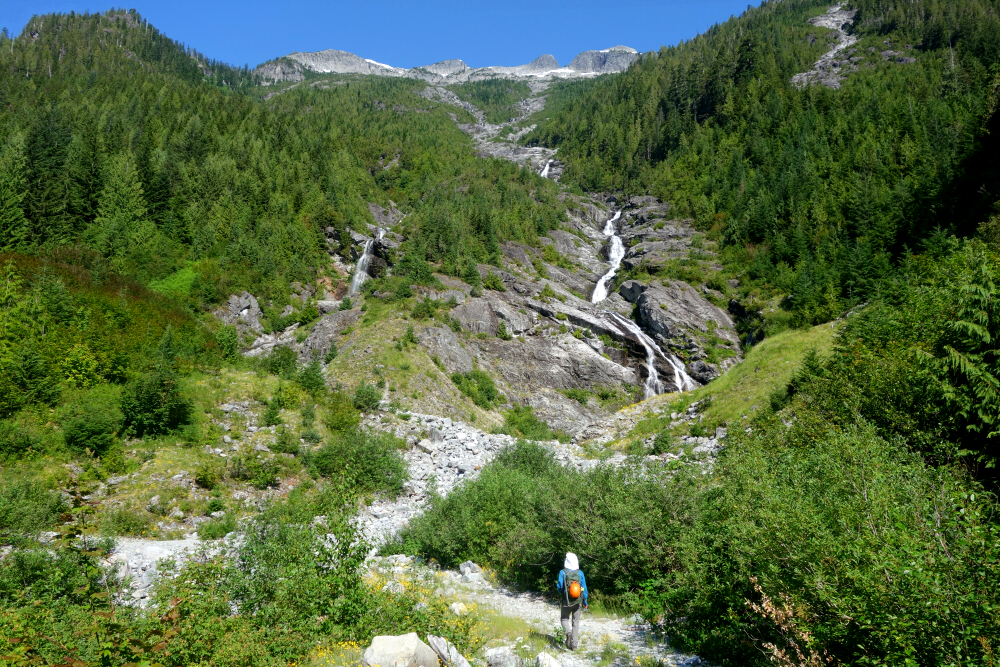
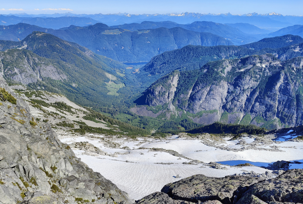
After a nice break, we pried ourselves from our perch on Steep and proceeded along the ridge towards the saddle between Steep and Darkside. Mostly easy going, with just one steeper bit immediately before the saddle that took a bit of route-finding for the best way down. Then back up from the saddle for a somewhat monotonous plod to Darkside, getting there at 4 pm, about 5 hours after starting that morning. Views were better from Steep I'd say. Didn't stick around for long as we had an unknown descent ahead of us not to mention a growing thirst for cold beer. Going with what appeared to be the quickest way down, we descended directly from the summit into the hanging basin between Steep and Darkside. This went well enough but do beware the potential for party-induced rockfall towards the latter half of the descent. Others have reported better travel by backtracking to the saddle and then descending from there, so maybe do that if you prefer not having to dodge basketball-sized boulders bounding down from above.
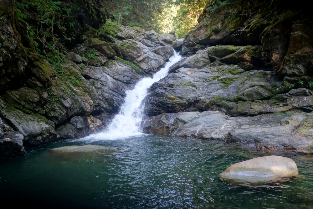
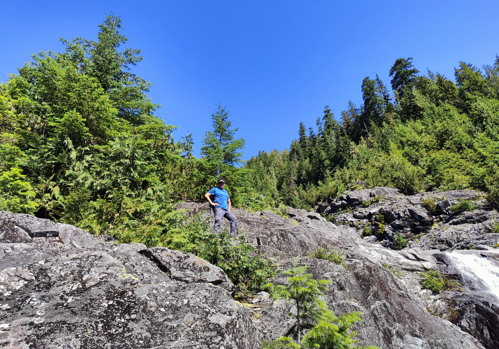
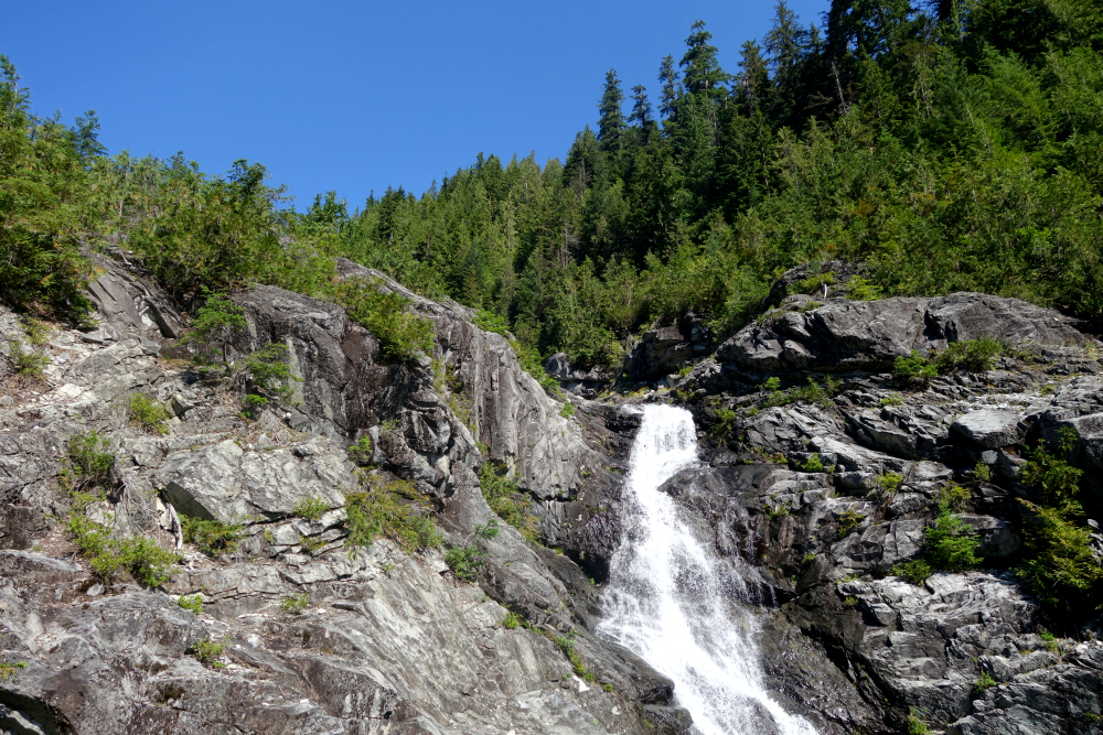
A large patch of snow provided relief from the unstable talus towards the bottom of the basin, which we followed into a steep chute with cascading water down into the Darkside Lake basin. A bit more talus traversing around the left side of the lake and back to the cabin in short order where a merry posse was hanging about and drinking beer. None offered us any, so we cut the chitchat short and continued for the remaining hike back to the truck, encountering still more parties on their way up. As we had ambitious plans for the following day which ultimately didn't materialize, Silvertip I believe it was, we continued the drive to Lillooet then back up north via the Fraser Canyon, finally stopping and setting up a hobo camp near Yale for the night. Unmotivated for anything big the following morning, we went and checked out the 2nd falls at nearby Emory Creek instead before resuming the long drive back home. In summary, the Steep-Darkside circuit truck-to-truck took us 7.5 hours at a relaxed pace and makes for yet another very worthwhile day trip in the Duffey region, and if you don't mind a healthy detour to check out a nice waterfall on the way home, Emory Falls doesn't disappoint!
Torrent Peak - East Route via Rutherford West, July 2024
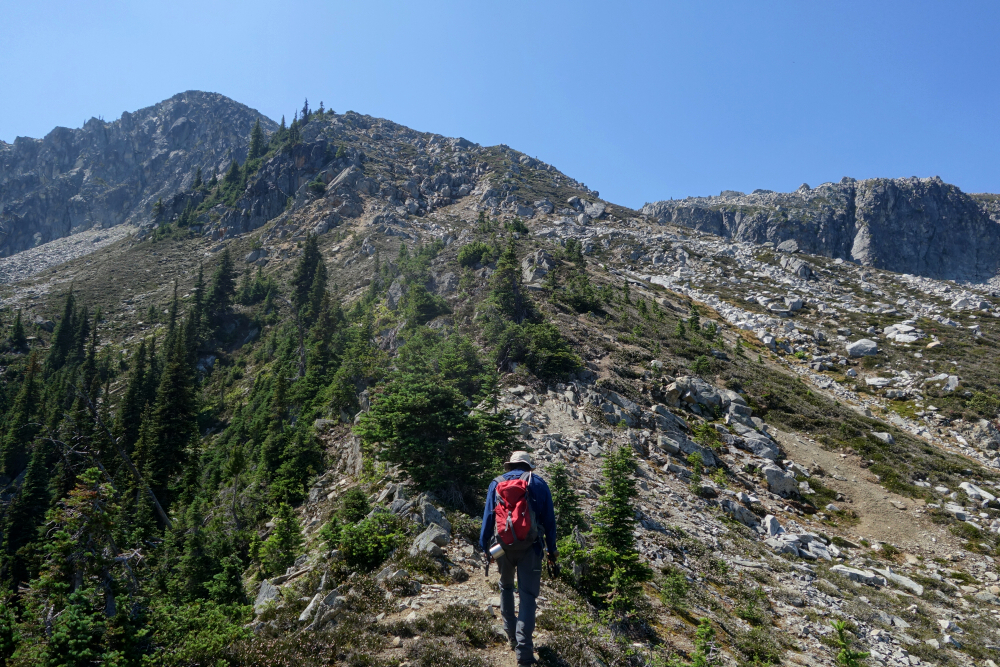
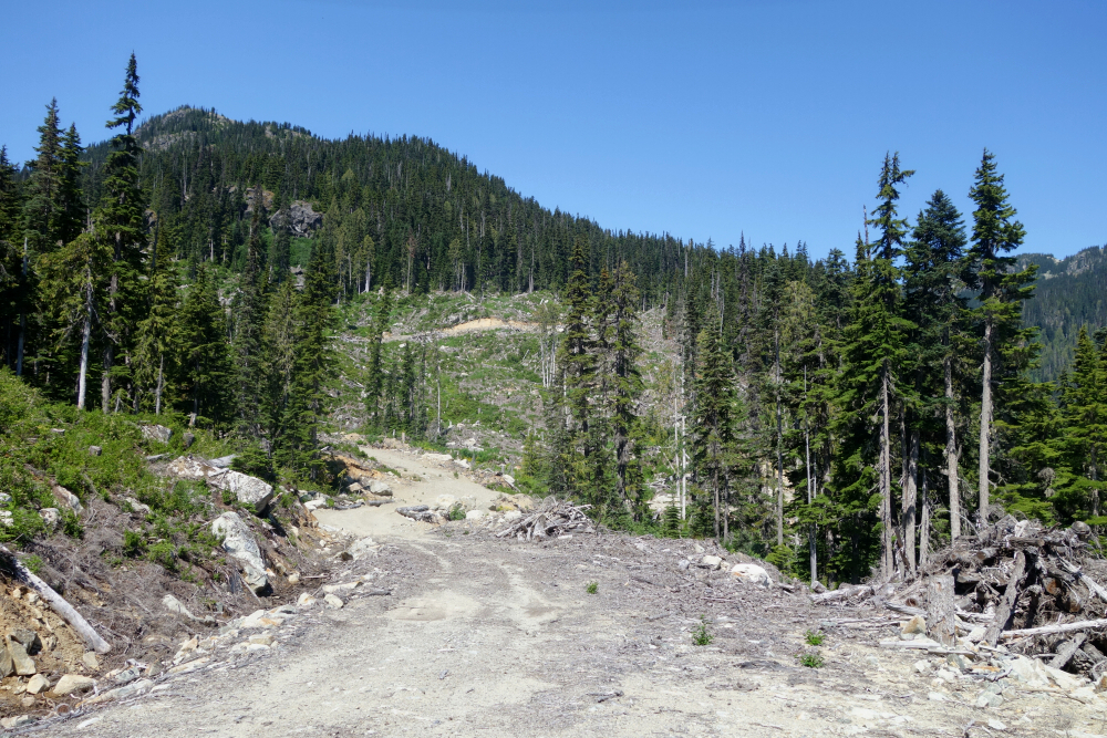
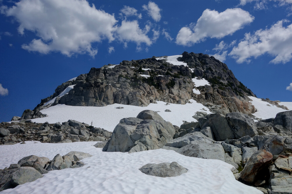
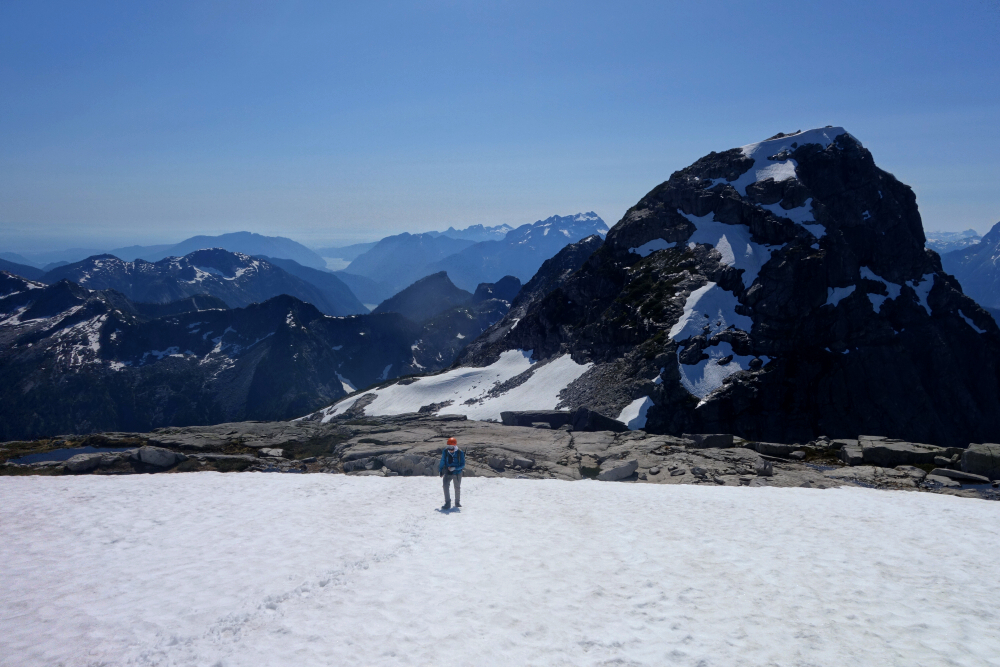
Torrent is a ~6600-foot peak situated on the Rutherford-Soo Divide about 22.5 kilometers as the crow flies from the town of Pemberton. Its relatively diminutive height belies the fact that a fantastic 360-degree panorama can be had from the summit and is the main attraction for most that make the journey to the peak. Good driving access, a relatively short approach and a recently flagged albeit rough but mostly brush-free trail adds to the appeal. With all that in mind and without anything else I could think of in the moment for a relatively chill solo day trip, off I went to bag Torrent!
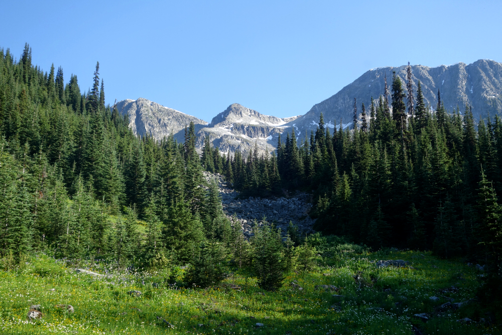
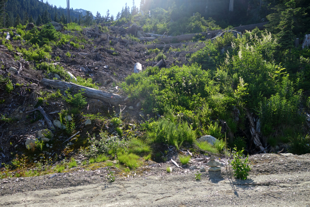
Drove up past Whistler, turning off the highway onto the now familiar Rutherford Forest Service Road (Ipsoot, Rhododendron), and continued straight for some 17 kilometers to the Rutherford West junction. Left here and continued for a short distance, parking right where the RUT47-2 spur branches off to the west. Gathered up my gear and started up the spur for about 2 kilometers before locating the marked start of the trail. I noted a cairn on the side of the road as well as some orange flagging and figured that must be it. The trail enters a cutblock shortly beyond the creek draining Torrent's east basin; the same creek the trail eventually follows up into the alpine.
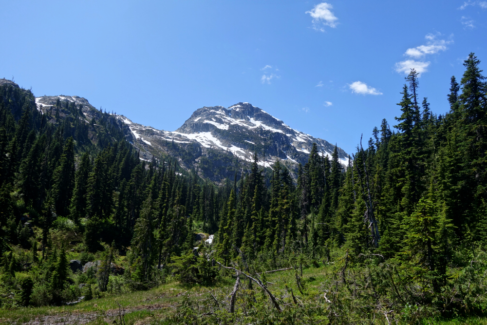
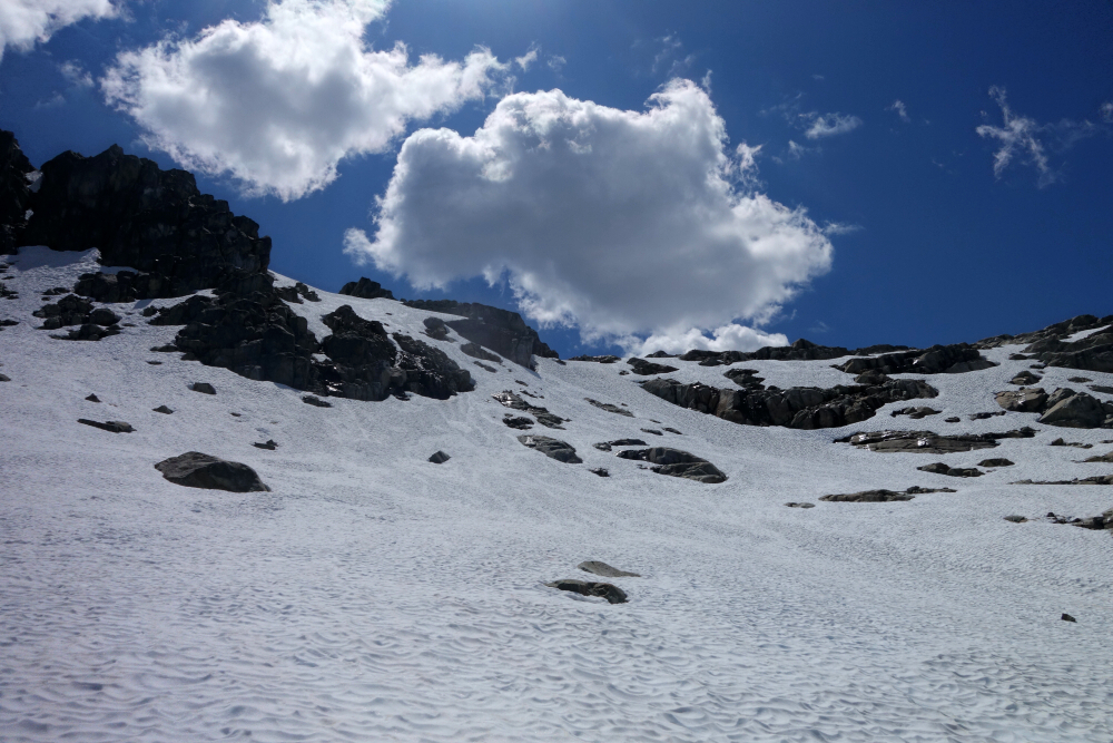
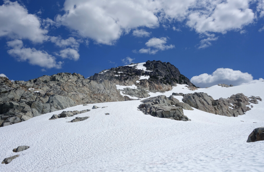
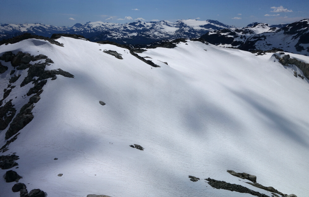
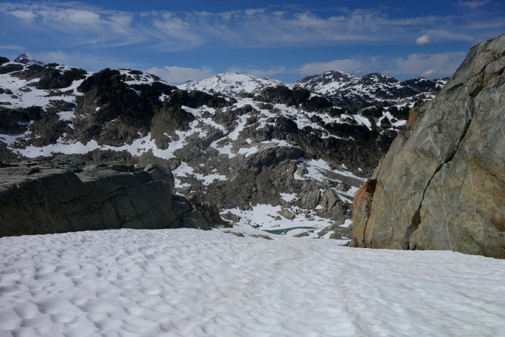
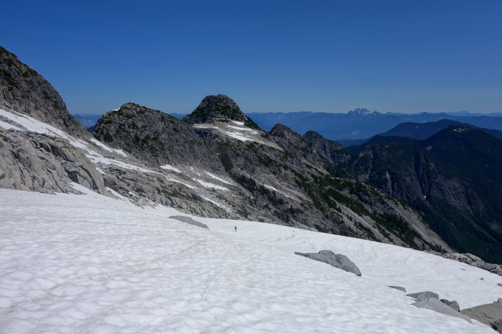
Followed flagging up through the cutblock and then into mature forest. No brush really to speak of save for the occasional blueberry bushes to push through. Flagging very easy to follow. Passed through some boggy areas and open meadow sections and soon thereafter reached the large talus and snow basin below Torrent's North Face. The way ahead is now obvious - up the talus slope towards the saddle above. Talus gave way to snow, which got progressively steeper as I approached the crest. Not wanting to bother with crampons and ice axe, I clambered onto the first rock outcrop I could safely reach, and trending left hopped between adjacent outcrops to reach easier snow above. I then continued up into a large snow basin before hooking sharply left for the final rock and snow scramble to the summit.
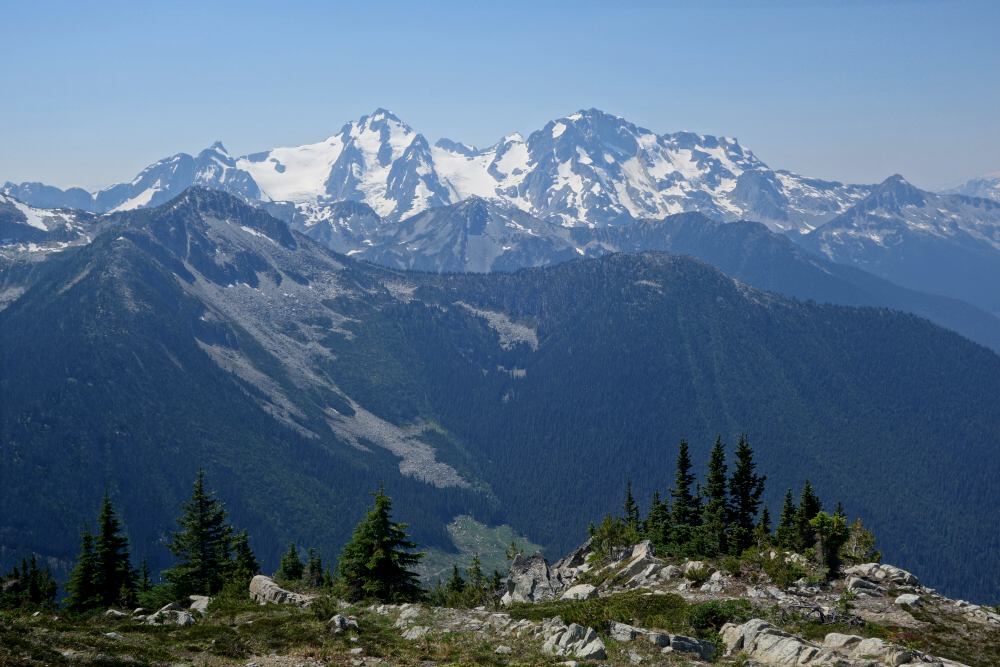
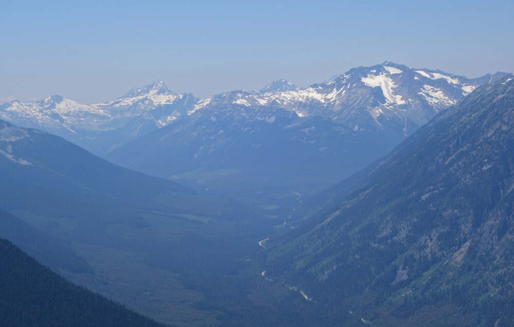
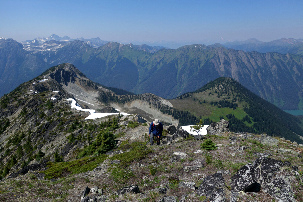
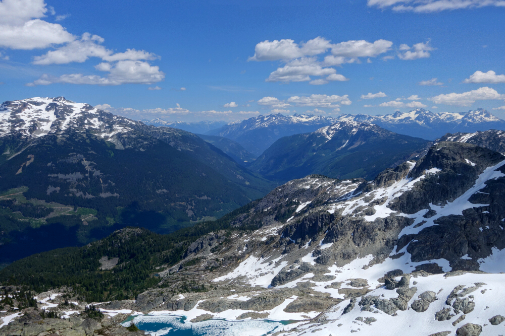
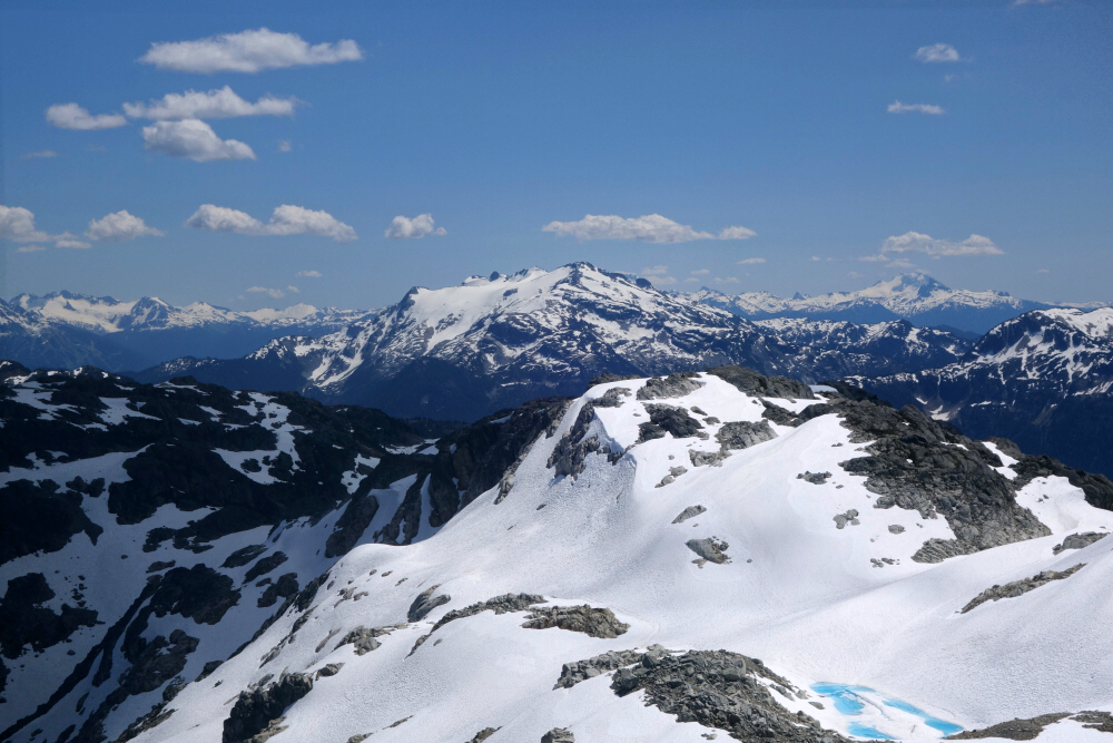
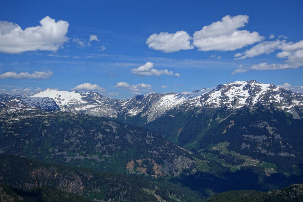
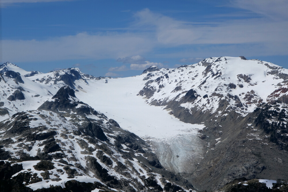
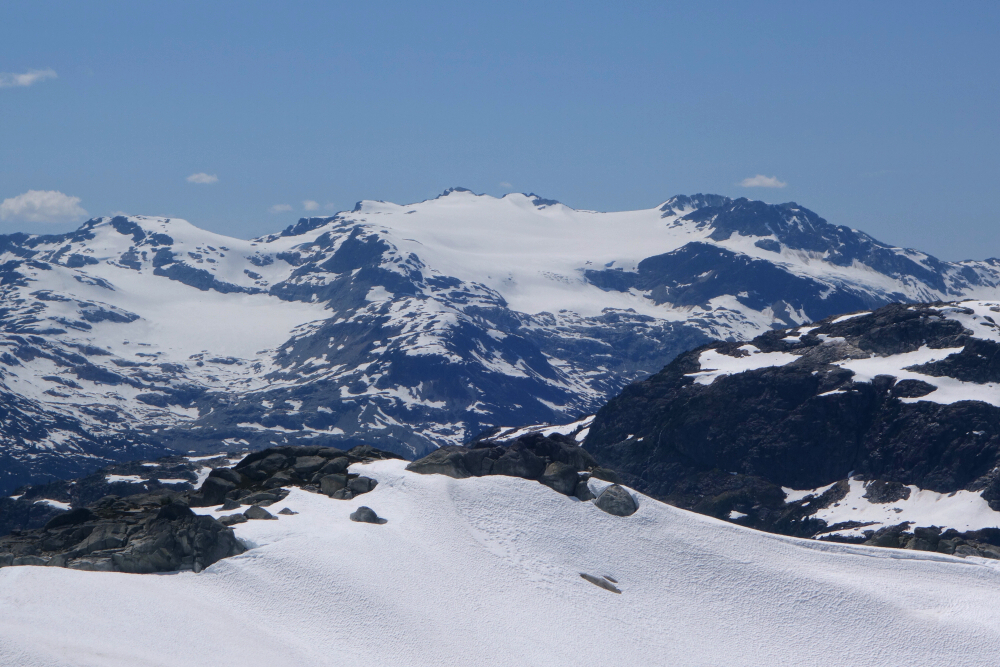
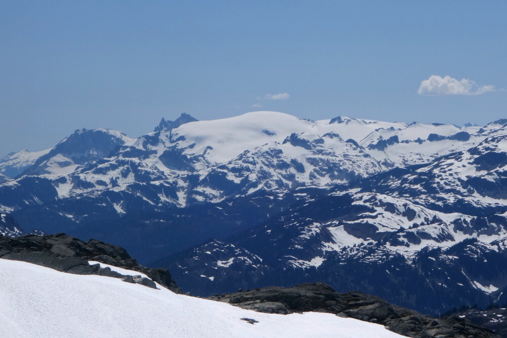
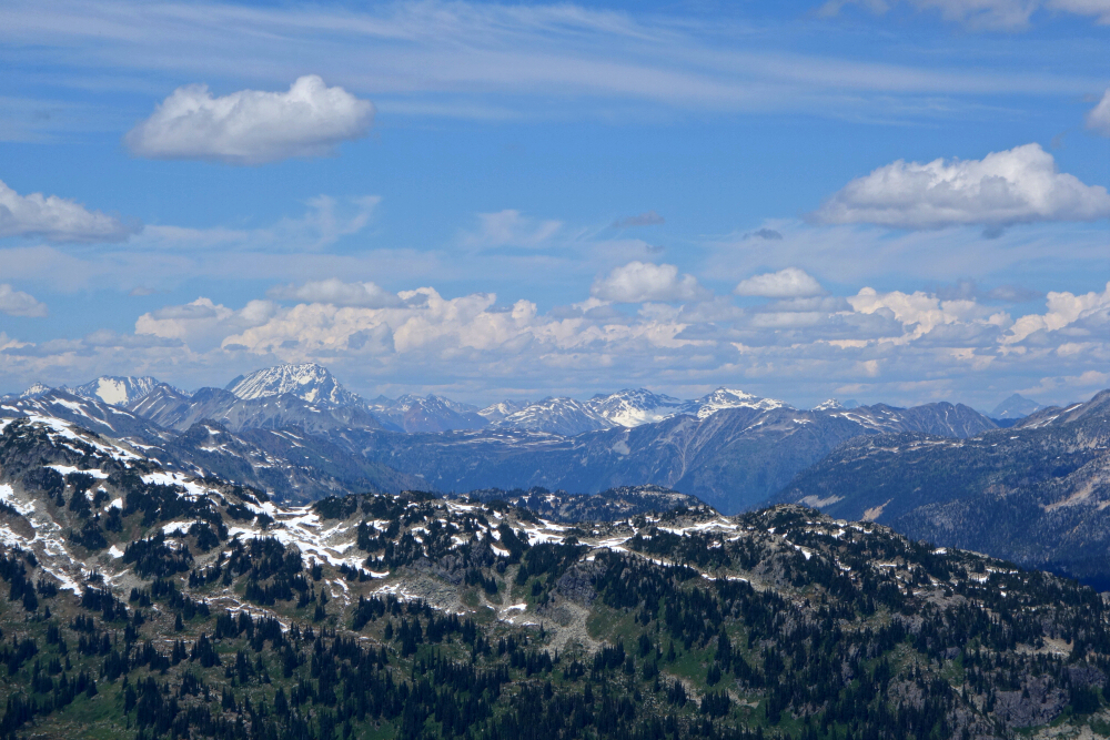
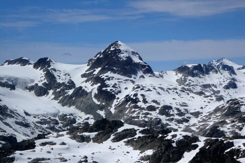
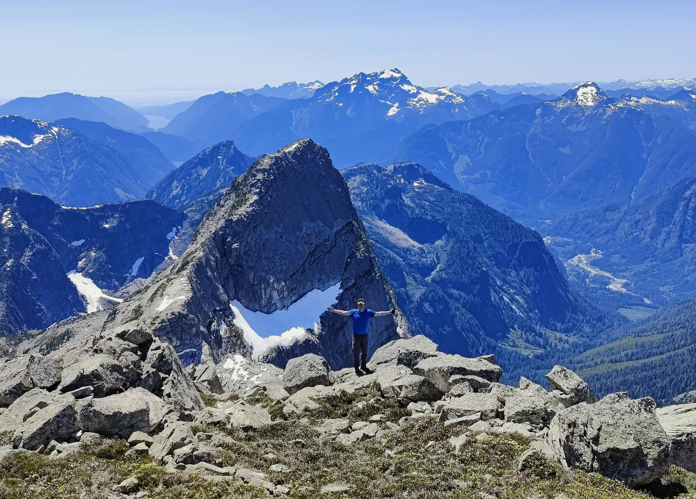
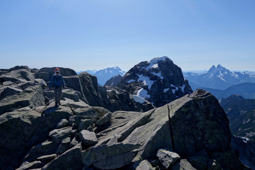
Took me a little over three hours to reach the top, so had time to spare and enjoy the view for a change! And speaking of the view, she be a goodun alright! Lotsa S2S big boys (and some not so big boys) on display - panning clockwise I could make out Currie, Sootip, Weart, Wedge, Overlord, Castle Towers, Mamquam, Rainbow, Garibaldi, Black Tusk, Cayley, Powder, Callaghan, Sisqua, Appa, Sampson, Rhododendron and Ipsoot! Plenty more if I look harder. Also, a neat up-close view of one of the eastern lobes of the Pemberton Icefield draining to the headwaters of the Rutherford. Started back down after about an hour of soaking in the views, mostly returning the way I came, but skipping the rock outcrops this time in favor of plunging down the soft afternoon snow. Back to the truck about half-past five in the afternoon for a satisfying 6.5-ish hour day of gallivanting in my glorious backyard!
Mount Ratney & Mount Bardeen - via Skwellepil Creek Valley, July 2024
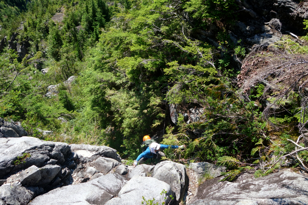
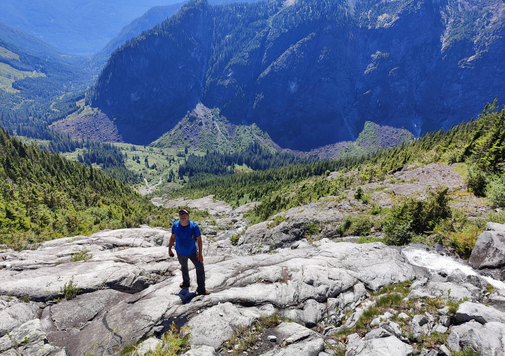
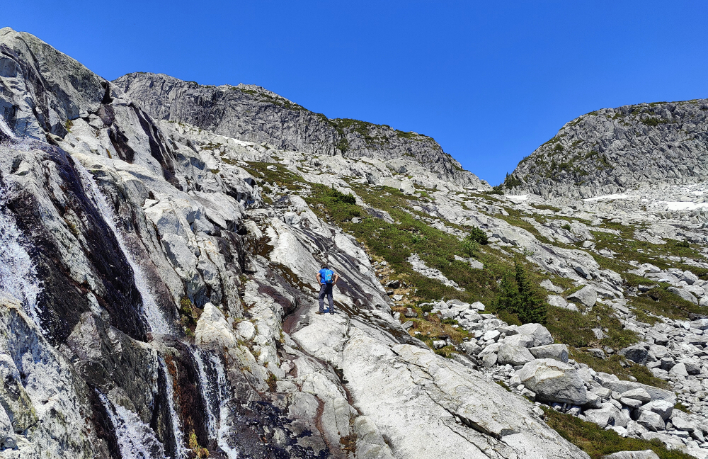
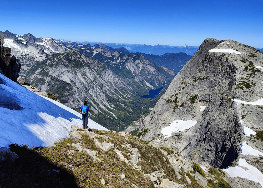
Back to the Chehalis Range, this time for Ratney and Bardeen, a ridge of peaks at the southern end of the range forming the divide between the valley containing scenic Statlu Lake to the north and Skwellepil Creek Valley to the south. The area has seen a surge in popularity in recent years thanks to the popular 4th-low 5th friction slab route on nearby Stonerabbit Peak, the lower of the 3 named summits situated at the western end of the divide. With reportedly good access via the Chehalis Forest Service Road, I wrangled Kevin into joining me on what was to be an unexpectedly long scorcher of day that tested our limits for heat exposure on a largely south-facing rock route.
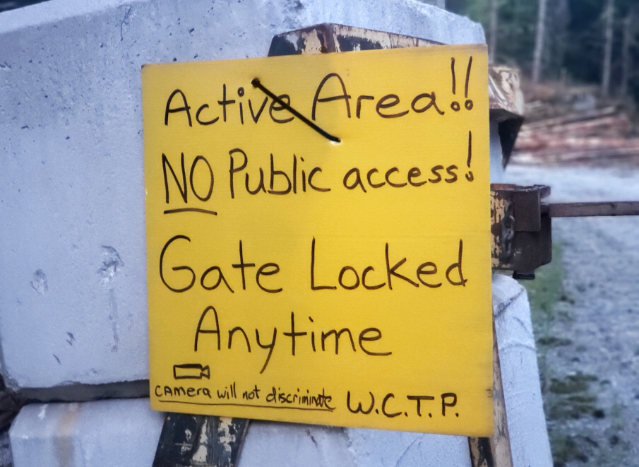
We made good time driving to the community of Harrison Mills, where we turned off the highway onto Morris Valley Road and then hanging a left onto Chehalis FSR which we hoped would faithfully deliver us to the SK100 branch for the remaining several kilometers to the "trailhead". Alas, a locked gate on the Chehalis FSR immediately after the bridge spanning Skwellepil Creek stopped us dead in our tracks and had us contemplating an additional ~7.5 kilometer walk along the road each way. Well shit, we're here now so just suck it up, I guess! Boots on our feet, packs hoisted and off we go at the crack of 8:30 am.
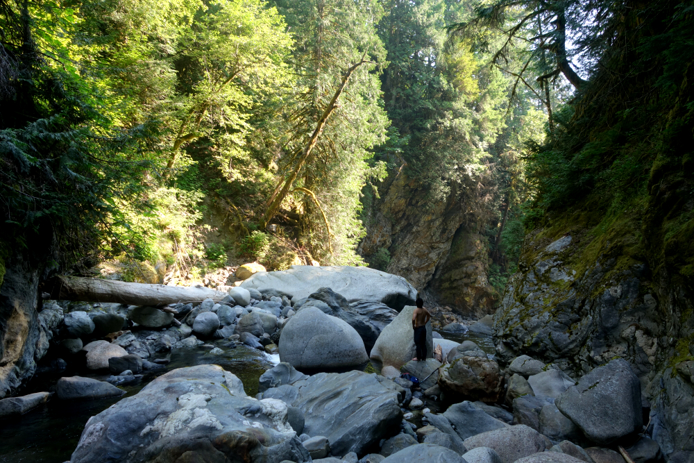
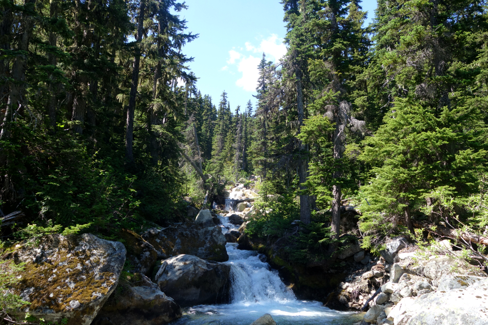
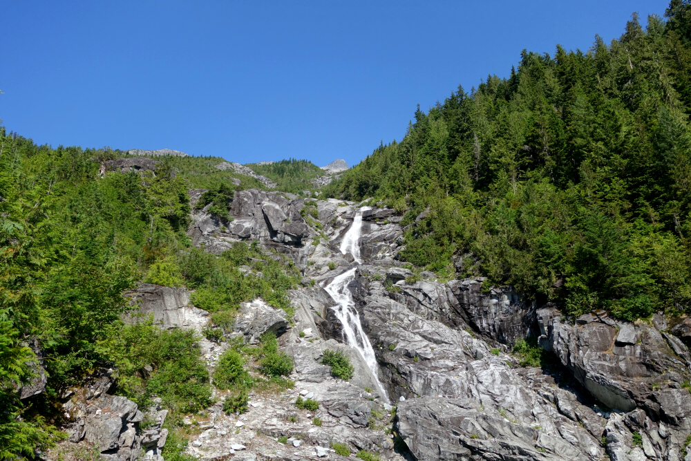
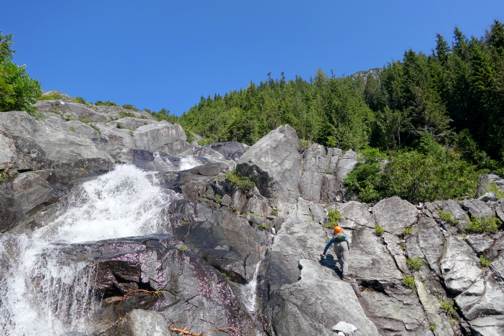
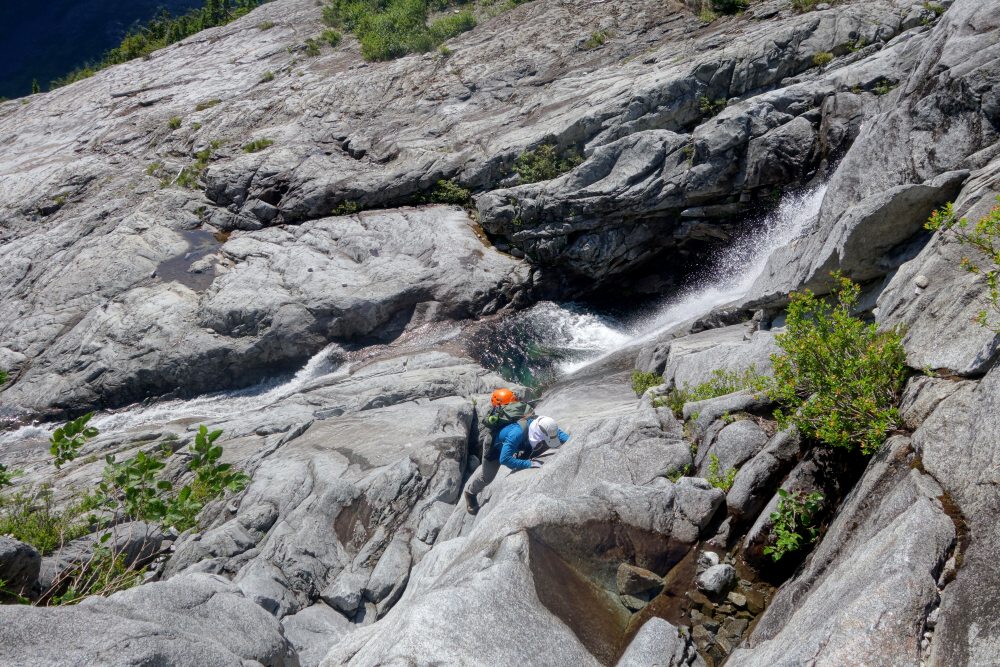
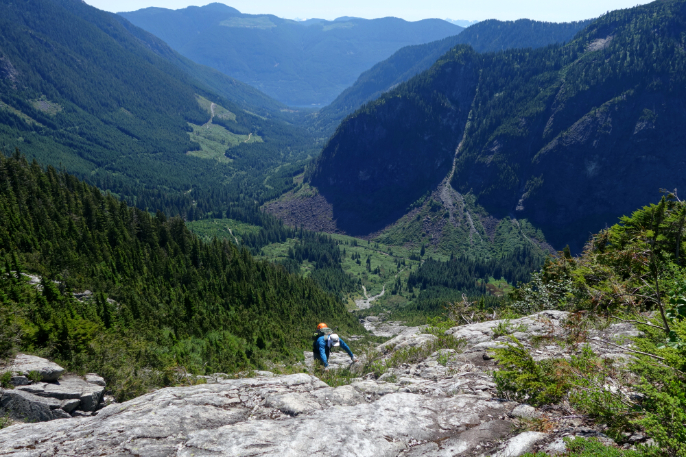
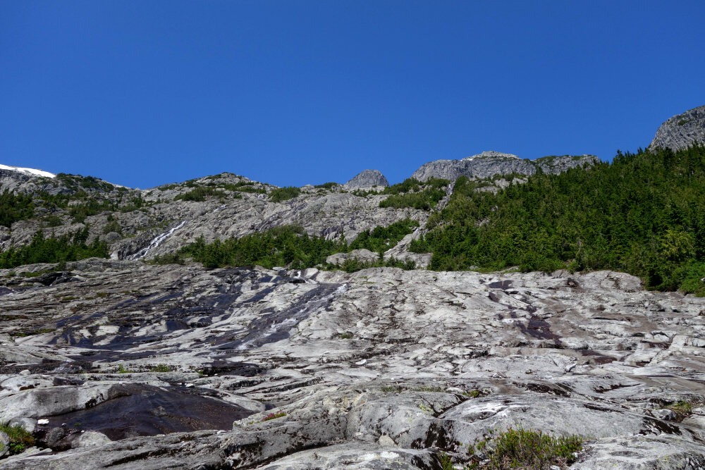
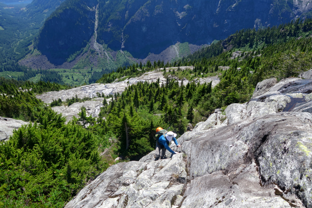
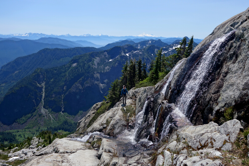
The road hike was uneventful, if not a bit boring but we made it to our turnoff in good time and started up along a faint trail adjacent to a rushing series of cascades flowing down from snow slopes high above. The gist for the next several hours was to proceed up the polished granite slabs generally on the left side of the creek, occasionally crossing over to the right for a bit to avoid brush and whatnot, but then soon crossing back over to the left before proceeding upwards. It was an incredibly scenic climb up with fun scrambling on what can best be described as a granite sidewalk interspersed with countless falls and pools and rushing water throughout! If only it wasn't so damn hot and humid out! Our pace suffered greatly for that but still we persevered and pushed on.
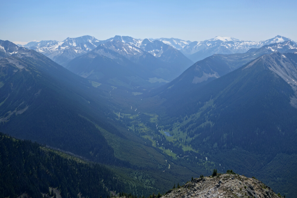
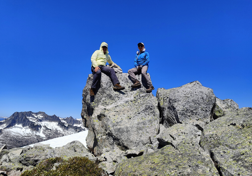
After what seemed like an eternity, we reached the alpine basin between Ratney and Bardeen and gradually veered off to the left aiming for a prominent saddle directly below Ratney's East Ridge. Crossing a large snow slope, we proceeded to the crest of the saddle and continued towards Ratney proper. The East Ridge appears steep and improbable from below, but as is often the case a viable route up became evident the closer we got. We managed to avoid all the steep snow by scrambling up heather and short rock pitches and ramps to finally reach the open summit area. Six gruelling hours to here, ugh! Grand views from up top, particularly looking to the west towards Judge Howay, Robie Ried and lower Winslow Creek Valley near where it merges with the Stave River before draining into Stave Lake. To the north there's of course Mount Clarke, serving as a nagging reminder that I have yet to get up it. Damn you Clarke!
Down from Ratney back to the saddle and then an easy hike over slabs and snow to Bardeen where more of the same views awaited us. Didn't linger as the day was starting to get away from us, so back down we go navigating as best we could back to the watercourse and granite sidewalk we followed on our way up. All was going well until Kevin's phone started acting up and because I didn't bother to record our track, we were left to navigate the old-school way sans GPS and ended up dealing with some short bits of unpleasant cliffy bushwhacking before getting back on course for the remaining scramble back to the road. Once there, it was simply a matter of placing one foot in front of the other in a race against the coming darkness back to the truck. Wasn't till a quarter past nine that our day finally came to an end, yes you read that right - a solid near 13-hour day for a couple of old farts. Uff! Key in the ignition, headlights on and back down the FSR we go, the cold beer never having tasted so good and stoked to finally have these two in the bag!
It would be very much appreciated if you please ask before copying and/or re-publishing content from any part of these pages. To do so, please click here to send a message via feedback form.


