Select from list below to jump to a specific area on this site.
| Latest Posts |
Tuesday, July 22, 2025
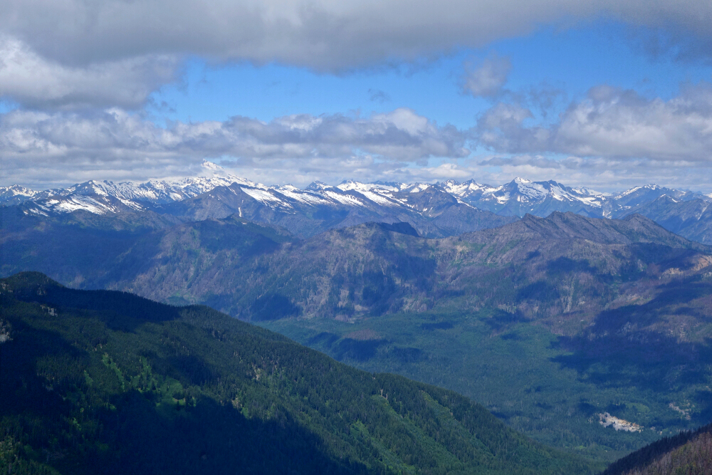
Rock Mountain - Rock Lake Trail, July 2024
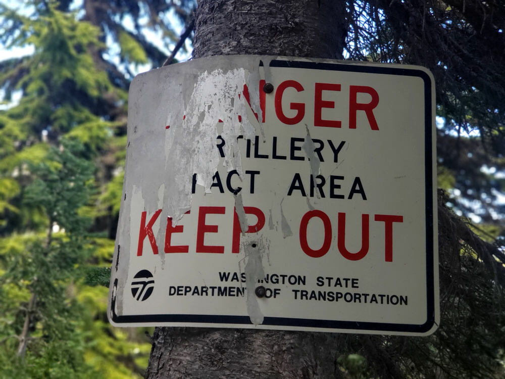
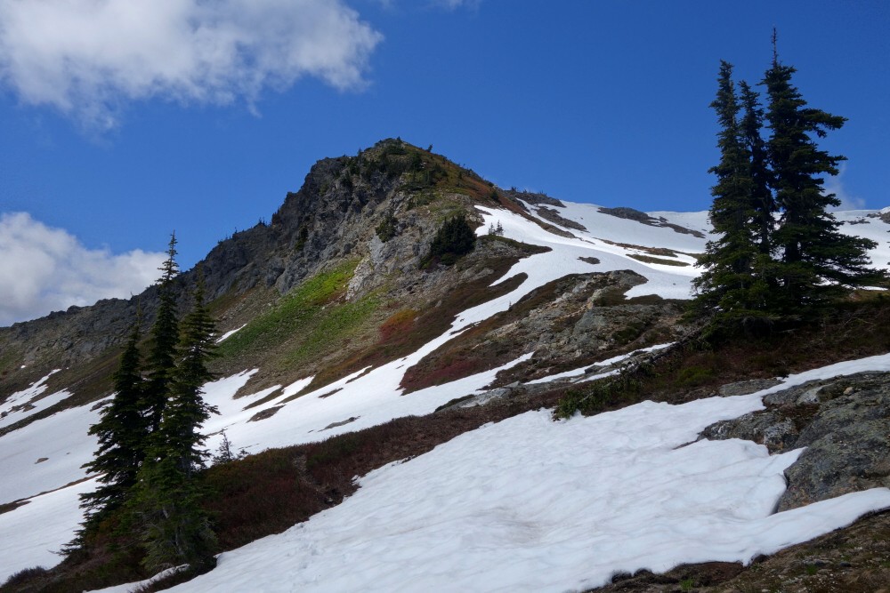
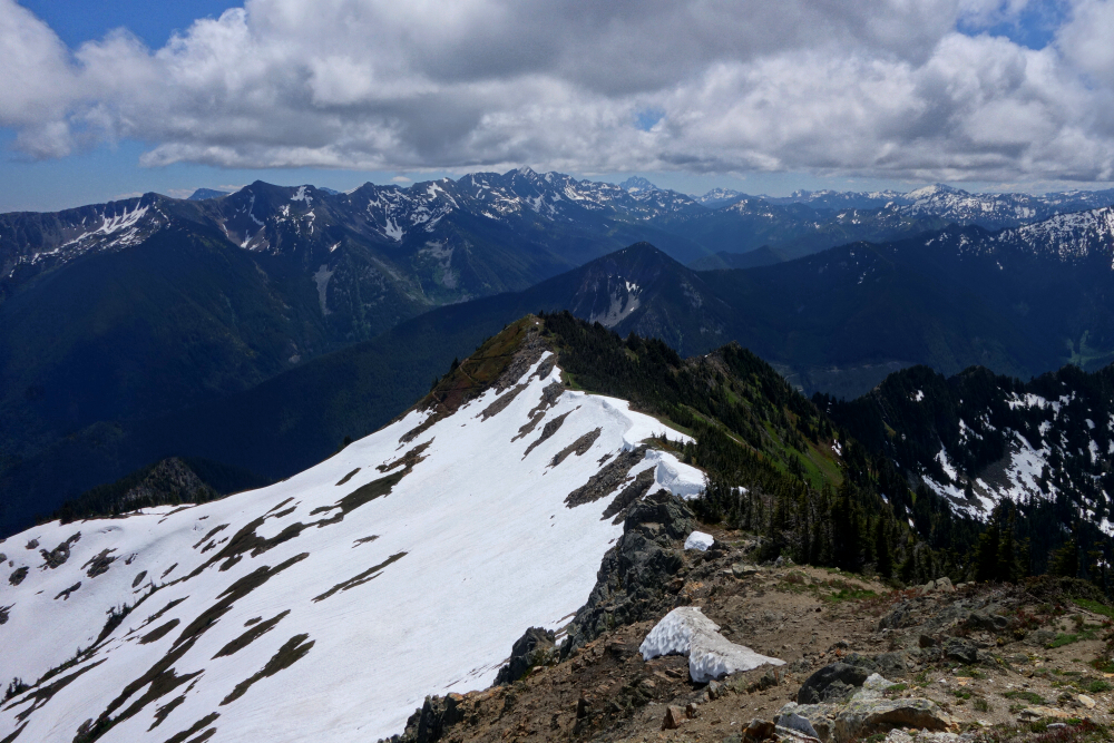
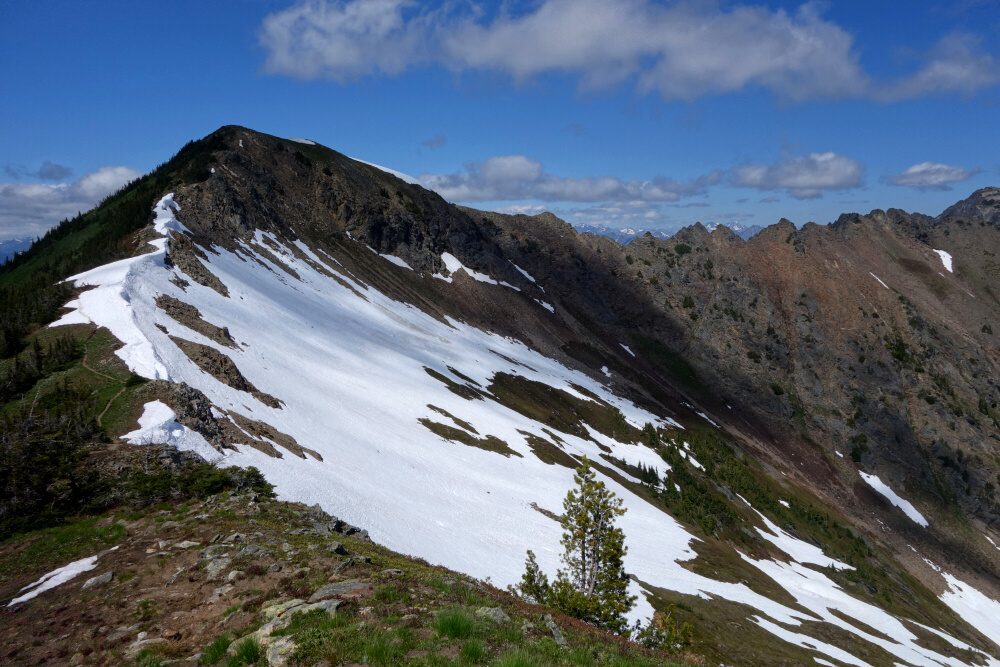
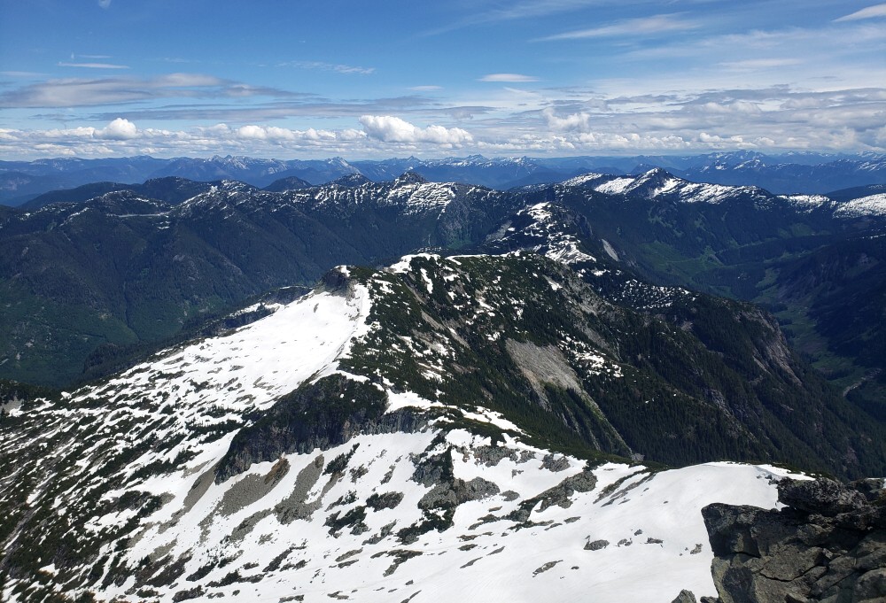
This was the first objective of my week-long mini peakbagging trip through WA last July. Kinda got maxed out with the bushy cross-country approaches and post-holey snow, and was in search of interesting and unclimbed (by me) peaks with great views that also happen to be served by good trails. Accessed directly from Highway 2, about 14 kilometers east of Stevens Pass, Rock Mountain fit the bill perfectly. It would be my second summit on the ~5-kilometer-long alpine ridge flanking the north-side of the Nason Creek Valley, the first being Mount Mastiff which I hiked with my beloved dog Ozzie (RIP) back in 2010. Rock is neither the highest nor the most visually striking of the 3 main summits along said ridge, that distinction going to Mount Howard, but it is nonetheless a fine outing with a relentlessly steep but efficient trail leading up to the peak.
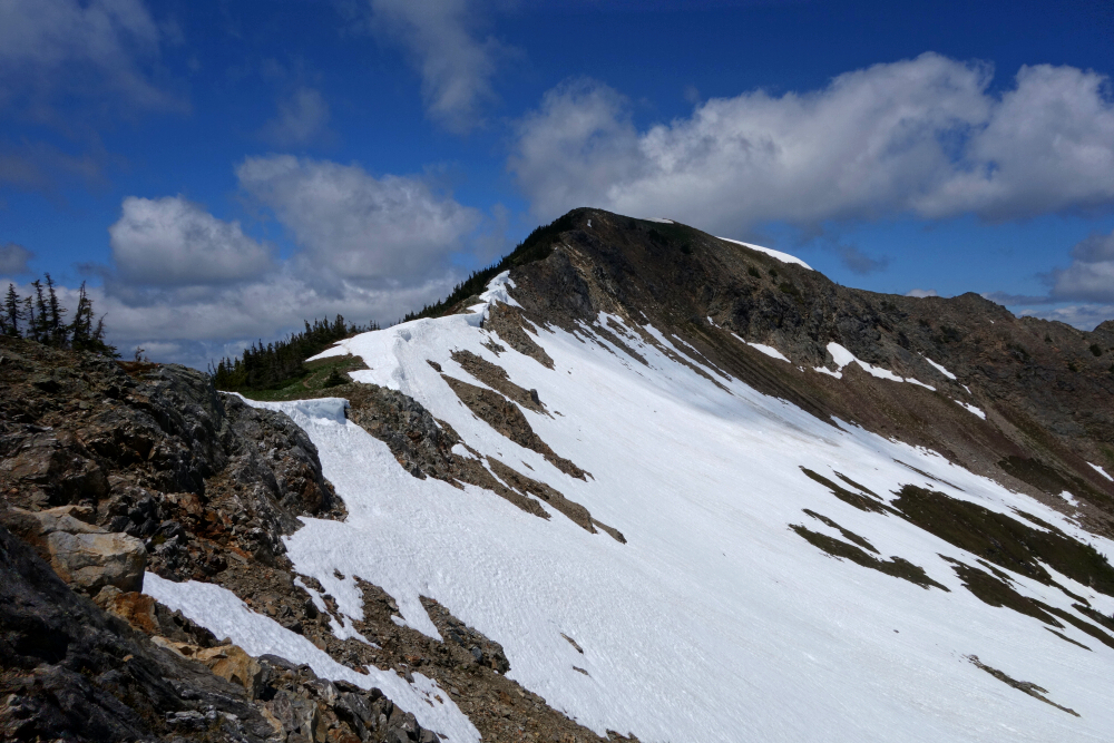
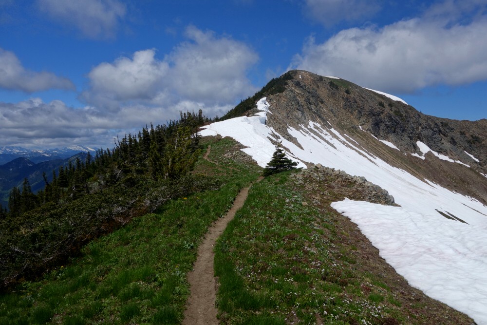
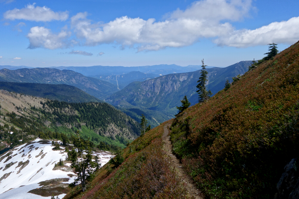
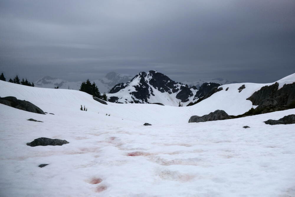
For something different I briefly considered the alternate approach and trail via Rainy and Snowy creeks on the north side but didn't relish the idea of abusing my campervan on the reportedly rough and bushy forest road to get there. No, just the standard grunt up from the highway would do this time. With over 4000 feet to be gained over 7 kilometers, this would be a great warmup for the other peaks on my itinerary anyway. Driving from North Vancouver, it wasn't till about half past 10 am that I started hoofing it up the trail. The ascent is steep, but straightforward, following an endless number of tight switchbacks up the south face/spur. Continued past Peak 5489 along the way, soon reaching treeline with open snow slopes above. Made a left here (right goes down to Rock Lake) and proceeded up the wide eastern spur to gain a large saddle directly below the South Peak. From here it was just a matter of putting one foot in front of the other for the remaining half kilometer to reach the summit.
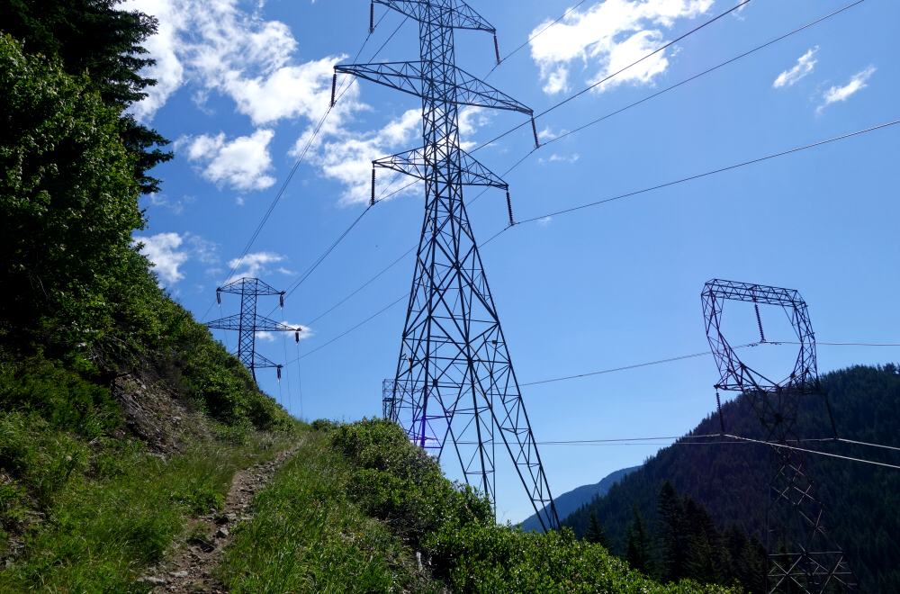
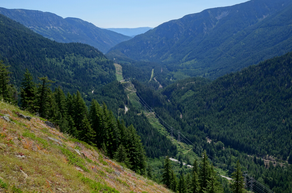
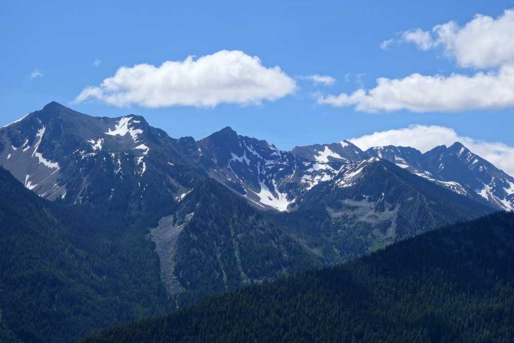
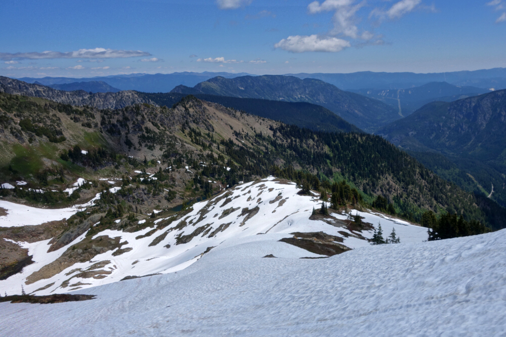
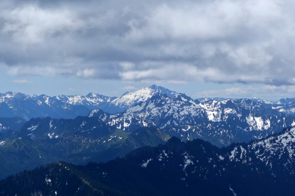
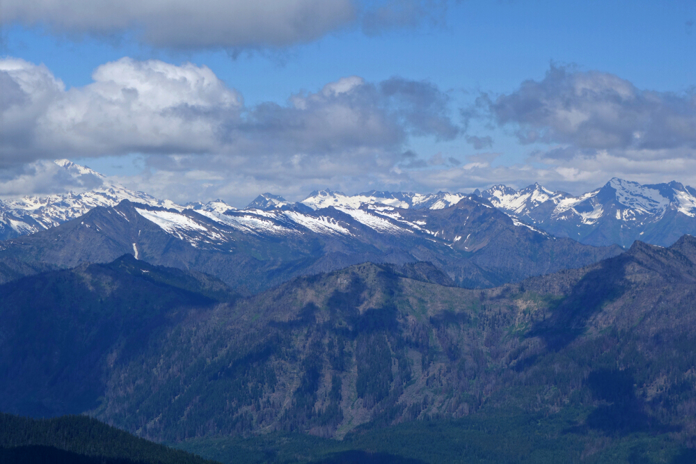
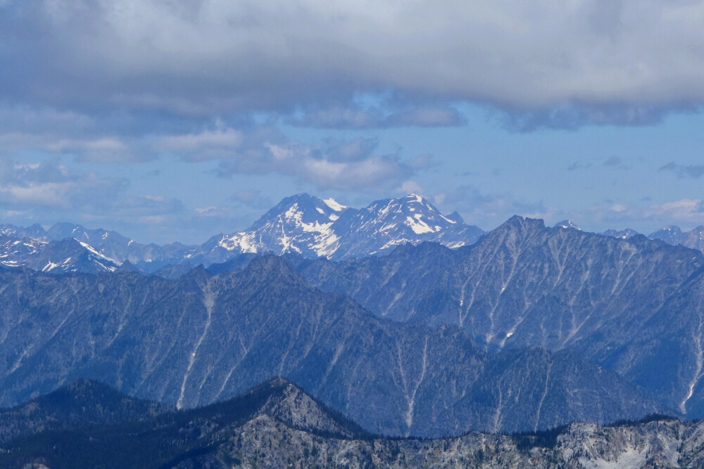
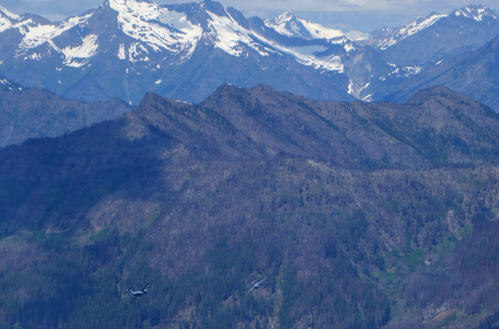
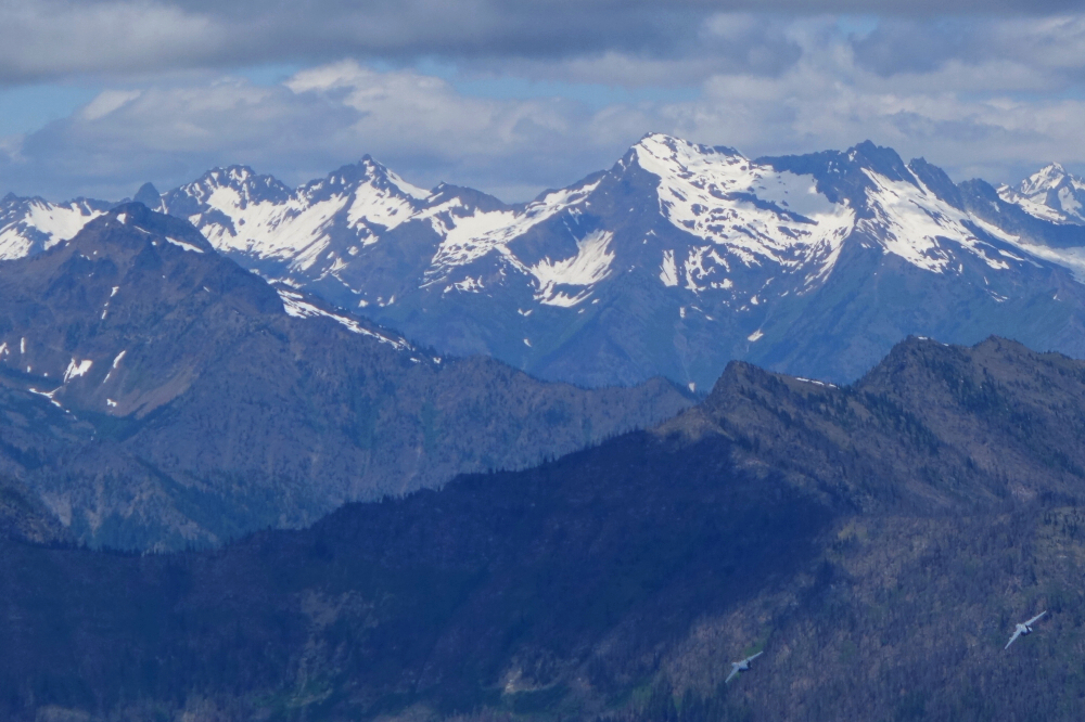
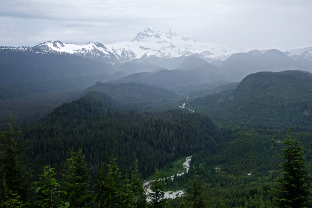
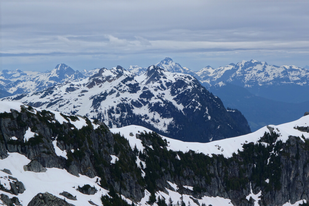
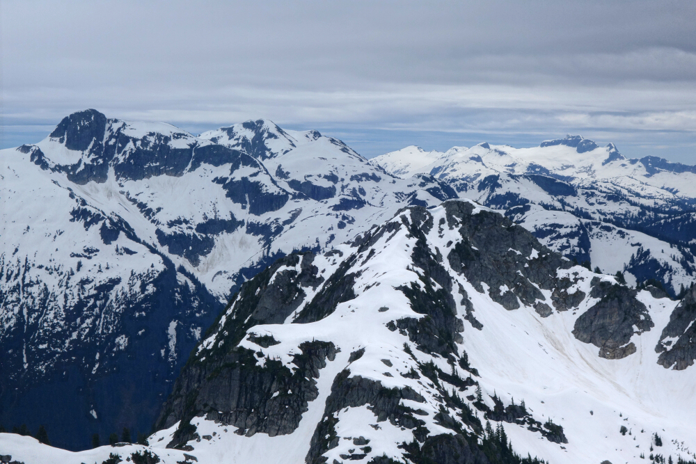
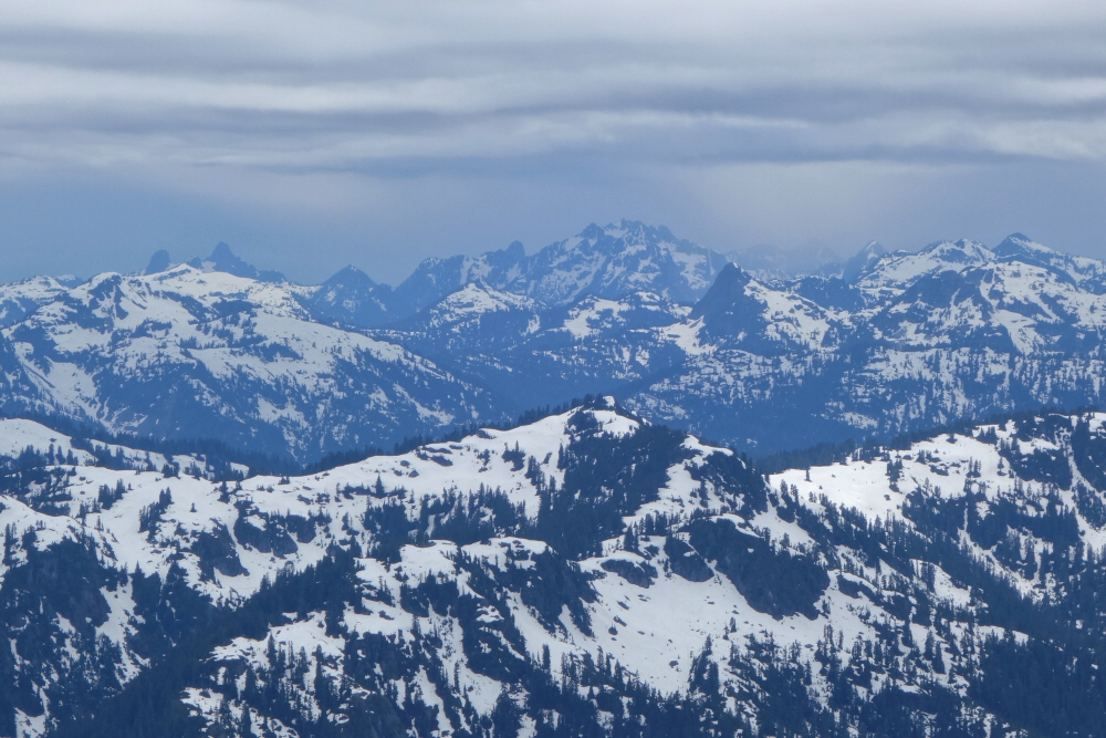
Cool and breezy up top, with clouds slowly beginning to part. Superb 360-degree views starting with the Chiwaukums to the south, Glacier Peak and the Dakobed Range to the north, and Nason Creek Valley winding its way through the mountains to the east. Spent a good hour or more up there, and I'm glad I did for just as I was about to head back down, a pair of C-17's came roaring down the Little Wenatchee River Valley before banking left up the White River Valley, all at an altitude BELOW where I was standing on the summit. Bear in mind that these aren't little fighter jets, but rather full-sized, four-turbine military transport jets, comparable in size to a compact version of the 747! Quite a sight to behold I tell ya. Started down very satisfied with the day and a great start to the remaining adventures planned for the week!
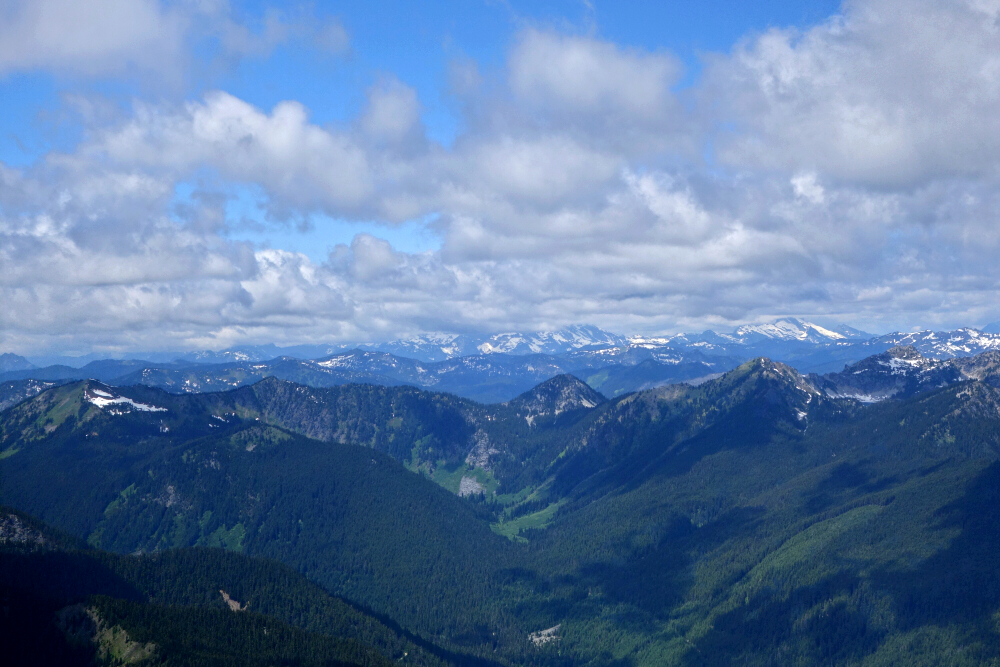
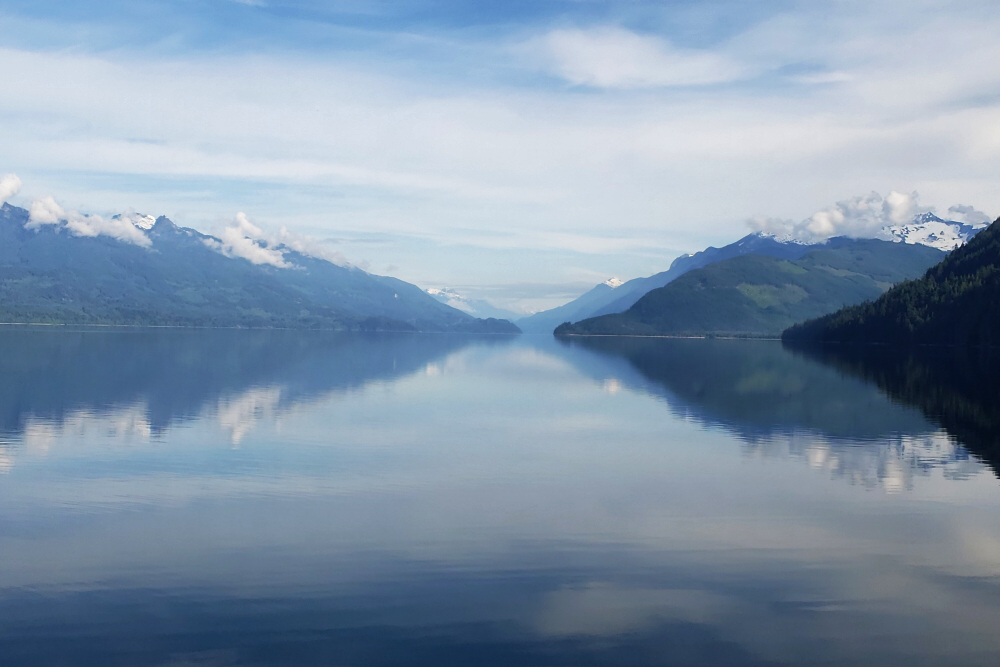
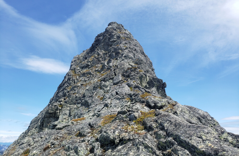
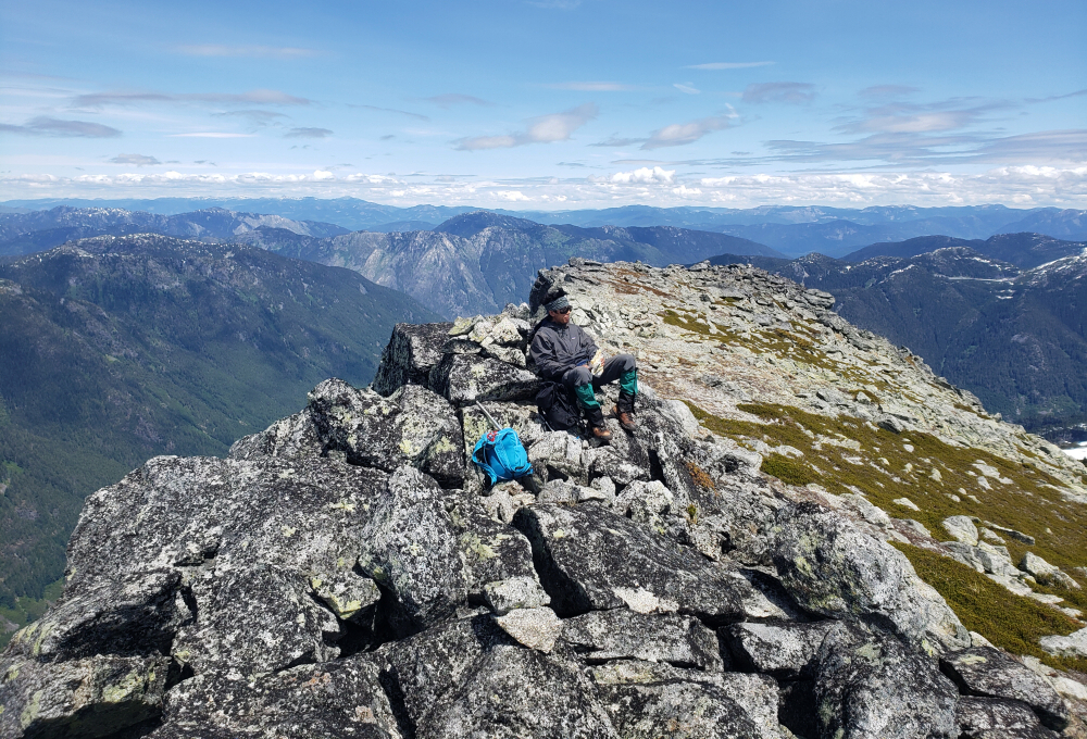
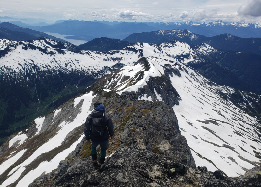
With recent reports of improved FSR access thanks to previously locked gates being left open, Wes and I seized the opportunity to finally tag Mount Urquhart. It is an attractive peak, appearing from most angles as a thumb of rock protruding from the forested hills that surround it. For those driving eastbound on Rte. 1 near Chilliwack on a clear day, its unmistakable summit horn can easily be spotted far to the NNE. Situated in the swath of mountains bound by Harrison Lake to the west and the Fraser Canyon to the east, this is an area where, save for Slollicum Peak, I have made little inroads so far. With this and a subsequent trip to the Old Settler, I was committed to once and for all changing that!
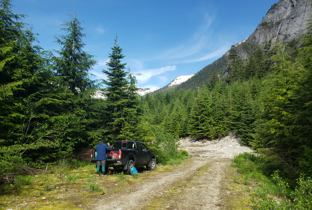
Considering the longish drive, we left town the afternoon prior with the intention of making a car camp at one of the numerous rec sites along the Harrison East FSR. Finally called it a night at the Cascade Peninsula Rec Site, making an impromptu spot of our own as all the sites were taken and it was getting close to being dark out. Nobody seemed to mind, so at least we had that going for us. I generally just pitch my tent in the truck bed, so if the parking spot is reasonably level I'm good. Wes on the other hand made do with a flat piece of ground on the trail leading to the outhouse. Good thing he's not the fussy type!
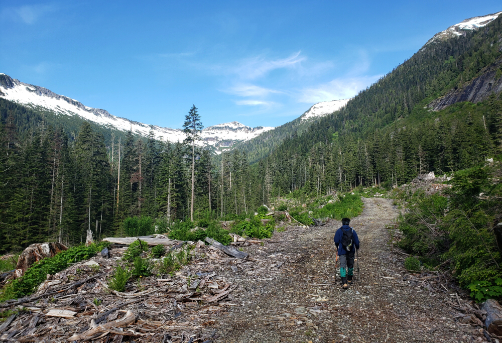
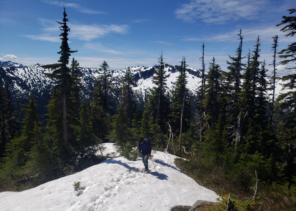
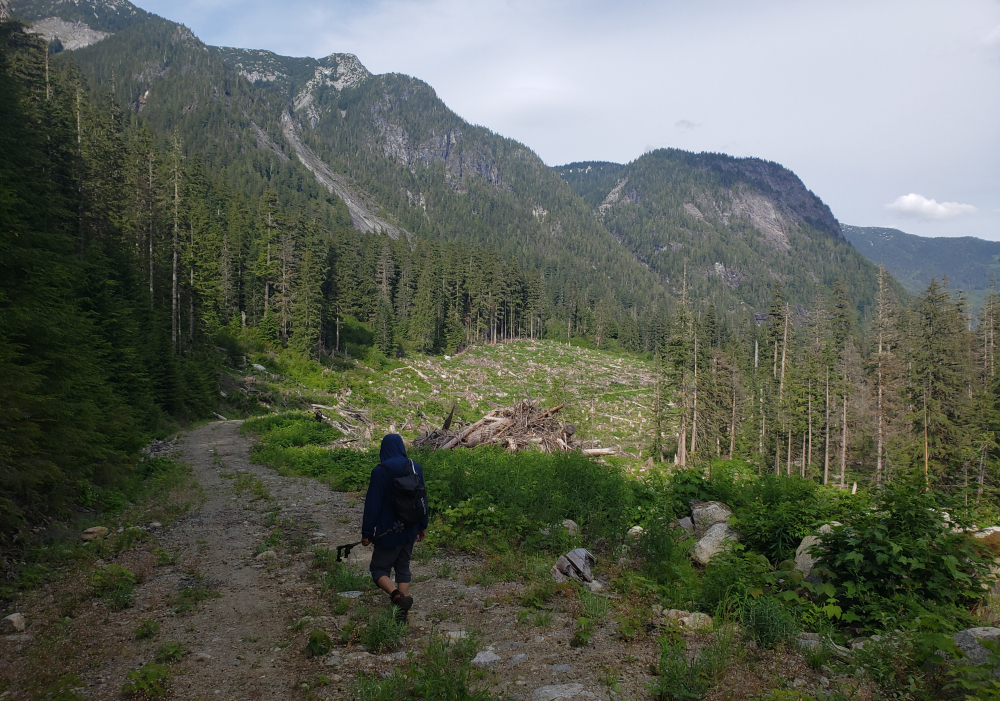
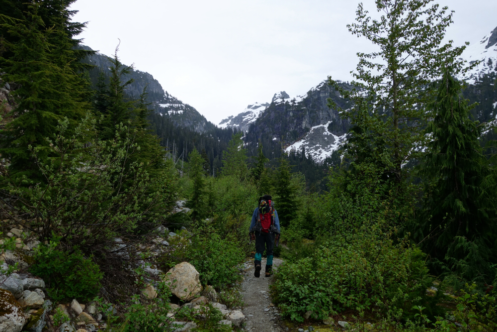
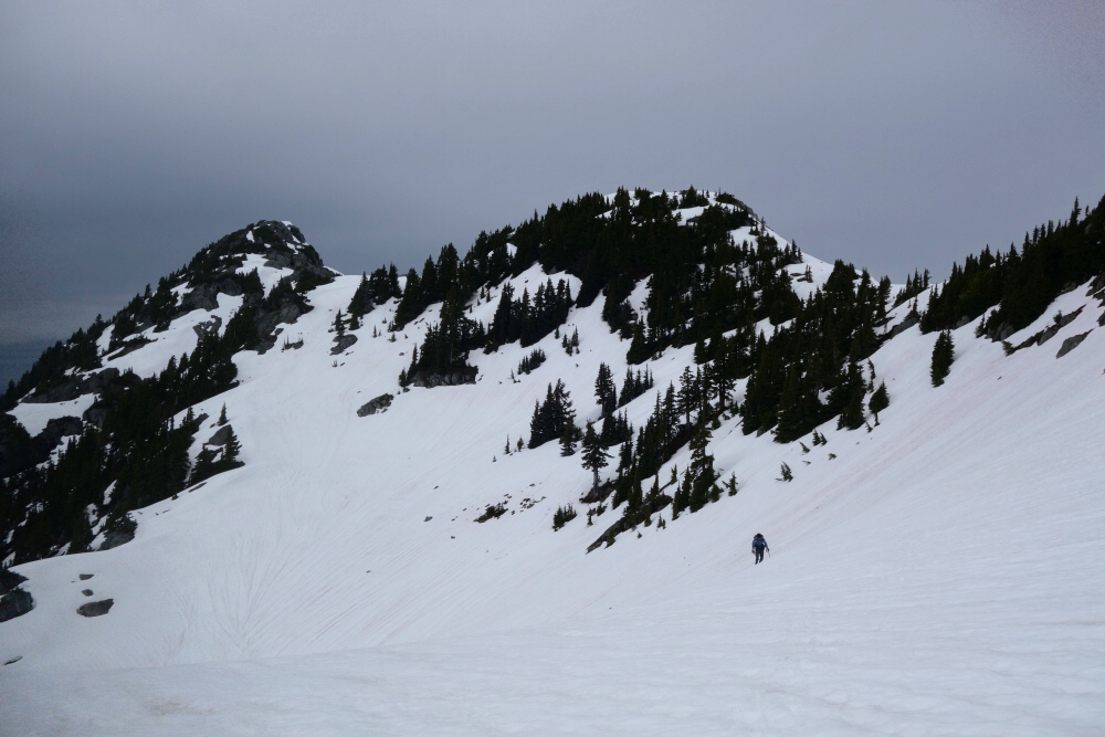
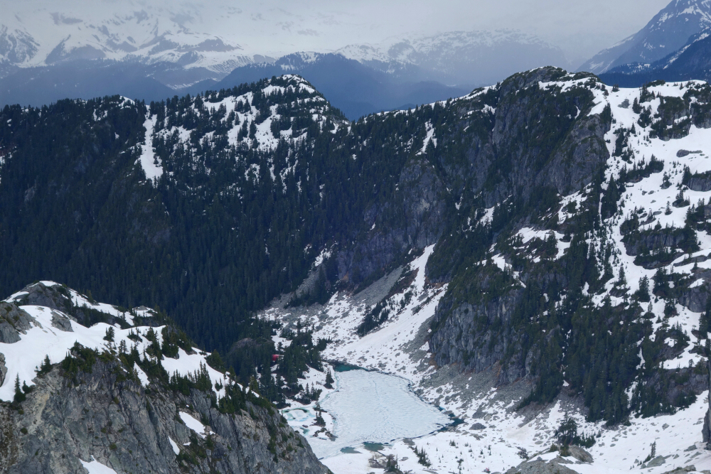
Up and at 'em first thing the next morning, completing the annoying pothole-ridden drive over the bridge spanning Cogburn Creek before hanging a left and proceeding along Cogburn FSR for some 14 kilometers to the BR2500 junction. Left here and continued to a final junction (BR2510) where we made a left once again and drove a kilometer or so before stopping. Parked right before a washout I could have easily driven over, but we were close to our peak by this point, and I saw no need to abuse my truck any further. Geared up and started hoofing up the road the remaining ~1.5 kilometers before diving off into the forest.
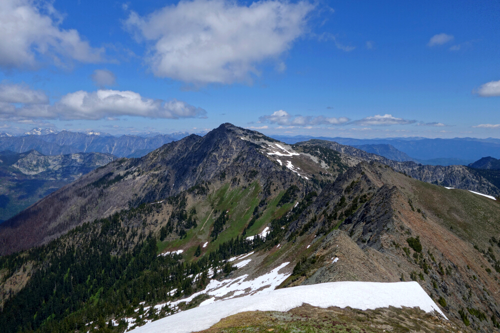
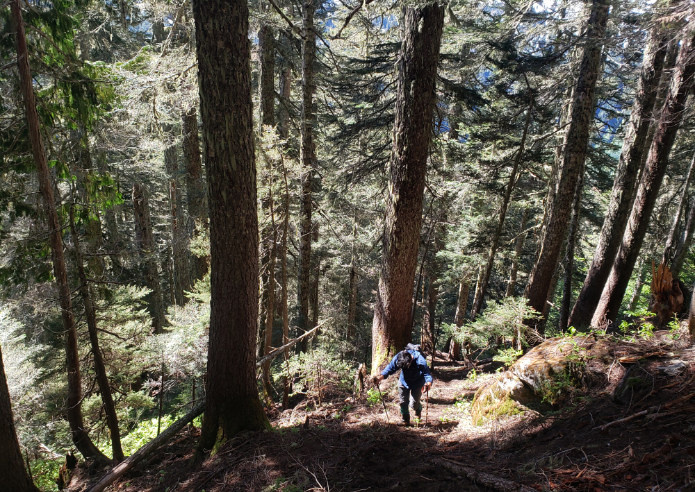
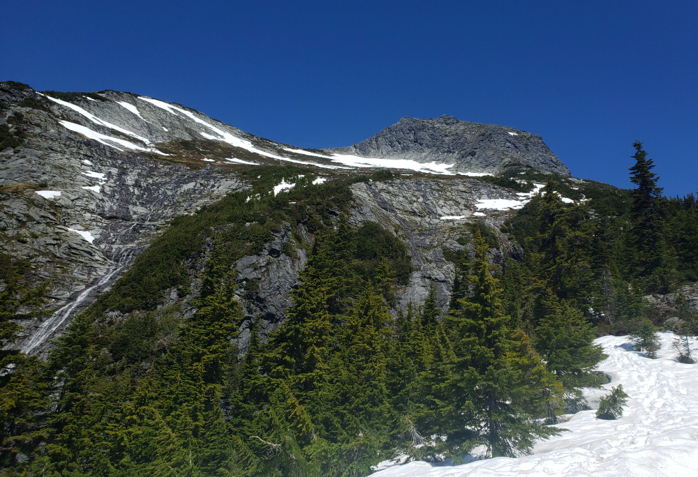
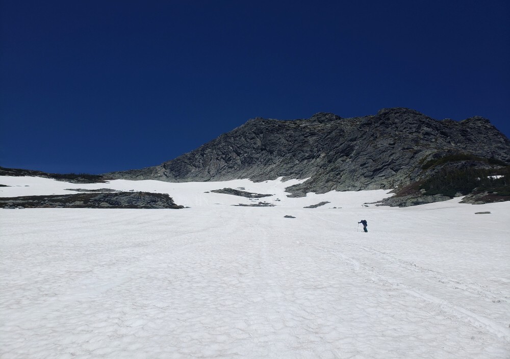
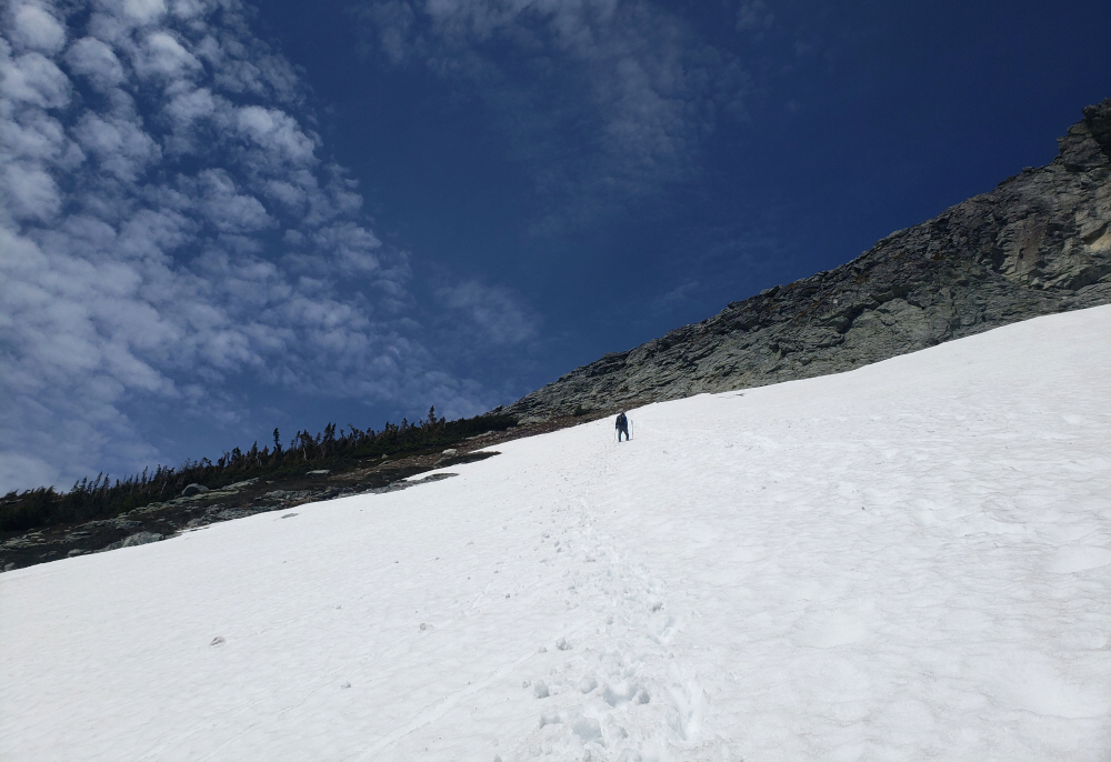
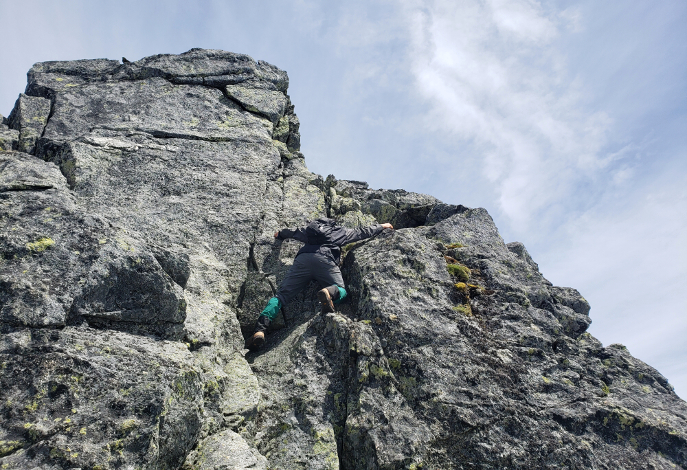
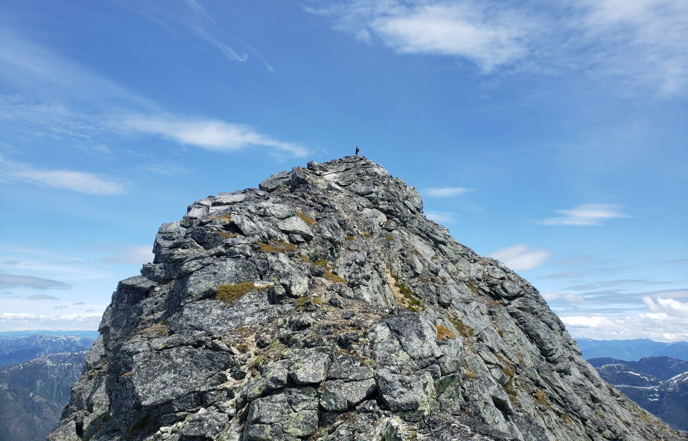
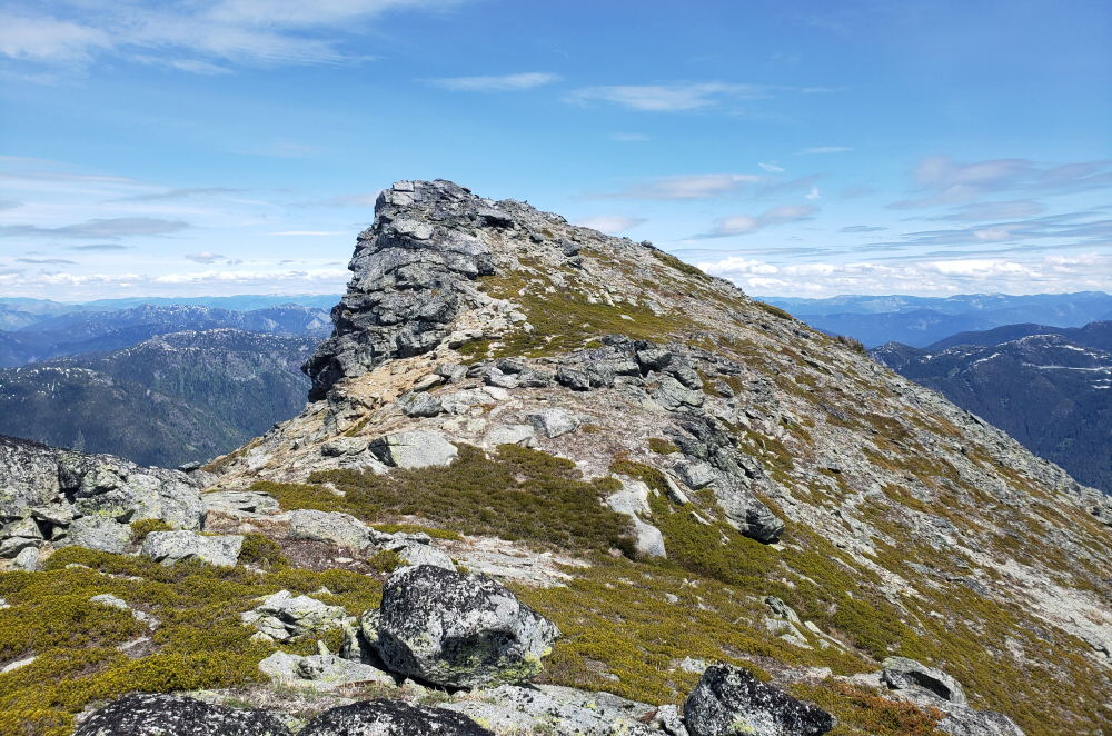
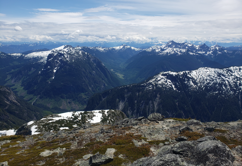
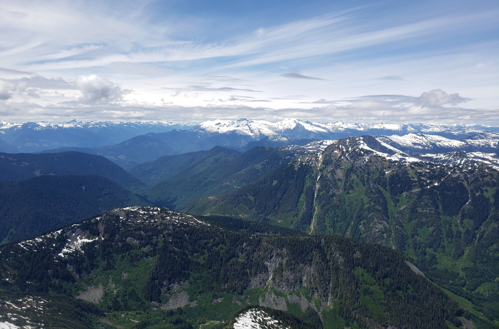
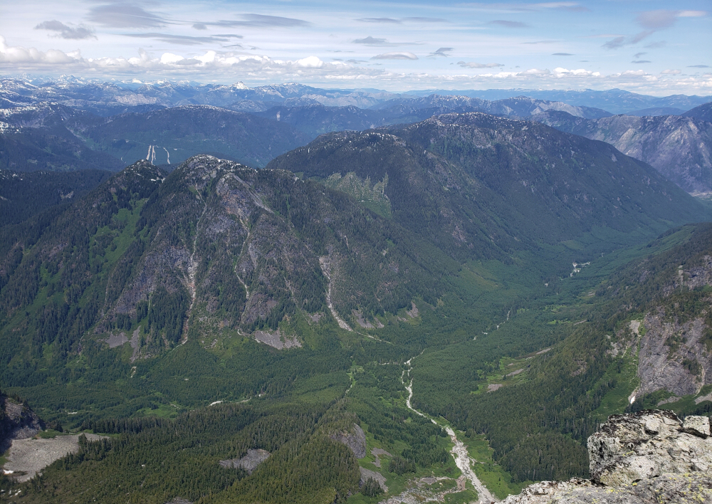
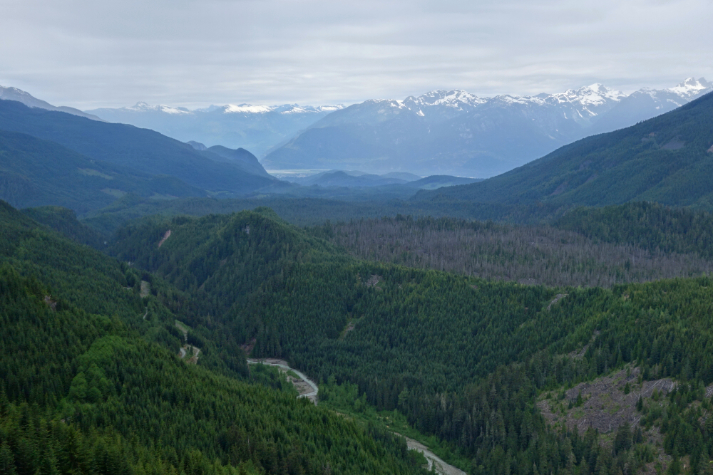
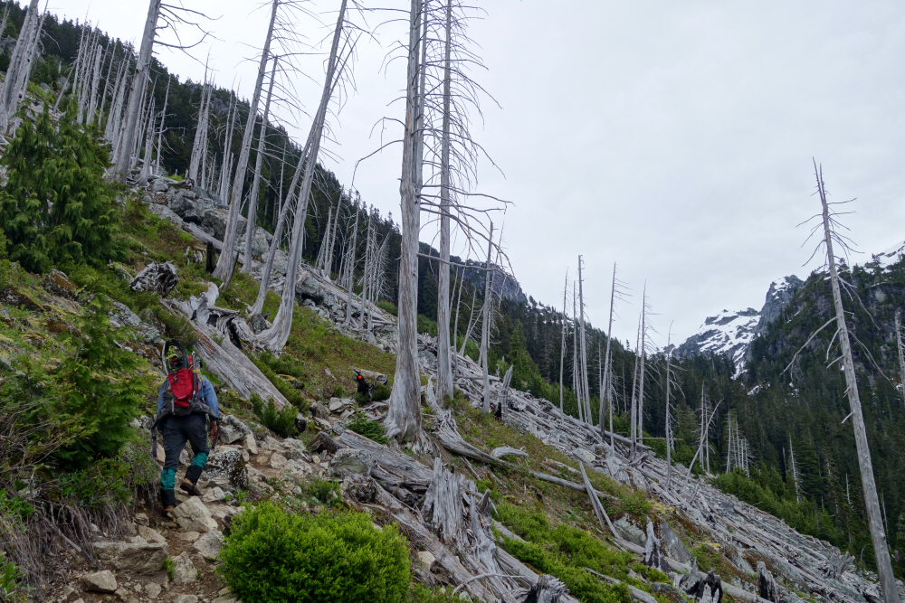
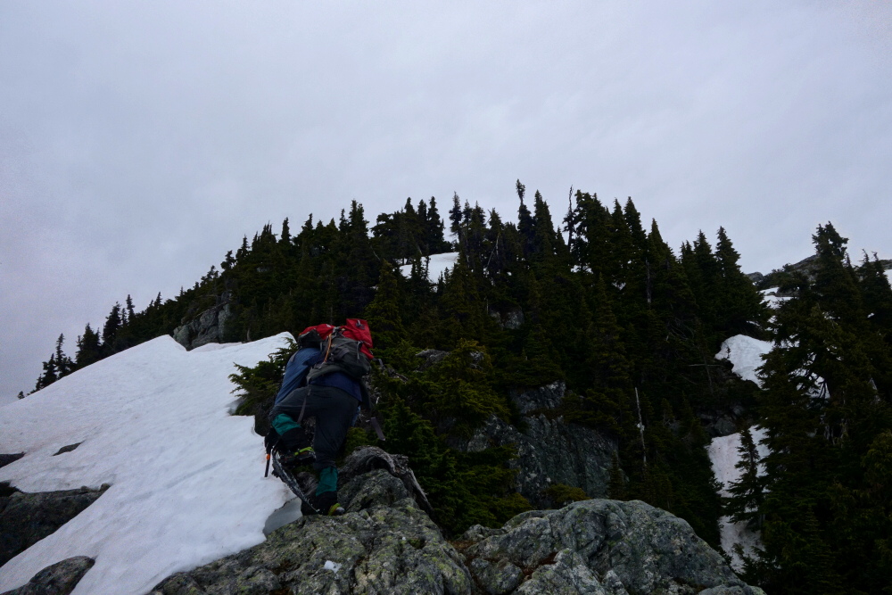
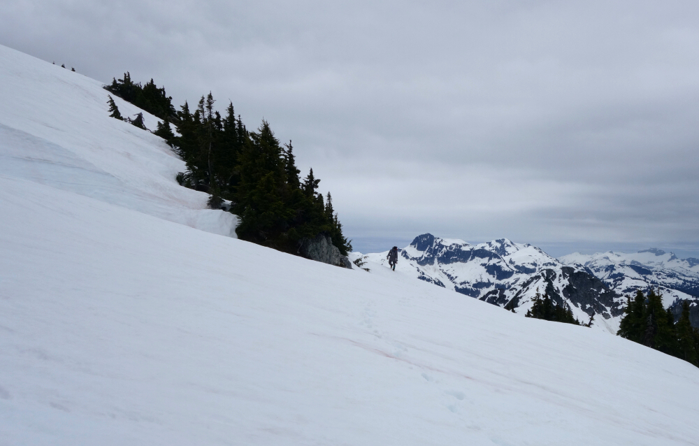
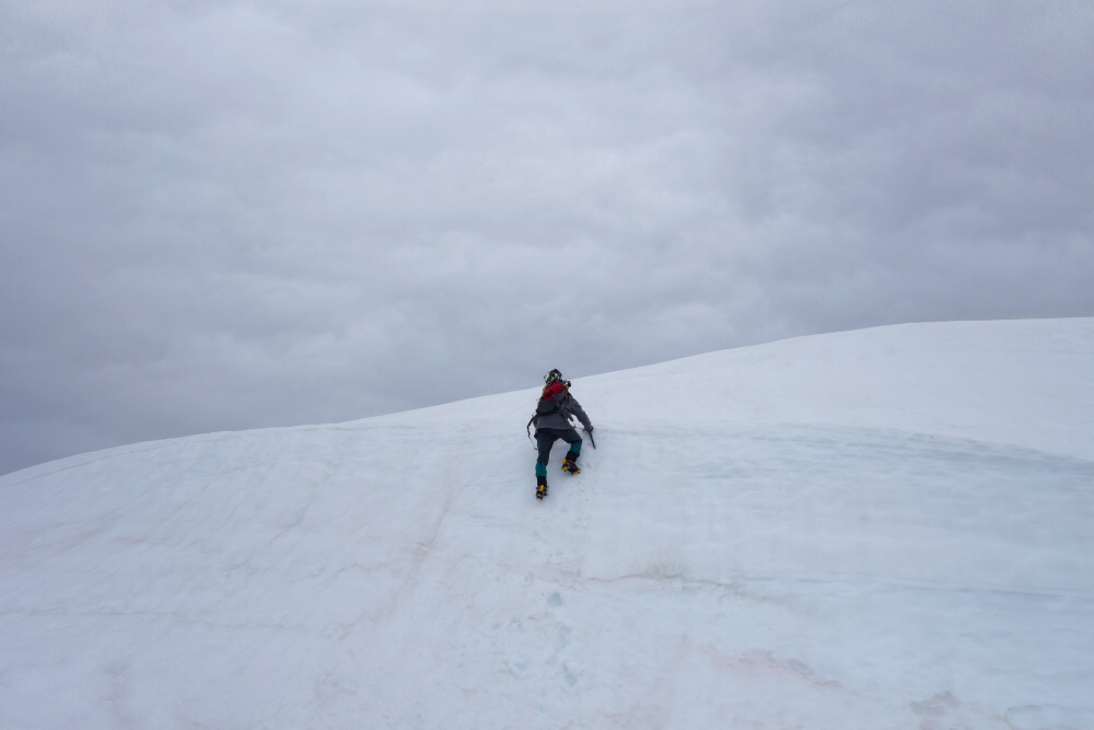
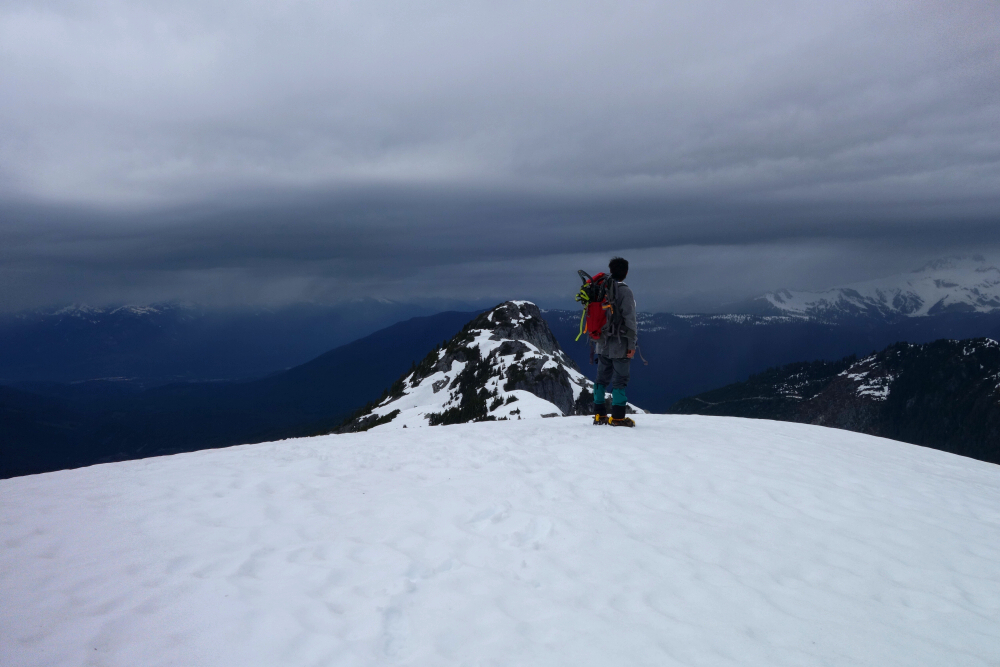
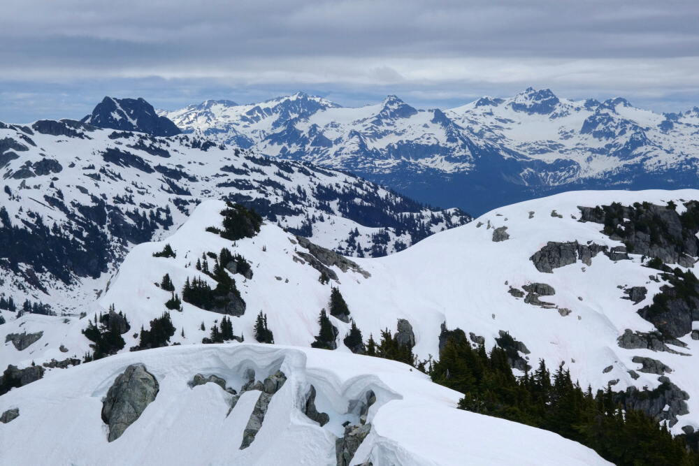
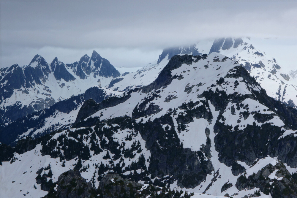
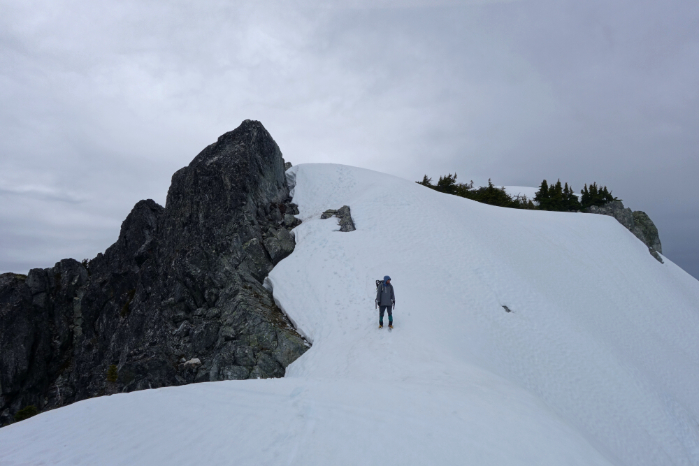
With GPX in hand, we followed a sparsely flagged climbers' path steeply upwards, eventually gaining the crest of a timbered spur protruding from the south flank of Urquhart. Trees soon thinned as we ascended into the alpine finding a mix of snow and heather. With the peak's imposing south face now directly above us, we traversed a large snow slope left (west) to reach the toe of the SW Ridge and our ascent route. Turing up the ridge, we proceeded up the steepening pinnacle before us, finding generally easy scrambling despite the daunting appearance from below. Soon found ourselves on the summit admiring the lovely 360-degree view! Most noteworthy were those looking south towards the Old Settler, NW towards the Breakenridge Group and SW towards Harrison Lake.
Had us a nice long rest up top before reluctantly beginning our descent. All was going well, until Wes motored on past me as I was refilling my hydration pack shortly before the descent back into the forest. Figured he'd stop and wait before dropping down into timberline where navigation would be a bit tricky, but oh no, he just blindly kept going only to then lose the trail and end up thrashing around in a ravine before I show up and help guide him back on course. Oh that Wes. Anyway, no further drama after that, returning to the truck for a very civilized 8 hours round trip.
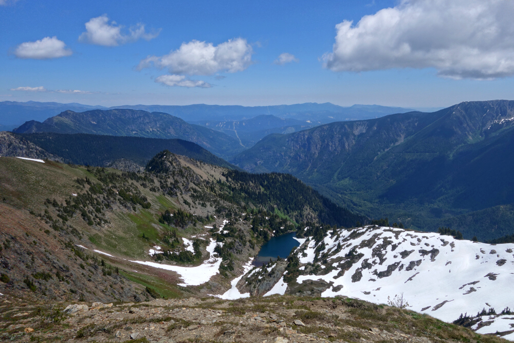
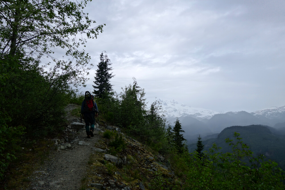
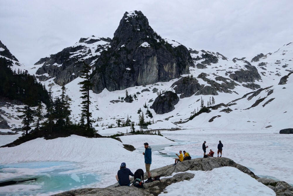
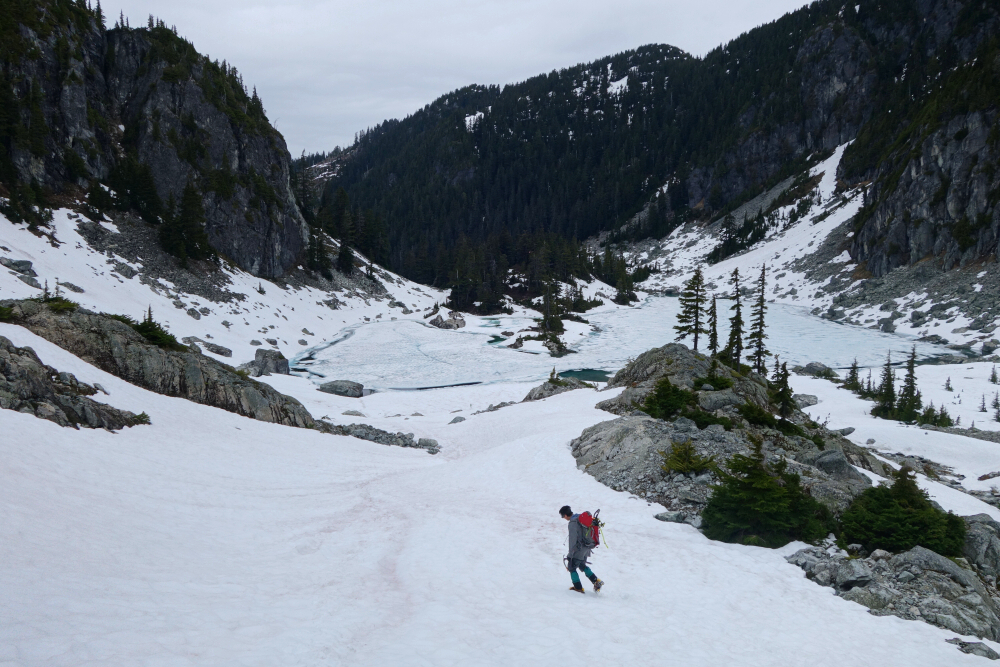
Set out for Gibson on what proved to be a marginal weather day, consistent with what the weather forecast predicted but which we foolishly hoped wasn't accurate. Made it to the trailhead under heavily overcast skies, thinking to myself that if at least if it doesn't rain all will not be lost. Several minutes into the hike, it started to rain. But fortunately, it wasn't heavy rain, more a light drizzle and so we forged on. Reached Watersprite Lake in good time and thankfully by then the showers had ceased. Wes and I have both been here at least once before, myself bagging the highest in the group Dreadnought Peak back in October 2018. No rain or snow whatsoever that time, opposite to the conditions we found at present.
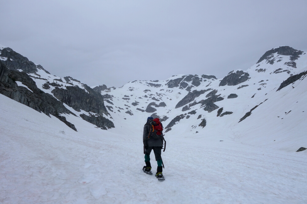
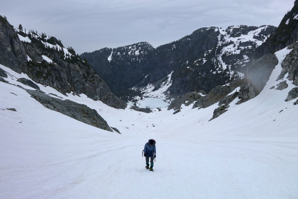
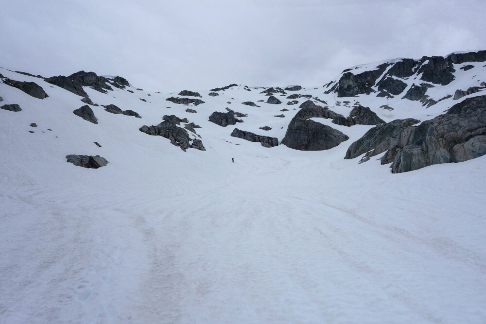
Snowshoes on, and around the south side of the lake we go aiming for the amphitheater cradled below Martin and Gibson peaks. There's an Epiphone Peak and Fender Peak nearby in case you were wondering about the guitar theme to the names here. Slogged up saturated snow to the Martin-Gibson Saddle and contemplated our next moves from there. Straight up from the saddle pitched up quite steeply with a rock step that looked like it might require technical climbing. No interest in experimenting with that, especially considering the conditions. Wes was all for it, but then his skill at assessing terrain and navigation leaves much to be desired. Decided to descend the opposite side of the saddle for a bit before traversing to a shoulder on the south side of Gibson. Proceeded from there soon encountering a rock rib beyond which was a vertical drop off on the peak's Southeast Face. Turned up along this rib, then onto a snowy bench to wrap back around to the Northwest Ridge, above the rock step. Short bit of steep snow from there to the summit proper.
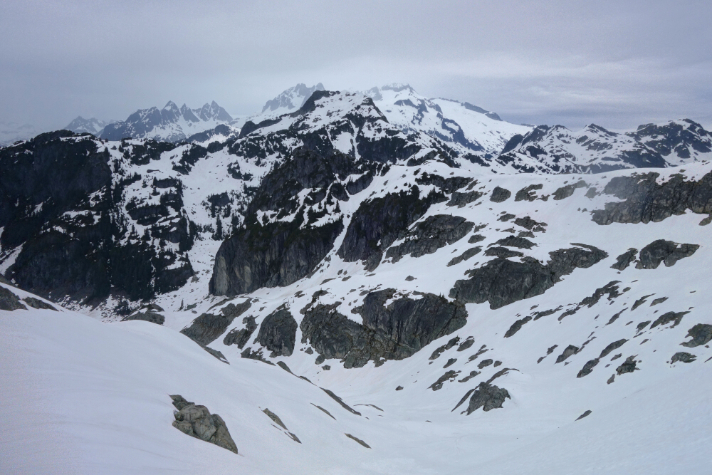
Views were decidedly moody thanks to the dark clouds just overhead and particularly to the west. Still a respectable panorama from up there panning from south to east to north: peaks flanking the east shore of Howe Sound such as Sky Pilot and co., Meslilloet and Gillespie Group to the south-southeast, the remote ranges adjacent to Pitt River to the east and northeast and finally north to Dreadnought with the Mamquam Massif lurking behind. Not too shabby all things considered! The rain soon resumed and so we cut our stay up top short, this time opting to descend via the North Ridge towards an obvious saddle. Some steep snow here, but still very saturated and soft, making for a nice long glissade. Returned to Watersprite Lake and on towards the trailhead again under intermittent showers. Changed into dry clothes and back down the rough FSR we go, content with having made the most of an otherwise "meh" day!
It would be very much appreciated if you please ask before copying and/or re-publishing content from any part of these pages. To do so, please click here to send a message via feedback form.


