Select from list below to jump to a specific area on this site.
| Latest Posts |
Monday, November 24, 2025
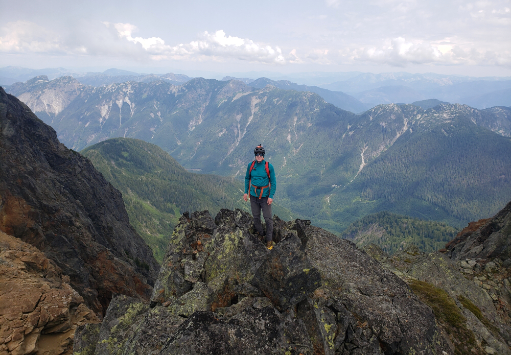
Saint Jacobs Mountain - East Route via Van Horlick FSR, August 2024
Came across Saint Jacobs several years back perusing Clubtread forums in search of inspiration for hikes I'd not done yet. Had only recently moved to BC but was already running low on the popular "low hanging fruit" options and looking to expand my horizons beyond the better-known published alternatives. Also finally had a 4x4 at my disposal which in these parts ought to be considered a necessity for any serious outdoorsman, adventurer, alpine rambler, what have you. A 2013 report by "Simonc", at the time an avid peakbagger who bravely pushed the boundaries of solo hiking deep in the South Coast wilderness drew my attention for some reason. Be it the peak's novel location (for me), the excellent alpine scenery dotted with brilliant turquoise lakes, or perhaps the reasonably good FSR access and minimal bushwhacking, I was intrigued to experience St. Jacobs for myself. And so, on the heels of a successful ascent of Silent Hub Peak the day prior, which incidentally was also a Simonc-inspired outing, Finn and I set out for yet another adventure in the so-called Duffey Lake backcountry!
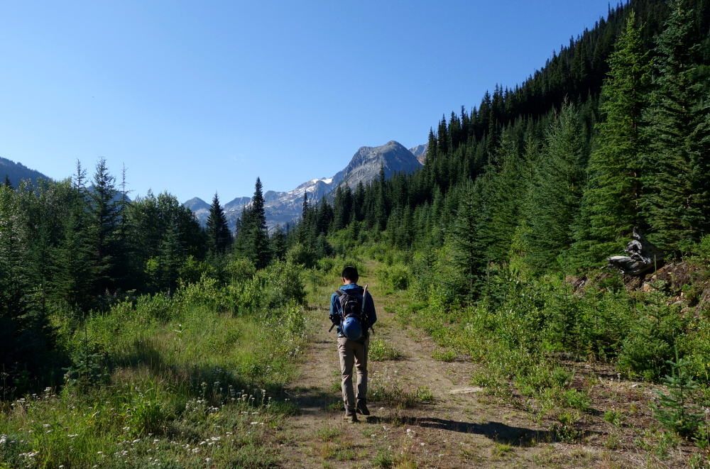
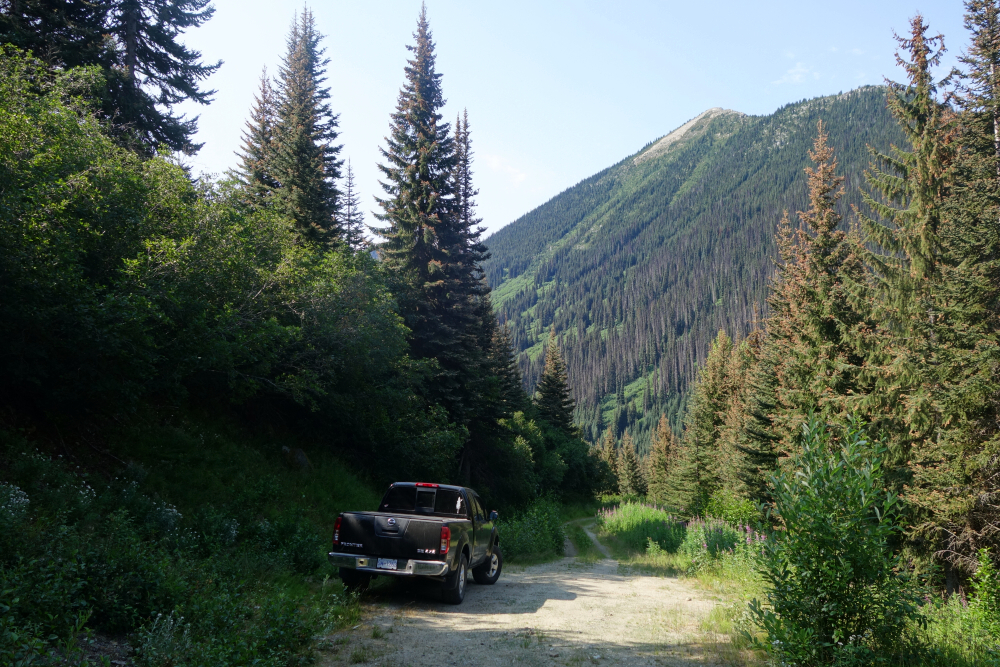
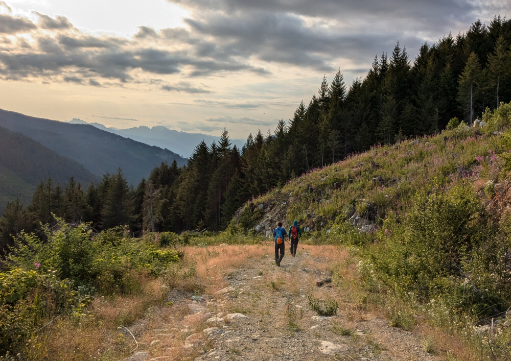
As per the report now over a decade old, we approached from the east taking the left spur off the main Van Horlick FSR for some 8.4 kilometers after turning off the highway. Unbeknownst to us at the time, newer forest roads have been extended up into the valley immediately west of St. Jacobs and its 43-foot taller neighbor Gideon Peak. As of this writing the preferred route appears to start from here instead. This approach is shorter with the option for combining both Gideon and St. Jacobs in a relatively easy day trip. However, from what I gather it also entails considerably more bushwhacking and is subjectively much less scenic. YMMV. Anyway, we continued up the spur for an additional 2 kilometers then turned right at a fork. Encroaching alders and some large water bars for the next kilometer or so, the last of which I dared not drive through. Not the day to lose my rear bumper and so reversed to where I could park without blocking the road. It was about 9 am by the time we started hiking.
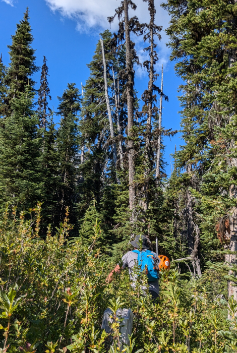
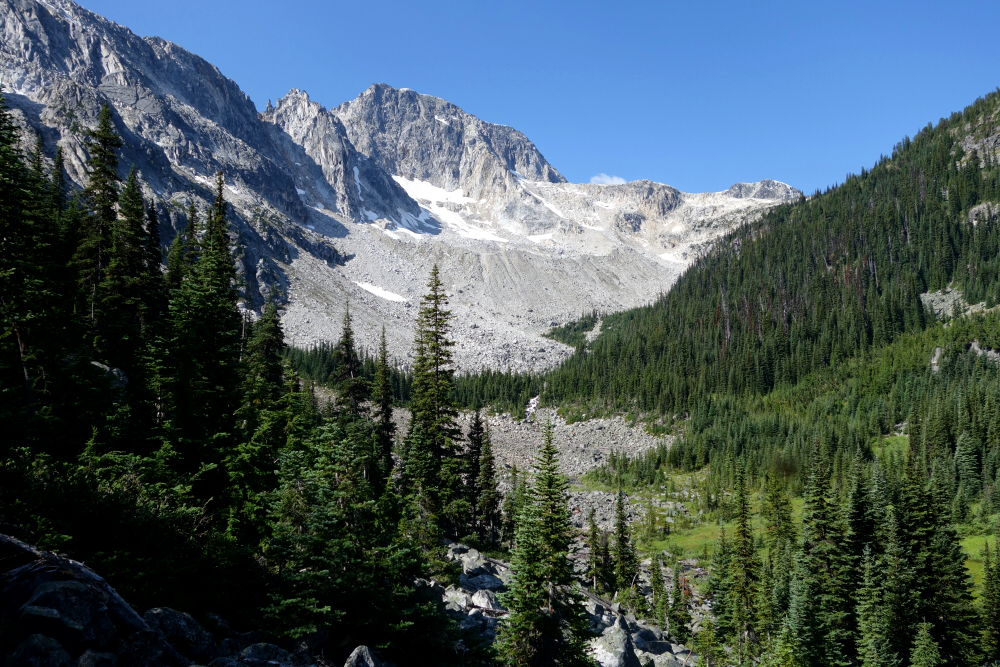
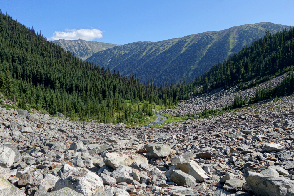
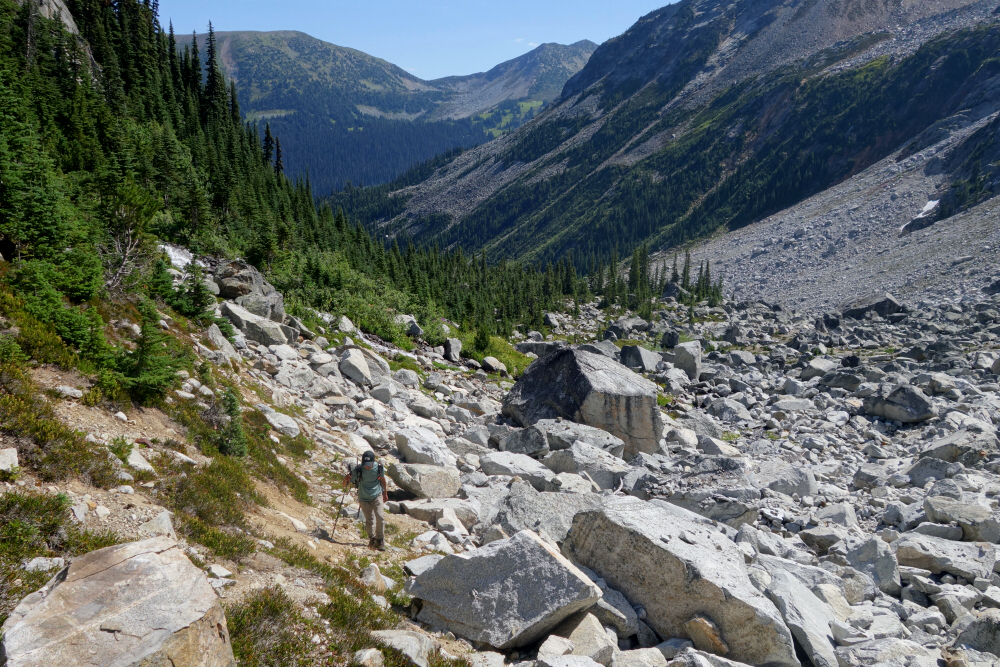
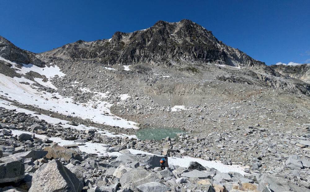
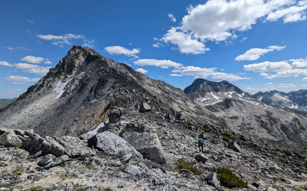
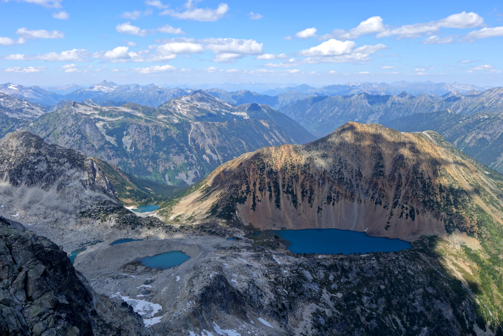
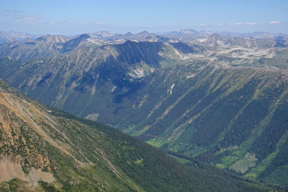
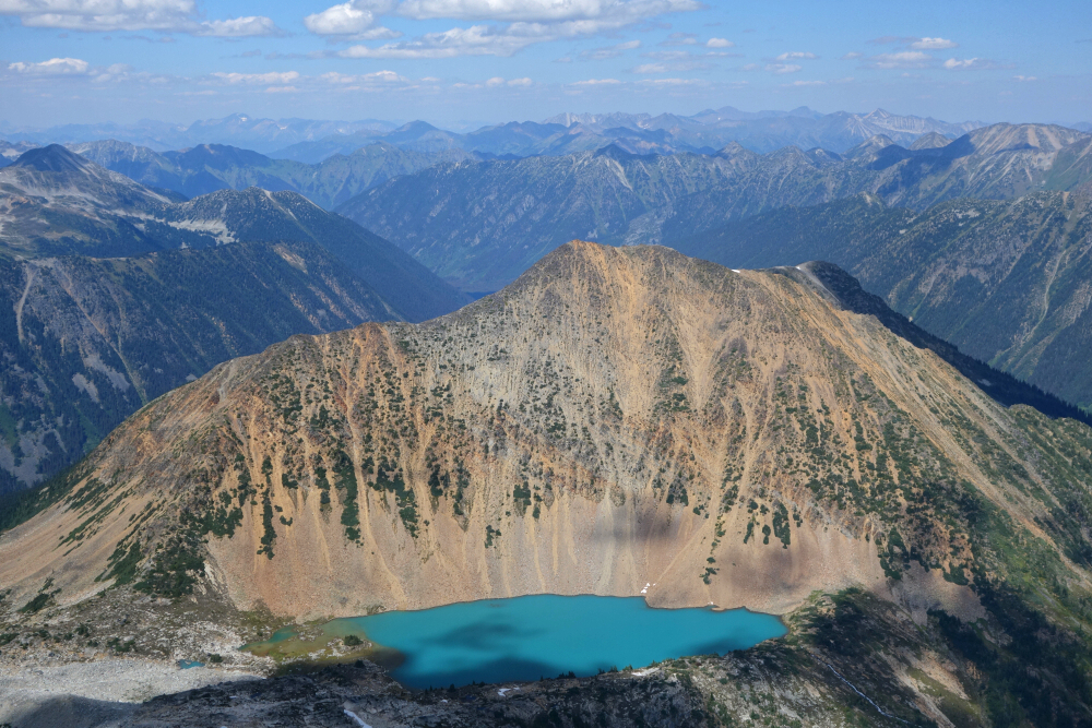
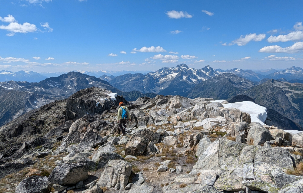
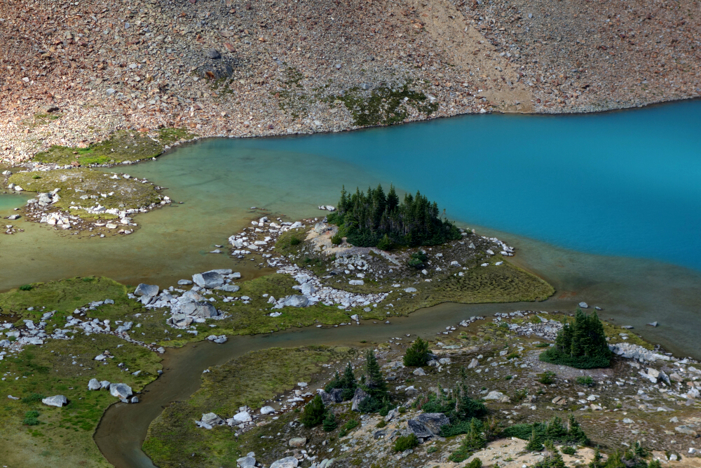
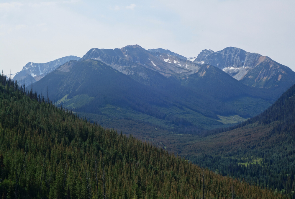
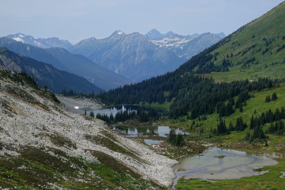
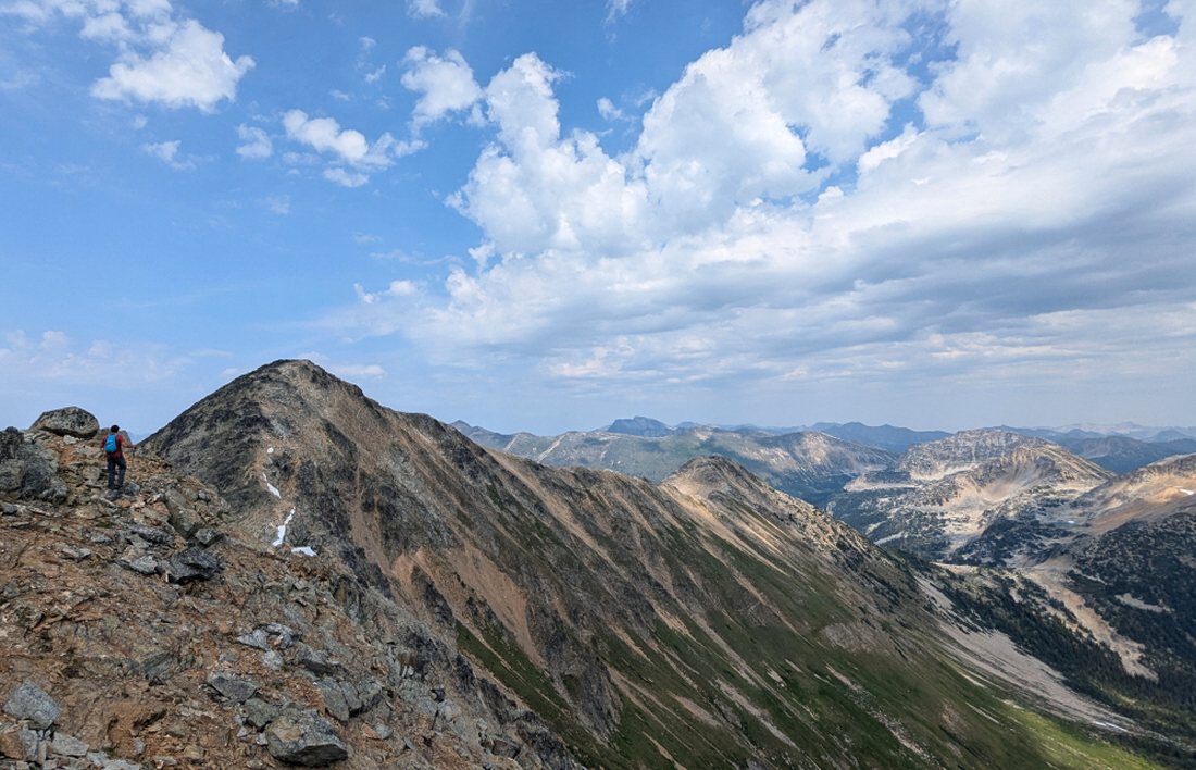
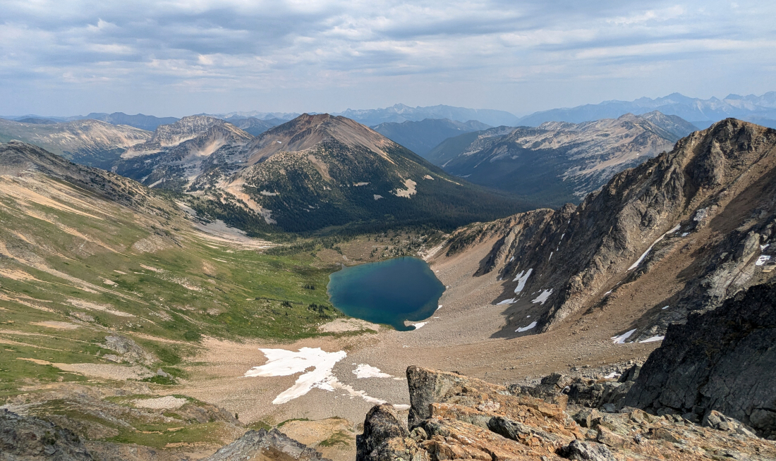
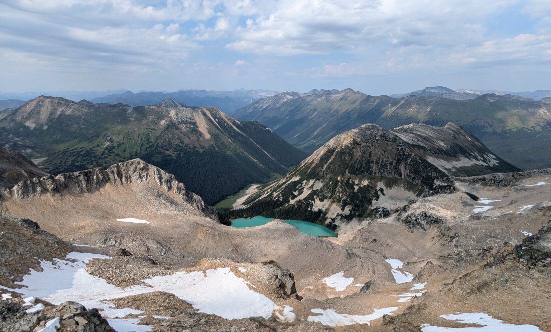
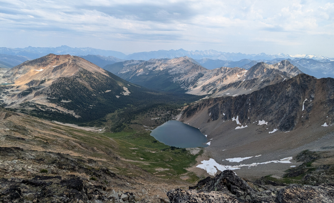
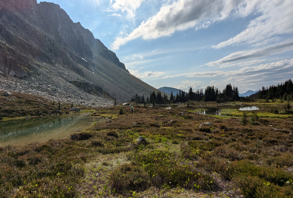
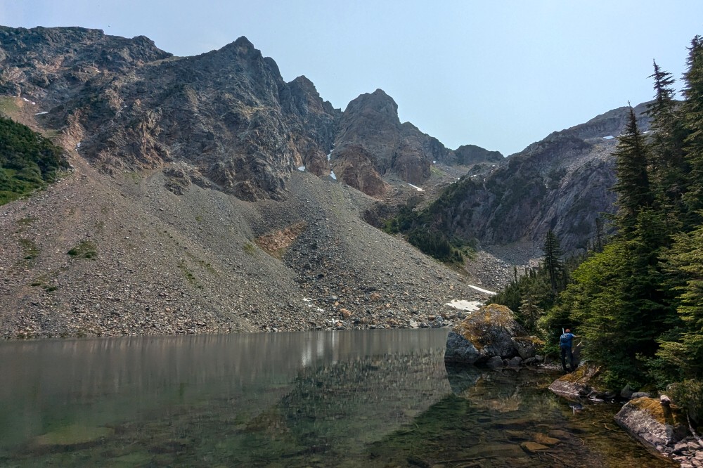
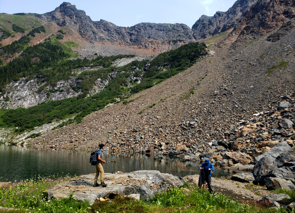
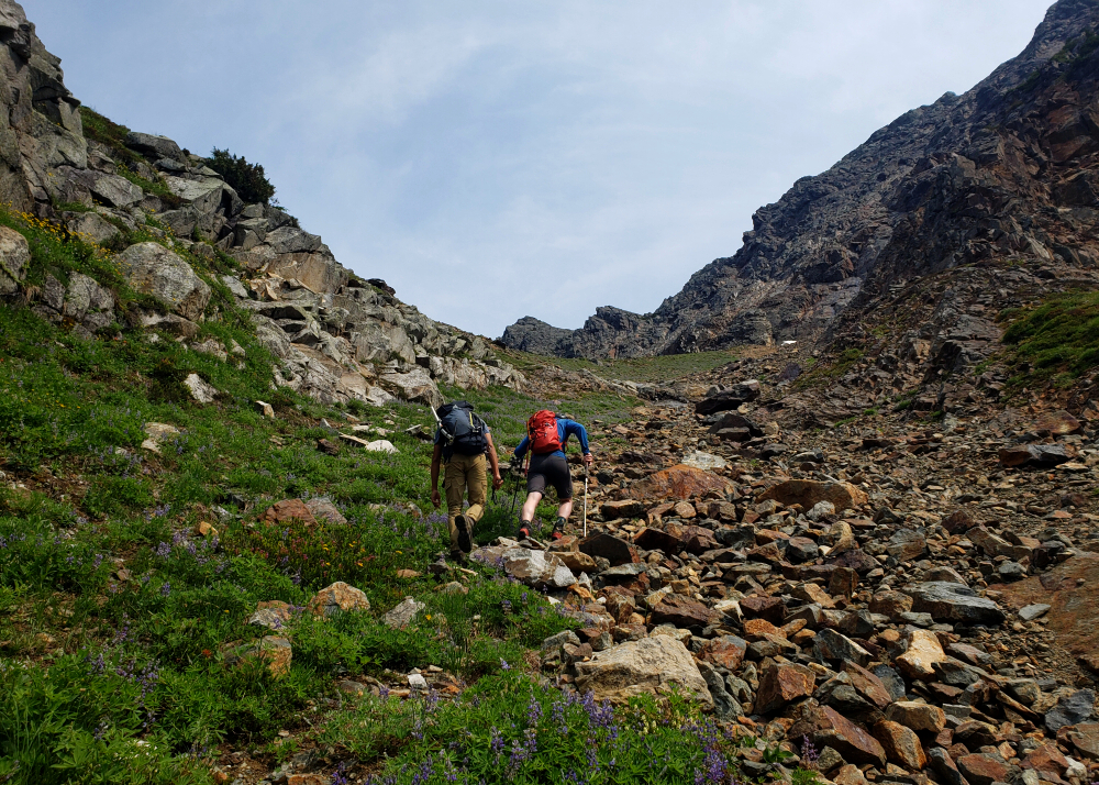
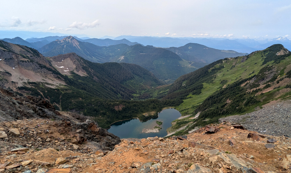
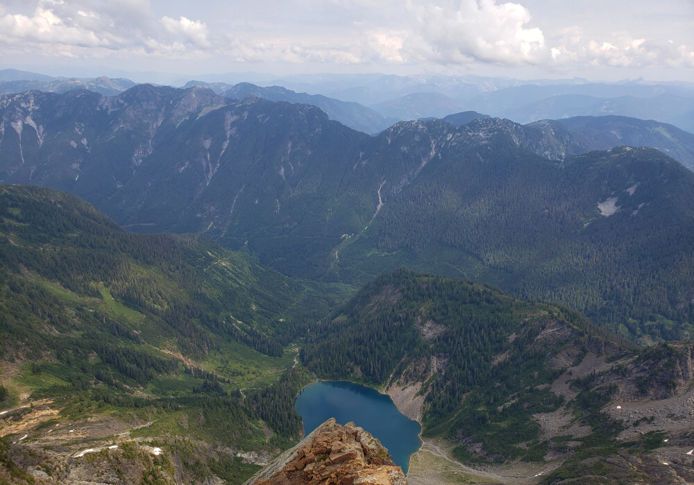
Hoofed the road for about 2.5 kilometers more to reach the creek draining the valley between St. Jacobs and Midian Peak. Turned off the road immediately past this and promptly dove into heavy bush. Now keeping the creek within earshot to our right, we endured a short but intense bushwhack (10 - 15 minutes perhaps) before intersecting a small boulder field that offered us an escape from the unrelenting undergrowth. This we followed up into the large talus basin below St. Jacobs's towering North Face. We could now finally see what lay ahead and we certainly had our work cut out for us! Talus seemed to go on forever, despite our taking every opportunity to minimize the boulder hopping by contouring along the rightmost edge. Crested a large moraine, hopeful for easier travel beyond only discover yet more of the same up ahead. Ugh! But at least the scenery was easy on the eyes with an impossibly emerald-blue Midian Lake stealing the show!
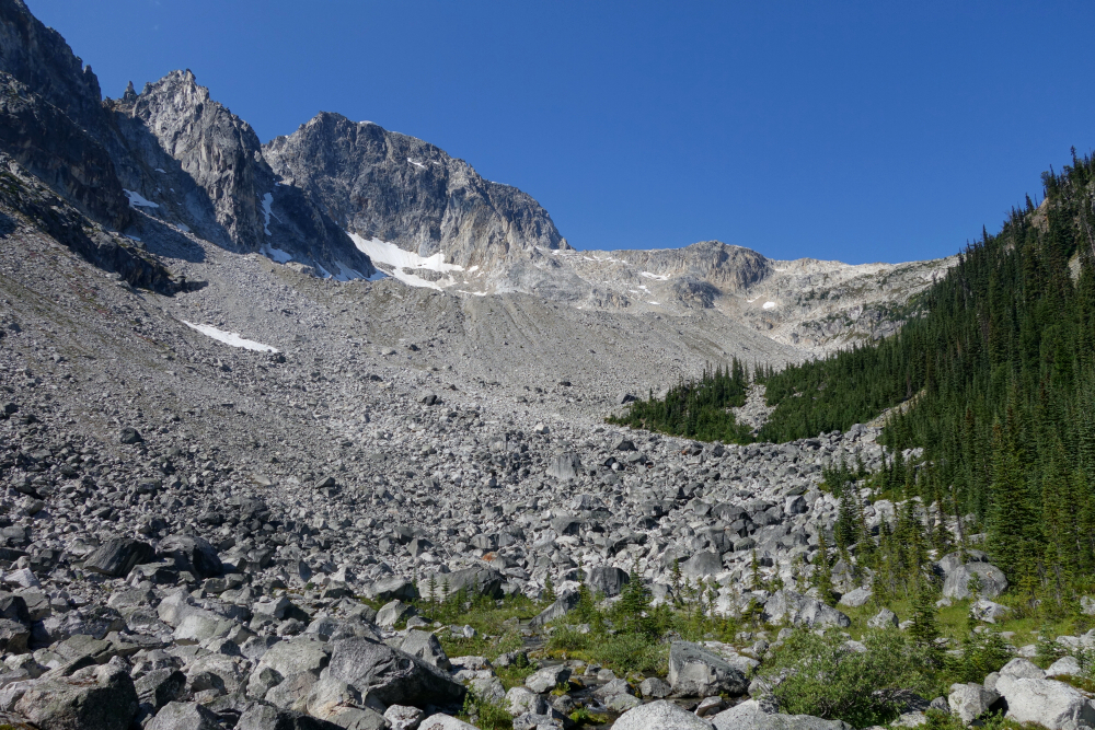
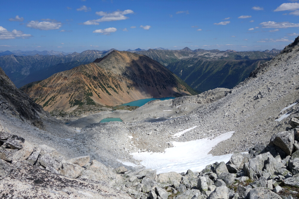
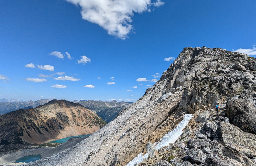
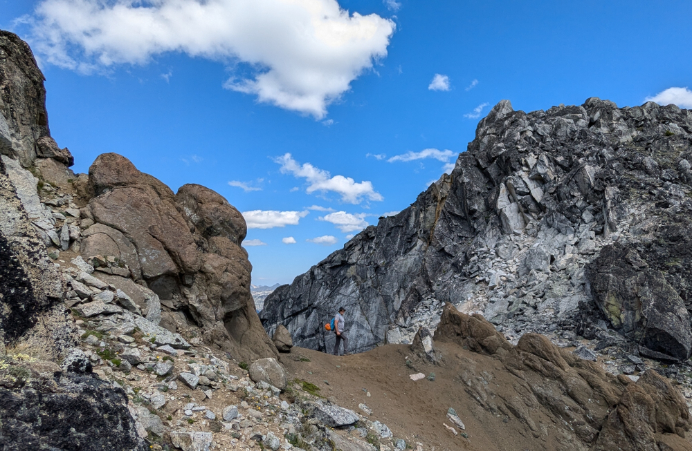
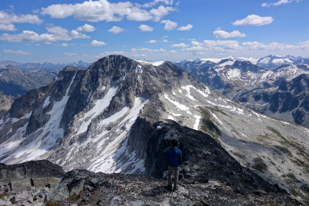
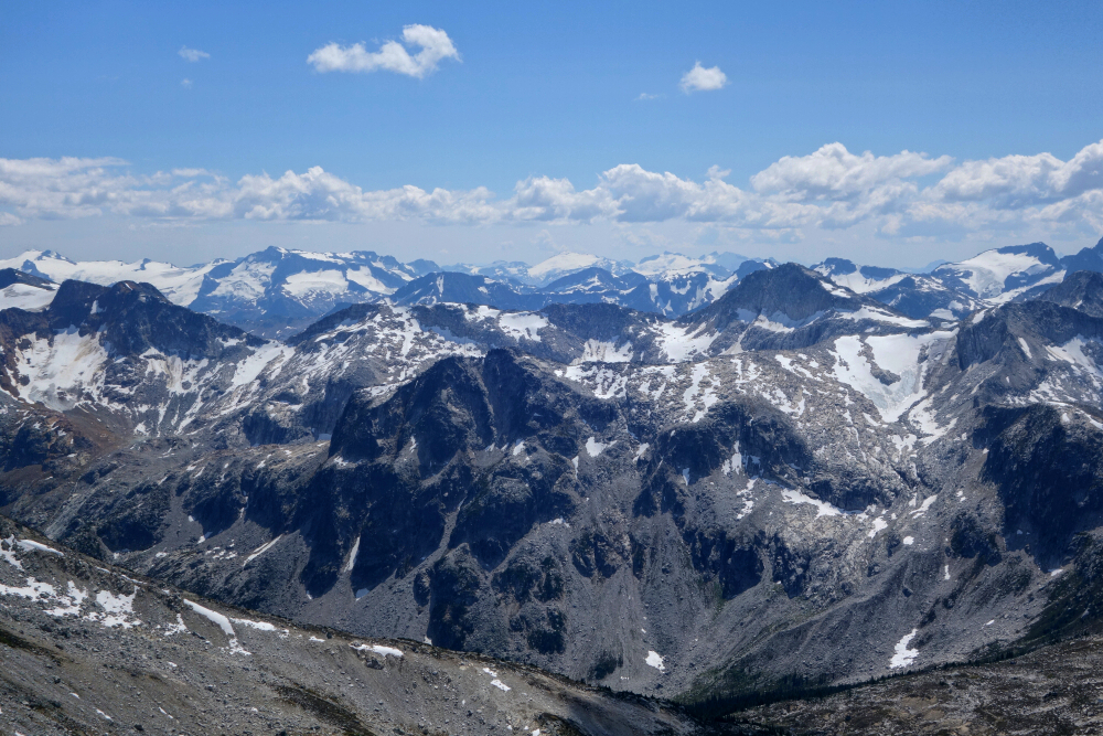
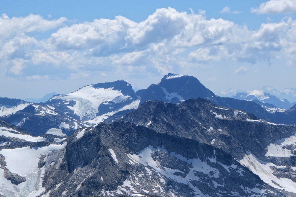
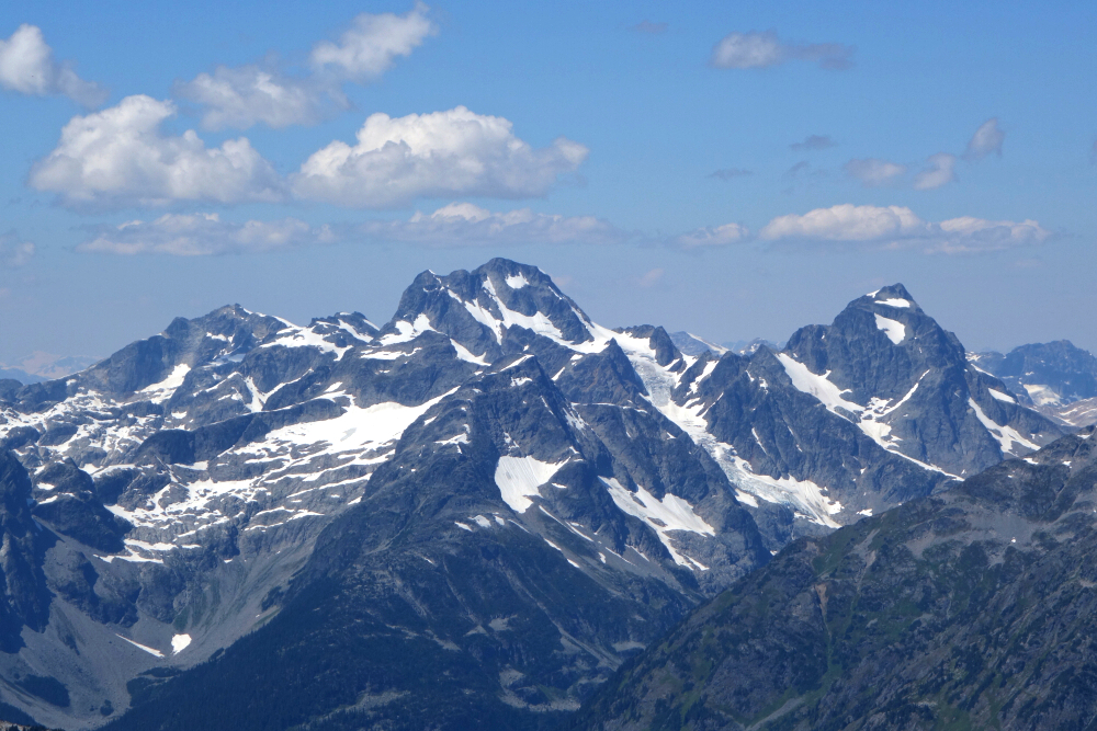
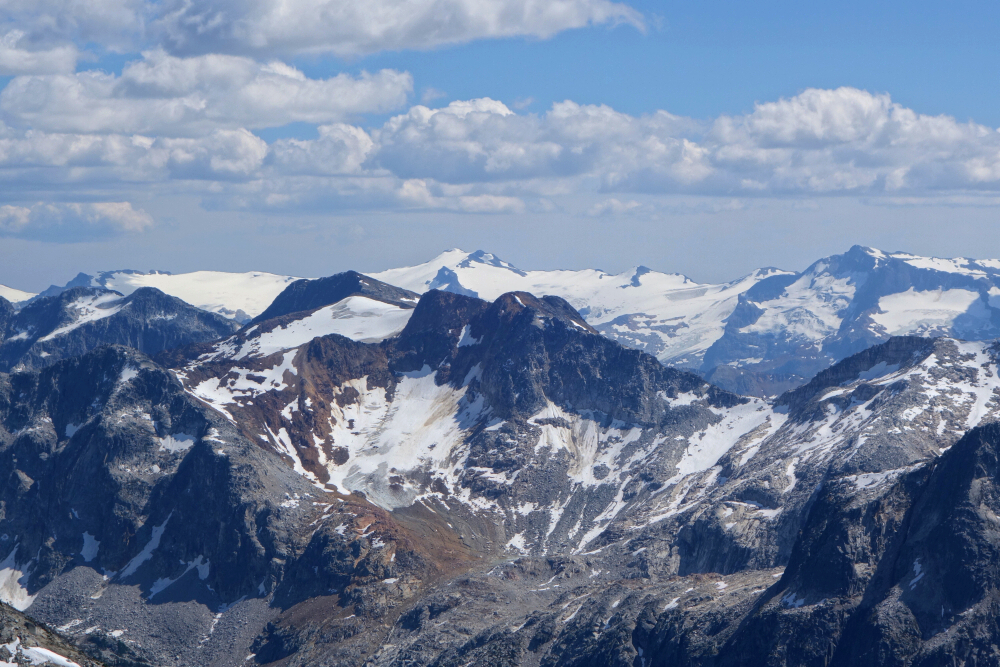
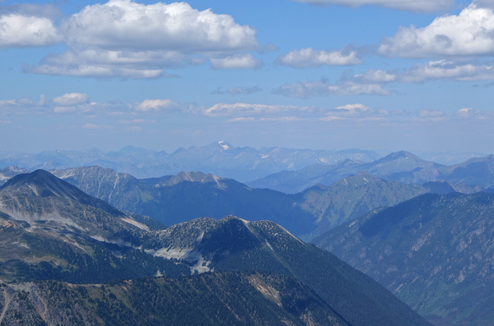
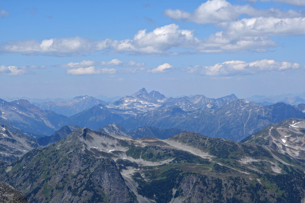
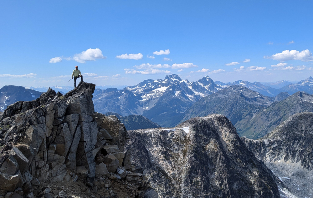
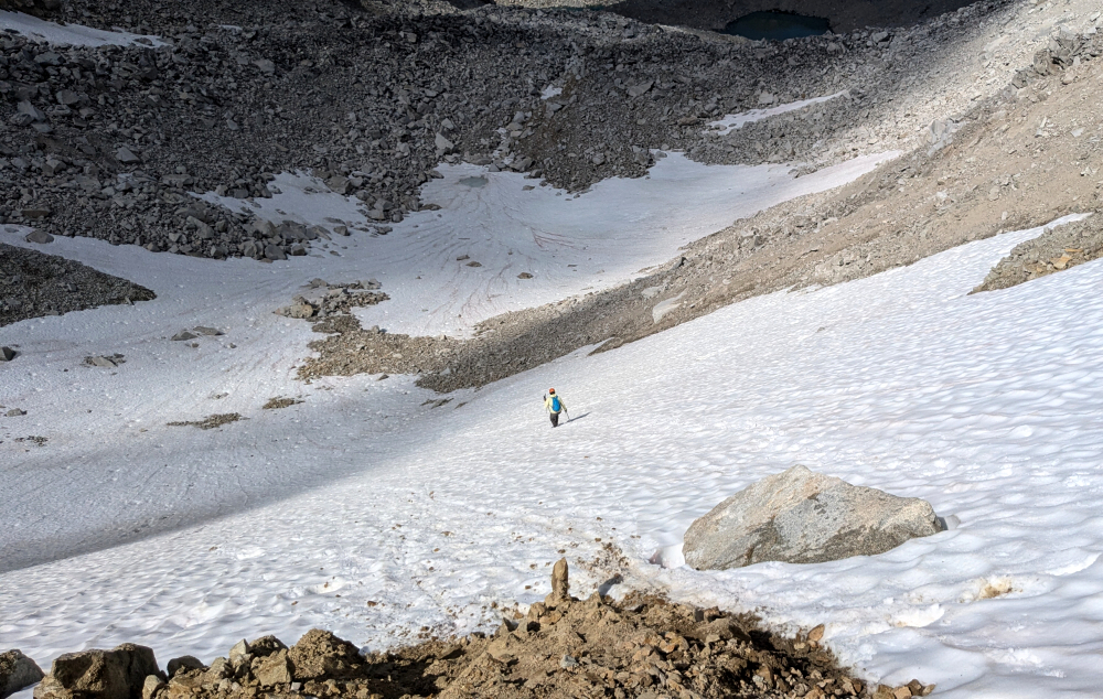
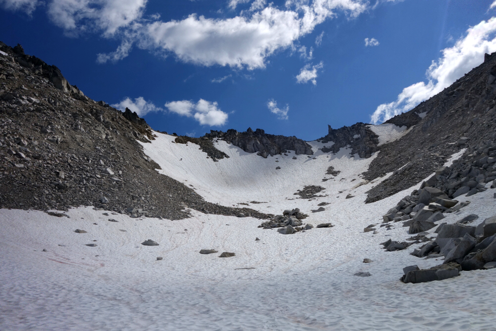
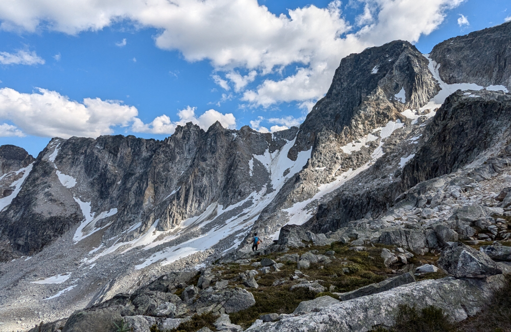
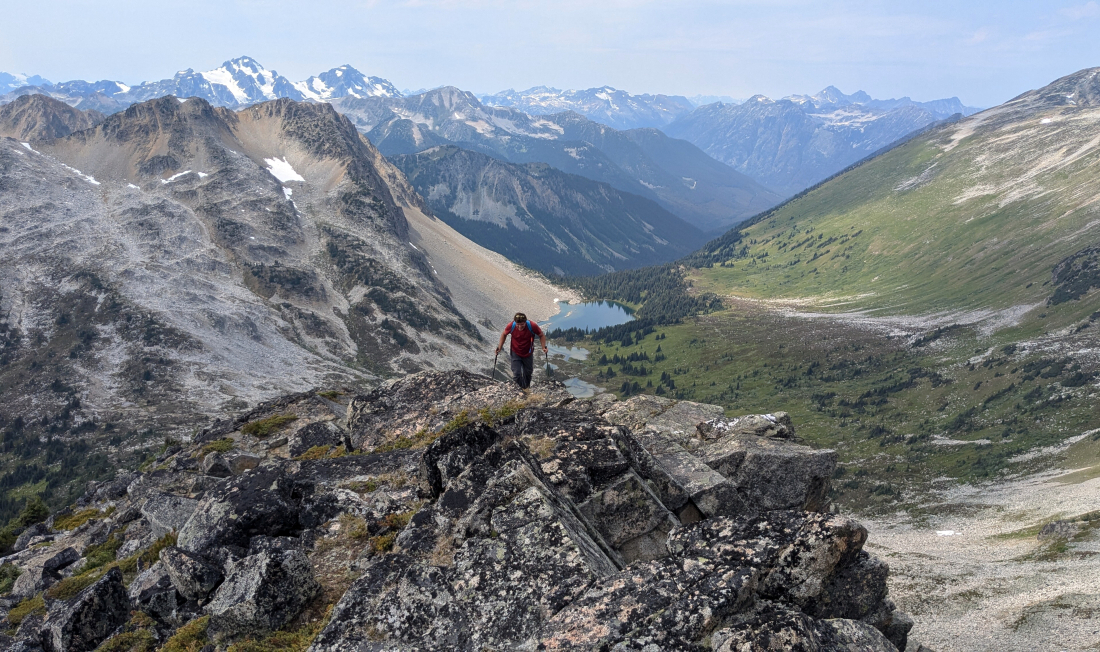
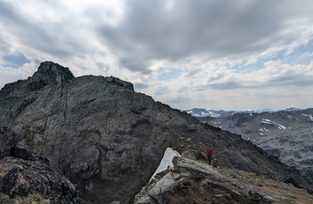
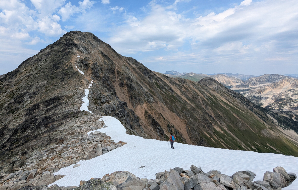
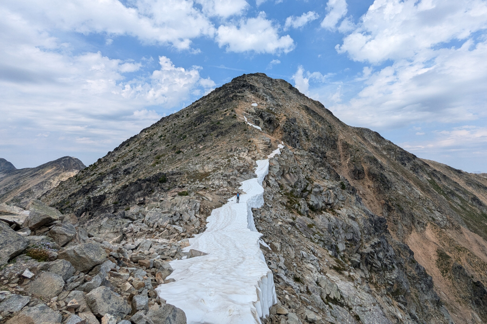
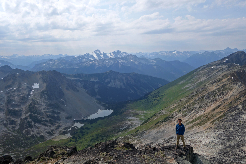
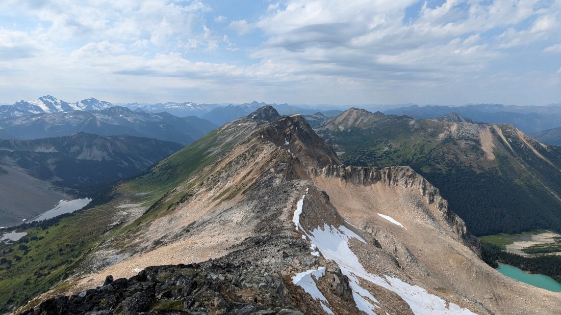
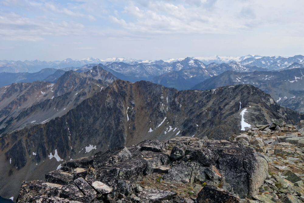
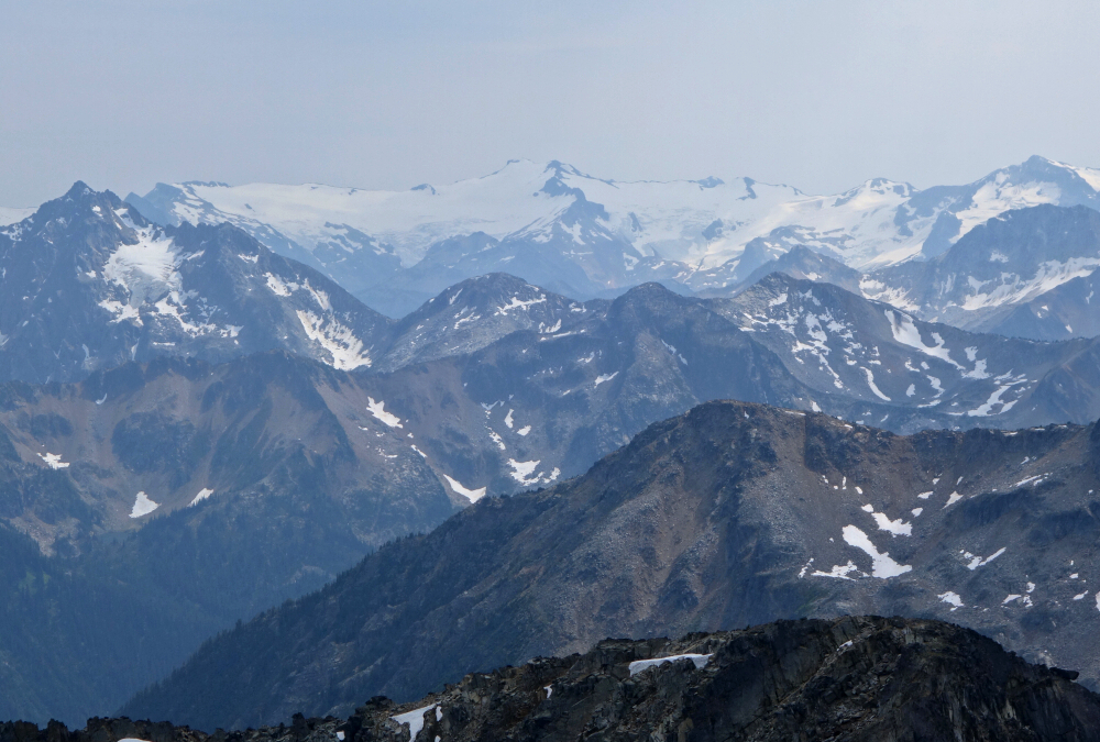
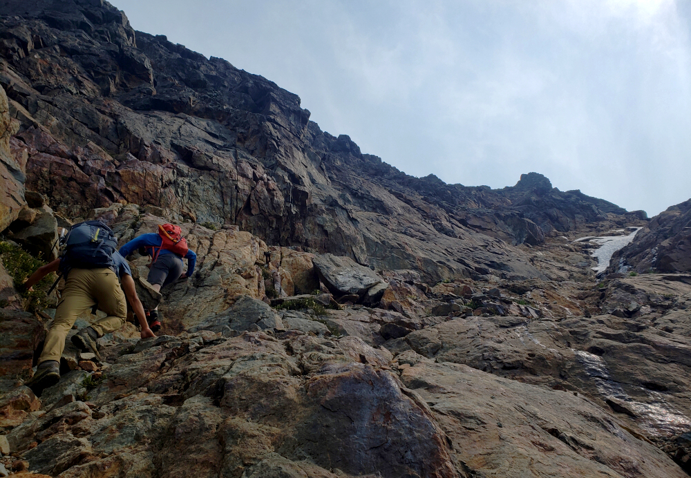
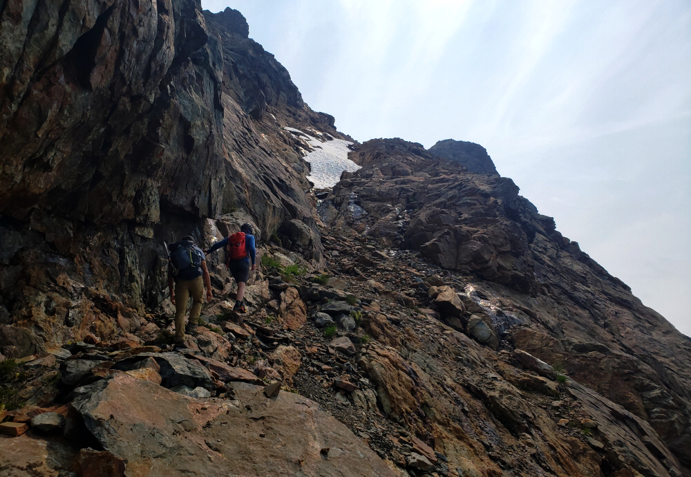
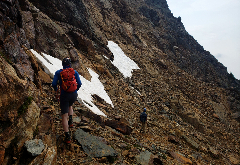
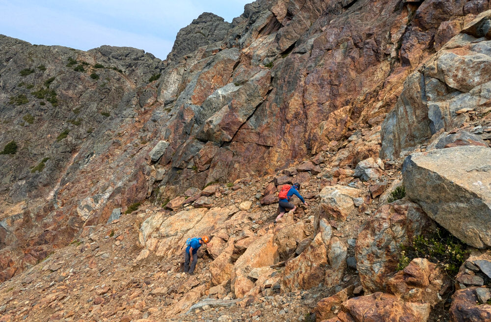
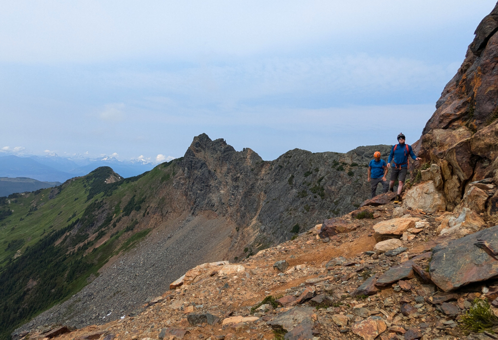
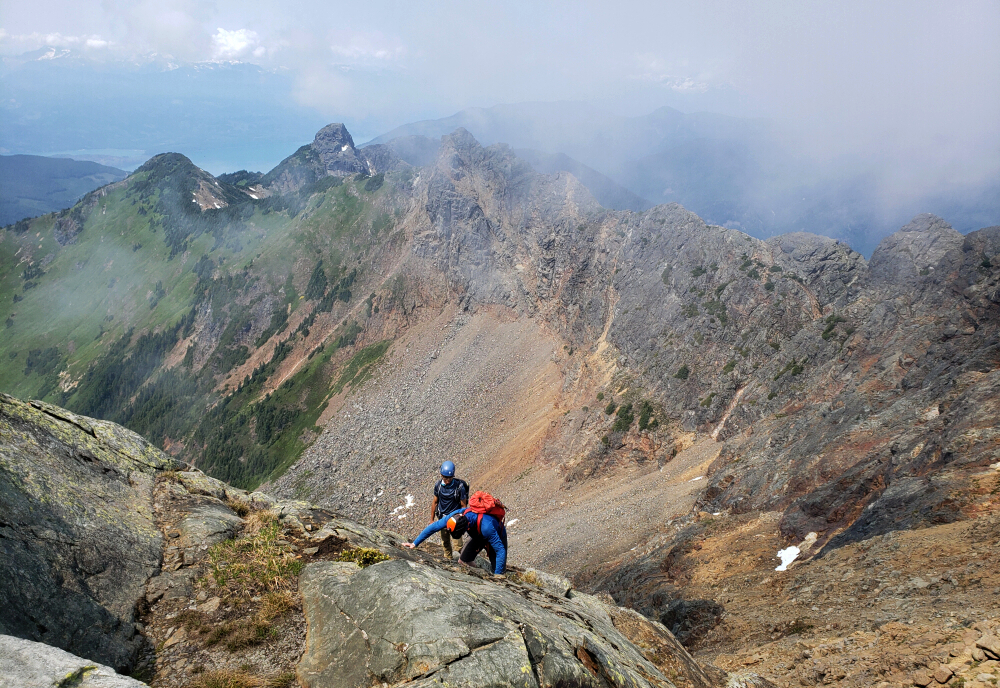
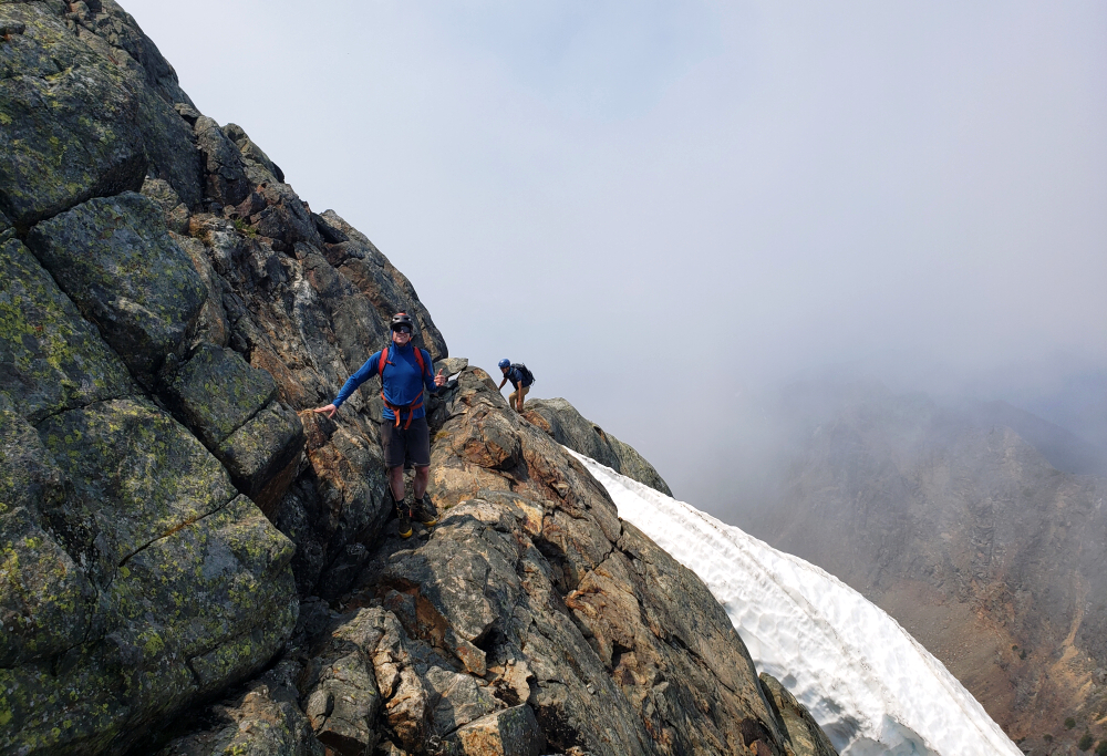
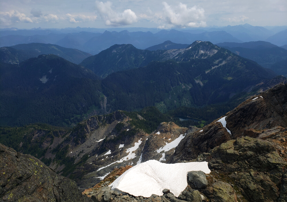
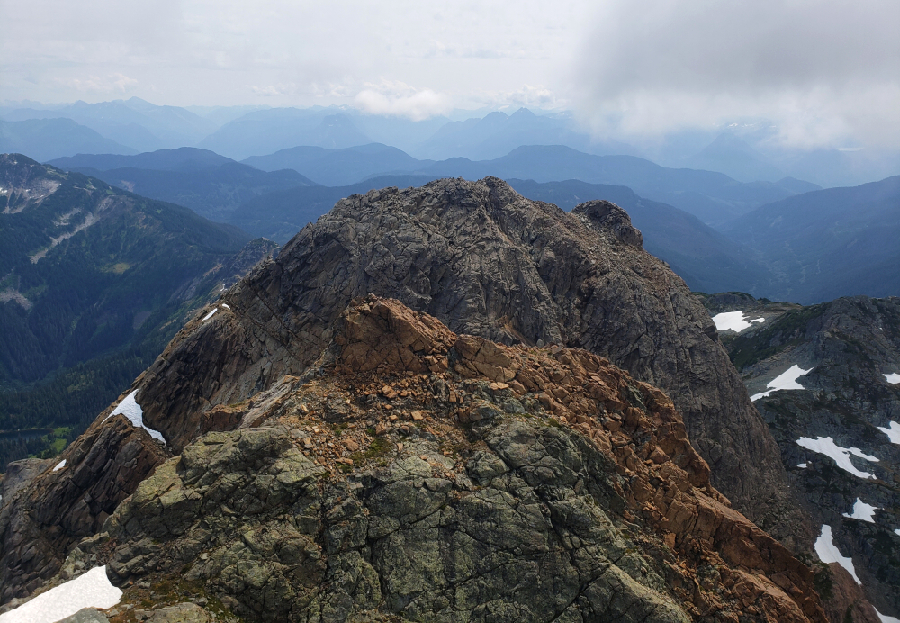
Down into the next basin and back up the opposite side. Then over another moraine into the upper-most basin, where mercifully we could take to snow for much improved travel towards an imposing headwall just beyond. Snow was still a bit firm here and we were too lazy to bother with crampons, so instead traversed up and right over steep and horribly loose rock and hardened mud to FINALLY reach a prominent saddle low on the West Ridge of our objective. All that remained now was an easy scramble to the top, into and back out of a minor notch along the way. Took us just shy of 5 hours truck to summit. Outstanding views of course, better than the previous day in part due to less haze and smoke aloft. Rock and glaciers looking to the south and west, unmistakably more arid and greener looking north and east. The connecting ridge to Gideon looked tempting, but it also seemed like a long way to go, easily an hour or more from St. Jacobs. I think Finn was for it, whereas I just wanted to relax and save my energy for what I knew was going to be a slow and tedious descent. Also, didn't quite care for getting home past midnight. 45 glorious minutes on the summit before reluctantly commencing the hike back down.
Returning to the saddle, we found the snow now suitably soft for plunge stepping and made quick work of the headwall pitch. Then back across all the talus and whatnot to reach the deactivated road several hours later. Short walk back to where we were parked, ending about 10 1/4 hours after starting that morning. Had we gone for Gideon as well our day would have probably ended somewhere around 10 pm, never mind the ~3.5-hour drive back home. Made the right call as far as I'm concerned. Goes to show that it isn't always about the highest, as this hike demonstrates. The journey matters as much as the destination!
Silent Hub Peak - via Pushki Lake Trail, August 2024
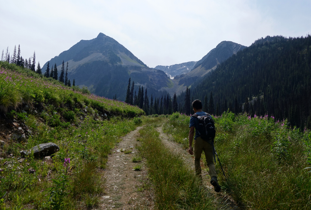
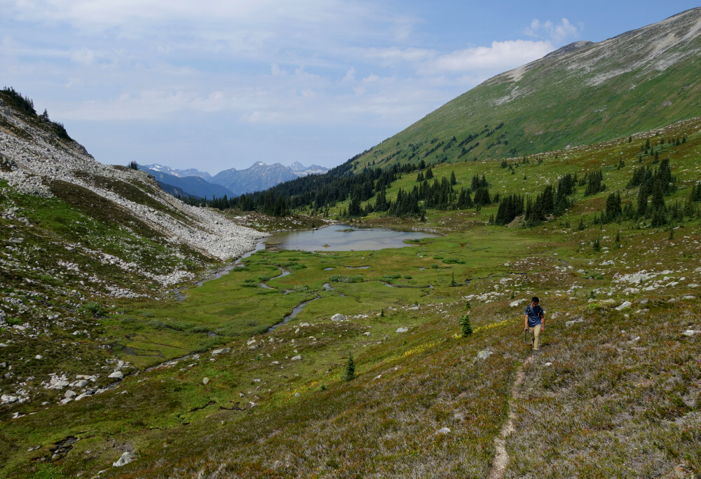
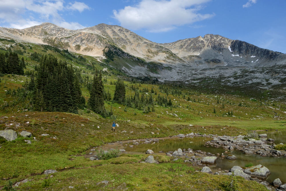
Got the idea for this glancing over from the Steep/Darkside peaks area where I happened to be hiking a few weeks prior. Looking to the southeast from the connecting ridge between the two, I spied a large turquoise-hued lake lying in a scenic side valley with an aesthetic looking peak rising from its head. As it turns out, the peak that caught my eye is named Pushki Peak and is connected by a ~3 kilometer-long ridge to slightly higher Silent Hub Peak, which incidentally is not visible from Steep, Darkside or anywhere in between. My investigation also led me to discover the existence of a not-so-well known trail that leads up from a spur that branches off Van Horlick FSR and continues into a parallel side valley. This trail, likely used by ATVs and in winter by snowmobilers starts from an old washout and footbridge that spans the creek draining the foregoing valley and proceeds along an otherwise perfectly good forest road for some 4.5 kilometers to road's end. From there a worn and minimally bushy path continues for about a kilometer more to the shore of beautiful Pushki Lake nestled in a large alpine cirque formed by Pushki Peak, Tandem Peak and of course Silent Hub Peak standing proud in the middle of it all. Sold!
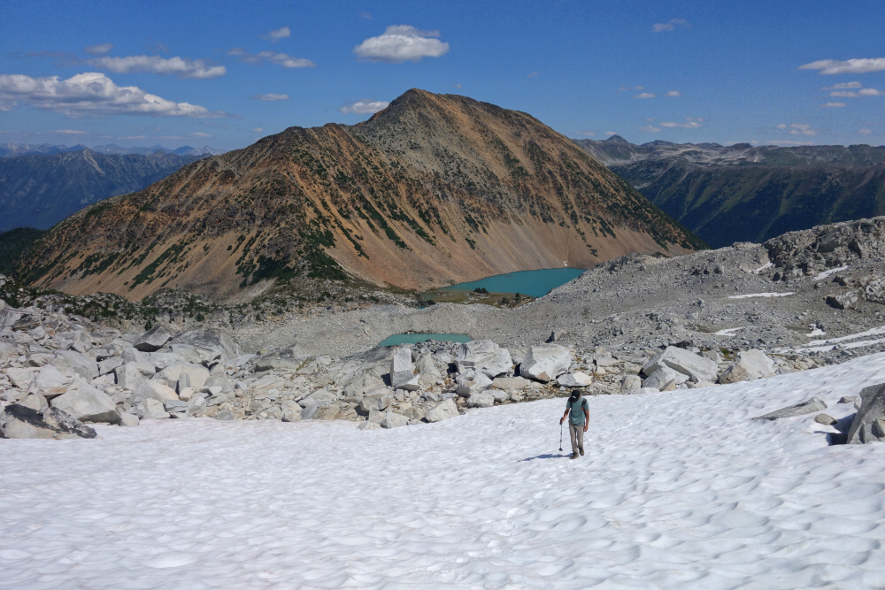
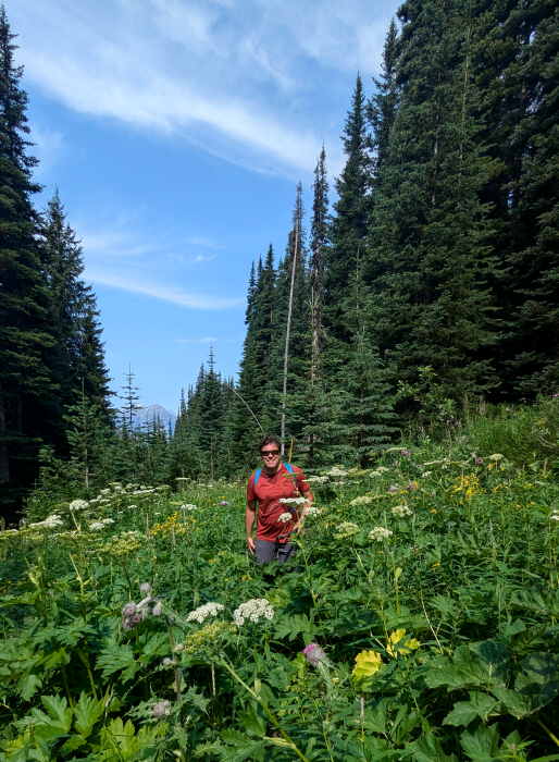
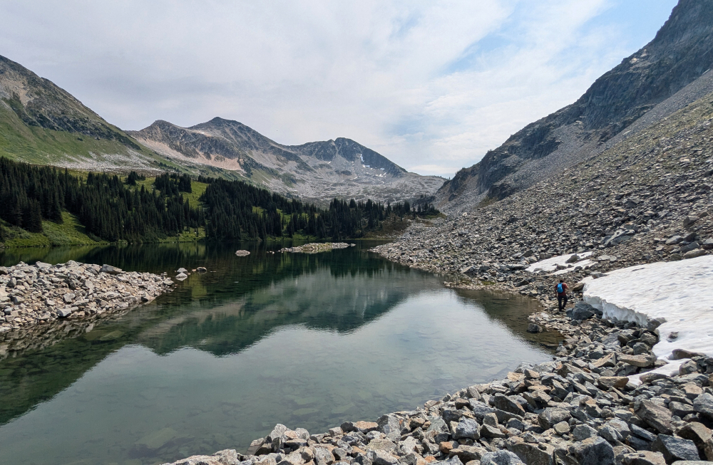
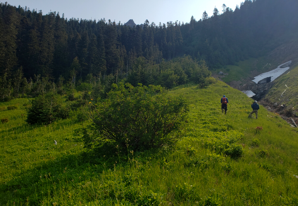
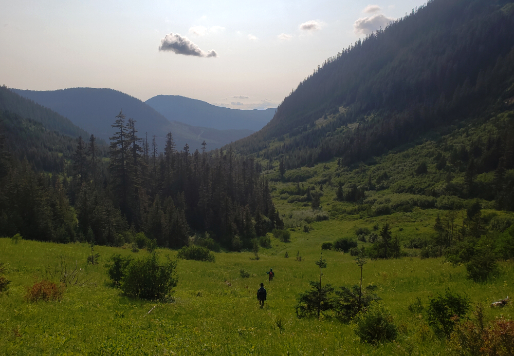
The decision to target Silent Hub for my next foray off the "Duffey" was a no-brainer, as they say. I recruited Finn, whom I'd climbed The Old Settler with the week prior into joining me on this as well as nearby Saint Jacobs Mountain the following day for an action-packed weekend of peakbagging. Off the highway and onto the now familiar Van Holick FSR (see Snowspider Mountain) for a bit over 6 kilometers to the before-mentioned spur which we followed a short distance more before stopping to park. Boots on and kicking dirt just shy of 11 am, over the bridge and up towards Silent Hub we go! Wished we'd brought bikes as the road was just a gentle incline most of the way. Trail continuation was easy to spot after the double-track ended, with just the occasional patch of waist-high veggies to wade through before reaching Pushki Lake. Got the first good look of our peak from here, deciding in the moment to make a loop of it by ascending to the Tandem-Silent Hub Col, up and over a sub-summit and then to Silent Hub proper before returning via a saddle between it and Pushki Peak.
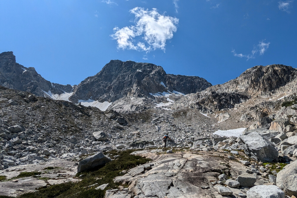
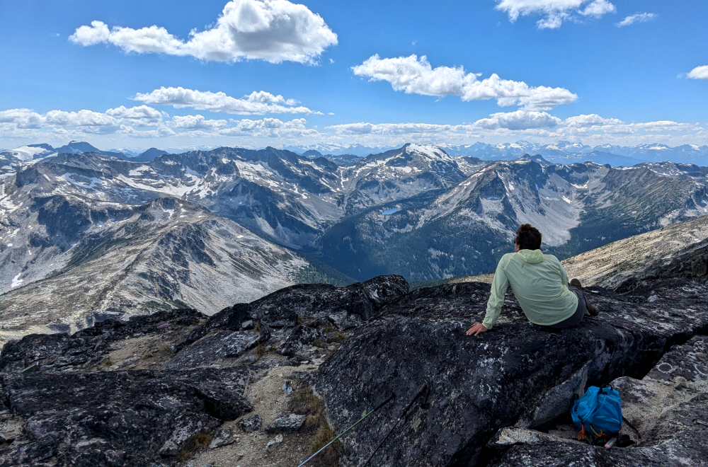
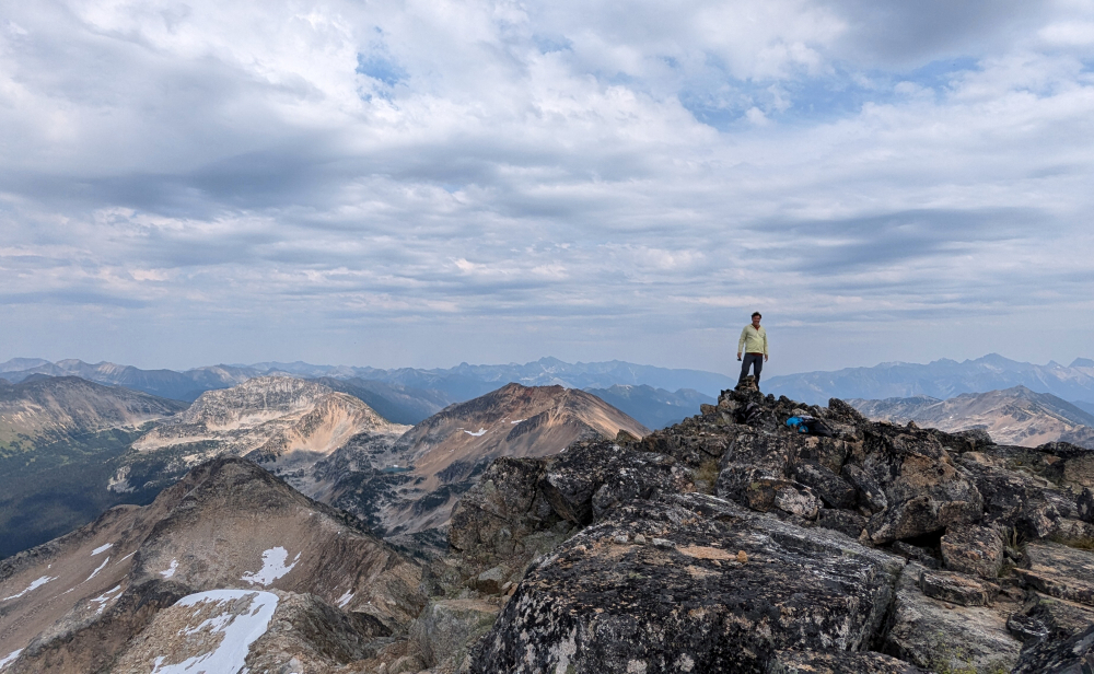
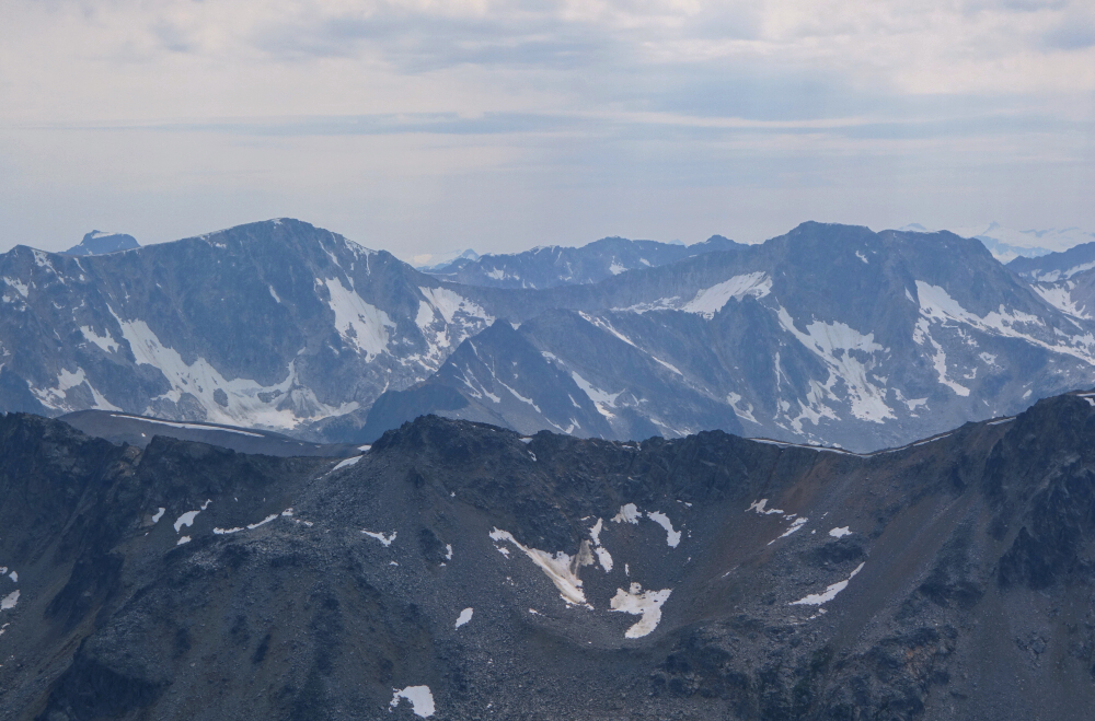
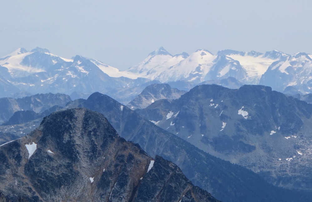
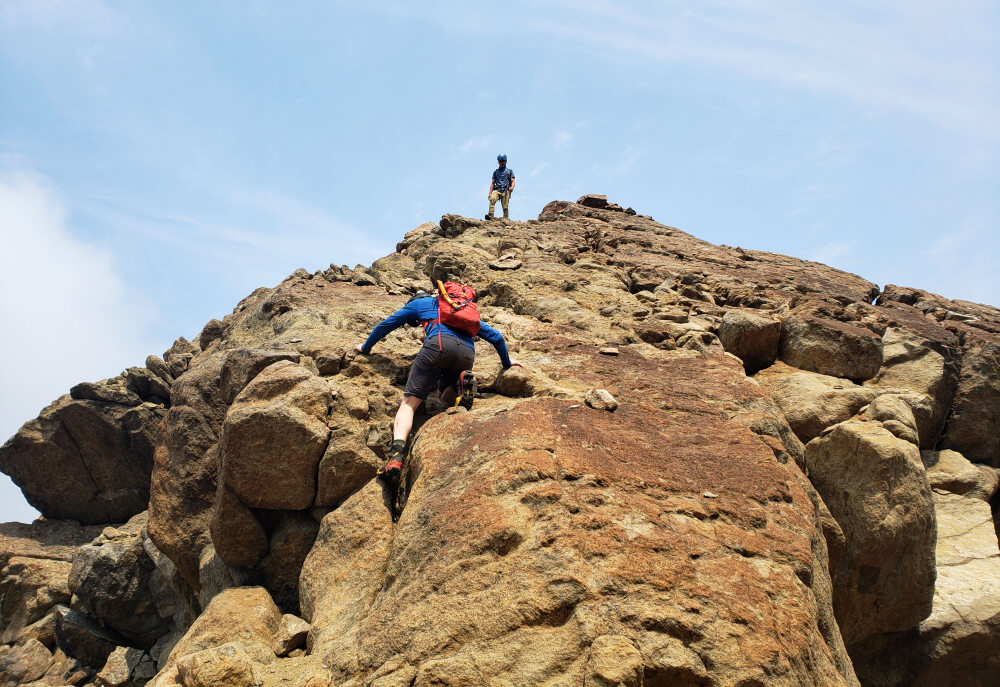
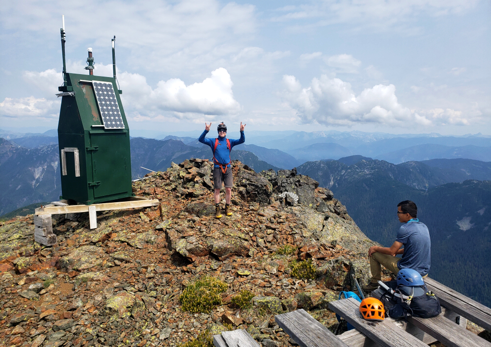
Contoured around the south-side of the lake over talus then up a short heather slope to reach another, smaller lake. Around the south shore once more to yet another lake beyond which a gradual heather slope leads on up to the col. Continuing up, we followed a spur that saw us onto the "South Peak" of Silent Hub. Up and over this, with some careful route finding necessary to navigate the tricky decent to a saddle directly below the true summit. Then finally an easy ascent from here to Silent Hub itself. About 4 hours to the top at a very manageable pace, enjoying a nice long rest at last and taking in the outstanding views. From the Joffre Group to Saint Jacobs and Gideon, the prominent glaciers clinging to the Skook Jim and Kwoiek groups and last but not least, the mighty Skihist Mountain lurking back there in the haze, there's a lot to feast the eyes on from here!
Headed down as planned via a saddle now on Silent Hub's Northwest Ridge. Had to navigate some cliffiness once below the saddle, flying blind as we were, but returned to the lake basin from earlier without too much trouble. Mosquitoes were out in full force unfortunately, so on go the layers for the sweaty walk back to the road and the truck some time thereafter. Back to the pavement and on to my go-to "freedom camping" spot off the highway for the night. Had ambitious plans for tomorrow, so turned in early very satisfied with the day and hopeful for more of the same the next!
The Old Settler - Middle Peak via North Talc Main FSR, July 2024
The Old Settler is highest peak on the Harrison-Fraser Divide and one of the more recognizable features along the east shore of Harrison Lake. It is impossible to miss from many other summits both near and far and beckons those who've laid eyes upon it to go in for a closer look. The mountain is composed of four main peaks grouped closely to each other with the tallest being the North Peak and the most frequently ascended being the Middle Peak, the latter thanks to its inclusion in the Scrambles Guide by Matt Gunn. I thought I had read somewhere that the peak is a volcanic remnant, and certainly the rock quality we experienced for most of the ascent was of the type one might expect to find on a rotten Cascades' volcano. That said, conditions improve greatly upon reaching the summit ridge and resembles the look and feel of that which is found in the Twin Sisters Range of Northwest Washington, famous for its solid and highly textured Olivine! Coincidentally, Old Settler is also well known for a handful of technical routes with reputedly sound rock, so it would appear to depend on where on the mountain one chooses to climb.
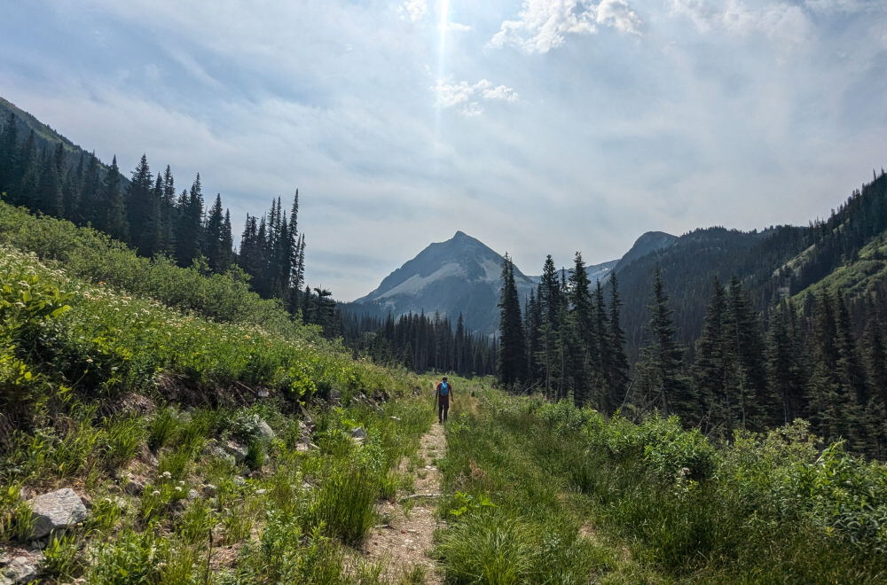
As with Mount Urquhart earlier in the Summer, this trip was made possible thanks to a recently opened gate that barred access to the trailhead for a decade or more. Same modus operandi as so many other trips in recent years; drop everything and get it while the getting is good! As of summer 2025, the gate is reported to be closed again, so bummer if you missed the party! Anyway, bearing that in mind Andrew, Finn, and I set out to capitalize on the fleeting access window and bag this icon of Southwest BC. Up some 24 kilometers along the now familiar Harrison East FSR before turning right onto North Talc Main and following it to the spur that continues a short distance into the side valley containing Daiphy Lake cradled directly beneath the peak's west and south slopes. A fallen tree stopped us short about a half kilometer from the trailhead, but despite the notorious brush the approach from here was barely over 3 kilometers to reach the lake. Spirits were high as we started up the remaining distance to the trailhead on foot.
Beyond the trailhead, the approach continues via an overgrown road as it makes a large switchback before vanishing in a thicket of alders. Flagging here coaxed us to our right for a short alder bash to reach another overgrown road now cut into the side of the slope on the north side of the creek draining the valley. Following more flagging and a worn path, we continued along the edge of this "road" to where it too disappeared, this time in a field of chest-high ferns. Only discovered upon our return, the gist here is to descend towards some alders at right, cross a minor stream and pick up yet another very overgrown road that leads east across the valley into an open forested area. Following flagging again, we crossed over the main creek branch and then proceeded up along the right (east) bank. Soon reached a sloped meadow area towards the head of the valley with a forested headwall above. Still following the occasional shag of flagging, we proceeded up into the trees for a final steep grunt up slippery duff to reach the crest overlooking Daiphy Lake. A short brushy descent from here saw us to the lake shore whereupon we finally took our first break of the day.
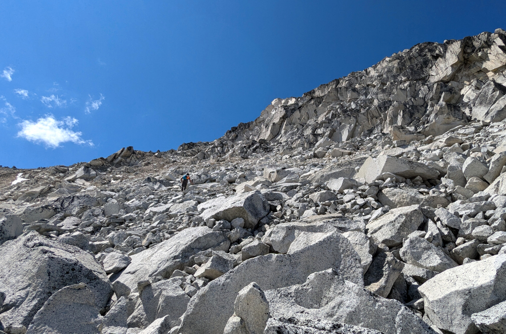
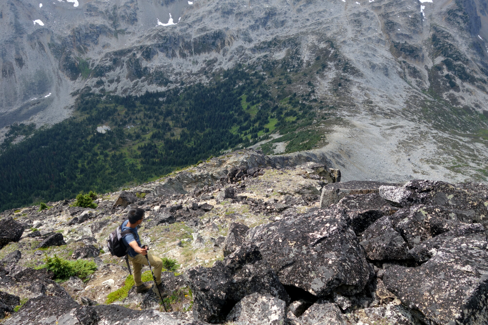
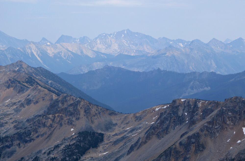
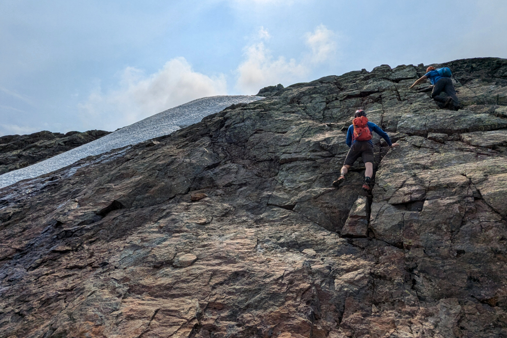
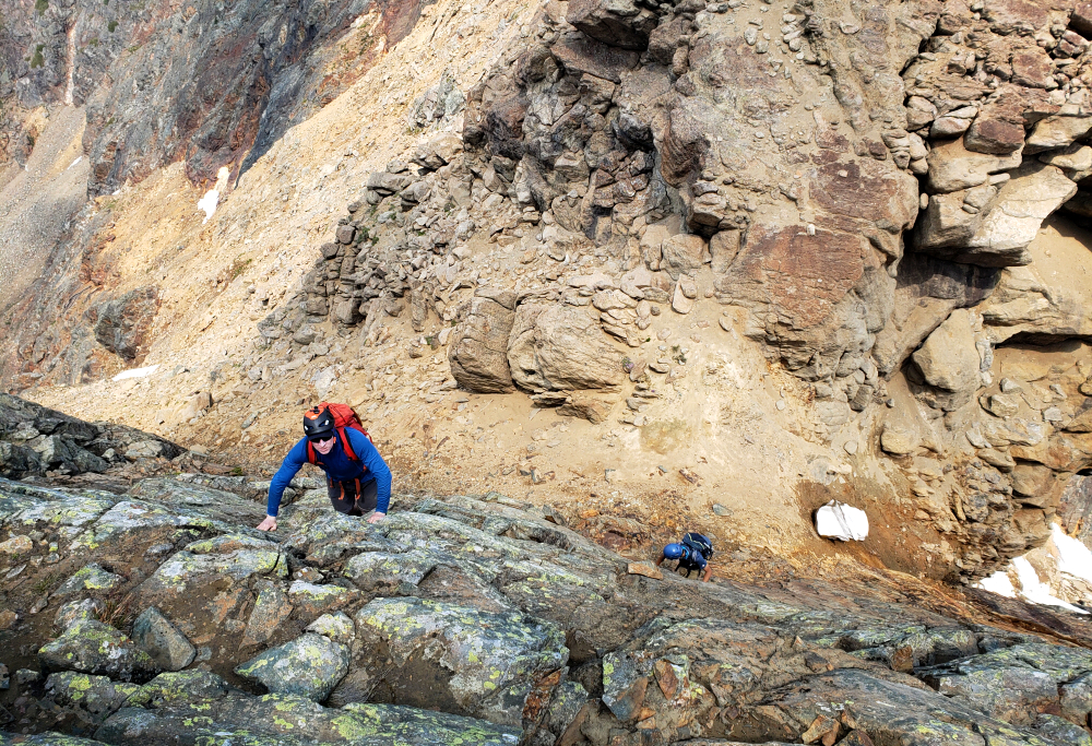
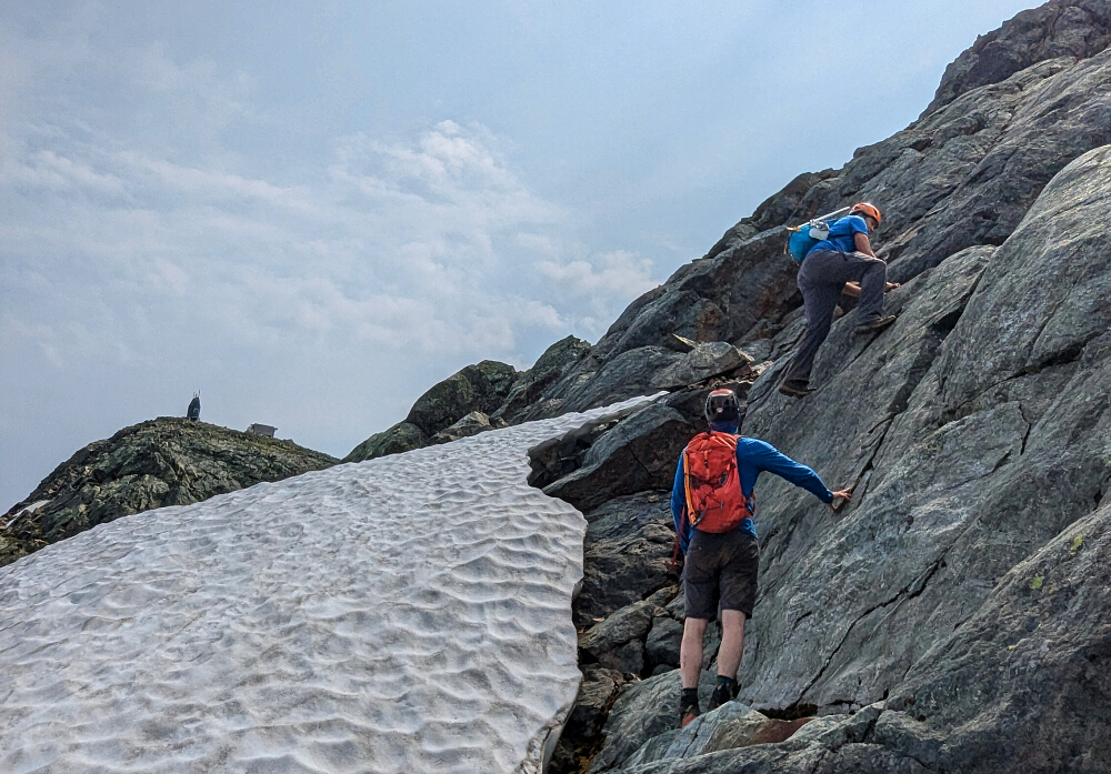
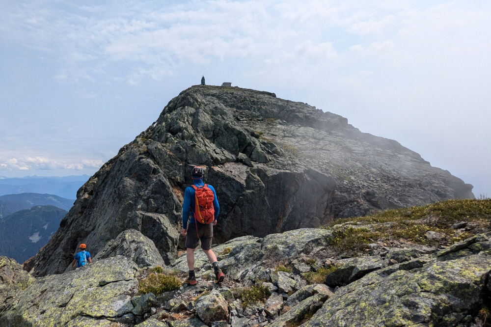
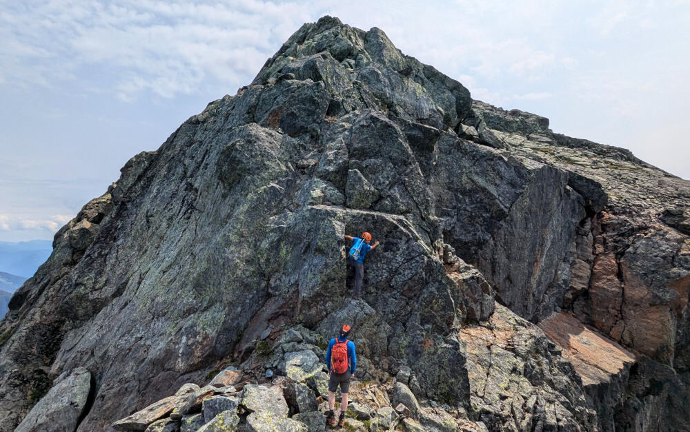
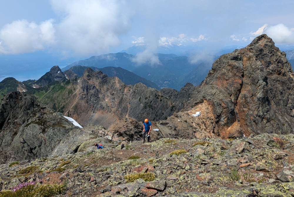
Looking across the lake, we could see the interminable talus slope we'd be scratching our way up next. Ugh! But first we had to contour around the lake, following the south shore until forced into thick bush up and over a cliff lest we go for a swim around it. Now onto the talus, making a rising traverse towards the bottom of an obvious sloping ramp feature that cuts across the peak's west face. Then up onto this ramp, following it back to the right towards the summit ridge. The rock here was friable and horribly unstable. While not particularly exposed, great care had to be taken not to dislodge boulders down onto each other. Reached the summit ridge just as my appetite for the shitty choss had run out. Fortunately, the remaining scramble from here to the Middle Peak summit was on solid rock and we all enjoyed working the "cruxes" first up a steep wall and finally up some steps on the blocky summit ridge. Yay, we made it! Enjoyed a nice long break up top, relishing the view despite the haze and intermittent cloudiness swirling about us.
Inevitably our attention soon turned to the North Peak as it is impossible to miss from Middle even if it's only about 100 feet higher. Andrew and I were on the fence, having indicated even before embarking on this trip that it may not be for us. Furthermore, based on what we experienced thus far, I wasn't entirely convinced of the soundness of the rock climbing unprotected up an exposed 4th-class ridge/buttress. Finn, was all for it and so took off for the North Peak while we wallowed in our indecision. Best let the ~150 lb twentysomething boy from Vietnam with something to prove tempt fate on the North Peak by himself. Lord knows I've survived my fair share of all that! The adage about "old bold climbers" comes to mind but moving on. All made it back down to the lake limbs intact, then returned the way we came this time detouring to avoid the portion of "trail" where we were chased by ground hornets hours earlier. About 11 hours round trip with about :30 spent up top. Stoked to have gotten 'er done, ain't ever coming back!
It would be very much appreciated if you please ask before copying and/or re-publishing content from any part of these pages. To do so, please click here to send a message via feedback form.


