Select from list below to jump to a specific area on this site.
| Latest Posts |
Friday, February 20, 2026
Mount Athelstan ("Peak 2460") - South Route via Upper Lillooet FSR, September 2024
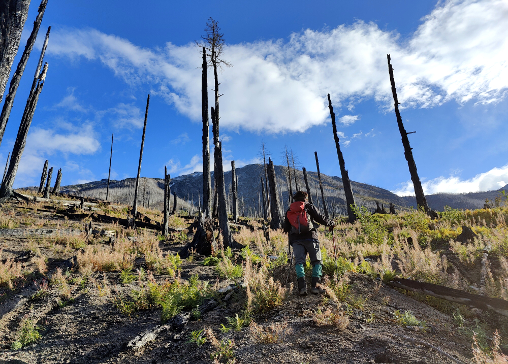
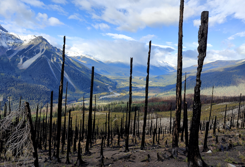
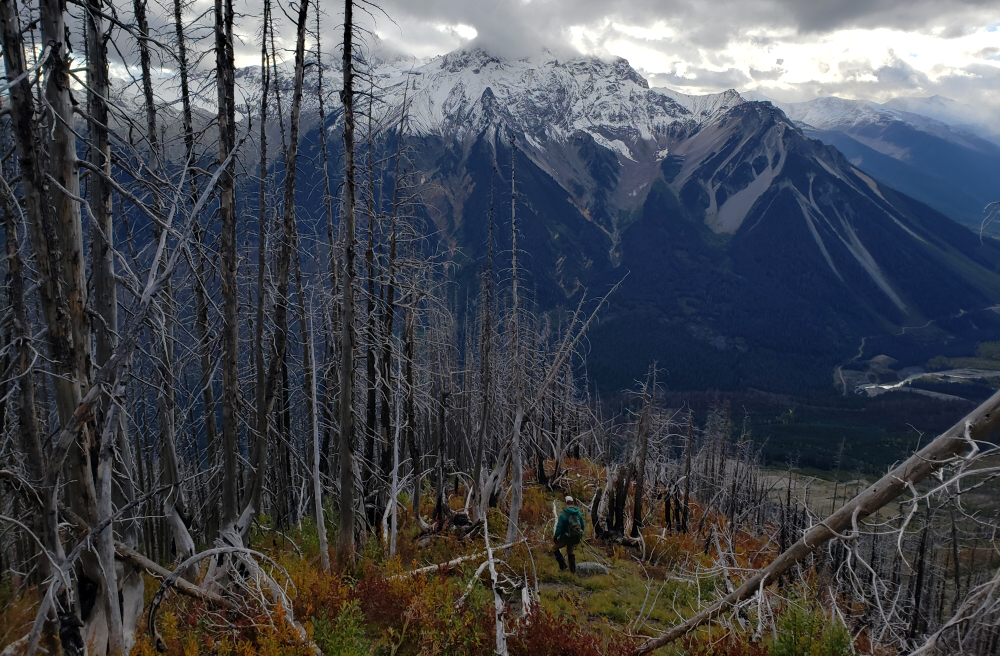
My fascination with Mount Athelstan began with a failure—an aborted attempt at Athelney Pass back in May. Looking up from the final stretch of the FSR, the ascent to the alpine appeared mercifully clear. A wildfire had swept through years prior, leaving a ghostly, silvered forest of charred trunks without the usual tangled understory. It looked like a rare gift in the brush-choked Coast Mountains. Determined to sneak in one last "big" objective before the scrambling season draws to a close, I lured Kevin and Wes into joining me on this remote objective at the headwaters of the Lillooet River Valley.
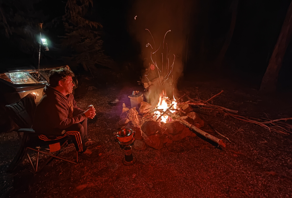
We drove up the night before, carving out a base camp at an abandoned recreation site near the Meager Creek confluence. As we sat by the fire, the mood was tempered by what we'd seen on the drive in: a healthy, silver dusting of fresh snow on the high peaks. I'll admit, I was the skeptic. Over beers, I suggested a pivot to a lower objective, but Kevin and Wes weren't having it. The vote was cast, the plan was set, and we turned in under a cold, starless sky.
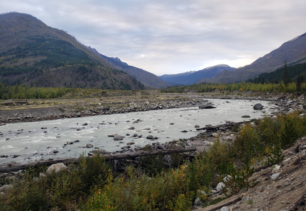
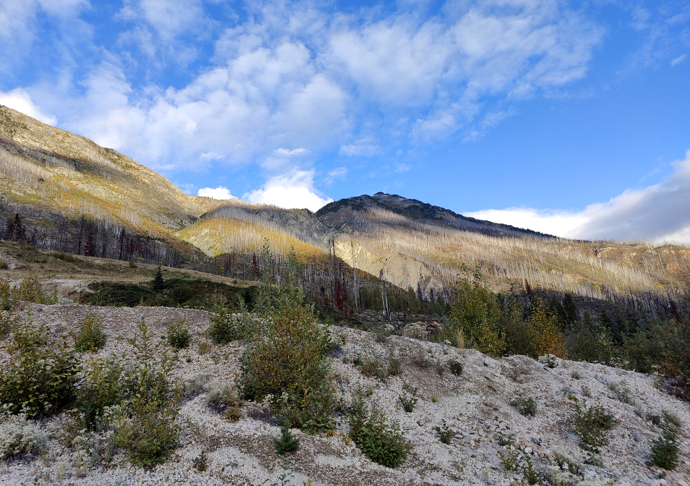
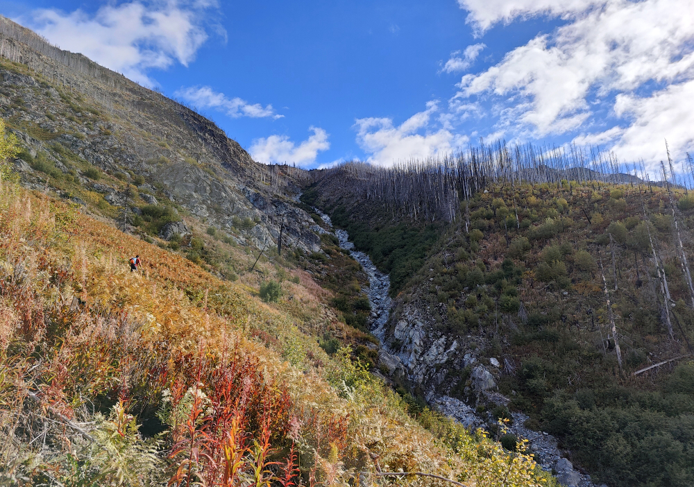
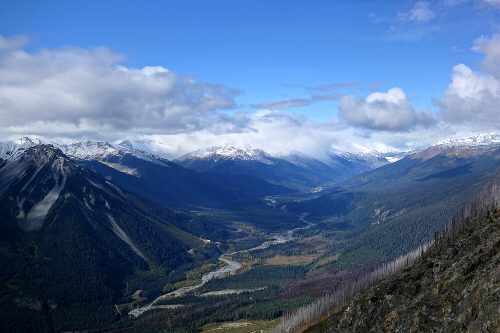
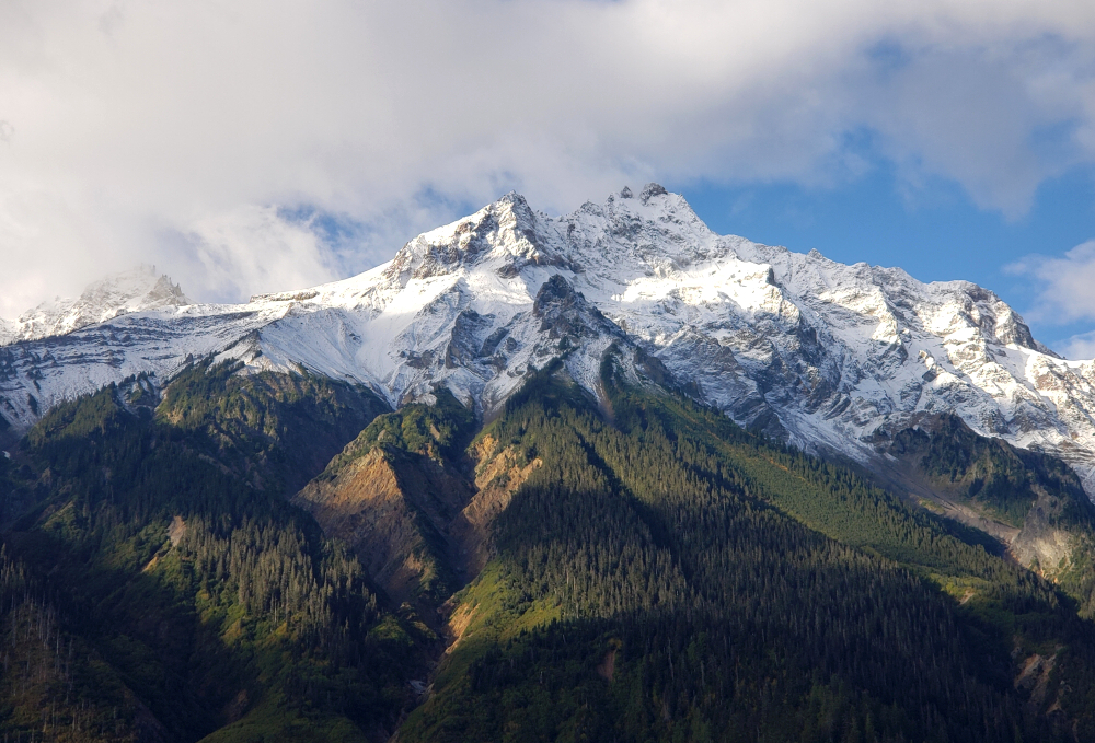
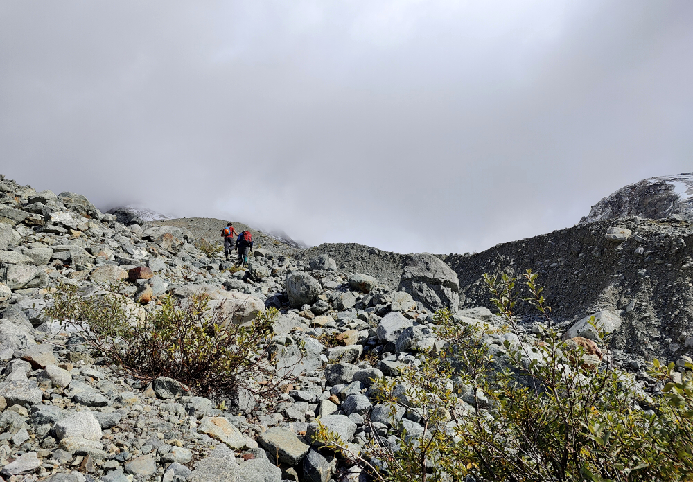
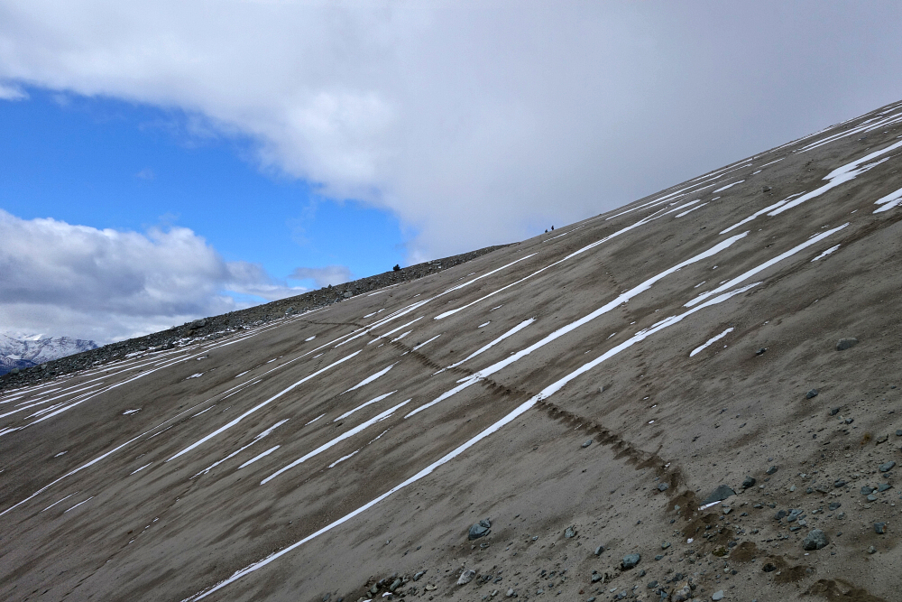
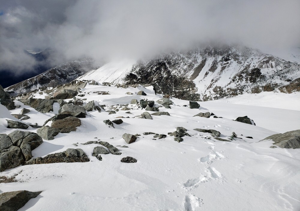
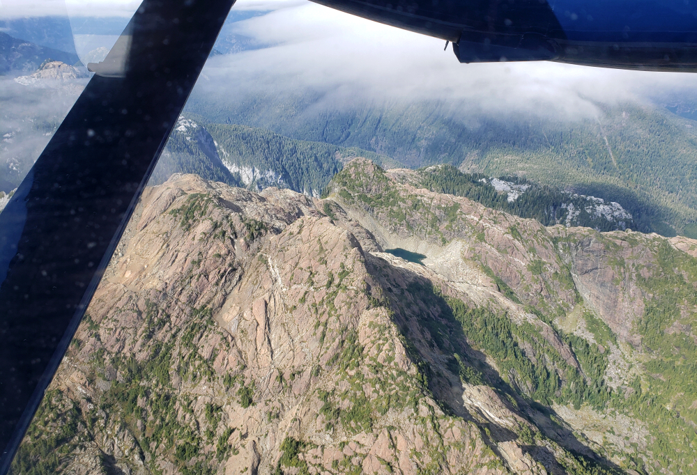
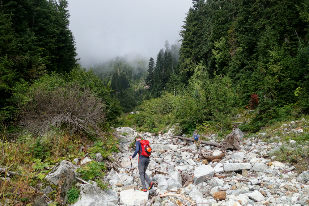
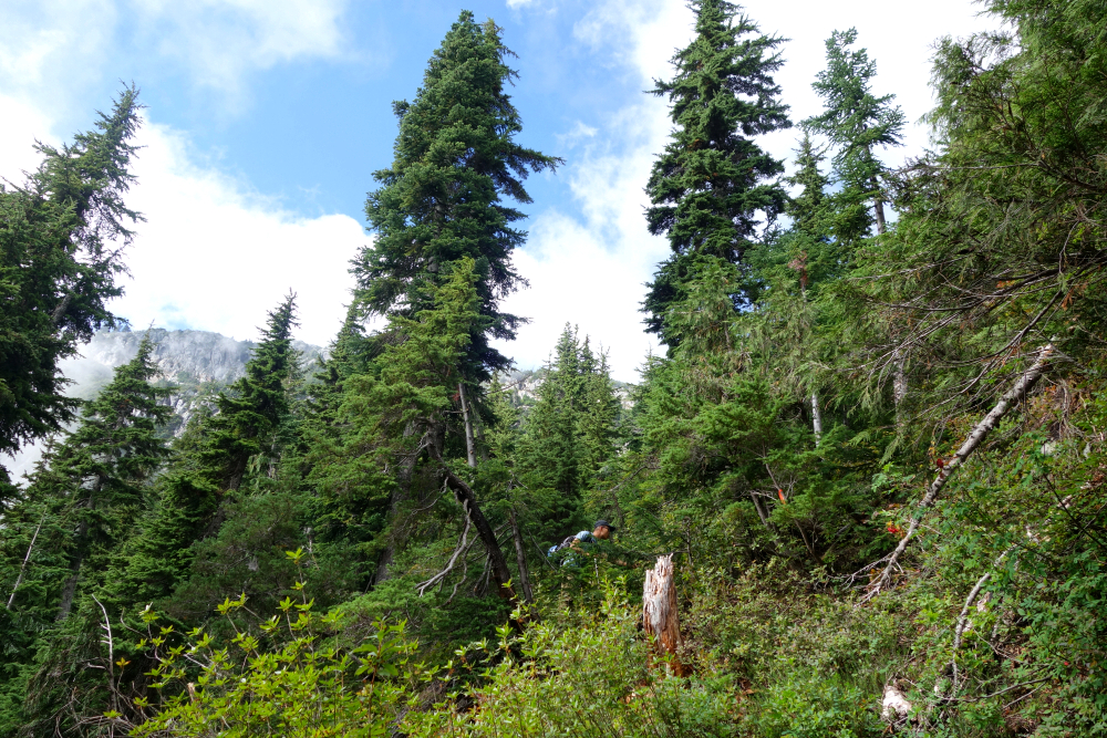
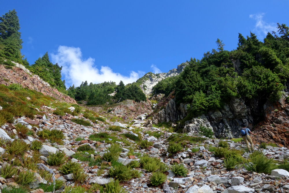
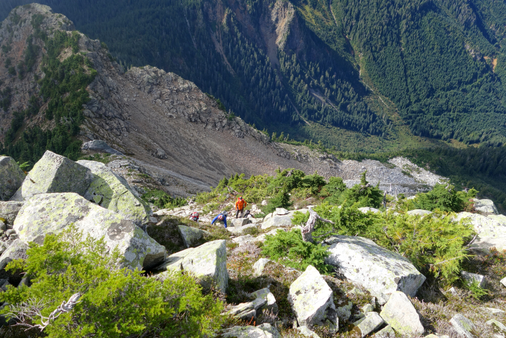
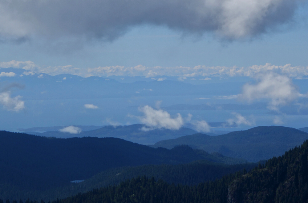
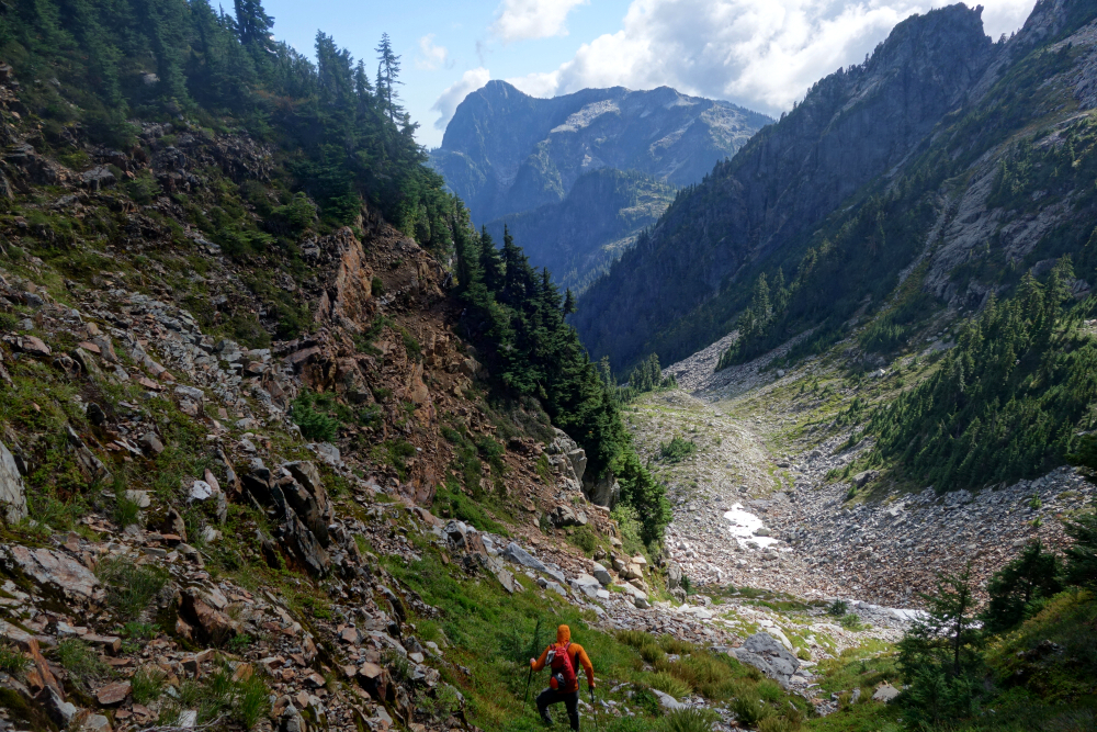
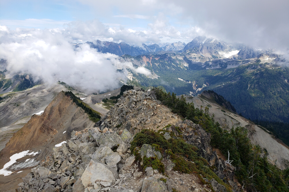
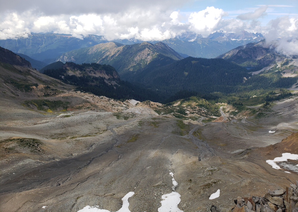
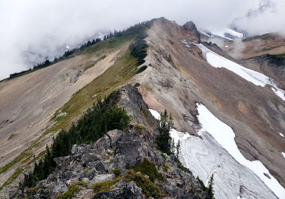
We set out for Athelstan at first light. We parked as high as the logging roads would allow and stepped into the skeletal remains of the forest. We had started too far left of the old pumice mine—the traditional starting point—and paid for it with a grueling ascending traverse. We spent the morning side-hilling across a slope of low-slung vegetation, leaping across two deep, ravine-like gashes in the earth. Eventually, we gained a timbered spur. The grade steepened instantly, but as we climbed, the reward arrived: sweeping, dramatic views of the Upper Lillooet River Valley and the Mount Meager Group rising precipitously from the opposite valley wall. The spur ended abruptly at a massive talus field. We hopped boulders, eventually gaining a lateral moraine that led us toward the vast pumice slopes guarding the summit.
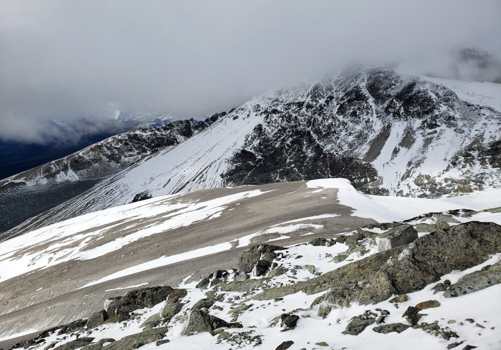
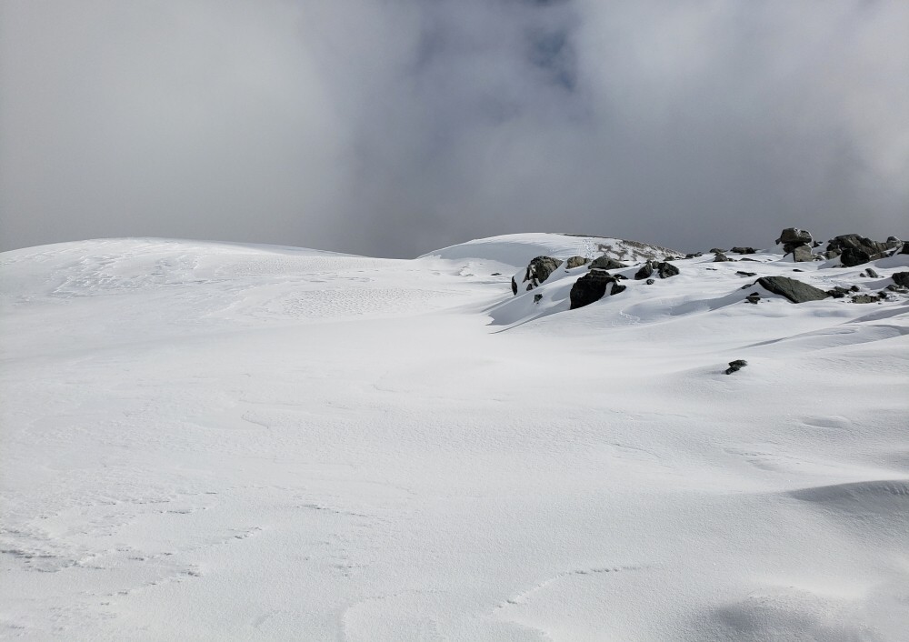
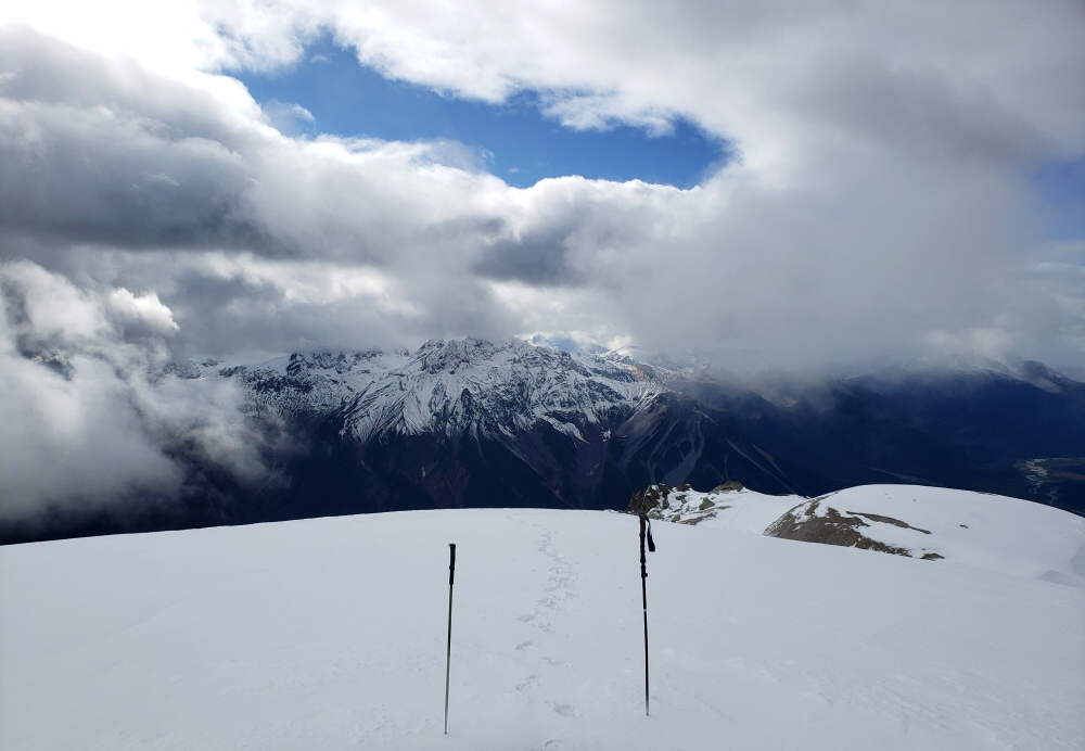
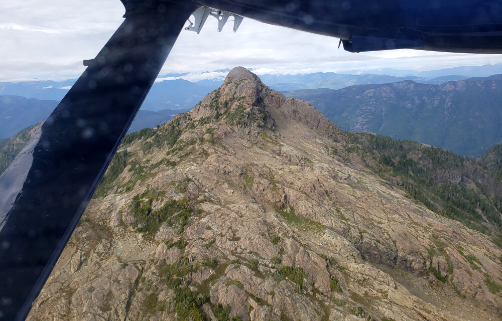
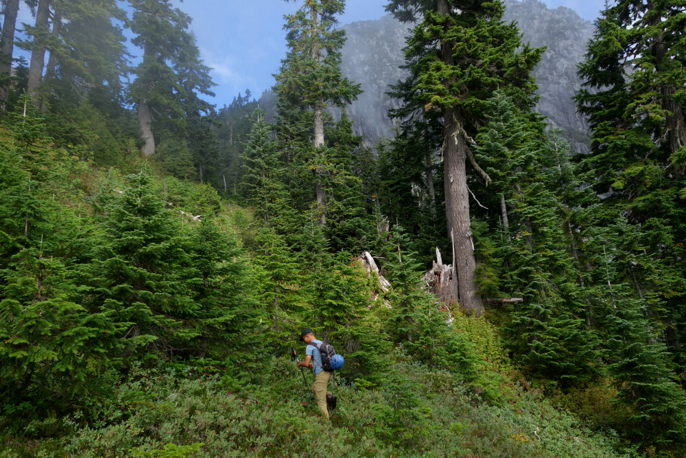
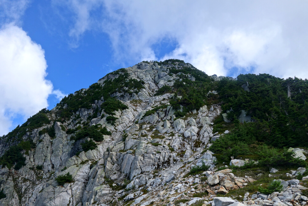
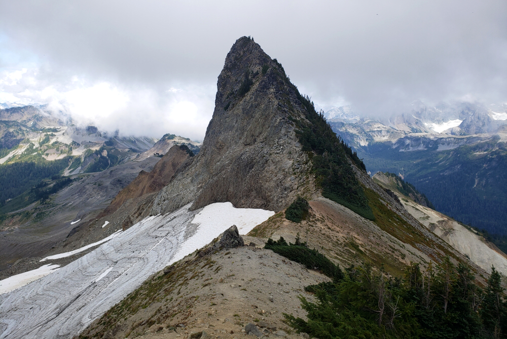
The mountains, however, weren't cooperating. Clouds clung stubbornly to Athelstan's crown, and as we climbed, the "dusting" of snow became a thick, icy plaster on the rock. Looking at the rime and verglas-covered summit tower, I knew the odds of a safe, enjoyable scramble were plummeting. For me, a summit without a view is a dealbreaker. I told the guys I was out. While Kevin and Wes disappeared into the whiteout to test their luck, I turned right and headed for "Peak 2460" instead.
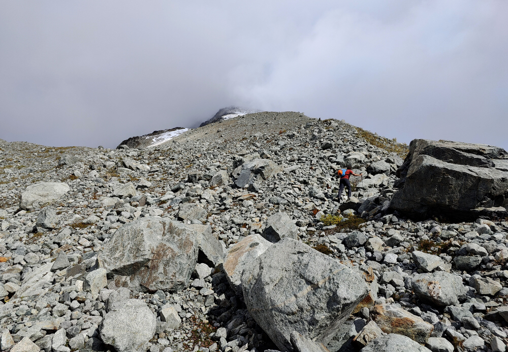
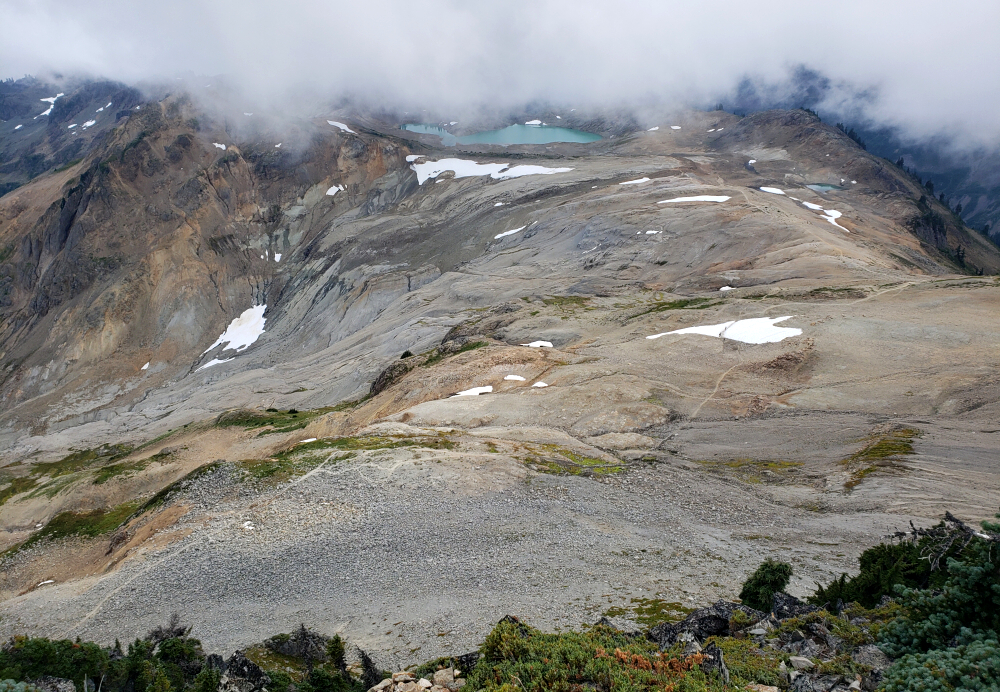
I crossed a wide, lonely pumice slope to reach the West Ridge of 2460. It was a trudge through sliding volcanic grit, eventually giving way to snow-choked rock near the top. To my surprise, I found snow-filled footprints in the pumice—proof that I wasn't the first person to settle for this unremarkable sub-summit as a consolation prize.
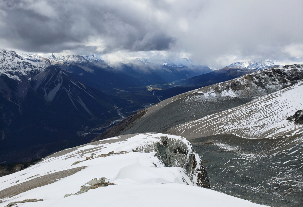
I remained on the summit of 2460 for 35 minutes, shivering in the hopes that the clouds would magically lift. They didn't. I headed back down to find the others; as predicted, they had abandoned their bid after realizing the summit tower was a bit more involved than hoped for. We retraced our steps down the moraine and the spur, but this time, we chose the "smart" route: heading straight for the pumice mine to avoid the morning's traverse. It was a brilliant plan until the very end.
Just as the mine came into view, the open forest vanished. I found myself drowning in a literal sea of chest-high ferns. Every step was a physical battle against dense, green resistance that seemed determined to keep us on the mountain. By the time we hit the flats, we were exhausted, damp, and humbled—but at least we knew which way not to go next time.
Lone Cone and Peak 86 - via Lone Cone & Pk. 86 Trail, September 2024
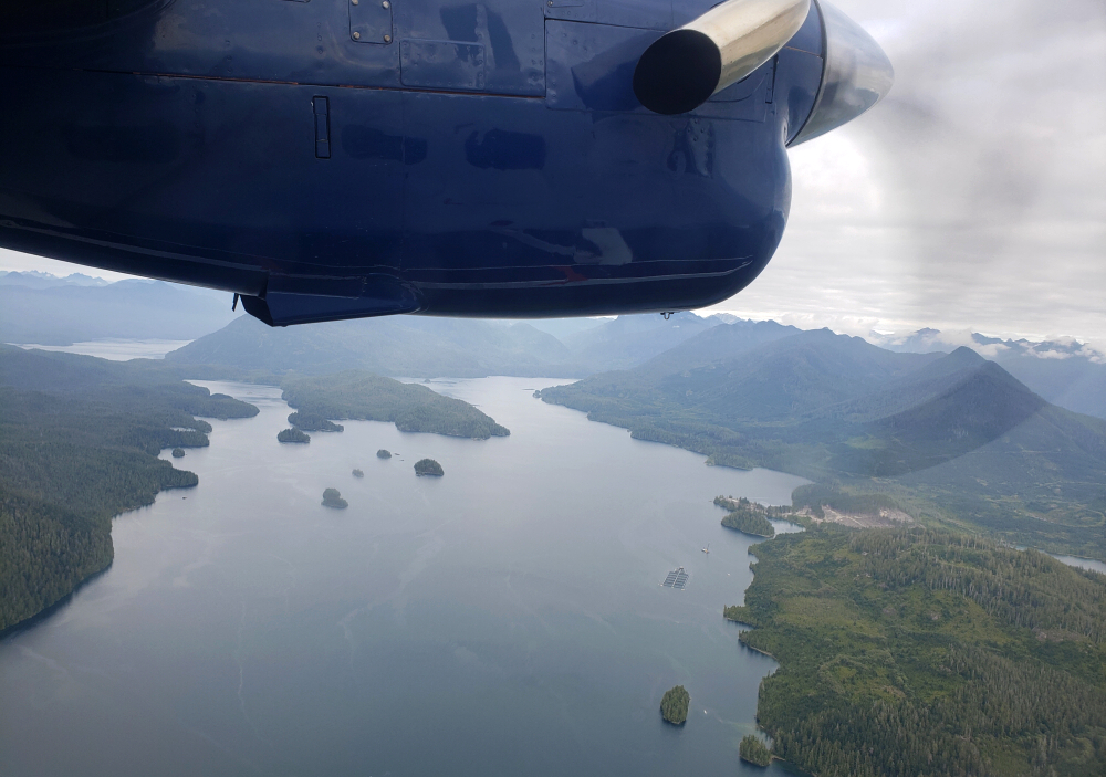
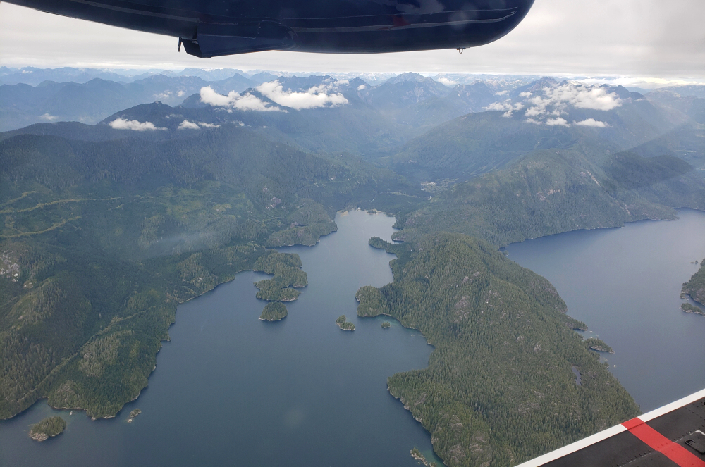
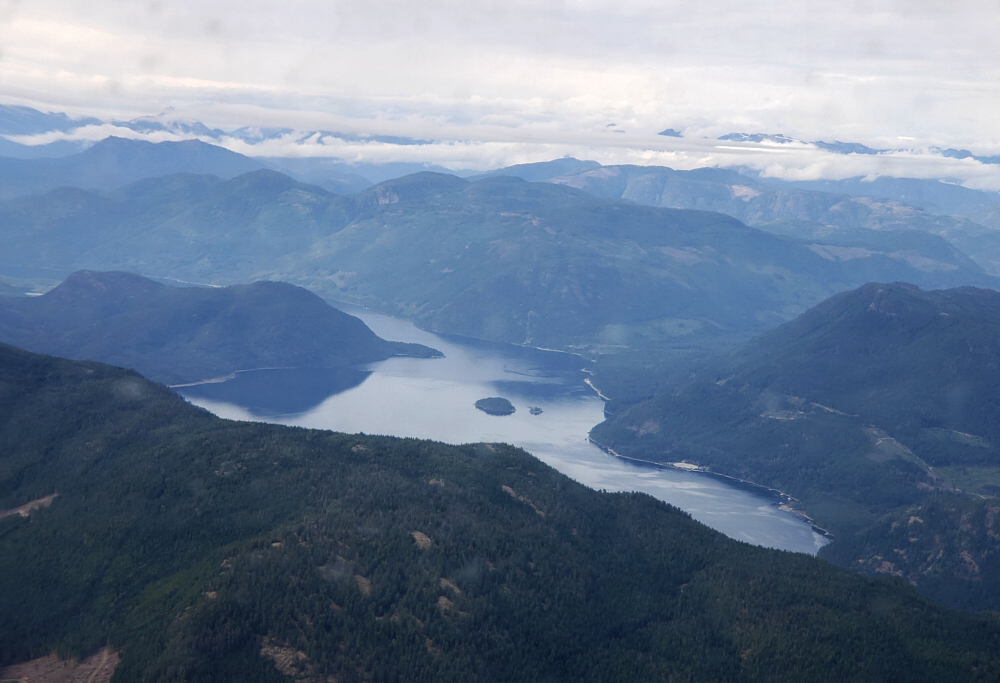
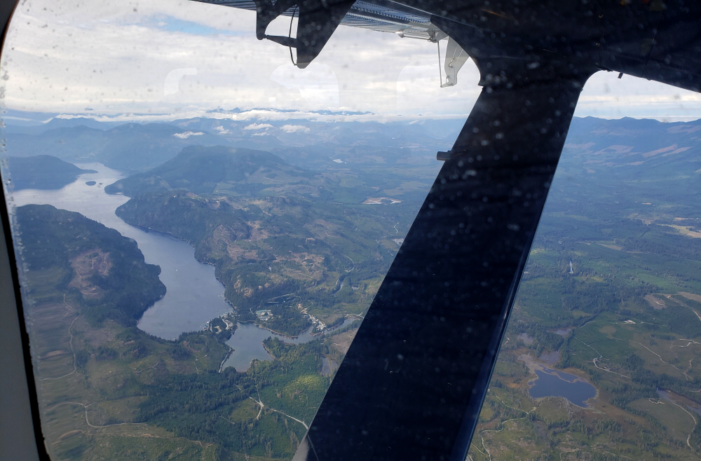
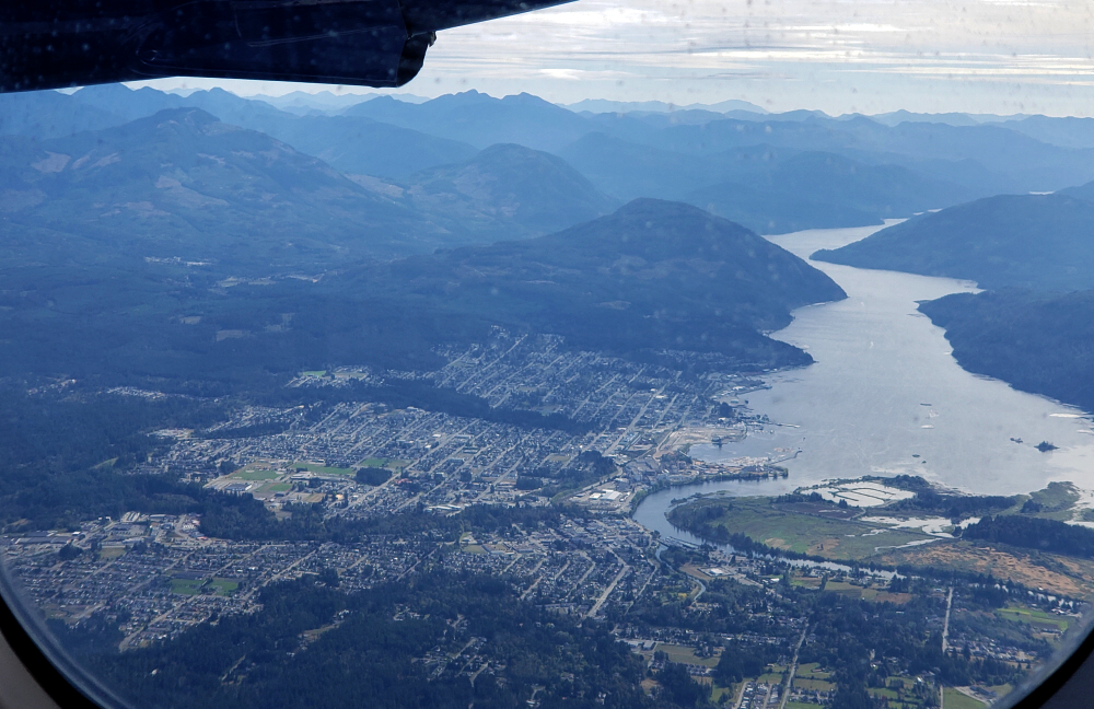
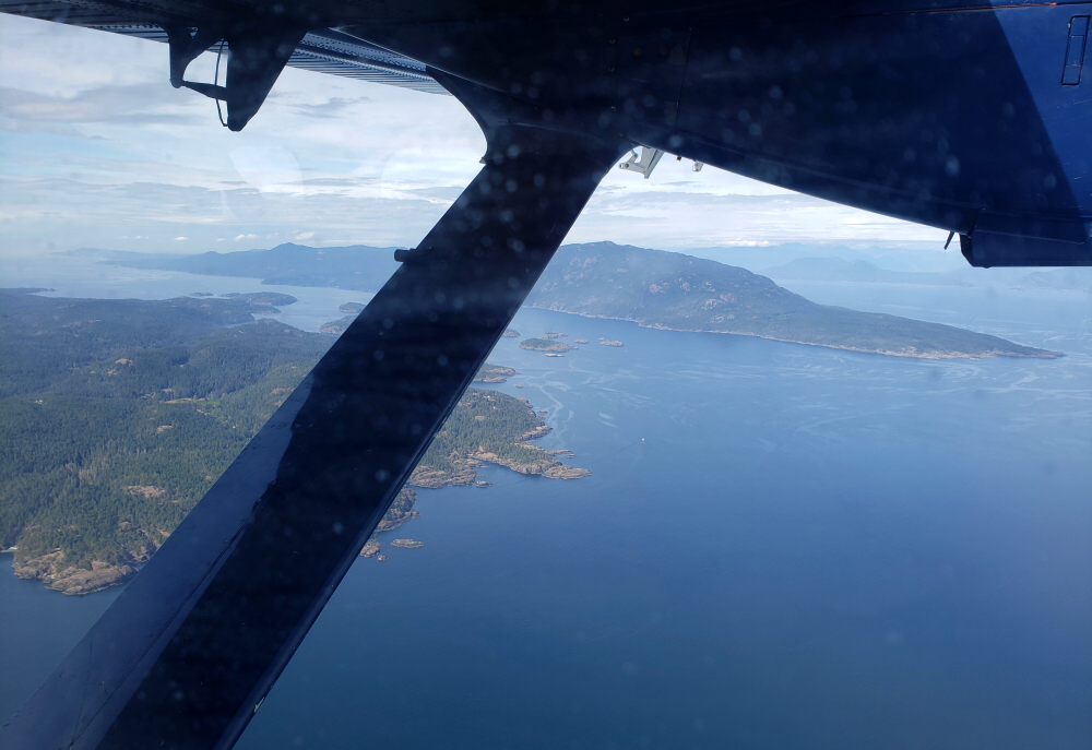
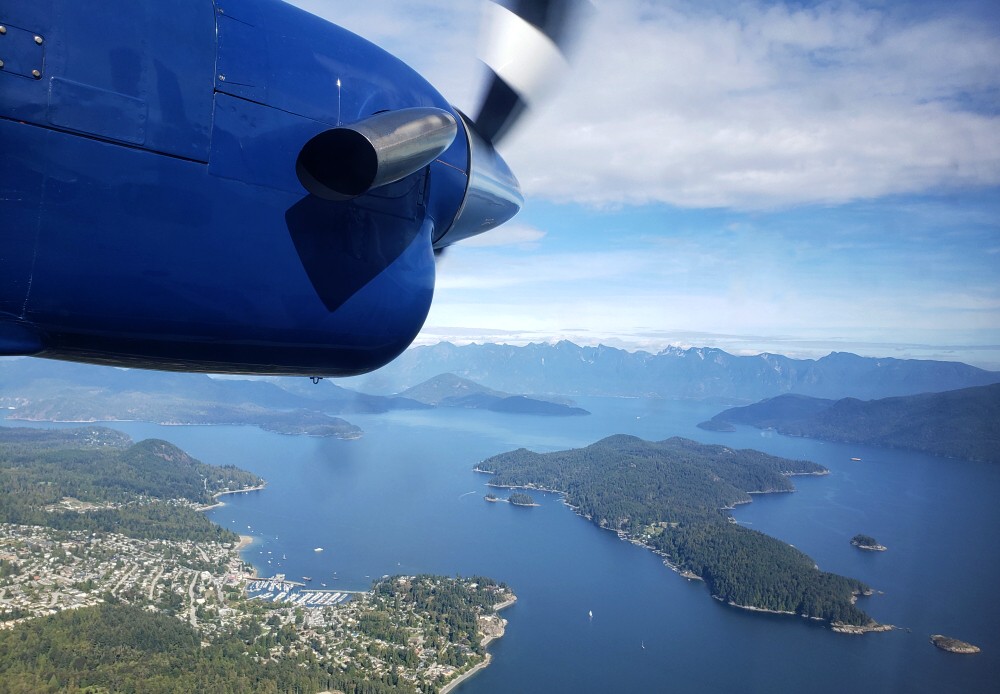
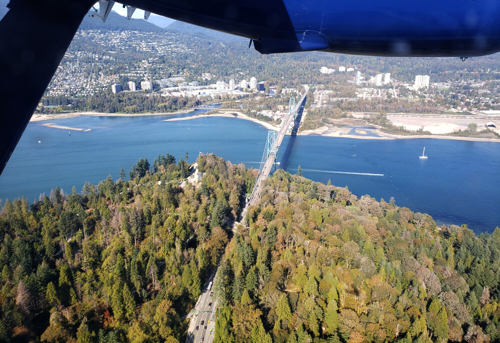
Several months earlier, Agata won a two-night stay at Pacific Sands Beach Resort in Tofino, complete with round-trip transportation by Harbour Air Seaplanes. What better way to celebrate her birthday? It wasn't our first floatplane departure nor our first visit to Tofino, but it would prove to be one of the most memorable—and certainly the quickest. Far more civilized than the long ferry crossing and the winding drive across Vancouver Island, we lifted off from Vancouver's Coal Harbour, pontoons skimming the water, and touched down at the Tofino marina just 45 minutes later. Efficient, scenic, and hard to beat.
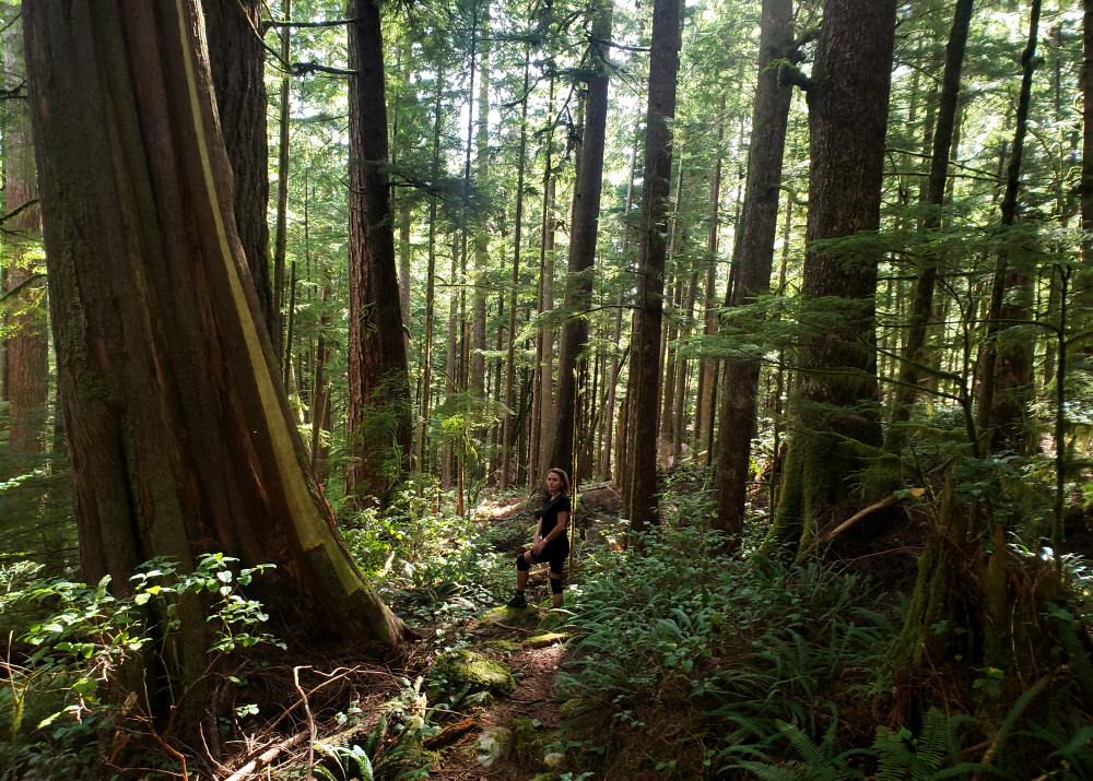
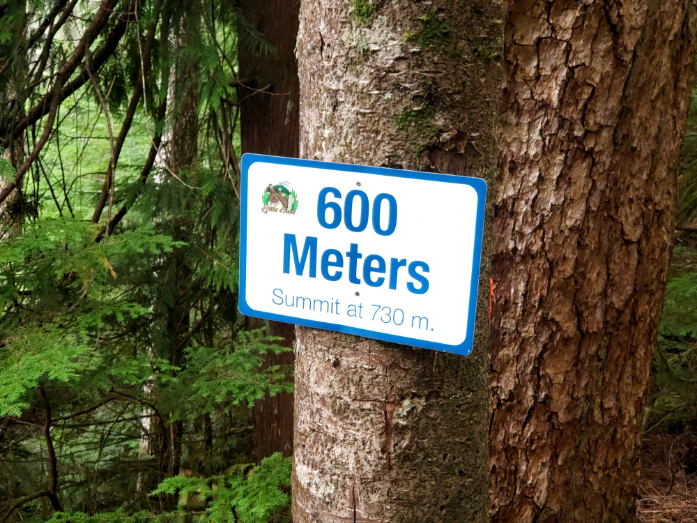
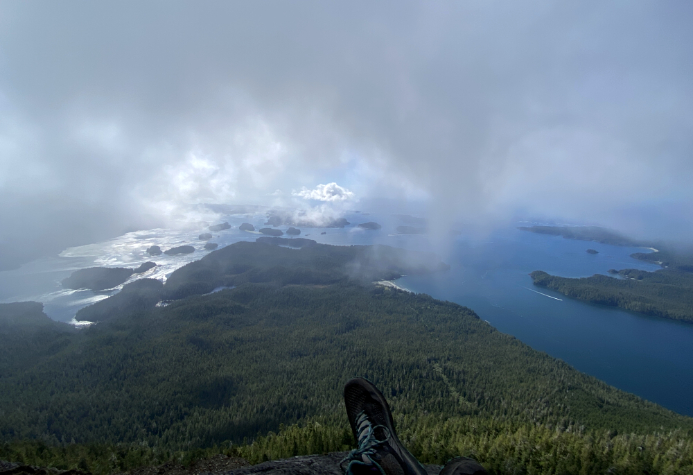
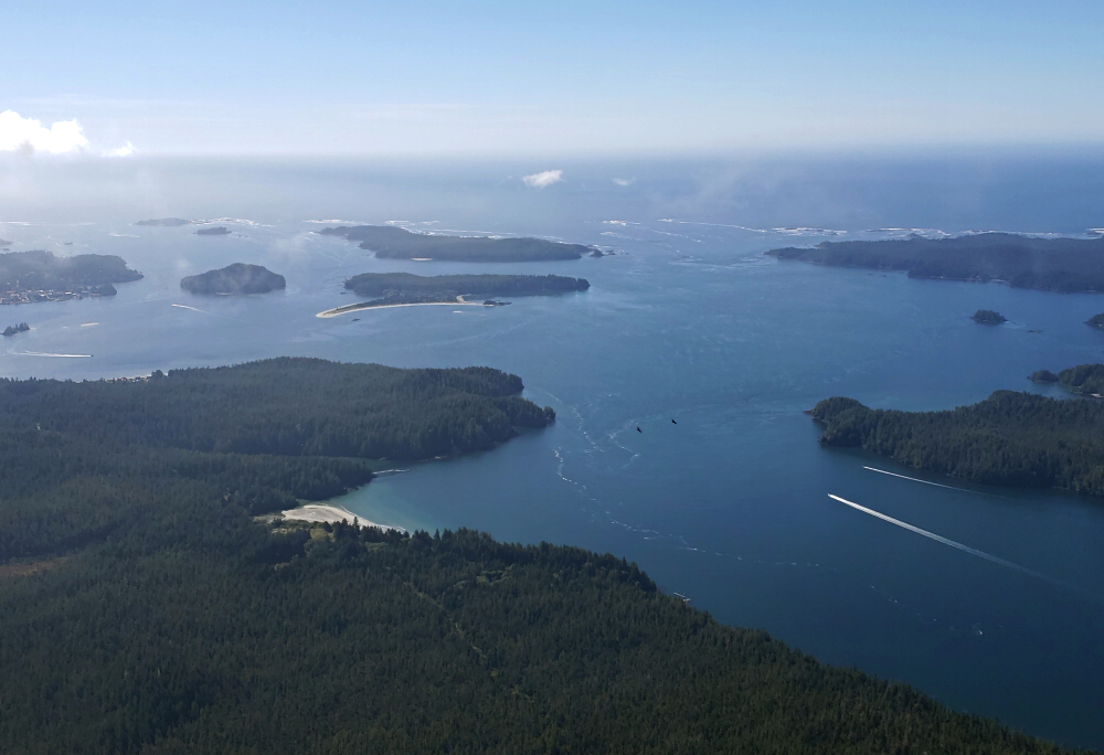
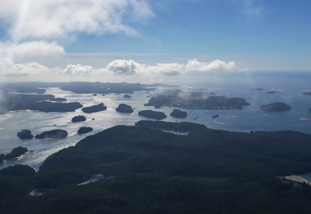
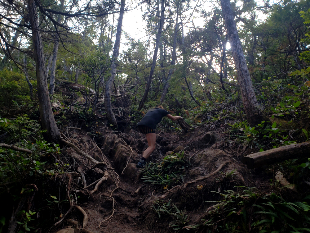
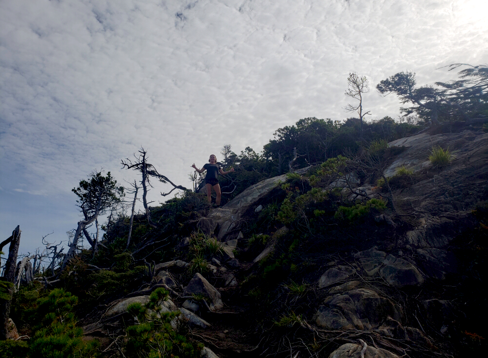
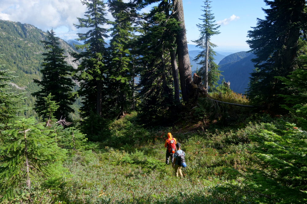
On previous trips, surfing had been the main draw. As fun as that's always been, it inevitably consumes the schedule and overshadows some of the region's other attractions. This time, we set our sights on the land—specifically, a pair of hikes promising expansive views over Clayoquot Sound and the wild Pacific shoreline. First up was Lone Cone, a 7-kilometre outing with roughly 2,400 feet of elevation gain on Meares Island. Until recently, public access to the island had been restricted by local First Nations; visitation has since resumed, though with an understanding that cultural sensitivities and respect for the land remain paramount.
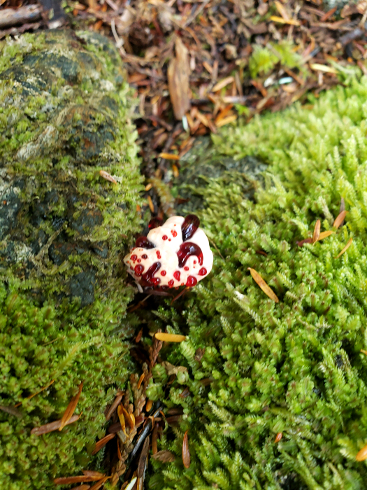
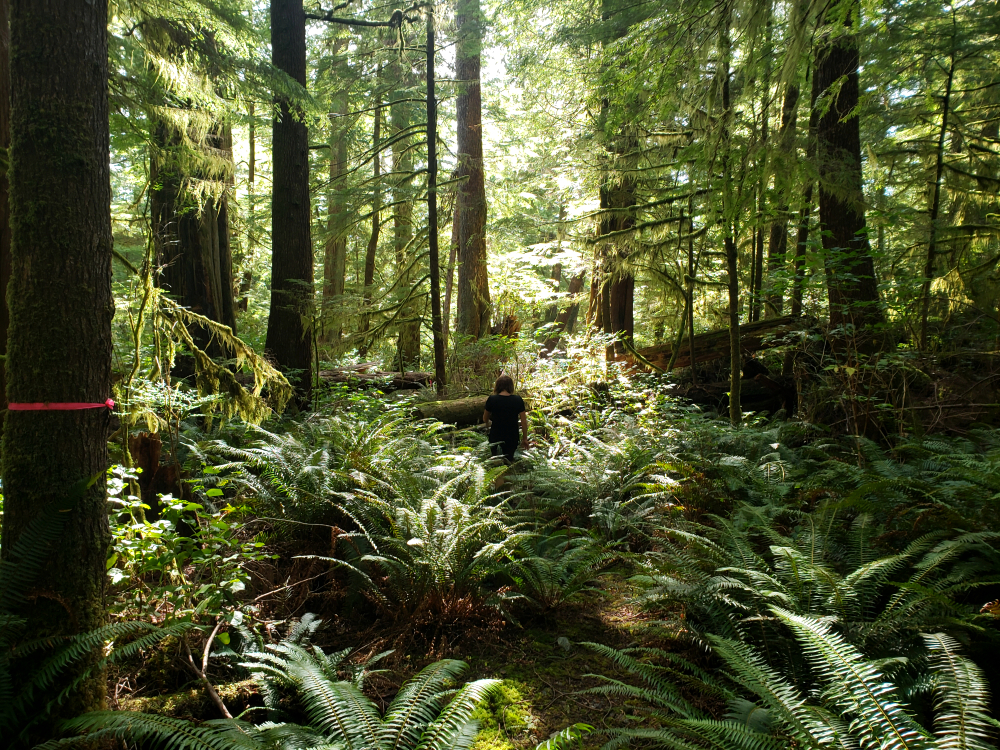
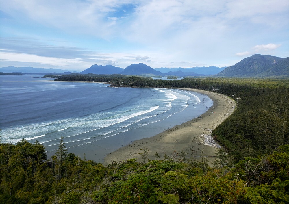
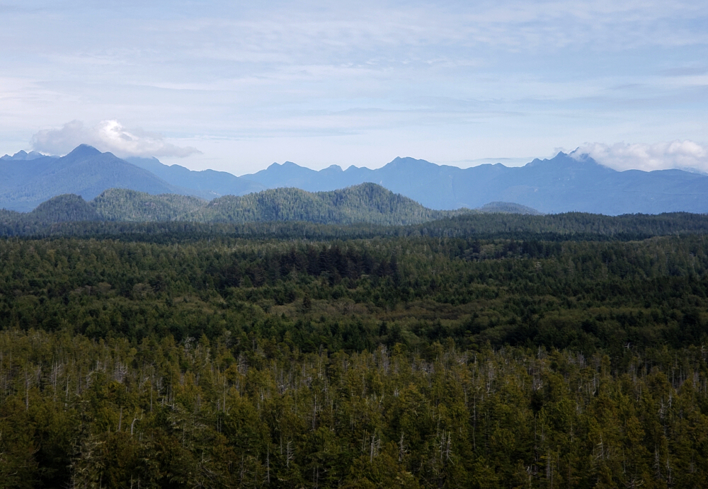
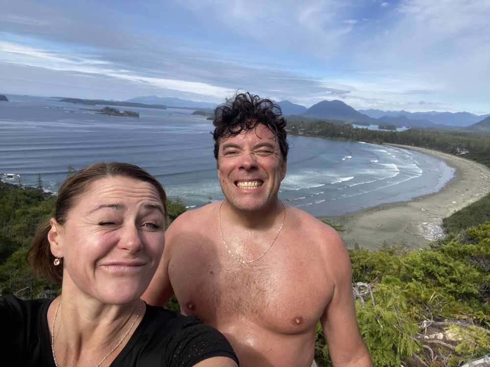
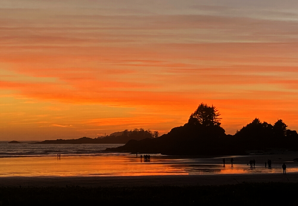
The trail begins gently, winding through dense coastal rainforest thick with moss and punctuated by predictably muddy stretches. Before long, however, the route tilts upward in earnest. The climb is sustained and steep through the latter half, relenting only near a small saddle between two modest summit humps. We bypassed the slightly higher, forested north summit—reportedly viewless—and continued to the south summit, where a rocky bluff opens to a sweeping southern panorama. From this airy perch, Clayoquot Sound stretched before us, dotted with countless islands, with the tip of the Esowista Peninsula and the town of Tofino beyond, and the Pacific Ocean fading into the horizon. Two hours brought us to the top; another leisurely hour was spent soaking in the view before descending. A bracing cold plunge by the jetty while awaiting our water taxi capped off a thoroughly satisfying day in the Tofino backcountry.
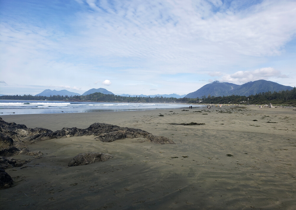
That evening unfolded in relaxed fashion—fireside drinks with old friends who, by coincidence, were also in town. The next morning dawned clear and calm, late-September light illuminating the beach. One final objective remained before our flight home. This time, no ride was required. From our doorstep, we simply wandered south along the sand, boots in hand, to the unsigned trail leading to Peak 86. As its name suggests, the summit rises a modest 86 metres (282 feet), but what it lacks in stature it makes up for in scenery. The lookout provides a lovely vantage over Cox Bay, the surrounding peninsula, Lone Cone, and the open Pacific. Naturally, I pushed a bit farther through the brush in search of a superior viewpoint from the true high point—there wasn't one—before rejoining Agata on the beach for our stroll back to the suite.
Tetrahedron Peak - West Face via Rainy River FSR, September 2024
For years, Tetrahedron Peak had been sitting there—visible from afar, quietly taunting me across Howe Sound. The highest point in Tetrahedron Provincial Park and the most significant peak in the Sechelt area of BC's Sunshine Coast, it had long captured my attention. Despite requiring a ferry ride for us mainlanders to reach it, the peak is clearly visible from the Sea-to-Sky Highway and lies less than 50 kilometres away as the crow flies from my home in North Vancouver. I got my first up-close look at it in November '22 from the summit of Mount Steele, which reignited my interest in scaling this enigmatic mountain. The only problem was a relative dearth of reports online, and those that did exist mostly complained of terrible bushwhacking.
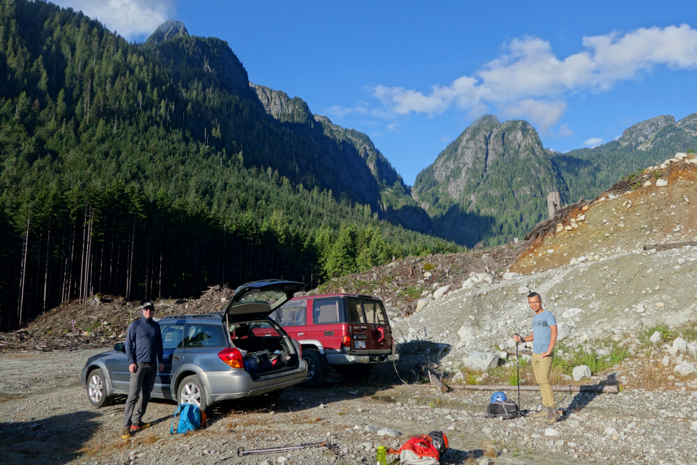
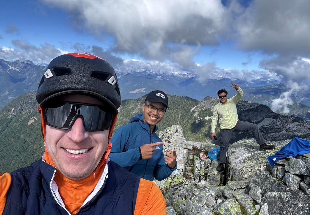
Fast forward to summer 2024, when reports began surfacing of ascents starting from newer forest roads on the southeast side of the peak. Bush was still said to be unavoidable, but it didn't sound particularly bad by South Coast standards, and the stats seemed very reasonable. As with so many other objectives in recent years, this became a drop-everything-and-get-it-done moment for Andrew and me. We recruited Finn—whom we'd climbed The Old Settler with earlier that summer—and hopped on the first Horseshoe Bay-Langdale sailing on a warm Saturday in September.
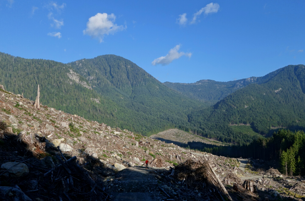
We drove off the ferry and proceeded north toward Port Mellon, an industrial site with a checkpoint guarding access beyond. We relayed our intentions to the person manning the booth, who registered our plates and waved us through. Continuing along the perimeter of the facility, we turned left onto the Rainy River FSR, then left again onto Branch 04 after about 7.5 kilometres. We drove as far as we could in Andrew's Subaru Outback before stopping at a large cross-ditch. Pulling up beside one other vehicle already parked there, we packed our gear and started up the road on foot.
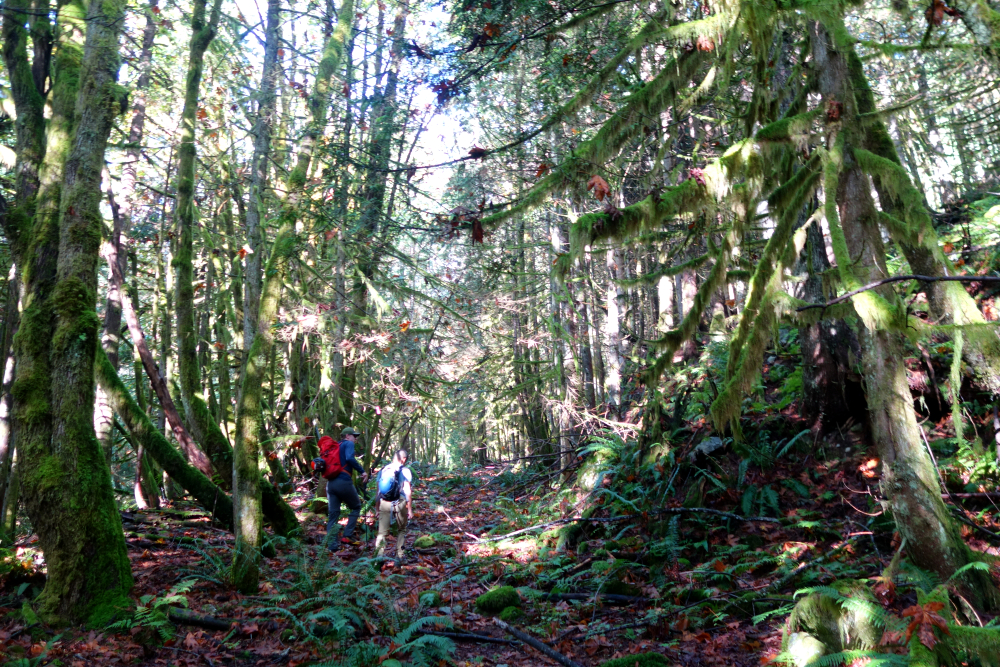
After 2 or 3 kilometres, we reached the road's end and entered the forest, continuing along an old, very overgrown road into the valley immediately southeast of the peak. A few more kilometres brought us to flagging that directed us left across a creek and up along the crest on the left side of a minor ravine. We followed this for a while before making a quick jog right to pop out onto a dry, boulder-strewn creek bed—likely the upper portion of the same ravine we'd been hiking beside earlier.
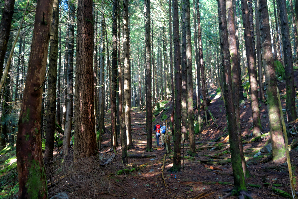
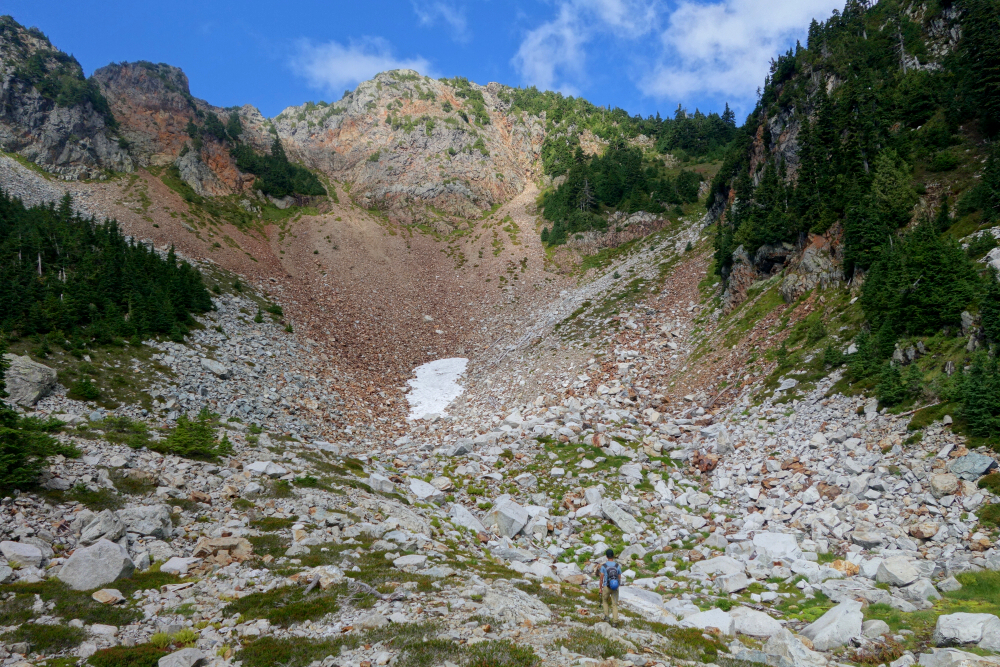
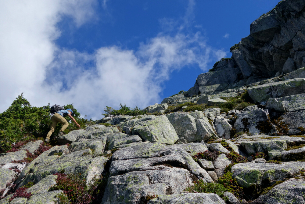
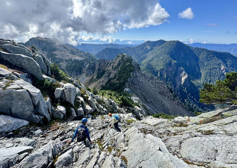
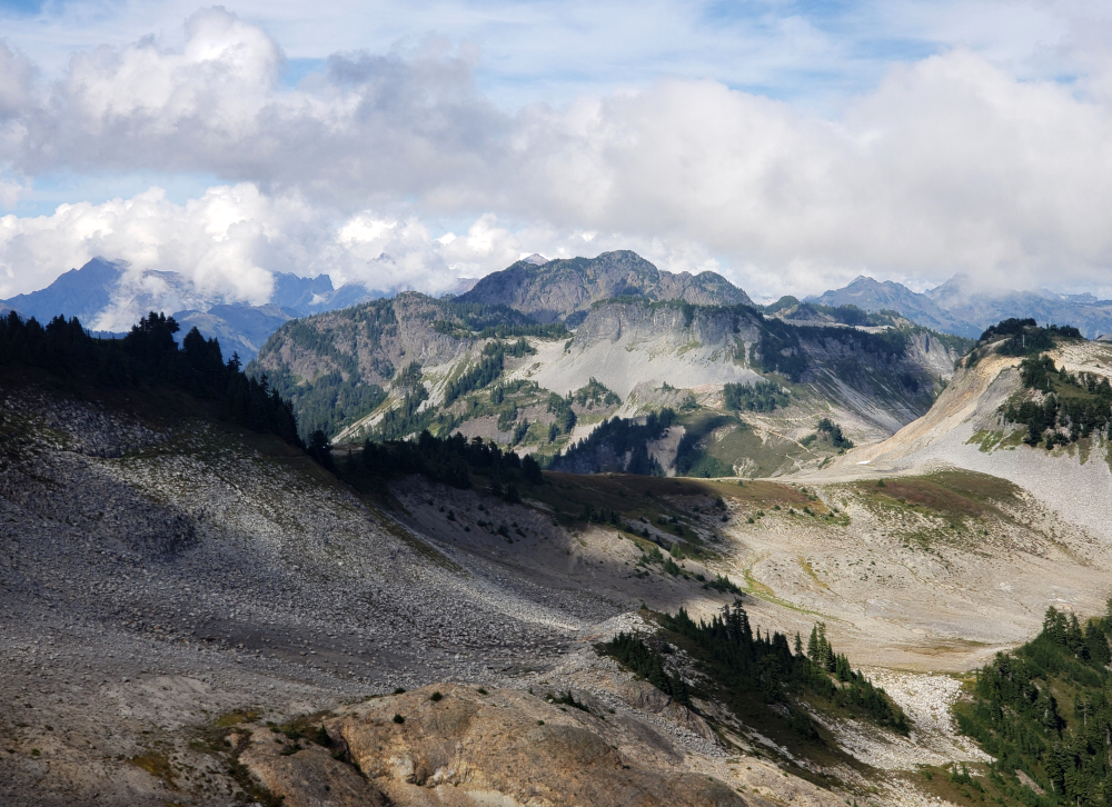
We hopped boulders up the creek bed toward a headwall at its upper end. A keen eye would have spotted a strip of flagging on the left just before the headwall comes into view. It marks the continuation of the route, which again follows a sharpening crest left of the creek bed as it narrows back into a ravine. Of course, we missed it. Rather than retracing our steps, we clawed our way up loose ground and brush out of the steep-sided ravine instead. It was miserable work, to be honest, and only Andrew had the good sense to turn back and locate the proper route. Back on the crest—where, lo and behold, the trail reappeared—we wisely followed it into the forest above. More flagging and a faint path led through heather, eventually depositing us into a large talus bowl southwest of the peak. From there, we climbed the bowl to reach a minor saddle on Tetrahedron's West-South Ridge.
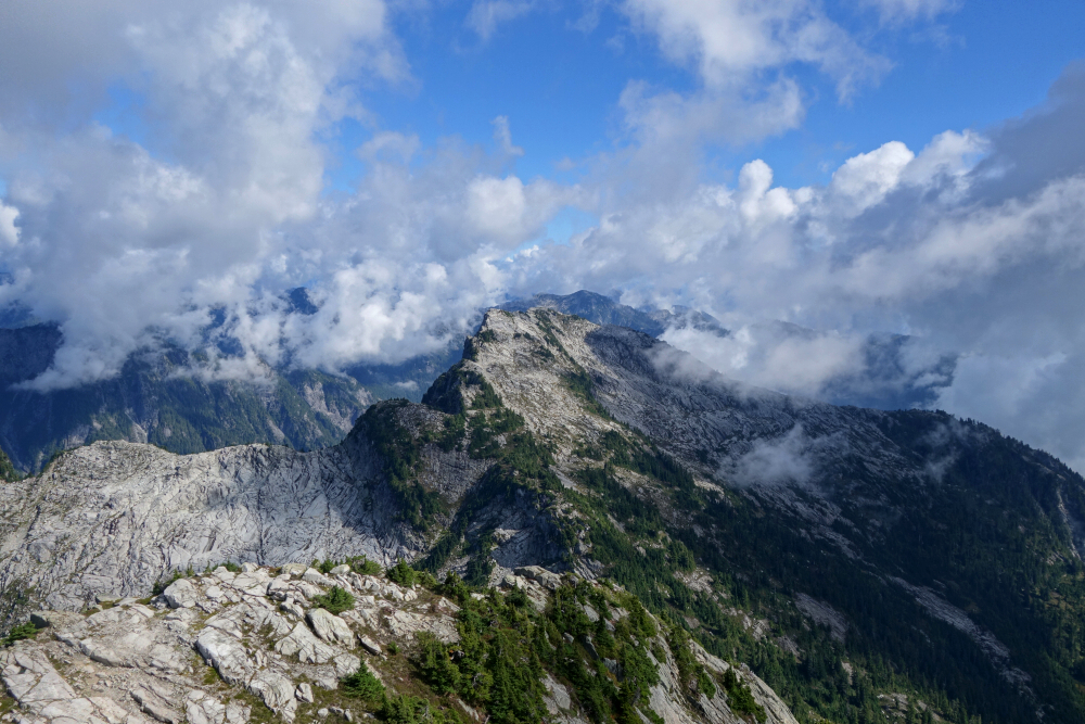
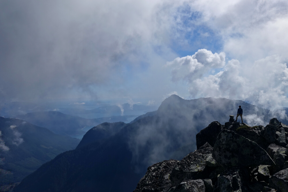
Looking up and right, we could now see the final scramble section and crux of the route. The idea is to climb along the krummholz as far as possible before cutting left into a shallow gully. A short scramble up and out of the gully leads to the base of a giant dihedral, where steep but straightforward scrambling gains the final summit ridge. Exposure is moderate at most, largely due to the steepness, but the horizontal plane is broad, with short scrambly steps interspersed with easier ground. We topped out on the summit ridge, with the true summit marked by a cairn a few paces to the south.
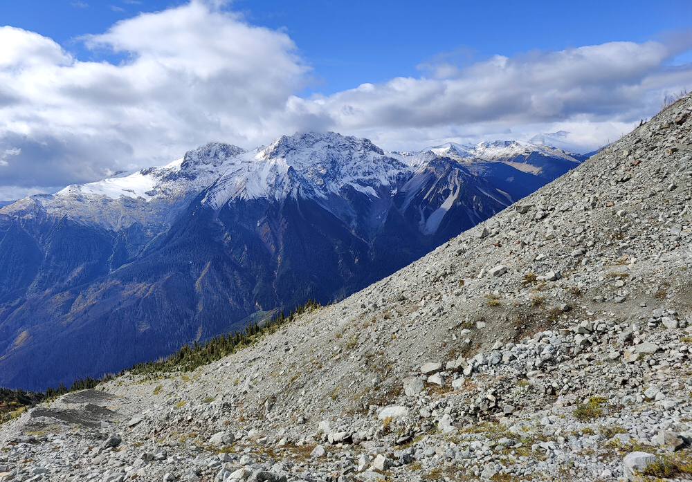
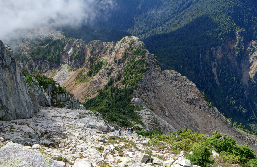
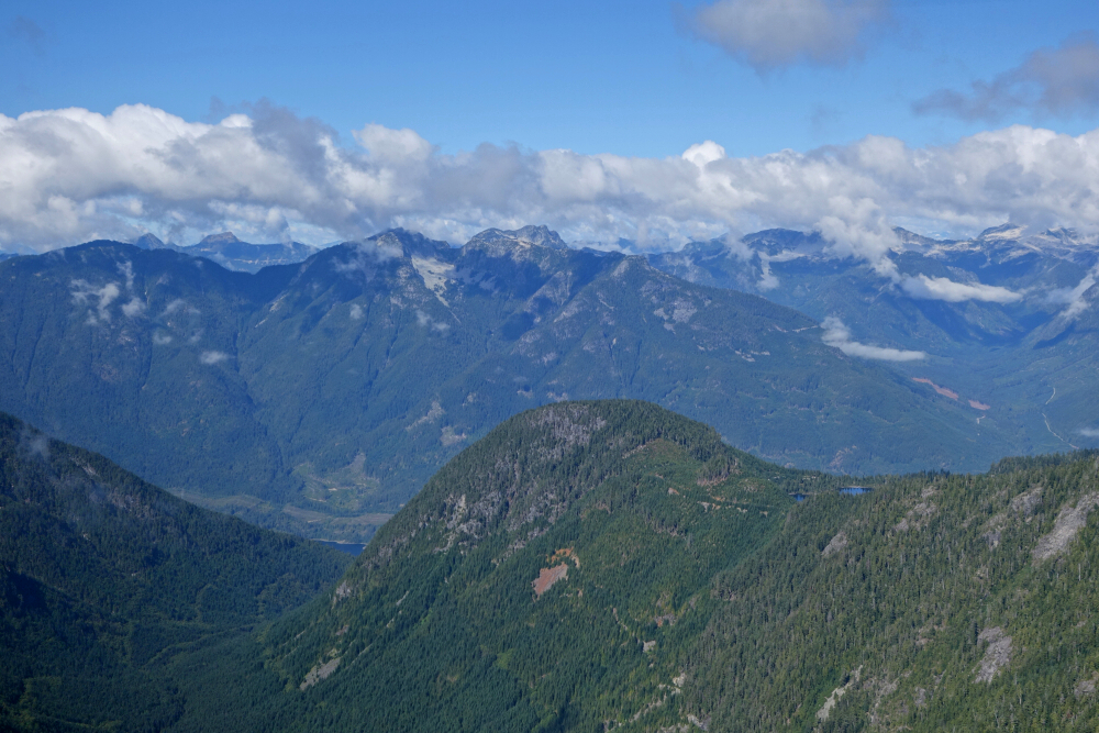
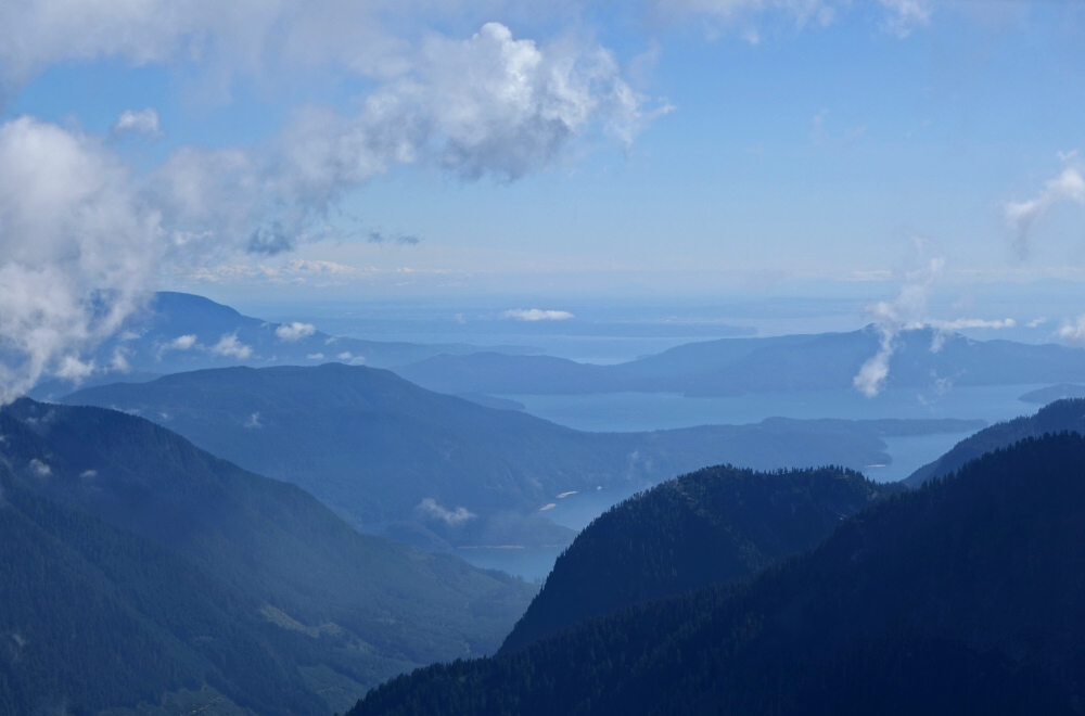
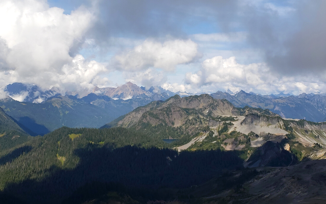
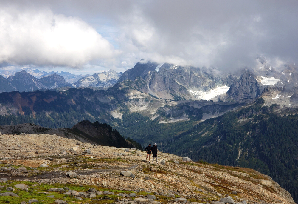
We enjoyed a few minutes of solitude before being joined by another party—presumably the owners of the vehicle we'd parked beside that morning. Clouds swirled about the summit—seems to be a trend lately—but there were still good views north across the valley containing Salmon Inlet, with Mount Gustavson and other peaks beyond. To the east stood Rainy Mountain and additional summits, though mostly obscured by cloud. The highlight, however, was the sweeping panorama to the southeast and southwest, overlooking Gambier Island and other islands in Howe Sound, stretching all the way toward Point Grey and the Strait of Georgia, with Vancouver Island faint on the horizon. Our ascent time was about 4.5 hours, with roughly 30 minutes spent on top before retracing our steps. Round trip came in just under 8.5 hours total for a thoroughly satisfying day in Tetrahedron country. The only disappointment? The four-hour wait for the return sailing to Horseshoe Bay. Ugh!
In the end, Tetrahedron Peak proved well worth the years of quiet curiosity. The views—when the clouds allowed—reminded me why these ferry-access summits hold such appeal. Remote yet so close to home, it felt like finally checking off a long-standing local classic. And with plenty more peaks scattered across the Sunshine Coast, I'll doubtless endure the crossing to and from Langdale many more times in the years ahead!
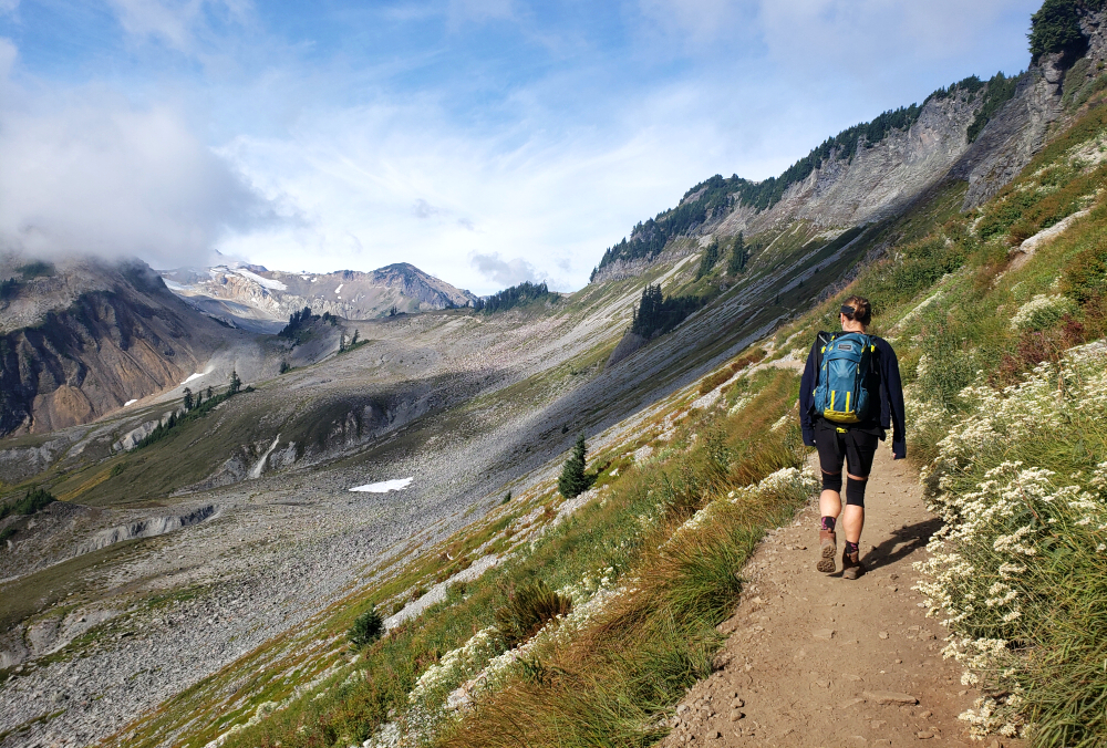
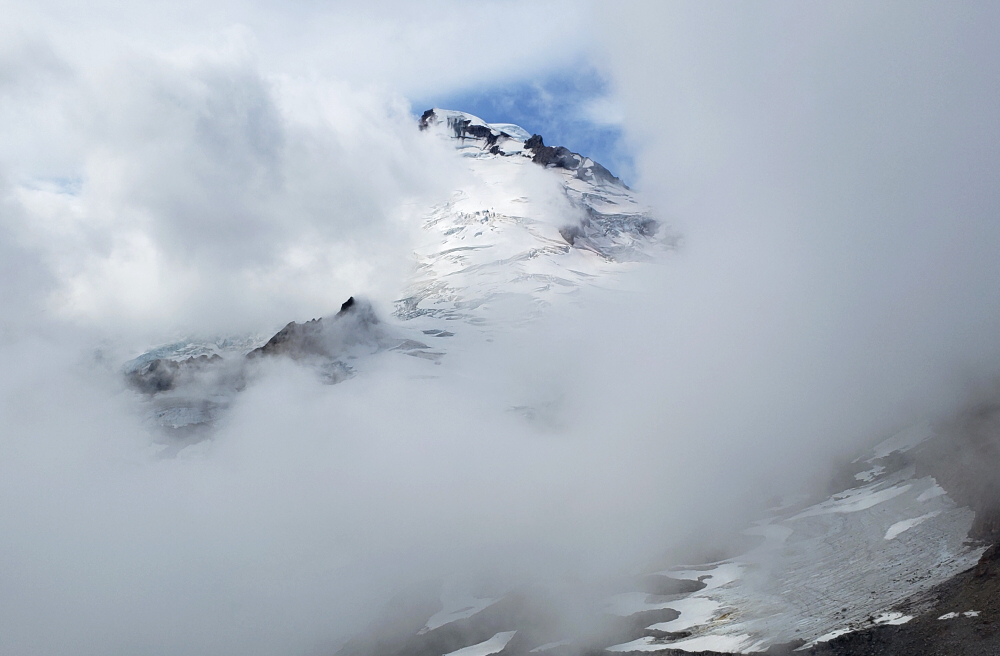
The Portals (East Peak) & Coleman Pinnacle - via Ptarmigan Ridge Trail, September 2024
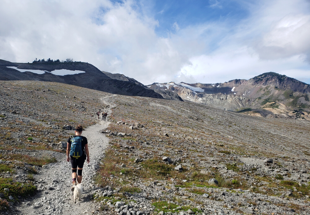
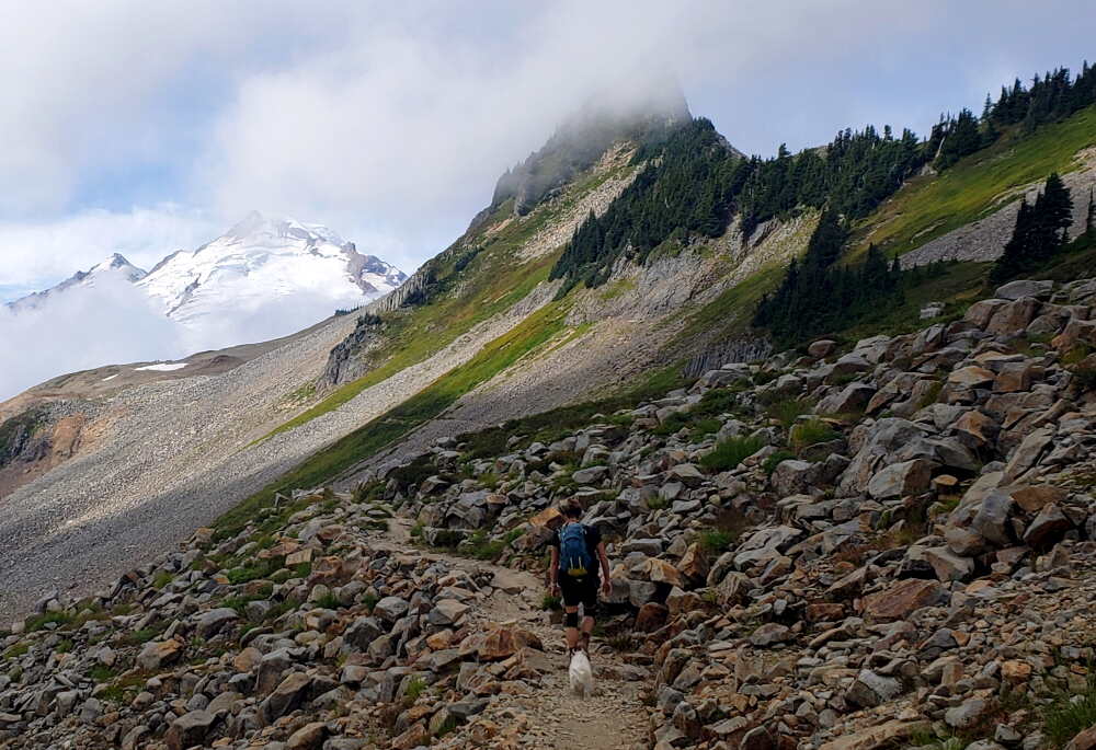
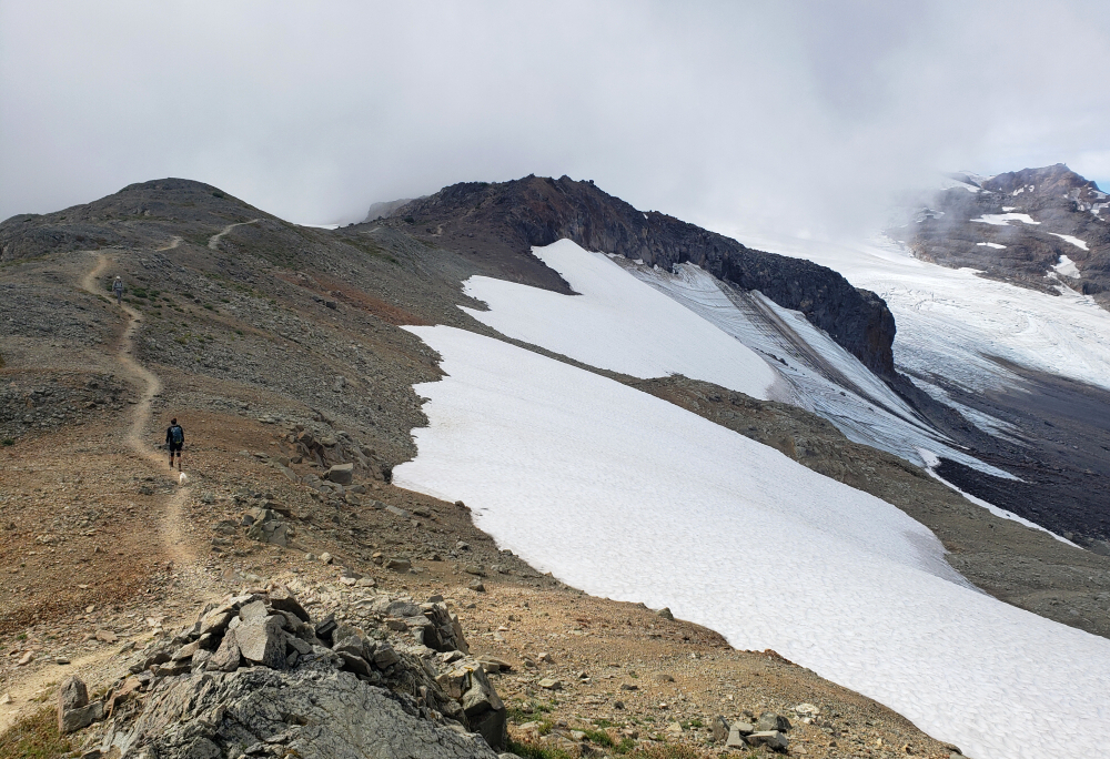
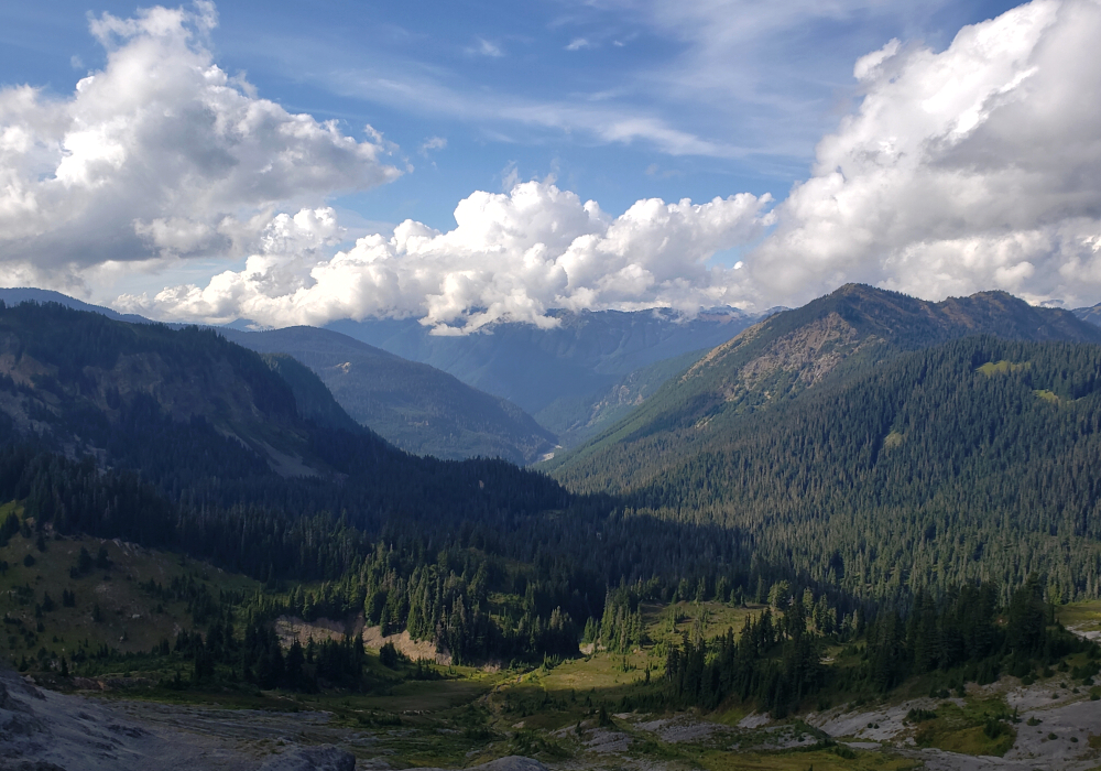
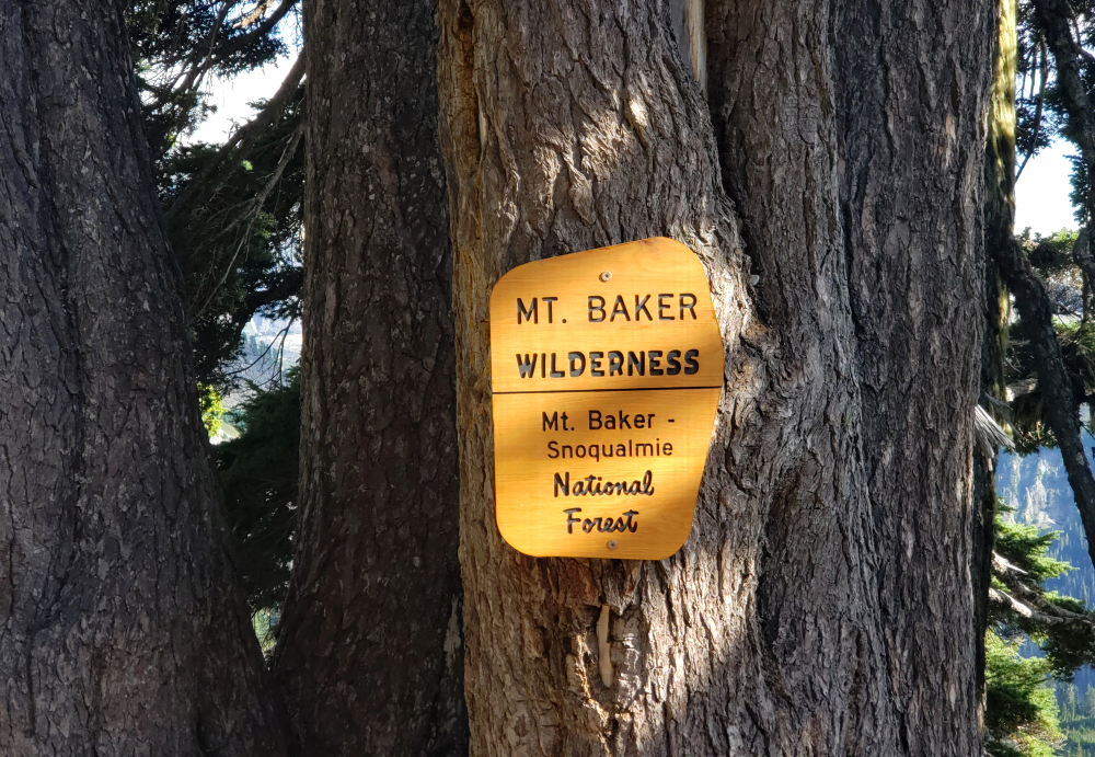
For our third and final day of hiking in the greater Mount Baker area, we set our sights on something a little more ambitious and headed out toward Ptarmigan Ridge, culminating with an ascent of the East Portal. Using the same approach as the Park Glacier route, it's an all-trail journey of roughly 9 kilometers each way to reach a somewhat unremarkable summit—made entirely worthwhile by the stunning, in-your-face view of mighty Mount Baker.
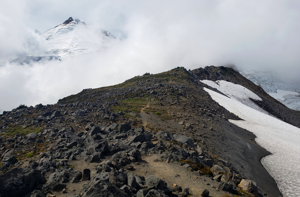
Not my first rodeo, as they say. I've lapped the slopes around Ptarmigan Ridge and Coleman Pinnacle several times on my snowboard, and also toured through the area during the final leg of the Watson's Traverse back in May 2013. This time, I allowed myself a minor detour to tag Coleman Pinnacle—because, well, it's there and practically begs to be climbed. It ended up being a bit more involved than expected, especially approaching from the north, but more on that shortly. This was also my first summer visit, snow-free, and I was joined by Agata and Pepper for an extremely enjoyable trek deep into the Baker hinterland.
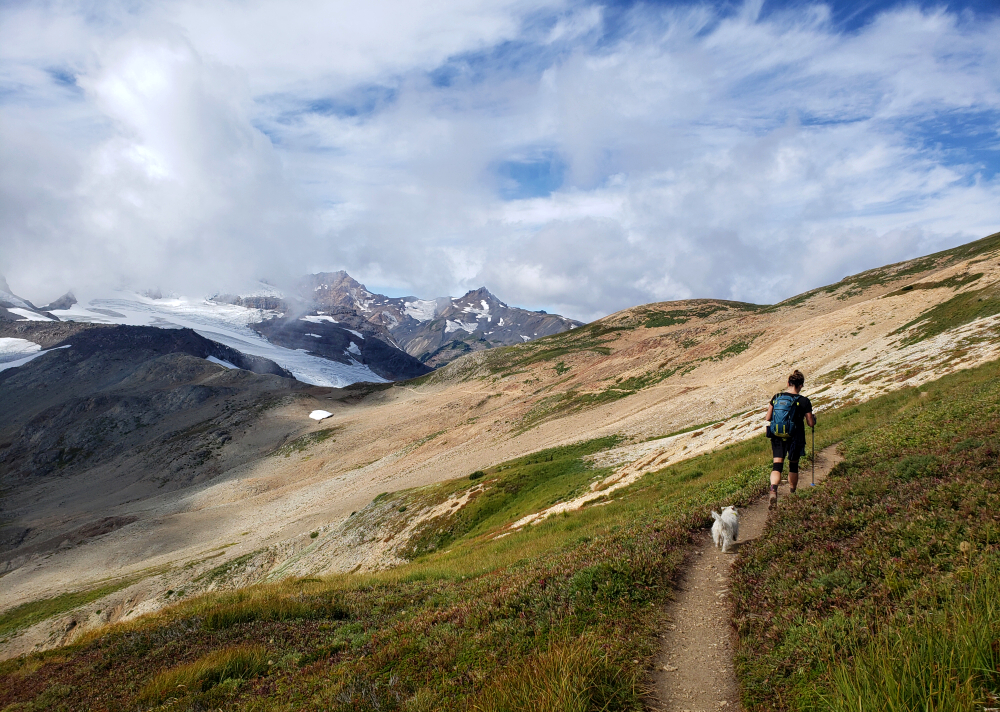
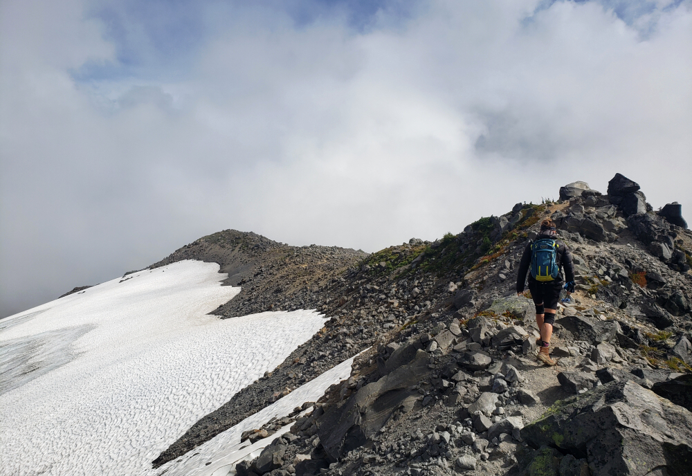
We set out at a very civilized 9:45 a.m., following the Chain Lakes Trail below the south-facing slopes of Table Mountain for about 1.7 kilometers to the Ptarmigan Ridge Trail junction. From there, we continued along an exceptionally scenic stretch beneath Ptarmigan Perch and into the heart of the Ptarmigan Ridge area, with Coleman Pinnacle and the Sholes, Park, and Rainbow Glaciers providing a spectacular backdrop.
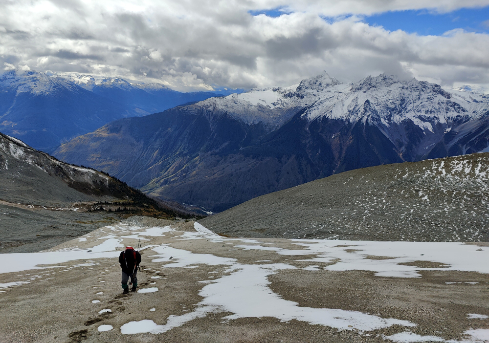
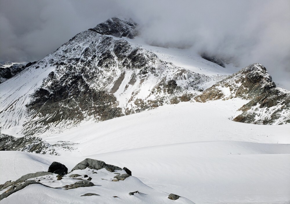
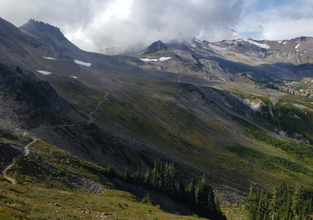
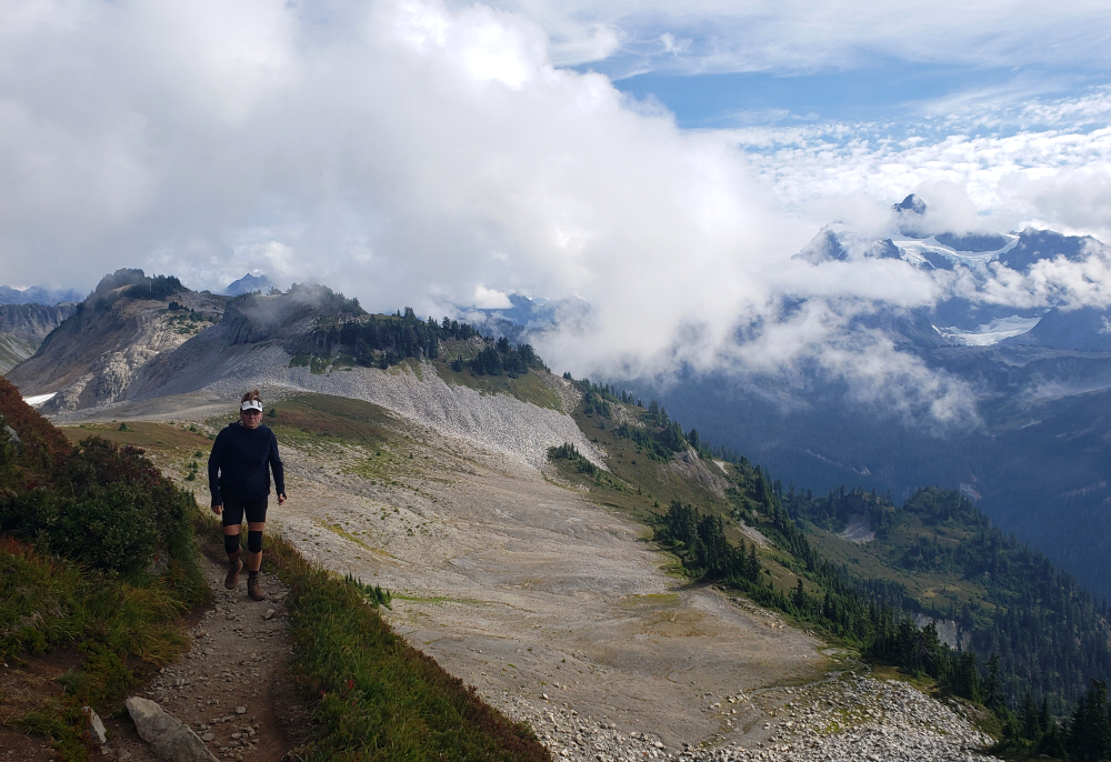
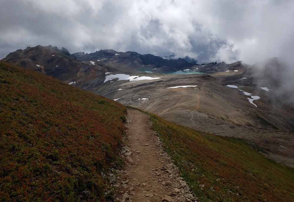
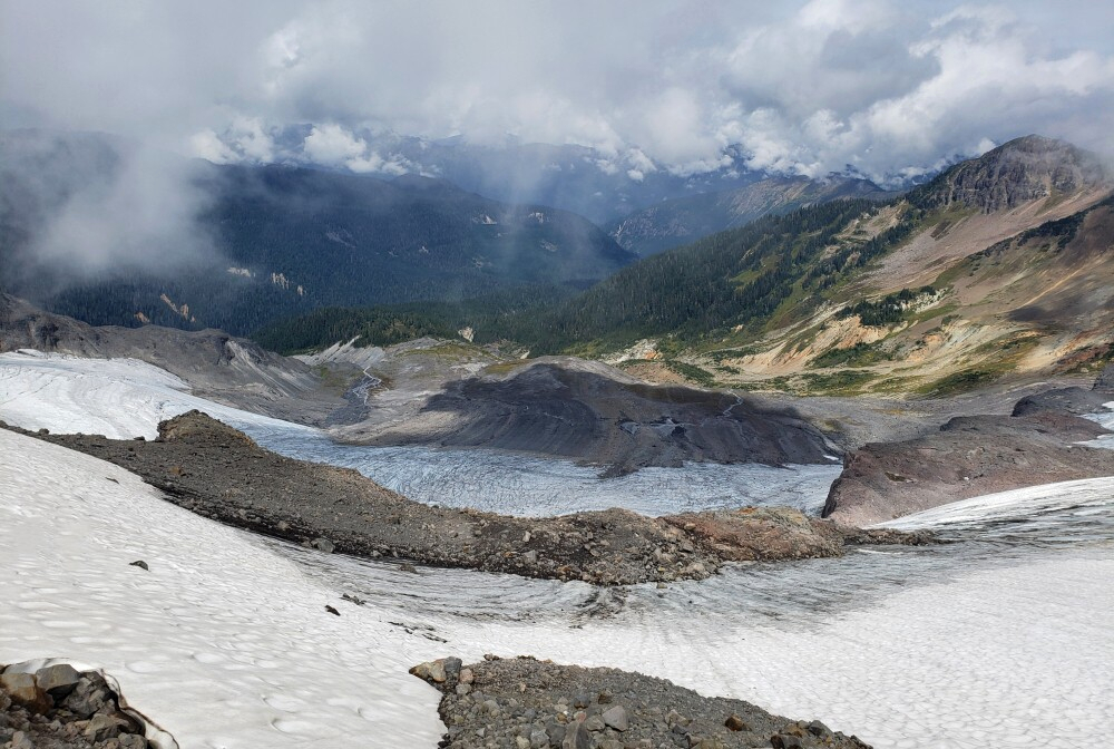
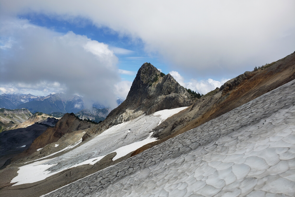
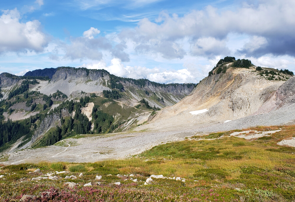
Rounding the south shoulder of Coleman Pinnacle, we finally caught sight of our objective, though it was partially obscured by cloud. Along the way, we spotted a herd of roughly 20 mountain goats grazing on a grassy bench below us. Continuing on, we reached a large saddle with Camp Kiser just beyond. From there, we followed the East Ridge of The Portals (East Peak) for a short distance more before reaching the summit. Clouds swirled constantly, allowing only fleeting glimpses of the heavily fractured Park Glacier below. We waited for quite some time in hopes the clouds would lift, but it wasn't meant to be, so we stopped for a bite to eat before retracing our steps.
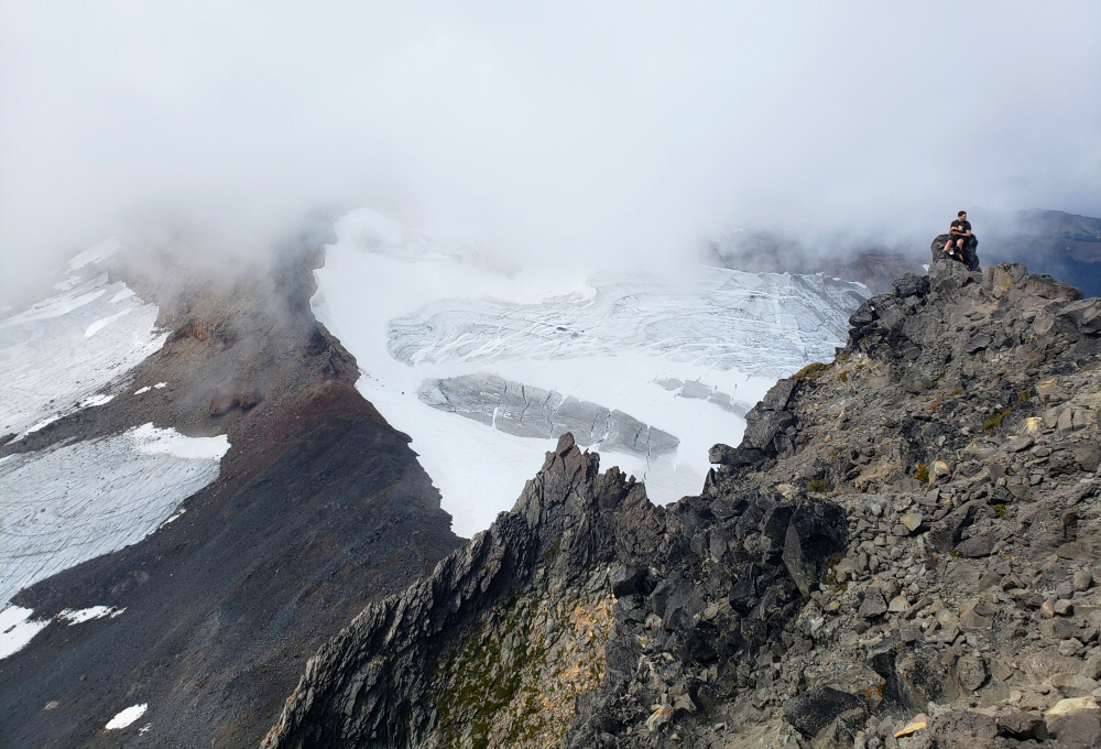
I parted ways with Agata and Pepper at a small saddle immediately east of Coleman Pinnacle and began ascending what appeared to be a viable route toward the gap below the peak's southwest ridge. What wasn't visible from below, however, was friable rock and steep, hardened mud, which eventually forced me out onto a small ice sheet clinging to the north side of the peak. Without crampons or an ice axe—and therefore no reliable way to ascend or arrest a fall—I chose the lesser evil of carefully scratching my way up the impervious hardpan. Somehow, I managed to reach the gap without losing my footing and cheese-grating my way back down. Phew.
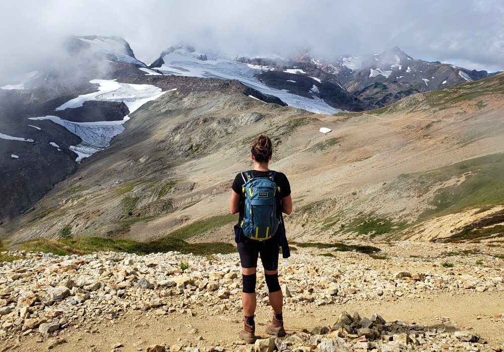
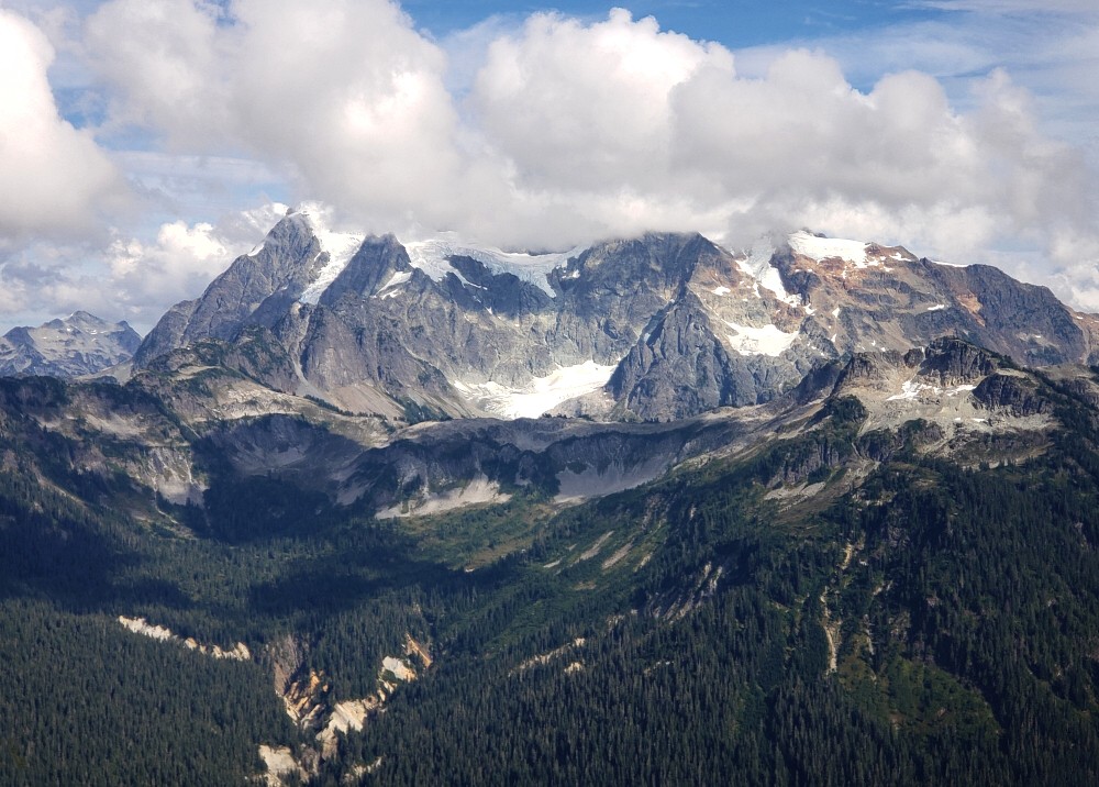
From there, a final easy scramble was all that remained to reach the summit. The reward was a fantastic 360-degree panorama: south across a moonscape-like basin with a hanging lake at its far end, northeast toward the peaks surrounding Bagley Lakes, and even glimpses of glorious Mount Shuksan, still partially hidden by clouds. After snapping a few quick photos, I began my descent, this time dropping down steep grass and loose terrain south of the gap to reconnect with the main trail.
I made my way back to Artist Point, where Agata was waiting with a freshly cracked can of Chuckanut Pilsner—the perfect way to end the day!
It would be very much appreciated if you please ask before copying and/or re-publishing content from any part of these pages. To do so, please click here to send a message via feedback form.


