Select from list below to jump to a specific area on this site.
| Latest Posts |
Monday, April 27, 2026
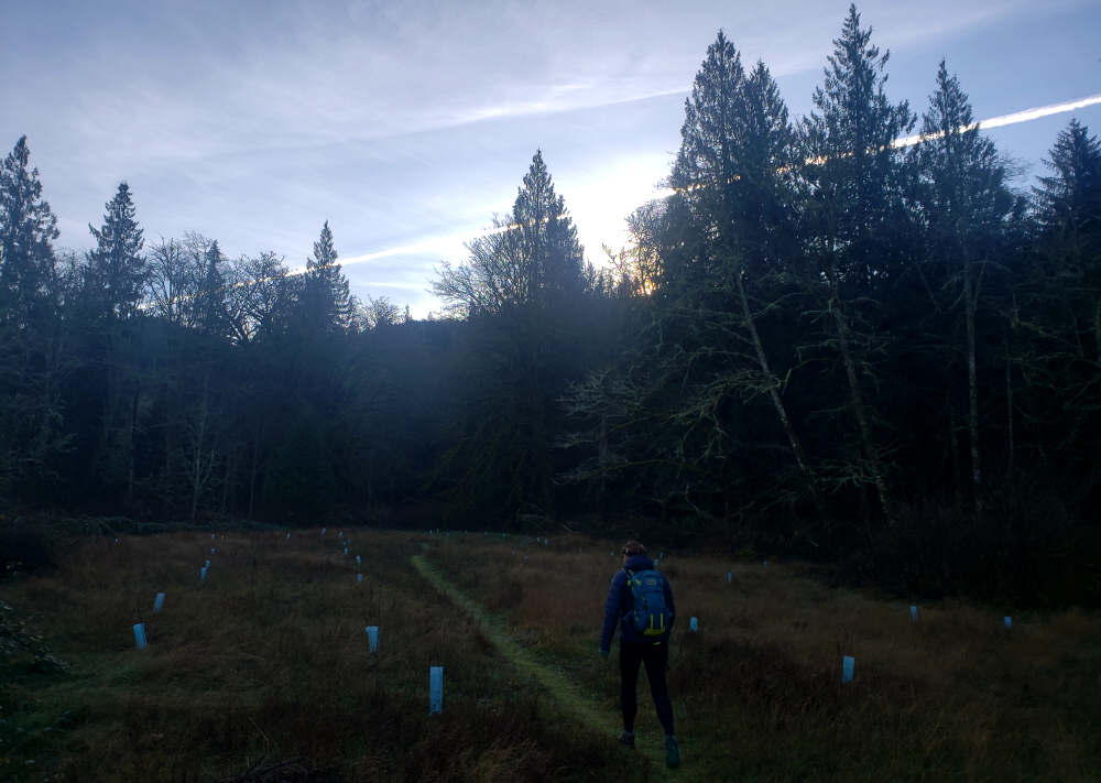
Gloria Peak - via Gloria Trail, January 2025
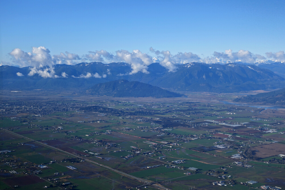
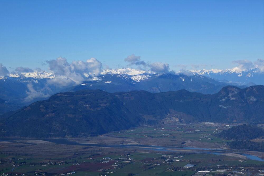
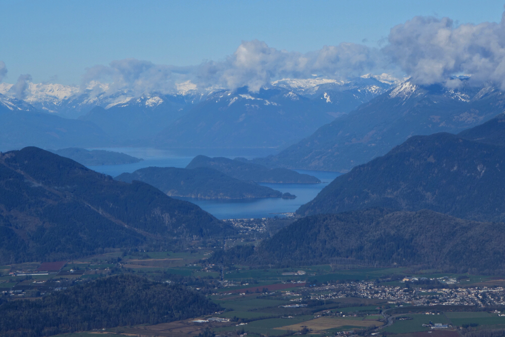
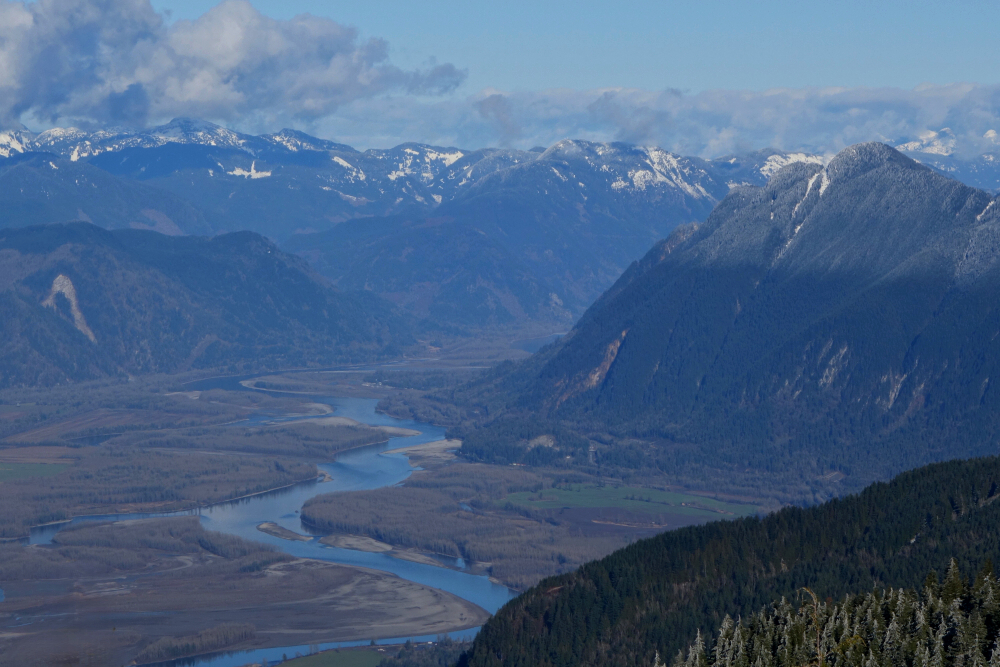
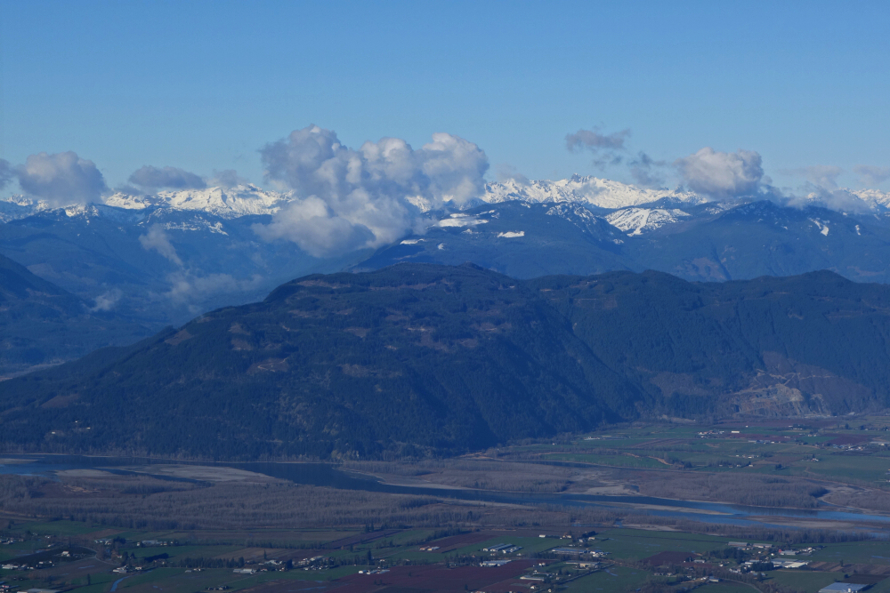
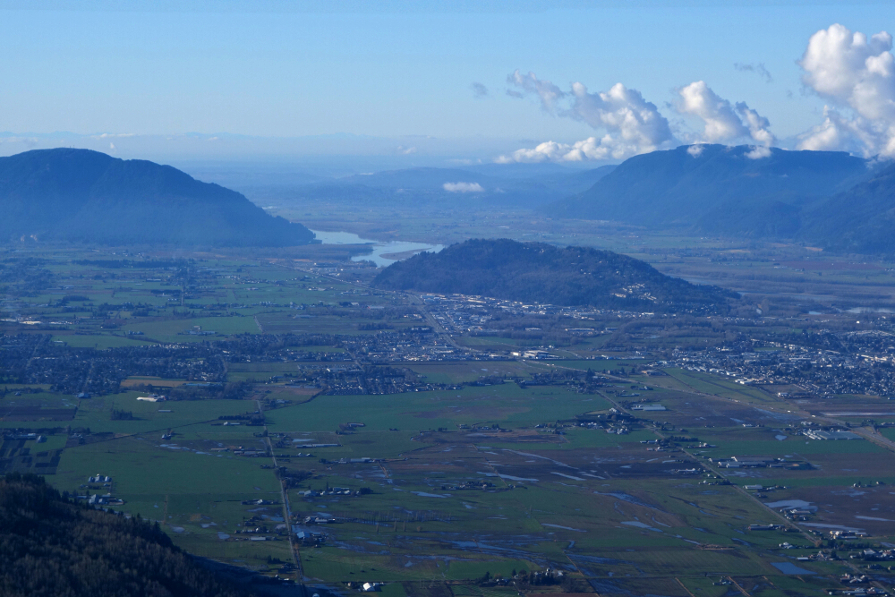
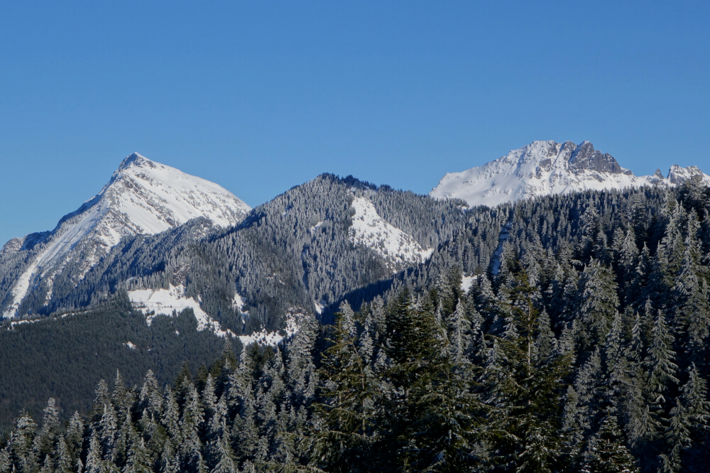
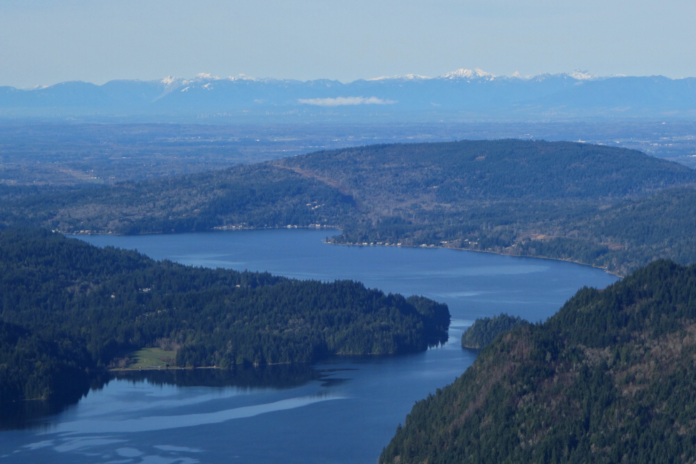
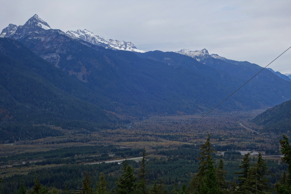
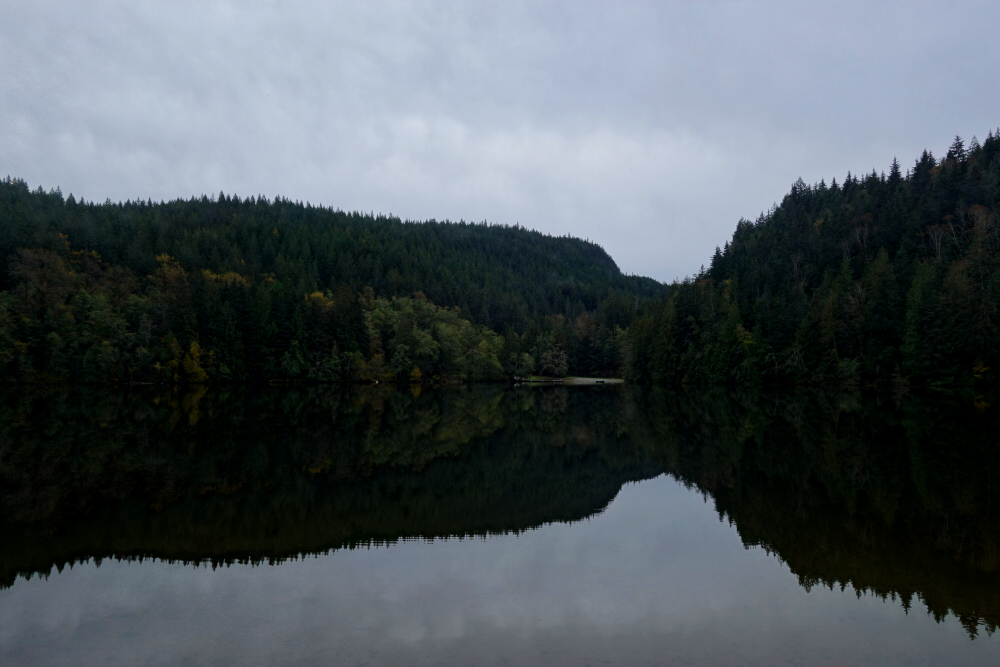
With a mediocre start to the ski season, I set out to pluck some low-hanging fruit in the Fraser Valley. With a modest elevation that remains mostly below the snowline throughout winter, Gloria Peak makes for an excellent objective this time of year. As with many peaks of this type, the true summit is entirely viewless and of interest mainly to the diehard peakbaggers. Fortunately, a lookout just before the summit more than makes up for it, offering outstanding views across the valley: over the Chilliwack flatlands toward Abbotsford, across the country flanking the Fraser River from Nicomen Island and the nearby foothills to the west, north over Agassiz with Harrison Lake beyond, and finally upstream to the northeast where the river exits the valley constriction west of Hope. In other words, another high-value hike.
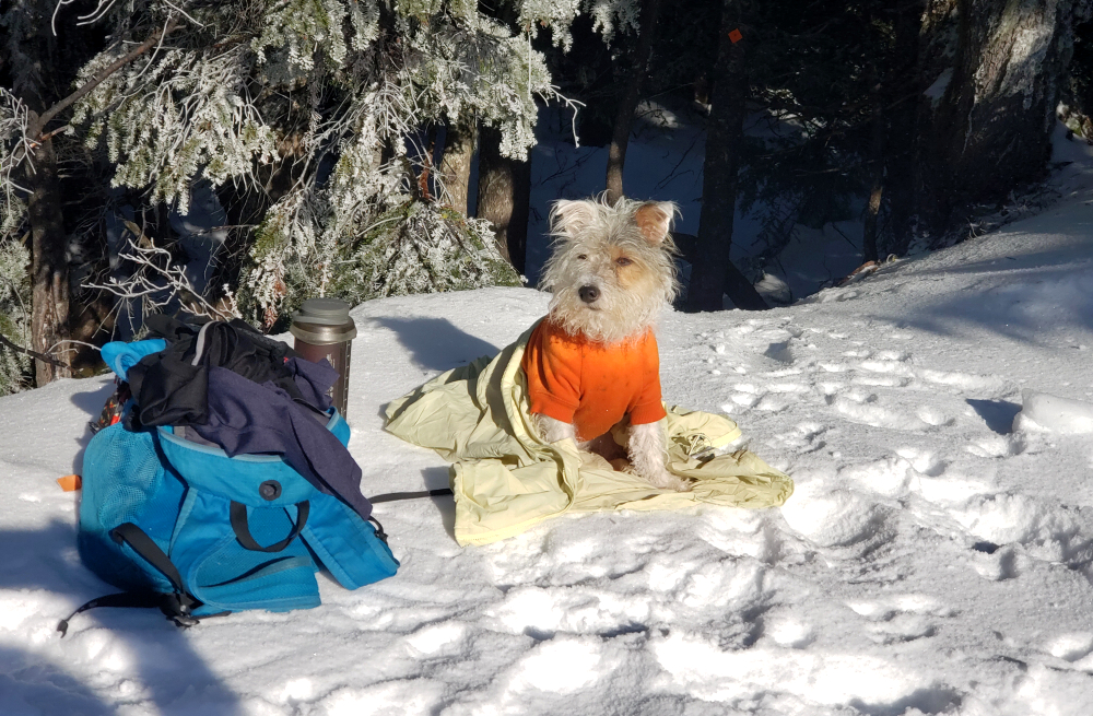
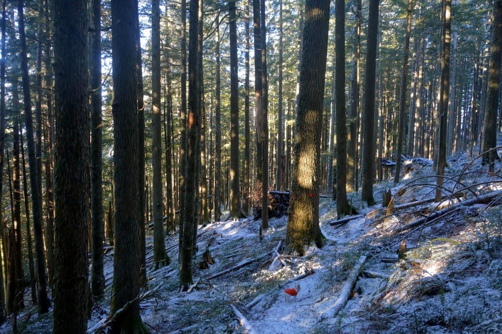
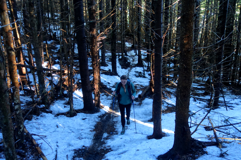
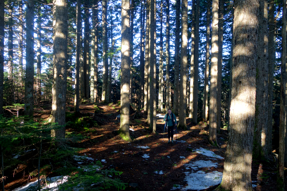
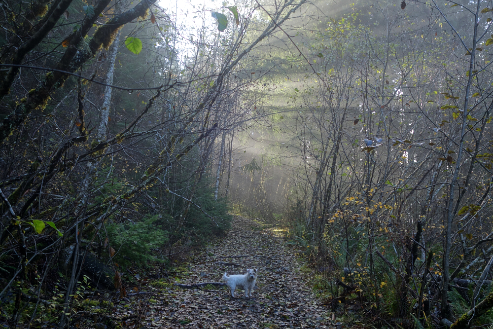
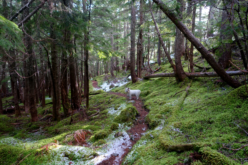
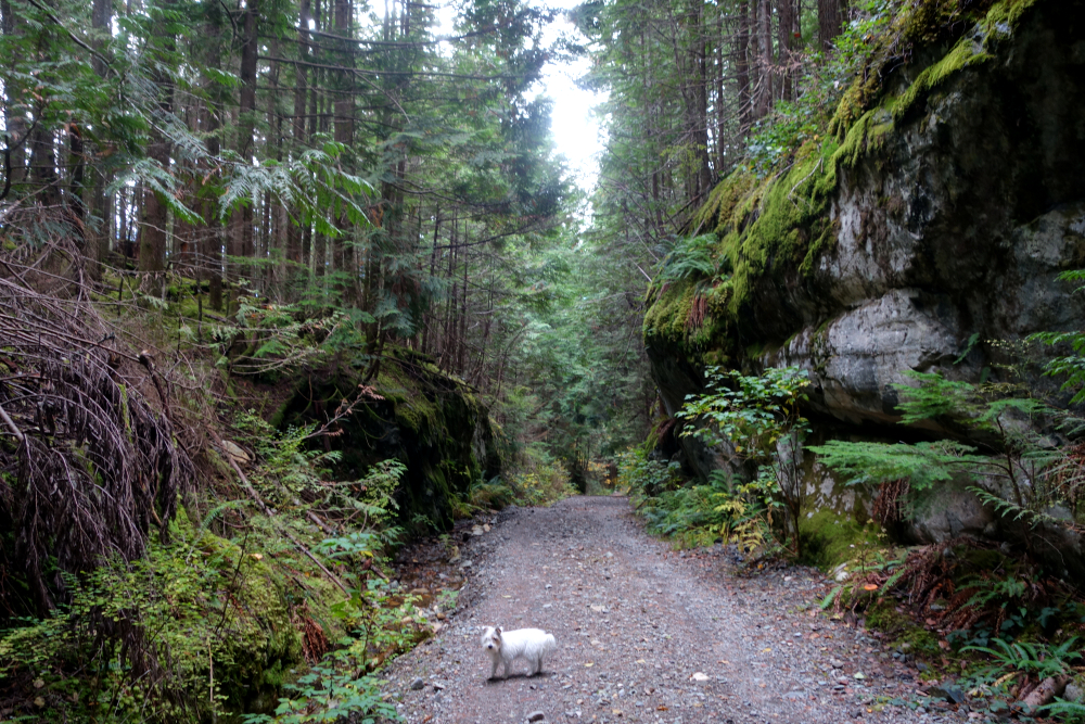
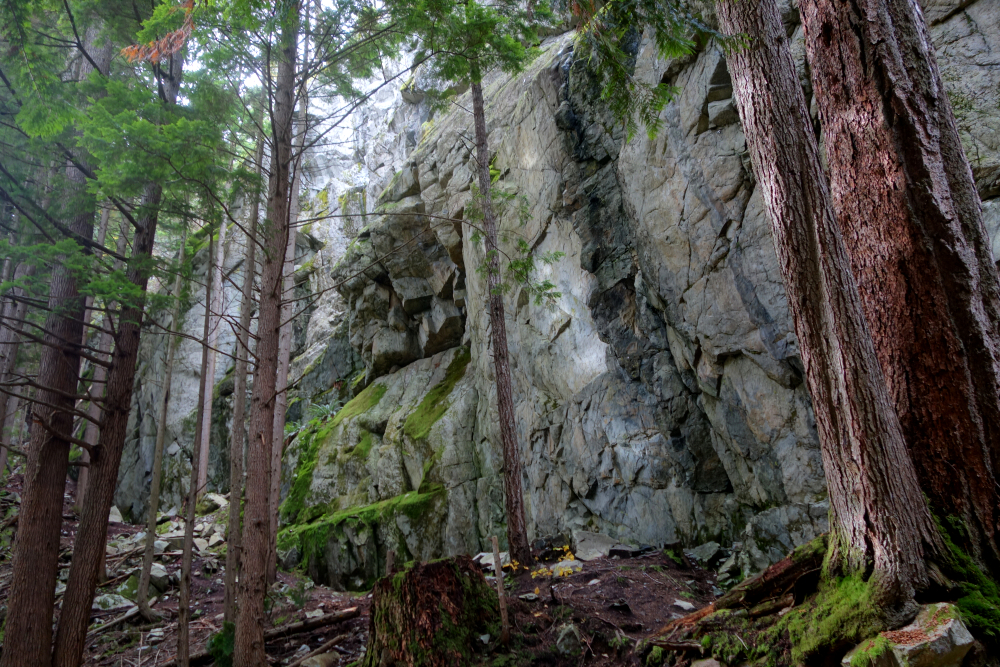
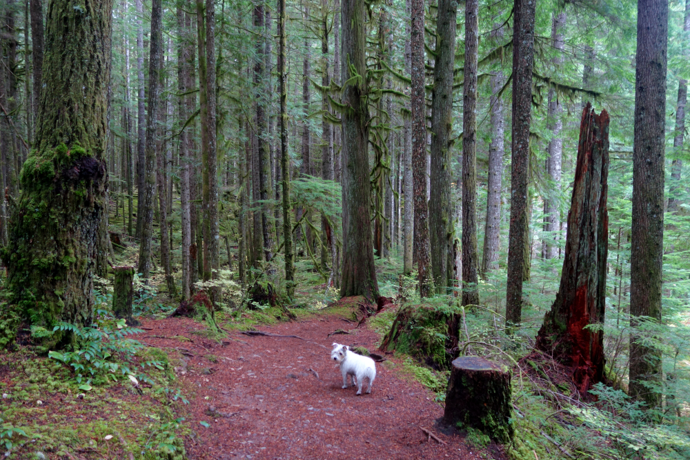
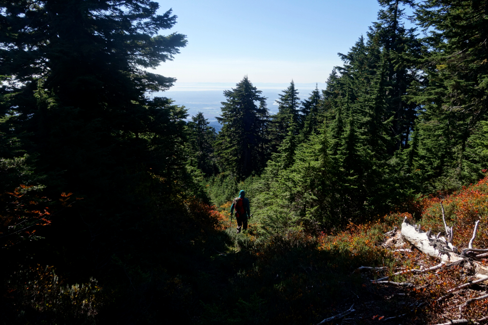
Once again with my trusty hiking companion Pepper in tow, we set out from the Chilliwack Community Forest at a very civilized 10:30 a.m. It's a bit of a maze of trails in there, and a GPX track proved helpful in getting onto the Gloria Trail without constantly wondering whether we'd taken a wrong turn. The lower portion was your standard forest hike-pleasant enough, though not especially memorable-until we reached snowline. There was maybe a foot of snow on the ground, but a solid trench from previous hikers meant no trail breaking was required.
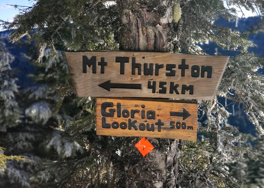
We reached the Gloria Peak-Gloria Lookout junction in under three hours, then turned right and descended roughly half a kilometer to the lookout. As advertised, the view was excellent and well worth the otherwise monotonous grunt to get there. After taking it all in, we climbed back to the junction and paused long enough to help Pepper warm her paws after so much time on snow. Gloria Peak itself wasn't on the agenda, let alone of much interest to me, so after a brief rest we began the descent. First hike of 2025, and a good one it was.
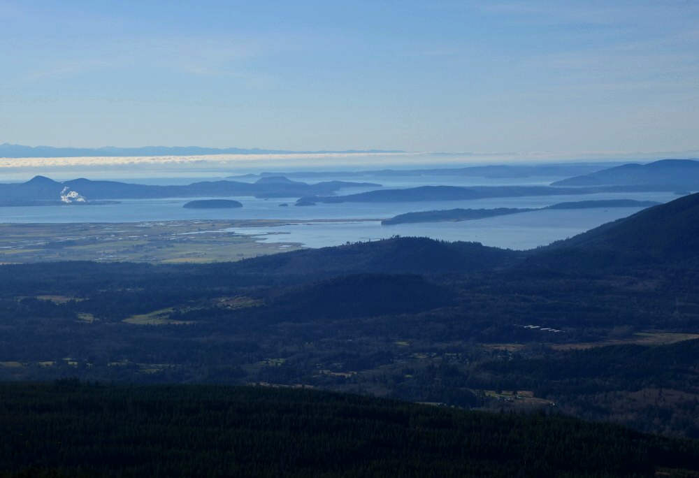
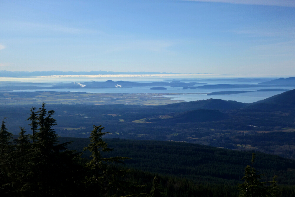
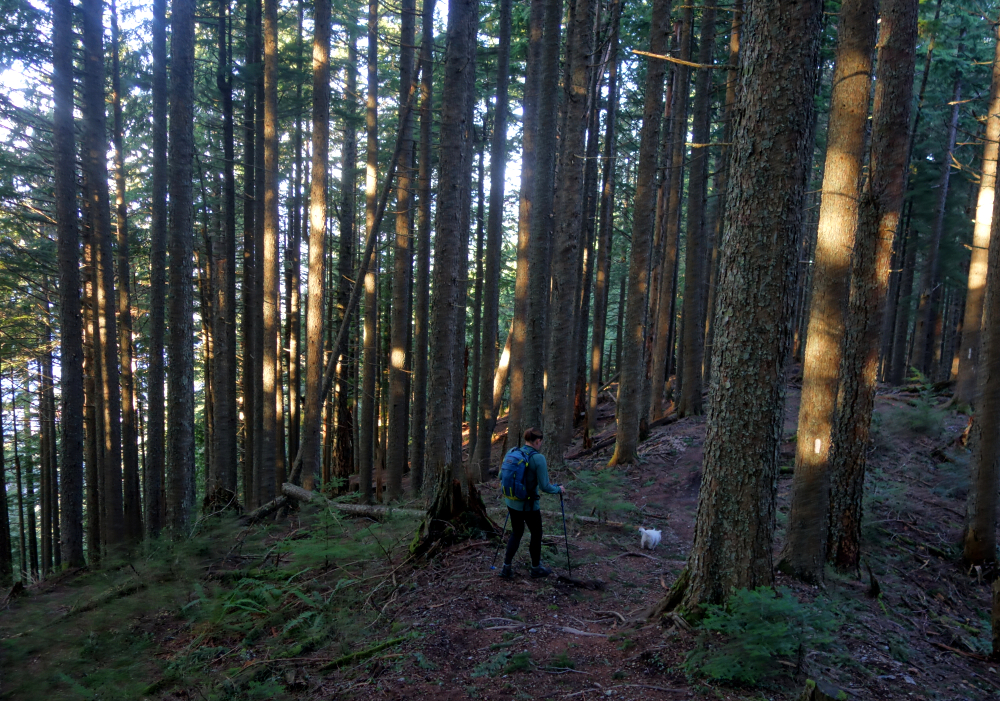
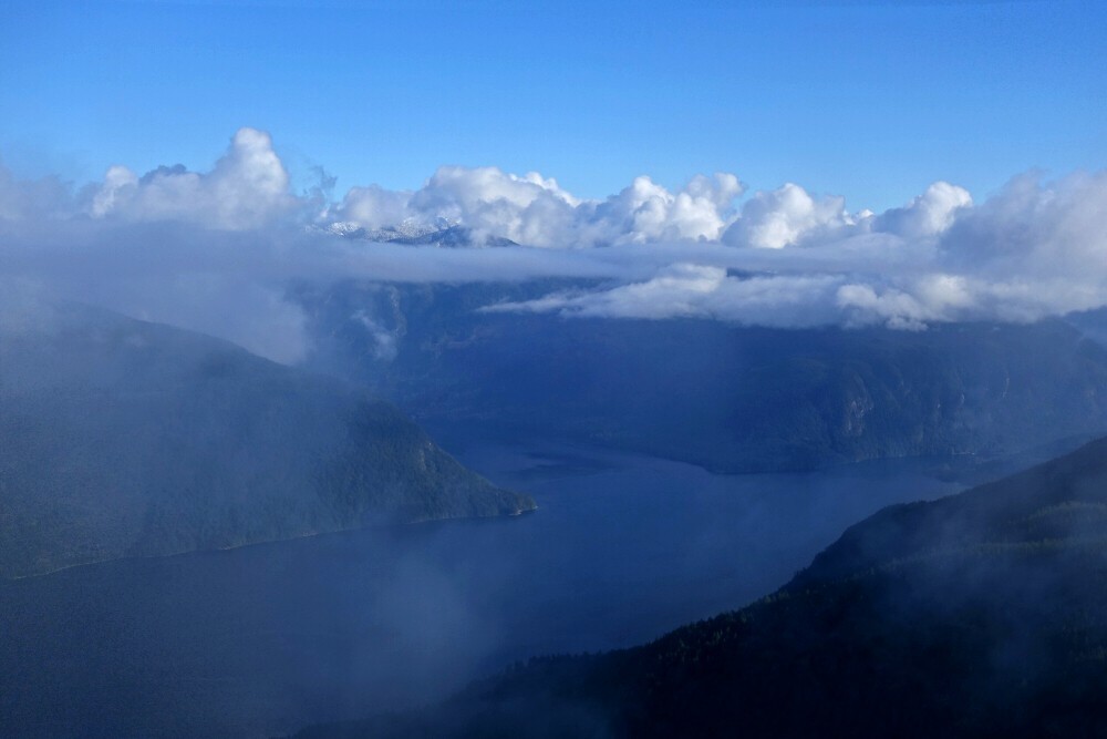
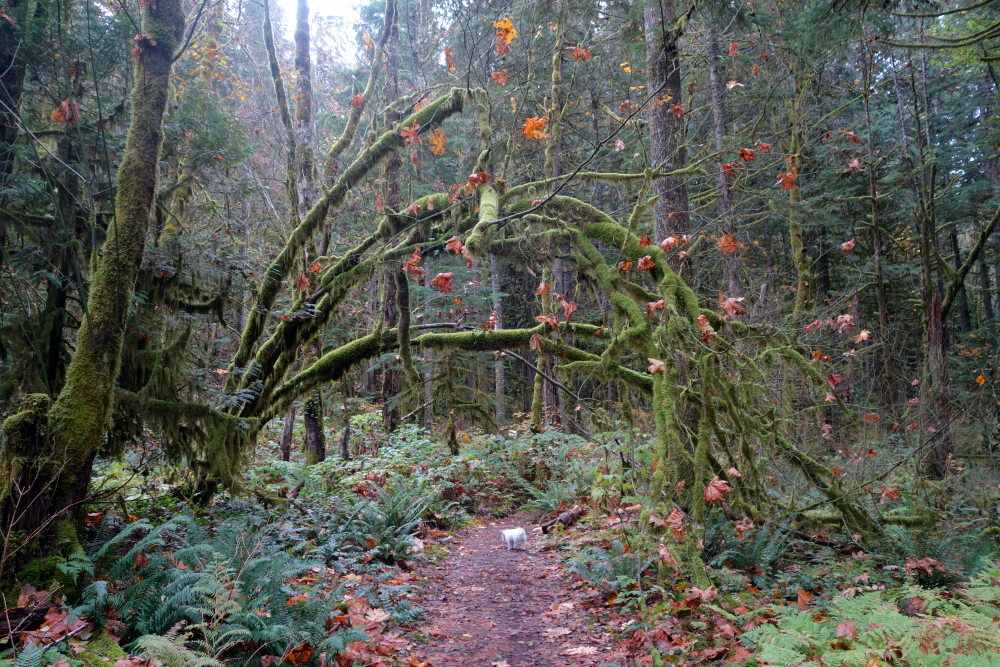
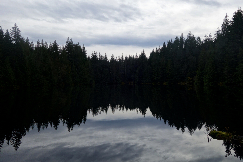
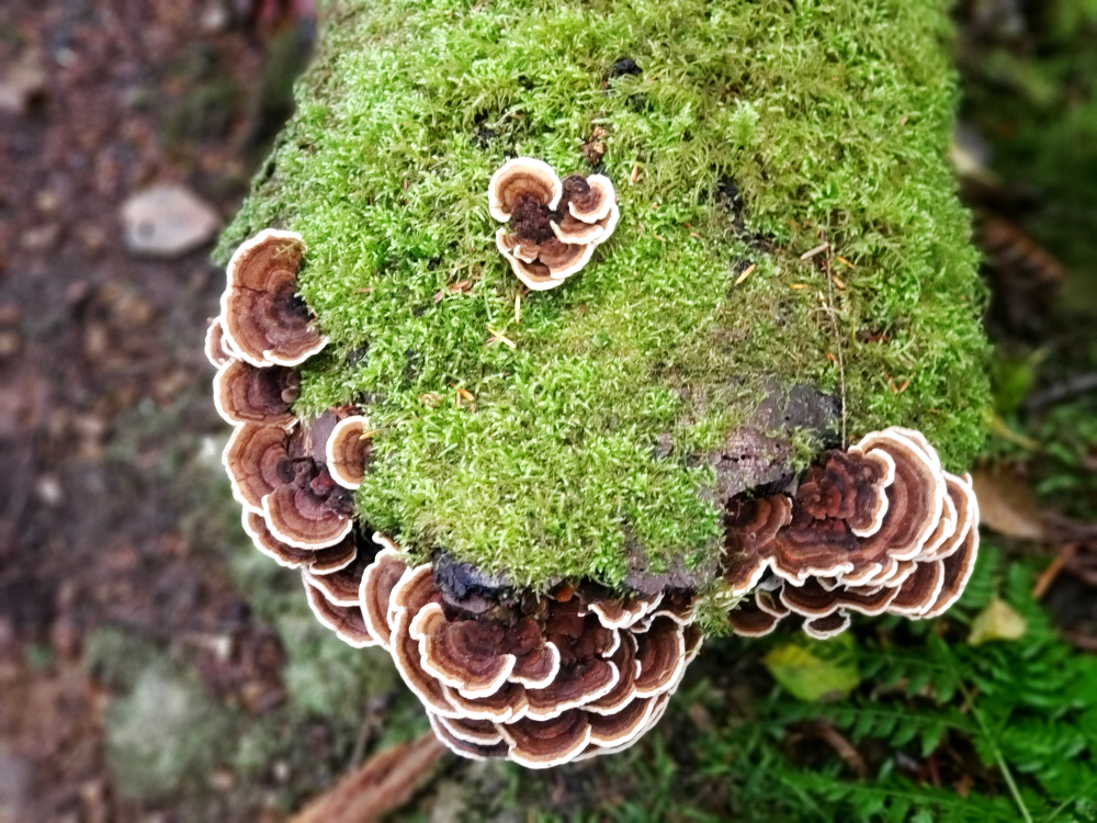
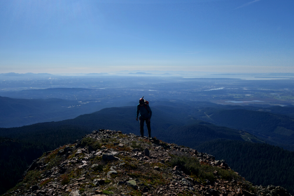
There are a couple of Sumas Mountains that I'm aware of. One lies in the Fraser Valley, immediately northeast of Abbotsford, BC, while the other sits about 24 kilometres to the south, just across the border in Washington State. This report is for the latter. I've been up the BC Sumas a couple of times, where a fantastic view unfolds over the Fraser River just downstream of its confluence with the Harrison River. As is often the case with these lower peaks, the best viewpoint isn't from the actual summit, which is treed and cluttered with communications infrastructure. The Washington Sumas is no different in that regard-its summit is also viewless and even requires a bit of bushwhacking to reach. That said, there are numerous excellent viewpoints along the way and near the top, including one looking back toward its northern namesake.
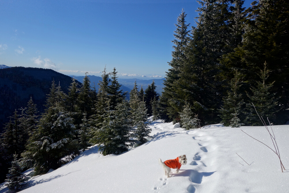
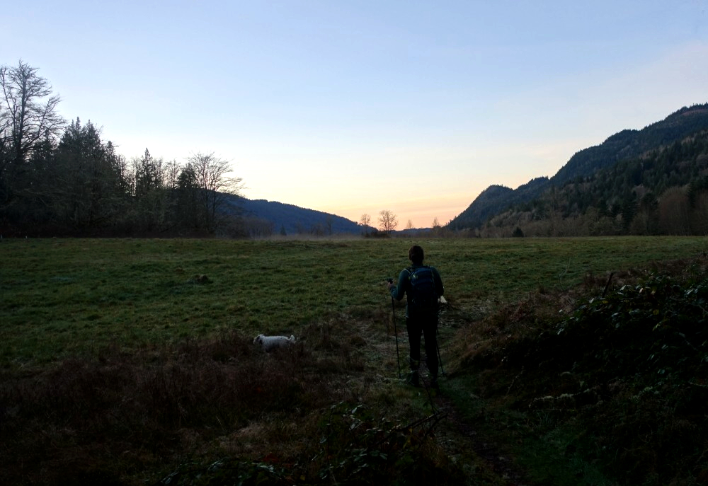
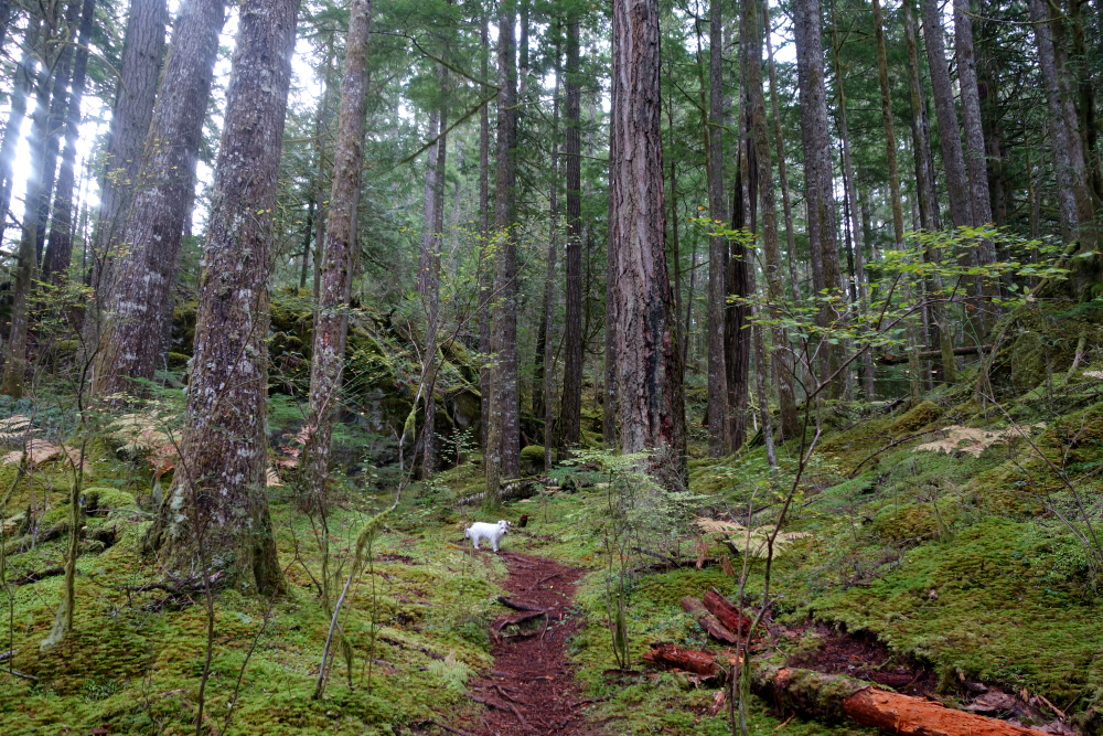
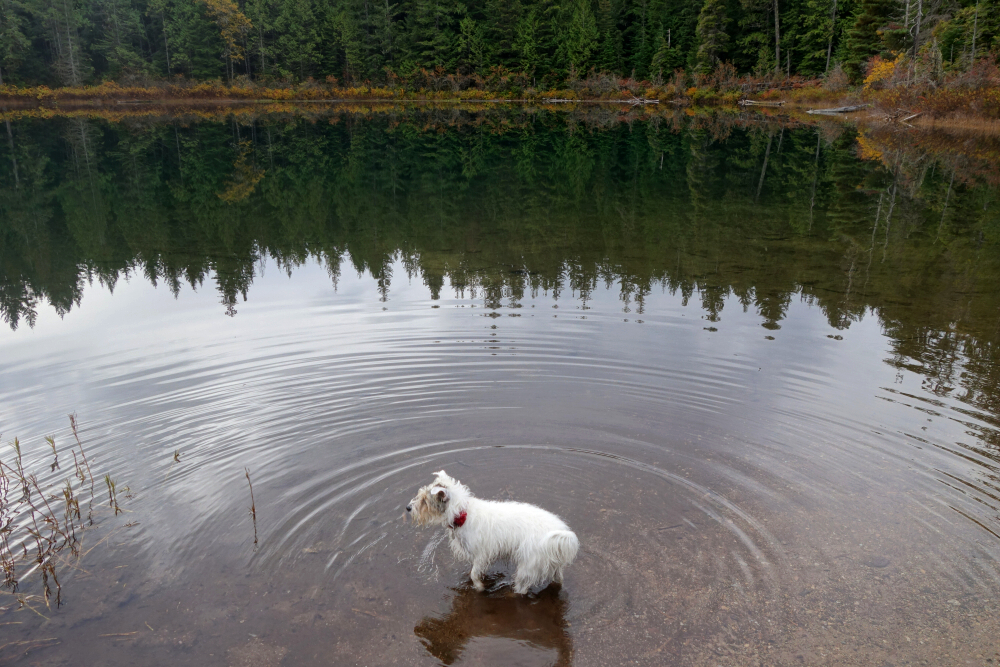
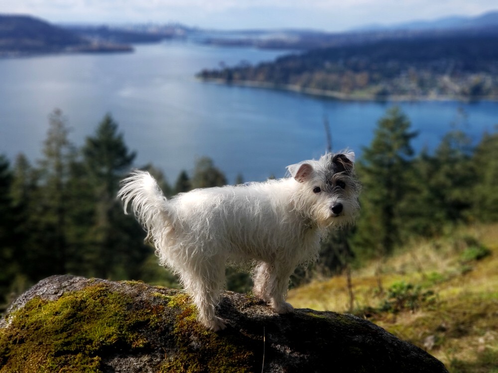
Looking to make the most of a fair-weather early December day, Pepper and I set out to explore the "other" Sumas for ourselves. It was a chilly start when I pulled into the Gold Mine Trailhead, with frost coating the pasture beside the trail. From there, we headed into the forest and turned left at the junction toward the "cabin." Originally built in the 1890s and later rebuilt, it's a quaint structure-at least from the outside-and apparently serves as a resting place for hikers and equestrians alike. Continuing past the cabin, we turned right onto the Cabin Loop Trail, followed shortly by a left onto the Ridge Trail.
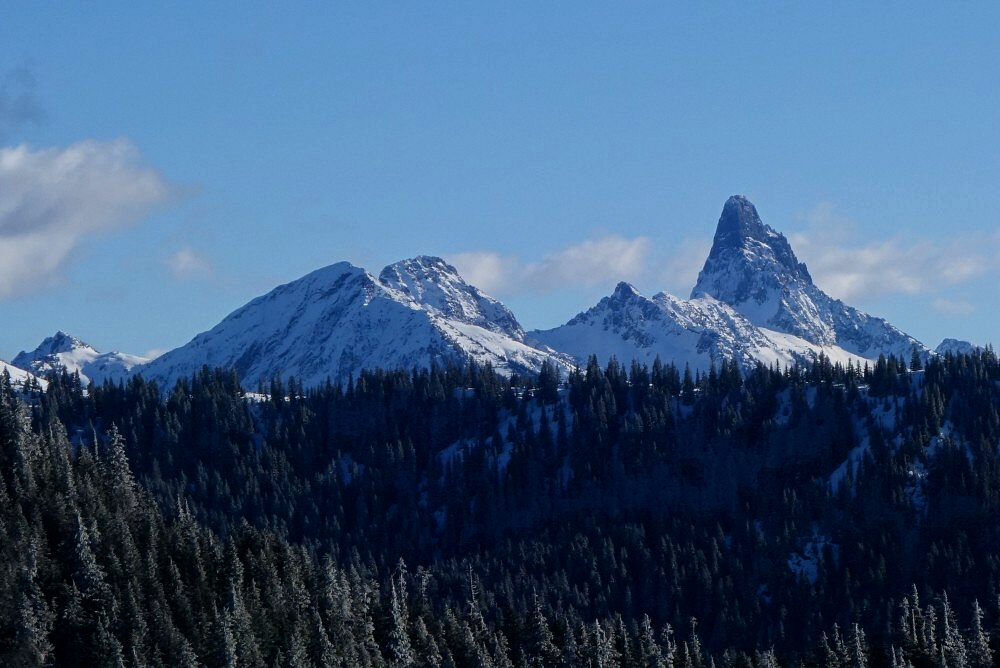
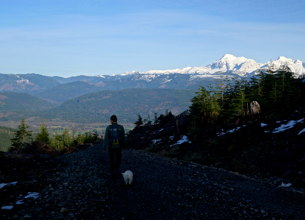
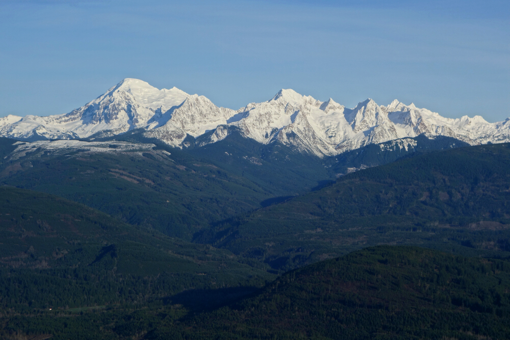
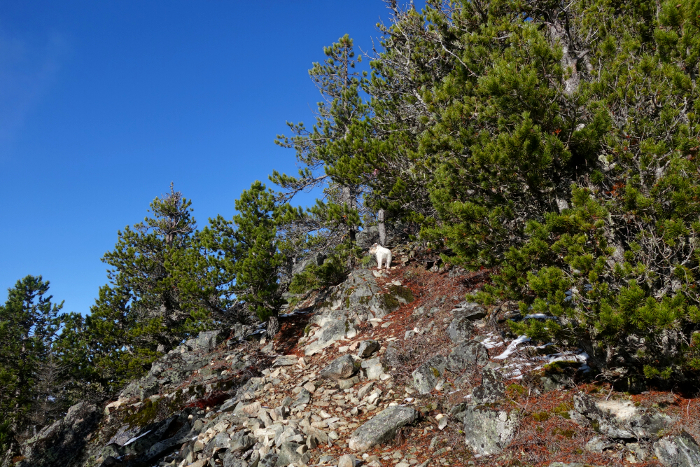
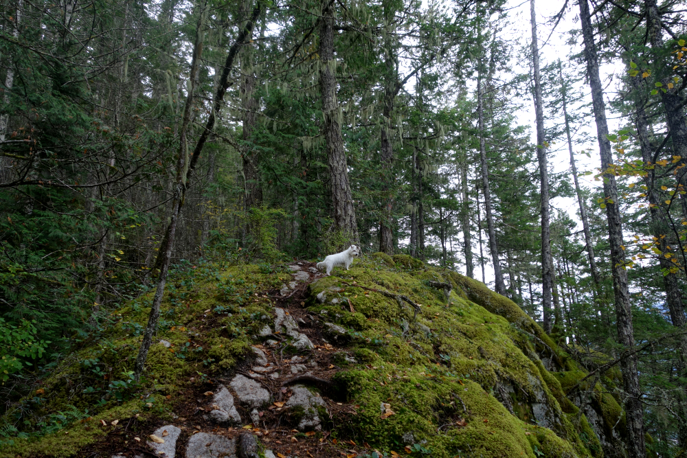
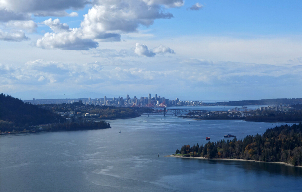
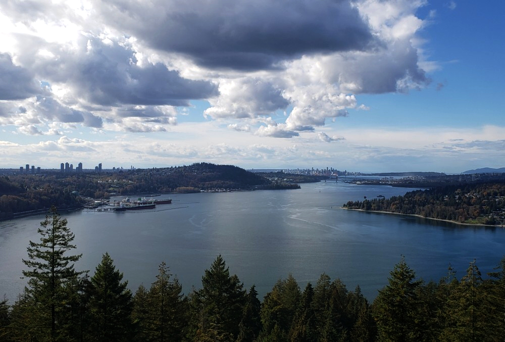
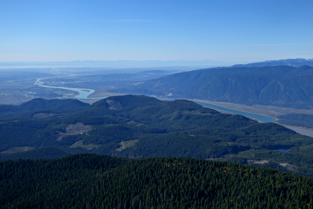
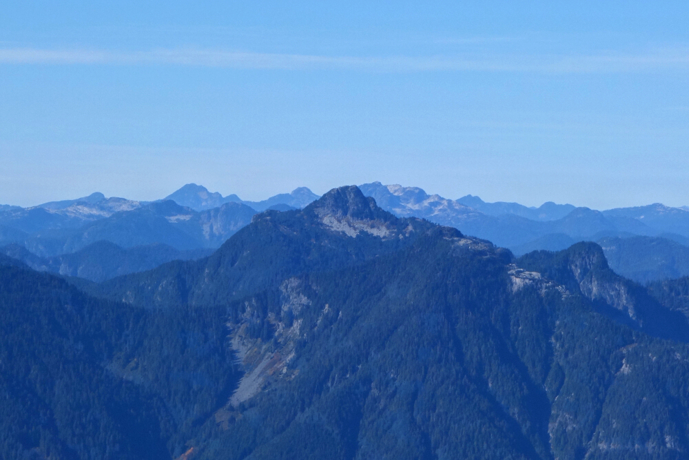
As we gained elevation, views began to open to the south over the northern Whatcom County lowlands. The trail soon reaches the toe of Sumas's north-northeast ridge, where the first unobstructed views north toward the Fraser Valley appear. From the Chehalis Range peeking out to the left, across to the "other" Sumas, Urquhart, Old Settler, Vedder (with Cultus Lake at its base), and finally the Cheam Range to the far right, the panorama was surprisingly impressive, and I took my time soaking it all in.
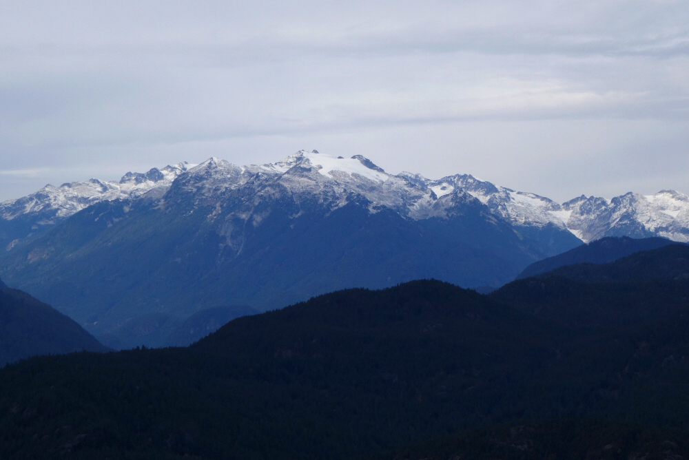
Continuing up the Ridge Trail, more views toward the Border Peaks area unfolded before the route made a sharp jog right to intersect a forest service road just below the summit. From here, an expansive panorama stretching from southwest to northwest opened up. The Olympic Mountains and San Juan Islands sat off to the far left, Birch Bay lay ahead, and to the right, snowcapped peaks such as Judge Howay, Robie Reid, Golden Ears, and the Misty Icefield stole the show. This little peak punches well above its weight. I poked around the north side of the summit area to see if any additional views could be found and was rewarded once again with a great look at Mount Baker and the Twin Sisters.
Finally prying myself away from the views, we headed back the way we came, making a short detour near the bottom to check out the old gold mine. It wasn't especially compelling, and with time ticking on, we didn't linger long before heading home. All things considered, for a "dumpster dive," this version of Sumas is about as good as it gets-and on a clear day, it makes for an excellent shoulder-season objective!
Anderson Mountain - North Route via South Bay Drive, November 2024
Continuing my race to the bottom-now officially entering dumpster-dive territory thanks to the changing of the seasons. I'm still on the hunt for hikes or peaks that are new to me and offer at least some redeeming quality: a view, a lake, something. Anderson Mountain, rising above the south shore of Whatcom Lake, fit the bill nicely, ticking both boxes for what might otherwise be a fairly uninspiring objective.
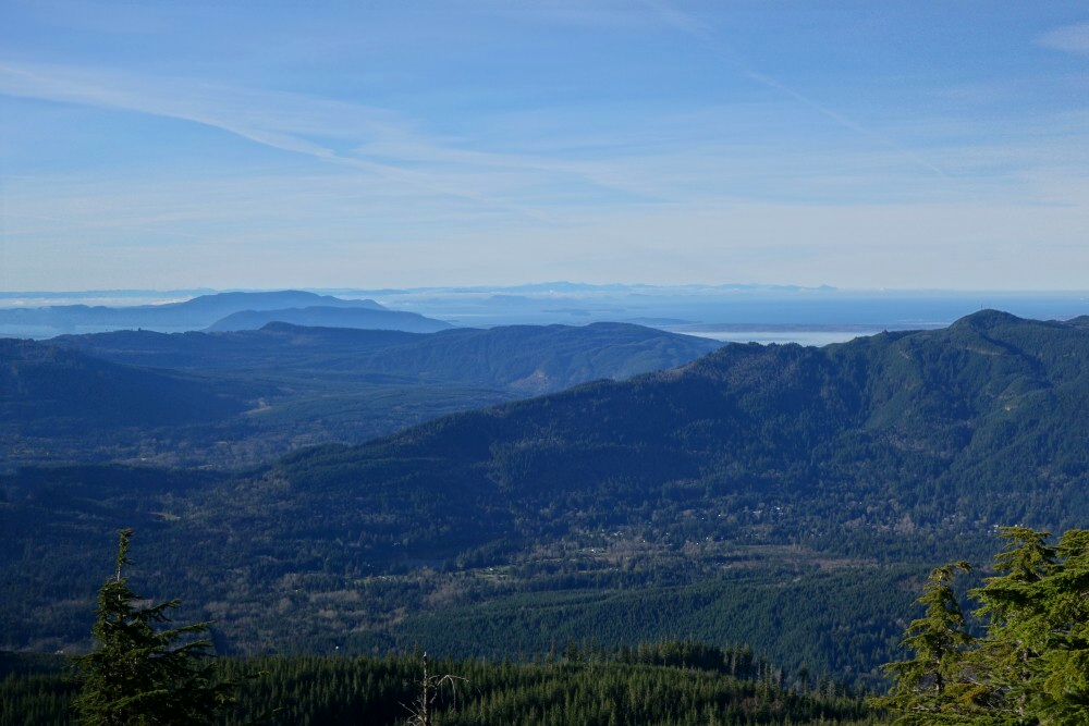
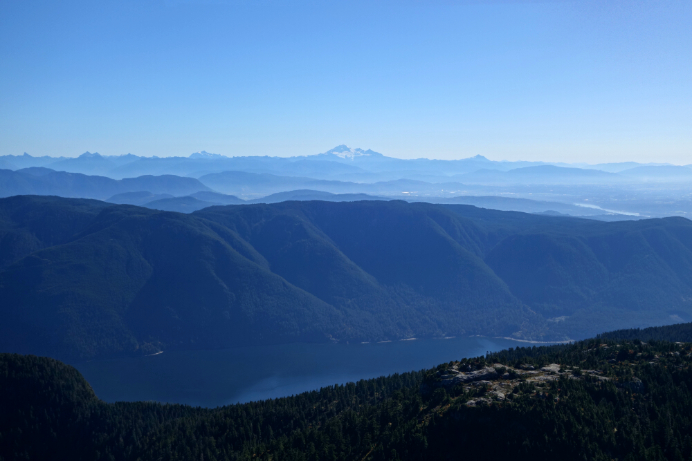
From an unmarked trailhead off South Bay Drive, the route passes through an open field before turning upward into the forested north-facing slopes of Anderson. Arguably more of an MTB downhill track, it makes for a sometimes steep and sustained grunt up to a large cutblock area about 0.75 kilometres shy of the "summit." From here, a surprisingly good view opens over Whatcom Lake, with Mount Baker and the Twin Sisters Range standing out beyond.
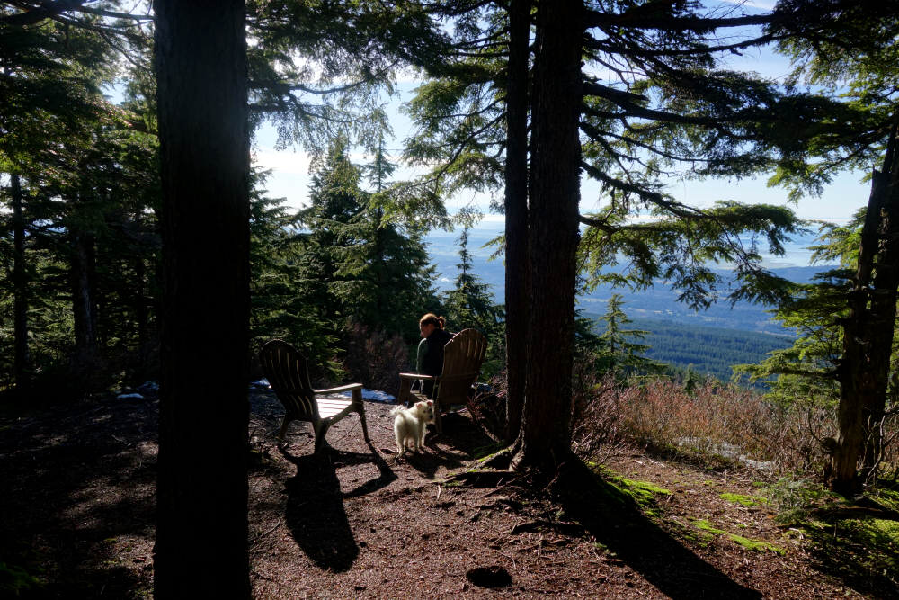
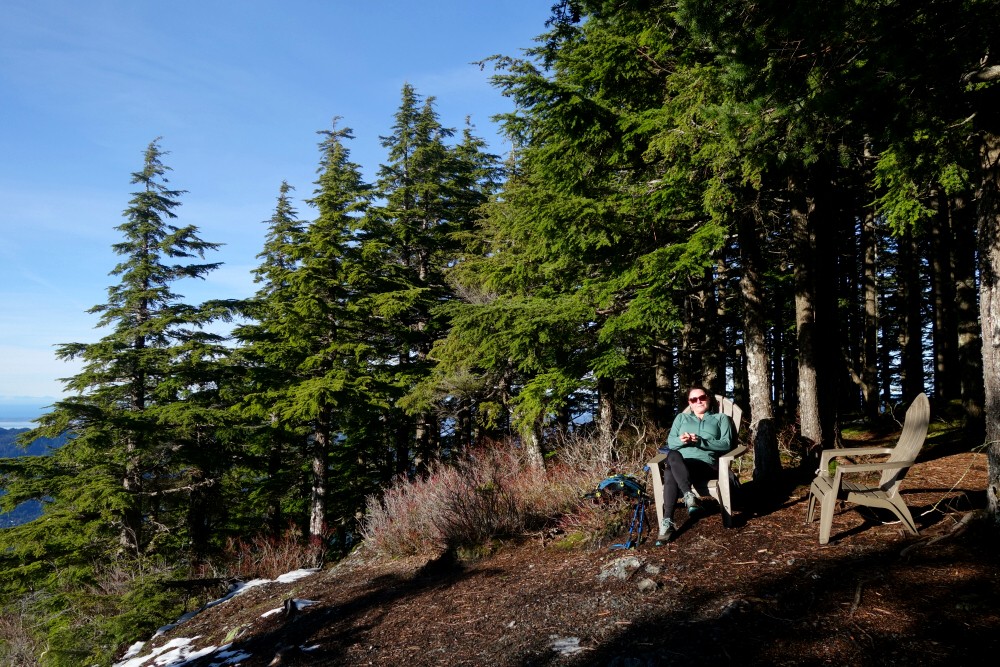
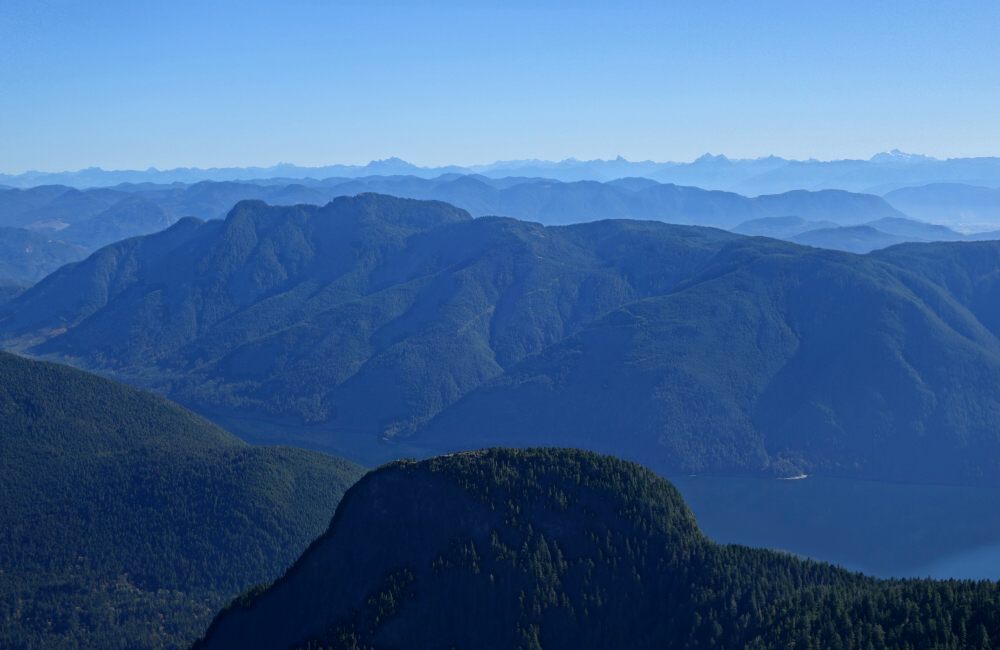
Continuing above the cutblock, the trail follows a minor spur back into the forest before easing off for a short final walk to a small lookout, complete with a couple of plastic patio chairs and fine western views out toward the San Juan Islands and beyond. We cracked a couple of beers and soaked in the weak sunshine as it cast a warm orange glow over our little perch. A trail continues beyond this point and appears to descend to intersect a forest road coming up from the south-again, likely more of an MTB route than anything else. The true summit lies somewhere beyond, reportedly viewless and likely trailless, so we didn't bother pushing any farther.
About three hours up and a little less back down, followed by the requisite Trader Joe's stop in Bellingham and our favourite Mexican fare at El Gitano. Buen provecho!
Mount Hallowell - Mount Hallowell Trail, November 2024
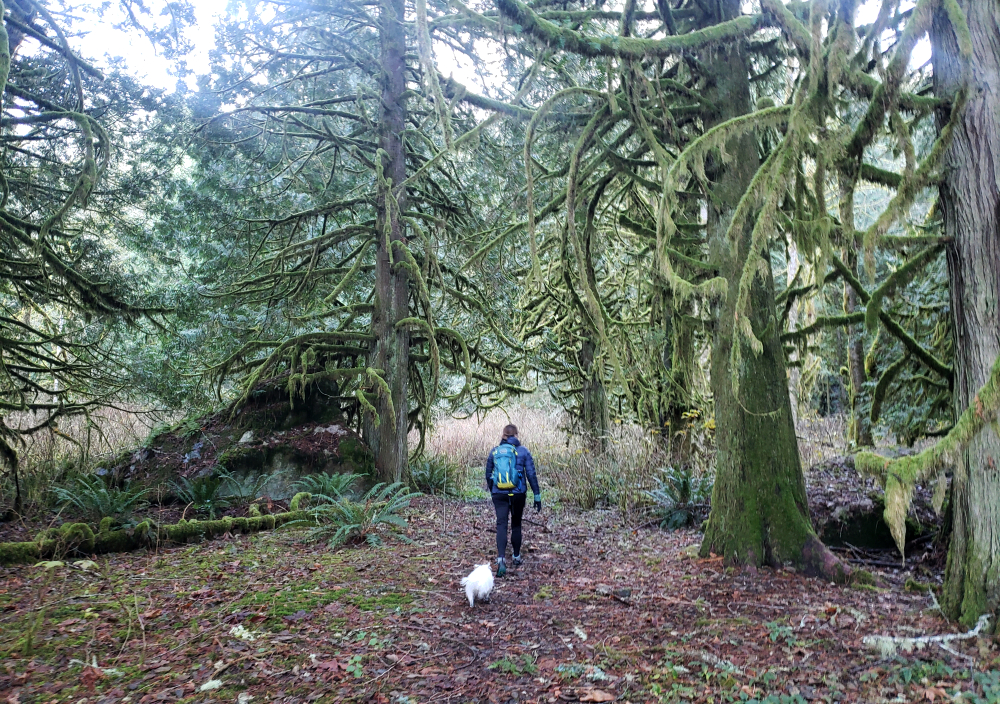
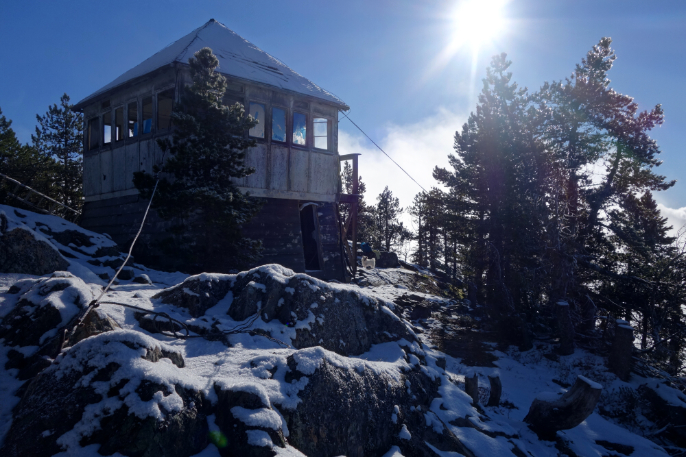
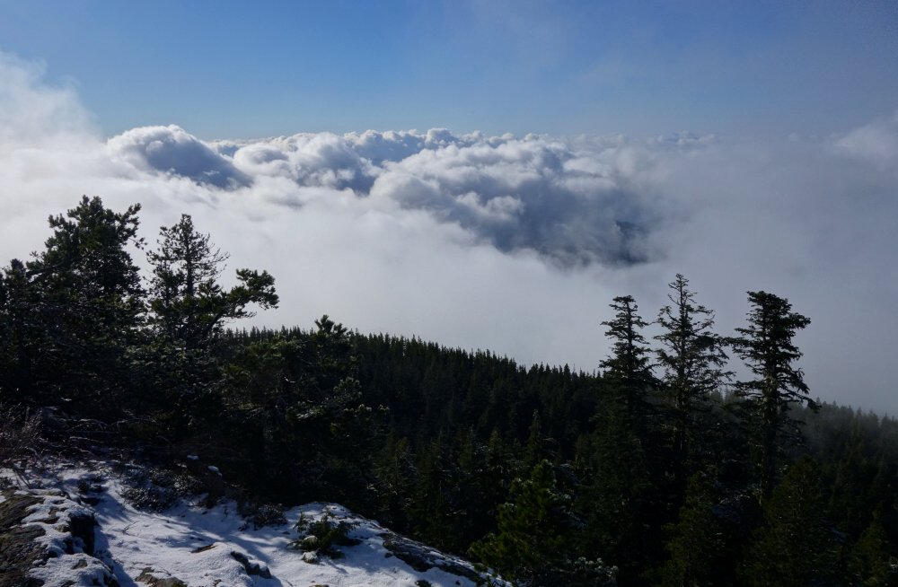
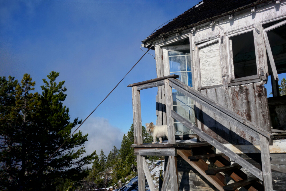
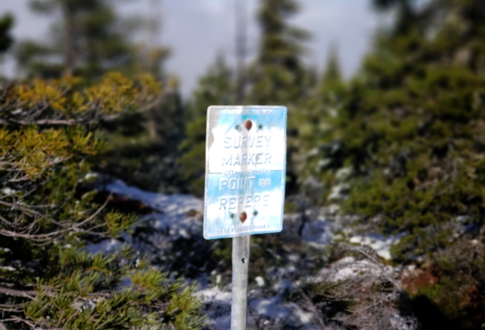
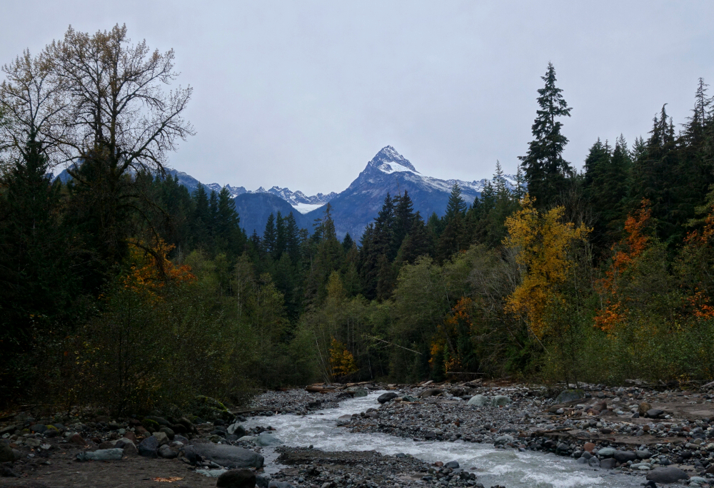
Out on the Sunshine Coast, north-northeast of the town of Sechelt, lies Spipiyus Provincial Park. As a destination, the park is rather unremarkable, existing primarily to protect pockets of old-growth forest and the fauna that depend on them. That said, there are a couple of "peaklets" with decent trail access that tend to attract local prominence-baggers, starting with the park's namesake and highest point, Spipiyus Peak. As it's reportedly a completely viewless summit, I saw little appeal and instead turned my attention to the only other officially named peak in the park-Mount Hallowell. Home to a now-dilapidated fire lookout, the summit is said to offer expansive views over the maze of lakes and inlets that define the region. I say "said to" because low-lying cloud obscured most of those views on this particular day-but more on that in a moment.
This outing followed a previous attempt in November 2023, which had been thwarted by an unusually deep water bar on the FSR we'd used to access the peak from the south. Rather than risk losing a bumper-and lacking buy-in from my partner for the longer standard approach from the west-we opted to bail and instead hike a couple of nearby objectives: Mount Daniel and Pender Hill. Fast forward a year, and I found myself once again looking to the Sunshine Coast for a low-stress, dog-friendly late-season outing. Hallowell was still unfinished business, so Pepper and I boarded the Horseshoe Bay-Langdale ferry and made our way through Sechelt and beyond on a crisp November day.
I turned right off the highway just before Sakinaw Lake Road and began climbing a surprisingly rough and steep FSR labeled "High School Confidential" on CalTopo. Not entirely sure what that's about, but I followed it as far as I was willing before parking and continuing on foot. What followed was a fairly monotonous grind up the road-left at a junction, then more cold, shaded walking before finally reaching the actual trailhead. From there, less than a kilometre remained to the summit. The final stretch climbed steadily, eventually breaking above the cloud layer into welcome sunshine and blue skies. I reached the summit and lookout just over two hours after leaving the truck.
While the sunshine was appreciated, the hoped-for views remained frustratingly elusive. A blanket of low cloud obscured most of the surrounding landscape, with only occasional glimpses appearing through drifting gaps. I lingered for about an hour in hopes things might clear, but it was largely in vain. At least Pepper made the most of it-bounding around in the light dusting of snow and poking around the slowly collapsing lookout. Eventually, with little sign of improvement, I packed up and started the descent, retracing my steps down the cold forest roads back to the truck. Win some, lose some they say-Pepper clearly enjoyed this much more than I did!
DeBecks Hill - North Ridge Trail (plus 4 Lakes Loop), October 2024
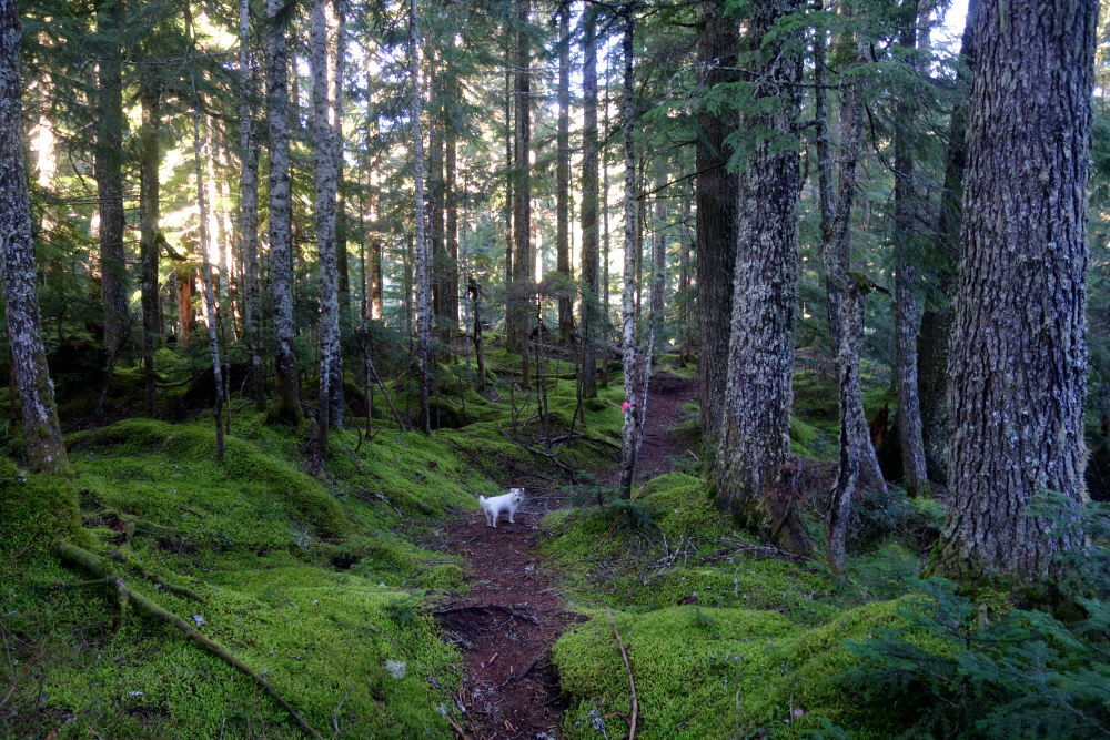
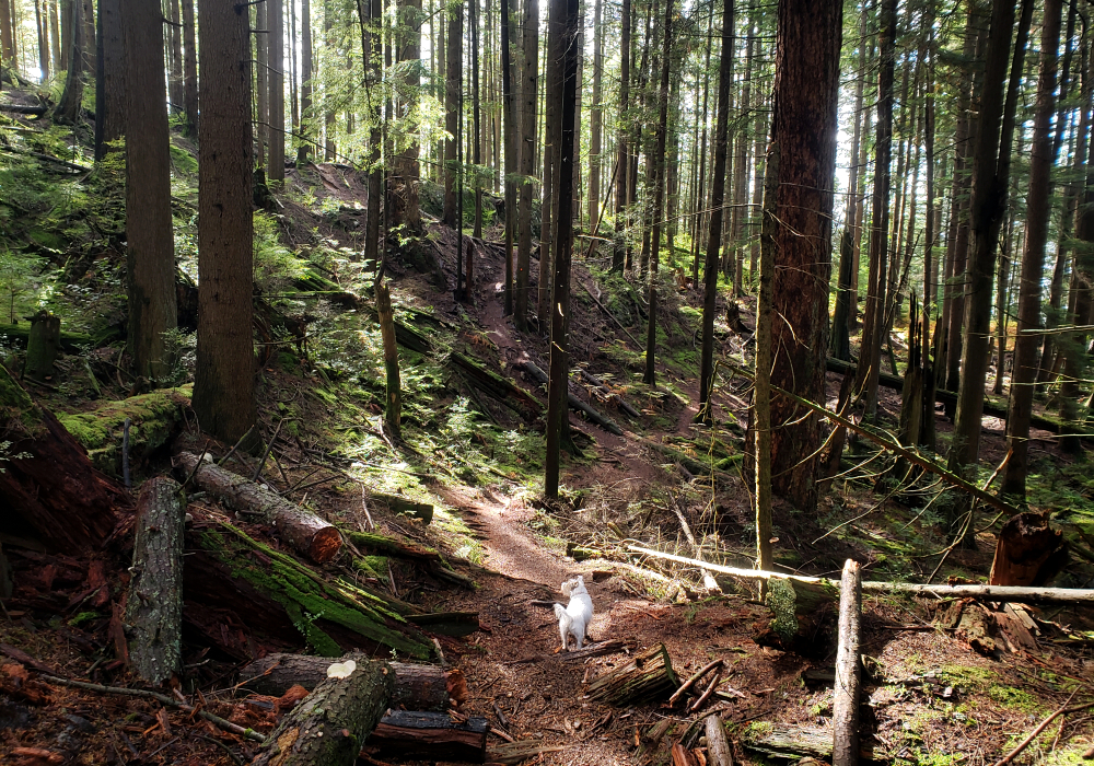
DeBeck's is a forested hill immediately north of Squamish city limits, adjacent to Alice Lake. Several mountain bike trails provide access to its radio-tower-infested summit from the south, but only one approaches from the north-the aptly named North Ridge Trail. With nothing better coming to mind on an otherwise marginal late-October day, I tossed my backpack and Pepper into the truck and headed for the North Ridge trailhead for a lazy day hike.
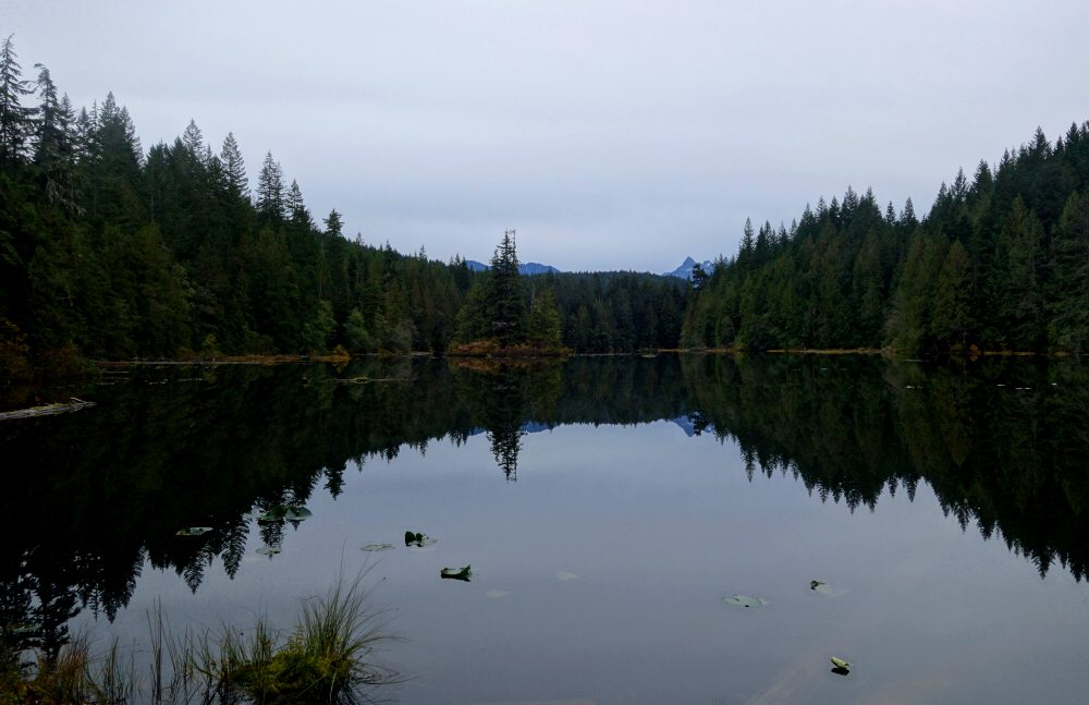
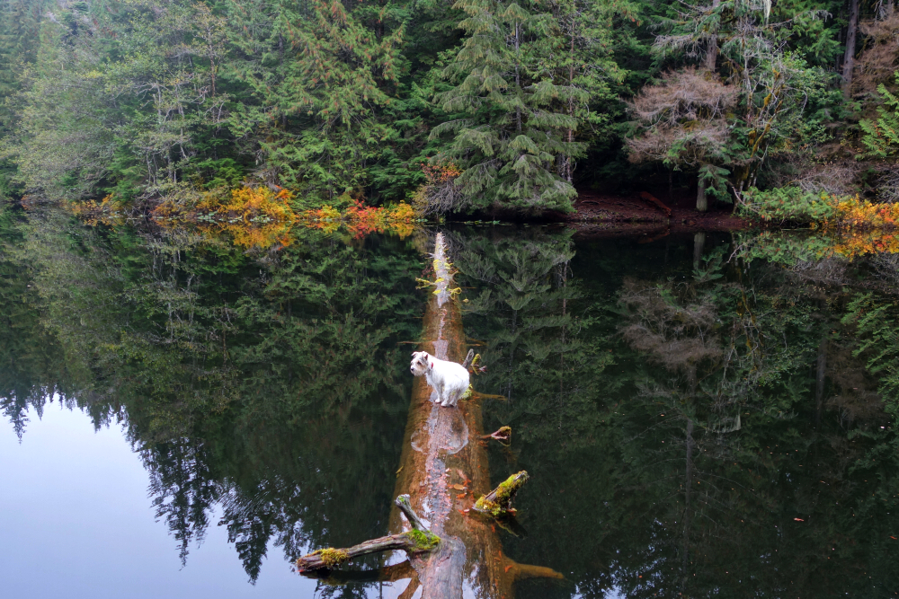
Having never actually visited nearby Alice Lake Provincial Park, I decided to up the ante by turning the outing into a loop. From the summit, I descended via the "DeBeck's Grind" FSR, which leads directly to the southern end of Alice Lake. From there, I continued along the "Four Lakes Loop," following established trails linking Alice, Edith, Fawn, and Stump Lakes, before returning to Alice Lake via the campground on its north shore. A short walk along the paved access road then brought me back to my starting point just shy of Highway 99.
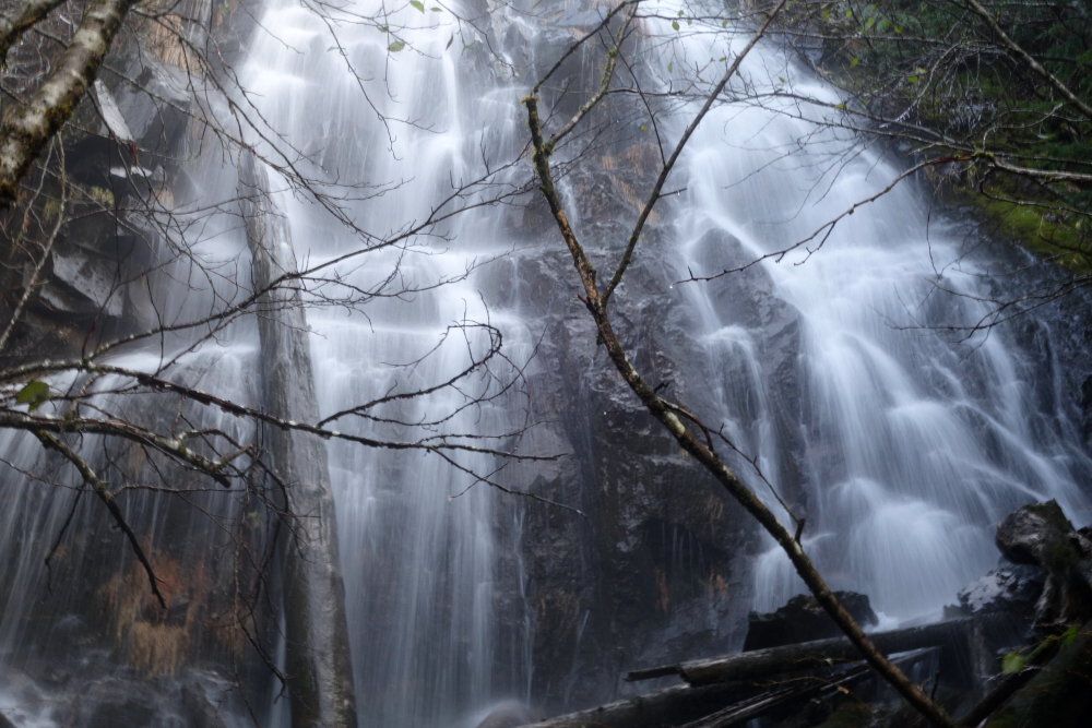
The views of the Tantalus Range from DeBeck's summit were better than expected, and it's hard to go wrong with a network of trails connecting a series of picturesque lakes. The stretch of trail along the Cheekye River, just east of Stump Lake, was particularly scenic, offering a unique perspective on Alpha Mountain with the Crescent Glacier looming in the distance. Wrapped it up with a short drive up a nearby FSR for some more views before calling it a day. All told, expectations for this little adventure were fairly low, yet it proved to be far more interesting-and enjoyable-than anticipated.
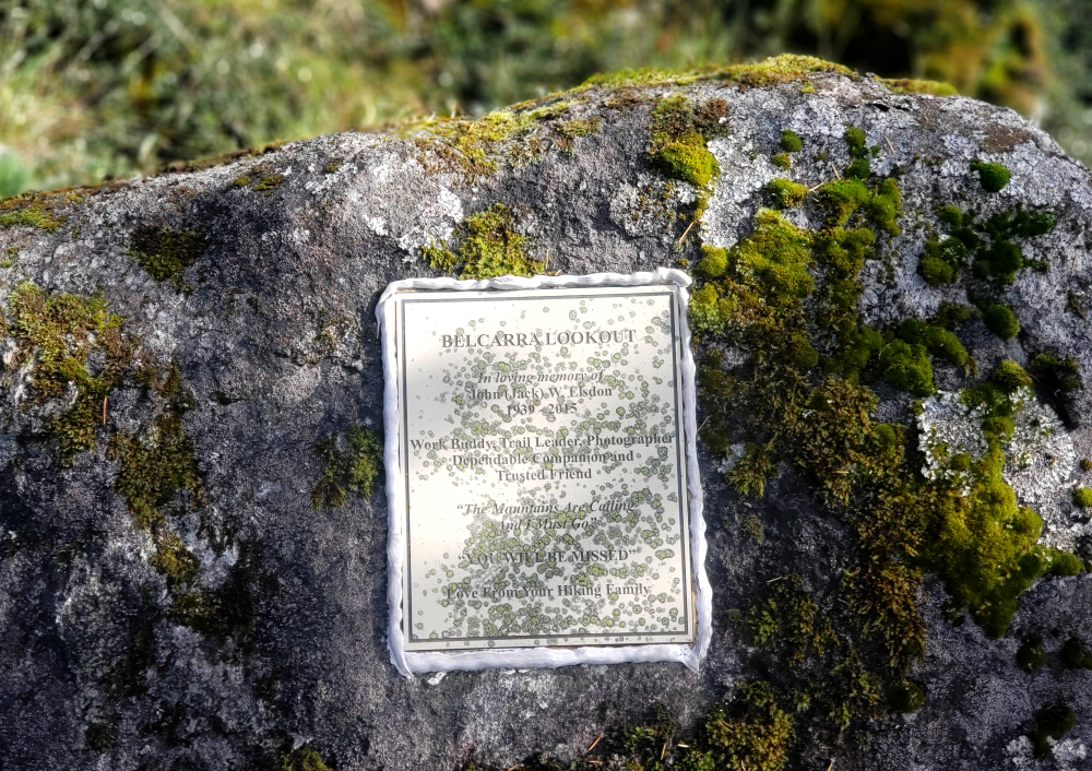
Belcarra Mountain - via Springboard Trail, October 2024
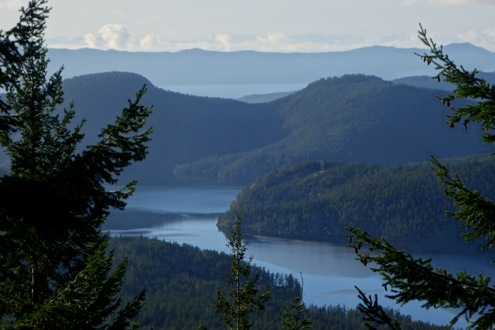
Second time's the charm at Belcarra, returning primarily for the views I'd been denied on my first visit. With no low-lying fog this time, I made my way over to Belcarra Regional Park for a quick couple of hours of wandering in the woods. The true summit is fully treed, as one might expect for such a modest peak, but the real appeal lies at a lookout on a minor bluff just west of the high point. From there, a fine view opens over the mouth of Indian Arm, looking down Burrard Inlet toward the distant city skyline.
There's a bit of a maze of trails in this area, but most will want to start via the officially named Springboard Trail. After that, an offline map is helpful-or otherwise, good luck. With Pepper in tow, we traversed over the summit as before, then followed a trail descending gently westward to intersect another path coming in from the northeast. A left turn here led a short distance to the lookout. Just under 3 kilometres of travel all told. After the obligatory oohing and ahhing, we headed back, this time continuing along the northeast trail for a small loop that eventually rejoined the Springboard Trail.
On our previous visit, we'd continued south from the lookout to intersect the Admiralty Point Trail, looping back to the parking area from there. It's a longer outing but recommended for a first-time visit. With the fog finally lifted and the views delivered, it felt like proper closure for this small but satisfying Belcarra revisit.
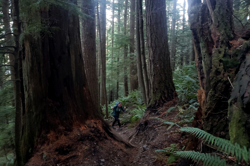
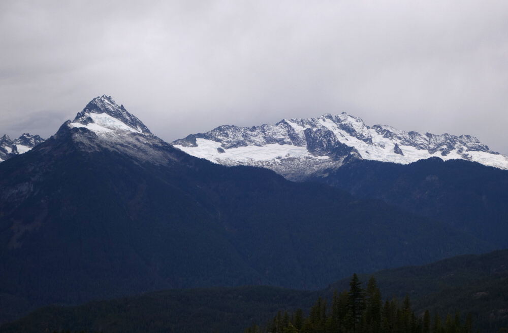
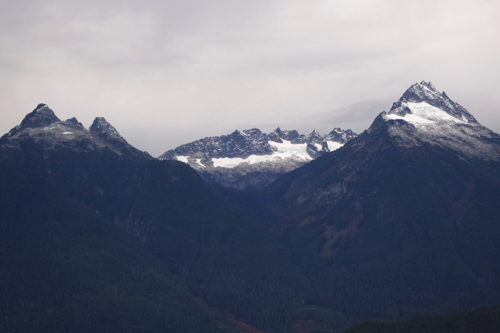
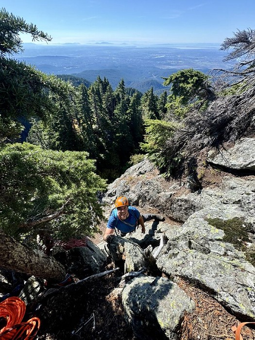
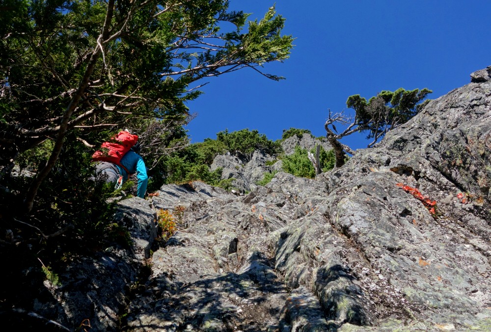
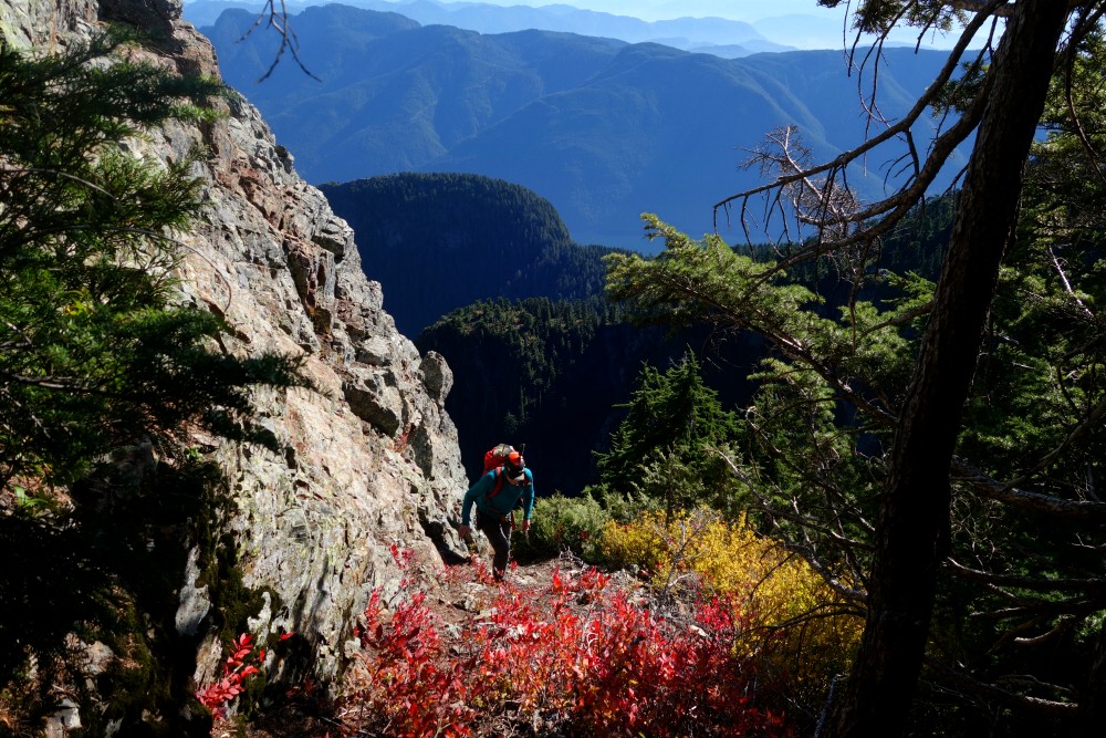
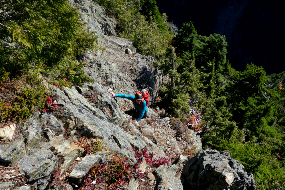
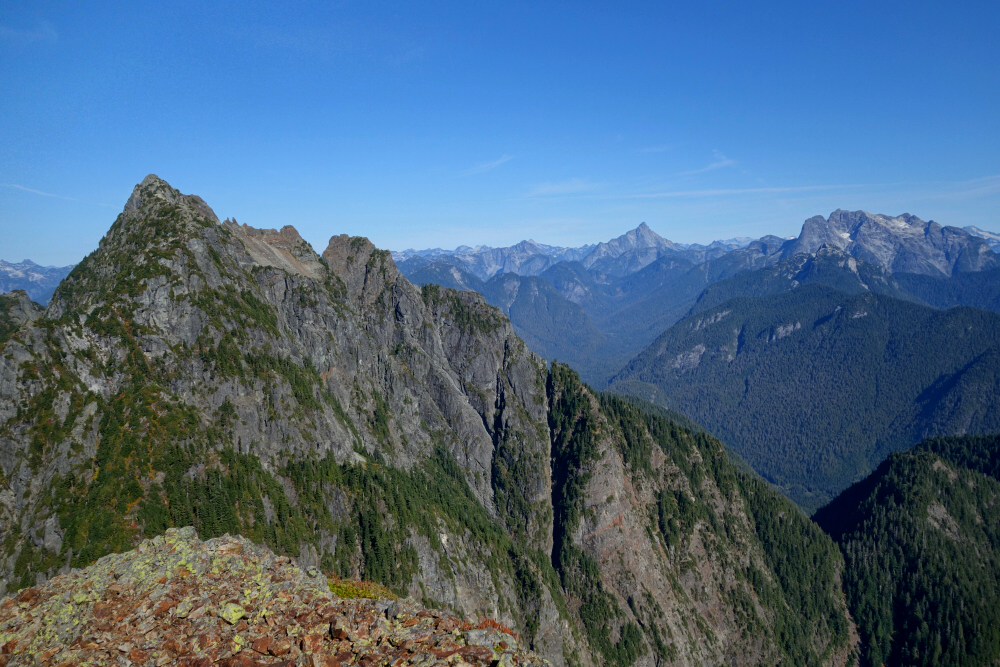
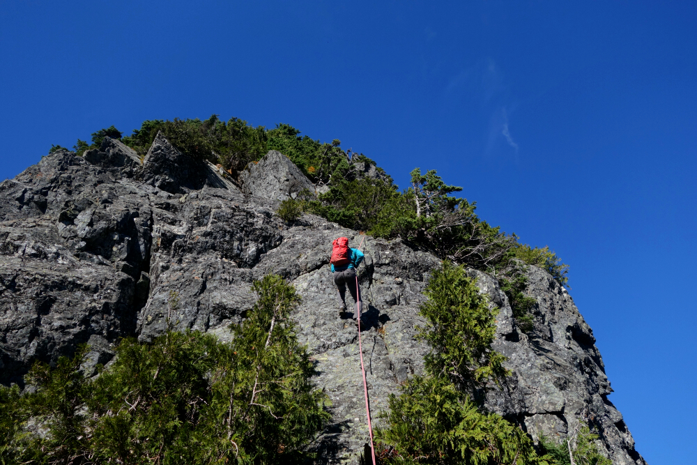
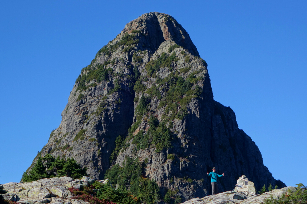
After Golden Ears and Edge Peak, Blanshard Needle is the next tallest of the named summits along the north-south crest of the Golden Ears Range. Seen from many vantage points-particularly from the Fraser Valley-it stands out as a prominent horn rising from the forested uplands at the southern end of the range. Typically approached via Alouette Mountain immediately to the south, it makes for an enjoyable, albeit longish, day trip featuring engaging scrambling with just a smidge of low fifth-class climbing thrown in for good measure. I'd been up Alouette twice before, the latter a solo attempt on Blanshard Needle itself. That effort ended at the base of the short technical pitch, where I turned back due to a worrisome case of dehydration compounded by losing my only water bottle somewhere on the approach. Feeling dizzy and a bit delirious-with not even a seep of water to be found on an unusually warm October day-I made the difficult decision to retreat with my tail between my legs.
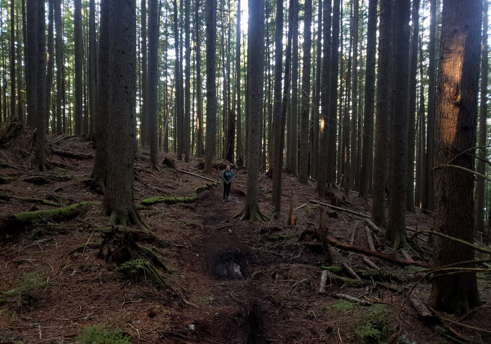
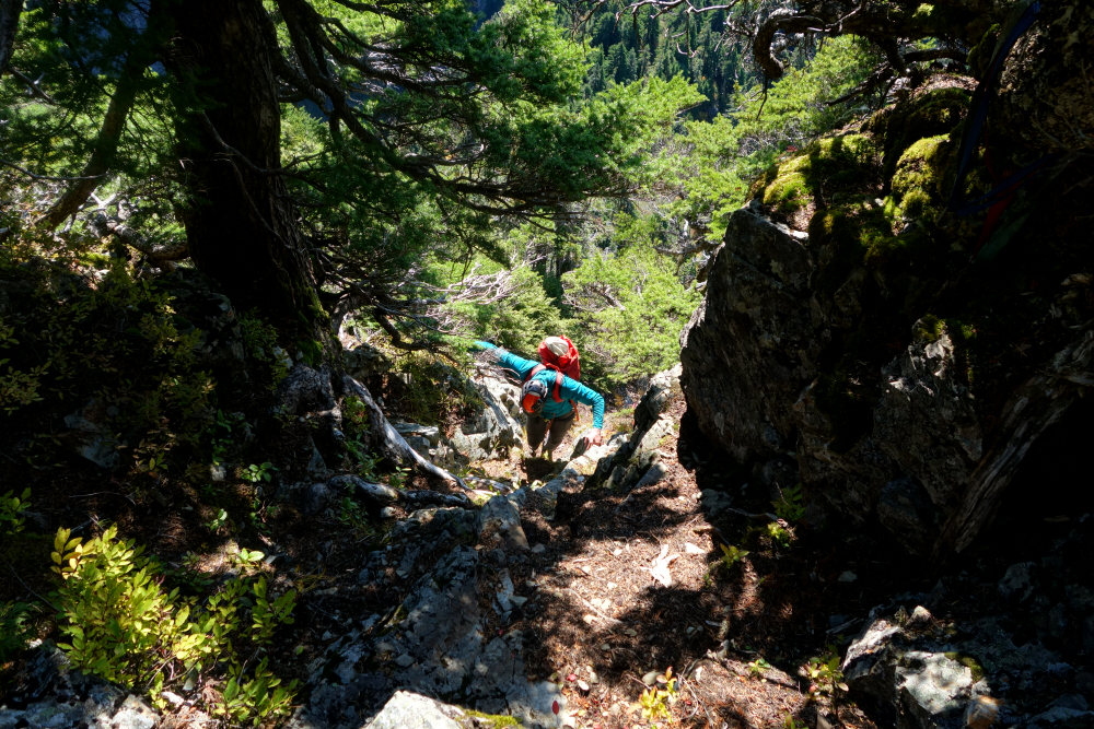
Beaten but not defeated, I resolved to return someday. First, though, I needed to let the memory of the approach trail fade a little. Factoring in Evans Peak, I'd already been at least most of the way to Alouette three times, and I'm not much for repeats-let alone four. Eventually, the stars aligned for redemption in October 2024, this time with Andrew along for the ride. Once again, we set off from the West Canyon Trailhead and began the familiar, steep, and somewhat monotonous grind toward Alouette. Between Alouette and Blanshard lies a deep chasm choked with brush, though a faint trail winds its way through the worst of it. I'd previously scoped out where to begin the descent into this chasm: just south of Alouette's summit, along the right-hand edge, following a small dry watercourse that turns into a loose and unpleasant gully farther down. I don't recall any flagging marking the entrance, though there were some markers lower down.
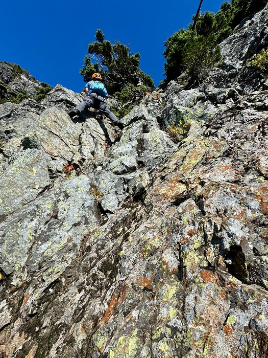
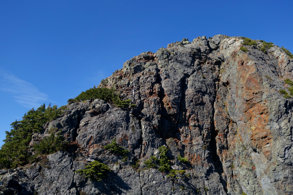
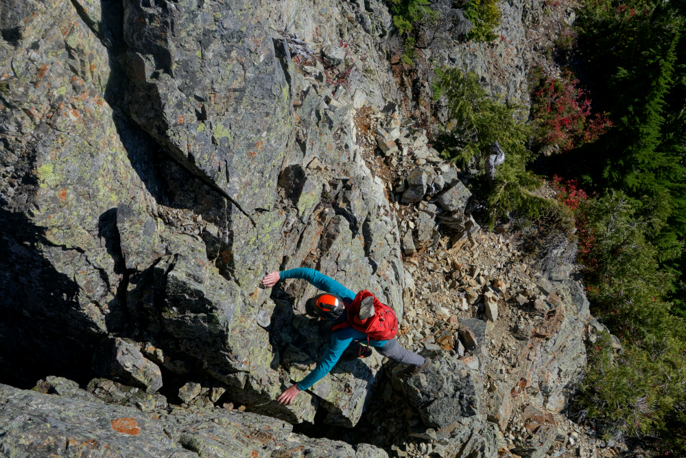
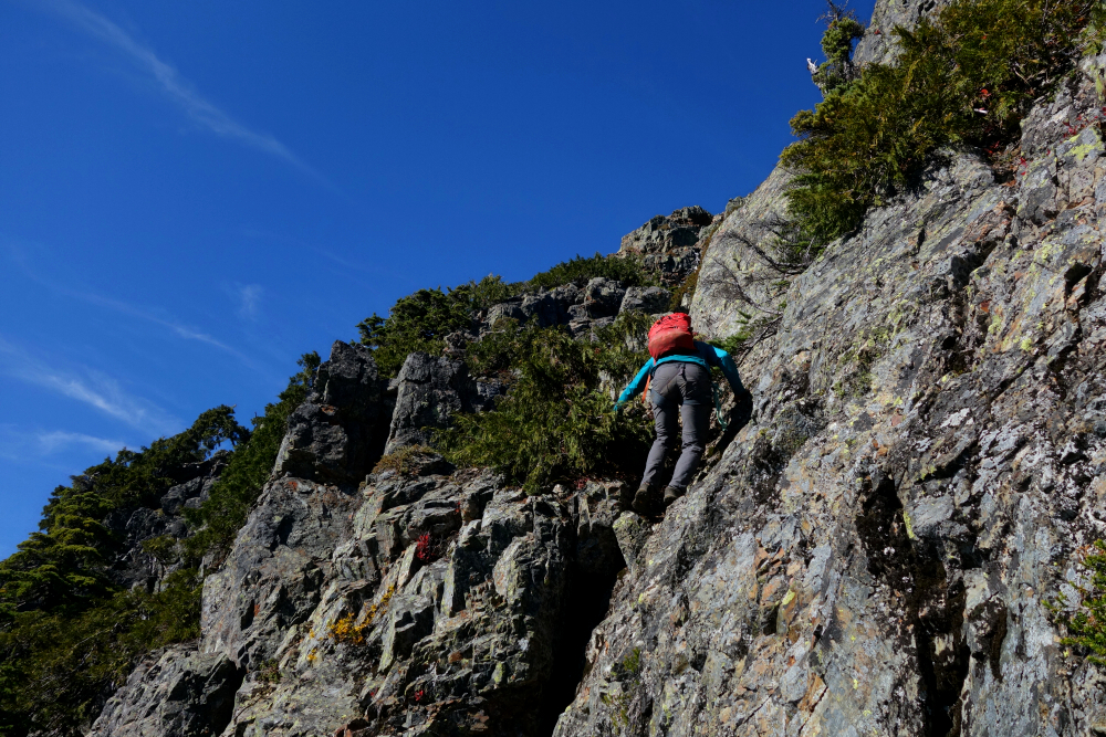
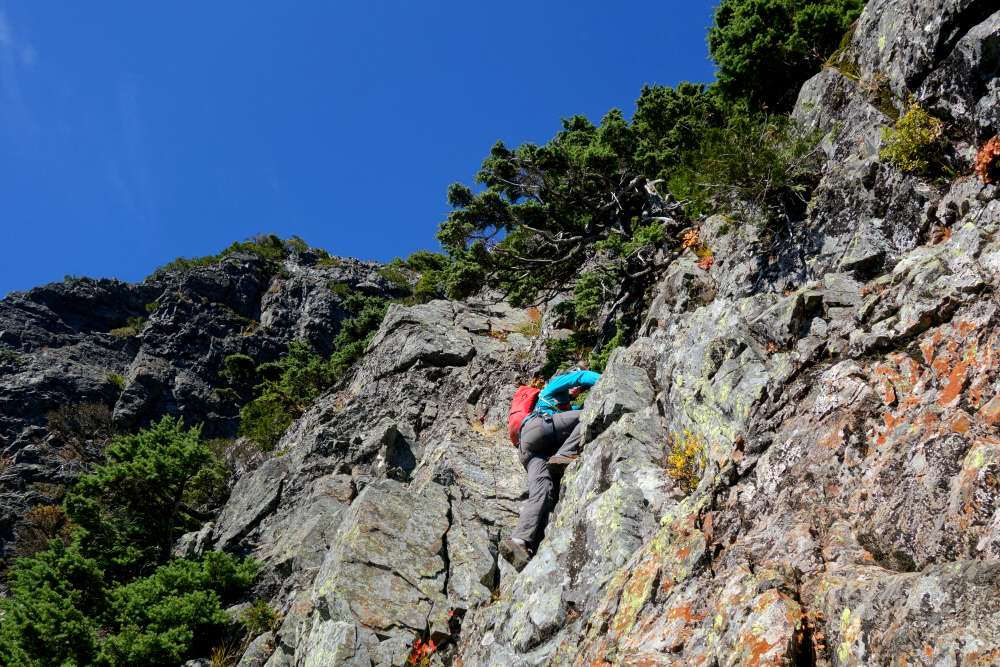
We descended steeply through the gully until it opened onto a grassy apron, then traversed right into the forest. Following intermittent flagging, we worked upward along a worn path leading toward a saddle, with the infamous Fly's Gully dropping away on the opposite side. A short final descent brought us to a staging area directly below a steep rock wall where the crux of the route begins. Here we roped up, with me taking the lead for a short pitch-just a move or two with exposure-to reach a small alcove where I set up a belay. Andrew followed, and we then stashed the rope for the remaining scramble to the summit.
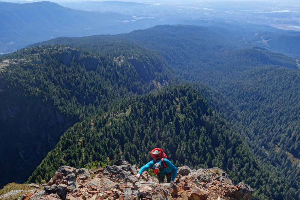
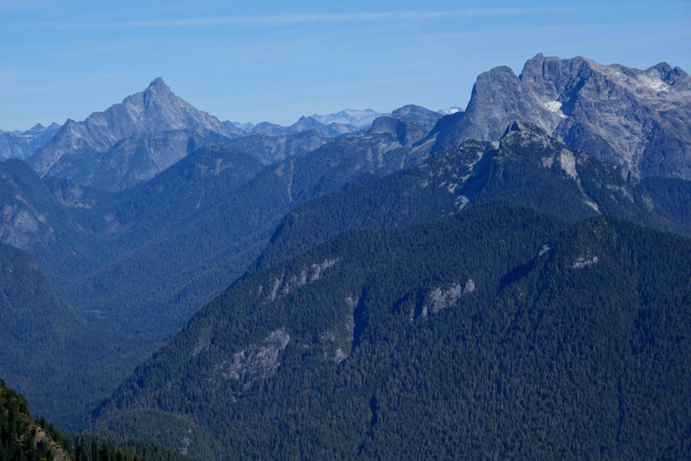
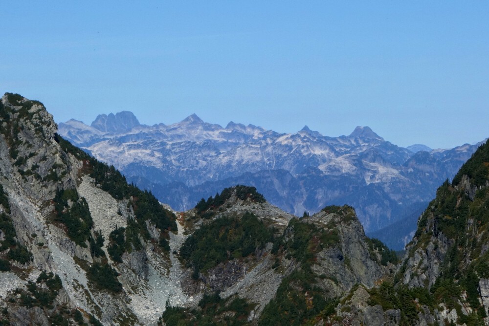
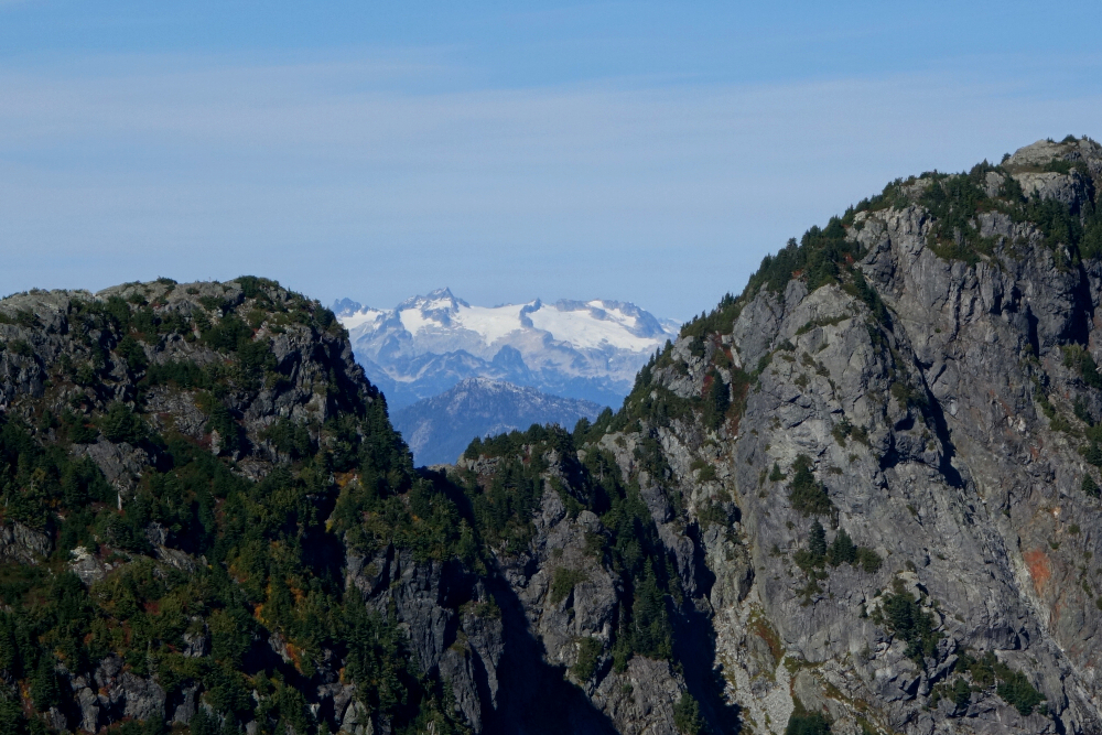
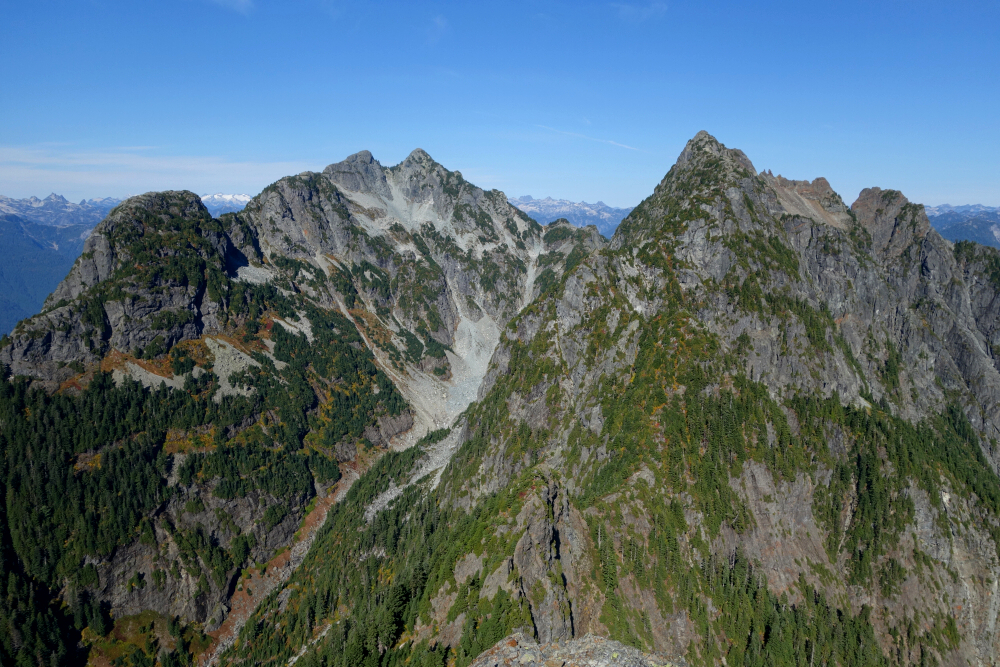
The next section above the belay was technically easy but steep and somewhat exposed. Higher up, the terrain eased into a mix of ledges, gullies, and short steps to scramble over. Near the top, the route traverses left to a notch with a precipitous drop on the far side before ascending the upper South Ridge to the summit. The views from this airy perch were superb, with the broad expanse of the Fraser Valley to the south and a sweeping panorama of peaks stretching from west to east. There were also excellent perspectives on Edge Peak and Golden Ears, along with familiar landmarks like Robie Reid and Judge Howay.
After a short break to soak it all in, we turned our attention to the descent. We retraced our steps to the belay alcove without too much fuss, then made a rope-stretching rappel on our 30-metre rope back to terra firma. Back across the chasm and over Alouette once more, we retraced the long trail back to the West Canyon Trailhead, tired but satisfied, and the rest, as they say is history!
It would be very much appreciated if you please ask before copying and/or re-publishing content from any part of these pages. To do so, please click here to send a message via feedback form.


